
Instrument approach – Kingaroy – Wondai
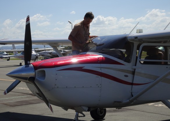
By March 2016 I’m most of the way through my Instrument Rating training. I’ve flown by instruments with an instructor by day and night and made instrument approaches into Sunshine Coast, Toowoomba, Bundaberg and Kingaroy. I’ve also had training and gone solo on the simulator at the aeroclub, practising the same approaches and departures and others such as Brisbane, Coffs Harbour and Mount Gambier. Now it’s a matter of practising what I’ve been taught in the plane. So on Friday 18th March I took my friend Ted Surka along on an expedition in the “ROC” – Cessna 182 VH-ROC.
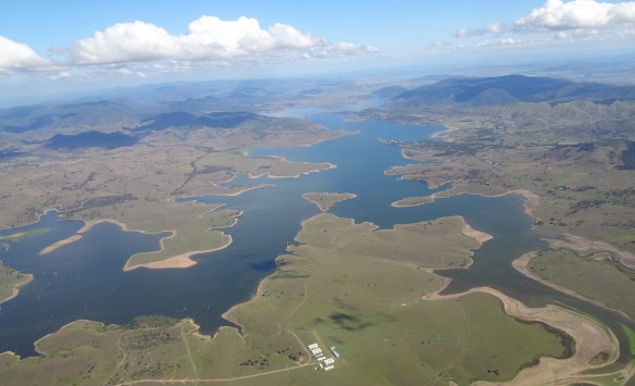
We flew from Redcliffe to Kingaroy via Kilcoy and Lake Somerset. It was a perfect day.
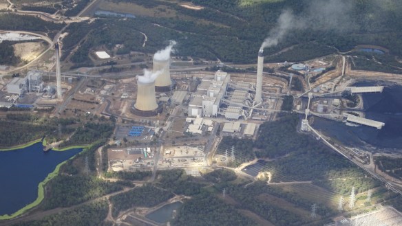
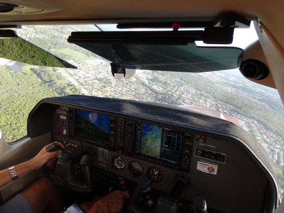
About 30 miles before reaching Kingaroy we tracked to the west to enter the southern RNAV (area navigation) instrument approach for runway 34. I wanted to practise what would normally be done in cloud but in this case it was on a fine day with good visibility. The RNAV approach involves using the GPS system to fly at an area lowest safe altitude (LSALT) to one of three entry way points, fly at least one orbit in a standard holding pattern, then enter the approach and descend on a 3 degree glide path to a minimum descent altitude (MDA) about 500 feet above ground level a mile or so in front of the runway. Under real life conditions all this would occur without any visibility of the ground until you emerge from the clouds. The aim is to fly down to emerge from the clouds prior to reaching the MDA and then land visually. If you don’t have visibility of the runway by the time you reach the MDA you have to abort the landing and climb back up to Lowest Safe Altitude. As it happens the holding pattern in this case was located about 3000 ft above Tarong coal mine and power station, so we orbited up there a couple of times and Ted got a good view of the mine and power station while I concentrated on keeping the plane within tolerance.

There was a fair bit of gliding happening at Kingaroy and they were using a tug plane on the cross runway to launch, directly across Runway 34 where we wanted to land, so I decided to abort the RNAV exercise about 5 miles out and do a normal visual fly over the field and then enter the circuit on the downwind leg for runway 34. This gave plenty of time to ensure there would be no “misunderstandings”. We had a good view of Kingaroy as we made our circuit. On the final approach the glider tug pilot was kind enough to allow us to do a touch and go between glider launches.

We had a very smooth landing and I immediately applied power and took off again, and headed to Wondai, a small town with a very well kept grass strip about 30 miles north. We did a circuit and a visual approach followed by a go around on short final. We then climbed out and away and headed back to Redcliffe via the Bjelke Peterson Dam and the Brisbane River valley.

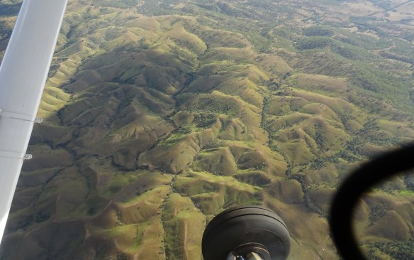
There was some really scenic country along the way.
We flew over Mt Mee and past Caboolture into the Redcliffe area. The amount of new housing around the North Lakes area was a surprise to Ted, as it is to most people who haven’t seen it from the air before.

Above is the view towards Brisbane over the Hornibrook Viaduct, with North Lakes in the foreground. Below is a new very uniform housing development built next to the new Redcliffe railway line.

We flew into Redcliffe at about 4:30. It was very quiet and we had the place pretty much to ourselves. Another smooth landing completed a really great Friday afternoon.
Thanks to Ted for all the great photos.
