
Mount Gambier – Blue Lake – Mount Schanck – Glenelg River – Port Macdonnell – Lake Bonney
The Limestone Coast is a name used since the early twenty-first century for a South Australian government region located in the south east of South Australia. It immediately adjoins the continental coastline and the Victorian border. The name is also used for a tourist region and a wine zone both located in the same part of South Australia. The region was underwater in prehistoric times so a thick layer of limestone was created out of the shellfish that lived and died there. When the seas subsided the limestone was gradually covered by soil and created the “terra rossa” region around Coonawarra that is famous for its red wines.
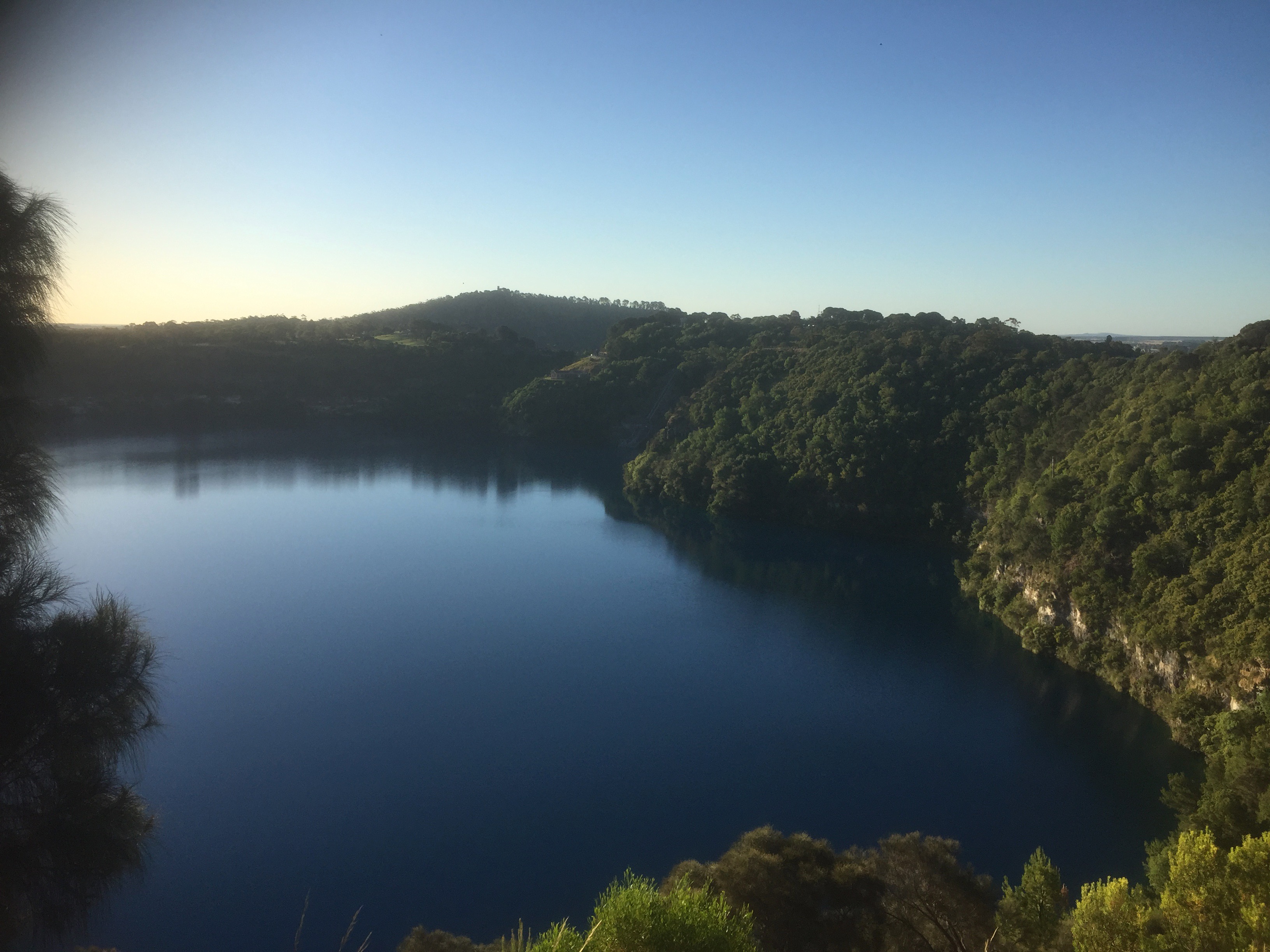
Mount Gambier is the largest city in the Limestone Coast and South Australia’s second largest city. The Mount Gambier area is famous for its volcanic craters and crater lakes that are spectacular from ground but also from the air, especially on a sunny blue sky day.
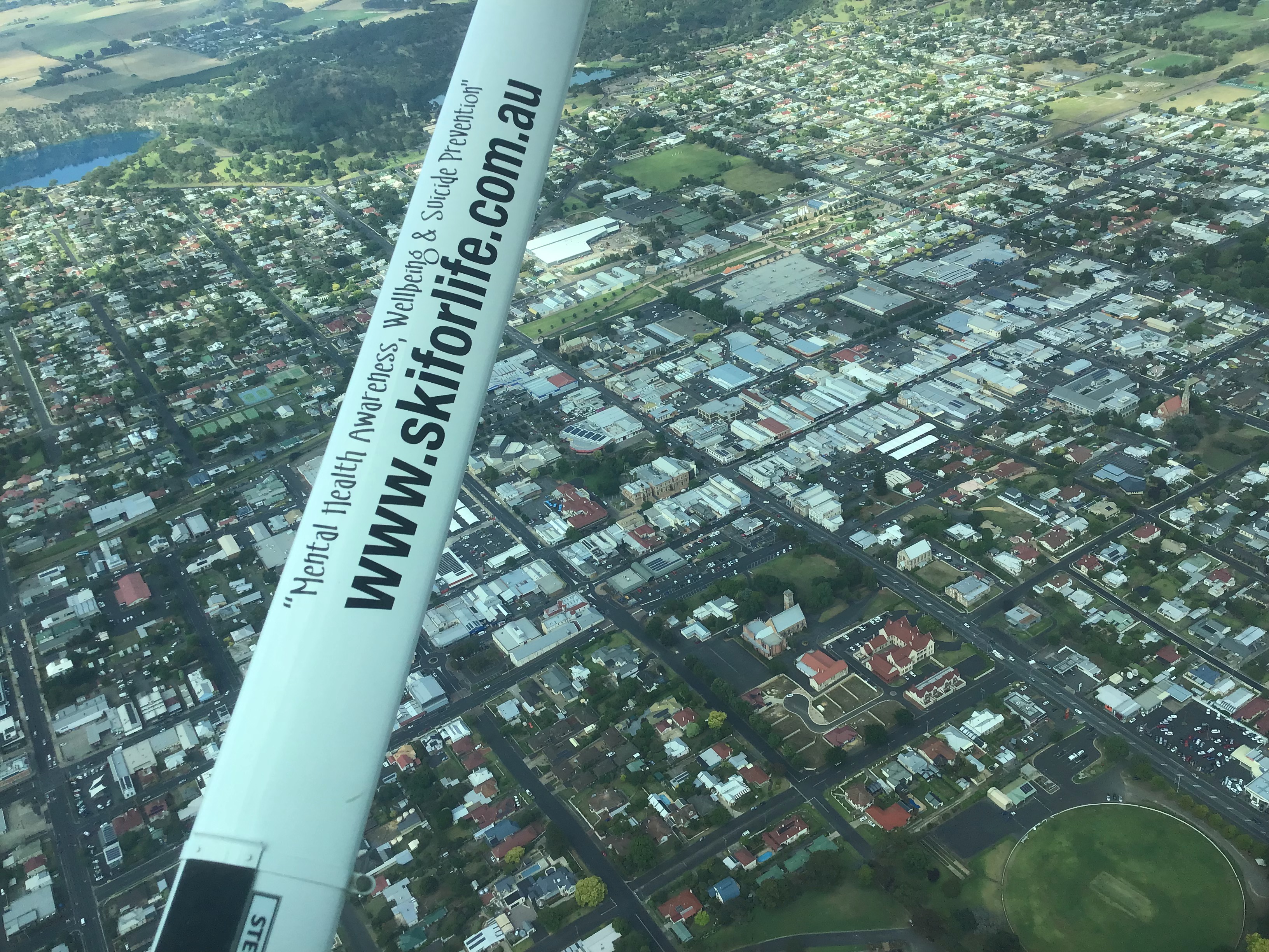
While visiting my mum who lives in Mount Gambier for new year in January 2022 I took my school friend David, his wife Rita and daughter Tansy for a flight around the area in Bob Rowe’s Cessna 172 VH-CNY. It was a perfect morning as we opened the hangar, with a few stratus clouds in the distance burning off and the wind sock hanging limp around its supporting pole. I did the preflight and we pulled CNY out onto the apron and fired it up.

I wanted to use RWY18 and depart on upwind directly to the city of Mt Gambier 5 km away but another aircraft was inbound to land on RWY 36 so we waited patiently for it to land and taxi up to the apron before we taxied down to the threshold of RWY18. It was an amazingly clear day and as we climbed out we could spot the Grampians, where David and Rita live, on the horizon, about 150km to the east.
Soon we were over the city at 2500ft and did a couple of orbits in different directions so we could all take in the views.

From there we flew around the edge of the crater lakes.
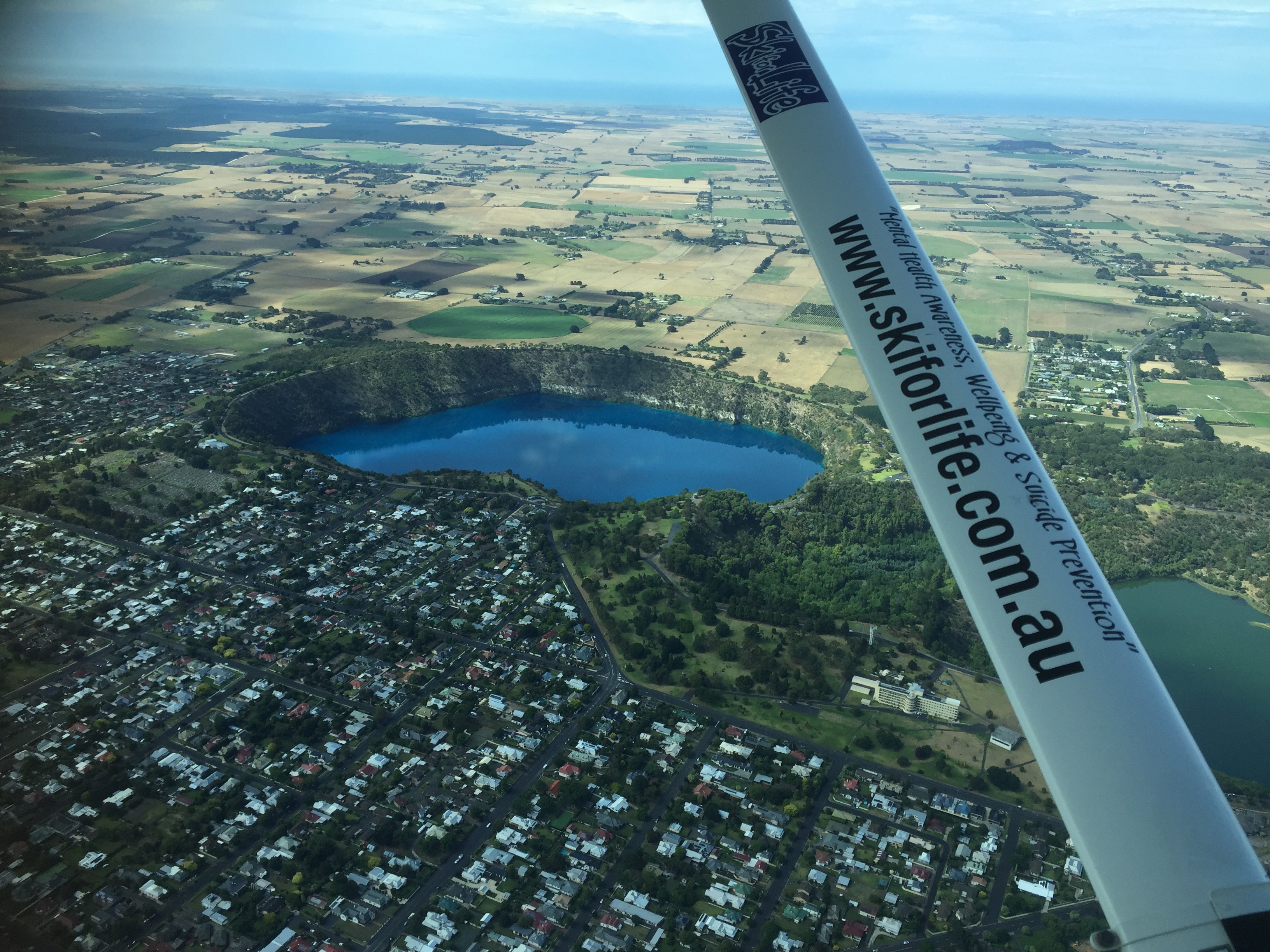
The lakes formed in the craters from volcanic eruptions 4600 years ago. It’s the most recent volcanic activity anywhere in Australia.
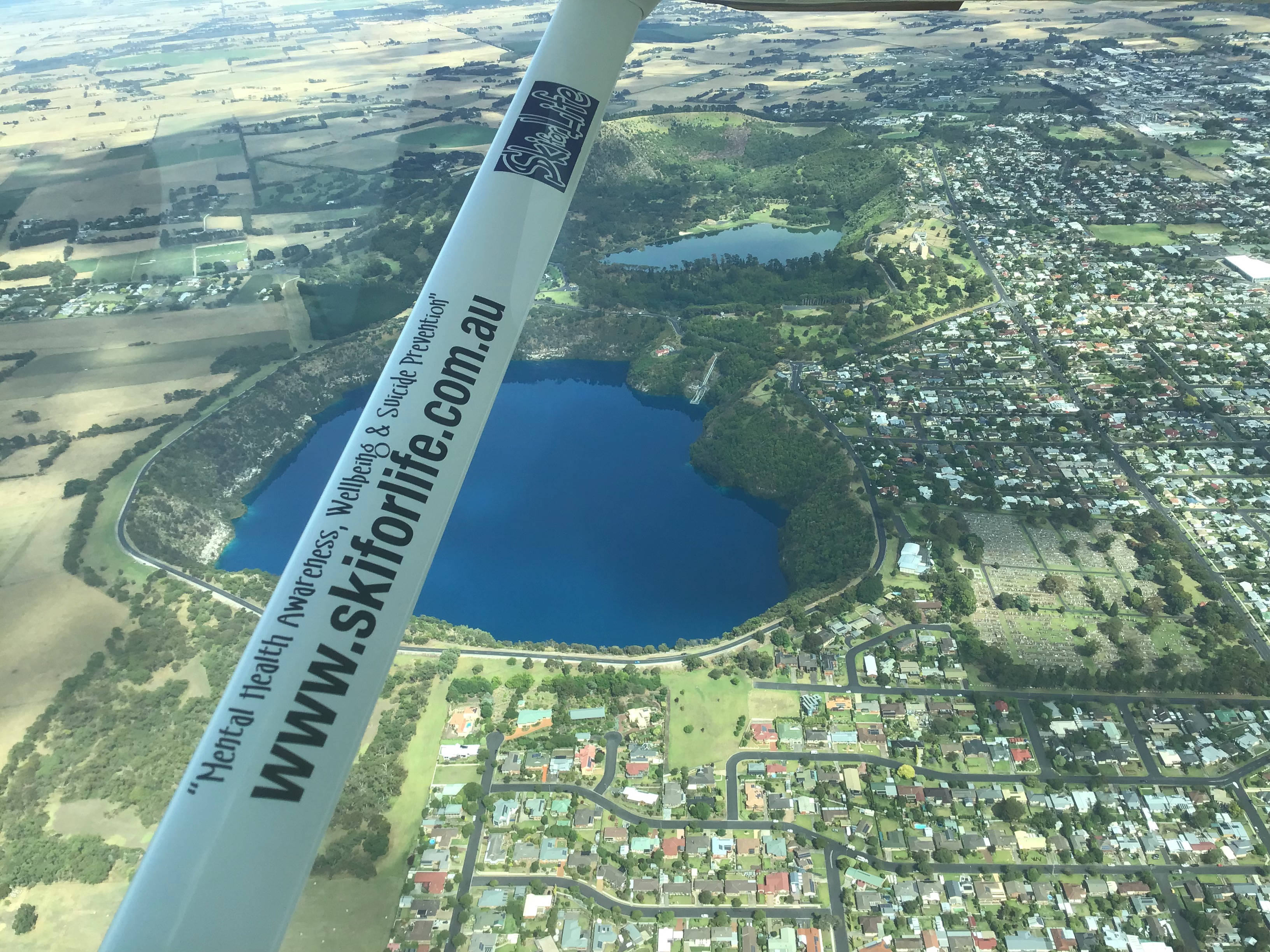
The water from the Blue Lake is used as the city’s drinking water so no swimming or boating is allowed. The only access to the lake’s surface is via an elevator on tours. The elevator shaft was cut through the limestone from the old pumping station. The Valley Lake on the other had is used for recreational boating, mostly waterskiing.
There is also a “Little Blue Lake” only about 10km to the south. We flew there next.
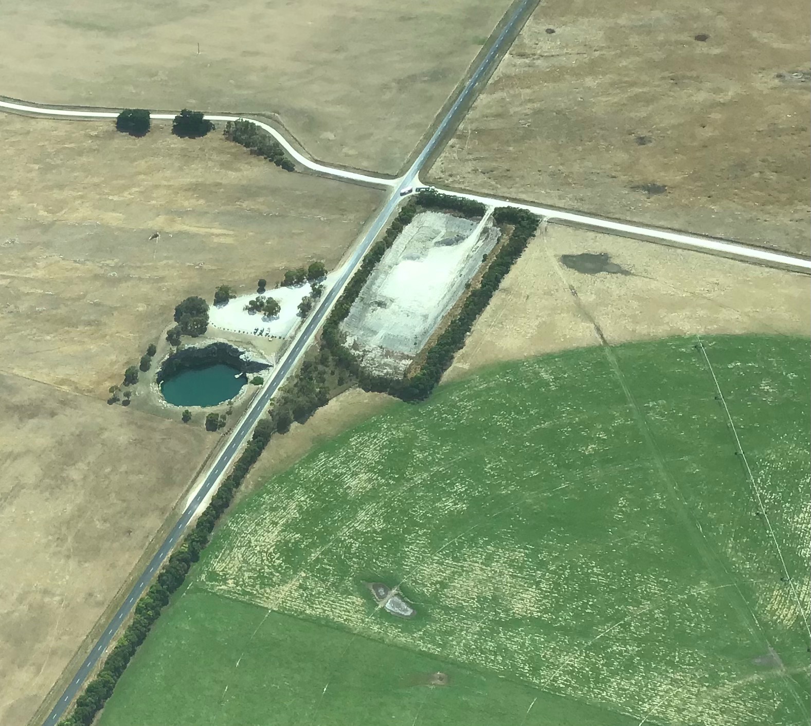
It’s a sink hole used for swimming and cave diving. There’s an extensive underwater cave system that divers love to explore. Since a number of drownings in the 1970s access for cave diving has been limited to suitable qualified divers. Nowadays they have to be holders of the CDAA Deep Cavern grade. The water is crystal clear, having been filtered through the surrounding limestone. The lake has a diameter of about 40 metres, with cliffs approaching a height of about 8 metres above water level and has a maximum depth of about 47 metres. A popular pastime for locals is to jump off the surrounding cliffs into the water. Given its depth, there’s no chance of hitting the bottom. According to a government website “Cliff jumping is dangerous and prohibited.” I suppose that’s so they won’t be sued by people who hurt themselves jumping in. It’s only suitable for experienced swimmers of course due to the depth of the water.
From the Little Blue Lake it was only a couple of kilometres to the Mount Schanck volcanic crater.
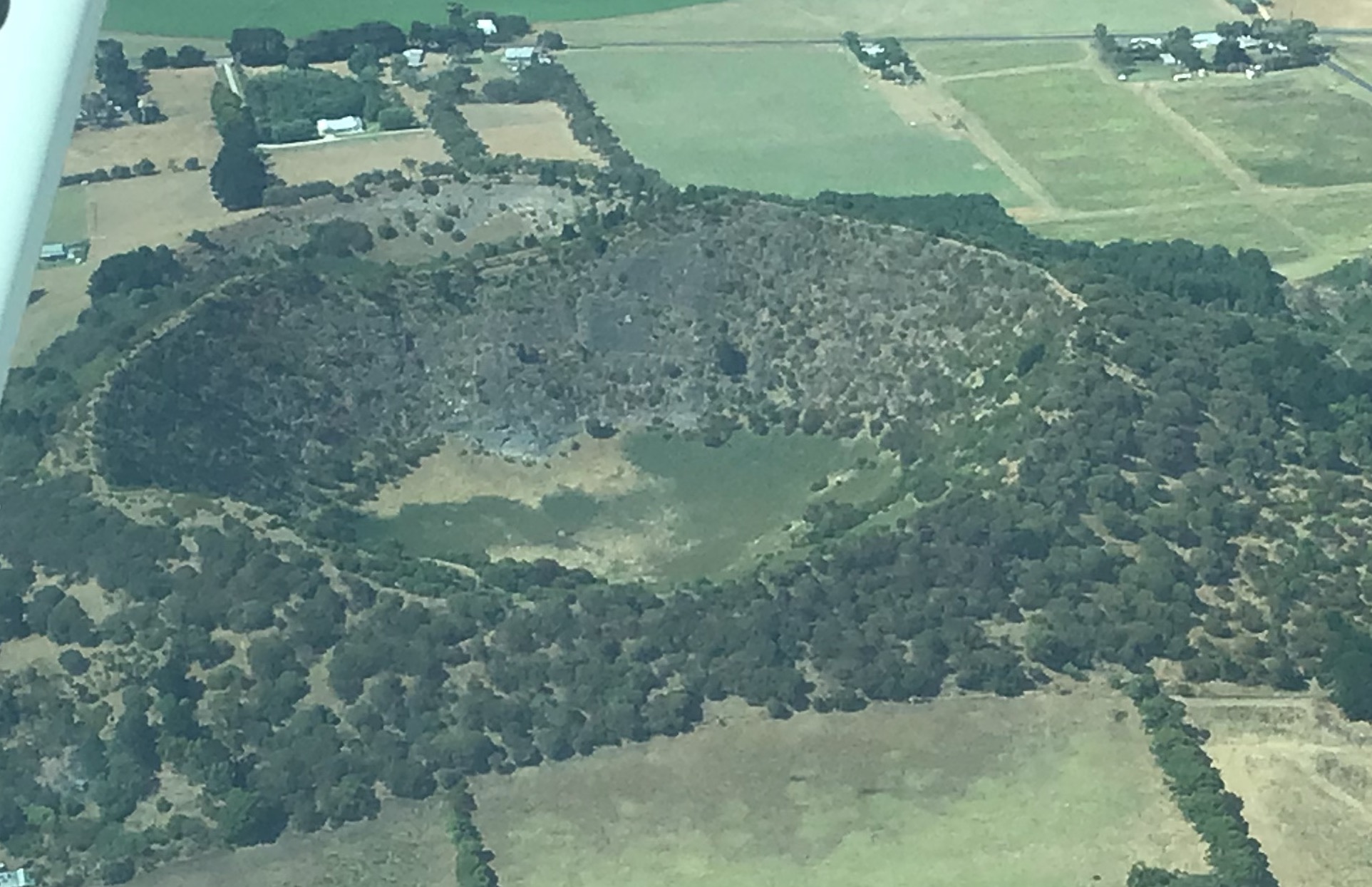
Part of Kanawinka Geopark (Kanawinka.org.au), Mount Schanck is slightly older than Mount Gambier. The 2km walk around the dormant volcano crater’s rim provides sensational views of Mount Gambier and surrounding areas. The volcanic cinder cone of Mount Schanck is a striking landmark. The cone has been little affected by erosion and rises approximately 100 metres above the flat coastal plain.
From Mount Schanck it was a 10 minute hop over to the Glenelg River on the Victorian border. We flew over the Princess Margaret Rose Caves, a subterraean limestone cave formation that is open for visitors during non-covid times. It’s quite a spectacular cave system so well worth visiting if you’re in the area. We followed the river as it wound its way between tall limestone cliffs down to its estuary and mouth at Nelson. In more normal times you can actually catch a boat from Nelson up the river to the Caves so worth considering – great day trip.

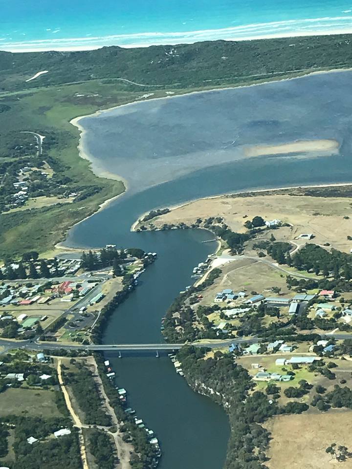
From Nelson we followed the coast past Piccaninnie Ponds, a favourite diving spot for serious cave divers

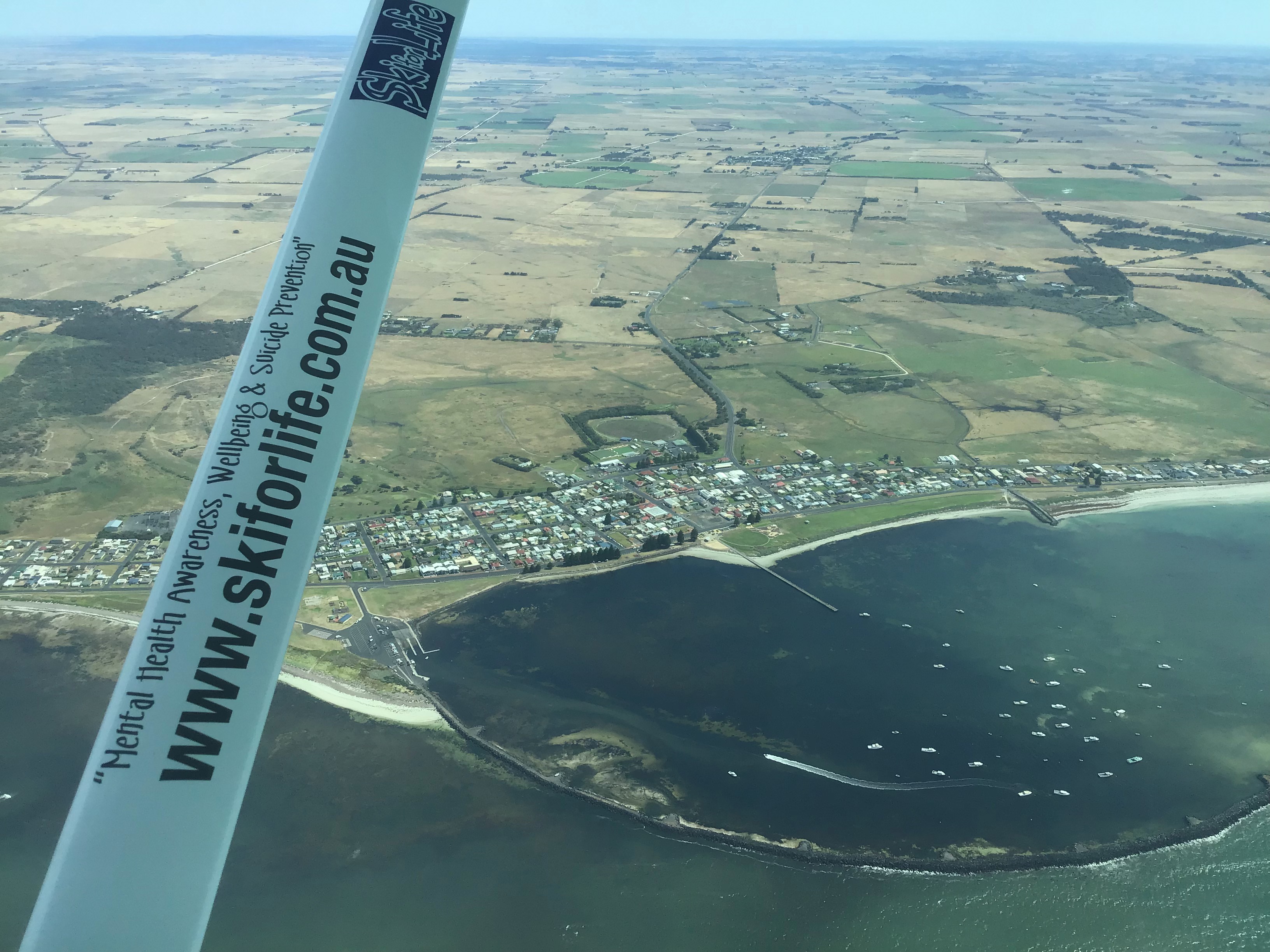
Further along the coast we flew over South Australia’s most southerly port, Port MacDonnell, a centre for the rock lobster fishing industry. Its breakwater is used to protect the fishing boats from the wild seas. It’s also called “the Shipwreck Coast” due to the high number of fatal shipwrecks that occurred in the 19th and early 20th centuries. There’s a great fish shop there where you can buy freshly caught and cooked rock lobster. Since China stopped import Australian lobster there’s more for us. Yumm!
Further along the coast we did a couple of orbits over the settlement of Pelican Point where another school friend has a beach house. He was expecting us and apparently waved but we couldn’t spot him, even after descending to 1500ft.

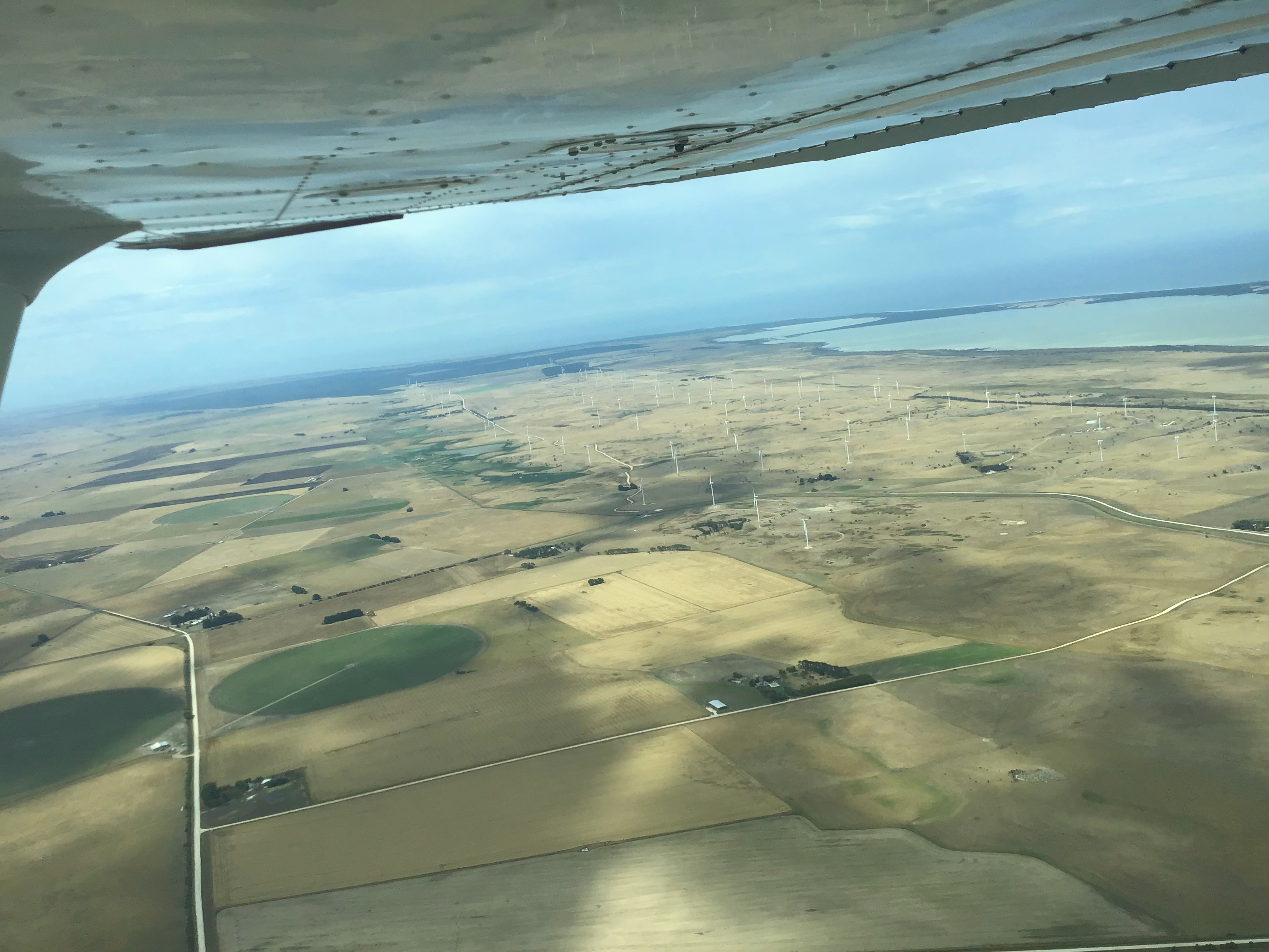
As we reached Lake Bonney, a large freshwater lake, we turned inland and passed over a massive wind farm. The 278.5 MW Lake Bonney Wind Farm comprises 112 wind turbines which include 46 Vestas V66 wind turbines and 66 Vestas V90 wind turbines.
I looked at my watch and noticed that we only had 30 minutes until my SARTIME. It was time to head back to Mount Gambier. In 15 minutes we were flying overhead the aerodrome. I checked the windsock and did a crosswind join for RWY11.

After a deliciously smooth touchdown we taxied back to the hangar and put CNY away. It had been an amazing and pleasant flight and I think we all enjoyed the aerial experience of the Limestone Coast.
