Moreton Island – Straddie – Gold Coast – Mount Warning – Scenic Rim
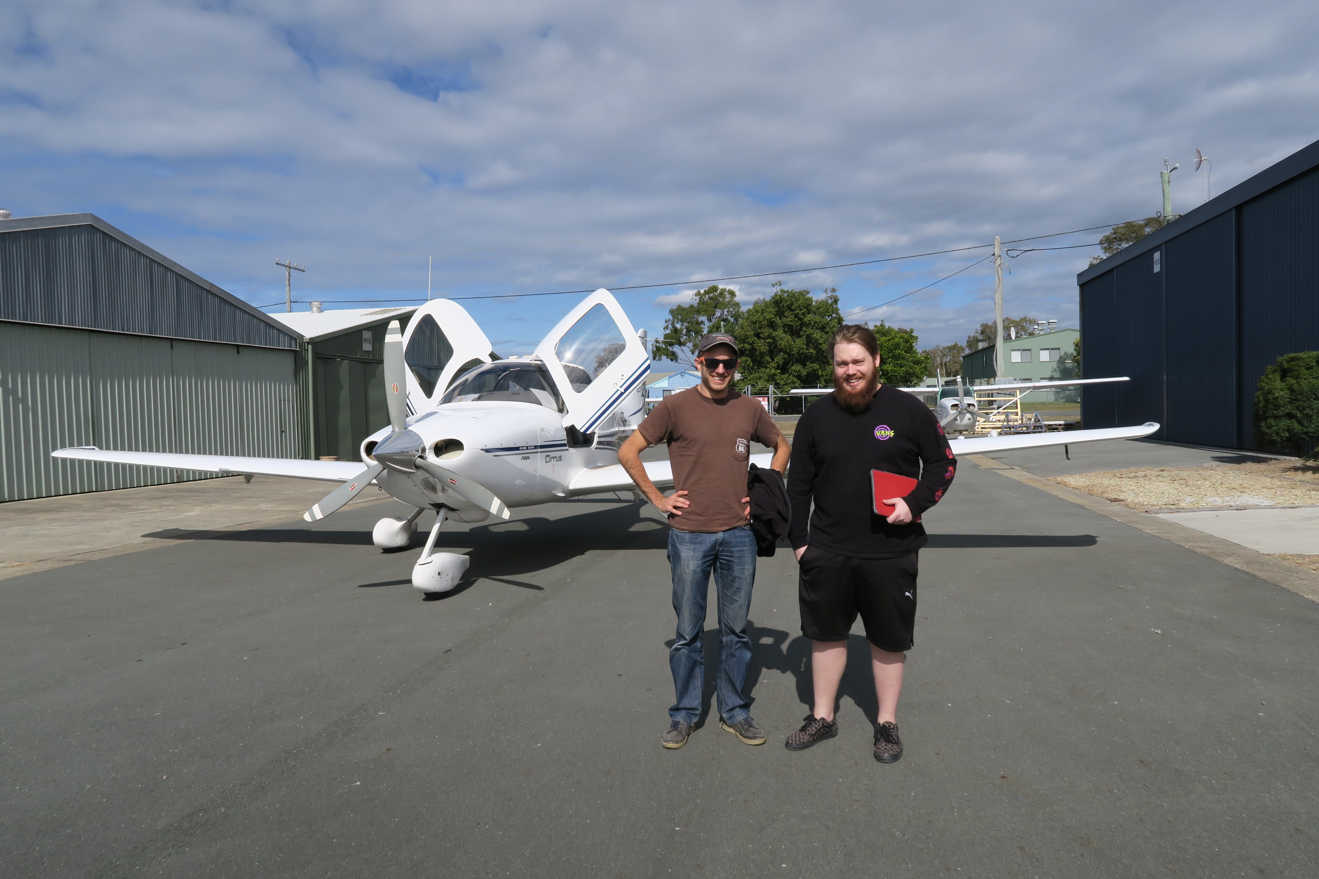
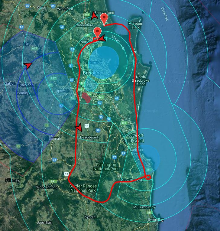
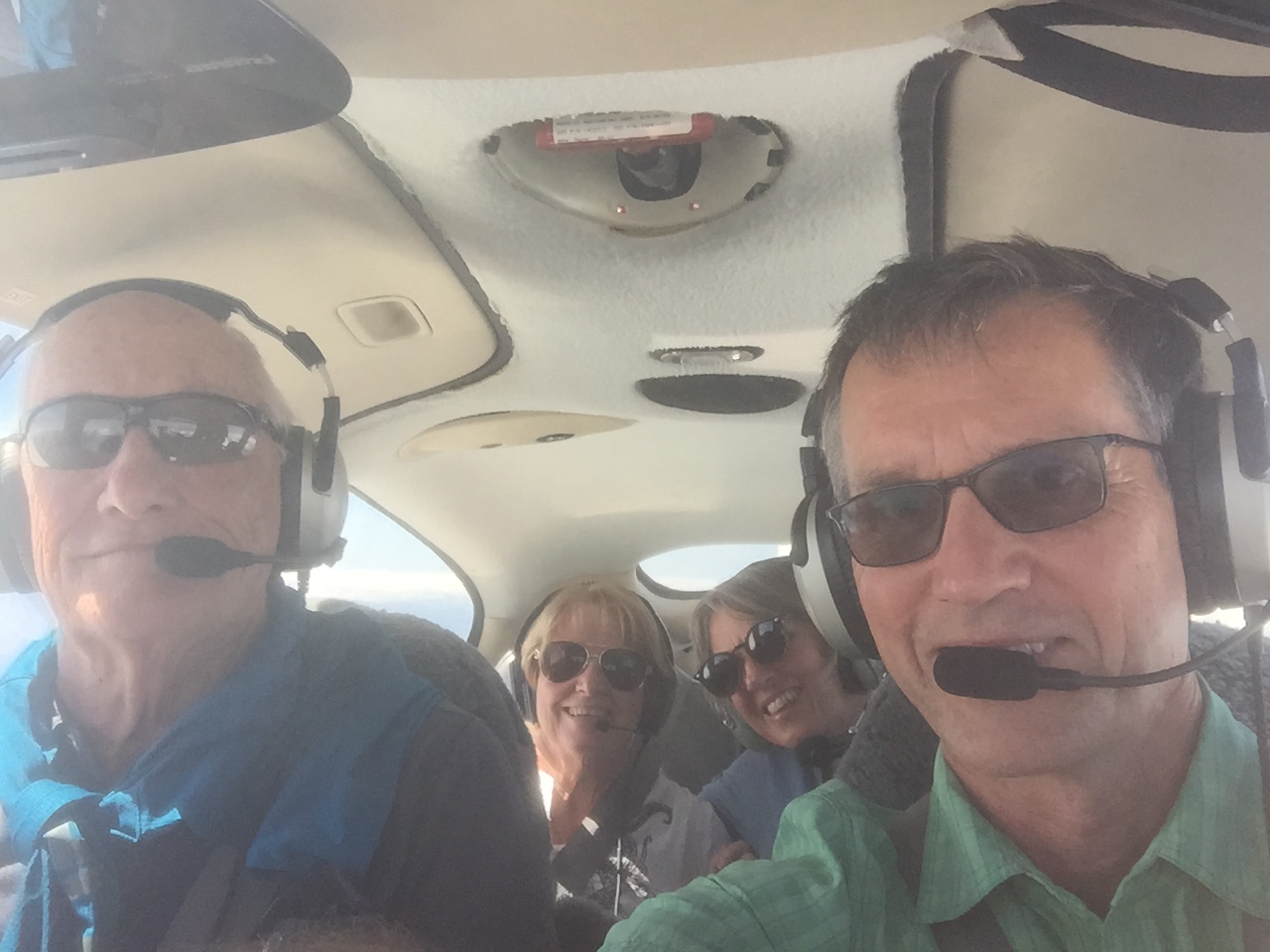
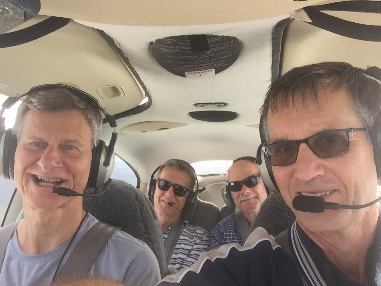
In May 2021 I took Tim along with his old schoolfriend Seb and Seb’s father Valther on a scenic flight down the coast and along the NSW/Qld border. The border ranges are also known as the Scenic Rim because they form the rim of a extinct volcano caldera, with Mount Warning being the volcanic plug at the centre. There are other volcanic remnants as well like Mt Lindesay but Mt Warning is the most impressive, also because, being located close to the eastern most point on the Australian mainland (Cape Byron), its peak is the first part of the continent to be touched by sunlight every morning. Tim had been hiking quite a bit around the scenic rim so it was good for him to see the area from the air. It’s also one of most spectacular areas I’ve flown over and I always remember my first flight along the border with an instructor from Redcliffe and being amazed at the rolling green hills and the villages dotted in between the volcanic remnants.
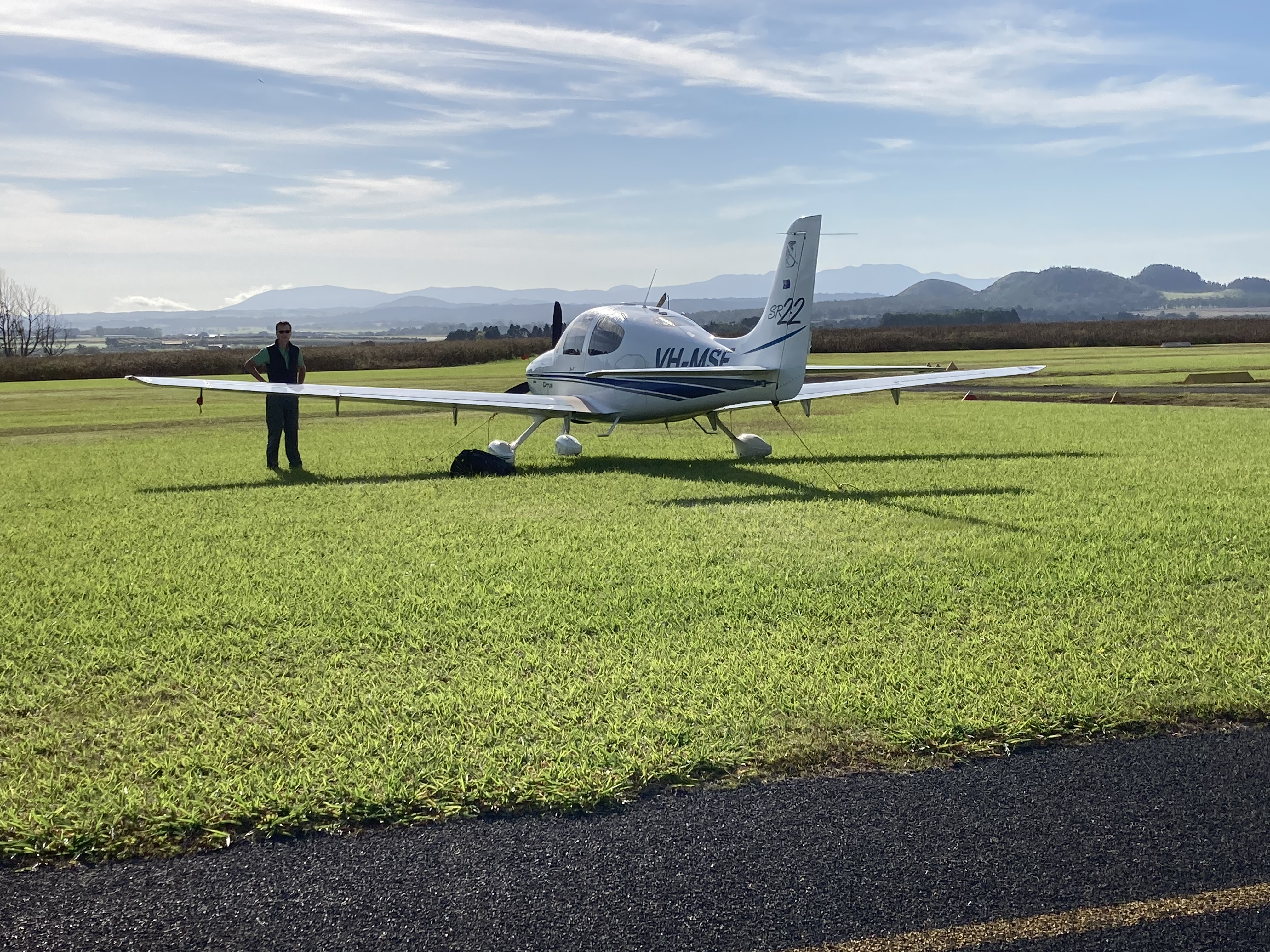
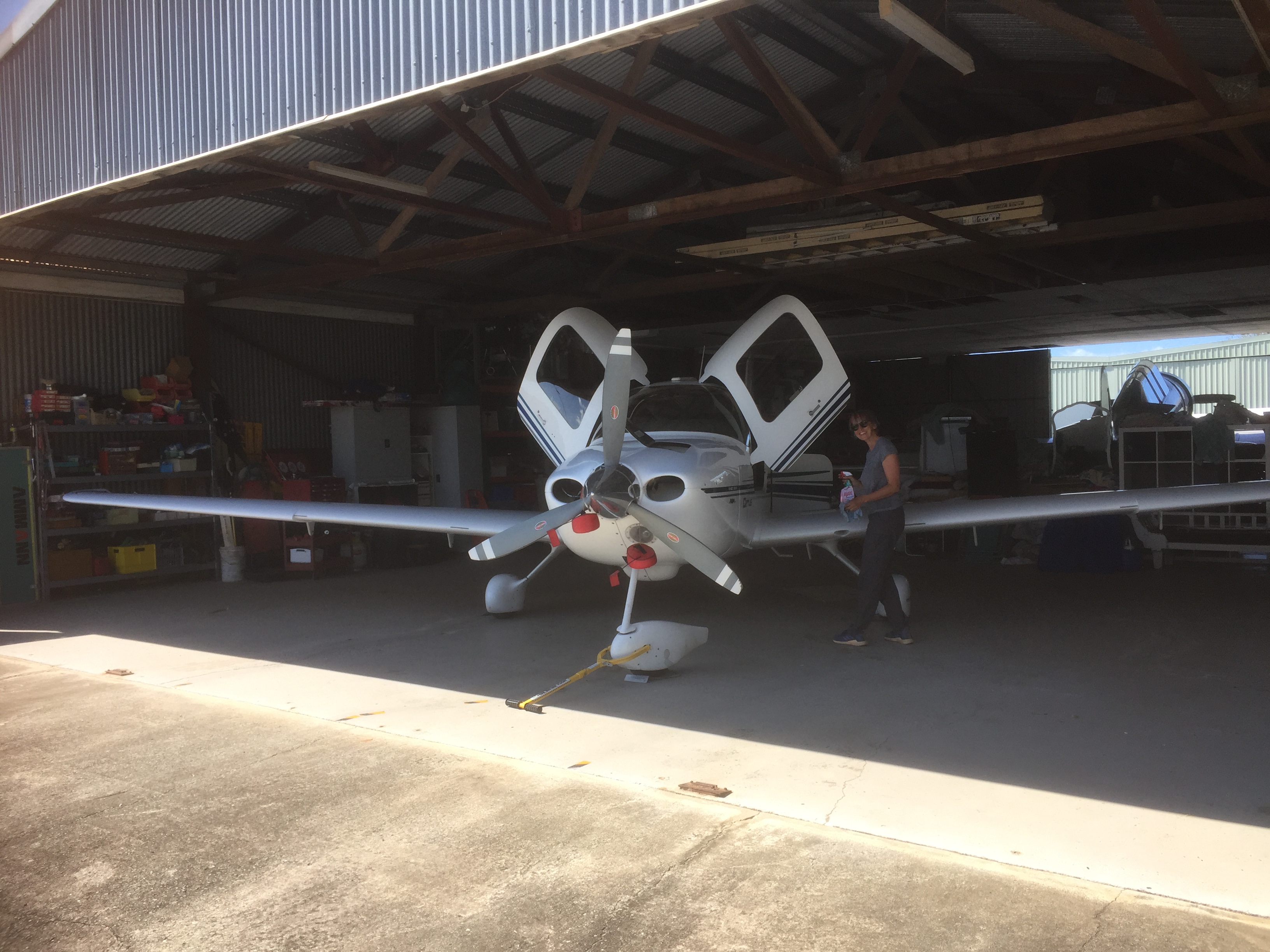
We started by pulling MSF out of the hangar at Redcliffe as usual and decided Seb should get in the front.
We took off and followed the coast around to Bribie Island.
Crossing the bay to Moreton Island we passed over Tangalooma Resort.
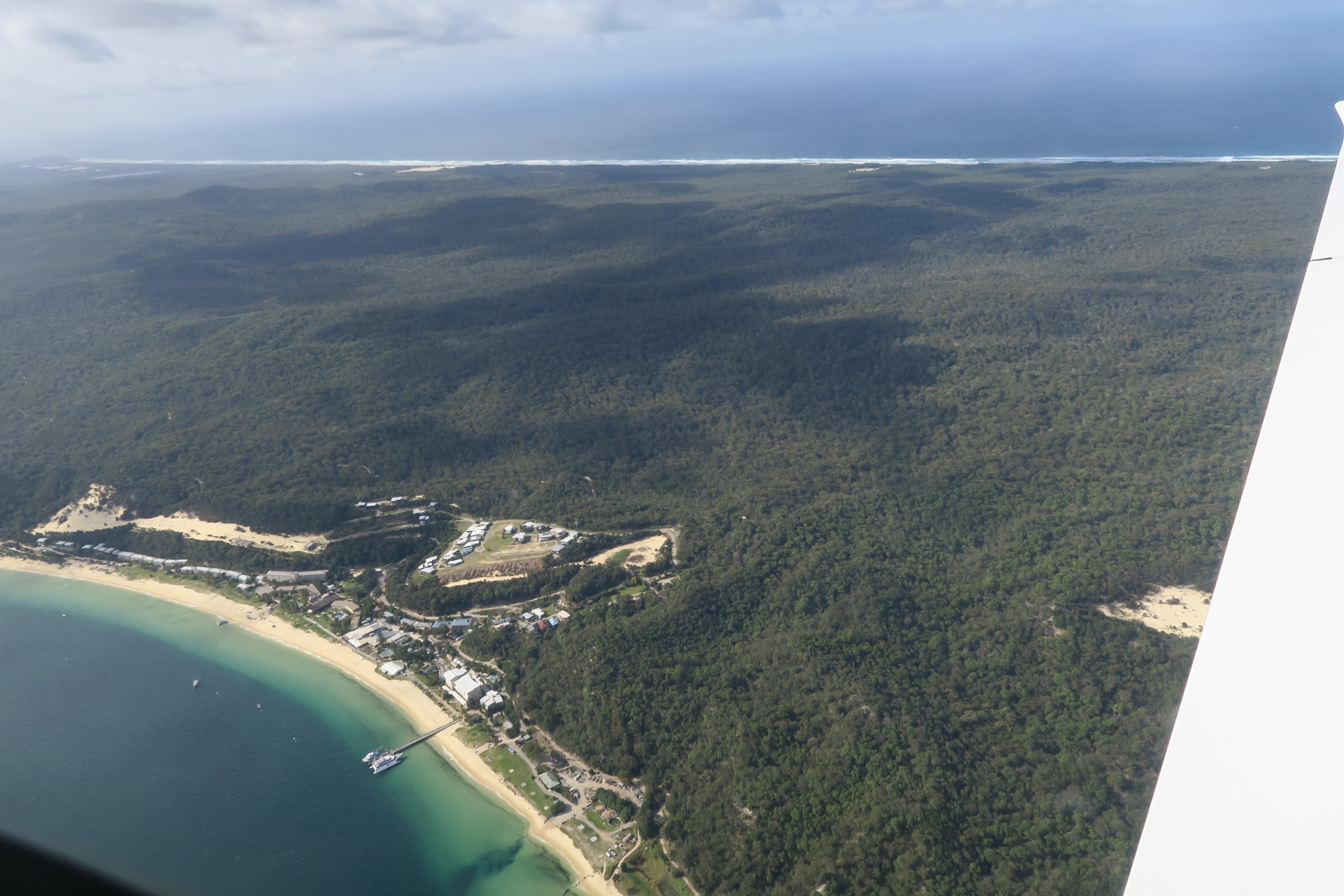
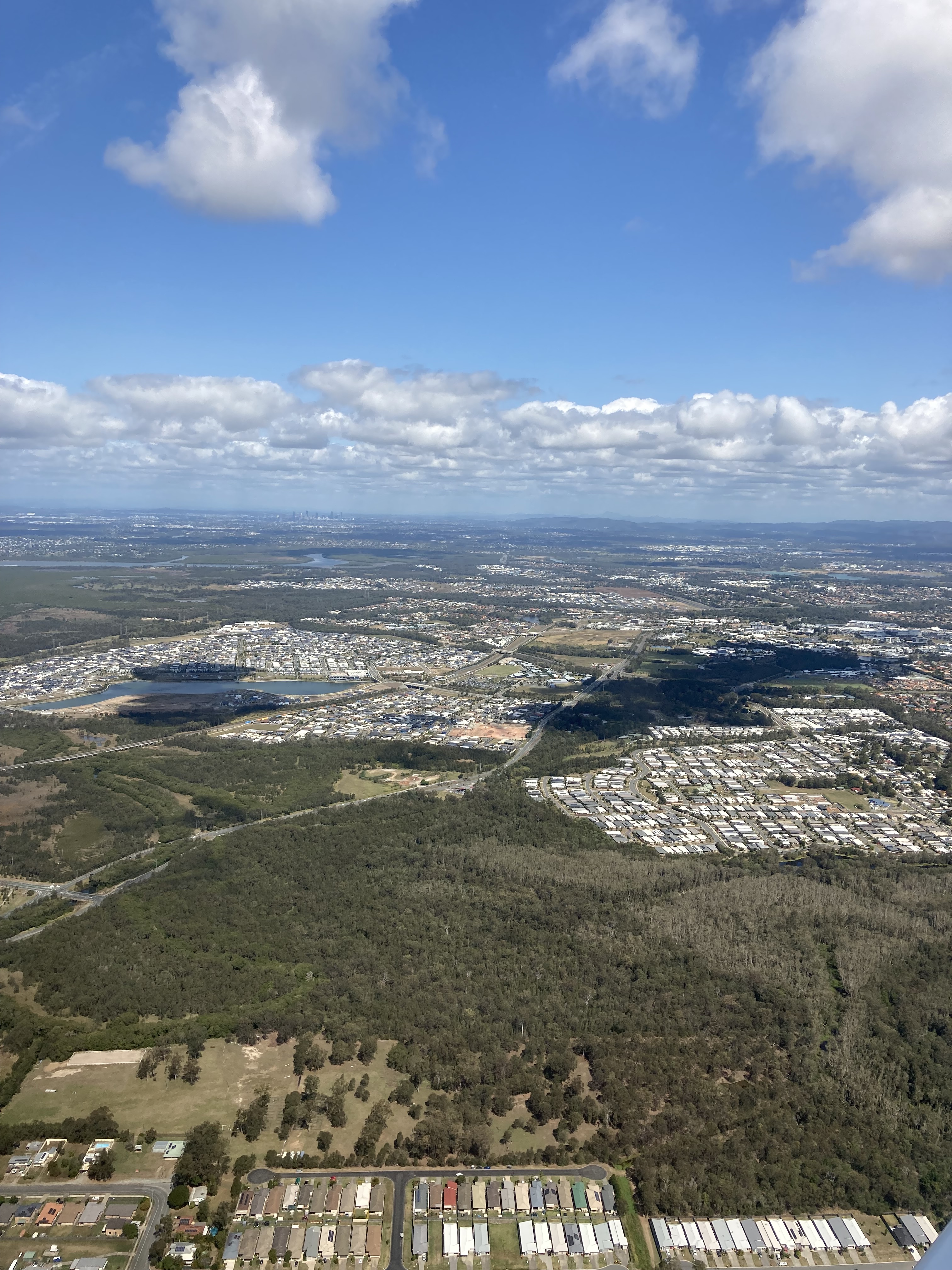
Flying down the west coast of Stradbroke Island we soon approached the Gold Coast. I obtained a clearance to enter the control zone but wasn’t able to fly down the coast to Tweed Heads as I’d planned. Instead we were directed inland from Burleigh Heads to stay clear of traffic arriving at the Gold Coast Airport.
Burleigh Heads
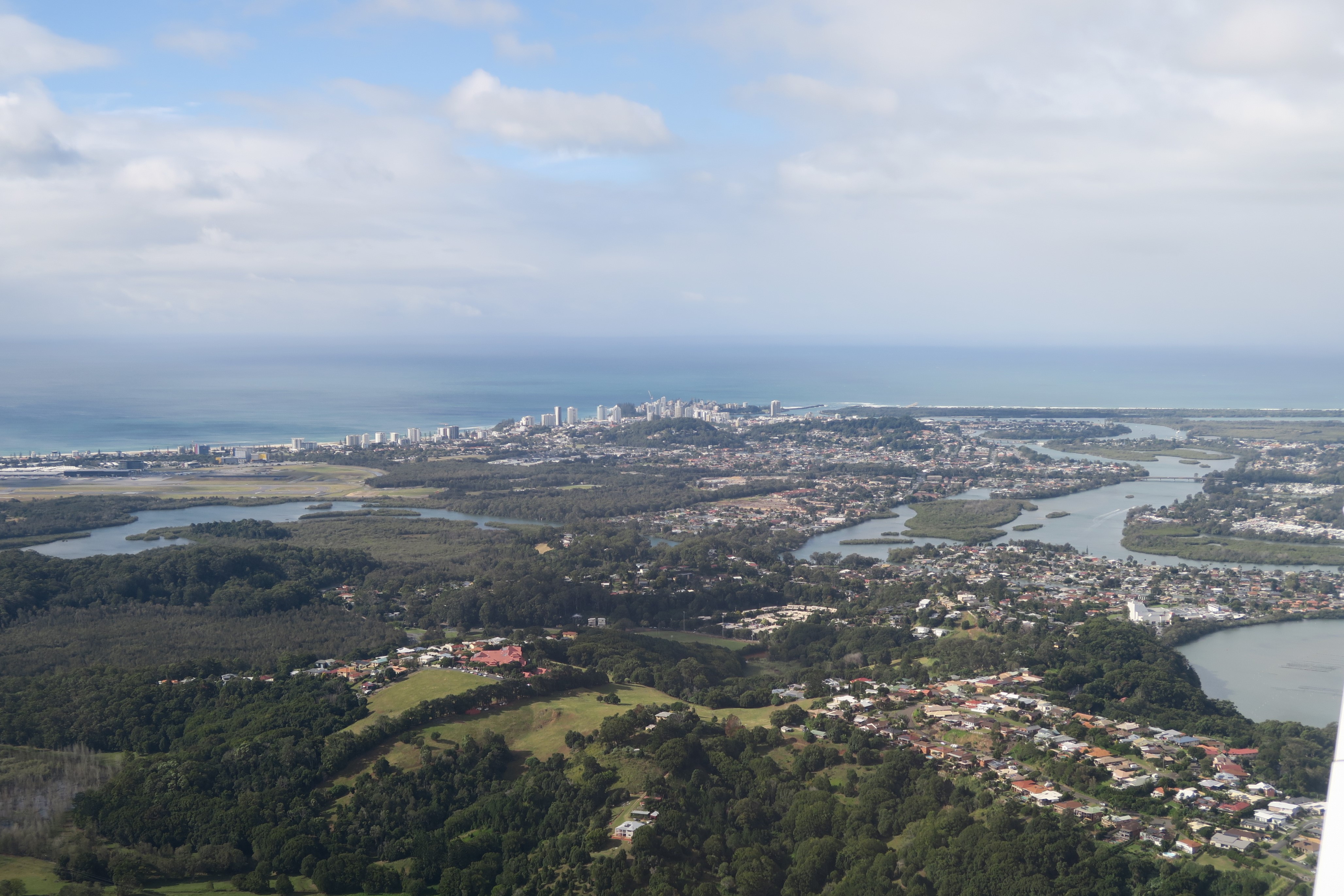
We could see the airport and Coolangatta/Tweed Heads in the distance as we flew down the western VFR corridor.
That brought us directly to Mt Warning.
After doing an orbit over a friend’s house at Round Mountain near Kingscliff we tracked inland, following the border as far as Mt Lindesay.
It really is spectacular countryside.
From Mt Lindesay we tracked up past Beaudesert and over the top of Kenmore and The Gap before returning to Redcliffe.
Valther took a video of the trip and spliced the best parts together, adding some music as well. Thanks Valther.
Watts at Biggenden – Controlled airspace violations – FNQ hotspots – A look into the past – St George flyaway – Noosa for lunch – A turf and surf adventure
Air combat engagement – Flight youth engineering – How to avoid excessive hangar rents – Stanthorpe flyaway – A birdy in Bargara – Chinchilla one long table – Electric aircraft the race is on
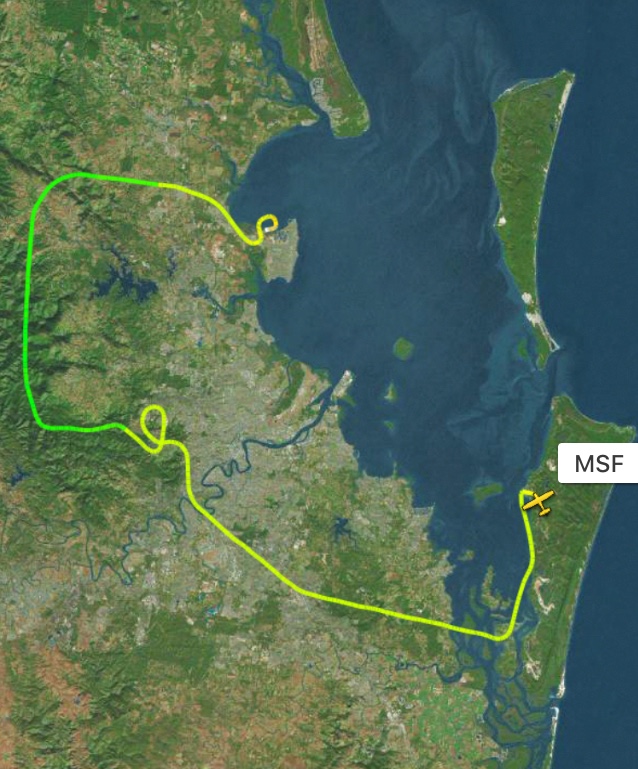
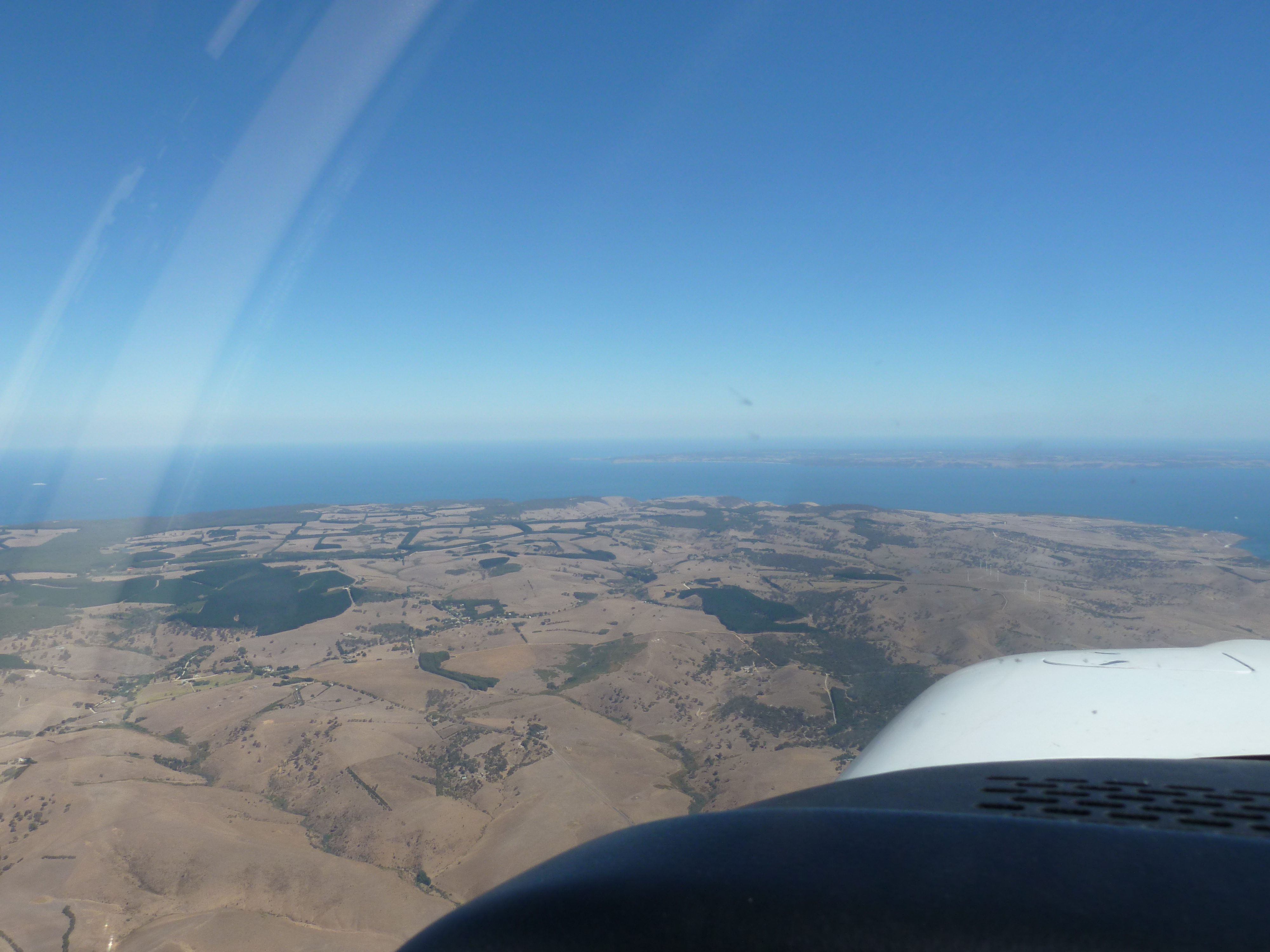
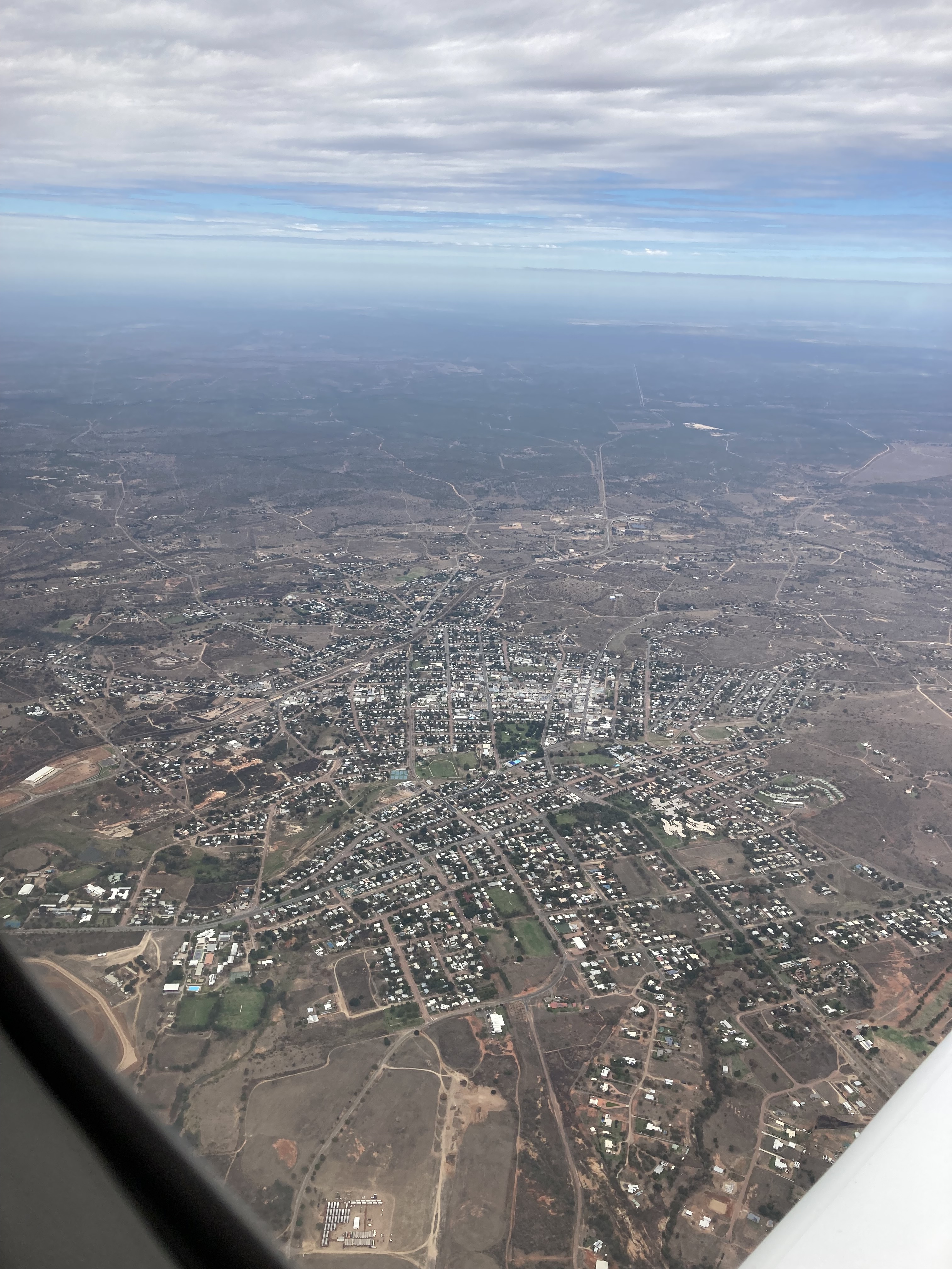
North Stradbroke Island (or “Straddie” to the locals) is located off the coast from Brisbane and is a bit of a local secret as a place to escape to for old style beach holidays. The largest town, Dunwich, has a small airfield with a grass and gravel strip. The local aeroclub likes to attract air tourists with a breakfast “fly in” held on the third Saturday morning each month. On Saturday 16th October 2021 my sister Liz and brother in law David joined me for a blue sky flight to the monthly breakfast. You may have seen further down the list of postings that one of my early flights was for breakfast at Straddie, a few years ago. I also flew there once on my way to Coffs Harbour. We’ve been quite a few places since but it’s always nice to go back and this was the first time in MSF.
Liz and David had flown with me before but we still did a preflight briefing including a description of the route I intended to fly. We’d be flying over water so there was a brief instruction on the wearing of the life jackets as well.
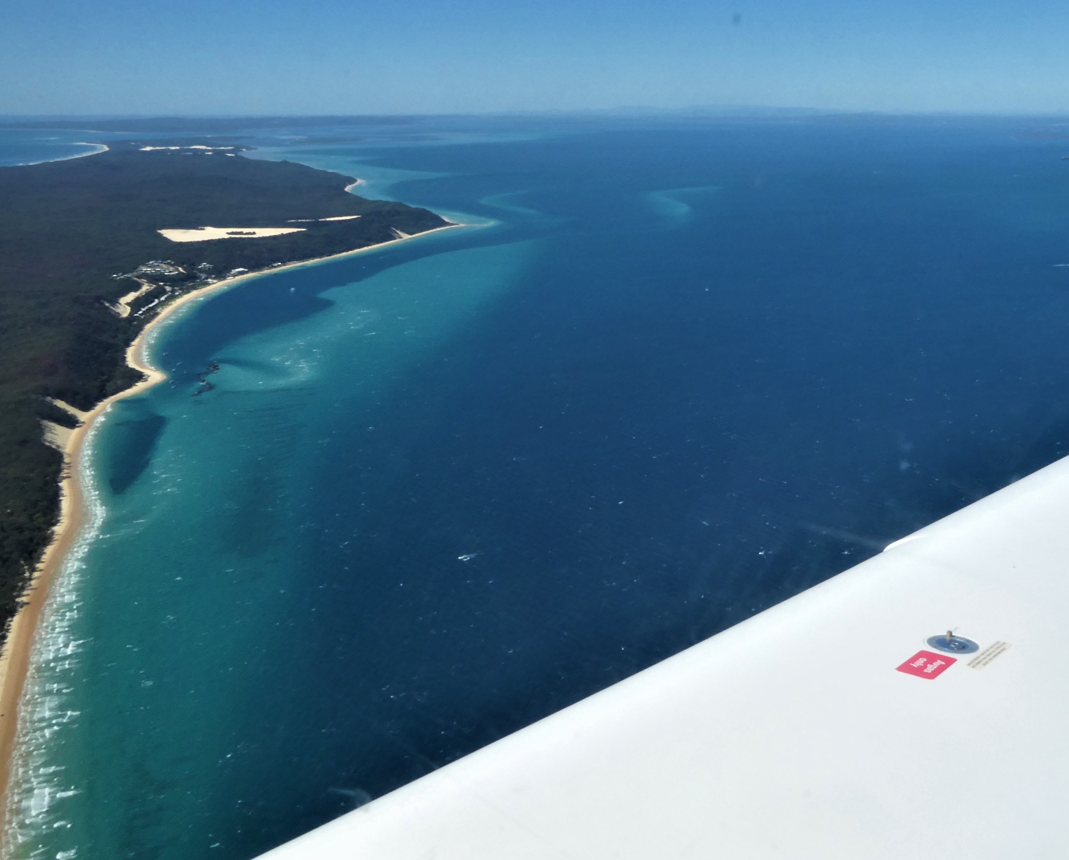
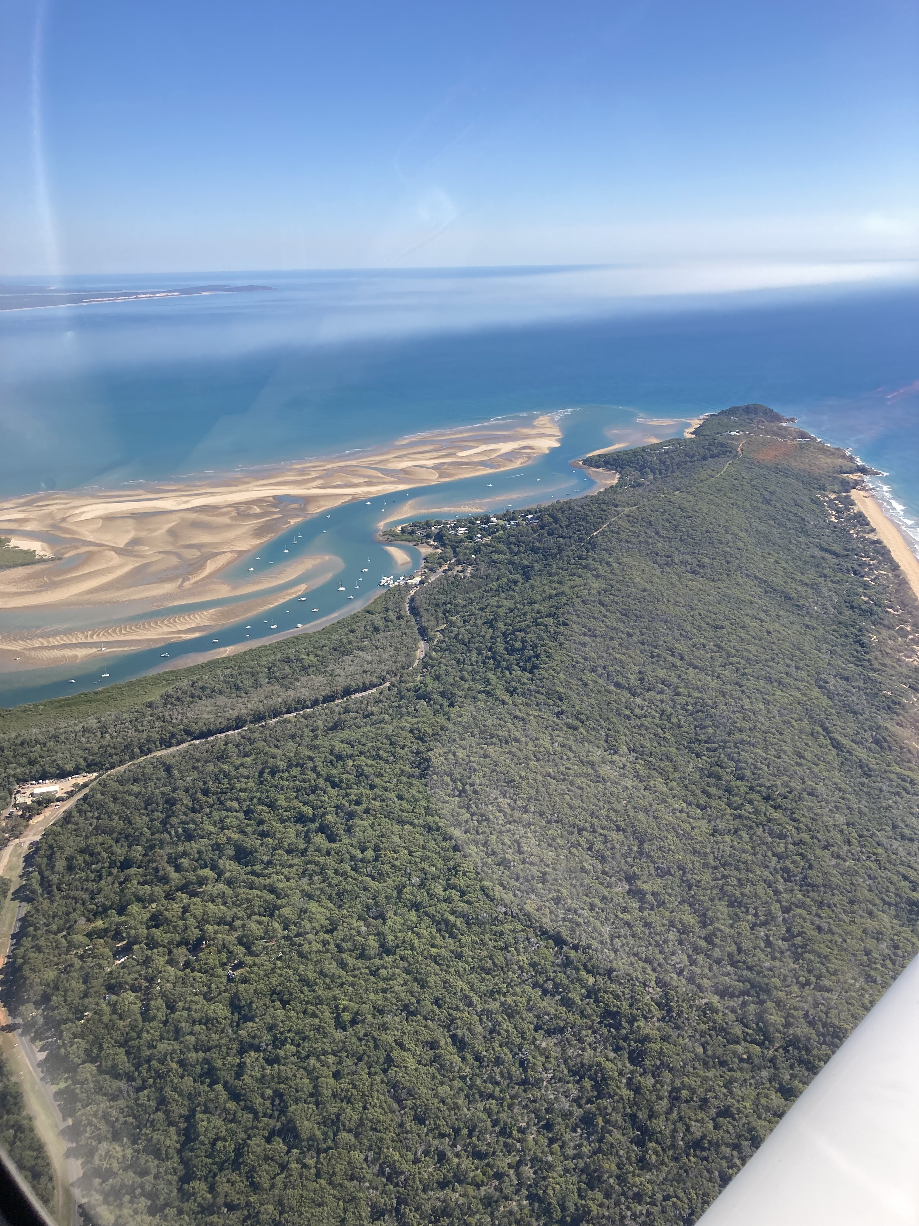
Taking off on RWY25 into a strong westerly wind, we followed the coast to Woorim on Bribie Island then crossed the bay to overhead the Tangalooma Resort on the west coast of Moreton Island.
Moreton Island with Tangalooma
The 15knot westerly caused a few bumps over the land but it was smooth as we crossed the bay and flew down the west coast of Moreton Island to Dunwich.
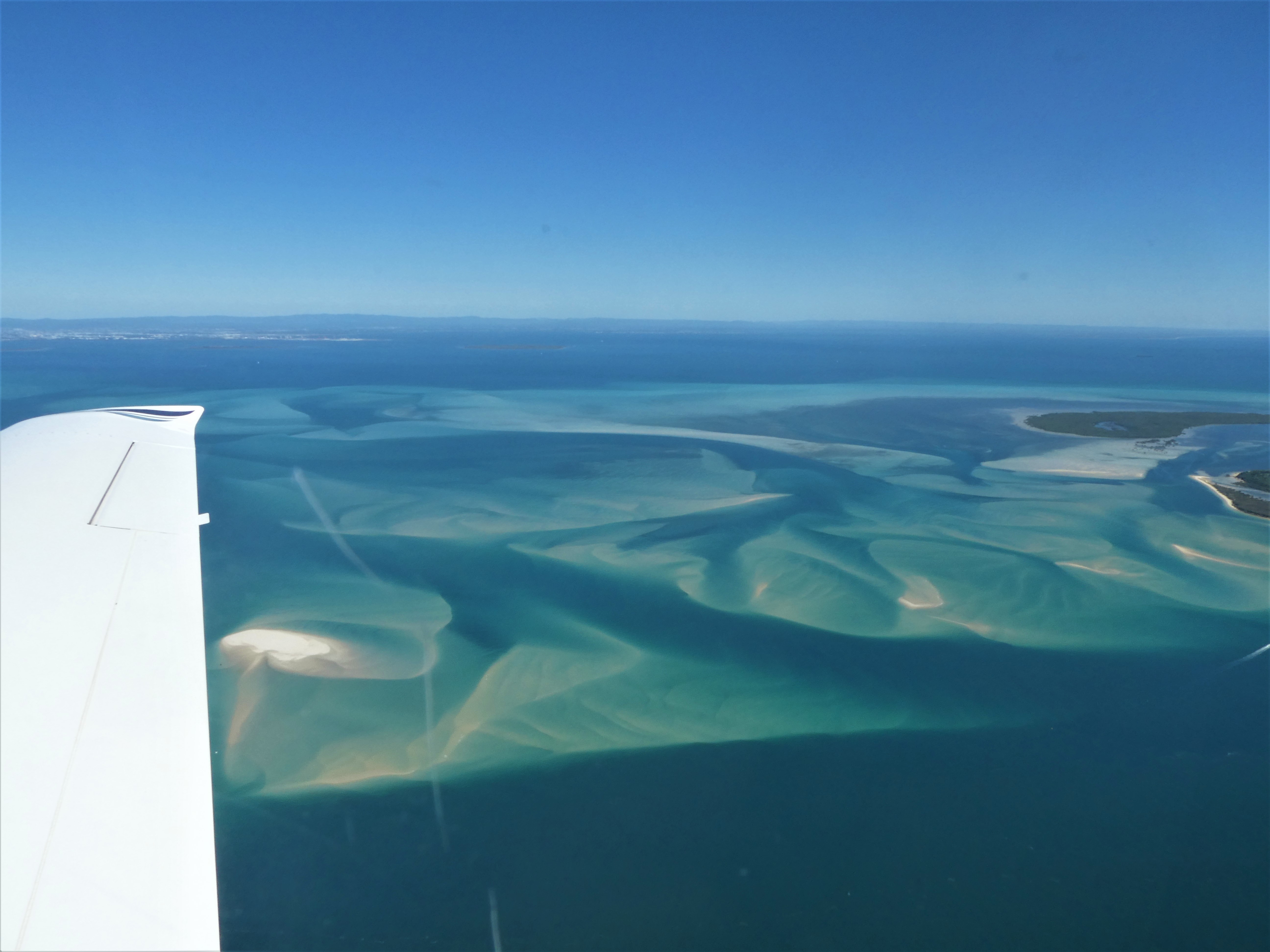
Patterns in the sand in Moreton Bay
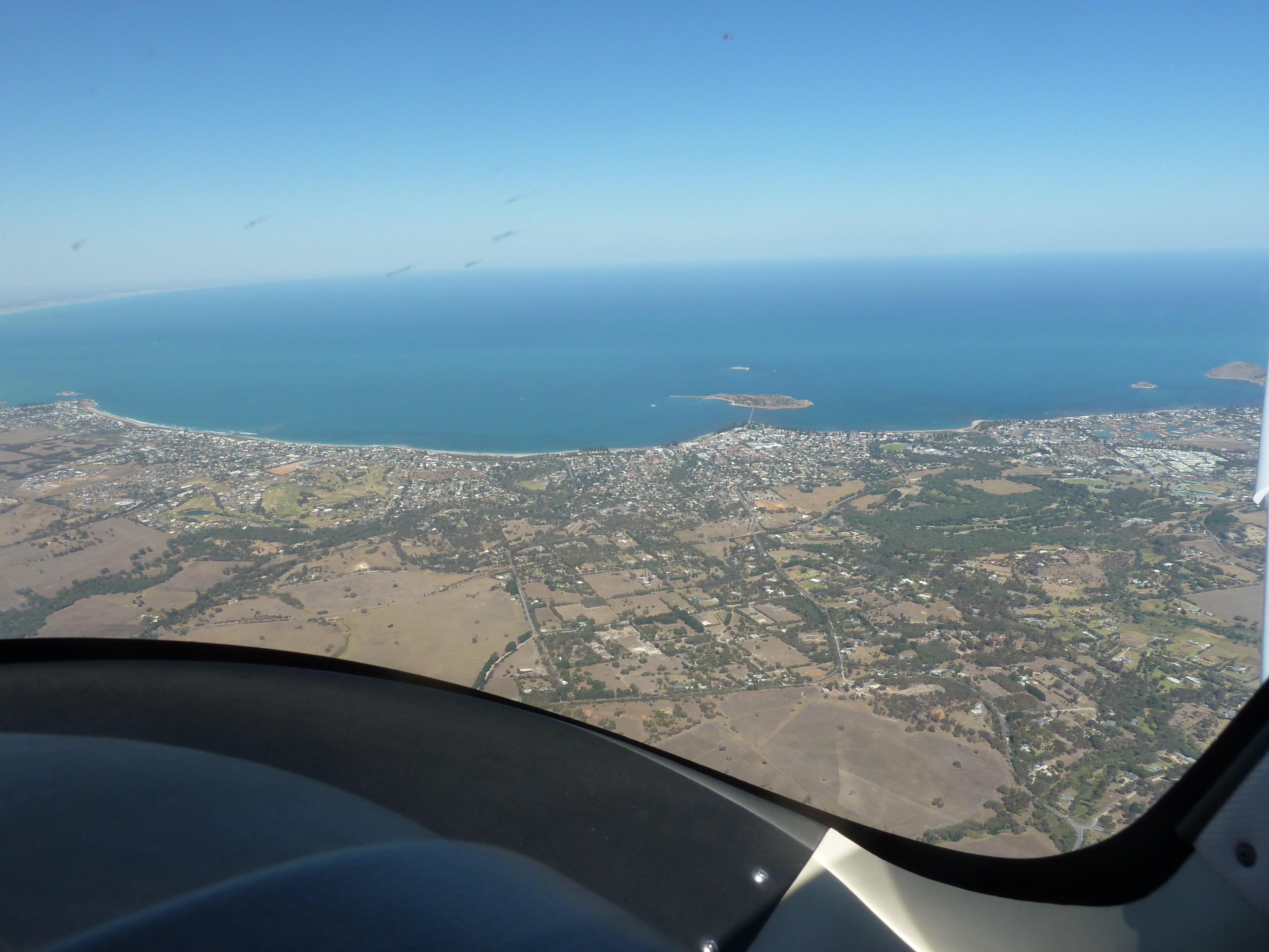
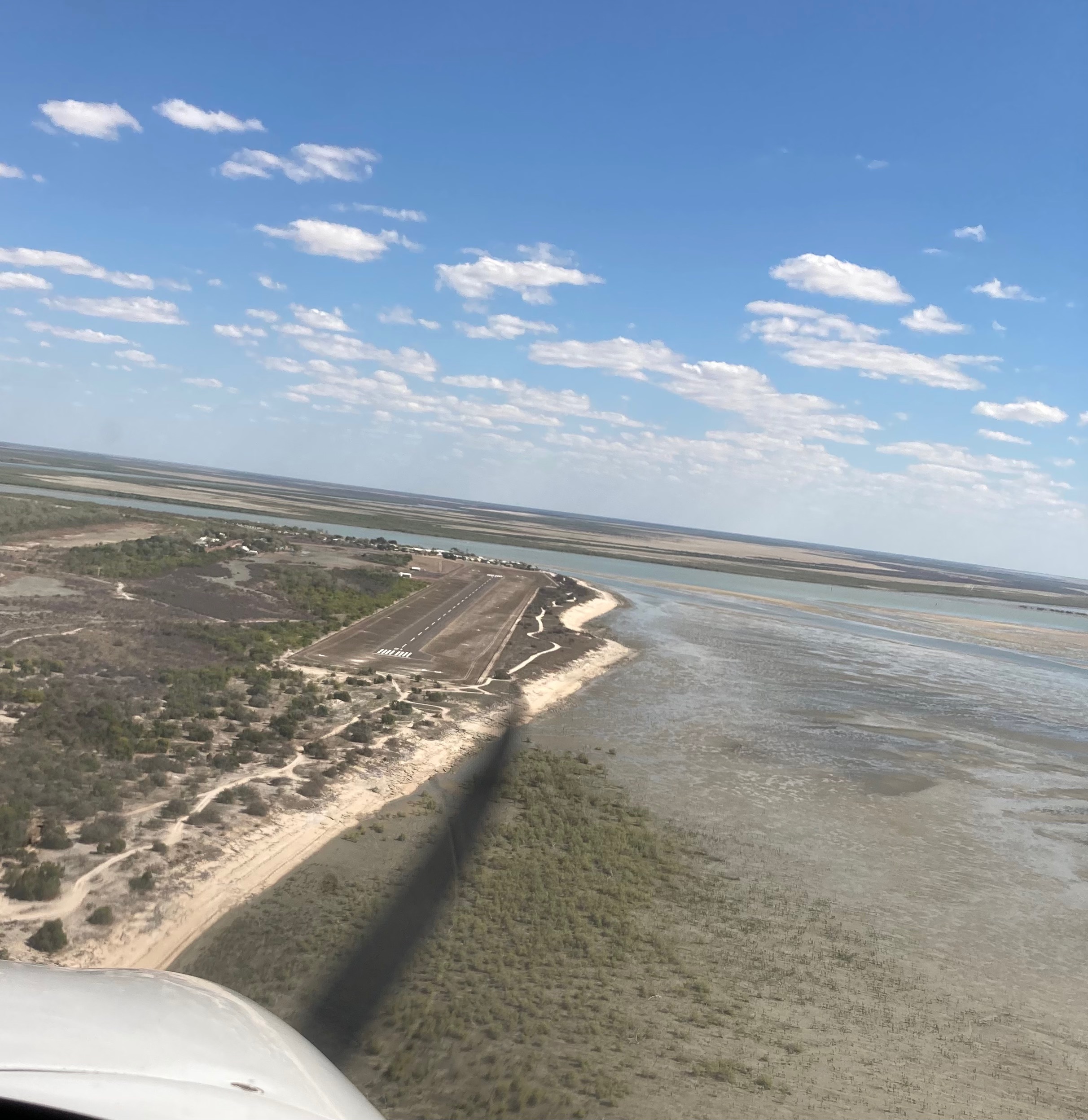
I mentioned that we’d have to inspect the windsock first to confirm the cross wind at the Dunwich strip wasn’t too bad. If it was too strong we would have to give the landing (and breakfast) a miss. We flew over the top of the airfield at 2500ft and the wind looked fairly calm. Another aircraft was taking off from RWY33 as we descended to circuit height and joined midfield crosswind. On final the windsock showed almost no wind and we touched down lightly, using most of the 800m long grass strip to pull up.
Flight route to Straddie
Liz had originally thought we’d go for a taxi ride to a cafe at Point Lookout on the north east corner of the island but I think she found the unique atmosphere at the Dunwich AeroClub just as much to her liking! Unfortunately Pat the owner had told me to arrive at 9am for breakfast but by the time we touched down just before 9 the food was almost all gone. Apparently the first plane touched down at 6:30! and breakfast was on just after 8am. At least we could watch most of the other 26 aircraft depart while we sat and drank our coffee.
By the time we were ready to leave there were almost no other planes left so we had plenty of time to backtrack the runway.
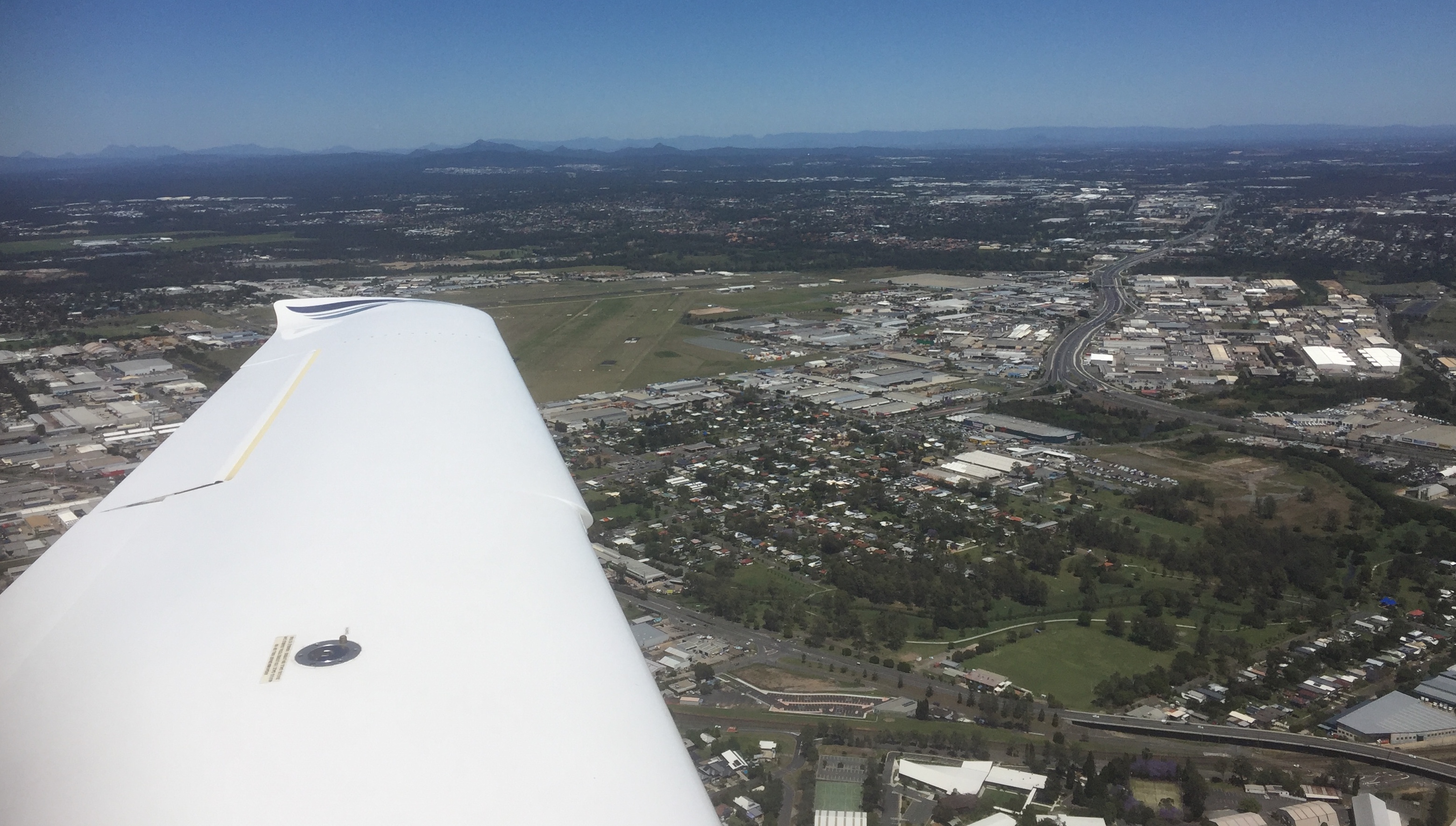
We took off from RWY33 and climbed out over Dunwich township then continued our orbit of the bay. First we flew to Russell Island and Mount Cotton and obtained a clearance to fly through the Archerfield controlled airspace.
Passing Archerfield Airport
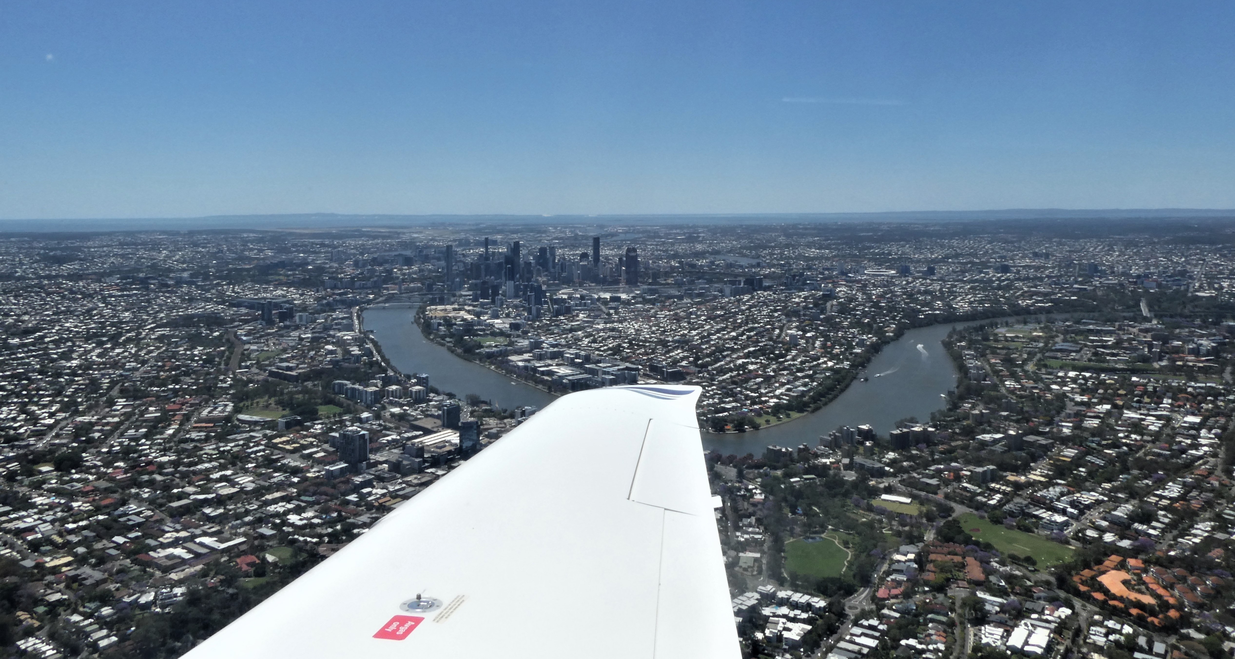
From there we flew between the Brisbane CBD and Mount Coottha before doing an orbit over The Gap and passing over Mount Glorious on our way back to Redcliffe.
Brisbane CBD and the Toowong Reach of the Brisbane RiverMount Coot-tha
I grew up in South Australia so ever since I obtained my PPL I was keen to do some flights around the state. After flying to Mildura in 2107 I knew how far it is to get there from Redcliffe so I decided in early 2018 to investigate whether it’s possible to hire aircraft locally, with the aim of flying on Qantas or Virgin to Adelaide and then flying private from there. It’d reduce the cost and save time. I’d noticed on the internet that for a small membership fee the Adelaide Aero Club hired out a few different aircraft including Cessna, Piper and Cirrus so while working in South Australiain 2017 I dropped into Parafield airport. I discovered that the Bruce Hartwig Flying School does check flights for the aero club out of their training centre at Parafield so decided do a check flight with them.
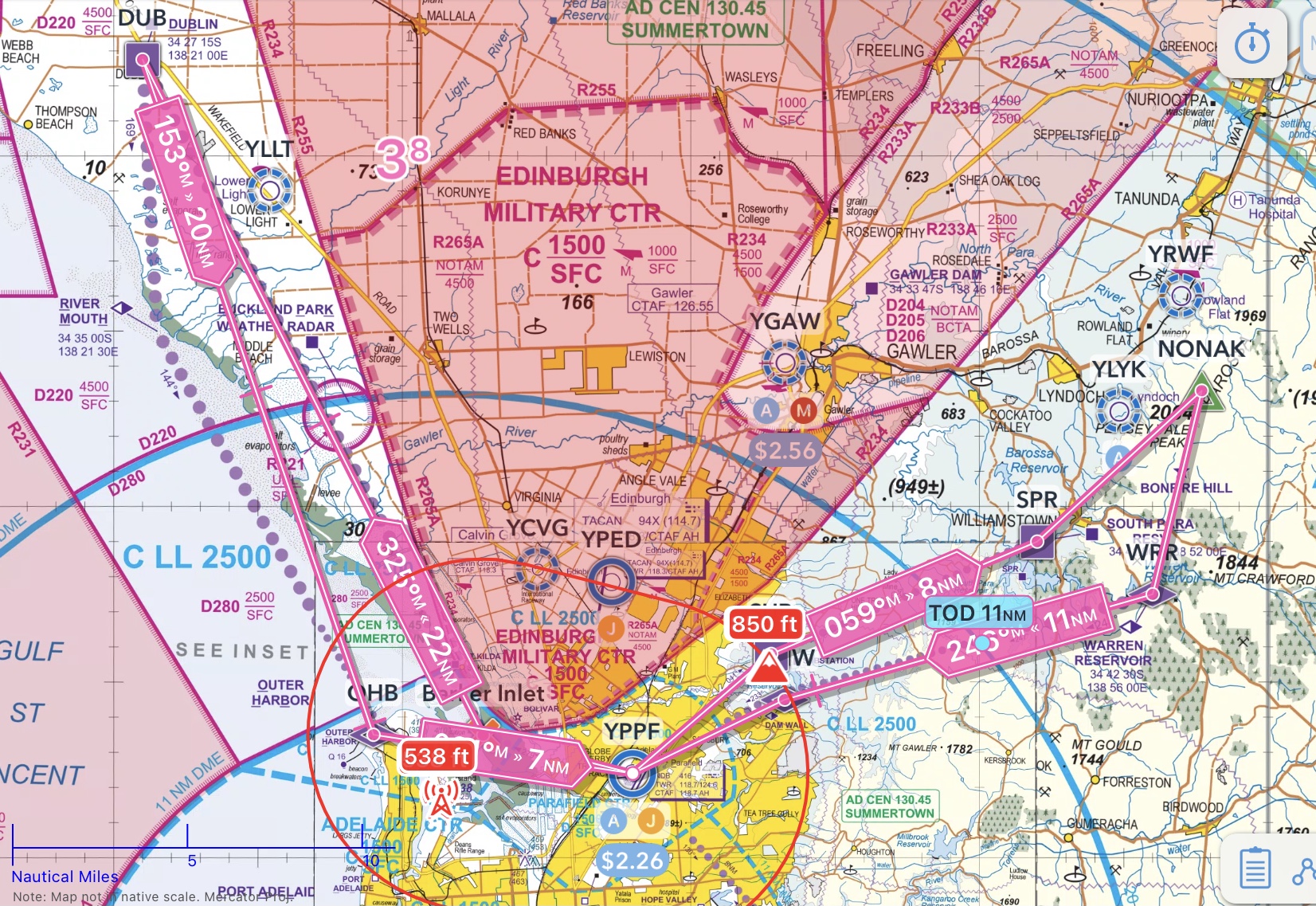
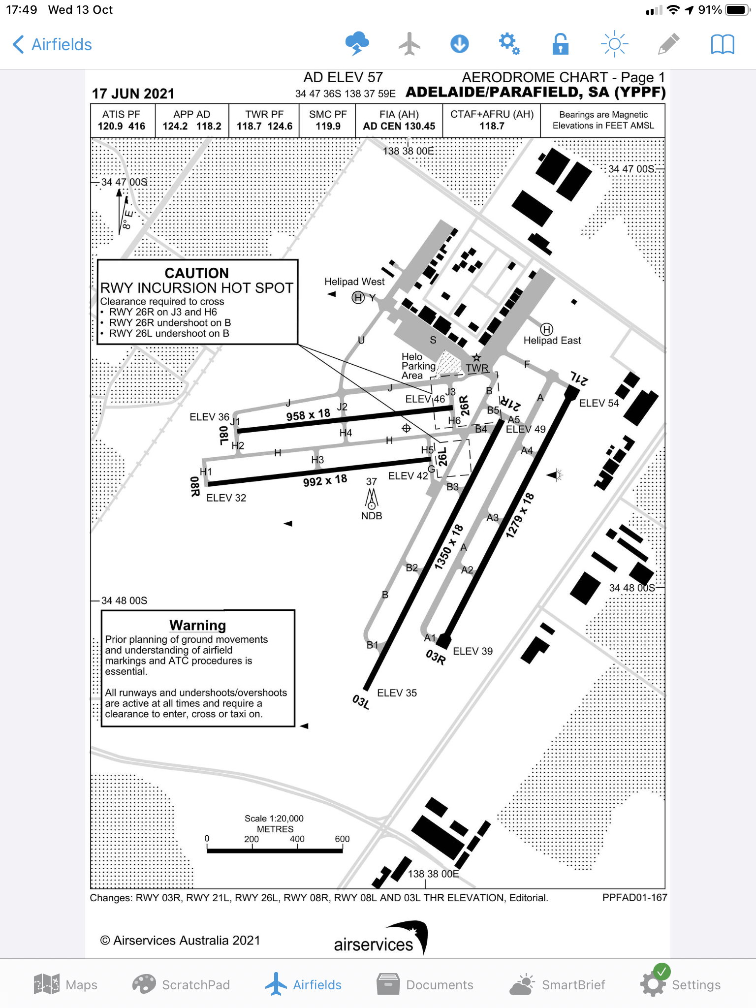
It’s fairly congested airspace as Parafield, being a D Class CTR, is located just north of Adelaide International CTR and just south of Edinburgh Military CTR with controlled airspace directly overhead. It’s a bit like Archerfield stuck between Brisbane and Amberley, but tighter. I decided to combine my check flight with some instruction to build up my local knowledge of the airspace.
Prior to arriving in Adelaide, I read up the ERSA on Parafield and the various procedures for departures and arrivals both VFR and IFR. I also reviewed the CASA OnTrack website for Parafield and listened into the live ATC for YPPF Ground and Tower and watched a couple of good YouTube videos of people flying VFR and IFR in and out of Parafield. I tossed around a few ideas with the flying school by email and then ended up with the following plan:
Day 1: Departure from YPPF via St Kilda to the north west corridor to the training area around Dublin, return to YPPF via Outer Harbour, touch and go, depart to the north east via Substation out to the southern Barossa and then return via Dam Wall to YPPF for a couple of circuits. This would allow me to become familiar with the ground movements and departure and arrival procedures for the two main VFR corridors to the north and east.
Day 2: Depart from YPPF via St Kilda obtain a clearance through Adelaide CTR coastal to Aldinga Beach and land for a break. Depart Aldinga Beach and follow the coast around Fleurieu Peninsula to Goolwa then back to Adelaide via Port Noarlunga, traverse Adelaide CTR and return to PPF via Outer Harbour. This would allow me to become familiar with the procedures for flying south via Adelaide CTR, the fastest way to Kangaroo Island, one of my would be destinations.
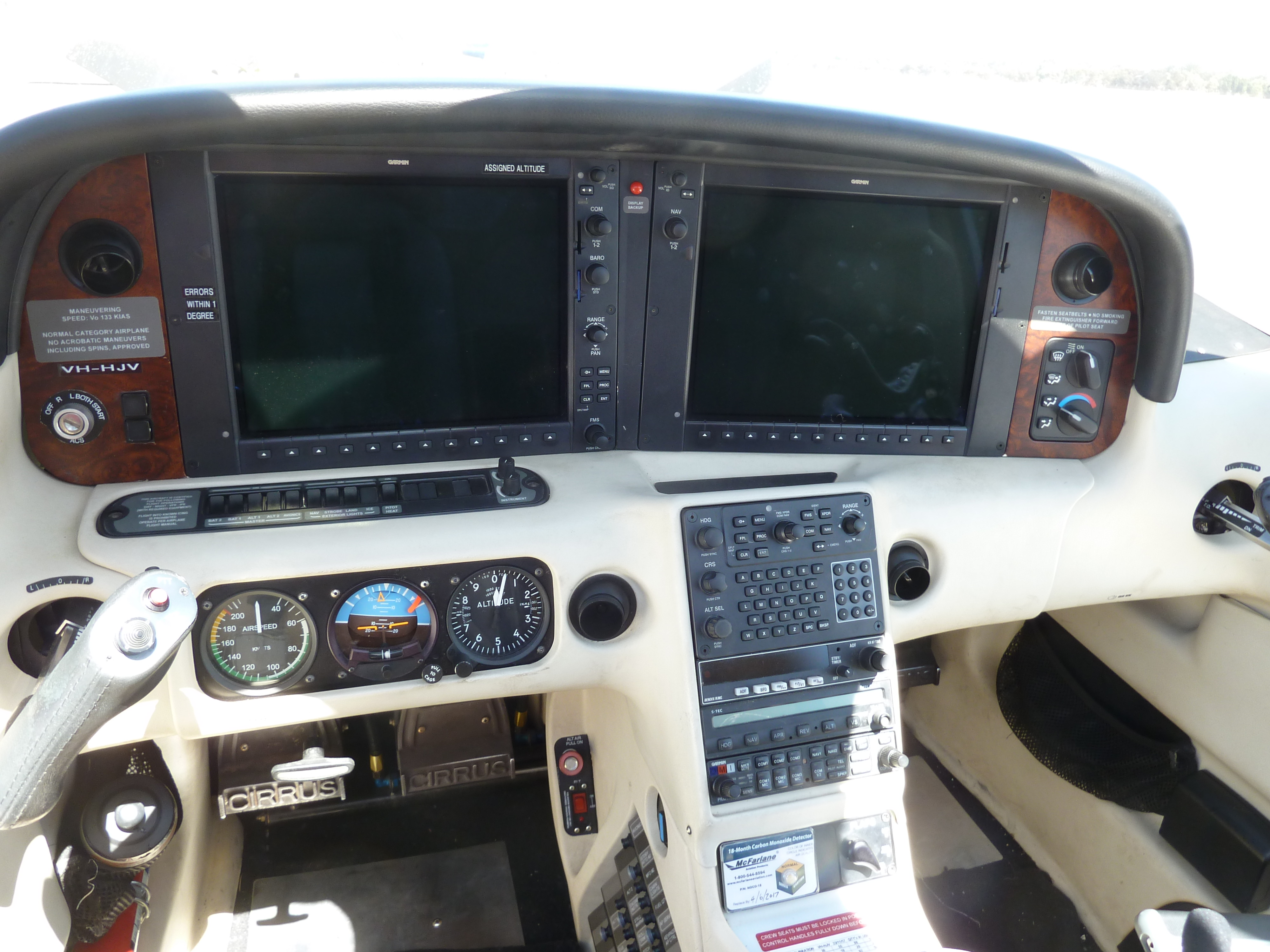
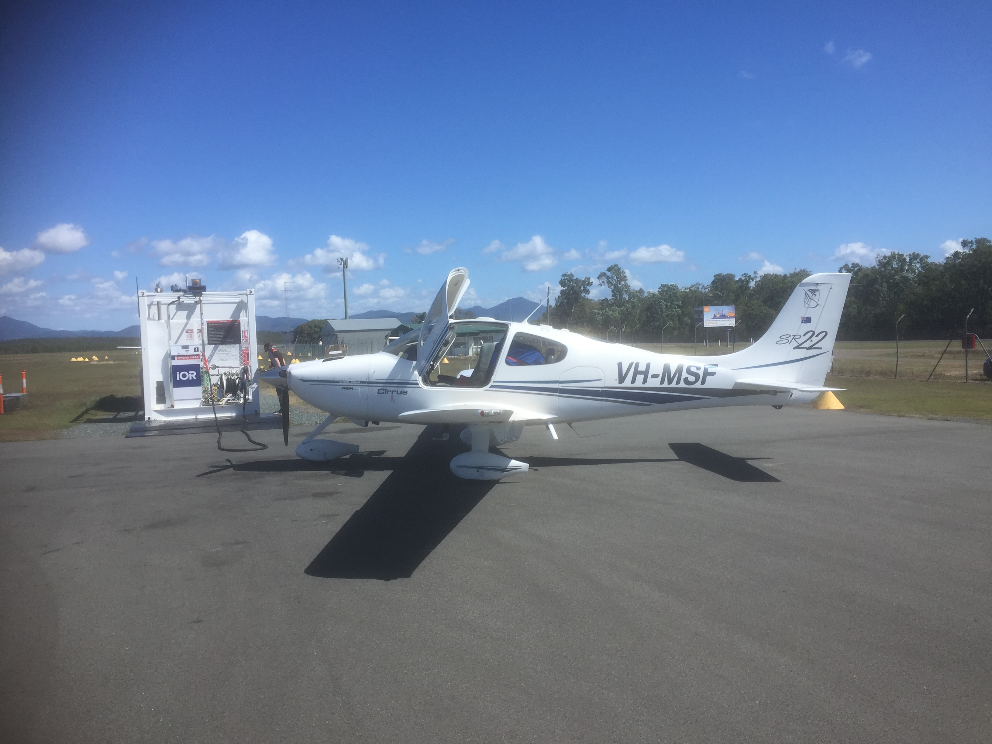
After booking an instructor and VH-HJV, a Cirrus SR20, I planned the flights in OzRunways and headed off to Adelaide, arriving at Parafield on a pleasant sunny afternoon. After about 30 minutes of familiarisation briefing I pre-flighted HJV and we were ready to go.
Kingsley the instructor noted that we didn’t need to put in a flight notification given that it was just a local flight without entering C Class airspace but I submitted one anyway. I wanted the ATC to be aware of the plan to fly out and back, touch and go, and fly out and back again as this isn’t something many people do. Kingsley was a bit concerned that ATC would have trouble dealing with it but given that they had the flight notification in the system they were fine.
With a north easterly wind Ground instructed us to taxi to Holding Point Bravo 1 for RWY 03L. After we took off from RWY 03L Kingsley told me to extend our upwind leg, to avoid a helicopter training area. That was the first piece of local knowledge. We then had to do a fairly tight left turn to avoid entering the Edinburgh CTR. Kingsley pointed out the border of the CTR, a line of trees that extended down to the south west. The second piece of local knowledge. We tracked south west to a large sand pit that’s used as a marker for the point to turn towards the coast and after passing abeam the Bolivar Strobe (it wasn’t working but Kingsley assured me it was there) tracked to St Kilda, remaining over water and maintaining 1000ft (more local knowledge). Once past St Kilda beach we could cross the coast following the VFR route north and climb to 2500. Kingsley said there’s no CTAF in this training area and you just have to listen out on the Adelaide Centre frequency for other traffic. Another piece of local knowledge. We passed by the Buckland Park Weather Radar, where the C- Class ceiling steps from 2500 to 4500 and headed for Dublin.
From Dublin it was back south and we descended via River Mouth to Outer Harbour where, at 1500ft, we called up Parafield Tower who guided us in to a base join on RWY03L. Kingsley pointed out the velodrome that’s on the border of the Adelaide CTR. Another piece of local knowledge.
After a touch and go we had to extend our upwind leg until advised by tower that we could track to the substation and climb to 1500ft. From the Substation we could climb to 2500 on the outbound VFR route via South Para Reservoir and on to Bonfire Hill. Kingsley pointed out the various visual cues along the way and it was clear that the out bound and inbound tracks could be mistaken without local knowledge given the similarities in the reservoirs used as way points.
After tracking out to Eden Valley we turned and headed back for Warren Reservoir, the inbound VFR waypoint and on to Dam Wall, where I called up YPPF tower again and was advised to prepare for a visual approach for RWY 03R. Approaching downwind however the controller changed us onto a visual approach via downwind RWY 03L, as there were a few Diamonds training in the 03R circuit and we’d be a bit faster than them. We did three circuits and then packed it in for the day. I felt pretty relaxed about the Parafield airspace by that stage.
The next day during my taxi call I requested a discrete transponder code in preparation for obtaining an airways clearance from Adelaide Approach. The wind was from the East so YPPF Ground instructed us to taxi to Runup bay Juliet for RWY 08L. We joined another aircraft at the run up bay, did our pretake off checks then requested a further taxi. At this point the ATC gave me a transponder code and told me to taxi to holding point Juliet 1. So we taxied down to J1 and after obtaining our clearance took off to the east, turned left, avoiding the Edinburgh boundary and tracked for St Kilda at 1000ft as we had the day before. On the way I tuned into the Adelaide ATIS and as we turned south at St Kilda called up Adelaide Approach requesting a clearance. ATC cleared us at not more than 500ft over water with a clearance limit of the Largs Jetty. There are a few jetties down the coast so it’s important to know which is which. As we approached Largs Jetty ATC changed the clearance limit to Henley Beach Jetty. As we flew further it was changed again to Brighton Jetty, and then after passing Brighton we were cleared all the way to Port Noarlunga and to climb to 1500ft.
Passing Adelaide International
Once past Port Noarlunga we were out of controlled air space and could focus on our approach into Aldinga. There wasn’t much traffic in Aldinga but we overflew at 2500ft and after checking the windsock, landed on RWY 03, a sealed but somewhat narrow runway, and taxied to the parking area. Aldinga is the centre for Adelaide Biplanes who do scenic flights around the area, as well as home to many private pilots. Being a Thursday there were only two other aircraft around however.
Aldinga
There’s a great café adjacent to the taxi way so we shut down and headed over for a coffee and something to eat. Aldinga would be a great spot to fly into sometime as it’s in the middle of the McLaren Vale wine district with plenty of accommodation options nearby. Certainly one for the future.
After our break we started up again and took off from RWY 03, turning left and followed the coast to Cape Jervis at 4500ft. Kangaroo Island was beckoning from across Backstairs Passage but we weren’t to fly there this time. That will wait.
Looking towards Kangaroo Island
From the cape we tracked east along the coast at 3500ft via Victor Harbour to Goolwa then returned to Port Noarlunga at 2500ft.
Victor Harbour
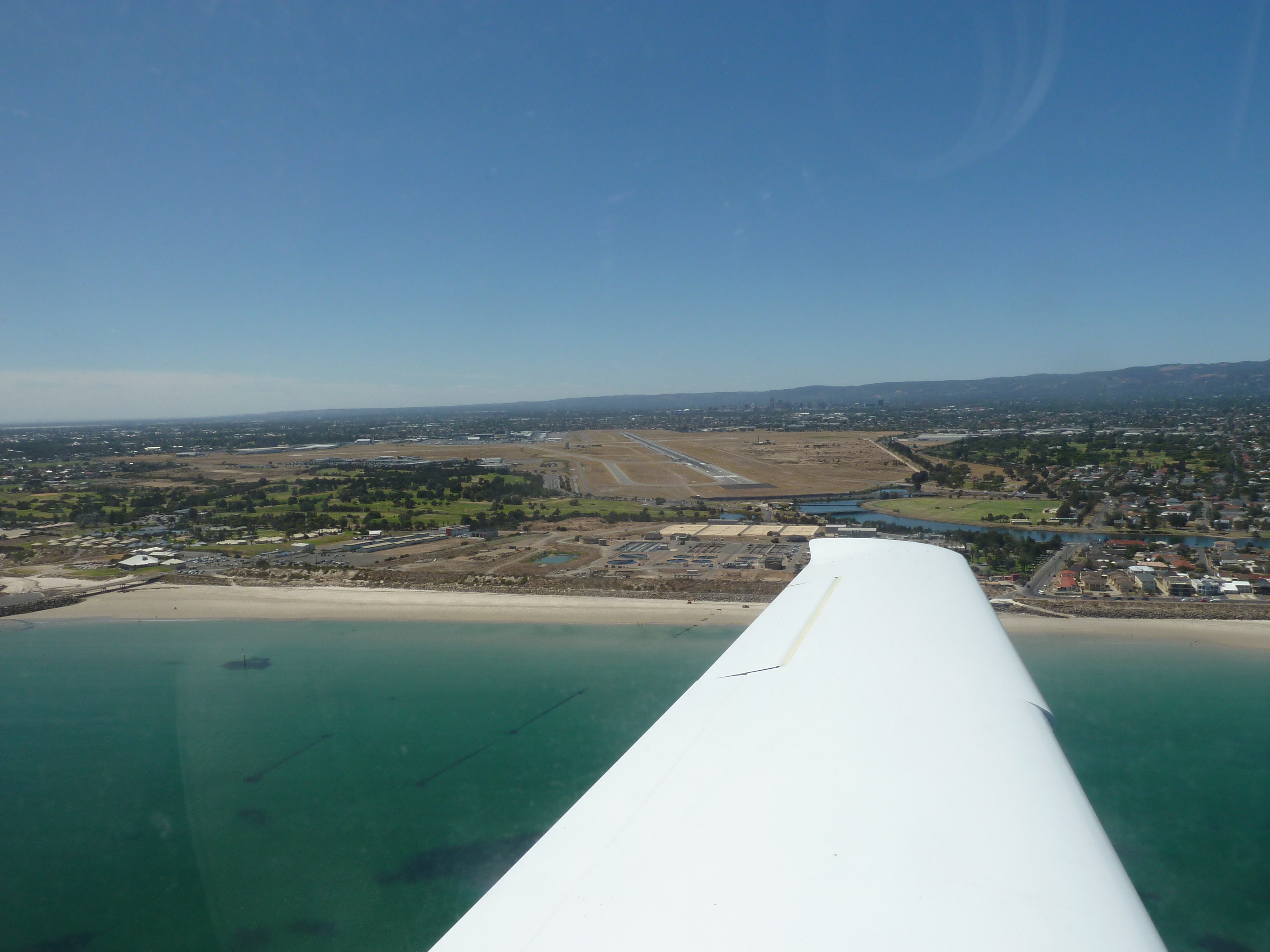
At Port Noarlunga we received another clearance from Air Traffic Control to fly through Adelaide air space. Once again it was not above 500ft and with sequential clearance limits. Once we were past Adelaide International we were cleared to climb to 1500ft in preparation for our arrival into Parafield via Outer Harbour. I listened to the ATIS and made the inbound call. The wind was still from the east so YPPF Tower cleared us for a straight in approach on RWY 08L. On short final ATC cleared us to roll through to the end of the runway to allow a shorter taxi back to the apron.
So after two lessons with the local instructor I felt confident flying around the airspace and was cleared to fly solo in HJV.
Postscript: It’s now 2021 and I haven’t returned to Parafield as yet. I’ve flown over the top but not into Adelaide. Something called Covid-19 got in the way. Hopefully I will still be able to fly out of YPPF in the future but only time will tell.
Agnes Water – Atherton – Karumba – Cobbald Gorge – Thursday Island – Cooktown
In August 2021 my wife Sigi and I took off for a couple of weeks to Far North Queensland, including “the Gulf Country” in North West Queensland, and the Tip of Cape York Peninsula. The Tip is the most northerly point on the Australian mainland so a worthy place to travel to and as far as you can go while still remaining in Queensland. We had originally been planning to fly to Western Australia but given the travel restrictions due to Covid-19 it seemed a better place to head for. The map below shows the route we took.
Our first stop was Agnes Water, one of our favourite spots, for a two night stay near the beach. We unloaded the folding bikes and rode into town.
Tied down at Agnes Water
Agnes was as pleasant as ever and we spent most of the day on the beach and rode up to the Town of 1770 to enjoy the sunset.
Agnes Water Beach
The next day we headed off to Atherton west of Cairns. We were planning to visit Pat and John, friends who live in Yungaburra on the edge of Lake Tinaroo. First though we needed breakfast at the Holidays Cafe, our favourite spot, with views of the beach.
Holidays Cafe
We rode out to the airstrip, loaded our bikes into MSF, and after preflighting taxied out. Taking off we turned to the north over the Town of 1770 and had a great view of the peninsula.
1770 on departure
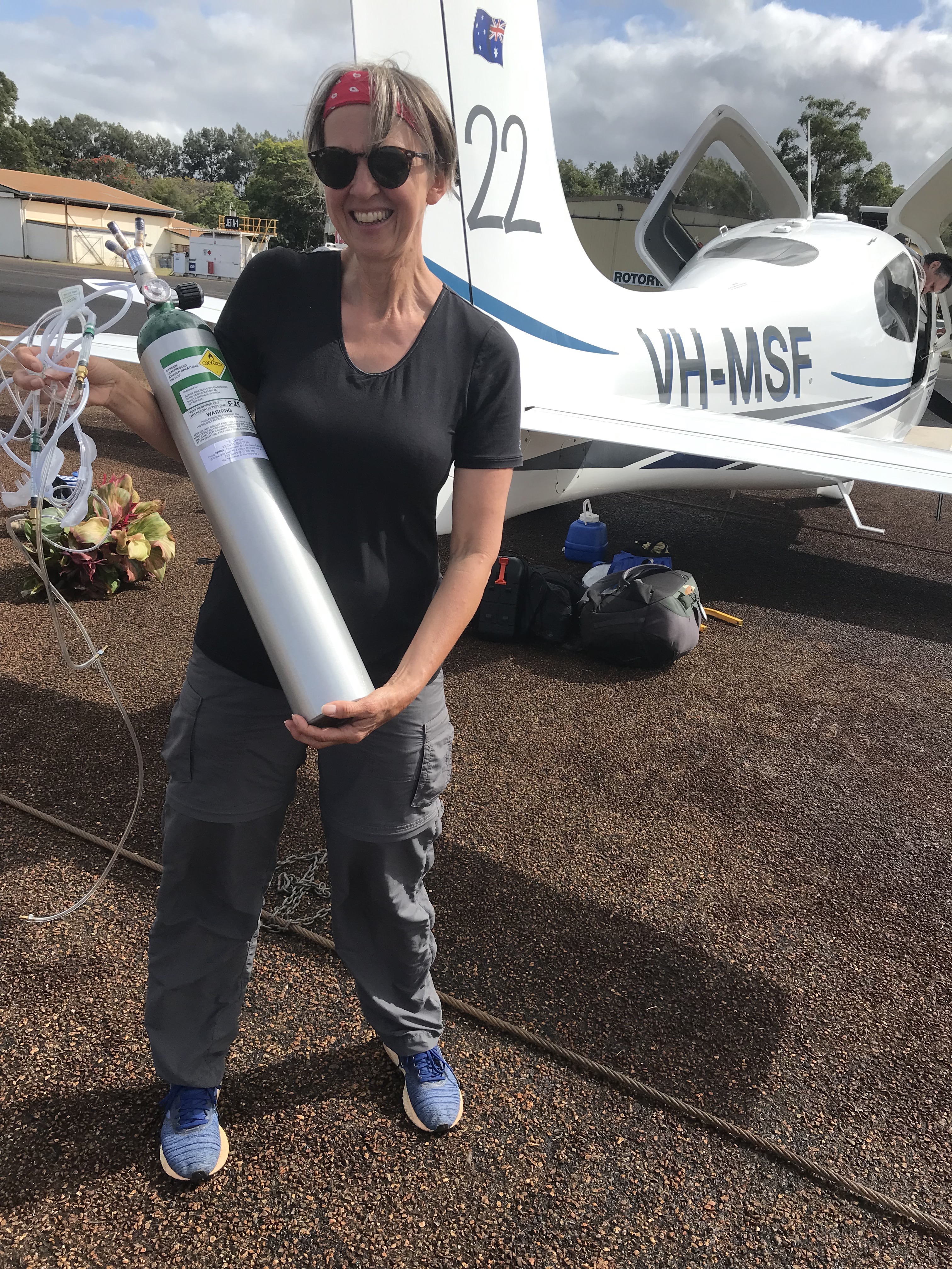
It was a few hours trip up to Proserpine where we could refuel and we took the opportunity to test the new oxygen system I’d bought recently. When you fly above about 7000ft your blood oxygen saturation starts to fall and as a result your concentration levels drop. It’s mandatory in Australia to use additional oxygen when flying above 10,000ft but it’s recommended for people over 60 to use it above 7,000ft. I have a system with a compressed oxygen bottle, regulators and cannulas, that blow oxygen up your nose. They don’t look pretty but they work well, as we discovered on our way to Proserpine. We were able to monitor our blood oxygen levels and adjust the flow rate to keep it around 96%.
Breathing oxygen through cannulas
We’d originally planned to fly to Mackay for refuelling but I read in the Notam that their Avgas bowser was out of action for a few days so decided fly to Proserpine instead. I hadn’t been into Proserpine since I flew there with my dad in 1977 so it was nice to see it after all those years. The airport is actually a long way out of town and surrounded by sugar cane fields so probably hasn’t changed in over 40 years. The GA area was quite a distance from the terminal building so there was no chance for coffee. Lucky we’d had one in Agnes at breakfast.
Refuelling at Proserpine
After refuelling we continued north, passing overhead Townsville and up the coast. Overhead Tully we had a great view of Dunk Island and Bedarra Island, and tracked from there direct to Atherton past Queensland’s highest mountain, Mt Bartle Frere (1611m).
Dunk (top) and Bedarra (bottom) Islands
There was a bit of cloud around but we were flying IFR so that wasn’t an issue. We just had to stay well clear of Bartle Frere! We flew into the amazingly lush Atherton Tablelands and landed on the equally lush green Atherton airstrip. It’s like landing on a deep shag pile carpet. They have AvGas available and you can fill up using the IOR app on your smart phone. Much easier that the old credit card swipe machine and a receipt is emailed to you straight away. No more problems with bung printers.
Lake Tineroo
Pat and John picked us up and drove us to Yungaburra where we had a pleasant evening catching up with them and planning our return the following week when we would take them with us up to the Tip of Cape York.
After our overnight stay at Yungaburra we had a 30 minute hop west to the town of Chillagoe. It’s an historic Queensland mining town and home to some pretty impressive volcanic rock formations and limestone caves. It also has a lovely sealed runway! What more do you need?
Balancing Rock near Chillagoe
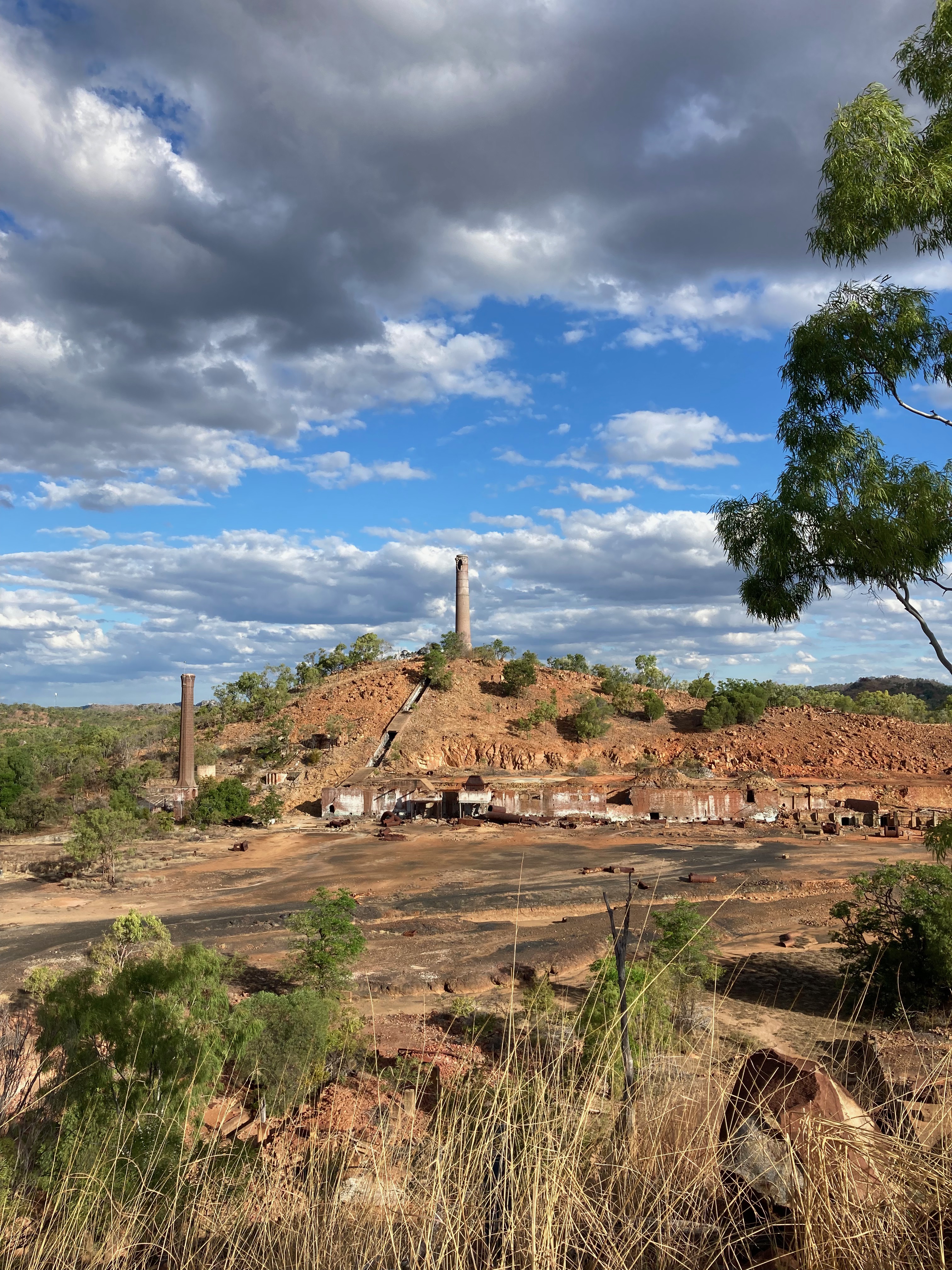
We stayed at the Eco Resort and Observatory, a repurposed (and modernized) mining camp from the nearby (now defunct) Red Dome Gold Mine. Unfortunately it was a bit of a cloudy evening and almost a full moon so there was no stargazing to be had in the observatory. The town is in a very scenic location and our folding bikes came in very handy to explore the area. It used to also be the site of Queensland’s first major copper and lead smelter. Unfortunately the smelters never made a profit and were closed down in the 1940s. That was after lots of capital was thrown in to build quite an extensive smelting complex and a railway line that ended right there. The ruins are quite interesting to view as is the huge slag heap!.
Chillagoe copper smelter ruins
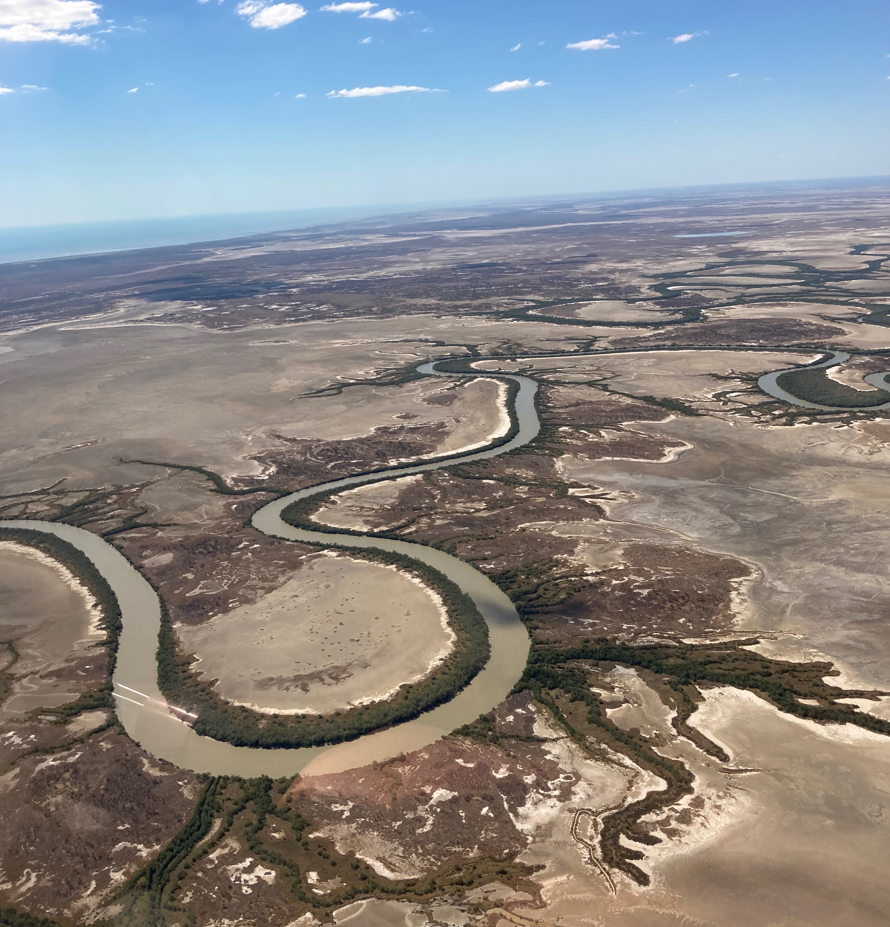
From Chillagoe we headed further west, towards the south east corner of the Gulf of Carpentaria. After about one hour’s flight we topped up the fuel at Normanton, then took off again and followed the Norman River for 10 minutes over to Karumba on the coast.
Norman River near Karumba
Now it’s important to know that there are two parts to Karumba. We stayed in the better part of town, near the mouth of the river. It’s about 5 minutes walk from the airport or one minute in the End of the Road Motel shuttle bus.
Final to Karumba
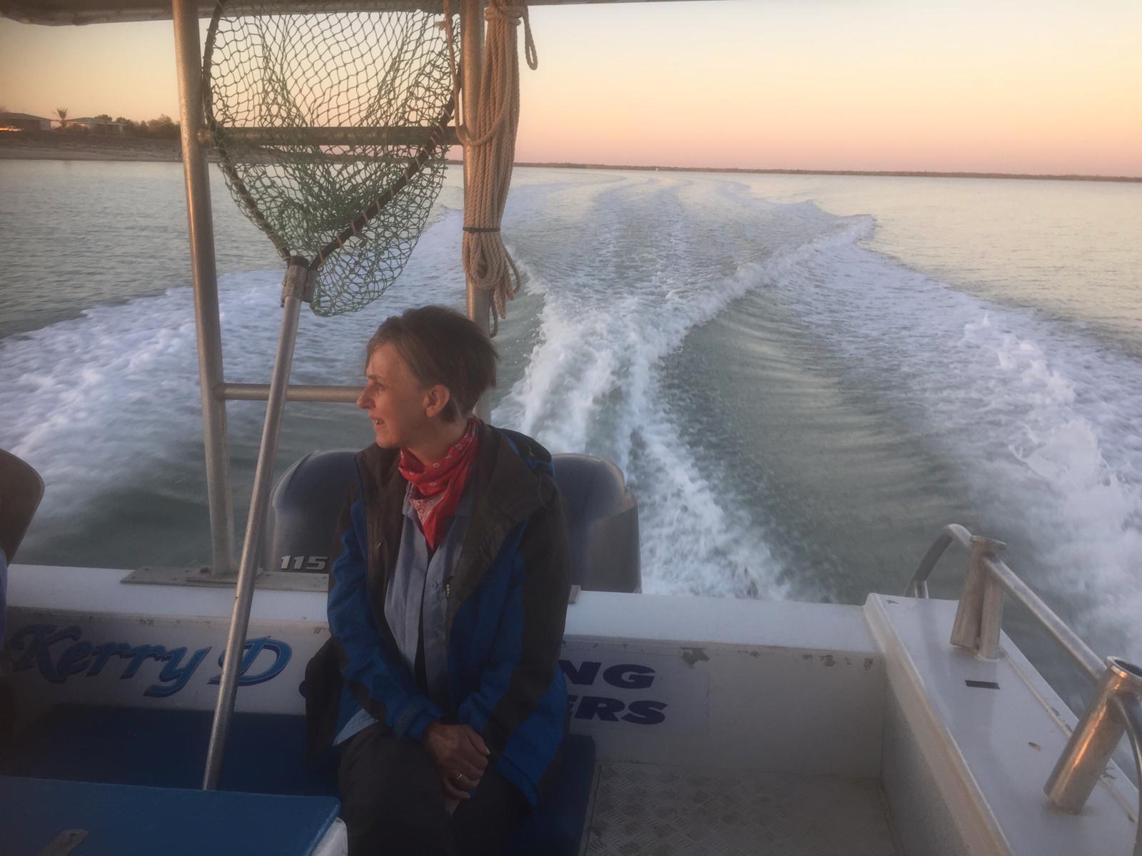
Very handy for fly in visitors like us and with great views to the west over the gulf and close to the boat ramp – ideal for the main attractions at Karumba: sunsets and fishing. After enjoying our first sunset over the gulf we had some amazing tapas at the motel’s own Anchorage Bar and Café then an early night and rose before sunrise so we’d make the 7am departure with Paul from Kerry D’s Fishing Charters for a trip out into the Gulf.
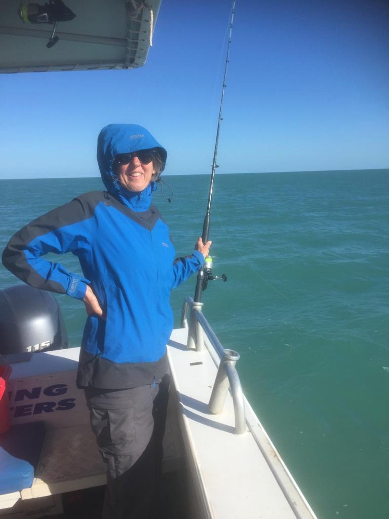
It was about 20 minutes until we dropped anchor and spent the next 3 hours dropping lines into the water. The fish were slow to bite at first but gradually picked up pace so in the end Sigi and I caught four salmon each and she caught a mackerel as well. Fellow anglers Ray and David from Ingham on the other side of the boat had even more luck and caught about 20 fish between them. And they were good sized fish, 1kg to 5kg each. Any undersized ones were thrown back in.
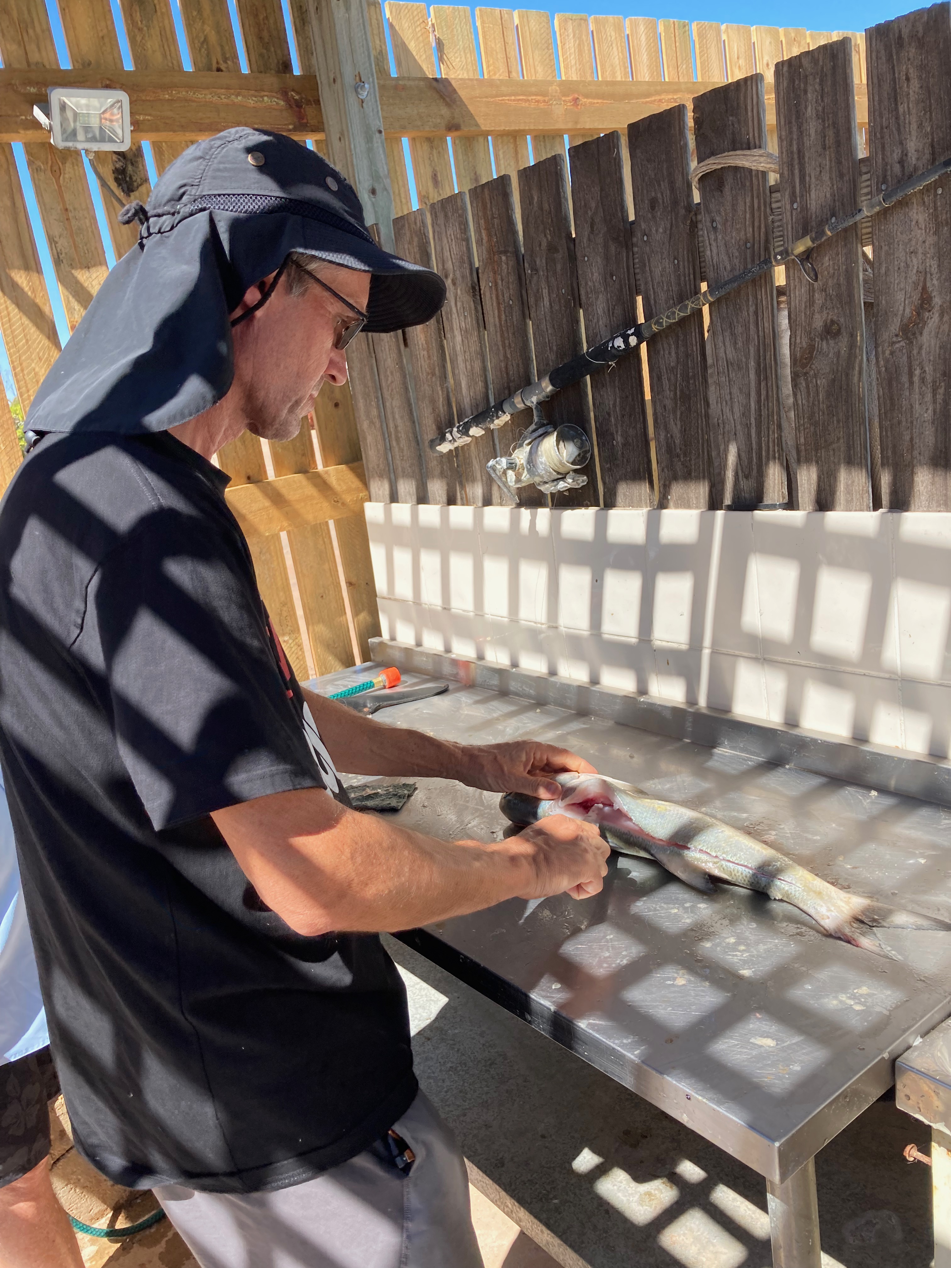
We took two salmon back to the motel where Ray and David showed me how to fillet them.
The motel has a great setup with barbecues on the foreshore where guests can cook the fish they catch while having a drink. The salmon were delicious, enjoyed with a view over the water. As the sun sank slowly in the west we joined a few other tourists for another drink at the aptly named Sunset Tavern next door.
From Karumba we flew to Forsyth just over an hour away and we had to be there before 9am to be picked up by a bus that would take us to Cobbold Gorge, our next destination. The alarm went off at 5:30 and, after checking the weather and NOTAMs and downing a bowl of muesli, I headed off to the airstrip. With the daily preflight completed we loaded up and climbed aboard. The GPS was programmed with a flight plan from Karumba to Forsayth via Croydon and we took off IFR into the wild blue yonder, turning over Karumba and leaving the Gulf of Carpentaria behind us once more. Climbing to 9000 feet in the calm, clear air we set course for Croydon.
Soon we were descending into Forsayth and shortly after we’d tied the plane down a driver turned up in a van and we headed off towards Cobbald Village, about 40km to the south west. About half way to the village we pulled up and transferred to a four wheel drive, driven by “Chook”, a fixed wing pilot who used to fly Cessna 172s, mainly for mustering cattle near Birdsville. Chook delivered us to the reception, telling us some of the history of the area as we went.
After checking in it was time for a coffee and a swim in the infinity pool near the deck and bar that look out over their dam. An idyllic spot, also for a bit of lunch.
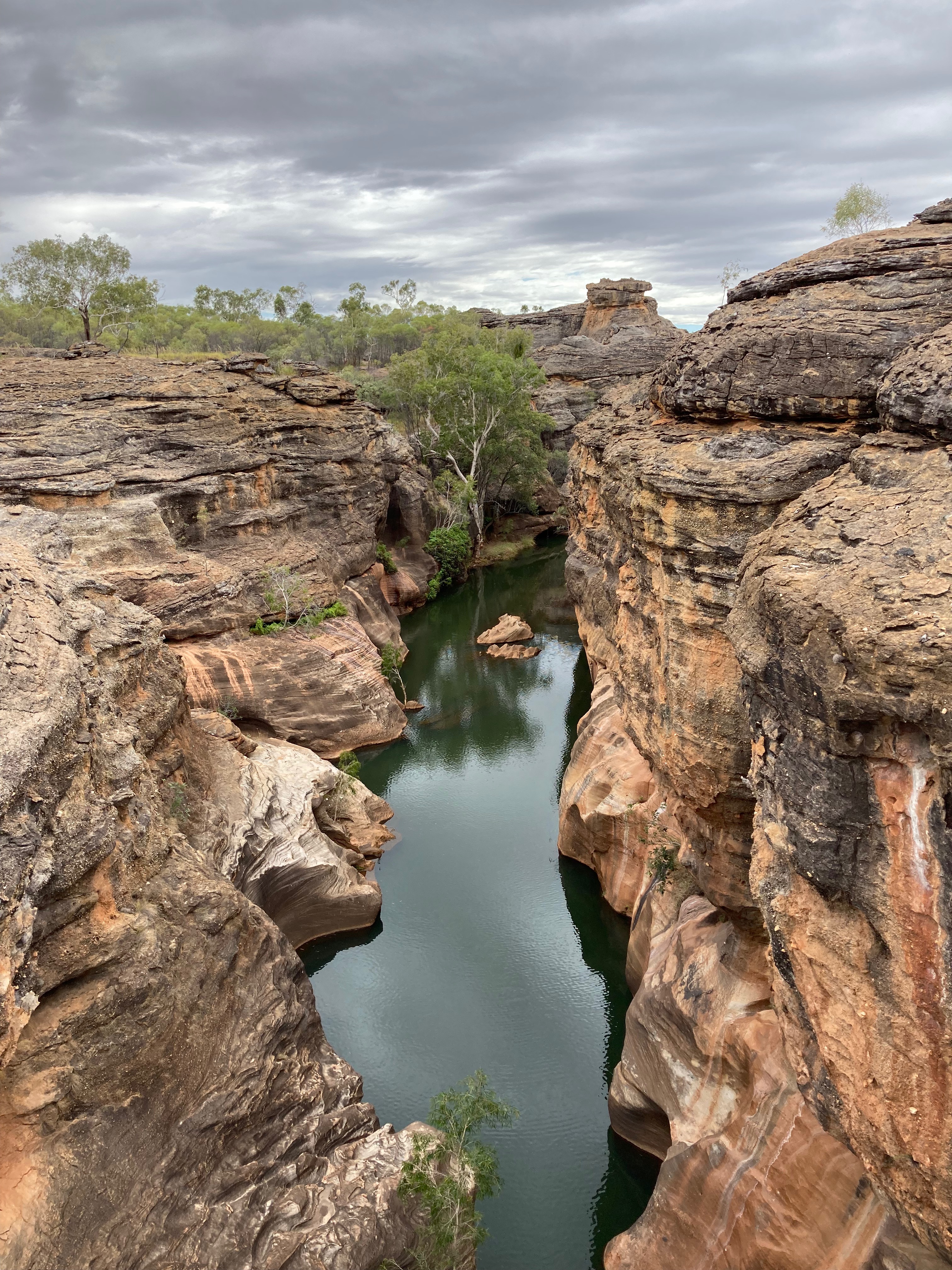
Next on the agenda was paddle boarding in the Cobbald Gorge. A minibus took us to the gorge, about 5km from the village along a dirt track that crosses the 100 metre wide dry bed of the Robertson River. Apparently there’s water flowing 3 metres under its surface in the dry season and in the “wet” the surface is 3 metres above the creek bed!
We’d never been paddle boarding before but were pleasantly surprised how easy it was to stay upright, standing on the board and paddling with a longish paddle. The gorge varies between 3 and 10 metres in width with sheer cliff faces either side that are about 20 metres high above the surface of the water, which itself is 3 to 20 metres in depth. It was very peaceful as we focussed on staying out of the water and not hitting the sides or any rocks. We reached the end of the navigable part of the gorge in about 10 minutes and turned back. On return we masterfully kneeled on our boards and then slid into the water for a pleasant cool off. We’d been told there are up to 15 fresh water crocodiles in the gorge but apparently they’re well trained and don’t bite any of the tourists! We didn’t see any.
Cobbald Gorge
Back at the village we had a lovely dinner on the deck looking out over the pool and the dam, followed by a few outback yarns from Chook around the firepit. It turned out that Chook and his wife Lorraine manage the resort between them and had only arrived eight months before after spending the previous 20 years near Birdsville. Chook said he’d gone as far as he could with cattle property management with responsibility for 30,000 head of cattle and wanted a change, so opted for managing a resort and herding 30,000 tourists per year instead.
We woke early and hiked about 3km from Cobbald Village along one of the tracks up to the top of Russell’s Hill to gain a view of the local area. The air was still cool but the climb warmed us up. A jogger! passed us as we went – must’ve been a local out for a pre-work workout. Back at the village there was a chance for a quick dip then breakfast on the deck.
At 10am we joined one of four bus groups for another trip to the gorge. This time it was a guided walk around the gorge and across a glass bridge that spans one of the narrower sections about 15m above the water. It was installed a few years ago and makes it possible to do a circuit where our guide, Johnno, introduced us to various bush tucker including “tennis ball trees” and “liquorice bushes”. There were also a few poisonous ones that Johnno warned us not to touch. Back down at water level we boarded a small electric powered boat that took us back up the gorge the way we’d gone the day before on our paddle boards, this time with commentary about the geology of the gorge and how it was discovered by the current owner of the station, Simon Terry, and a school mate in the 1980s. This is extremely rugged country and not very accessible and the local indigenous people had traditionally avoided the area since a geological event had caused the water flow direction to reverse a few thousand years ago, making it “devil country”.
Over the past 30 years the Terry family have developed Cobbald Gorge into a very successful business venture that is sensitive to the environment and local customs. They started with day trips from Forsayth in the 1990s to camping on site, to rudimentary huts to the comfortable cabins, deck restaurant, infinity pool and other facilities they have today. They do a really good job, and the staff really seem to enjoy their work. They don’t have many fly in guests but it is a great spot to fly into. You should definitely add it to your bucket list.
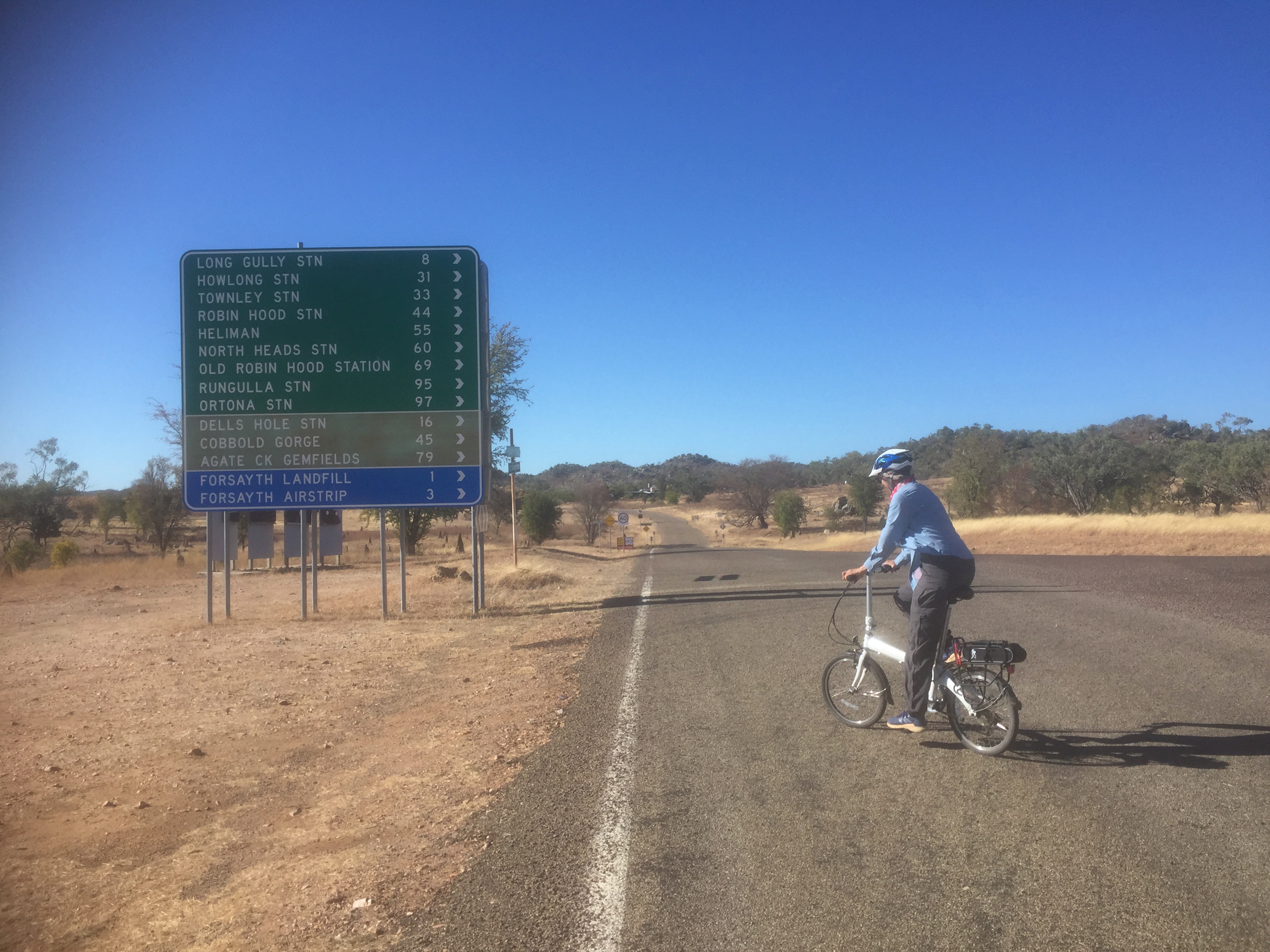
In the morning Johnno dropped us at the airstrip where we loaded our bags and unloaded the folding bikes. Time for a bit more exercise! It was a 4km ride into Forsayth from the airstrip – perfect for the bikes in the cool morning air. Arriving at the Forsayth Hotel we noticed our driver from the other day at the servo. He waved and said “See you at the pub!”. The hotel is also owned by the Terry family who run Cobbald Gorge you see, and Steve works there. The pub was on the verge of closing about 5 years ago and as they all say, when an outback pub closes, the town dies. So Simon Terry bought it and redeveloped it into a “staging post” for Cobbald Gorge visitors. Steve mentioned a few of the “hot spots” to visit in Forsayth. We had ridden past them all within 15 minutes and, having thereby exhausted the scenic spots of Forsayth, rode back to the airstrip.
Taking off from Forsayth we flew over Cobbald Village and the gorge as well as the “Howlong Station” homestead and airstrip, where the Terry family live. Then it was time to practise an RNAV instrument approach. Under my private instrument rating I have to do at least one of these every 6 months to stay “current” and it seemed a good time to practise. There was one at Georgetown nearby and no other traffic, so…what an opportunity! We followed the waypoints from Whisky Delta to Whisky India, Whisky Foxtrot and did a missed approach climbing out to the east, and set course for Pinnarendi, another cattle station located on the Kennedy Highway just west of the dividing range.
RNAV instrument approach for Georgetown
Pinnarendi StationStay & Cafe is a family run small business established in 2016. They have a 1.5km long grass strip adjacent to their homestead, camping ground and “Brick Oven” café where Nadine and Ronnie serve the best coffee and home made pizzas and cakes west of the range (really!). It’s a great setup with the camp ground under shady trees and a “station stay” cabin that will accommodate a couple quite nicely.
Pinnarendi garden and cafe
It was lunch time so Sigi and I shared a pizza and a piece of cake. I also had an affogato and it was the best I’d had in a long time!
Nadine and Ron have three children and a four seater plane that travels at 115 knots so Ron wants to upgrade to a 6 seater, maybe a Cessna 210 or a Bonanza. The children attend boarding school in Charters Towers about 300km to the south and Ronnie often picks them up in the plane on a Friday afternoon and drops them back on Monday morning. It’s about a 3 hour round trip for him. They shared some of the stories of life on the property (Ron is 5th generation) including living through Cyclone Yazi that took the roof off their house. They had a photo album full of photos to prove it too!
Bidding farewell to Pinnarendi we climbed out to the north east. As we headed towards the dividing range some friendly cumulus started to build up so, given we were flying VFR, it was a game of “dodge the clouds” as we headed for the hills. In 20 minutes we were descending between the clouds into lush green Atherton where John and Pat were parked next to the airstrip, waiting for us.
Parked at Atherton
After a “day off” touring around Yungaburra and the Atherton Tableland with Pat and John it was time to head north again. This time we were off to “the Tip” (of Cape York that is) and we were taking Pat and John with us. Last year when we visited them they indicated that they’d be keen to see the tip again as John used to work up there for the Queensland Fisheries Department so when we said we were heading that way they leapt at the opportunity. First we had to rearrange the luggage, leaving the bikes at Yungaburra, along with our oxygen bottle and some other bits and pieces. With an extra two passengers aboard I was trying to minimise the weight so I could maximise our fuel loading. After weighing all the bags I calculated we could load 220 litres into the tanks, more than enough. We were out at the Atherton airstrip at 9am and took off at 9:30. Climbing to 6000ft we headed north, with the first waypoint Mossman, where John grew up.
Unfortunately the cloud cover obscured the view of Mossman but Port Douglas appeared in the distance through a hole in the clouds. Further on we passed over Daintree Village and followed the Daintree Valley.
Daintree Valley
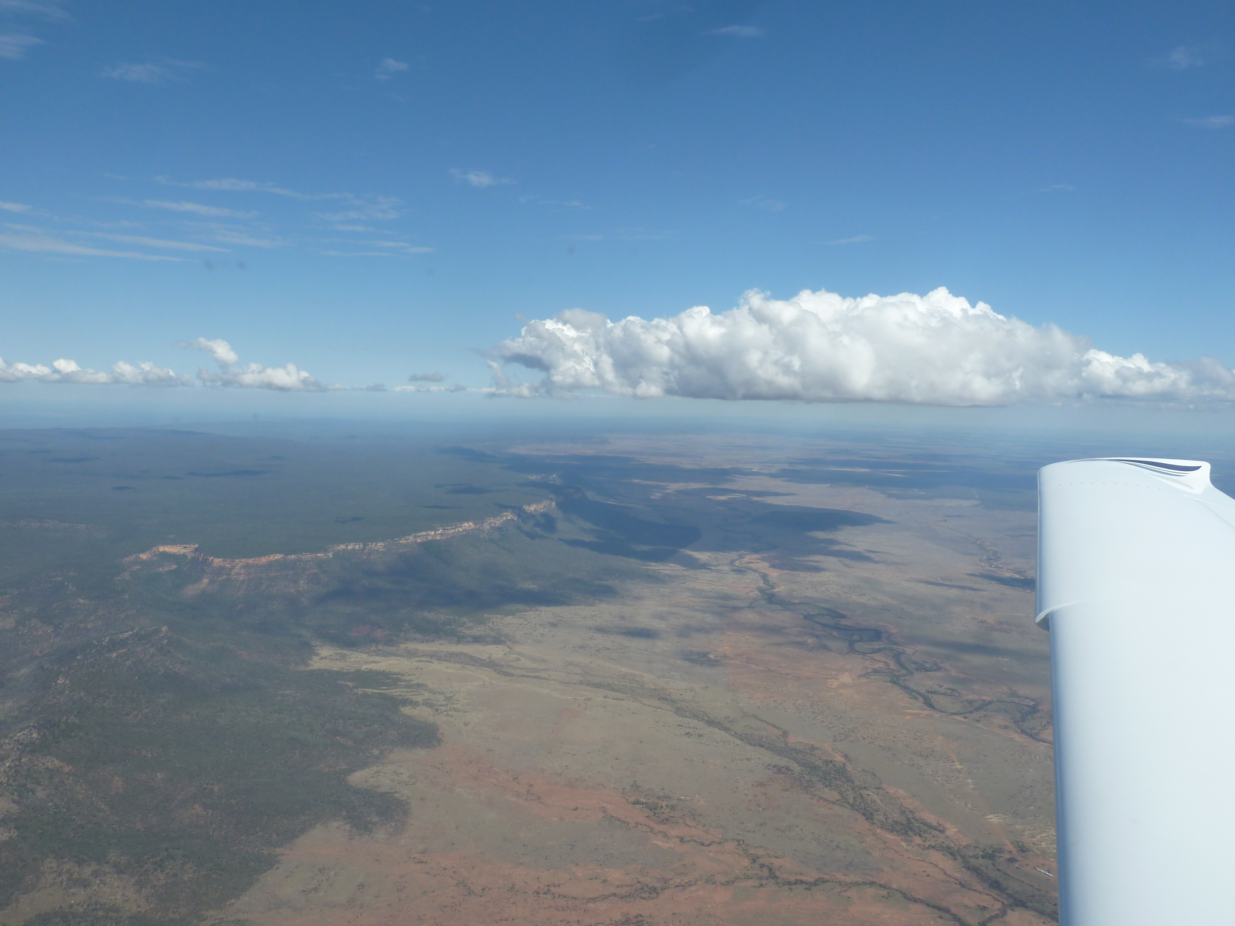
Passing over the dividing range, we flew over Lakeland, where the Peninsula Development Road starts its long journey to the Tip of the Cape. The area is scattered with irrigated banana plantations.
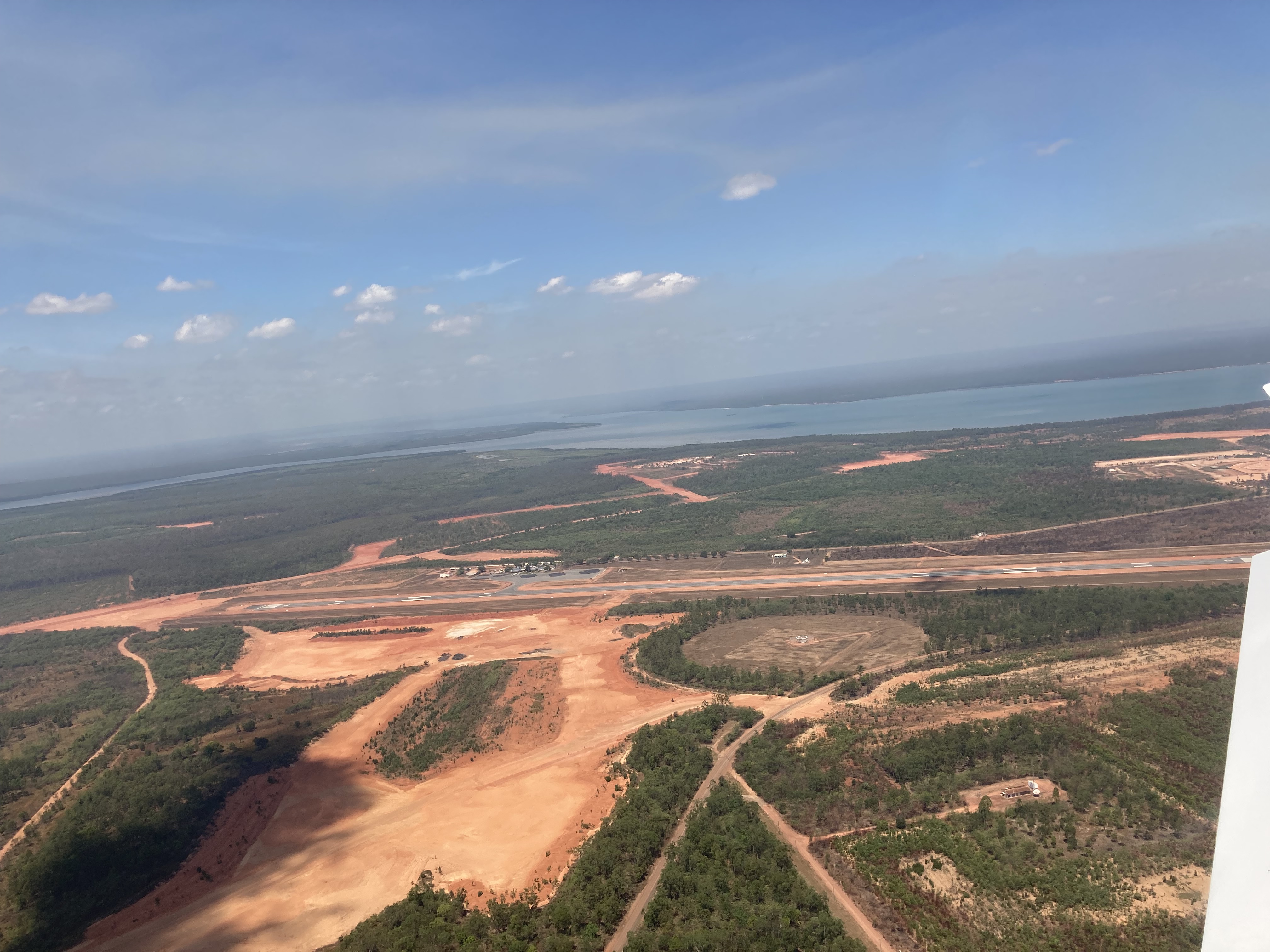
The cloud gradually thinned out as we followed the road northwards, passing over Laura and Coen and eventually turning left to descend into Weipa, centre of Rio Tinto’s bauxite mining in Australia. The airport is surrounded by revegetated mining areas.
Weipa Airport
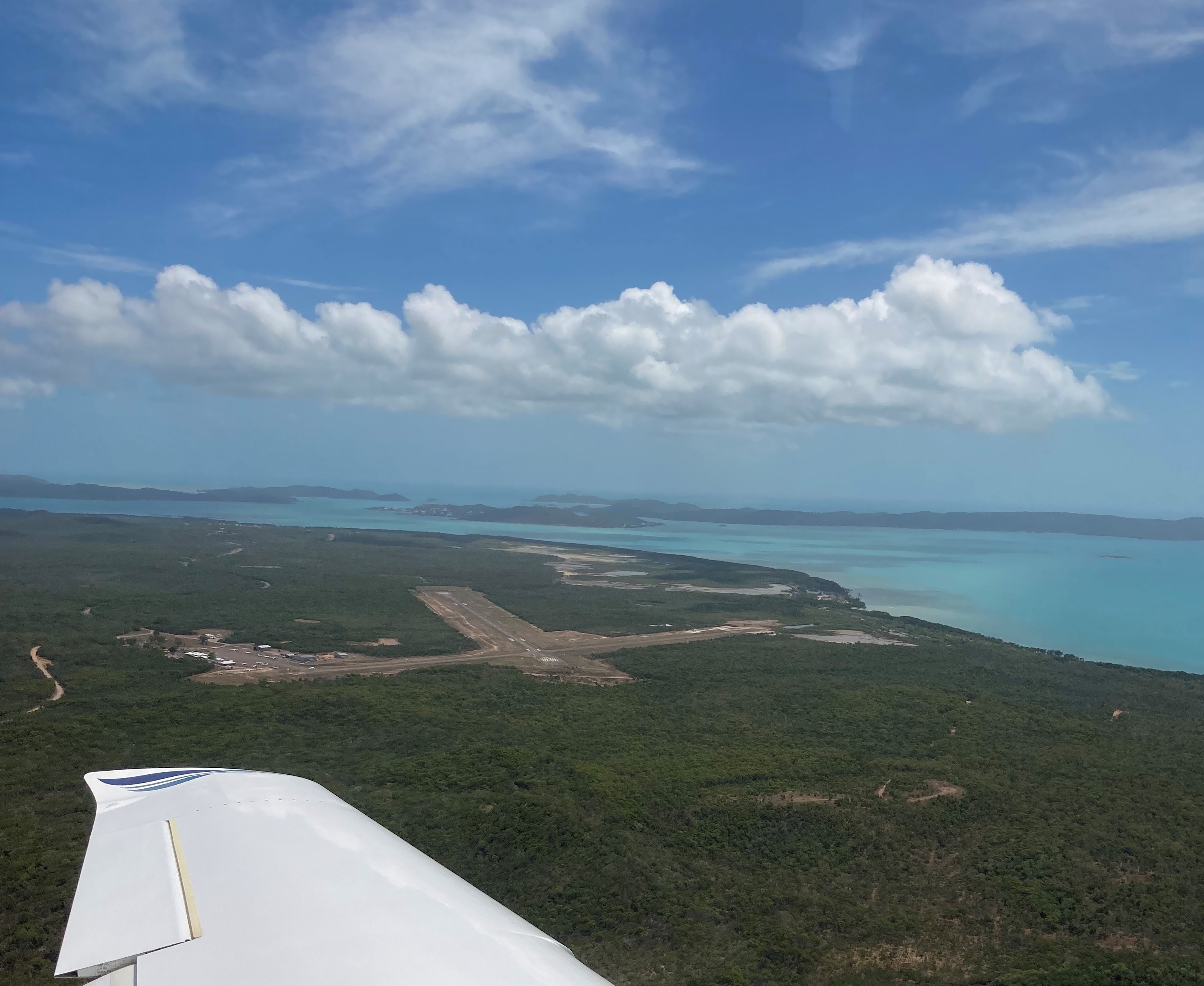
We landed at Weipa just before the Flying Doctor in his King Air, putting the refueller under stress, as he had to refuel us, the RFDS and a QantasLink Dash 8 that arrived shortly after. We had a short chat with the RFDS pilot who was dropping off a patient from Cairns then heading up to Bamaga and Horn Island to pick up some other patients. “I’ll race you there!” he quipped as he headed back to his (faster) plane. There was no cafe at the Weipa terminal so after a toilet stop we climbed aboard, watching the RFDS plane taxi out to the runway. He took off and we followed shortly after, climbing to 7000ft and leaving the bauxite mines behind, following the coast towards the Northern Peninsula (aka Bamaga) airport. Starting our descent 12 miles before Bamaga we passed overhead at about 4,000ft and spotted the RFDS plane parked on the apron. Yep he certainly beat us there. Descending through clouds over the clear blue waters of the Torres Strait we had a great view of the islands and soon had Horn Island in sight. Checking the AWIS we joined downwind for RWY 14 and landed on the long, wide runway.
Horn Island with Thursday Island in the background
As we were tying down the plane the RFDS King Air taxied in and we waved to each other. We definitely beat HIM to Horn Island.
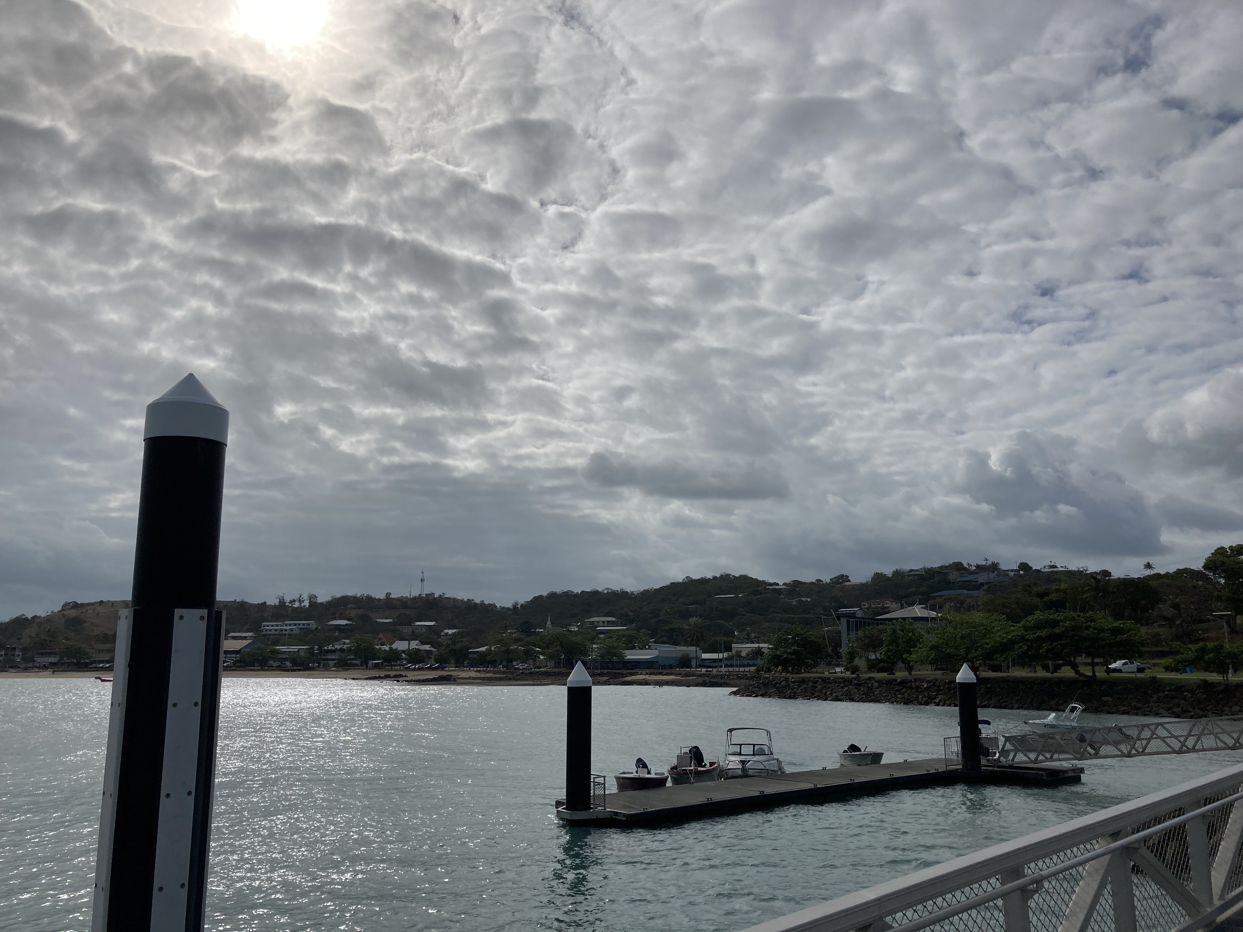
The next day it was time to catch the ferry over from Horn Island to Thursday Island, commonly known as “TI”.
We’d arranged to meet Dirk from https://torresstraitecoadventures.com.au/ over at TI at 9am and he’d suggested we catch the 7:30 ferry and have breakfast and a coffee at his favourite café (the Makai) on the esplanade beforehand.
The 20 minute ferry ride across to “TI” was very enjoyable and the café was a 5 minutes walk from the ferry terminal. The coffee was great as were the croissants and brioche. There was a real French patisserie hidden in the backrooms. There was a feel of “Death in Paradise” about the place as the local police joined the office workers and hi-vis crew lining up for their morning caffeine fixes. We sat down at a table across the road overlooking the beach and the sparkling water with Horn Island and Prince of Wales Island in the background, as a variety of boats paraded past.
Just after 9 Dirk appeared in his minibus and we piled in. He gave us a running commentary on the history of the island as he drove us around the town then up to Green Hill, where there is a underground museum in the old wartime fortifications. I discovered for the first time that parts of New Guinea were under German control until the first world war so was a strategic location for capture early on in the war.
Other highlights were the hospital and the high school and of course the cemetery including the Japanese section for many of the pearl divers who died of the bends. He also showed us the grave of Bernard Nomak, the designer of the Torres Strait Flag, who was also a local. Dirk is descended from one of the more famous families on the island and seemed to be known to everyone on TI and across the islands in general. He dropped us off at the top of Hargrave Street, a steep one with a shop at the top owned by a lady who does fabric printing.
Thursday Island
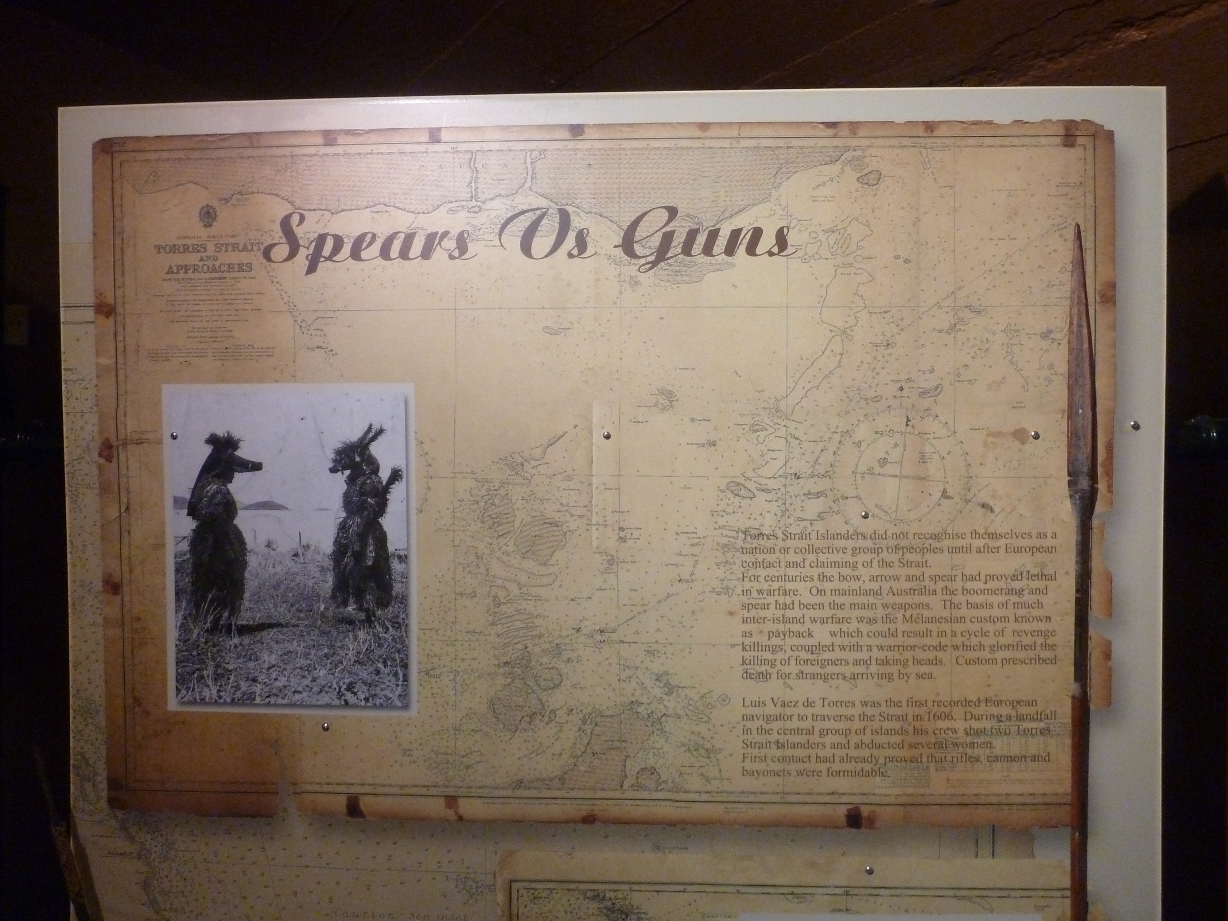
From there we wandered down to the main street for lunch at the Top Pub. Unfortunately no locally caught fish, just frozen stuff from the mainland and even as far away as Tasmania. That was a bit disappointing given the abundance of seafood that surrounds the island. We dropped into the cultural centre that had a display about how the indigenous people were converted from warrior head hunters to Christians by missionaries from New Caledonia. They are still quite religious up in the islands and take their church going seriously. After a drink at the other pub, The Grand Hotel, we caught the ferry back to Horn Island.
The next day we were flying back to the mainland but first we visited the Horn Island heritage centre, where they have various paraphernalia from the first and second world wars and the time since. It was an interesting collection, tucked away in a somewhat dated “resort” that itself wouldn’t have been out of place in wartime.
The motel minibus took us back to the airport and I obtained our quarantine clearance from the official there, after handing over our remaining apples and carrots, and obtaining two cans of insect spray in return. We had to spray the plane’s interior with one of the sprays before departure and spray it with the other one on our arrival on the mainland. It’s part of their attempt to keep PNG bugs out of Queensland. Taking off initially to the west we did a one hour scenic flight around the nearby islands at 2000ft.
First over to Hammond Island, then past Thursday to Friday Island and Prince of Wales Island, which is by the far the largest.
Thursday Island from above Hammond Island
Turning 180 degrees we headed back around the west coast of PoW then over Friday, Hammond and Wednesday Island before heading for the Tip of Cape York and York Island.
The Tip of Cape York Peninsula
From there it was back along the coast over the top of Roko Island, Seisia and Bamaga and finally descending into the rather fancy sounding “Northern Peninsula Airport”.
Turning onto final at Northern Peninsula Airport
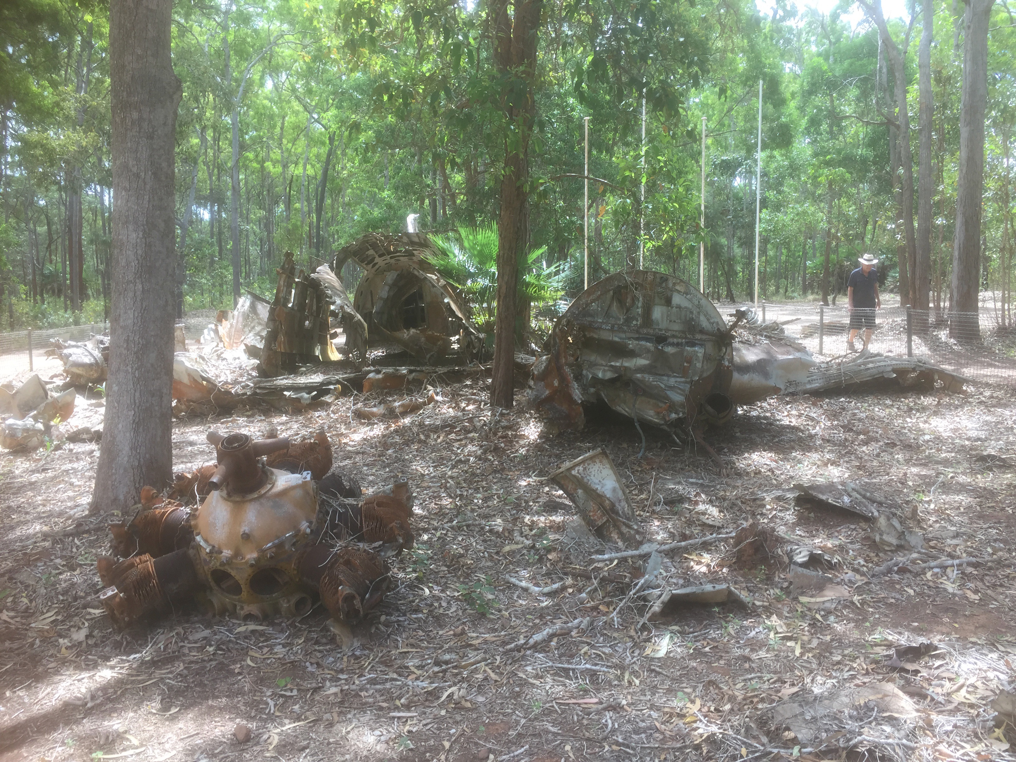
The plane was secured and we were picked up by Robert from the Cape York Peninsula Lodge. On the way we stopped to view the wreck of a DC3, that crashed there in May 1945 while travelling from Archerfield to PNG.
We checked into the lodge, a nice place with very shady gardens and a refreshing swimming pool. Now it happened to be a public holiday in Bamaga so nothing, not even the shop or the pub was open. Robert said it was for some event that had been cancelled due to Covid but they were having the public holiday anyway. So Sigi and I explored the deserted streets of Bamaga until a pack of 6 or 7 stray dogs took a liking to us and followed us all the way back to the lodge where they decided to take up residence just outside our room. They were large dogs too so it was a bit unnerving at first but in the end they were all well behaved and just seemed to want some companionship.
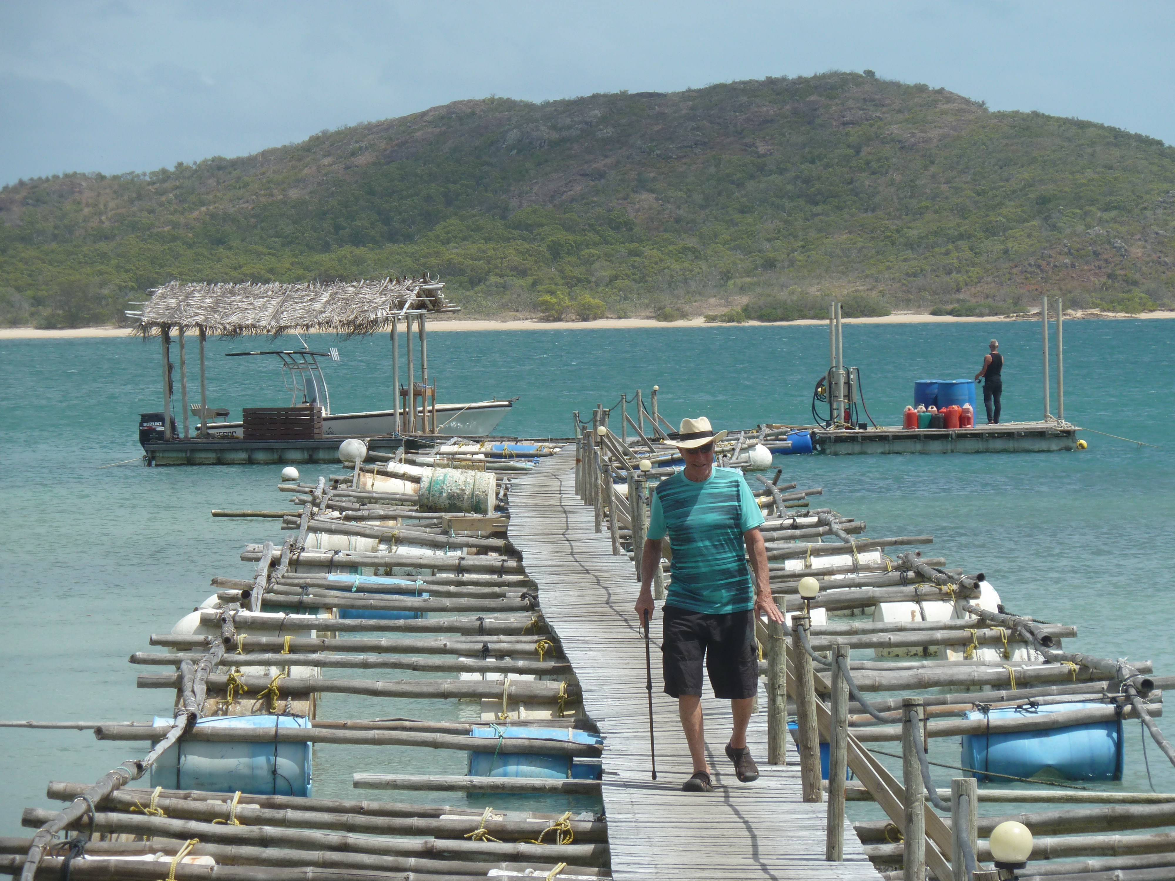
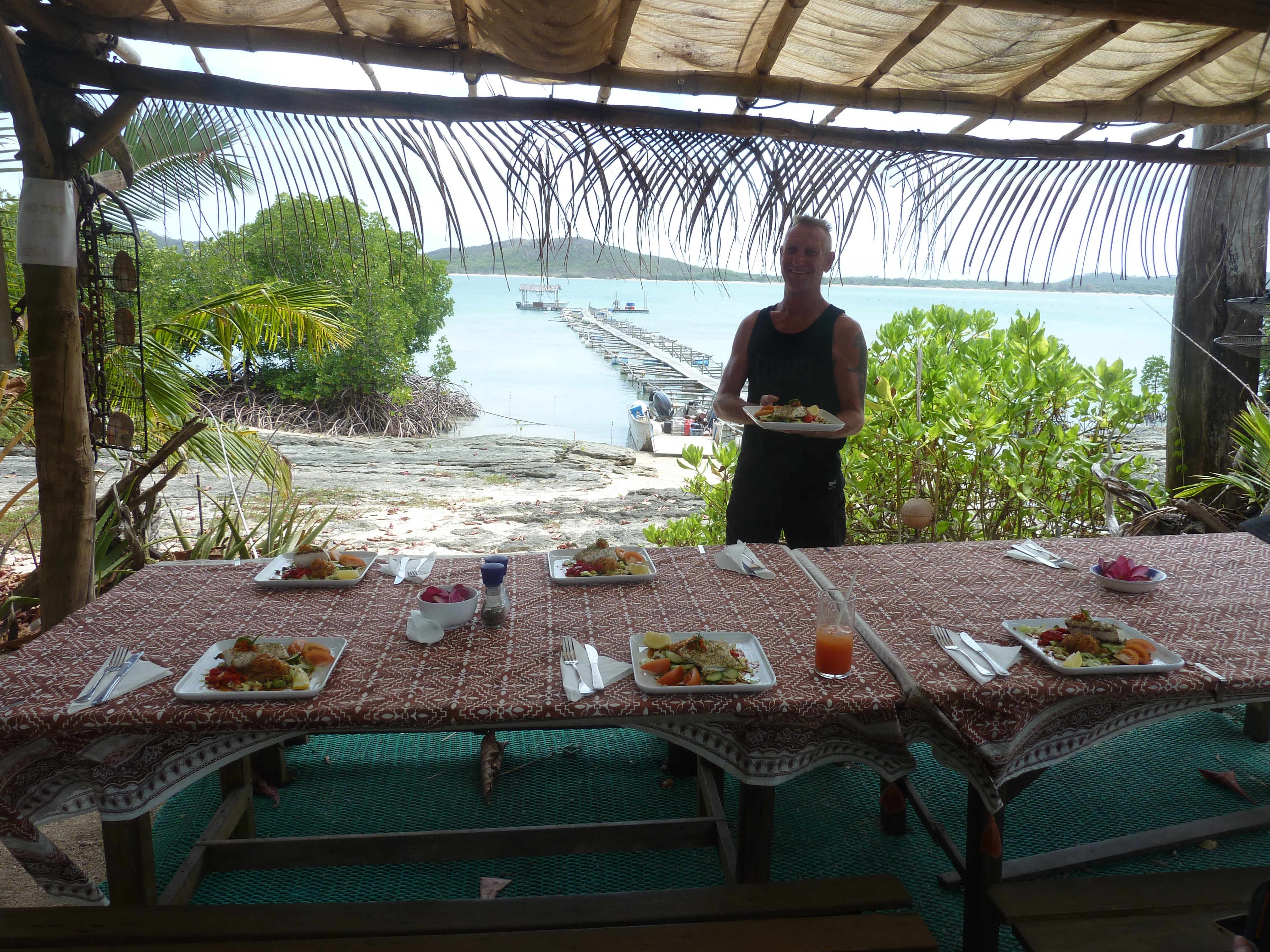
Our next stop was one of the highlights of the trip. John had booked us a night at Roko Island up the coast from Seisia, which itself is a 5 minute minibus ride from Bamaga. Roko is a low key “resort” run by a local guy called Jason and has a good name as a place to chill out and catch fish, and take boat trips to the Tip of Cape York. https://www.rokopearls.com.au/.
Jason was away for a few days so his skipper, a young guy called Andreas, picked us up in his boat at the Seisia boat ramp. In about 20 minutes we were disembarking at Roko on their bamboo outrigger wharf and being introduced to the rest of the crew.
Roko Island Jetty
Nigel is the caretaker, barman and handyman, and in his own words “looks nothing like a Nigel”. He brews his own beer on the island and generally keeps the place looking spick and span. Some sort of tradie he built the shower and toilet block out of local stone and did an amazing job with it.
Some of Nigel’s handiworkNigel and John at the bar
Dallas is the chef. He said he’s based in the Gold Coast but was spending the winter on Roko for a change. It seems he’s a very well qualified chef and was keen to provide us with meals that we’d remember.
Andreas, Dallas, Nigel
A couple of drinks were followed by lunch under the awning with a view over the sea to Possession Island. Soon after lunch Andreas had us back on board the boat for a “trip to the tip” – the Tip of Cape York that is. In about 40 minutes we’d travelled between Possession Island and the mainland, turned around the corner through some rather rough seas and then travelled along the coast off Punsand Bay to the Tip. Andreas pulled up on a deserted beach and it was only a few hundred metres to the northernmost point of the Australian mainland.
At the Tip
It was much better than driving up there and having to walk over the hill from the car park. On the way back the boat’s outboard stopped and Jason had to pump some fuel through manually. As the boat rocked on the croc infested waters the theme song from “Gilligan’s Island” played in our heads! But no, in 5 minutes the vapour lock problem had been sorted and we were powering westward again. Andreas took us around the west side of Possession Island and showed us the memorial to Captain Cook where he went ashore and claimed the Australian east coast in the name of King George. We also went ashore, doing the “stingray shuffle” as we went to scare off any that might be resting on the sandy bottom.
Going ashore at Possession Island
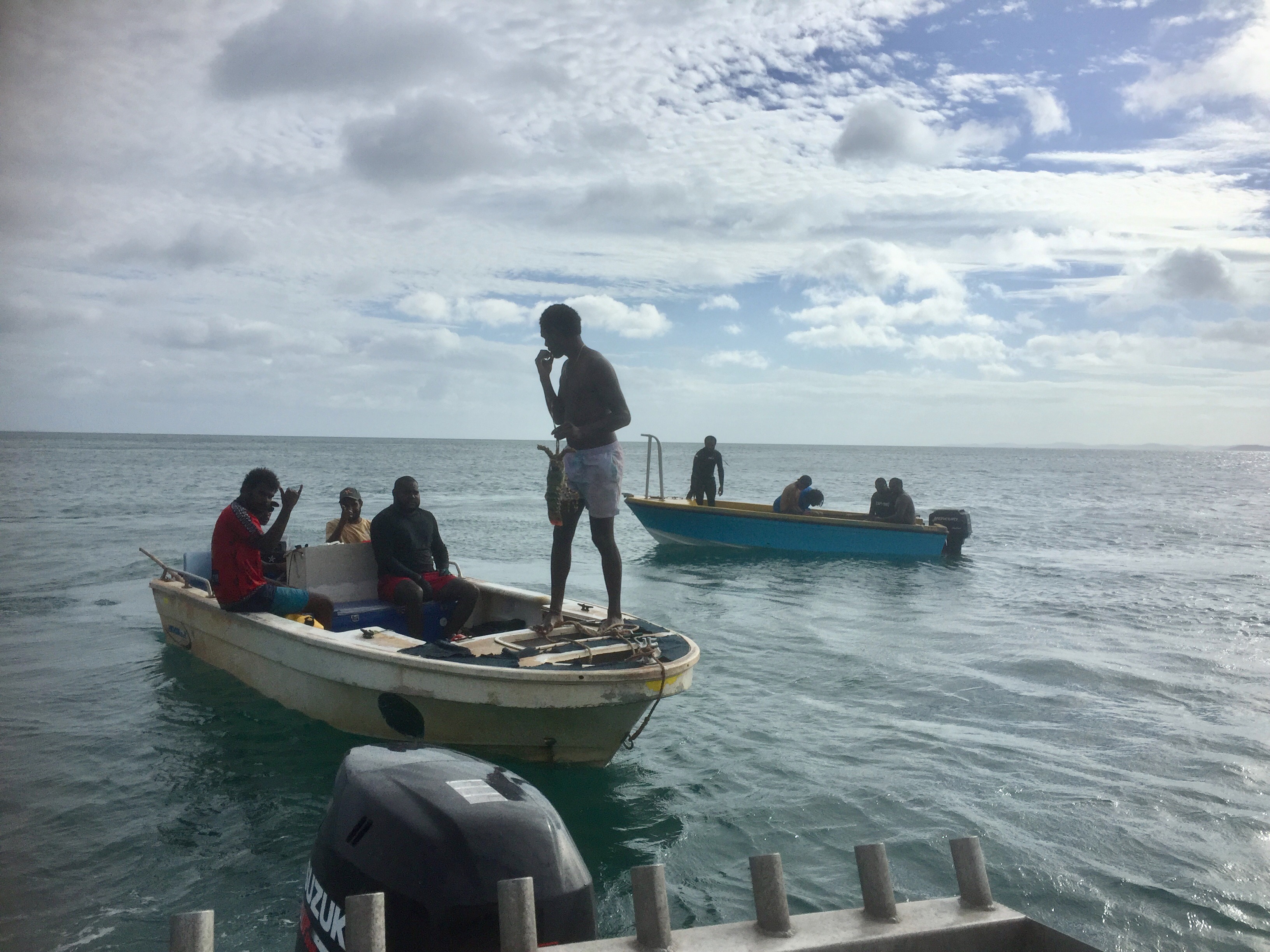
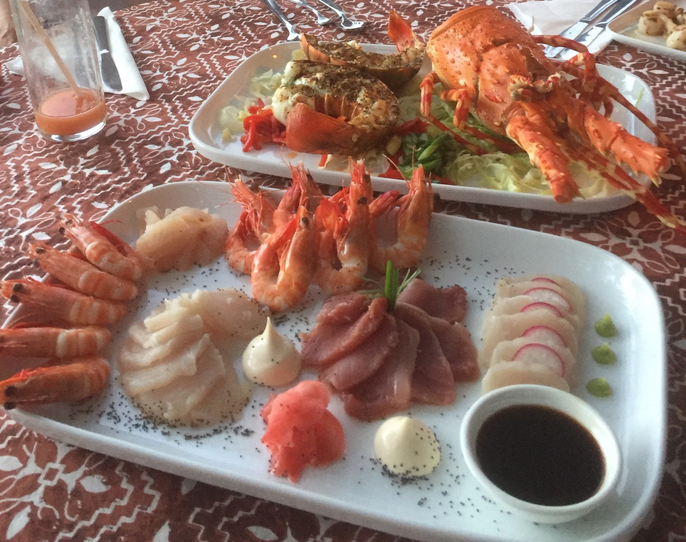
Soon we were back on the boat heading for Roko but not before we stopped alongside a couple of boats of local fishermen who were out diving for lobsters. Andreas suggested we offer $50 for a lobster and we duly received one that he assured us Dallas would be keen to prepare for our dinner.
Sure enough, not long after our return to Roko Dallas had the lobster ready to go in the oven and was busy preparing sushi from tuna and queen fish that he’d caught earlier in the day. He was very proud of his skills with the local fish and was keen to give us a meal we wouldn’t forget.
Sushi and lobster for entrée was followed by a main of queenfish. Delicious and couldn’t be fresher.
We all went to bed feeling rather full but not before we went spotlighting for crocodiles in the mangroves (without any luck – or maybe we were lucky not to see any?) and stargazing at the Milky Way.
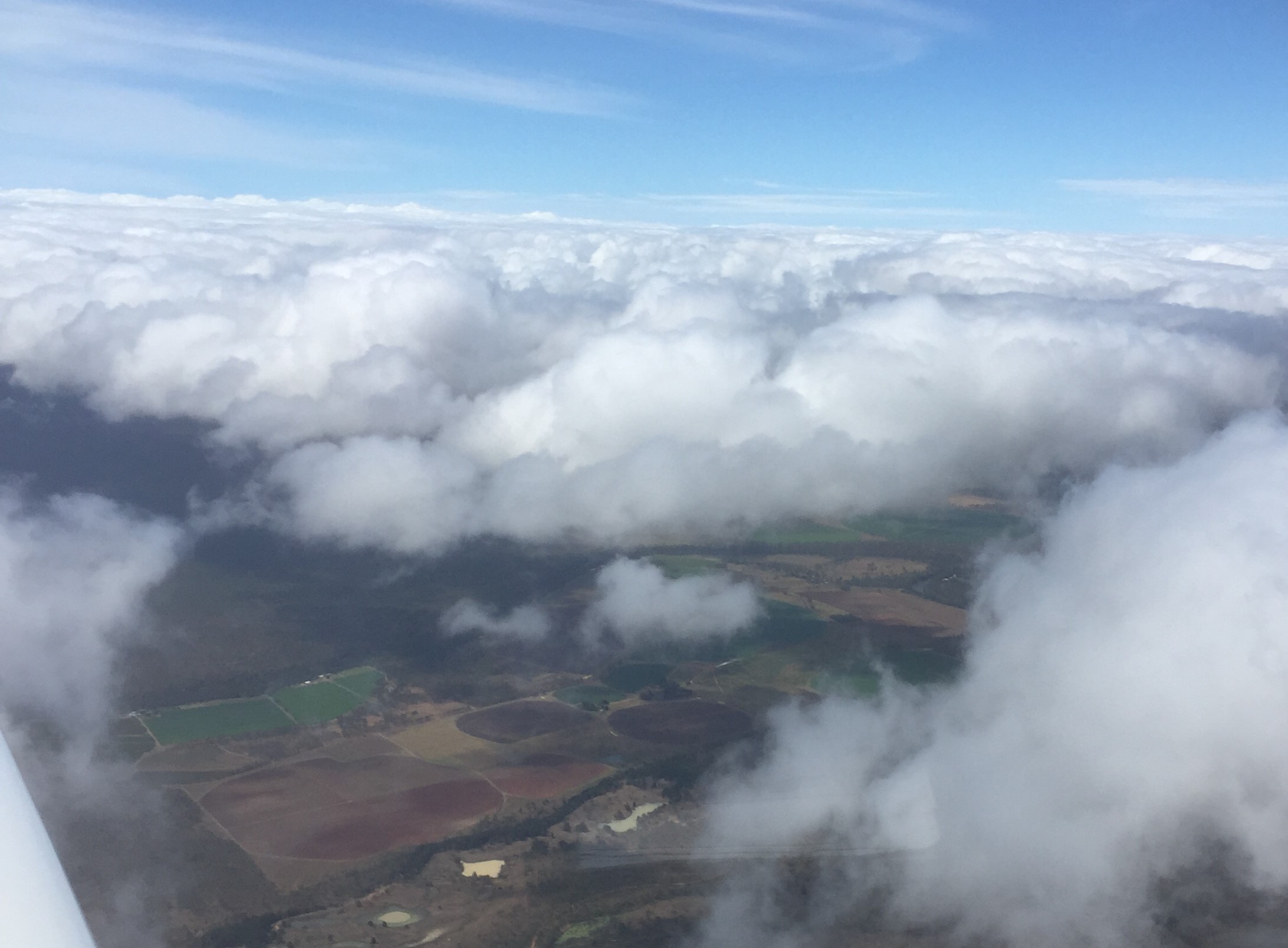
The next day it was time to head southwards again. We woke to a glorious morning in our tropical paradise. While we had breakfast Andreas worked out a cunning plan that would deliver us to Seisia in time for a 10:30 take-off while ensuring he could then drop off two of his other guests at Punsand Bay and take the other couple to the tip of the Cape before lunch. After a fast boat transfer followed by a minibus ride to the airport we were untying and preflighting MSF ready for the trip south. The weather had come over a bit cloudy and the BOM was forecasting cloud to about 8000ft, especially along the east coast, so my initial plan to fly along the coast to marvel at the Great Barrier Reef from above was abandoned and I elected to fly IFR straight down the middle of the Cape instead. We took off, were identified on radar by Brisbane Centre, and climbed up through the cloud to 7000ft. At first we were visual but then the cloud tops rose to meet us so we were in IMC. Good practice for me but not so comforting for passengers, so I requested traffic at 9000ft and we climbed up above the cloud.
Above the clouds above the Cape
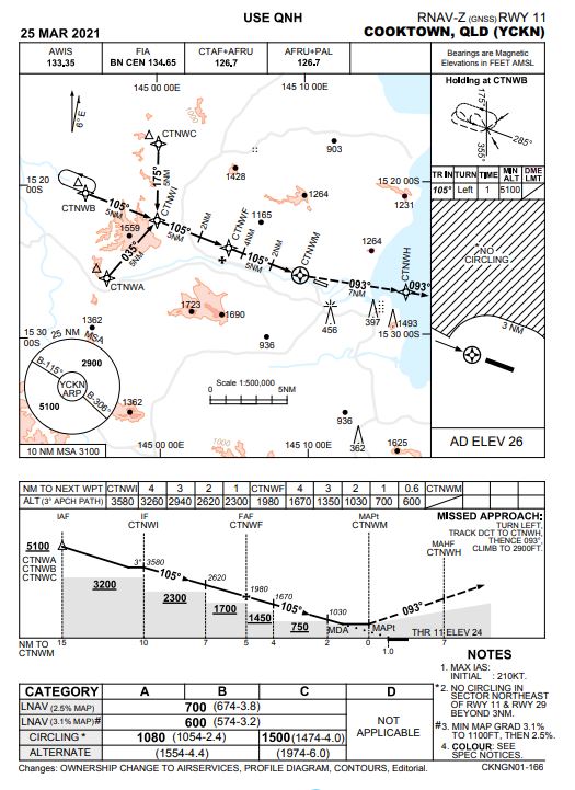
It was clear that it’d be a bit of IMC on descent into Cooktown so I prepped the RNAV RWY11 instrument approach and went through the QADCAPS routine. All was good. Soon we were descending through the clouds and became visual at about 3000ft and 15 miles out.
RNAV instrument approach for Cooktown
It was a pleasant straight in approach to Cooktown. After refuelling Mick from the River of Gold Motel picked us up and took us into town.
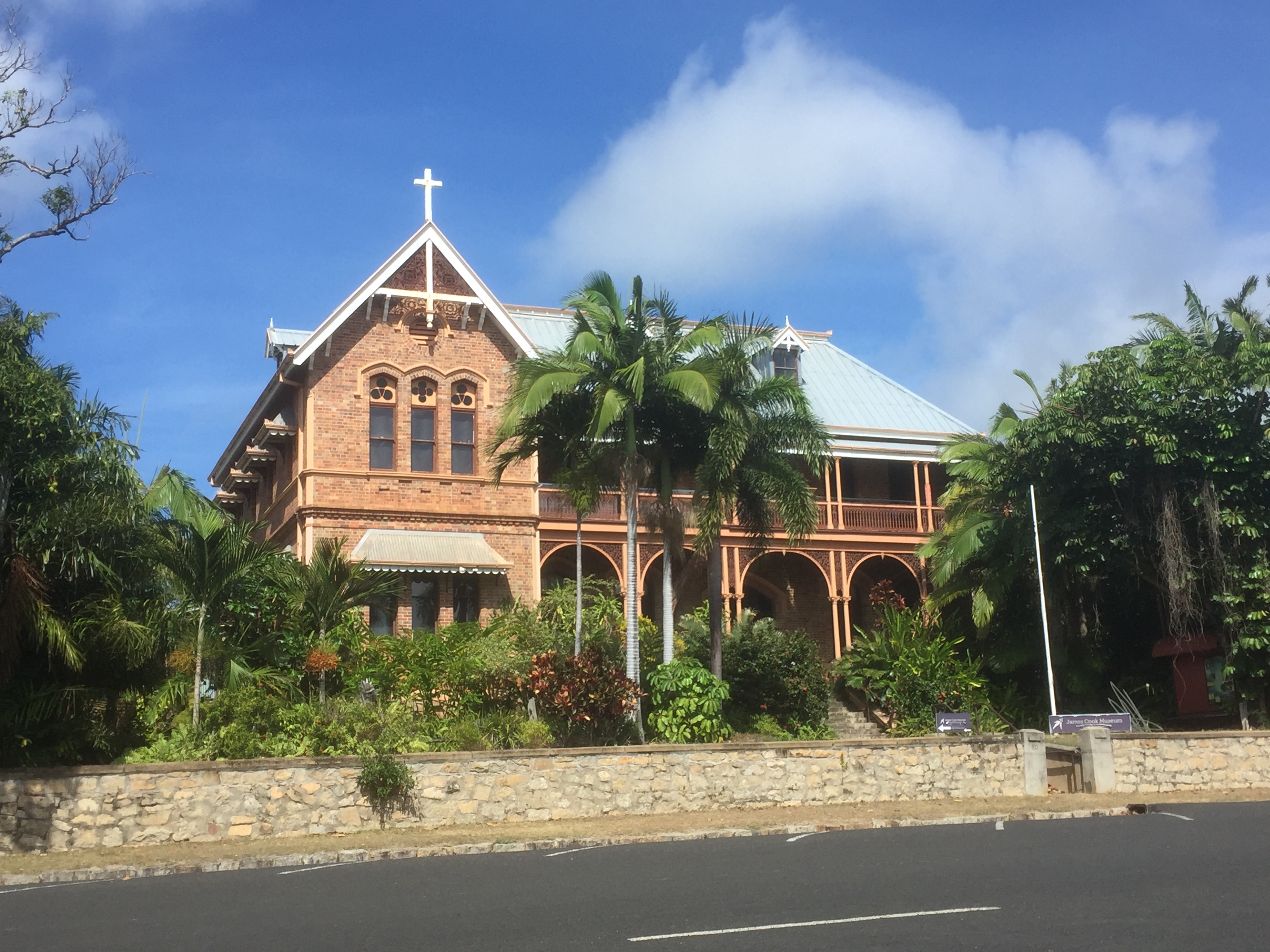
After a good night’s sleep it was a “lazy day” in Cooktown, including a visit to the local heritage museum and the James Cook Museum to brush up on hour history. There was also a new “Reconciliation Centre” that told the story of how Cook negotiated with the indigenous people while he was stuck there.
James Cook Museum in Cooktown
Lunch was fish and chips overlooking the Endeavour River and in the evening we boarded the sunset cruise for a trip up river to learn more about the area.
Sunset over the Endeavour River
In the morning it was time to head back to the Atherton Tablelands to drop Pat and John off. The weather report wasn’t looking too good, with plenty of cloud around and a few showers as well. There was a TEMPO for rain at Mareeba later in the day so I decided it was best to leave early. It was only a 30 minute flight that we’d intended to do via the coast to enjoy the views of the Daintree but it was clear there’d be no views that day. I submitted a flight notification planning to track first inland to Lakeland then south to Mareeba and then to Atherton. Mareeba is at about 1500ft AMSL while Atherton is about 2500ft and it was likely that Atherton would be either in cloud or have very low visibility. So, my plan was to descend into Mareeba on the RNAV instrument approach and then, once we emerged from the cloud, to assess whether we could fly the last 13 miles to Atherton or would have to land at Mareeba.
RNAV instrument approach for Mareeba
That’d mean having to arrange a lift back to Atherton where Pat and John had left their car but that wasn’t too big a deal. I discussed this plan with Sigi, Pat and John over breakfast so they were aware of the possibility and John started to line up a friend to pick us up. We arranged for Mick to take us out to the airport a bit before 9am and were lifting off by 9:30, climbing through the clouds to 6000ft. We were then in and of cloud (IMC) as we tracked from Lakeland to Mareeba.
Climbing out of Cooktown
As we approached top of descent Air Traffic Control asked what my intentions were and I told them I was planning to do the RNAV and then when visual decide whether to fly under the cloud to Atherton or land at Mareeba. They checked with Cairns Approach who control the airspace over Mareeba who said that was good with them so I was approved to do just that. It was a fairly quiet descent through IMC with occasional glimpses of the ground below but not much until we were about 1500ft AGL and the view to the Mareeba runway opened up in front of us. I looked to the south and saw a wall of cloud and rain where Atherton should have been. That made it an easy decision. “Brisbane Centre, Mike Sierra Foxtrot will be landing at Mareeba”. “Mike Sierra Foxtrot”. So it was a straight in approach and soon we were tying the plane down alongside a variety of other aircraft.
On the ground in Mareeba
John’s mate Greg drove us back to Yungaburra. On the way, as we drove up the “jump up” towards Atherton, it started to spit, then as we passed the Atherton airstrip the rain came and the visibility was down to a few hundred metres. We all agreed, “Yep, that was the right decision.” We drove back to Yungaburra for one last night with Pat and John before heading home.
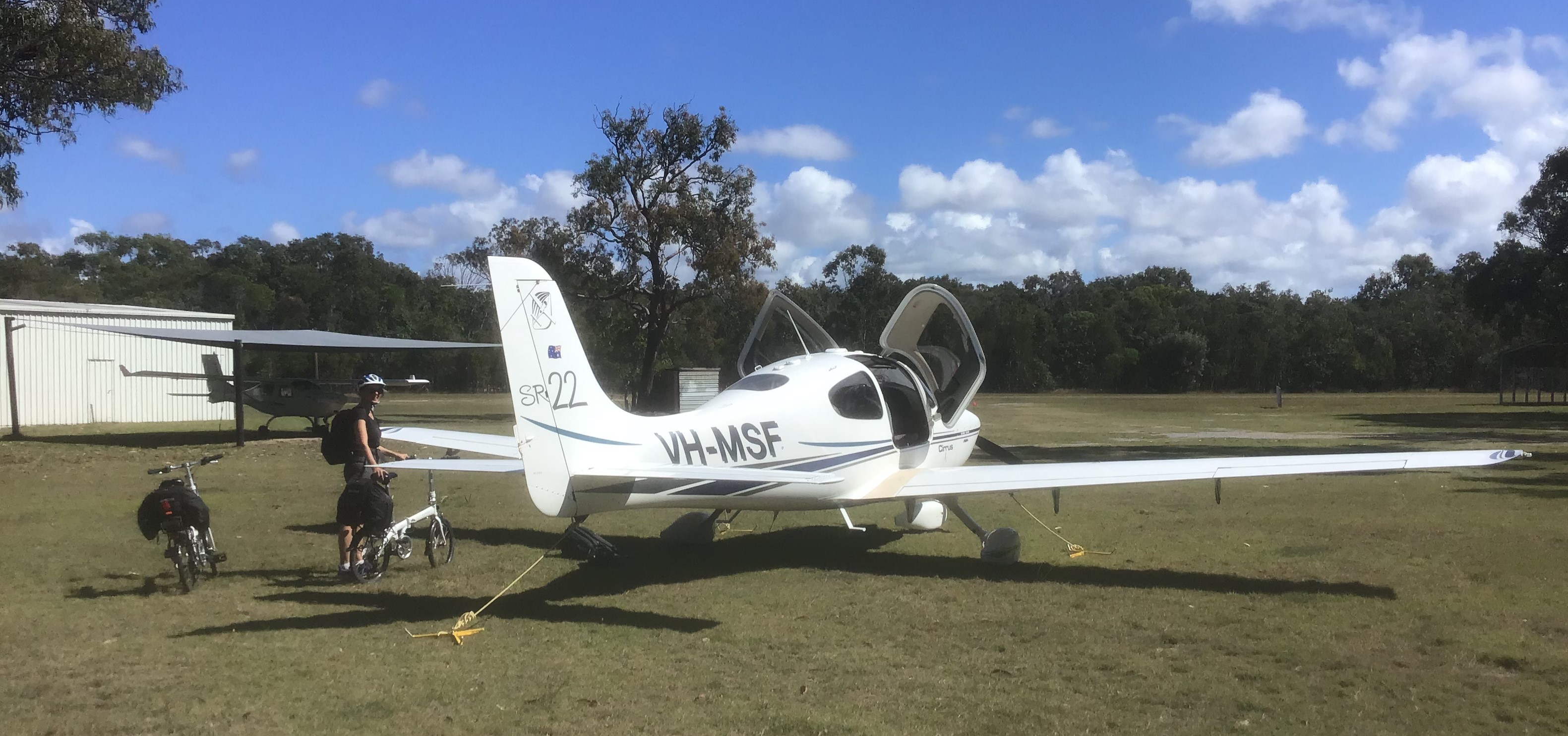
In the morning it was time to depart FNQ. There was quite a bit of cloud forecast along the coast so we decided to take the inland route via Charters Towers and Emerald. First though we had to load our folding bikes and our oxygen tank.
Sigi with the oxygen tank
With just the two of us we had plenty of room and could fill the fuel tanks as well without going over max weight. The bikes were installed and secured on the back seat behind me and the oxygen tank with regulator strapped to the back of Sigi’s seat. With the oxygen turned on and the cannulas puffing up our nostrils (looking very elegant) we took off from Mareeba IFR and, after being identified by Brisbane Centre, climbed through the clouds to 7000ft and south, via a waypoint over Pinnarendi.
Climbing out of Mareeba
Our portable oximeter allowed us to check the blood oxygen levels and adjust the oxygen flow to stay around 95%. I’d noticed on the first leg north that without the oxygen at 7000ft my blood oxygen had dropped below 90% so it felt good to have that extra spurt to keep our heads clear. It was overcast below us for the first hour, making it a fairly uninteresting trip until the clouds cleared just before Charters Towers.
Charters Towers
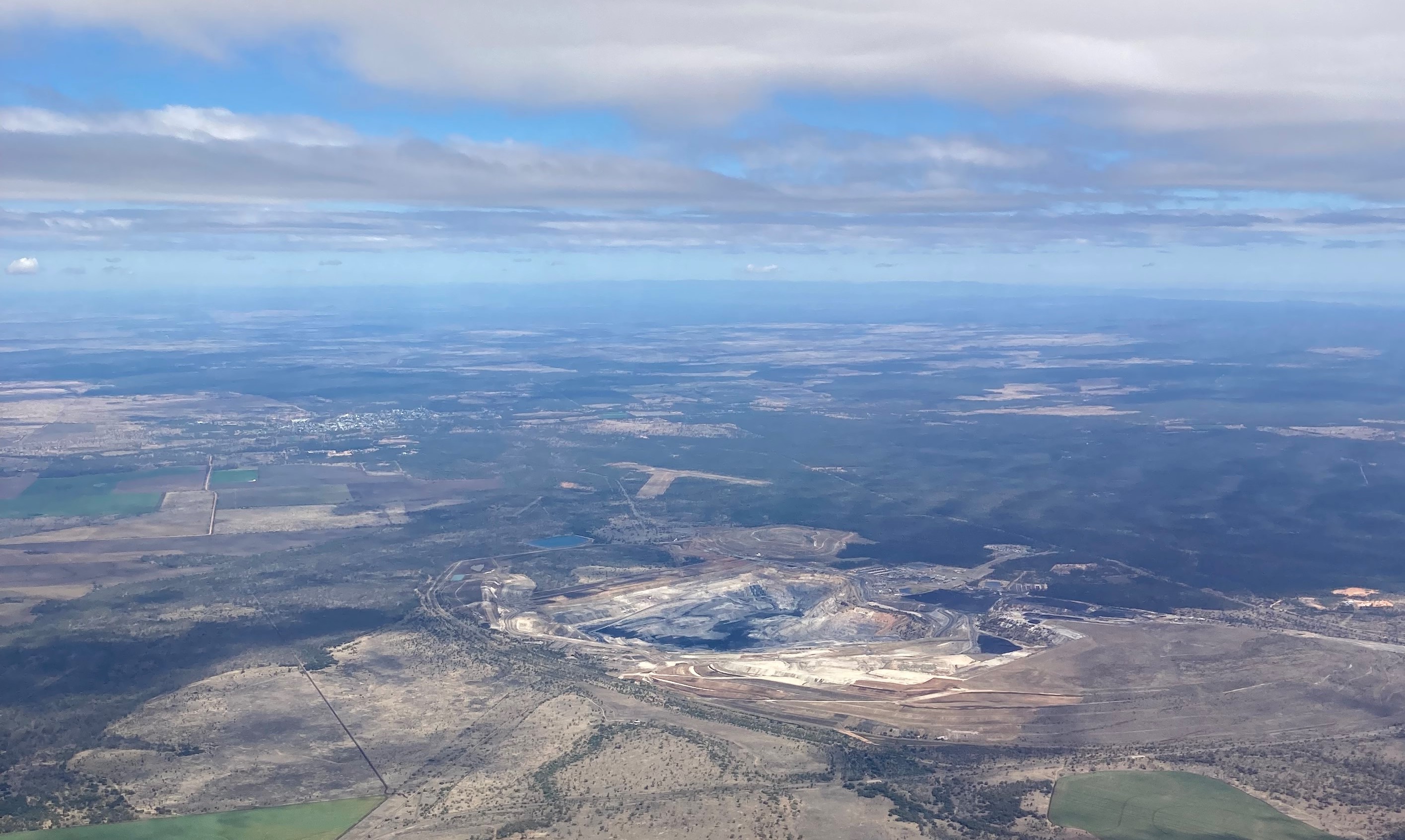
Soon we were passing Lake Dalrymple, formed by the Burdekin Dam, and then Clermont and the Blair Athol Coal Mine.
Blair Athol coal mine and Clermont
I then spotted what appeared to be a road running east/west but it wasn’t on the map. Puzzled at first I concluded it was the new railway track to the Adani coal mine that’s still under construction. It might take a few years for it to appear on the maps I suppose but it certainly stands out.
We seemed to be very much on our own up there until Air Traffic Control made us aware of another aircraft that was about 10 miles away and due to cross our path. We were flying IFR at 7000ft and he was flying VFR at 6500ft. As we got closer the controller said “It’ll be quite close so I suggest you climb to 9000ft NOW” so we commenced a climb and as we did saw the other aircraft pass directly below us. It wasn’t really close but considering there were probably no other aircraft in a 50 mile radius it was quite a coincidence that we got as close as we did. In any case, it was good to have ATC looking out for us. Another advantage of IFR.
Not long after we commenced our descent into Emerald to top up the tanks. We’d been looking forward to a coffee at the airport but, as is often the case in these Covid times, the café had closed shortly after the QantasLink flight had departed so we had to make do with a soft drink and a carrot from our emergency rations. Having refilled the fuel tanks, we climbed to 5000ft, tracking direct for Agnes Water, passing over the Blackwater coal mine and the Exhibition Range.
Exhibition Range
After about an hour we descended to our “old favourite” strip where, as usual, we did the low overfly to check for kangaroos then landed, tied down, unloaded the bikes and rode into town. It was good to be back in familiar territory. We checked into the Mango Tree Motel and enjoyed a meal and a drink at the Cody’s Place as the evening approached.
The next morning we were heading home. After a early morning walk along the Agnes Water beach and breakfast at the Holidays Café we loaded our things onto the bikes and rode the 3km out to the airstrip. The forecast was for a bit of cloud so I filed an IFR flight plan. The wind was picking up and blowing at about 10 knots from the south east so we took off to the south, climbing out over central Agnes Water, and making contact with Brisbane Centre once were at about 2000ft.
Once identified we soon reached our cruise altitude of 5000ft and started passing in and out of stratocumulus clouds that were arranged in parallel rows running across our path. It was good IMC practice and always fun to see what would appear each time we popped out of the cloud into the next bit of clear air.
Stratocumulus cloud
The intermittent cloud continued as we passed Gympie and at about Kenilworth the air traffic controller was obviously wondering what my intentions were as we flew closer to the Brisbane controlled airspace.
Mary River near Kenilworth
“Mike Sierra Foxtrot, what are the in-flight conditions?”. “We’re in and out of clouds so not visual, Mike Sierra Foxtrot”. “Mike Sierra Foxtrot”. I decided to make it easy for him so: “Centre, Mike Sierra Foxtrot, top of descent will be at MORBI and I expect to be out of the cloud and visual above our lowest safe and intend to descend into Redcliffe below the control steps”. “Mike Sierra Foxtrot. Copy and thanks for that.” The descent to Redcliffe was spectacular as always, past the Glasshouse Mountains and over the bay and northern suburbs of Brisbane.
Redcliffe Peninsula
We put MSF away in the hangar and headed for home. The end of another great trip.
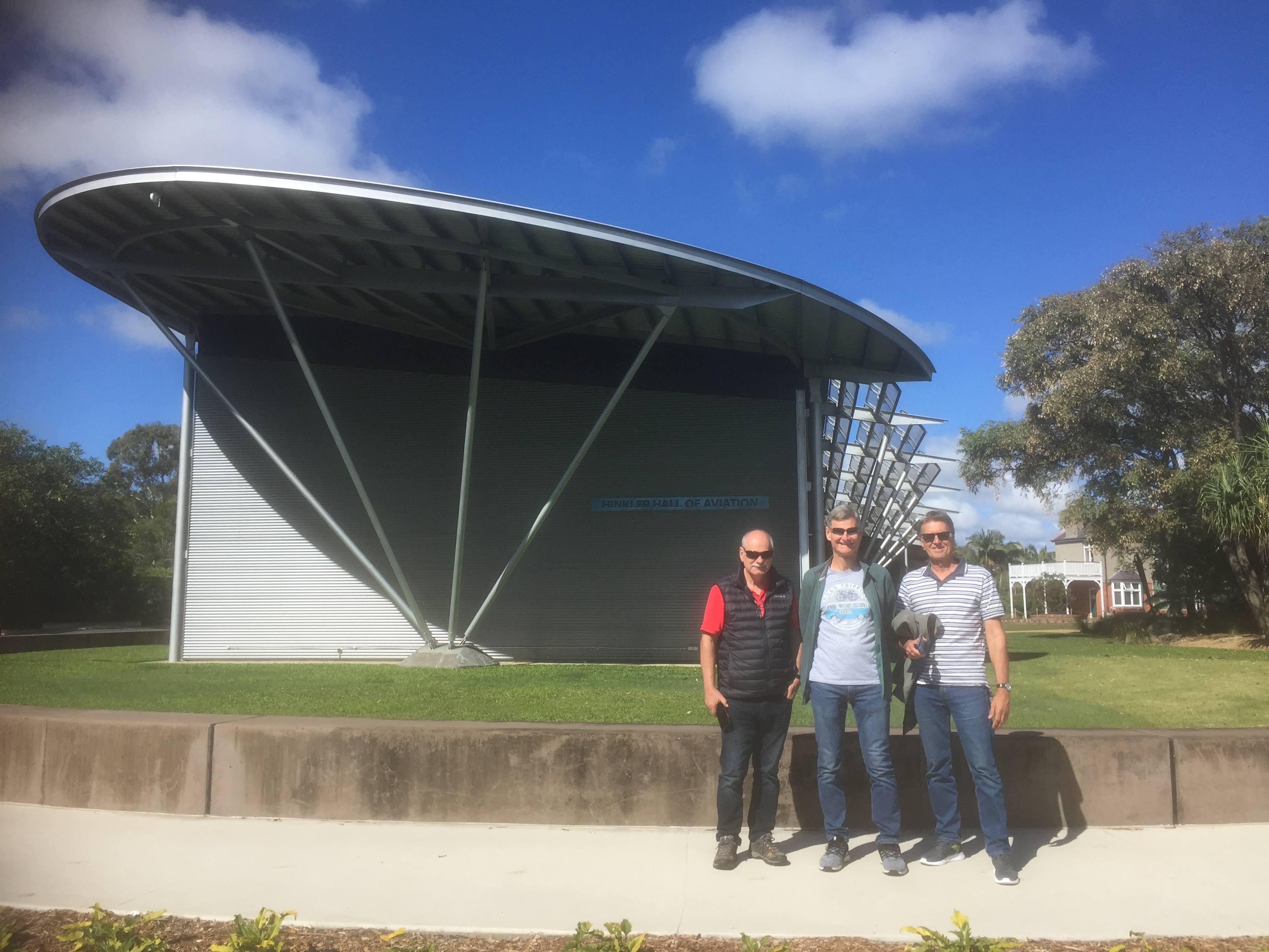
Our three day “golflyaway” had been planned for months. A few other golfers of varying levels of ability who I play nine holes with on a semi-regular basis had agreed with me it would be great to fly down to Coffs Harbour and play on the famous Bonnville course. Initially we’d planned it for late in 2020. However, our plans were disrupted, first by Covid lockdowns, then by weather on two occasions (why play golf when the weather’s no good?), and then by us struggling to agree on a date that would suit us all. When one of us suddenly had to head overseas for work (yes, that is still possible these days) we shanghaied one of my neighbours to sign up for a July 2021 departure. Then at the end of June came the risk of the imminent NSW border closure. So our original trip to Coffs seemed unwise, and at Ted’s suggestion we “pivoted”….to Bundaberg/Bargara.
Tied down in Bundaberg
The flight up was meant to be VFR and an opportunity to spot whales along the Cooloola Coast and in Wide Bay but low cloud and showers appeared in front of us before we reached Double Island Point and forced us to head inland. Tracking towards Maryborough, avoiding the Wide Bay restricted area while remaining clear of cloud became difficult. I could see a wall of cloud to the north so I asked ATC to switch to IFR and climbed up above lowest safe before entering the cloud and flying in IMC until we were 20 miles south of Bundy. Finally it was all clear again. Ted, Mark and Joe all seemed to enjoy the experience of flying in IMC.
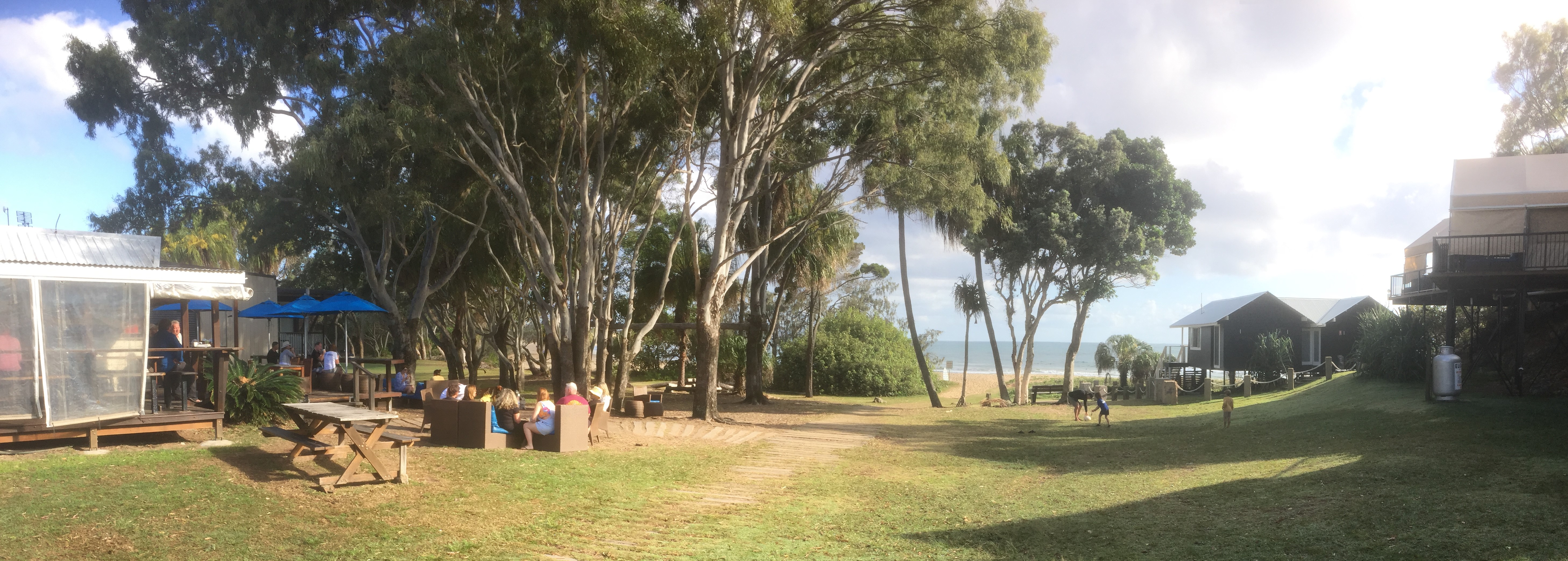
We were visual into Bundy and while I tied down the plane Mark fetched the hire car. Nine holes at the Bargara Golf Club were followed by an opportunity to watch some pro golfers demonstrate their skill at a pro/am event. After a couple of drinks at the 19th hole we headed back to our Airbnb for the night.
Watching the professionals
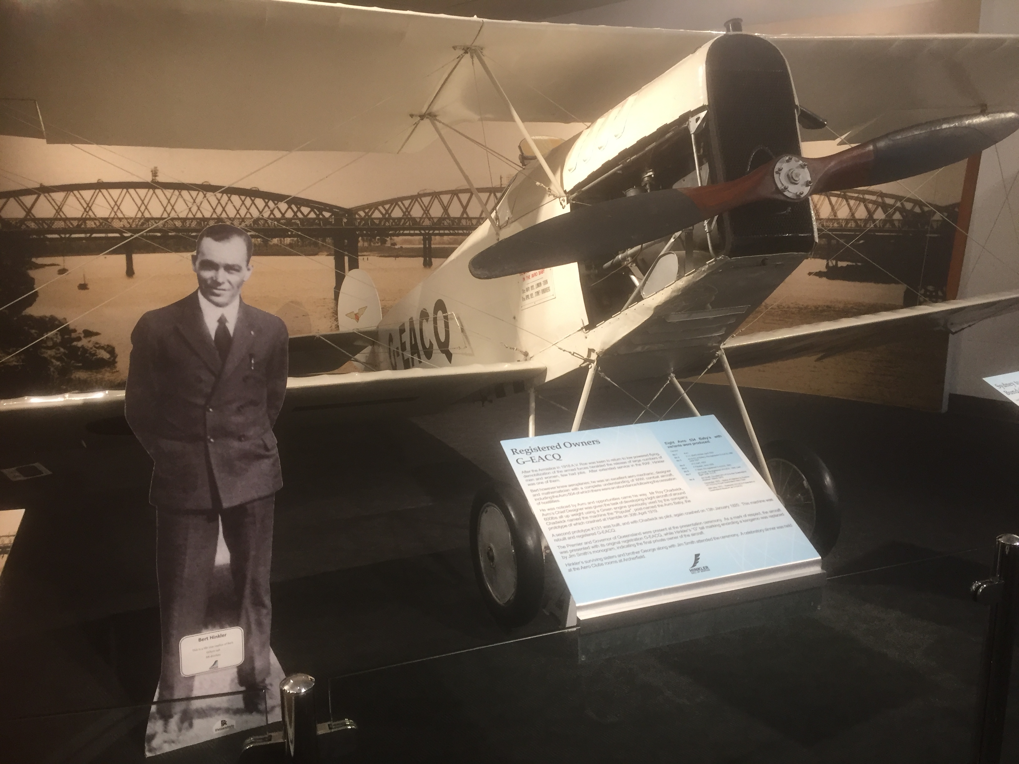
The next day we’d booked 18 holes at the Coral Cove Golf Course about 15 minutes’ drive away. We weren’t due to hit off until midday so that gave us the perfect opportunity to visit one of Bundaberg’s key attractions. With the main hall a structure of soaring glass and steel made in the shape of an aircraft wing, and set in the lush Bundaberg Botanic Gardens, the Hinkler Hall of Aviation brings to life the adventures and achievements of Australia’s famous pioneer solo aviator and native of Bundaberg, Bert Hinkler. It outlines Bert’s life achievements and personal story.
It houses numerous full size display aircraft and unique museum artefacts, including the beautifully restored ‘Mon Repos’, his relocated home. Bundaberg supporters arranged to have the house taken apart in England and brought out to Bundy where it was rebuilt brick by brick. Anyone who is visiting Bundaberg should drop by for a visit. It would also be worth having a flyaway just to visit it. They have a nice little café on site as well.
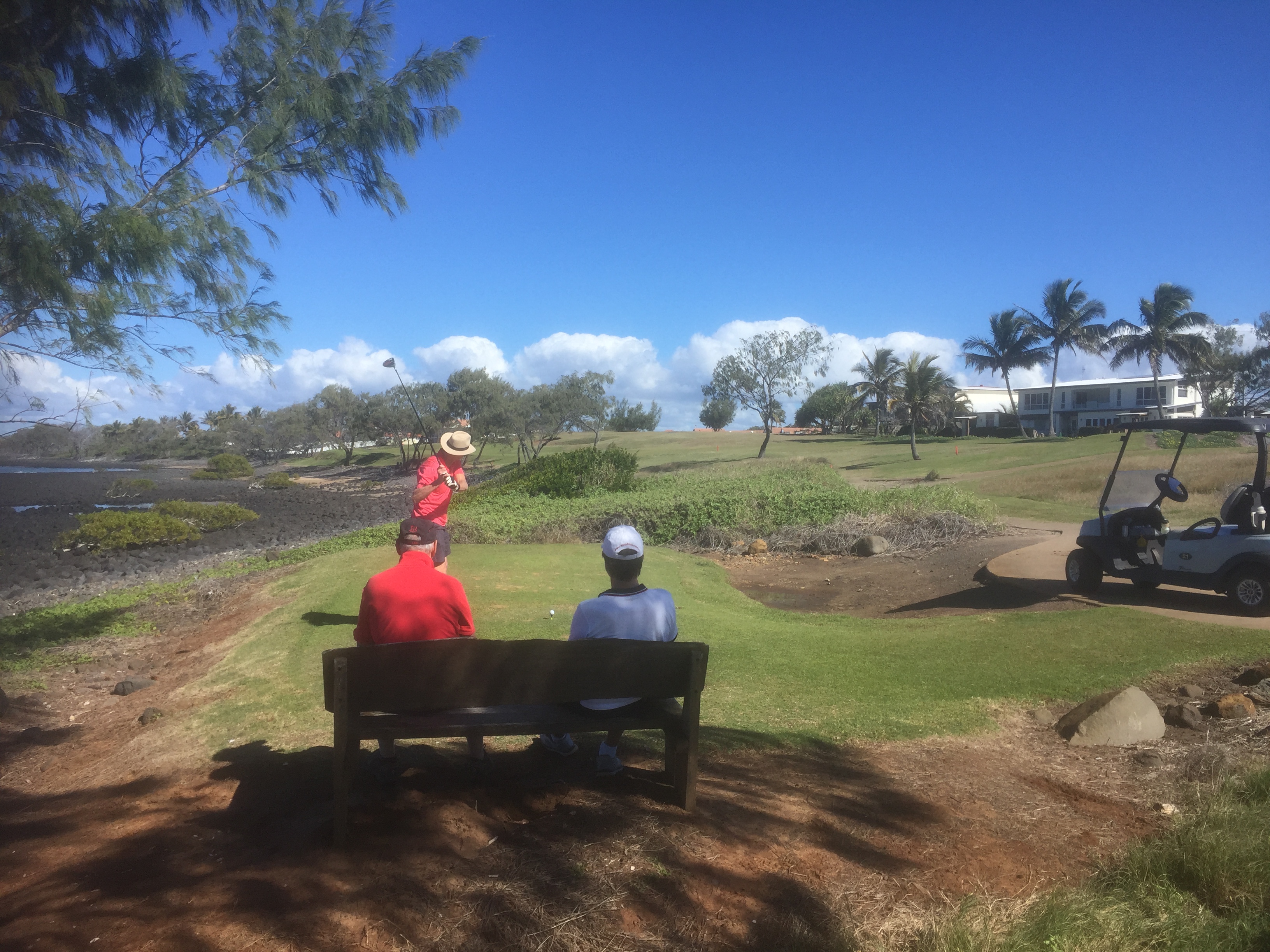
Anyway, having learned all about Bert Hinkler’s exploits we headed out to the Coral Cove Championship Golf Course.
Mark tees off at Coral Cove
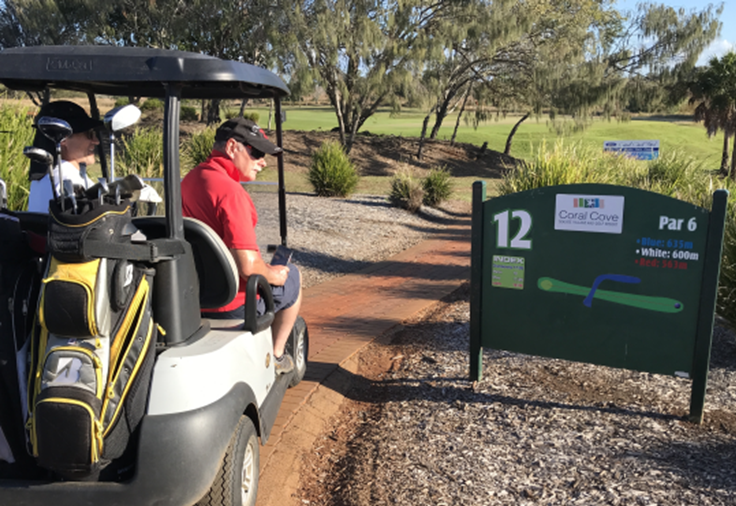
It has very long fairways, and in fact the 12th, at 635 metres, is Australia’s longest. Long enough to land a plane on.
Understandably, hiring a cart was mandatory and even with carts we only managed 16holes before dusk and closing time. Nevertheless we had time for one drink at the 19th hole before heading back to Bargara.
The next day after breakfast at the Windmill Cafe in downtown Bargara we drove to the airport, where we were treated to a few flypasts by an RAAF wedgetail (Boeing 737) as they practised their instrument approaches into Bundy.
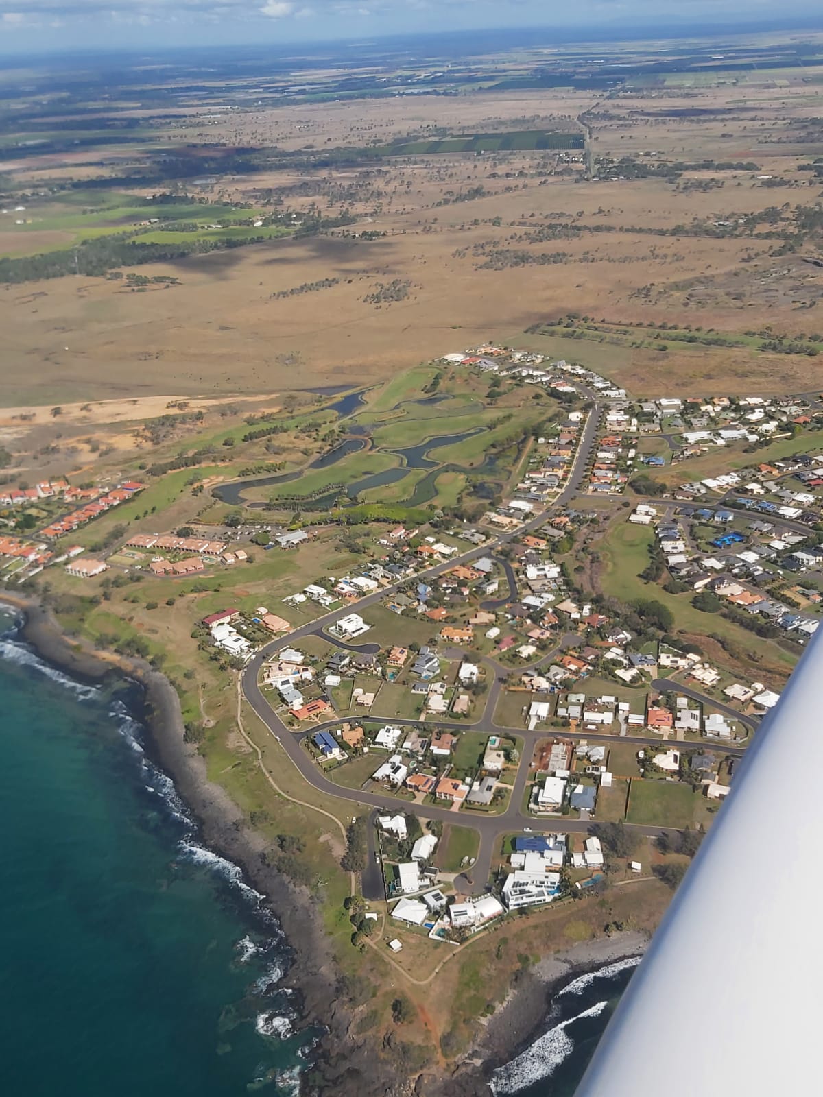
Then it was our turn, taking off and tracking east at 1500ft over the city and the rum distillery to Bargara, where we had a bird’s eye view of the two golf courses we’d played at.
Coral Cove
Following the coast we overflew Woodgate and Burrum Heads.
We then turned inland to Biggenden, where we stopped for lunch at the Grand Hotel.
On the ground in Biggenden with the clouds gathering
Clouds were gathering during lunch so we headed back to Redcliffe IFR, flying in and out of the clouds at 5,000ft until we were near Maleny, where we had a clear view of the Glasshouse Mountains on descent.