On Thursday 1st August 2024, after two days flying in the mountains out of Denver and two days flying out of Milwaukee, I had my fifth day of flight training in the US. Brett Silvester and I flew an SR20 along the coast of California accompanied by an instructor. We’d scheduled a one-day stopover in LA on our way back to Brisbane and, given how easy it’d been to arrange a flight with Pilotsmith at Milwaukee the previous week, we decided to attempt something similar in LA. At first, I’d thought of arranging a flight in a High Wing Sling, as I’d been impressed with the one I’d seen in Oshkosh, and they have a training school in LA. However, there wouldn’t be a high wing available that week, and Brett was keen to fly a Cirrus again, so I hunted around on the internet for a Cirrus flight school instead. I found Calair, who are based at Hawthorne airport, only about 10 minutes by taxi from LAX and when I emailed them they said there’d be no problem arranging a flight with an instructor that day. So we were set.
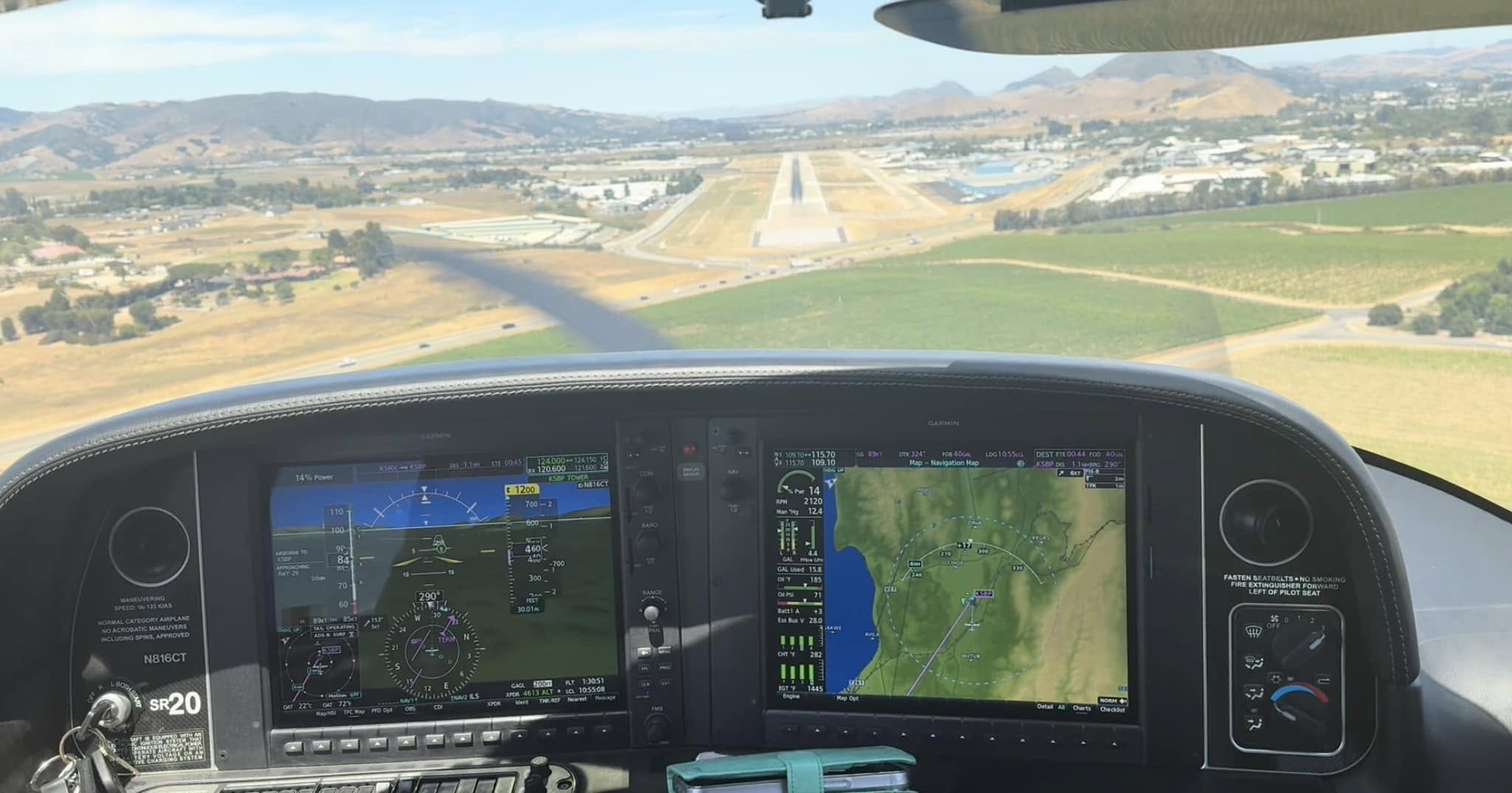
Brett and I stayed overnight in a hotel in Hawthorne and turned up at 9am for our flight with Dana, a young, keen as mustard instructor, who was only too keen to let us take her for a flight up the coast. As with the other instructors in the US, we’d let Dana do the radios and we’d focus on flying the plane. We discussed our options for a flight plan and agreed to fly up the coast past Santa Monica, Malibu and Santa Barbara to San Luis Obispo.
Flight route taken
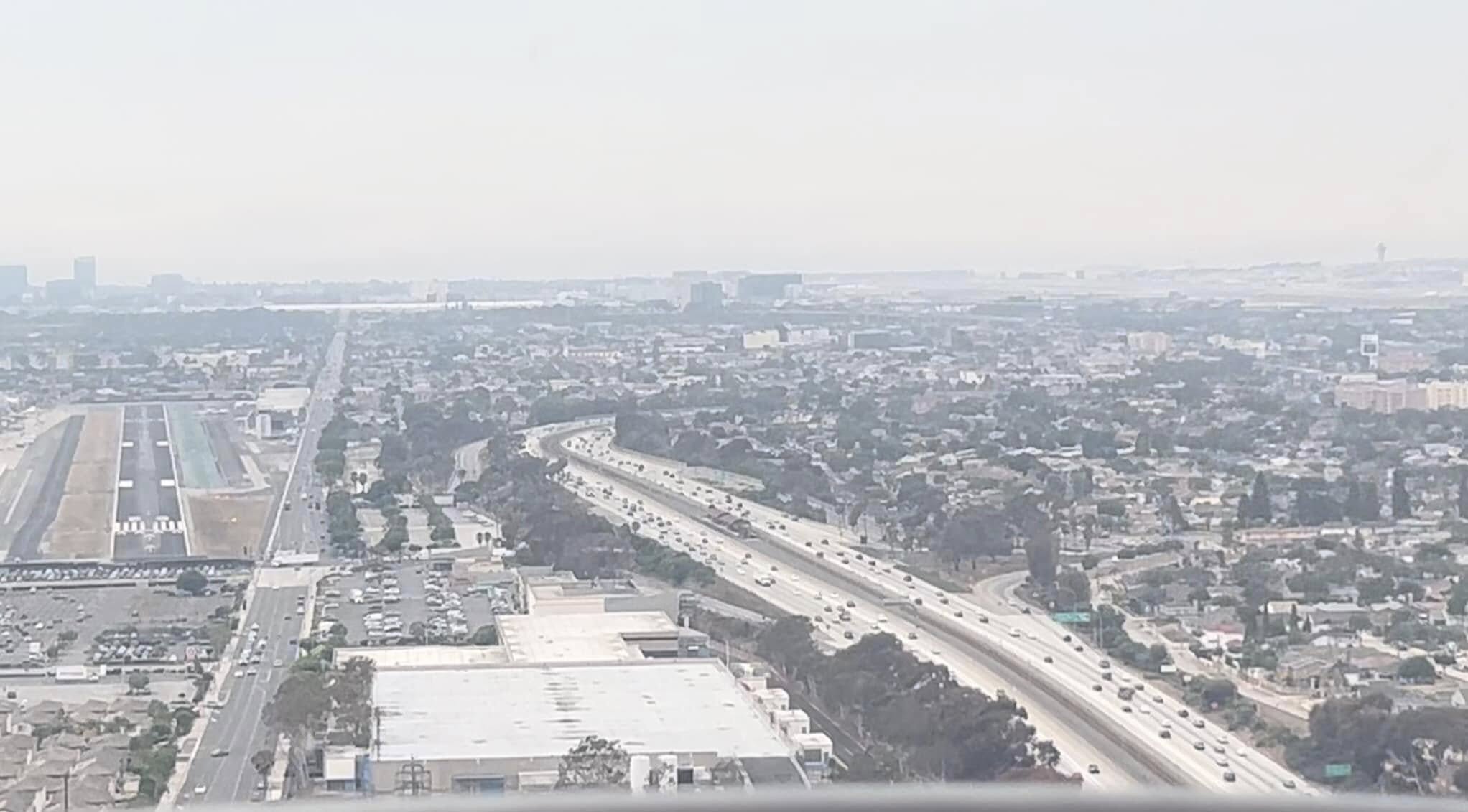
It was a fine day with blue skies as we taxied out to the runway, which is in the middle of suburbia, jammed between a road and a line of office buildings and warehouses.
Hawthorne runway left with LAX in the distance on the top right
I flew the outbound leg, Dana instructing me to climb out of Hawthorne Airport and turn left, heading south west until we reached 4500ft. Once at that altitude we were above the controlled airspace over LAX so could turn and head north, passing right over the top of it.
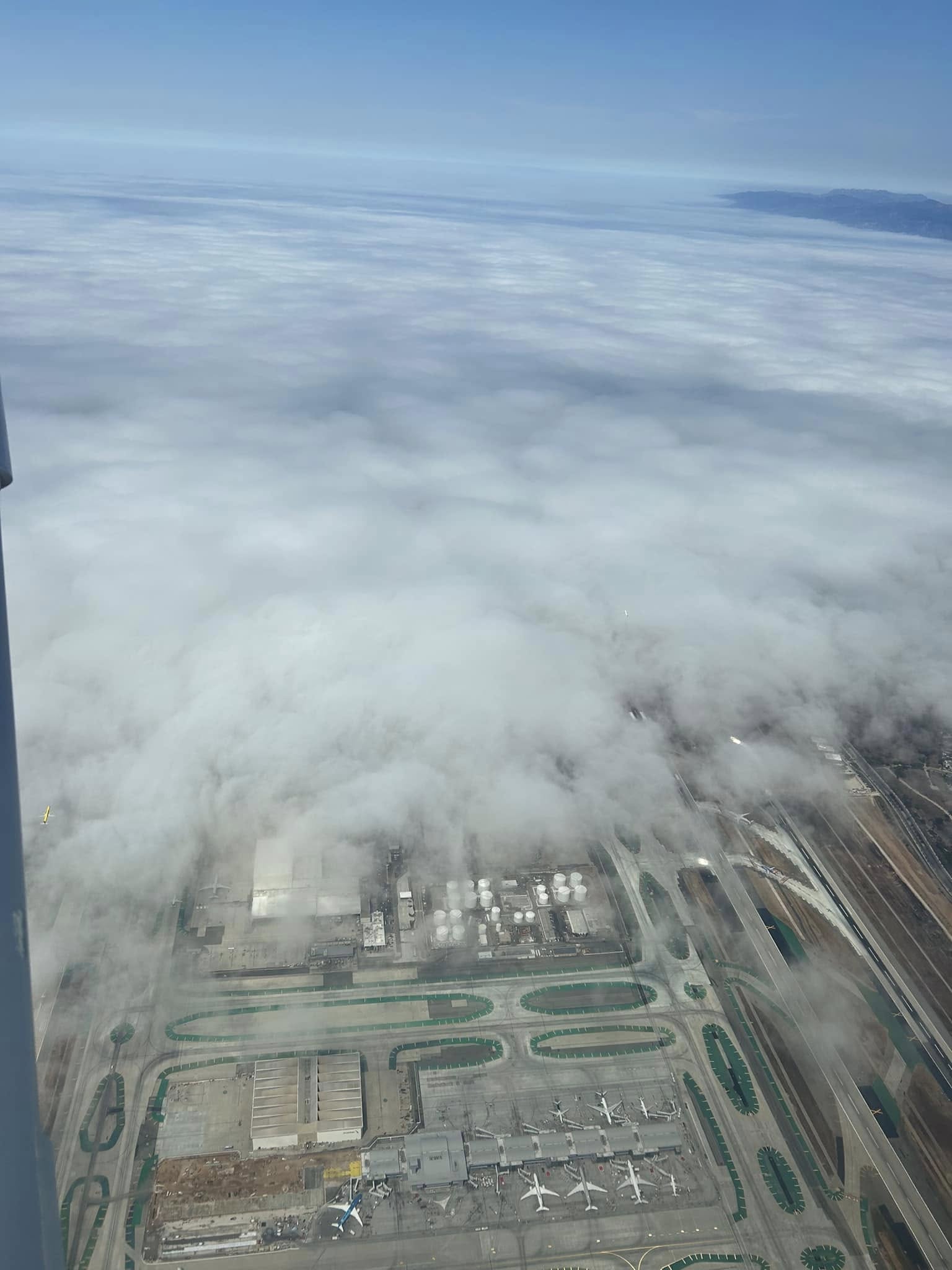
Unfortunately, the coast and most of LAX were covered in sea fog so we didn’t get much of a view of the activity on the ground there.
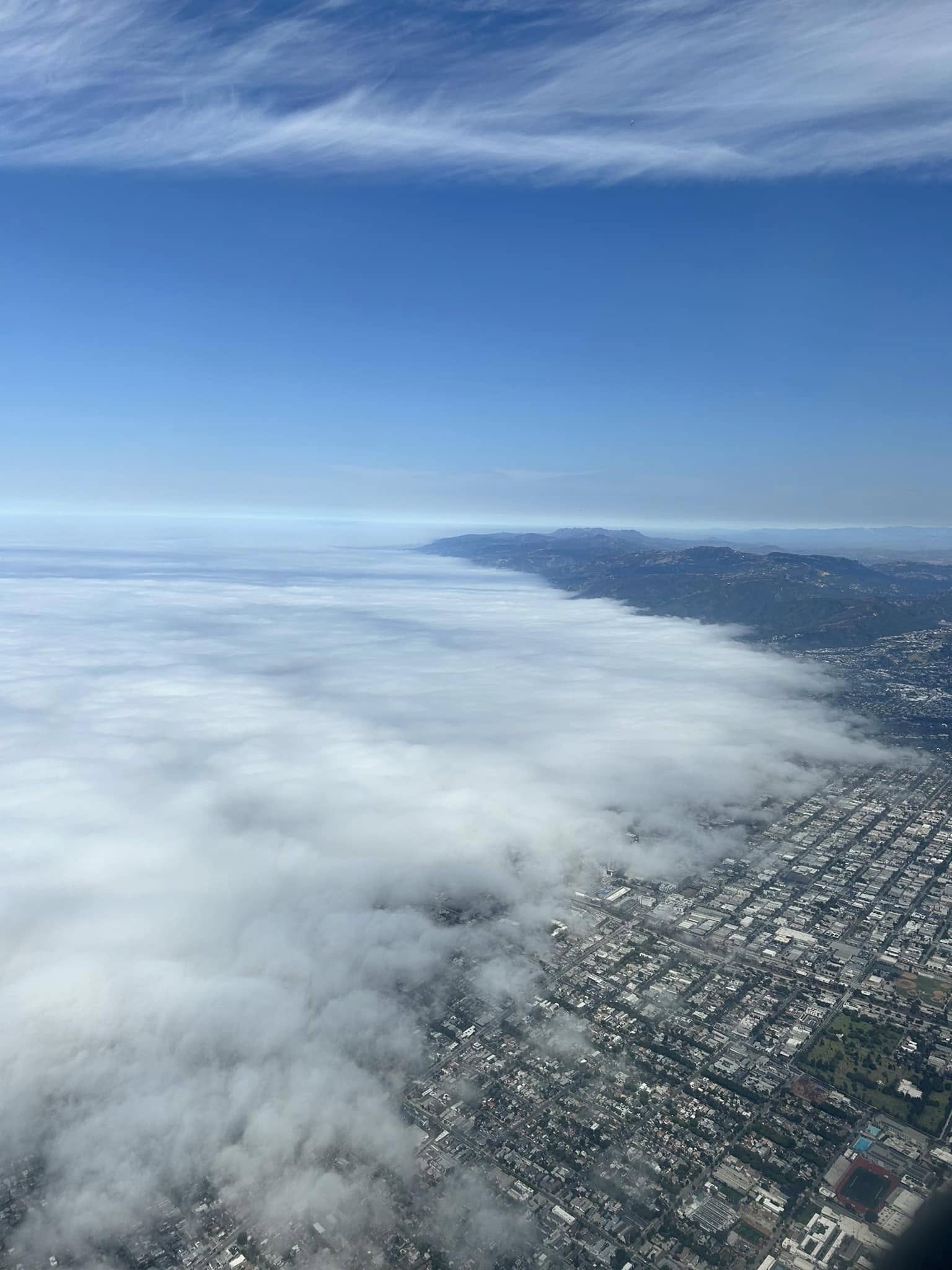
Santa Monica
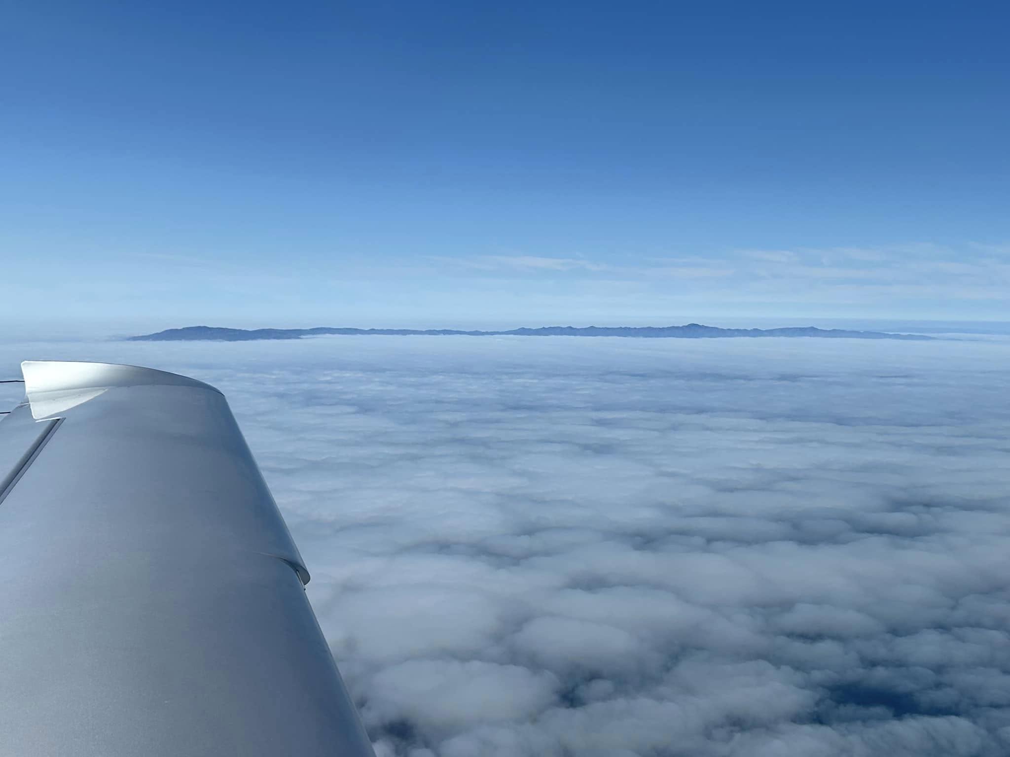
The fog continued up the coast further on, blanketing Santa Monica and Malibu so they were almost invisible but we had great views of the Malibu hills. We also glimpsed some islands off in the distance poking out of the clouds.
Further out the fog burned off so we had great views of Ventura and Santa Barbara.
It took us about one hour until we started our descent into San Luis Obispa.
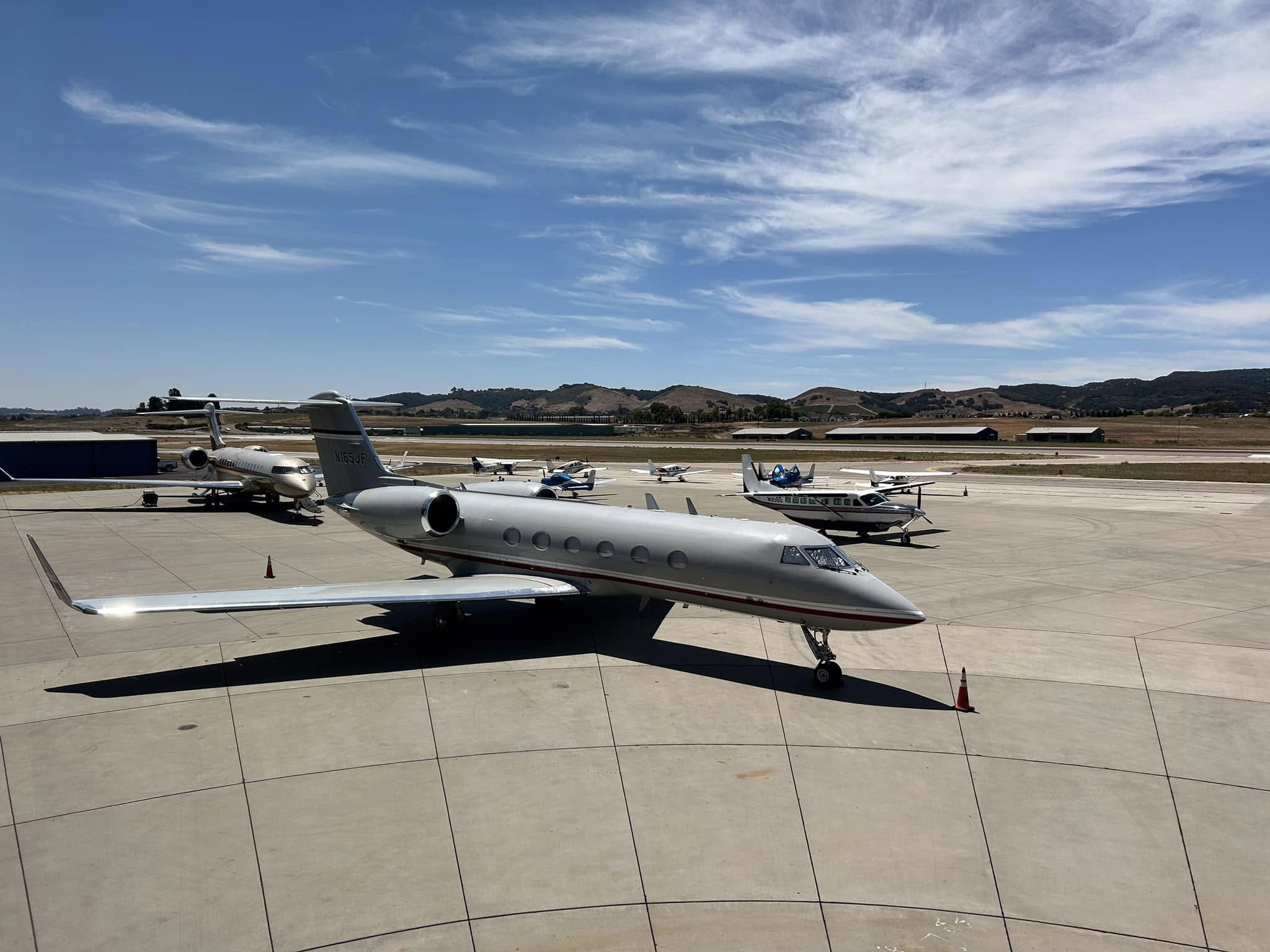
We pulled up on the apron and wandered past a few slightly larger planes on our way to the impressive FBO.
After checking out the FBO facilities I climbed into the back seat and Brett climbed into the front for the return flight. The fog had cleared by that time so we had good views, for example of Santa Maria below.
Santa Maria
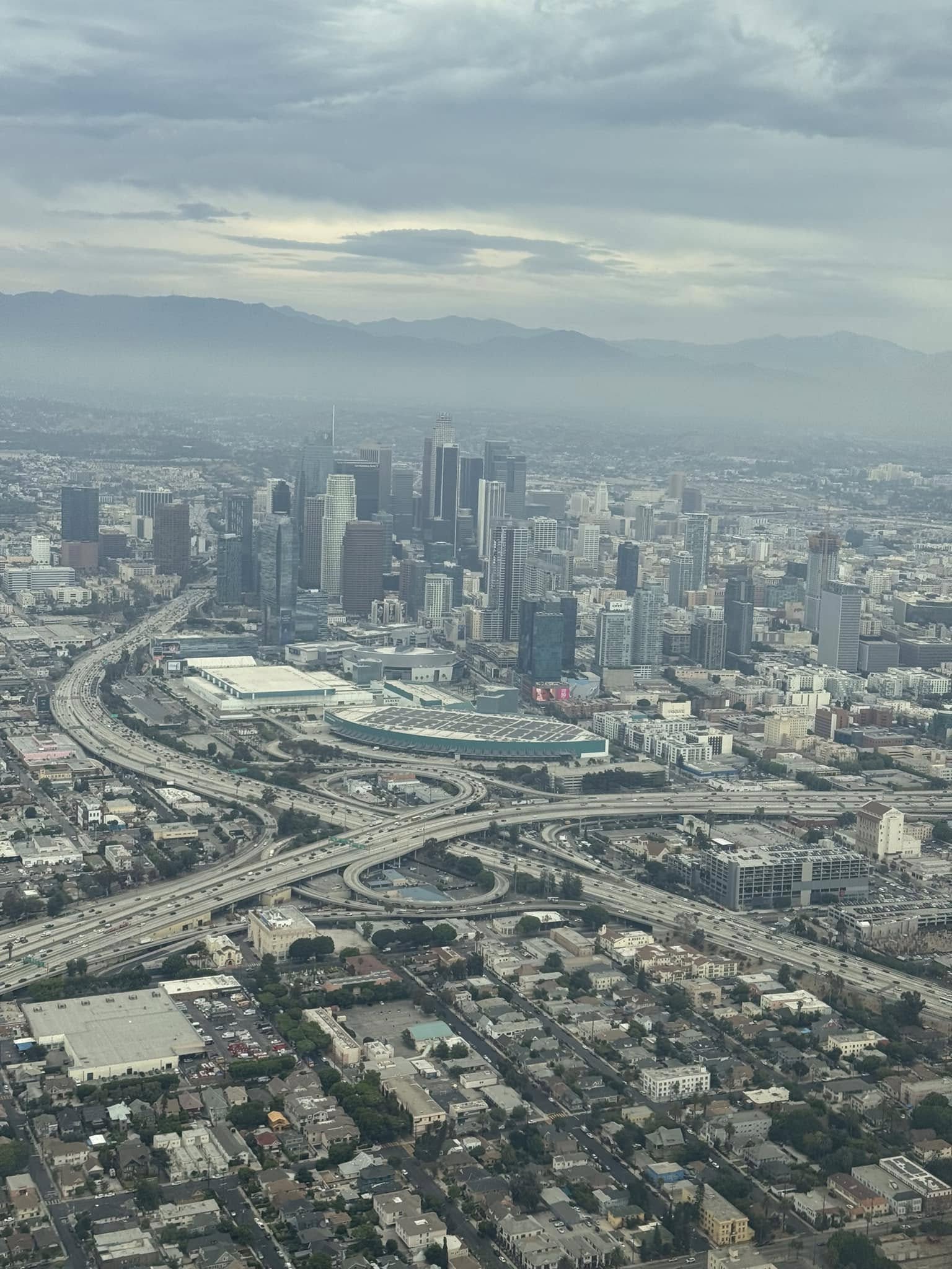
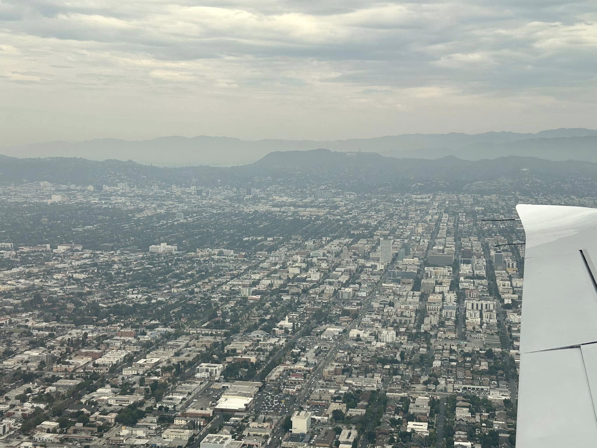
Dana asked whether we’d like to fly past downtown LA so we did so, at 1500ft, before passing under the jets approaching into LAX and landing back at Hawthorne.
You can just make out the Hollywood sign on the hills in the distance
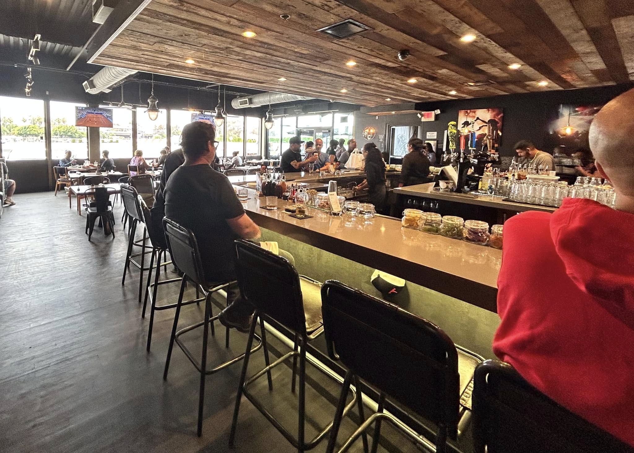
Hamburgers at the airport bar with a view of landing aircraft were followed by a short walk down the street to SpaceX, who apparently launch their rockets not far from San Luis Obispo, before we caught an Uber to the BIG airport. Our US adventure was over.
I’ve loved the Alps ever since my first visit to Europe in 1978. The mountain scenery is just spectacular and the villages dotted around make it look like something directly out of a story book. It’s a tourist’s paradise. Of course, the best way to see the mountains is from up high, either by hiking up them ….. or flying. I remember many a flight in a commercial jet high up over the alps, looking down and wondering what it’d be like to fly at low level amongst them. Ever since my friend Peter Hastings went gliding in Austria some years ago, I’ve pondered how I could arrange my own light aircraft flight in the Alps.
If you want to fly in another country you can usually have your Australian licence converted to a local one by doing a theory test and a few hours of flying with a local instructor but I’ve grown to like the idea of simply flying “dual” with a local instructor or safety pilot. First, it avoids the paperwork and cost of transferring my Australian licence to a local one. Second, the local pilot can act as “tour guide”, pointing out places of interest to fly to while transferring their knowledge of the local area. Third, they can look after the radio communications, that differ slightly in each country, leaving me free to fly the plane and enjoy the scenery.
In addition, for a challenge like mountain flying you really need some training in the special procedures and dangers of flying in the mountains and valleys. So for my first experience in the mountains in 2023 I did an actual three day mountain flying course in the New Zealand Alps and learned the basics of what to do and what not to do when flying in the mountains. That story is here: https://privatierair.com/2023/04/01/mountain-flying-in-new-zealand/
In 2023, encouraged by my friend Hans “Septimus” Geitner, I also arranged a couple of flights with a flight instructor in northern Germany along the Baltic Sea coast. I didn’t need any particular training for that. The instructor merely acted as a “safety pilot”, sitting in the right hand seat while I flew the plane. If you’re interested in that story here’s a link: https://privatierair.com/2023/08/21/a-scenic-flight-along-the-baltic-coast/
Then in 2024 I did a couple of days of mountain flying with a flight instructor in the US Rockies out of Denver that further impressed on me the spectacular views when flying around the mountains and improved my skills in landing and taking off on short runways at altitude, while also highlighting how dangerous the mountains can be if you don’t know what you’re doing. Refer to: https://privatierair.com/2025/01/18/mountain-flying-in-the-us-rockies/
So, when Sigi and I planned a visit to Bavaria in June 2025 I thought I’d try to arrange a day or two of mountain flying in the Alps. It would be early summer so there’d be long days and reasonably good chance of fine weather, albeit with a high risk of afternoon thunderstorms. I reasoned that if I allowed three days I should be able to fly on at least one day and probably two, weather dependent.
First, I contacted a flight school in the Algau region of southern Bavaria but they weren’t too helpful or interested. I had more luck with Michael Hochenrieder, who works at the AirLink Flight School in Salzburg, just over the border in Austria. Although Salzburg is a major airport with international flights it’s not too busy and the Alps are literally right there on the doorstep so there’d be no flight time required to transit to them, so was an ideal place to be based for a few days. AirLink have a few Cirrus aircraft in addition to a Cessna and Piper. Michael is an “EASA & FAA Flight Instructor (Airplane + Helicopter), an EASA Flight Examiner and Platinum CSIP” There’s a variety of mountain flying training info on the Cirrus Training website including a couple of articles on mountain flying published by Michael.
It turned out that Michael and the other Cirrus instructors weren’t available in the last week of June but a Cessna 172 was, along with alternative instructors. Michael put me in contact with David Bekhit, who has a background as an aviation mechanic (LAME). He was available on the Thursday morning and all day Saturday. David put me in contact with Thomas, who was available on Thursday afternoon, and also onto Reinhard, who was available on the Friday. Thomas was originally a musician in the Austrian military band until he became a pilot and now flies corporate jets for Porsche out of Salzburg. Reinhard was a sound engineer with the Austrian equivalent of ABC radio, who learned to fly when he was 18 and since retiring from the “Rundfunk” is the chief flight instructor with a local aero club. He freelances for AirLink when they need additional pilots. So, with these three interesting guys I thought I may be able to fly on three separate days in various directions out of Salzburg. I just had to agree with them where we’d go and when.
I drove the three and a half hours down from Sigi’s sister’s place near Amberg on the Wednesday afternoon so we could get an early start on Thursday. The weather forecast for Thursday was for a clear morning but a gradual build-up of cloud in the afternoon followed by thunderstorms from about 3pm on. So, we wanted to get going sooner rather than later.
I’d booked into a family BNB “Gasthof” in a village just over the border in Germany, about 20 minutes drive from the airport. It was a very comfortable and reasonably priced place to stay for a few nights.
Gasthof Gumping in Ainring
The village was set amongst farms with views to the mountains.
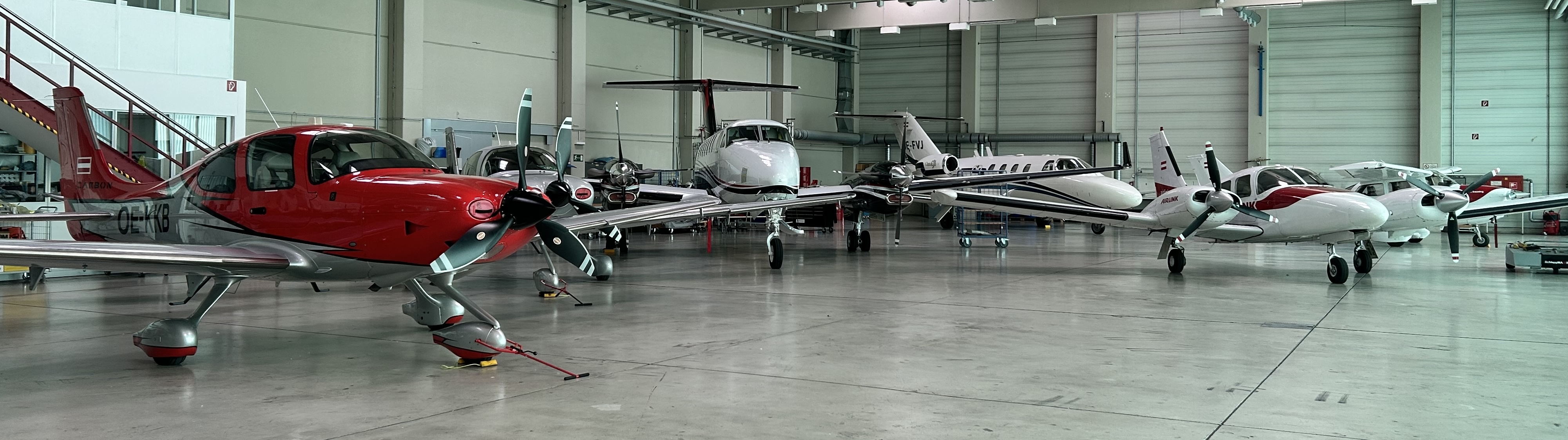
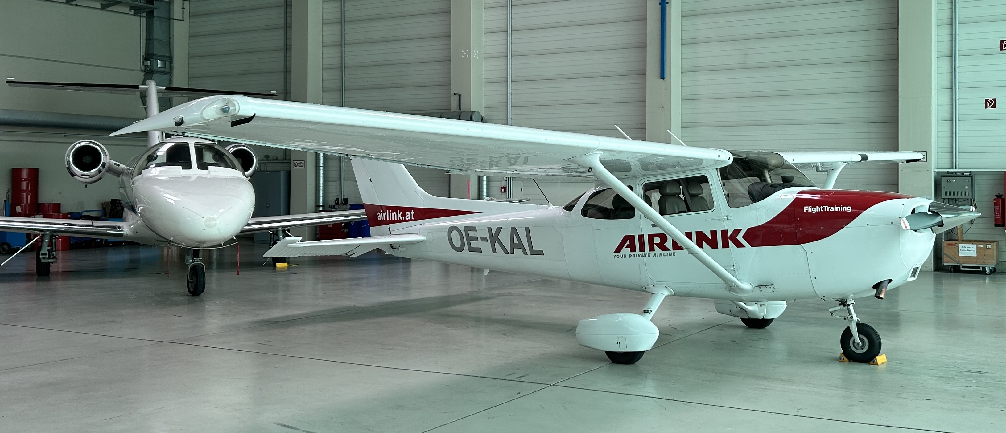
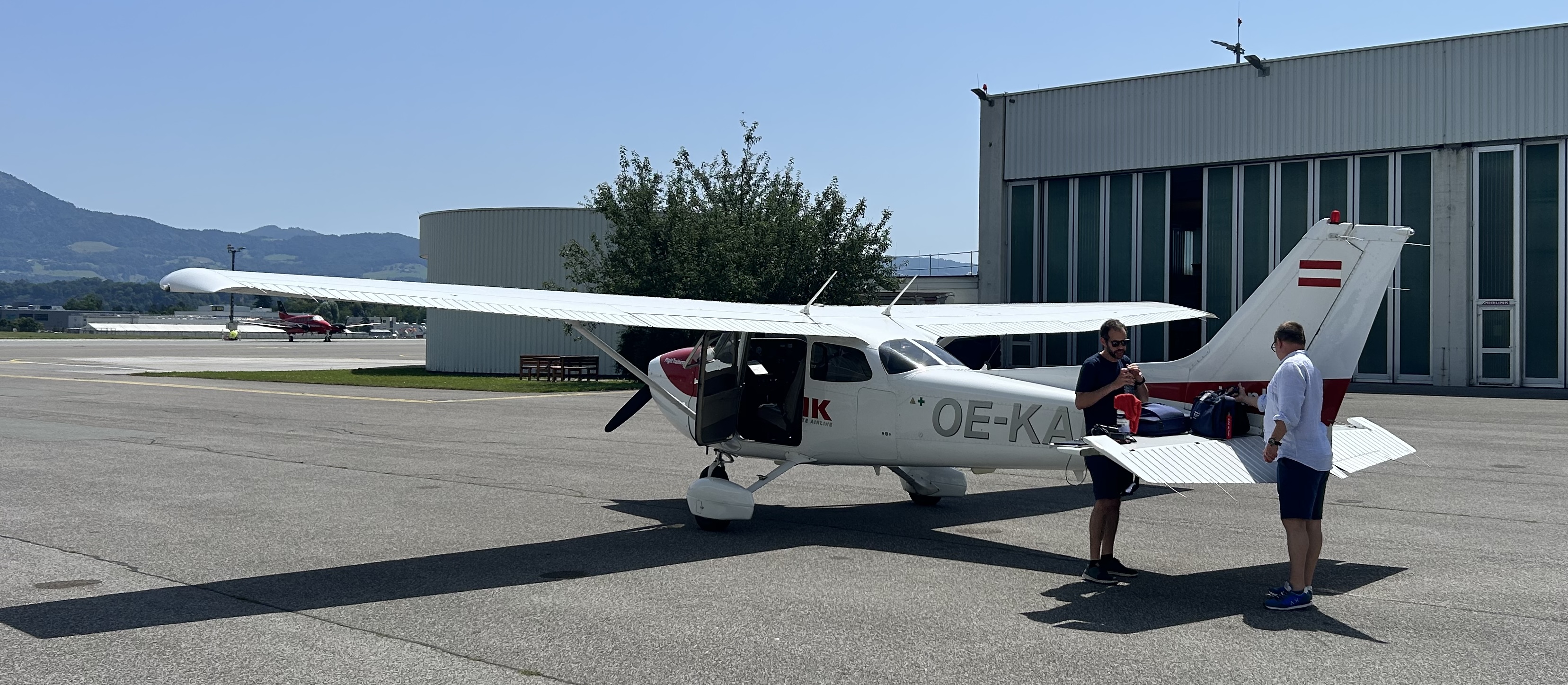
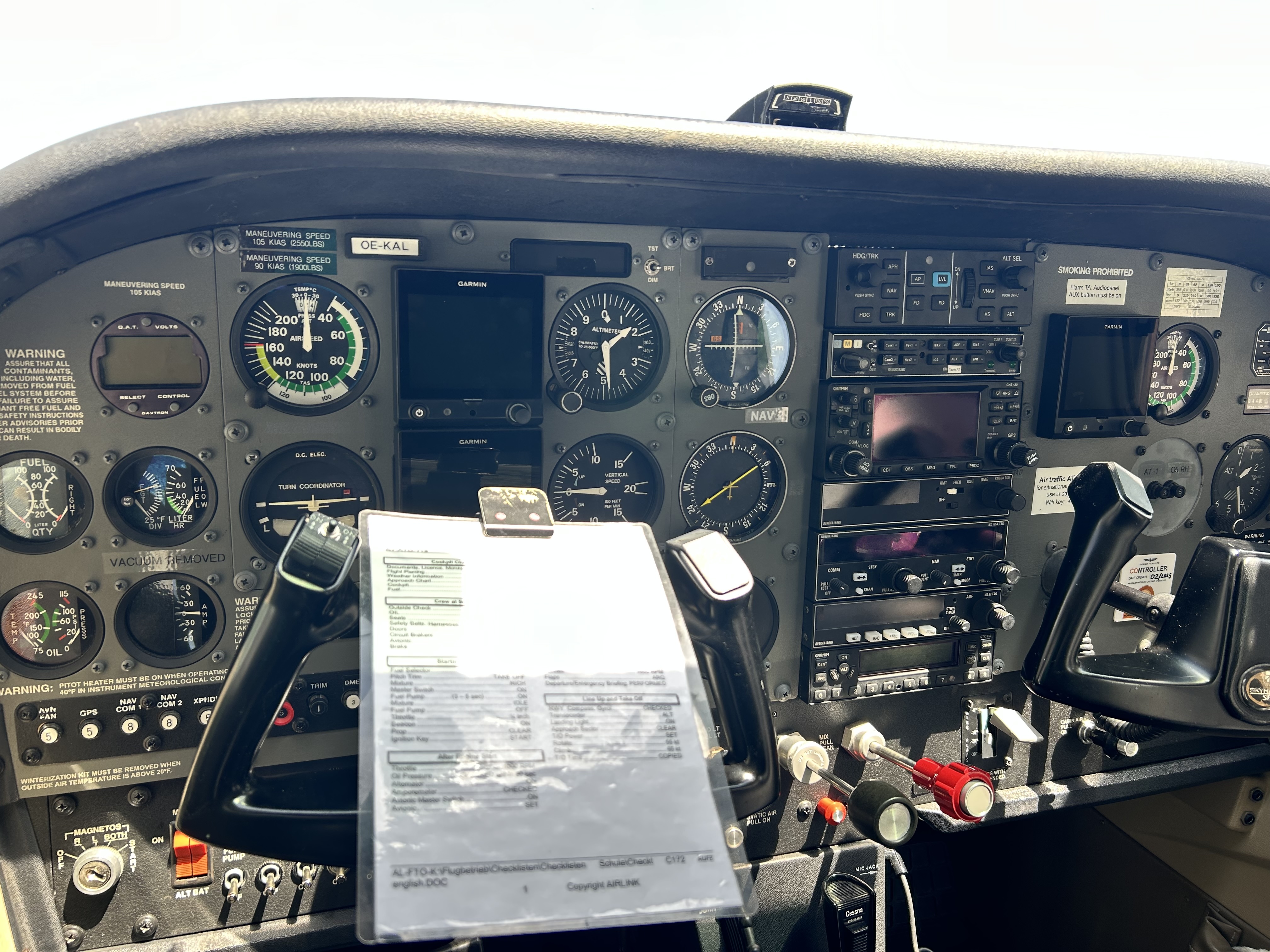
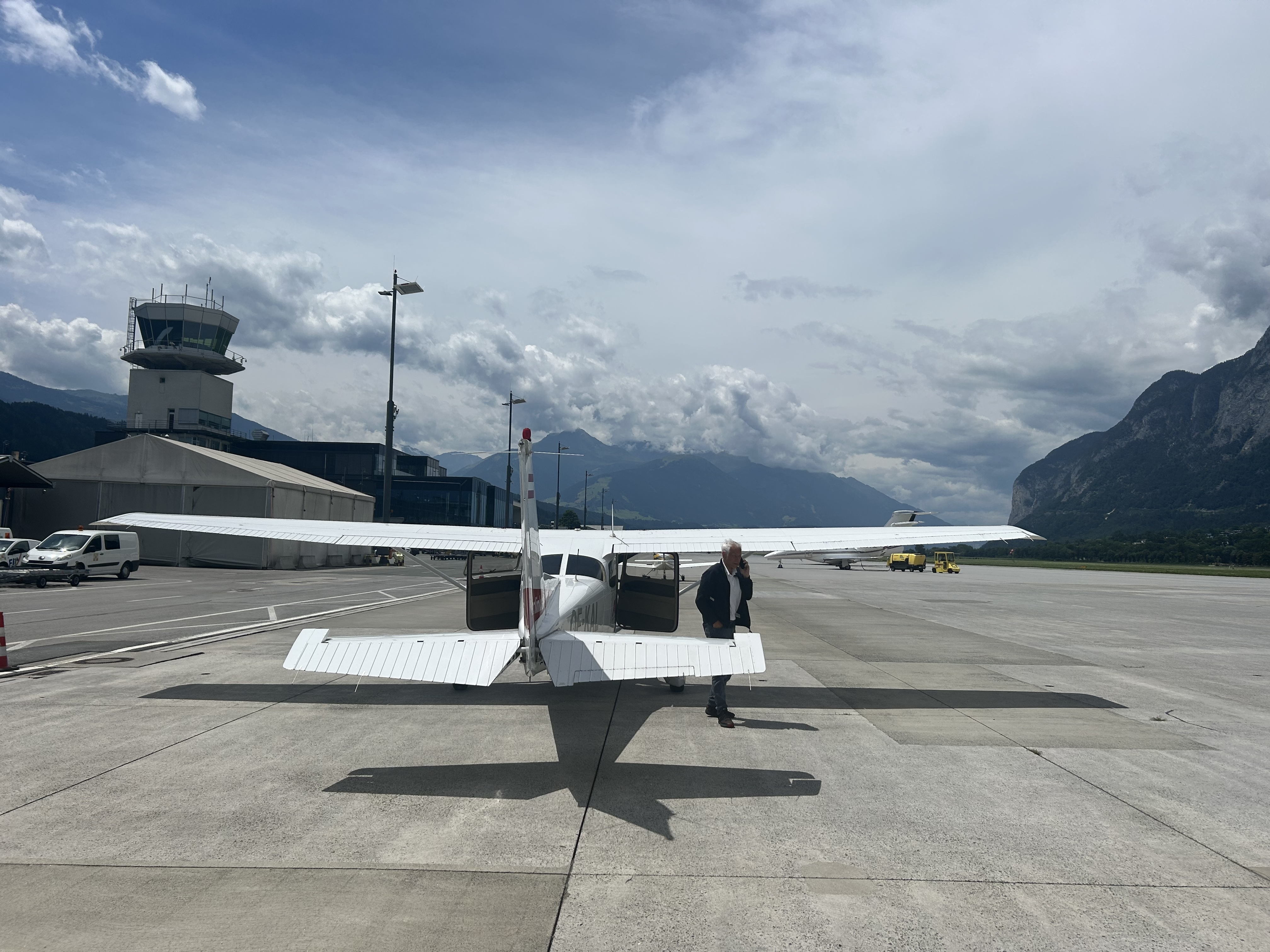
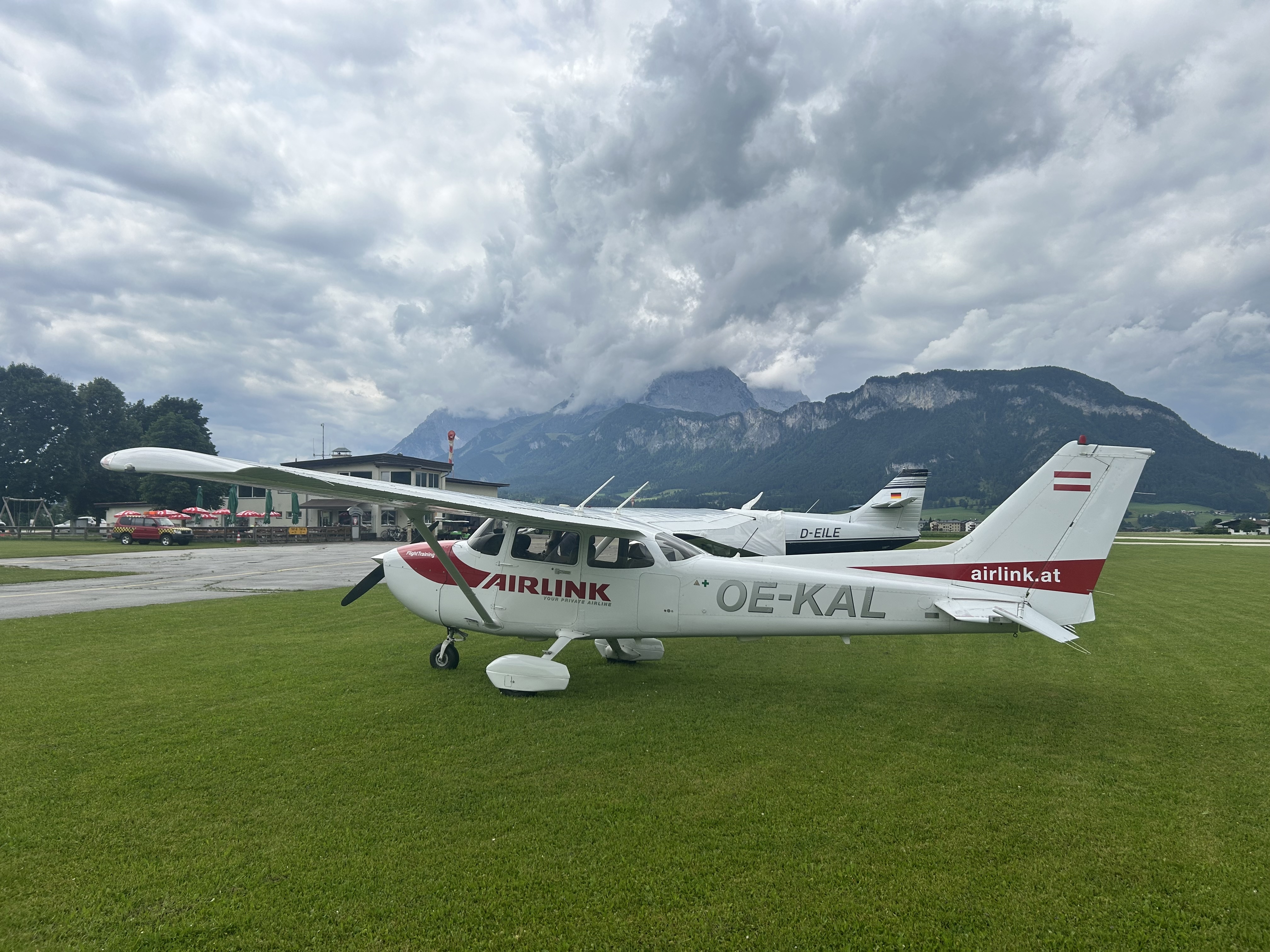
I arrived at the airport at about 7:30 on Thursday morning and David led me through their hangar full of a variety of propeller and jet aircraft. He had already fuelled and preflighted OE-KAL, a 2005 Cessna 172SP with a mix of gauges and electronic displays, that was fitted out for IFR and had a nice autopilot that would make taking photos while flying much easier.
David pointed out that, although the plane was IFR rated, if we were confronted by cloud we probably wouldn’t be able to switch to IFR because radio contact with the Vienna Central air traffic control is limited. The mountains shield the radio reception unless you’re flying really high. So therefore, you have to plan to fly VFR in a way that you don’t get caught out by cloud or weather. Up to date weather reports, personal observations and experience in the mountains are therefore essential to fly safely.
Although the aviation radio communication all over Europe is in English they do use some slightly different terminology so, as we did during my flights in New Zealand and the US, we agreed that David would look after the radios while I flew the plane. Another advantage of having a local sitting next to you in a foreign environment.
David introduced me to the Austrian flight planning website that they use to check weather, submit flight plans etc.
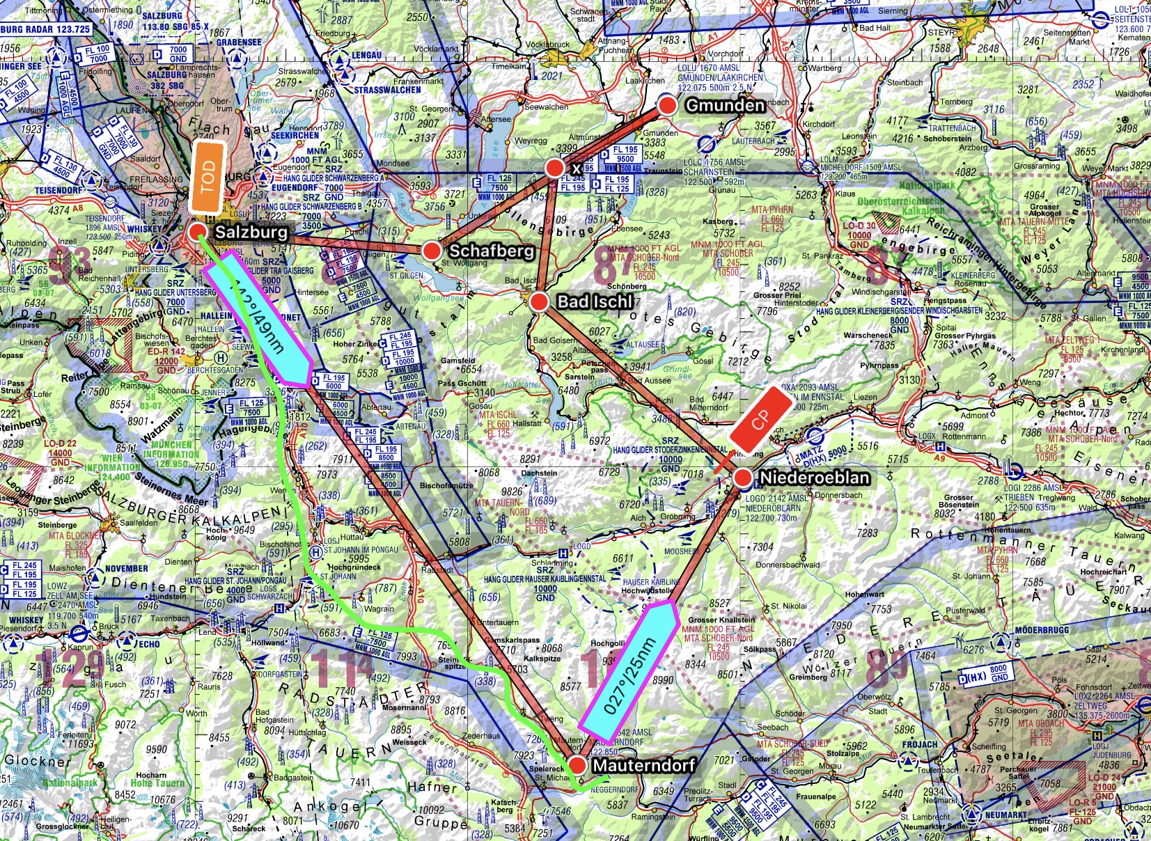
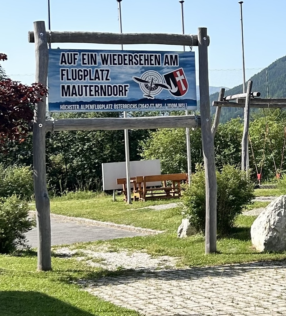
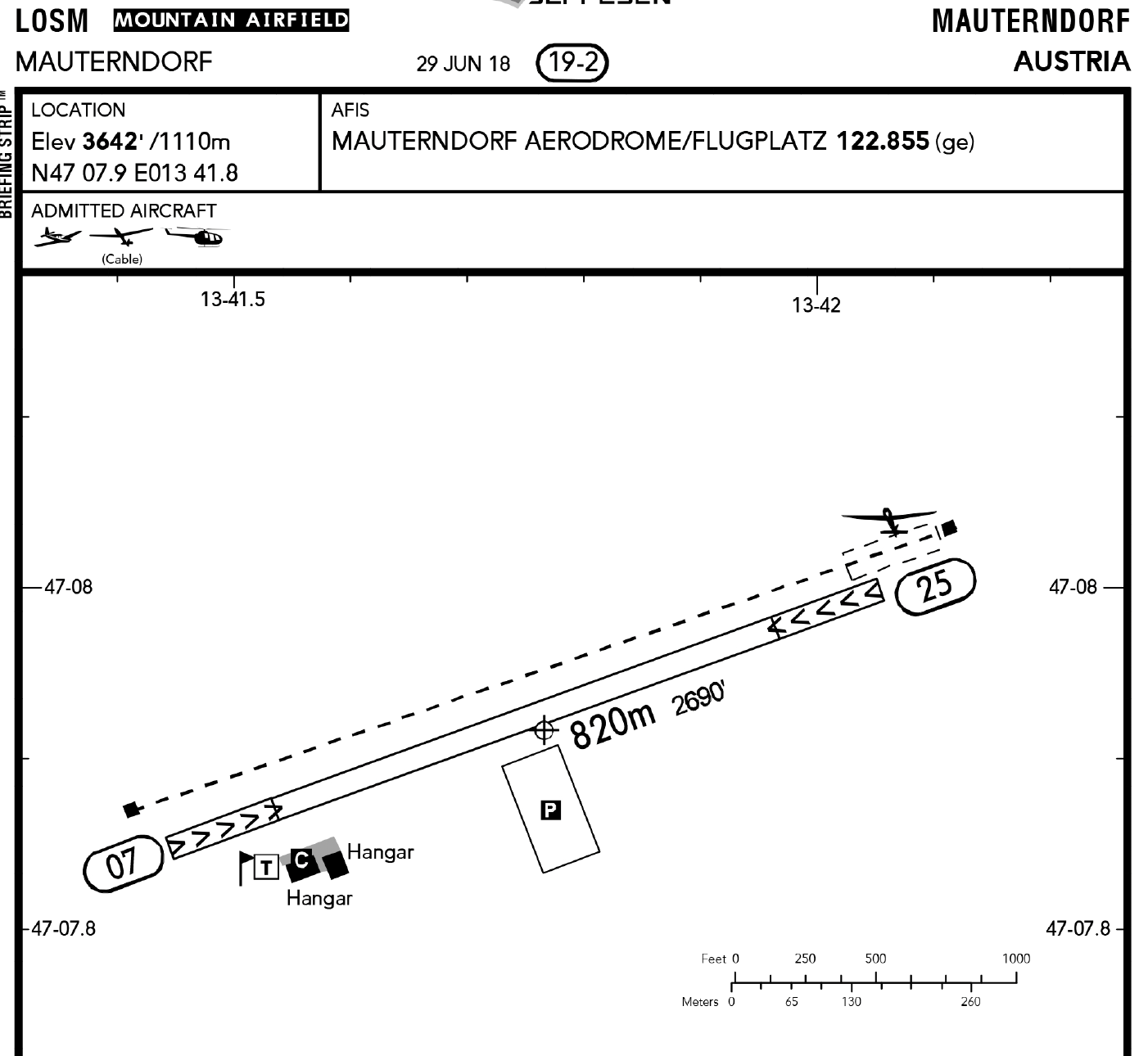
After discussing the weather forecast and a few flight options, we decided to fly to Mauterndorf, Austria’s highest elevation airfield. Surprisingly, it’s only 3642ft MSL, so not much higher than Armadale in New South Wales. I suppose the mountains are so steep in Austria there aren’t many level fields where you could construct any airfields higher up. It’s very different topography from that in the US Rockies where the mountains aren’t so steep and there are plenty of high altitude plateaus that allow you to land at up to 10,000ft MSL.
Thursday morning’s flight route
We taxied out to RWY15 did our runups, were cleared to enter and lined up.
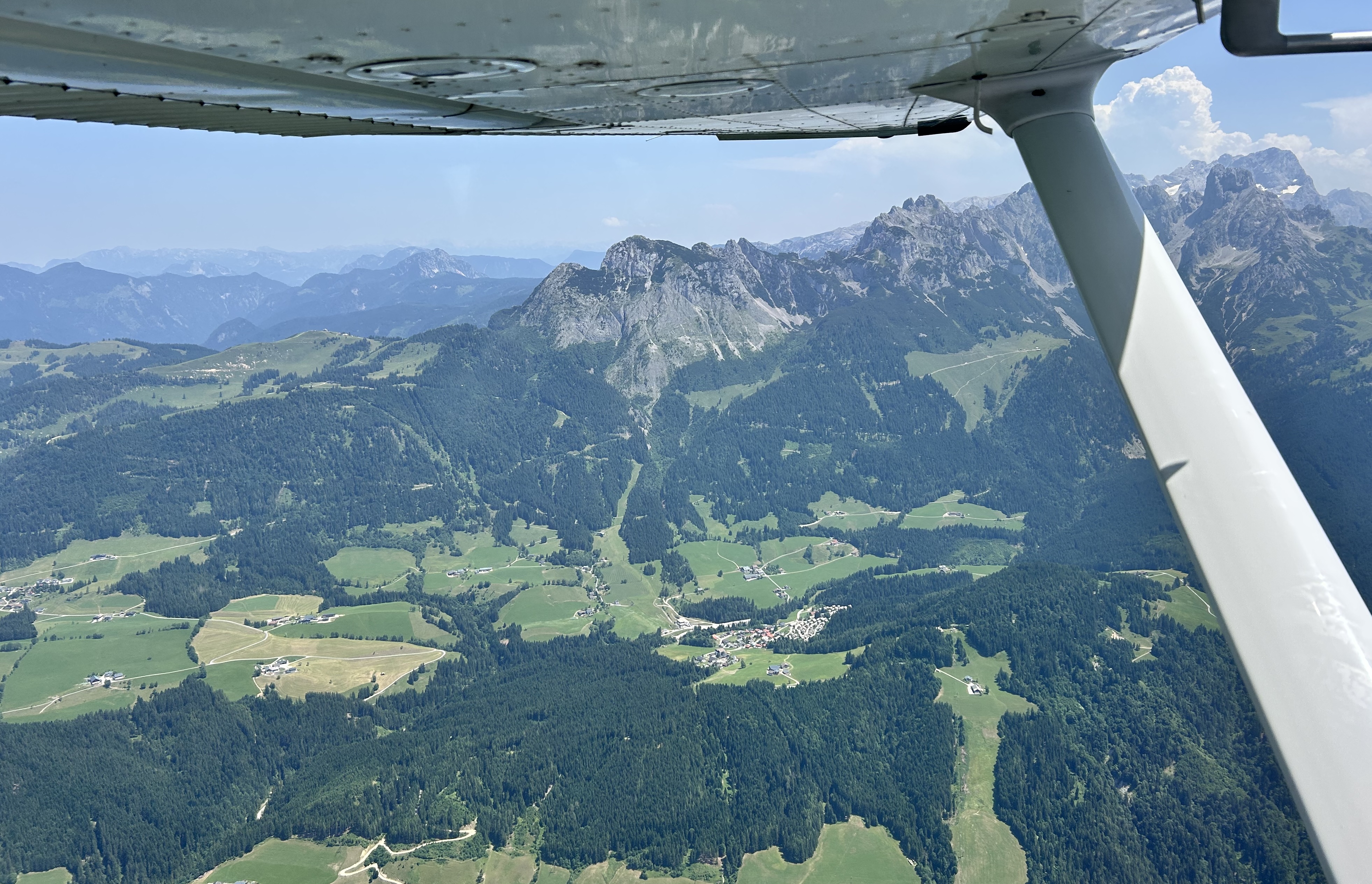
Taking off to the south we climbed over Hallein, following the Salzach River as it wound its way through the spectacular mountain scenery.
Making our way over a couple of passes and along various valley our 30-minute flight to Mauterndorf took us via Obertauern, a ski field that each year has the longest ski season of anywhere in Austria. It was the location of ski scenes filmed for the Beatles film “Help” back in the 1960s and was the scene of a rather embarrassing collision (not on the ski slopes but on the dance floor) between Sigi and me soon after we first met that led to a late night emergency trip down the mountain to the casualty department of the local hospital. But I digress…
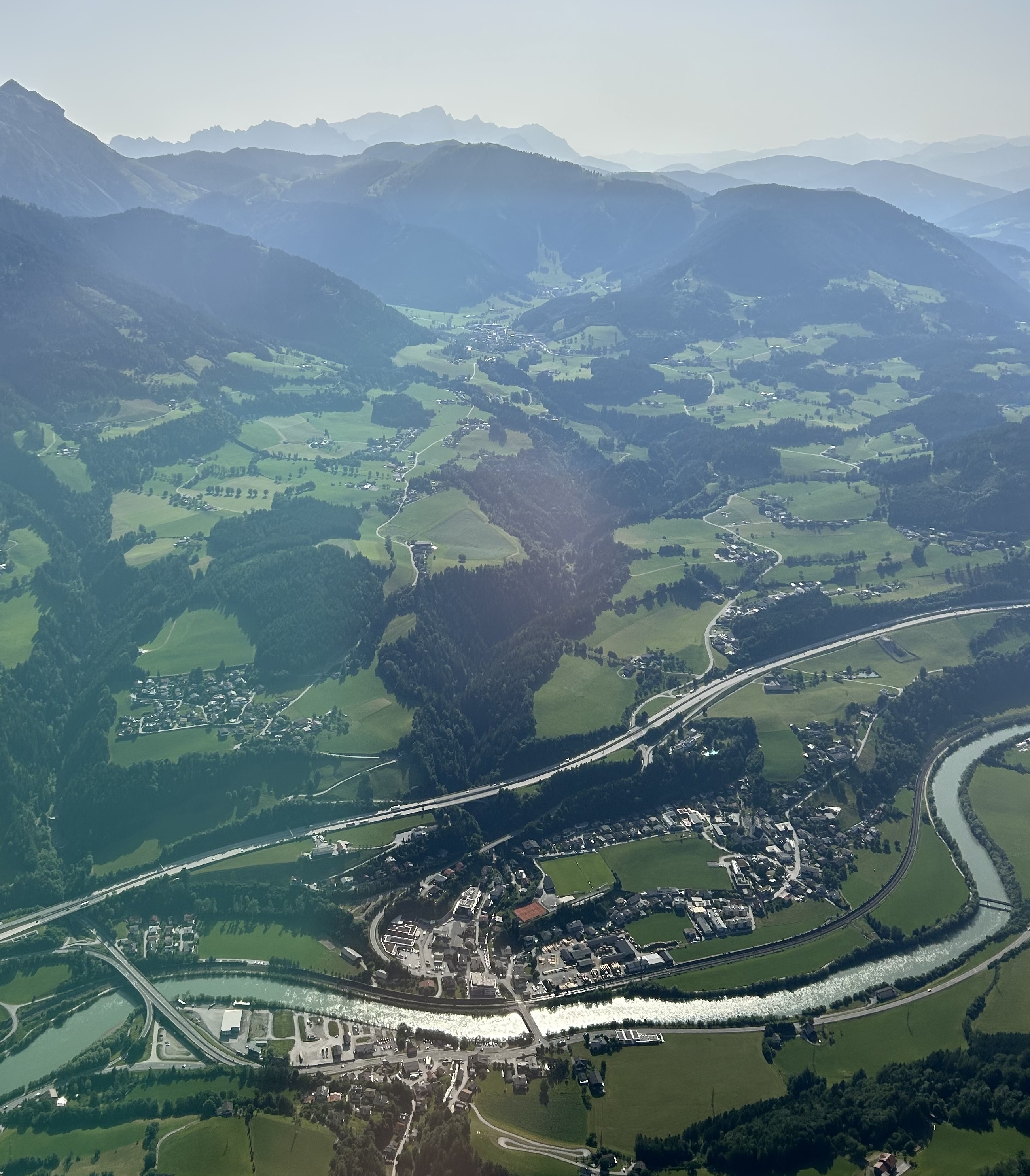
Descending into Mauterndorf we had to do a very wide left hand circuit around an inconveniently located mountain to land. Coming around the corner the grass runway appeared in the distance and we floated down a rather long final for a soft landing.
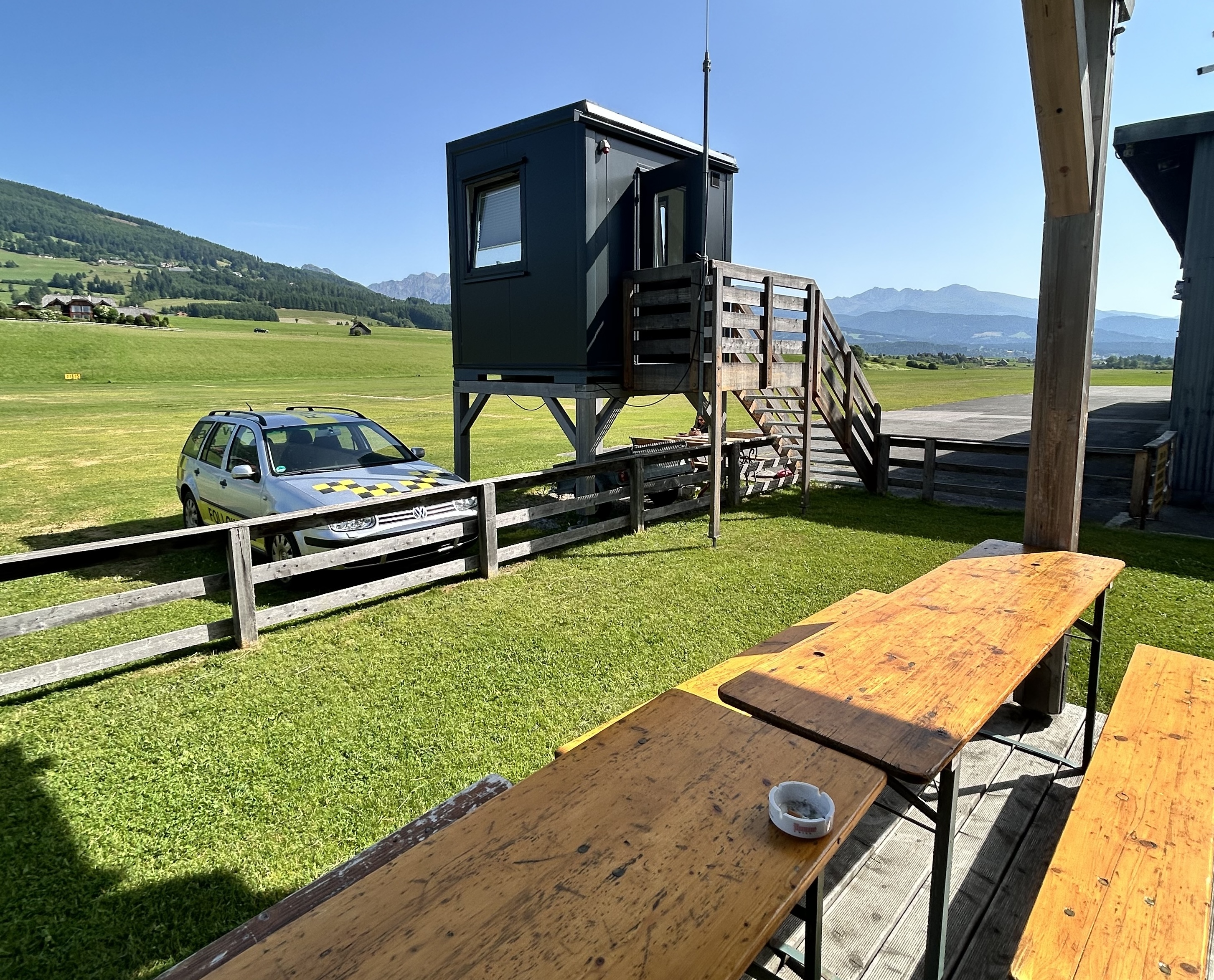
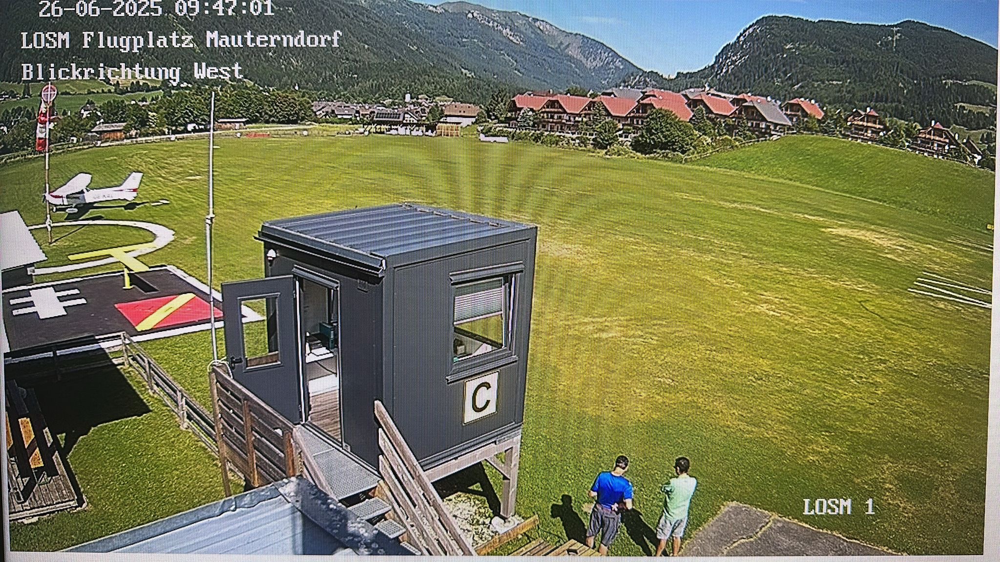
I originally had wanted to do a touch and go but it wasn’t possible. First of all because it’s a one-way airstrip. You land from the east and take off to the east, due to close proximity of mountains to the west. Another reason why a touch and go wasn’t possible was because I had to pay the landing fee. You see in Austria, as in Germany, all the airfields have to be manned by a radio operator who provides information on weather, wind, the status of the airstrip etc and collects the landing fee. He may also sell you a cup of coffee if you’re lucky. In this case the guy was from Frankfurt and his summer job was working as the radio operator at the airfield. With only about 20 aircraft a day on a busy day it was a pretty cruisy job and he wasn’t complaining. He did have to mow the grass airstrip at least three times per week through the summer though.
He was very chatty and was a bit concerned whether we’d calculated our take off distance correctly because there’d been a few aircraft that had flown in but couldn’t fly out again with the passengers they brought due to the altitude and weight limitations. Some passengers had to return to where they came from by train! We assured him that we’d done our calculations and the 172 would get us off the ground before we reached the end of the runway. Nevertheless, he advised us to get a bit of a run up and not stop at the end of our backtrack but to continue to roll around to the threshold so we’d need less runway distance to take off.
By taking his advice and also using the “soft field” technique, remaining in ground effect until we had enough speed to climb, we were well above the ground by the time the 820-metre-long runway disappeared behind us.
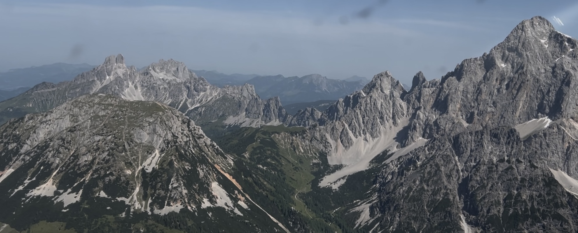
We were off to Gmunden, where the airfield has a 500-metre-long runway, located on the northern edge of the mountains. On the way we passed numerous scenic spots like the Dachstein mountain, Hallstaettersee and Wolfgangsee.
Dachstein MountainHallstätter SeeWolfgangsee
On final approach into Gmunden we had to approach at an angle and fly over some houses and trees on short final, making it a bit more challenging than your average landing. A bit like at Shute Harbour in the Whitsunday Islands but, at only 500 metres, a much shorter runway.
This airfield also had an operator in the control tower who happily took my landing fee and told us about two motorised gliders of Australians who visited recently on their way from England to Ukraine as part of a fund-raising exercise. He was definitely a local Austrian as I couldn’t understand what he was saying to David and he had to switch to “Hochdeutsch” to explain things to me.
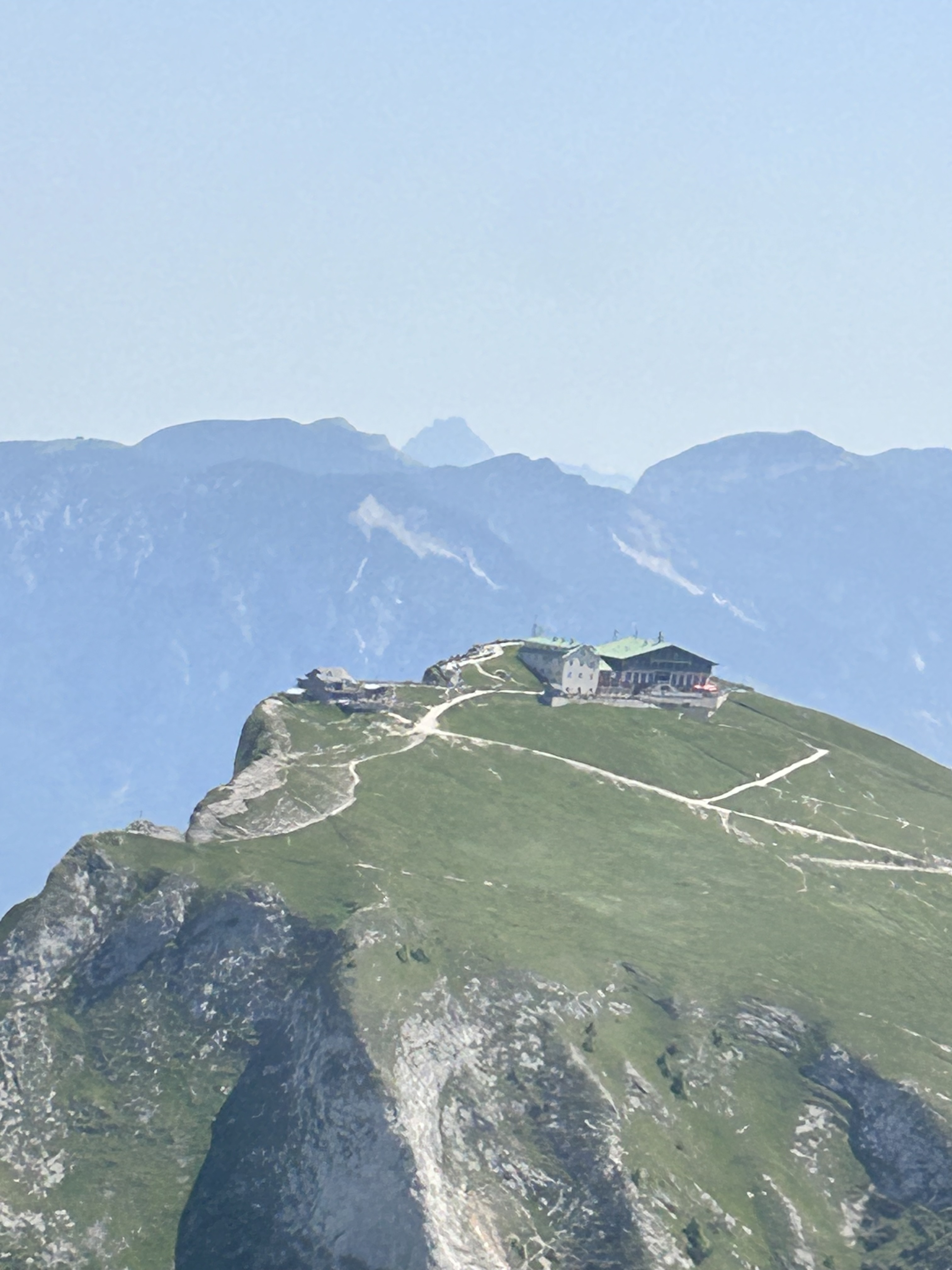
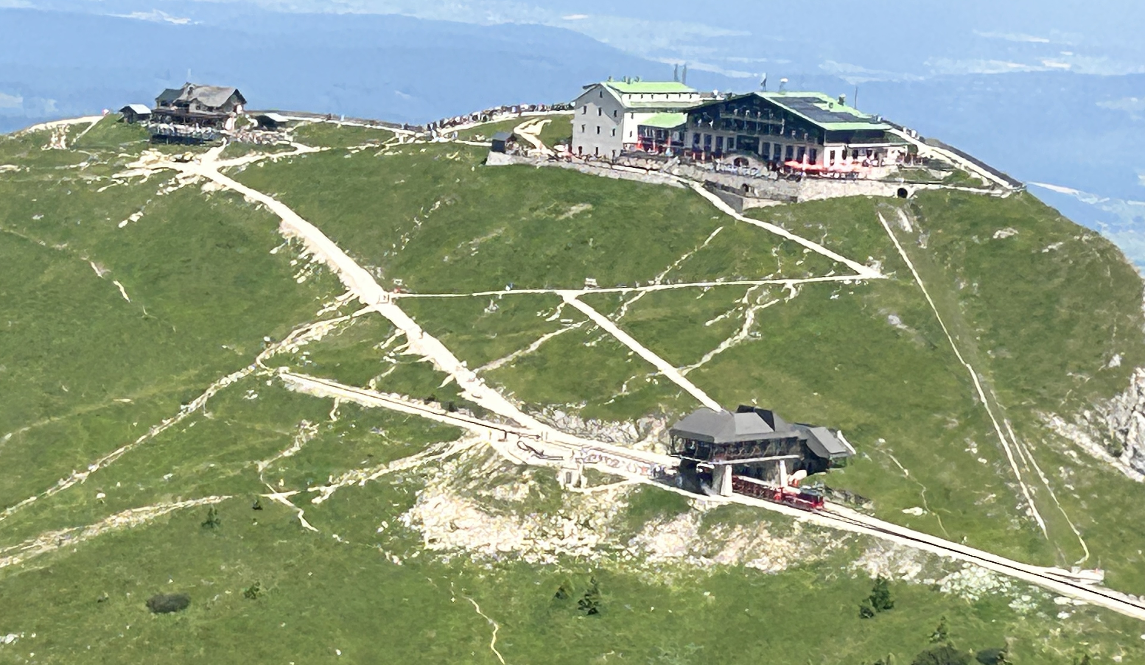
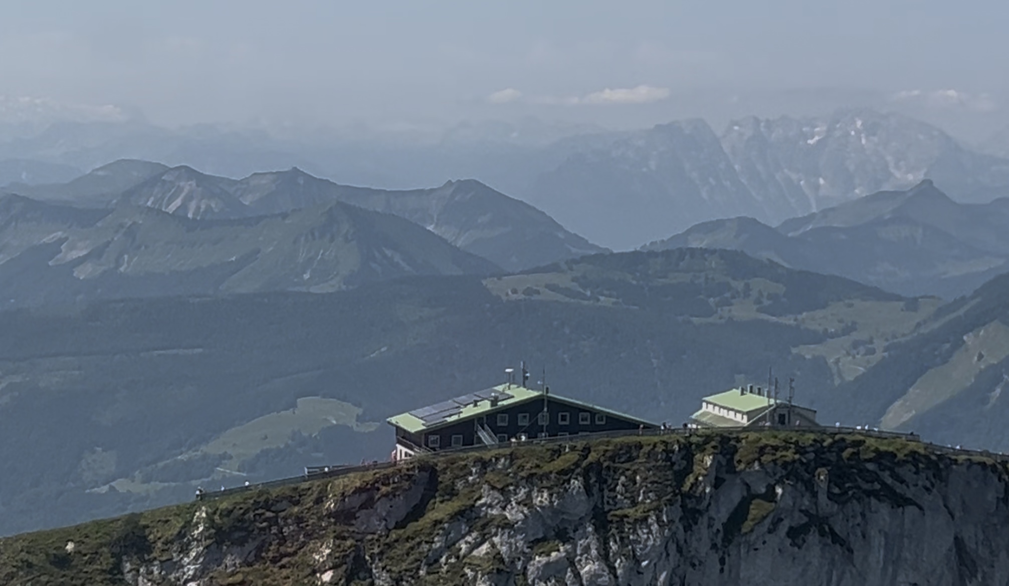
Payment made, we climbed back into KAL and headed back to Salzburg, passing the Schafberg mountain on the way. This mountain has a large hotel/pub at the top, perched on the edge of a precipice.
If you’re energetic you can hike there from the valley below or if you’re not so energetic you can take a funicular railway. Once at the top you can enjoy lunch with a magnificent view of the surrounding mountains and valleys. And you can stay overnight if you want to enjoy the sunset and sunrise from the mountain top. We flew an orbit around the hotel and waved to the people lined up along the viewing platform.
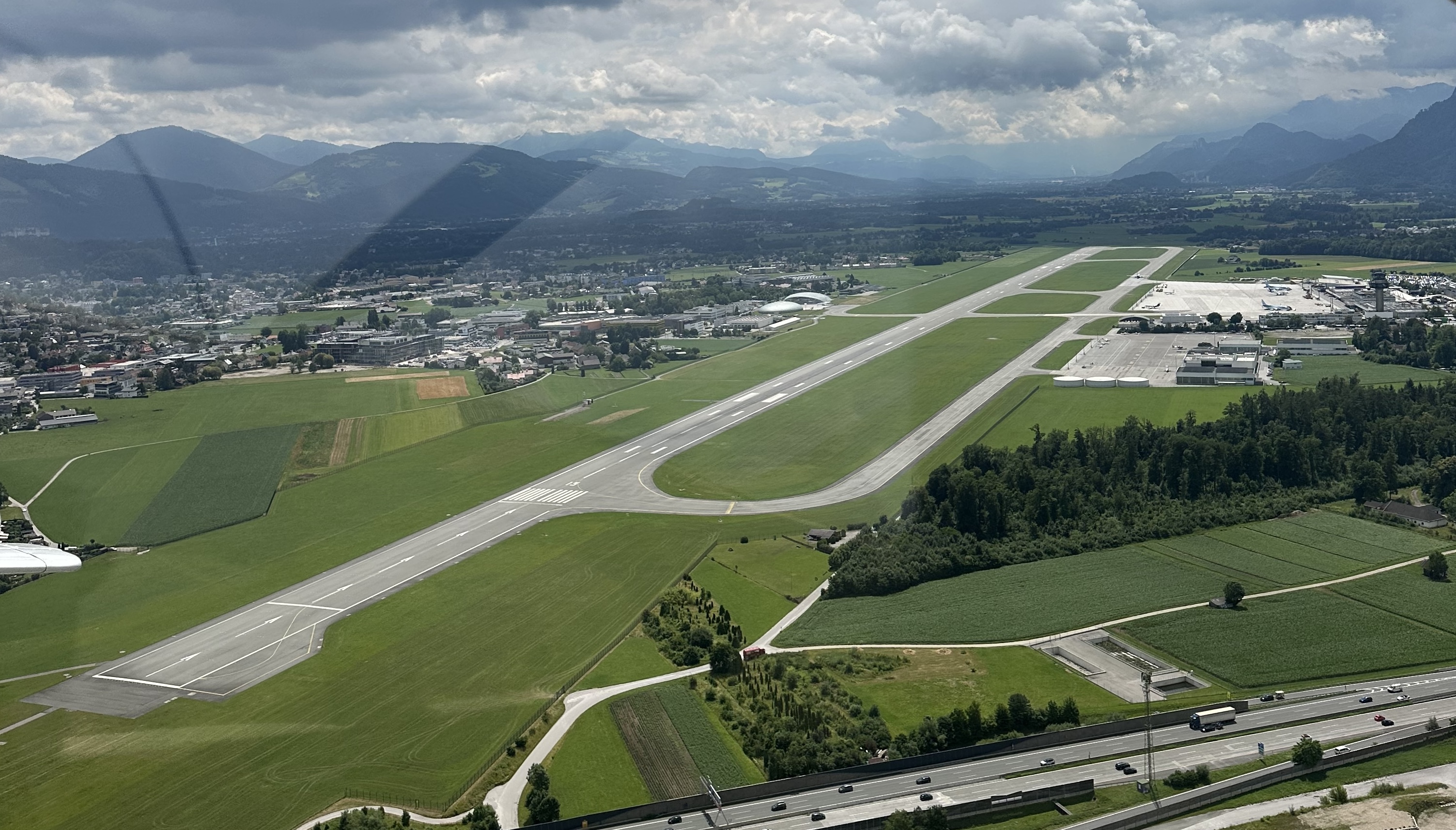
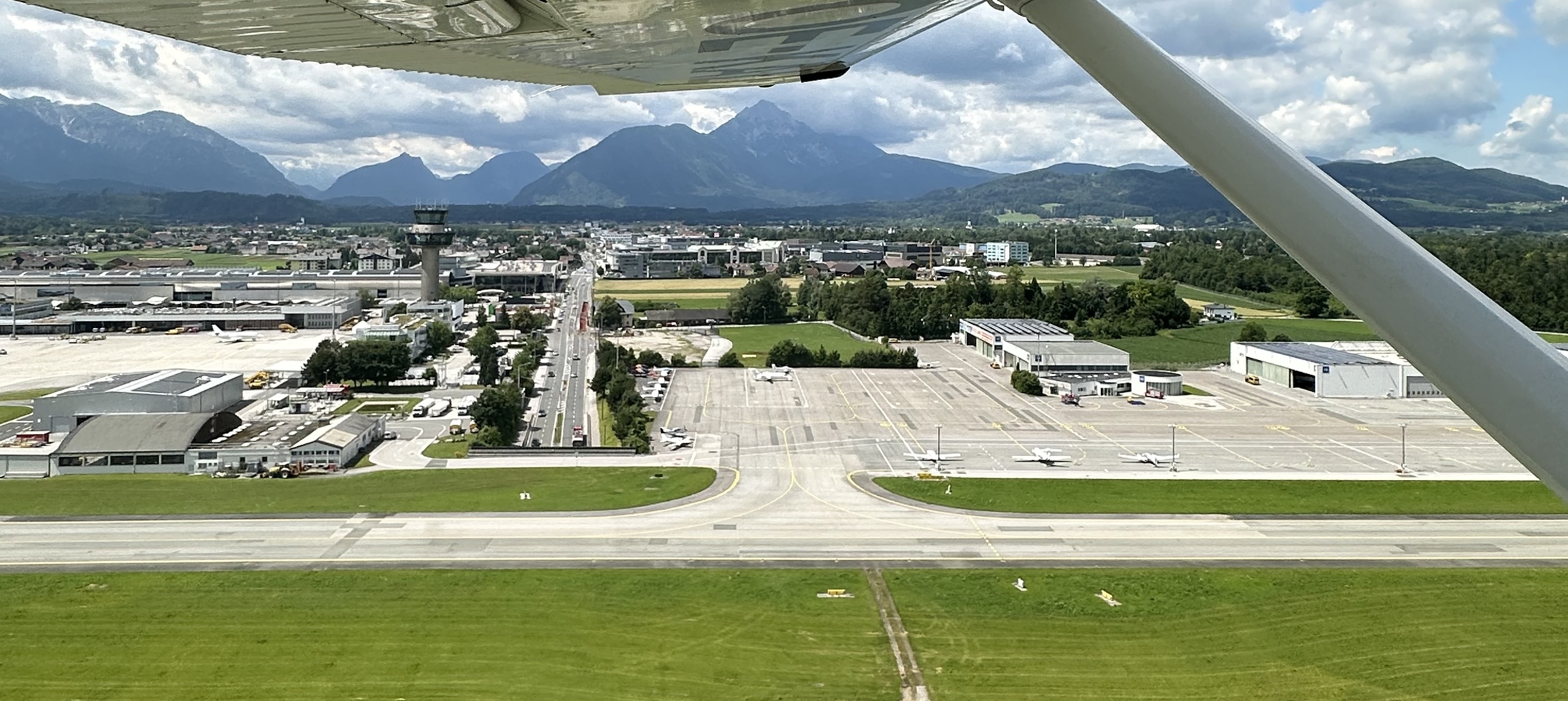
From Schafberg it was only about 10 minutes back to Salzburg where we were instructed by the air traffic controller to do a “scenic circuit”, joining right downwind for RWY33 on the eastern side of the downtown area providing us with an excellent view of the old town and the fortress on the hill.
Back on the ground David handed me over to Thomas, who would take me on the afternoon flight.
Originally, we’d planned to fly to Innsbruck in the afternoon but the time had got away and the forecast thunderstorms were getting closer so we decided we’d better head off straightaway and only fly as far as Zell am See, about 20 minutes to the south west.
This was another very scenic flight, taking off to the north from RWY33 before turning to the south to pass over Hallein as in the morning.
Thursday afternoon flight route
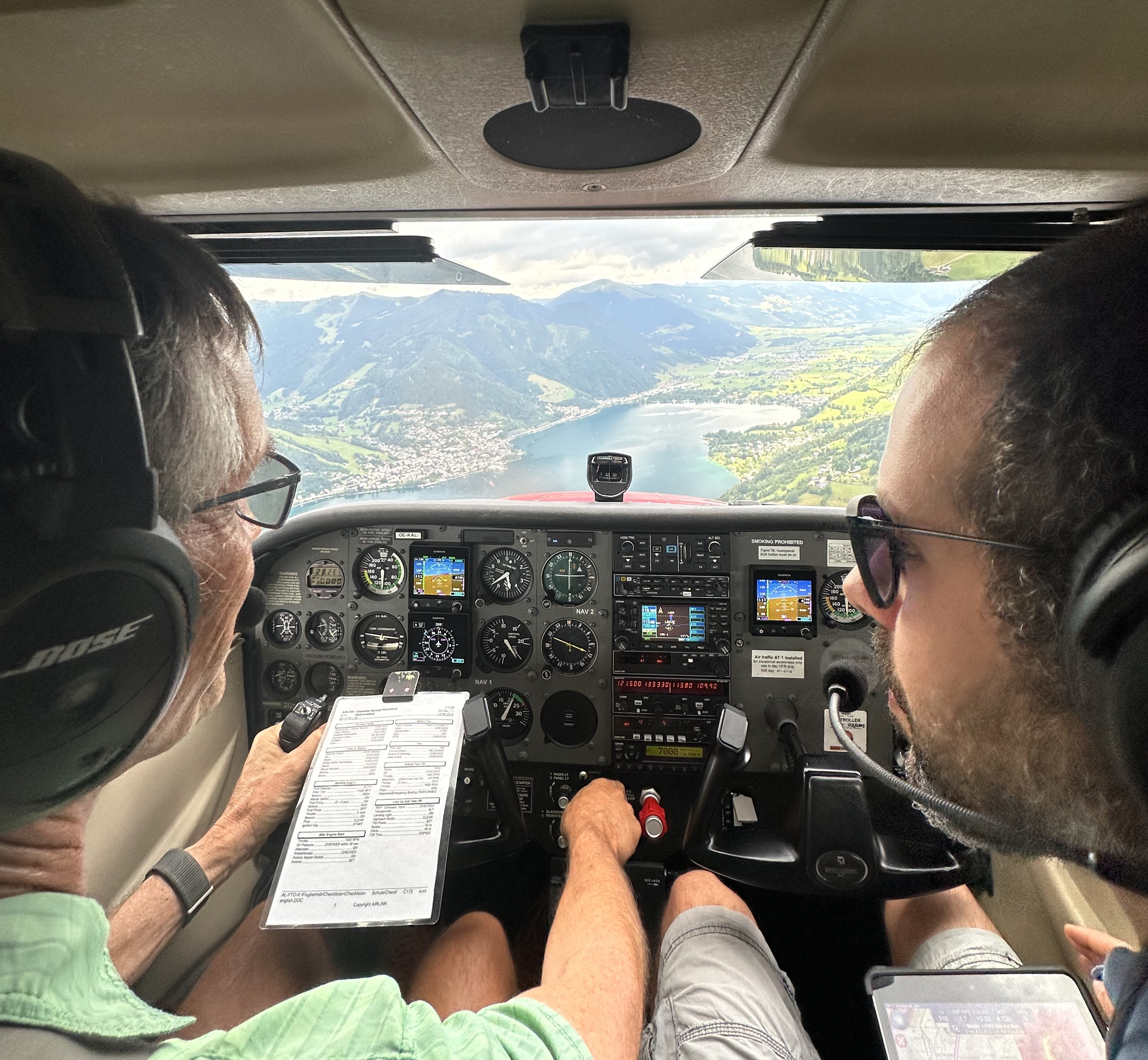
In this case though we turned right towards Saalfelden via a variety of valleys. We turned left at Saalfelden and passed over the Zeller Lake from the north at 4000ft to avoid outbound traffic that should be at 3500ft. Thomas instructed me how to fly the correct approach descending from the middle of the lake. We passed low along the edge of the mountain so that we could almost touch the cattle grazing in the meadows below.
Thomas checks the weather on the ground at Zell am See while storm clouds gather on the horizon
We had planned to stop for a cup of coffee but as we walked around the aircraft, we felt a few drops rain and the sky looked suspiciously stormy to the west. The bad weather was approaching. So, we cut short the visit and were soon climbing out over the Zeller Lake to the north.
Climbing out of Zell am See airport
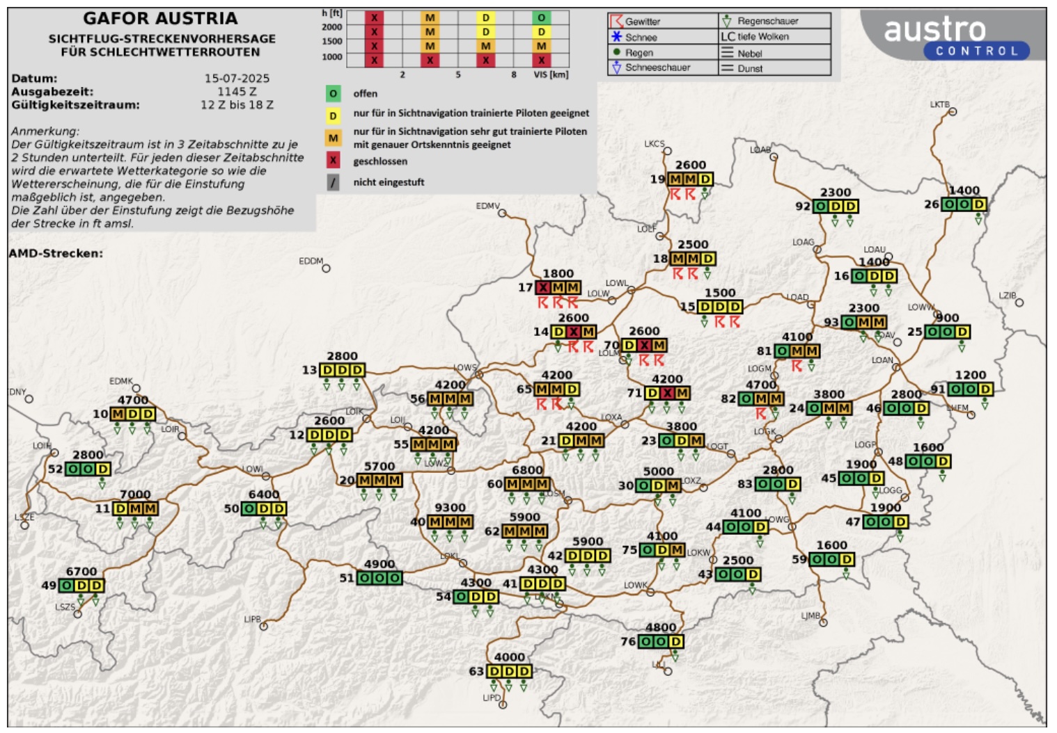
For the next part of the flight Thomas had arranged a “low level” valley traverse, simulating what we’d need to do if there were low cloud and we had to fly back to Salzburg via the Saalach Valley. Due to the topography and the fact that it’s often cloudy in the Alps there are “GAFOR” maps showing the weather conditions expected for the next 6 hours along all the main VFR valley routes in the country. This is a special requirement for such alpine regions, where VFR routing between mountains higher than the physical performance of pilots (oxygen) or the aircraft are common. A “reference altitude” is nominated for each valley and as long as you remain above that altitude, the valley should be wide enough to turn around for its entire length (as long as you’re flying slowly enough and on one side and not down the middle). You also need to ensure the cloud base is sufficiently high above the reference altitude that you avoid flying into cloud. Depending on the height of the cloud base and the visibility each valley is classified as open, difficult, marginal or closed in real time for each 2 hour period in the coming 6 hours. This takes a lot of guesswork out of whether to fly a particular route or not on a particular day. On that day the Saalach Valley was rated “open” so we had no trouble flying through it to the other end.
GAFOR Austria Map
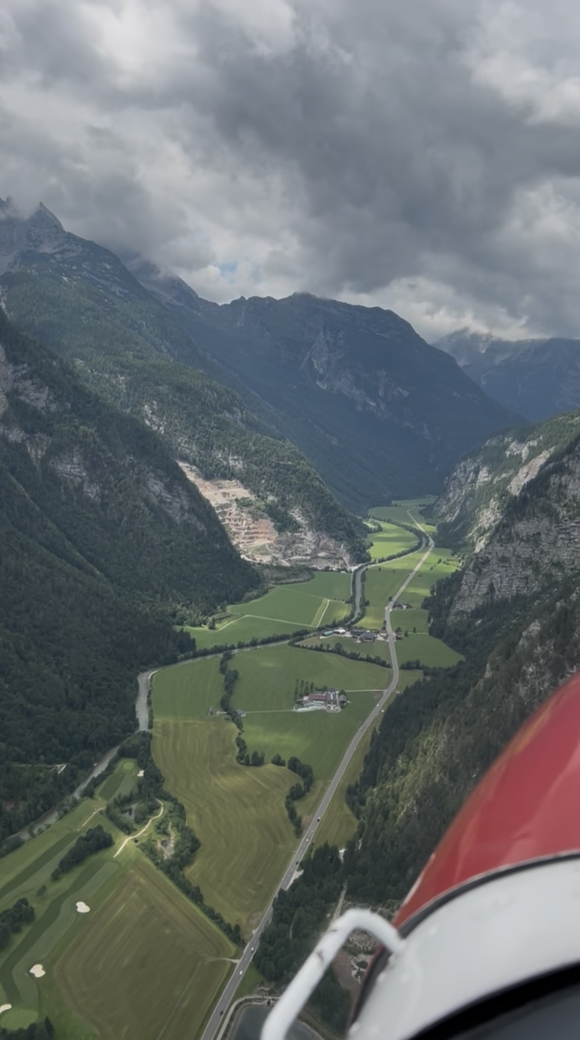
Thomas demonstrated how to fly along the edge of a valley. The idea is to fly as close as possible to one of the valley walls. If you fly close to the “outer” side of the valley in each bend you have the best possible view around the corner each time. So if the bend is to the right, you fly on the left side and vice versa. This technique gives you the best chance to see whether any aircraft are approaching from the opposite direction, as well as any cloud that could be blocking your way forward.
As we flew around each bend I switched to the other side of the valley to see around the next bend. In a situation of low cloud you’d know if the valley ahead was blocked by cloud and that you’d have to do a 180 turn and head back the way you came. Of course, this was just an exercise that Thomas demonstrates with all his students as part of their mountain flying training. In our case the cloud base was well above the 3500ft MSL that we were flying but it showed me how you’d act in situation with lower cloud.
Flying along the wall of the Saalach Valley
As the valley opened up at the far end, we crossed the border into Germany and, after skirting around the edge of a German military training area, we were back in the open. Crossing back into Austria we joined downwind on the western side of the airport for another landing in Salzburg, this time via the right circuit for RWY15.
Not long after we landed the first drops of rain fell and a half hour later there was the first clap of thunder. We’d made the right decision to only fly to Zell am See and not to wait too long before heading back. Today’s takeaway: get out early in the day and read the up to date forecasts and the sky. The weather can change quickly in the mountains.
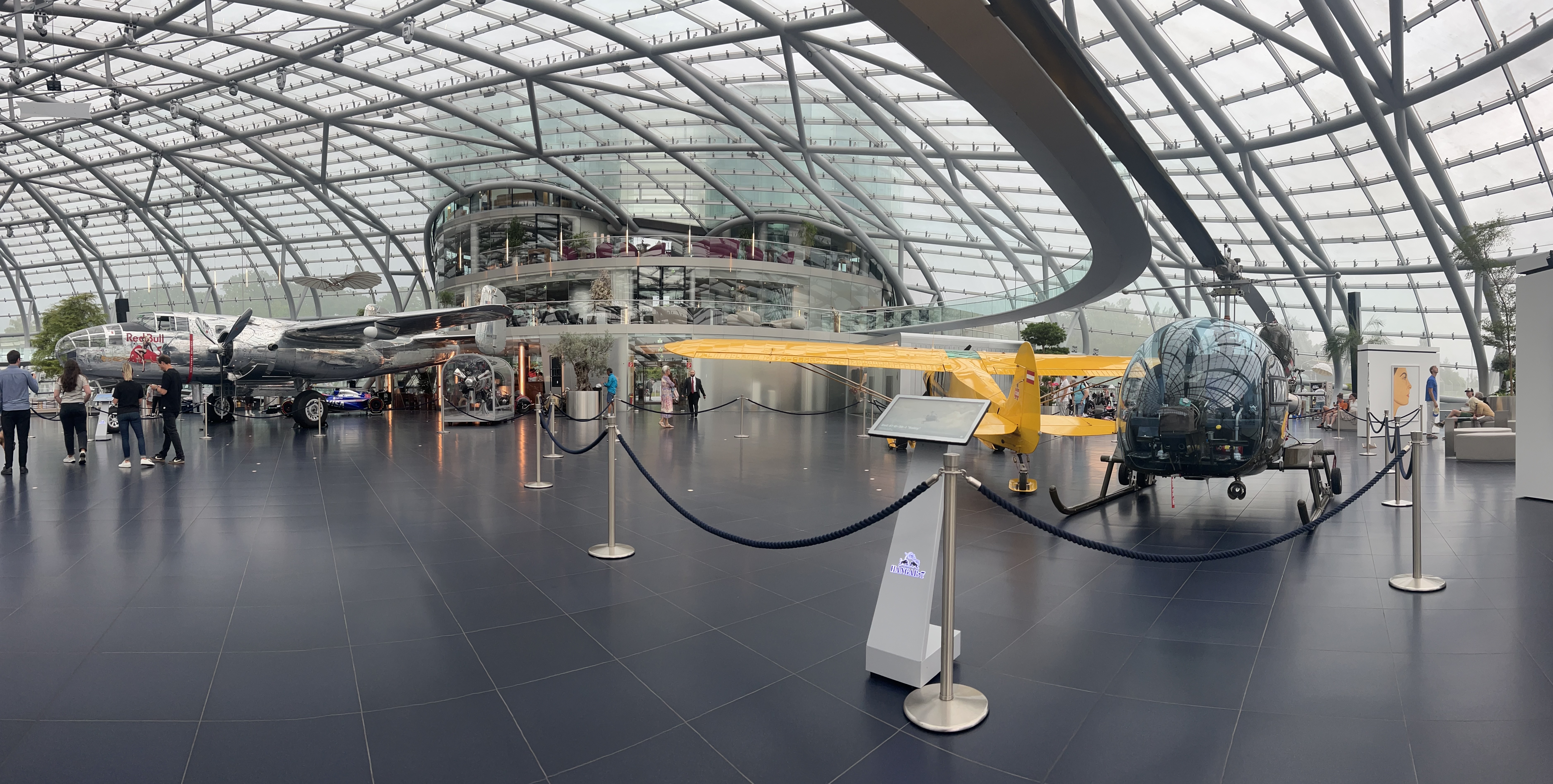
I left Thomas and drove over to Hangar 7, the Red Bull aviation museum, located on the other side of the airport. It’s an impressive piece of architecture. I had a good look around while heavy rain fell outside and thunder claps reverberated around the building. It has a great collection of aircraft, cars and motorbikes. It also has a very swish bar and restaurant but they were both booked out for private functions so I wasn’t able to have a drink to celebrate the day’s flying threre.
Hangar 7 interiorHangar 7 on the right, viewed from the circuit
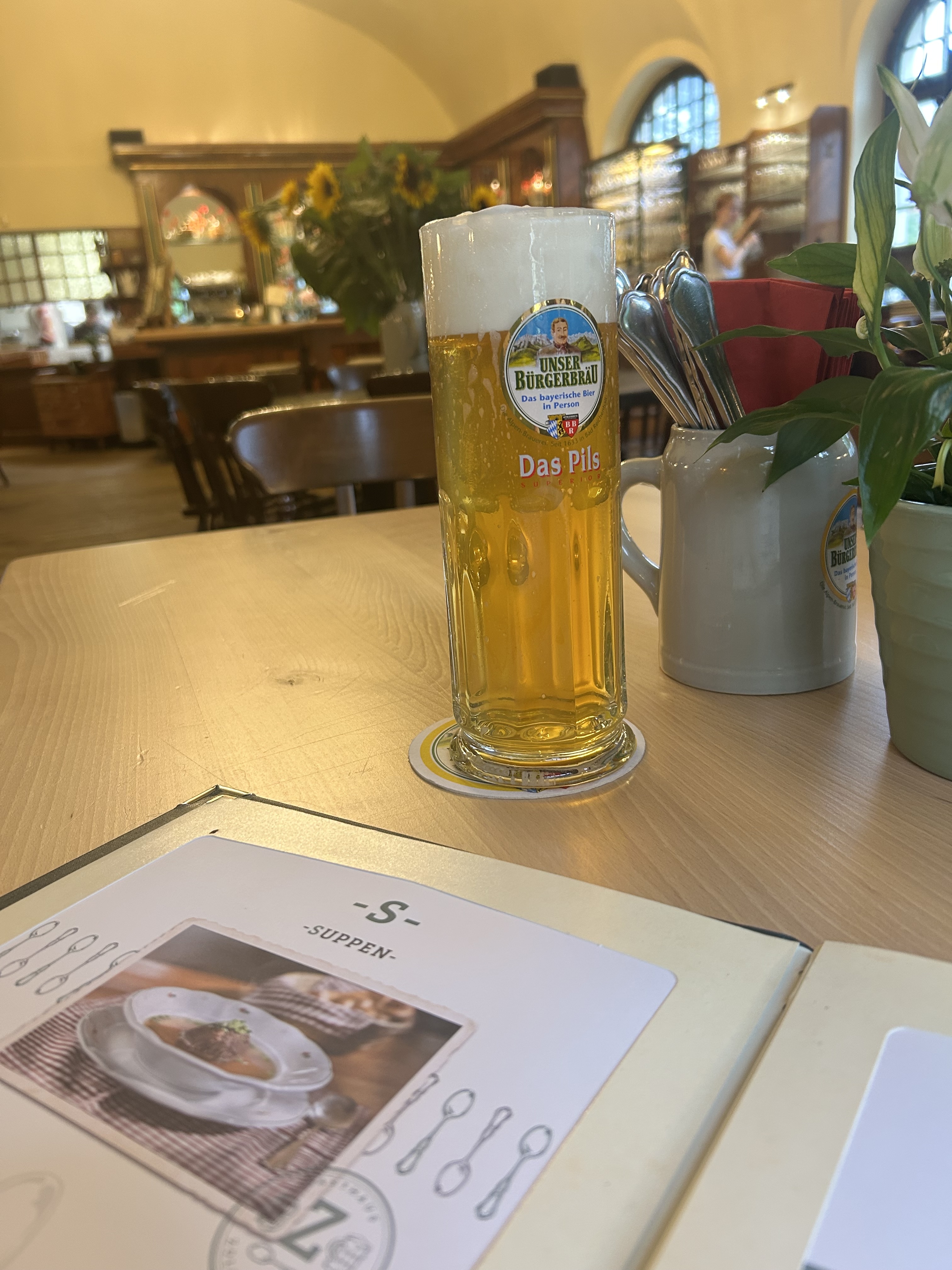
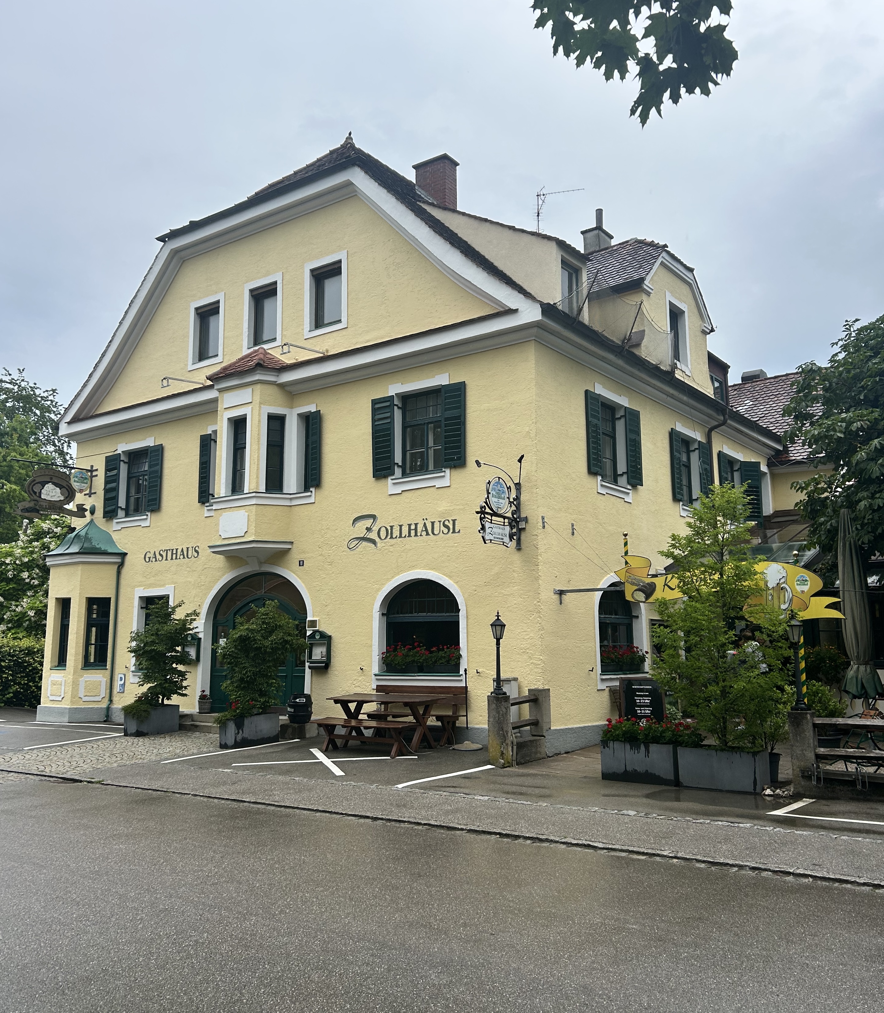
On my way back to the BNB I did manage to find a pub (Gasthaus) located just next to the border. It was called the “Customs House” and had a lovely beer garden but since the rain had started I had to settle into the very cosy restaurant for a beer and dinner.
On Thursday the weather report for Friday had indicated it would fine up in the afternoon but by the time I woke up on Friday morning it had changed, with showers forecast in the late afternoon, so I sent a WhatsApp message to Reinhard and we agreed to meet at 11am rather than 1pm. As we hadn’t made it to Innsbruck on Day 1 we made a plan to fly there and return via St Johann in Tirol where we could land and have a coffee.
Friday’s flight route
I preflighted the plane and watched it being refuelled from a truck while Reinhard finalised the flight plan. I was surprised when a guy came over and started to clean the windscreen. That’s normally a job that I have to do but here was a guy who was paid to do it. And then he started to clean the bugs off the leading edges of the wings and mumbling about how he really needed more time to do the job properly and apologising for not being there earlier. What service!
Taking off we first crossed the border into Germany and passed over Bad Reichenhall before crossing the border back into Austria and heading towards St Johann for a bird’s eye view of where we’d land later.
St Johann airport
More amazing mountain scenery appeared as we entered the Inn River valley at Woergl and following it upstream to Innsbruck.
Approaching Innsbruck we had to hug the mountain slopes on the southern side of the valley so that we’d stay clear of any IFR aircraft approaching us from behind for a straight in landing to the west.
Approaching Innsbruck
We were to land into wind from the west so we had to join right downwind for RWY08 and fly past the city on the way. A Eurowings jet was taxiing out, so we continued a long downwind until he’d taxied out, back tracked and turned ready for take-off.
View towards Brenner Pass and Europa Bridge
Then we obtained our clearance to turn base and then had a long final, landing early to avoid “wake turbulence” from the departing jet, and therefore had an equally long taxi to the far taxi way. But there were no other planes around so it didn’t matter. A “follow me” van appeared and we followed it to the apron. A man with bats waved us into our parking position. That was a first for me!
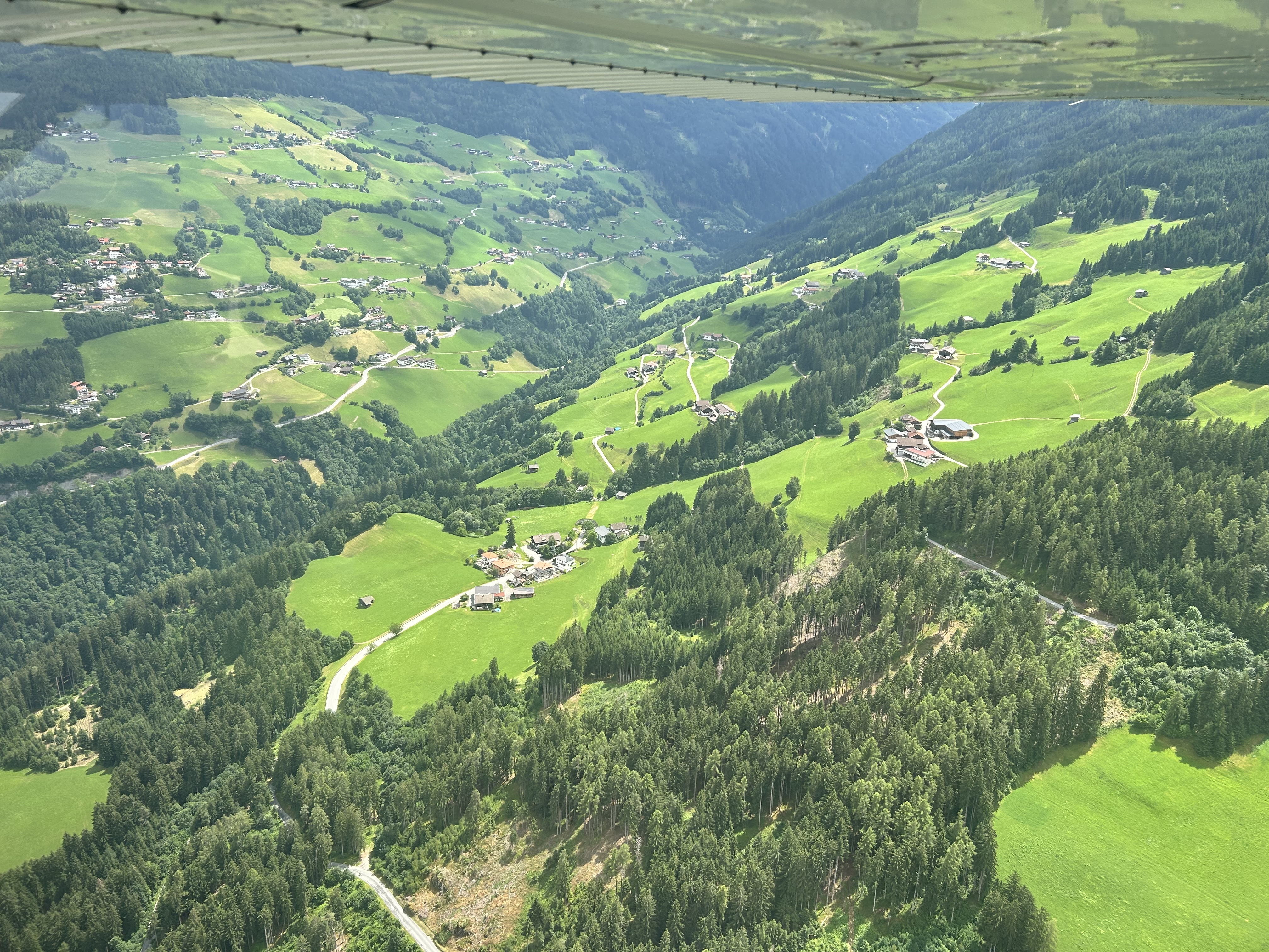
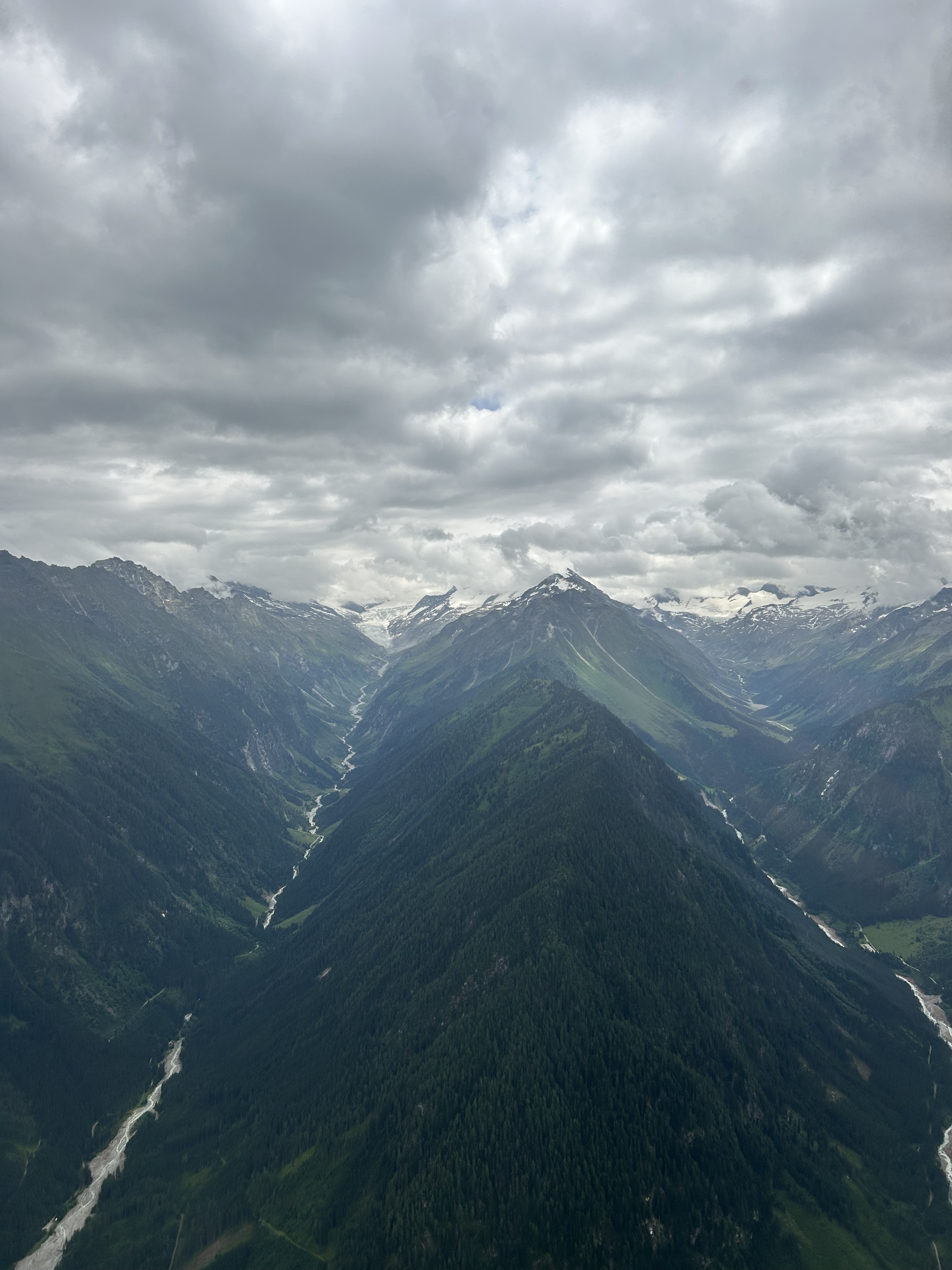
After a quick briefing for our next leg, we took off to the east, making a right turn just after take-off to avoid downtown Innsbruck, and passed over the Olympic ski jump and then turned left to track east. Flying alongside the mountain on the southern side of the valley, we climbed to 7000 ft so we could fly over a pass into the Zillertal (valley). The valley took us to the east, with views to the Gross Venediger mountain and the main ridgeline of the Alps and some glaciers to the south. The mountain tops were hidden in the clouds.
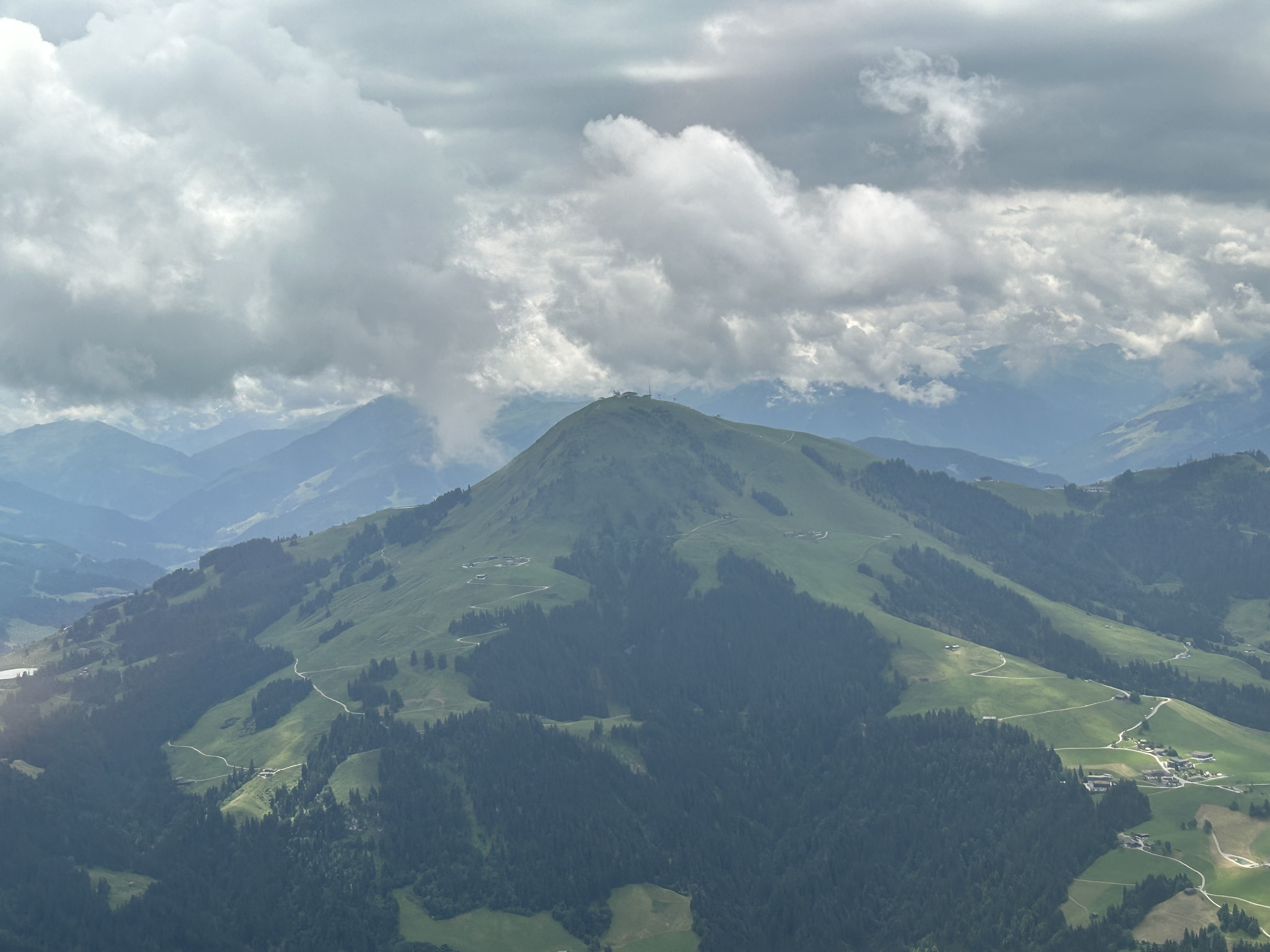
Just west of Mittersil we turned north and were soon passing over Kitzbuehl, famous for its annual downhill skiing championships, and descending into the circuit for St Johann. Following a motorised glider in we extended downwind to give him time to land and vacate the runway.
On the ground we walked over to the terminal building and I paid the landing fee then had a coffee with Reinhard in their very pleasant outdoor café. The restaurants and cafés are done very well at German and Austrian airports. Much simpler than in the US but a very enjoyable place for pilots, passengers and plane spotters to sit and enjoy the comings and goings.
As we taxied out again the motorised glider was taking off in front of us, so when we took off I kept a close eye on it to ensure we didn’t get too close. It was also heading in the same direction and seemed to be flying/climbing at the same speed as we were. Those motorised gliders are pretty fast. Our route took us past the famous Watzmann mountain on the German/Austrian border and then past the Kehlsteinhaus aka Hitler’s “Eagles Nest” and Berchtesgaden before descending back into Salzburg.
As we approached Salzburg the air traffic controller directed us to fly a “tight right base” for RWY15 and get a move on as a jet was on approach and would land soon after us. So, we cut the corner and dived in and were soon on the ground. Reinhard told me to “add some gas” as we taxied along the runway to the first exit. Leaving the runway we turned and saw the jet about 100 feet above the ground just about to touch down where we had been about 30 seconds before. That’s the closest I’ve come to forcing a jet to do a go around. In hindsight maybe the controller should have told us to do a long downwind so the jet could land in front of us. But it worked out ok.
A team arrived to put the plane away while we went upstairs to do the paperwork and the first few drops of rain began to fall. It was good timing once again.
David turned up while we were in the office and, although I hadn’t expected to be able to fly on all three days it looked like we may be able to even fly on the Saturday as well, so I arranged to meet him at 11am. He was a bit concerned about the weather forecast, so we agreed to WhatsApp at 8 in the morning to finalise our plans.
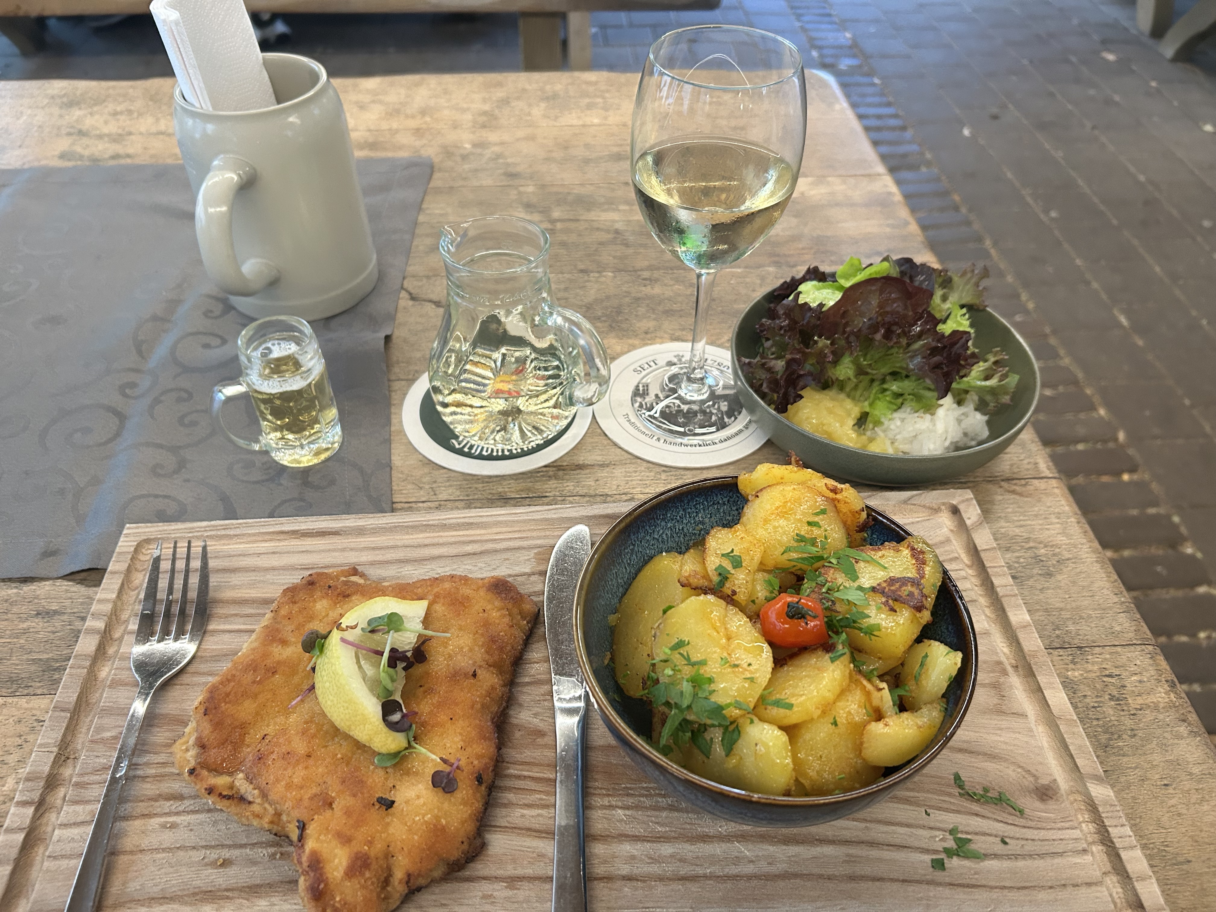
I drove back across the border to Ainring and found another pub in the village that had a great beer garden where I could enjoy a schnitzel and a glass of local wine.
On Saturday morning I woke to an overcast sky but the TAF for Salzburg indicated that the cloud would clear by midday so David and I agreed to meet at 11, make a plan and get away about 12. David asked whether his friend Mary could come with us for the ride so of course I agreed. Why not have someone else enjoy the flight?
When I arrived at the airport it turned out that Mary also has a private pilot licence and had obtained her licence at the same time as David but only flies as a hobby. She hadn’t flown much so far but was keen to fly as often as money allowed. A gratis flight as passenger was just perfect for her. She’d sit in the back and take photos.
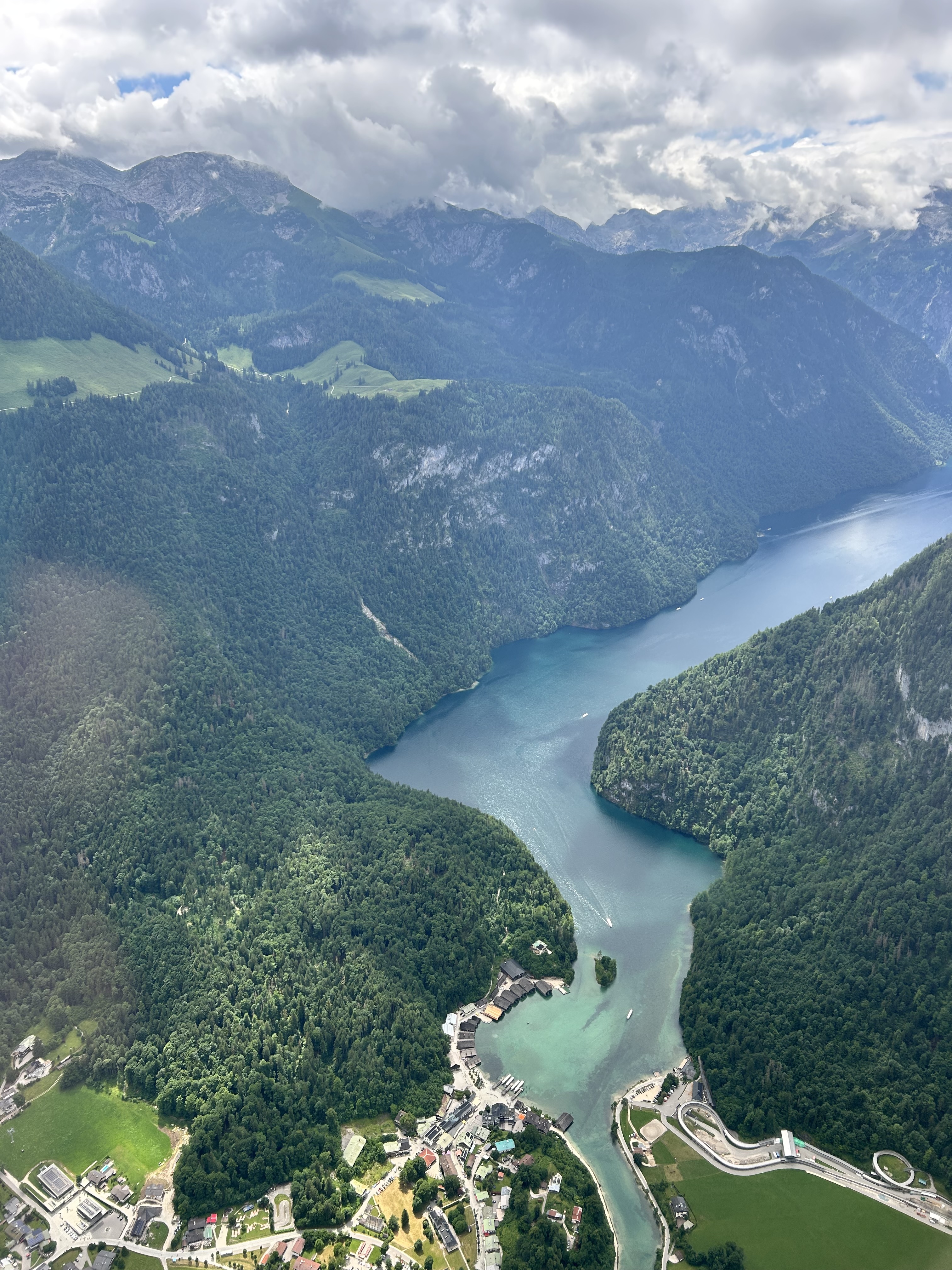
First, I suggested flying to St Johann again but Mary said that they close the control tower for lunch so we could fly in but would have to wait until 1:30 when they opened again to pay our landing fee and fly out. That timing wouldn’t work so we agreed to fly to Zell am See, and have a coffee and something to eat there. We’d assess the cloud as we went and decide exactly what route we’d take. On the way, I wanted to fly over Lake Koenigsee and try to see the Kehlsteinhaus from the other side.
Saturday flight route
This time we took off to the north, turned left and tracked downwind and on further to Hallein. A that point we headed west into one of the first valleys towards Berchtesgaden.
RPT apron left and GA apron on the right from downwind
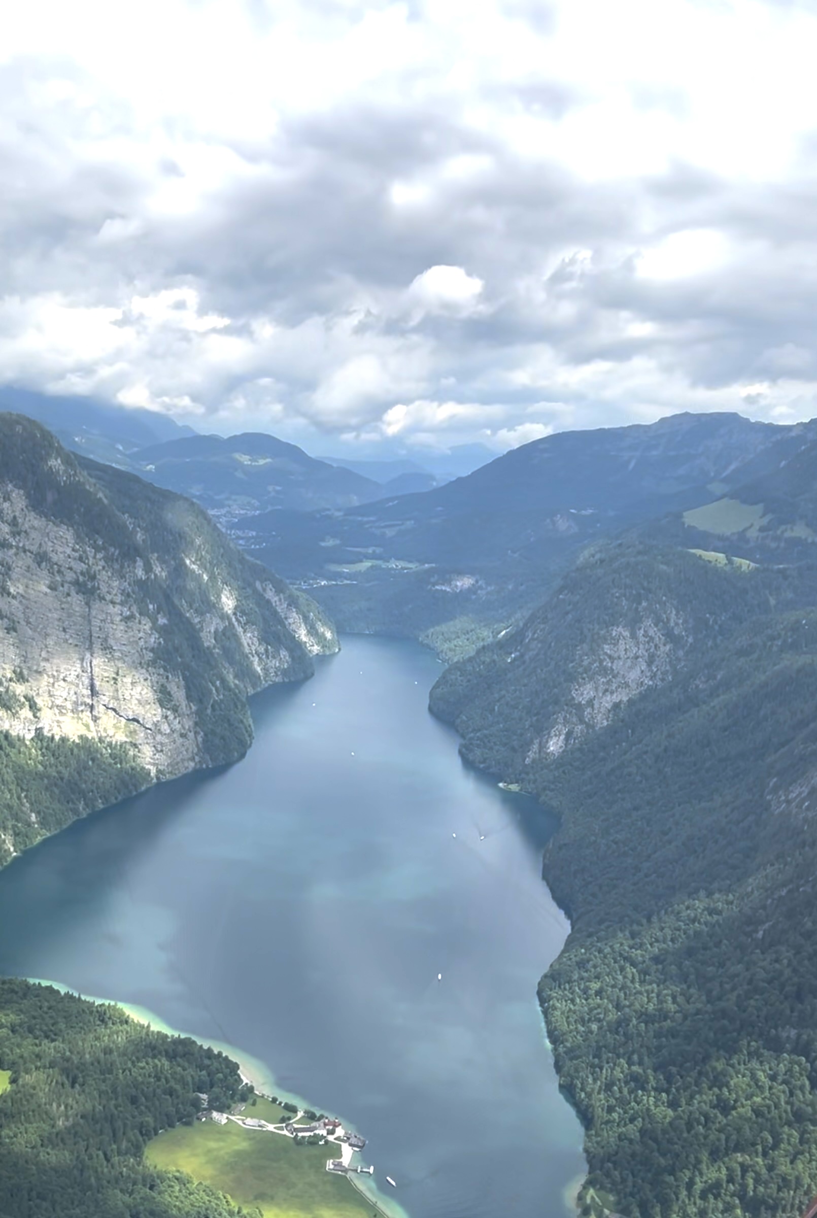
Lake Koenigsee (King’s Lake), at 190 metres deep, is one of the deepest lakes in the alps with sheer cliff sides that apparently plunge far under the water’s surface. There were legends of Nazi treasures dropped in the lake at the end of WW2 but as far as I’m aware none has been found to date. In 1997 they did discover a Volkswagen Beetle at the bottom however, complete with driver. Apparently one wintry night in 1968 the unfortunate driver drove his Beetle off the frozen surface of the lake into the water and drowned.
The scenery was quite spectacular, with the clouds hanging around the tops of the mountains that surround the lake making the landscape look a bit surreal. We flew to the far end of the lake and did a 180 degree turn allowing us really great views of the lake and the mountains.
On the way out of the valley we spotted the Kehlsteinhaus up on top of the mountain way above us.
Out in the main valley again we continued south and over another pass before tracking west towards Zell. On Thursday afternoon we’d approached from the north so this was a different approach but I already knew the pattern to fly to join downwind. We flew over the lake again and hugged the side of the mountain, passing only a couple of hundred feet above some farm houses and were almost able to say hello to the cattle grazing peacefully in the meadow beside us.
Turning base early enough to avoid two paragliders we continued our turn onto final for a smooth touch down.
This time we had time to visit the restaurant and pay the landing fee. Mary kindly paid the landing fee for me as a thank you for taking her along. And David shouted us coffee and cake while we sat outside on the patio with a view over the apron. A top spot. A Beechcraft Bonanza flew in and out a few times taking tourists for scenic flights. Zell am See is a very popular destination for private pilots so the apron and restaurant can sometime be overrun on weekends but it wasn’t a problem for us. Probably the amount of cloud had kept the fine weather aviators away.
After about 45 minutes we headed out to the plane again and took off to the east then turned to the north and flew over the lake again.
We retraced our route from Thursday afternoon, flying along the Saalach Valley at 3500ft until we popped out at Bad Reichenhall.
Then it was a short flight to join the left base for RWY 31 at Salzburg. This time it was a “firm” landing and we taxied back to the hangar. David told me that if I go back he’d sign me off for my European licence conversion. Meanwhile I assured him that I’d happily be his safety pilot if he comes out to Australia for a visit sometime.
After completing the paperwork and taking my leave from Mary and David it was time to jump in the car and drive the three and a half hours back to Amberg.
It’d been an amazing three days of flying and had way surpassed my greatest expectations. I can’t recommend AirLink too highly as a flying school to visit if you want to do any mountain flying in Austria. I’d been to Salzburg and Austria quite a number of times before so wasn’t interested in the normal tourist things there but if you haven’t you could combine some mountain flying with a visit to one of Europe’s loveliest cities too. And the surrounding country is great to explore on the ground as well if you haven’t done so already.
Finally, if you’ve made it this far you are either really keen on flying in the mountains or just super interested in what it’s like to fly there. You can learn a lot more from a mountain flying instructor like those I’ve had the pleasure to fly with in New Zealand, the US and Austria. Meanwhile, to get a taste of what’s important take a look at a couple of excellent online presentations Michael Hochenrieder presented for the Cirrus Owners and Pilots Association (COPA) in April and May 2021. The first is about VFR flying in the mountains and the second is about IFR mountain flying.
The VFR presentation relates to a fatality near Innsbruck while the IFR one relates to one at Zell am See. My experience in the mountains so far has only been under the VFR. IFR flying in the mountains is a different thing altogether as you’ll see in that presentation. I’m not sure I’d want to do it (you wouldn’t get any views of the mountains for a start) but some people need to do it for business or other reasons. It requires a different or extra set of skills that are addressed in the IFR presentation. Things like ensuring your aircraft has sufficient climbing ability for the given set of circumstances. I recommend you have a look at both presentations.