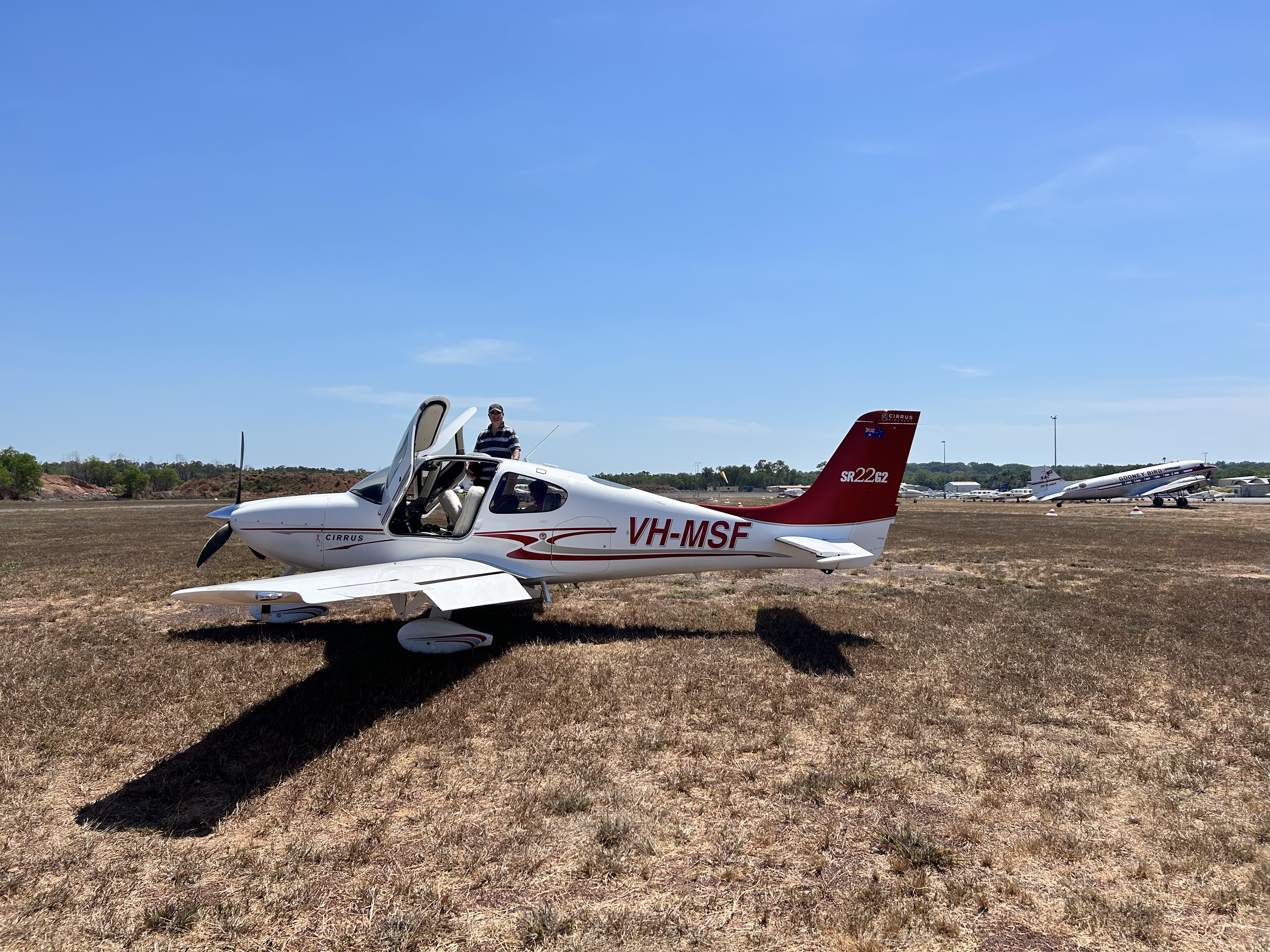
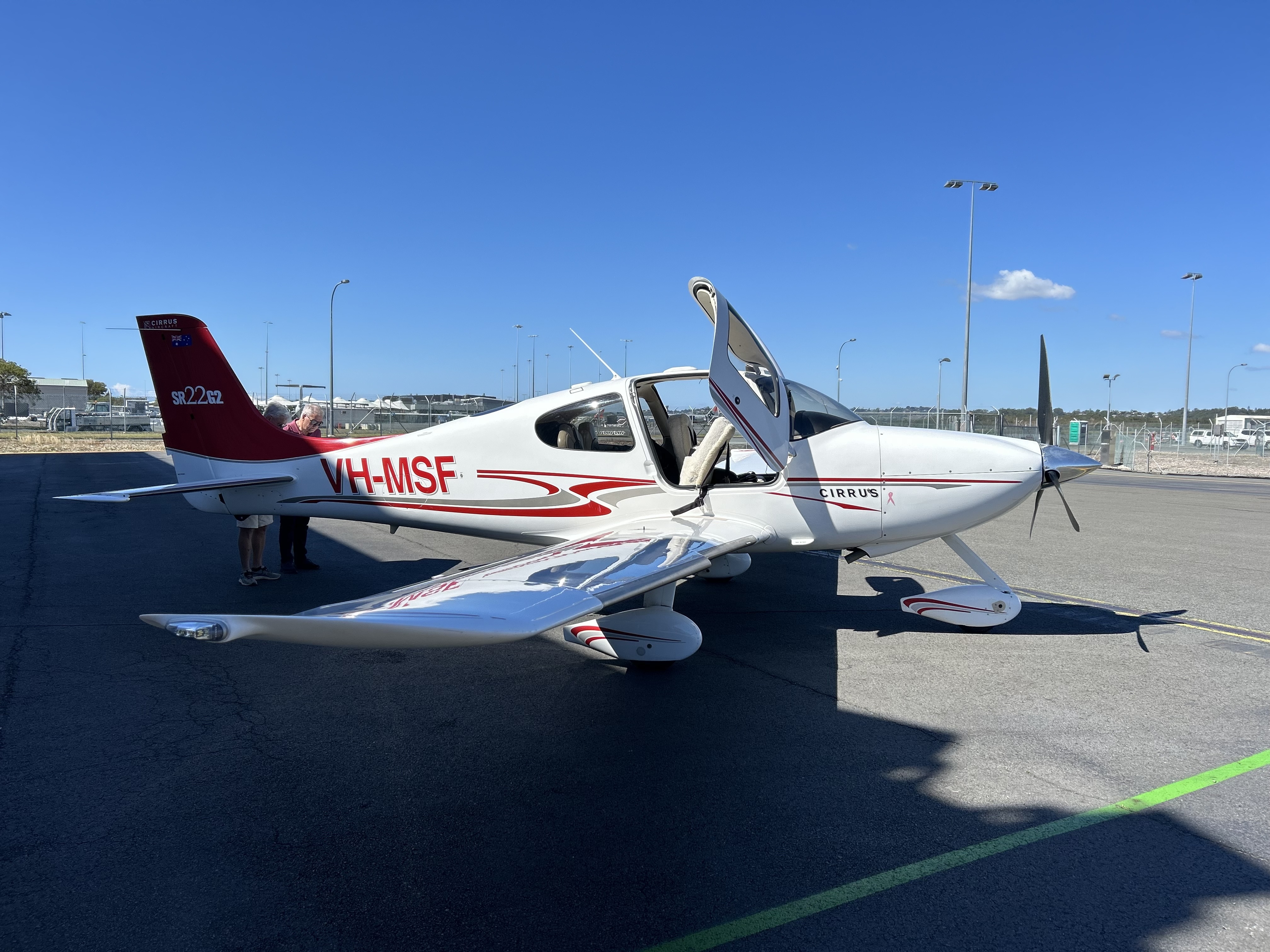
In August 2025, after a weekend of Cirrus presentations, tours and events around Darwin as part of the biennial Cirrus Life event, Brett Silvester and I flew MSF from Darwin back home to Redcliffe. I replaced Mike Cahill who had flown up to Darwin in MSF but didn’t want to fly home in the Cirrus. So Sigi and I had flown up to Darwin with Qantas and I was to fly home with Brett, who had flown up to Darwin with Mike.
Preparing to leave Darwin
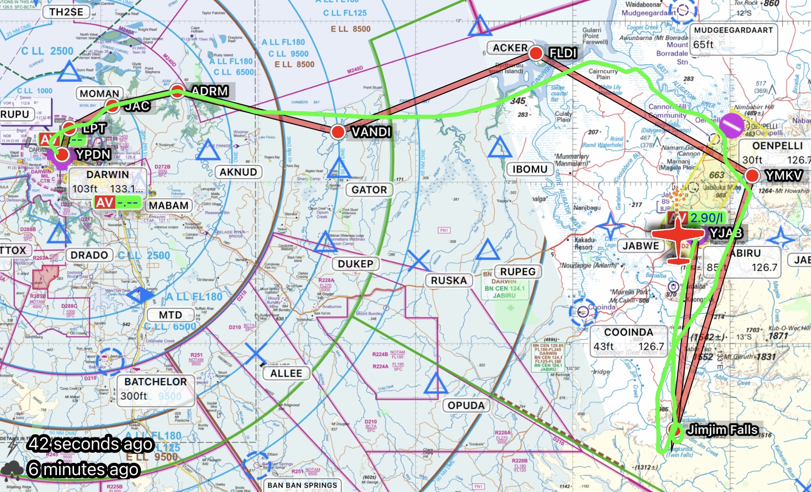
On Day 1 Sigi joined us for a shortish VFR hop from Darwin to Jabiru on the edge of Arnhem Land, leaving controlled airspace behind us and flying at 2000ft along the coast past the Adelaide River mouth, Mary River and South Alligator River before tracking inland along the East Alligator River to Oenpelli.
Adelaide RiverEast Alligator River
The country went from dry to bright green as we passed Oenpelli.
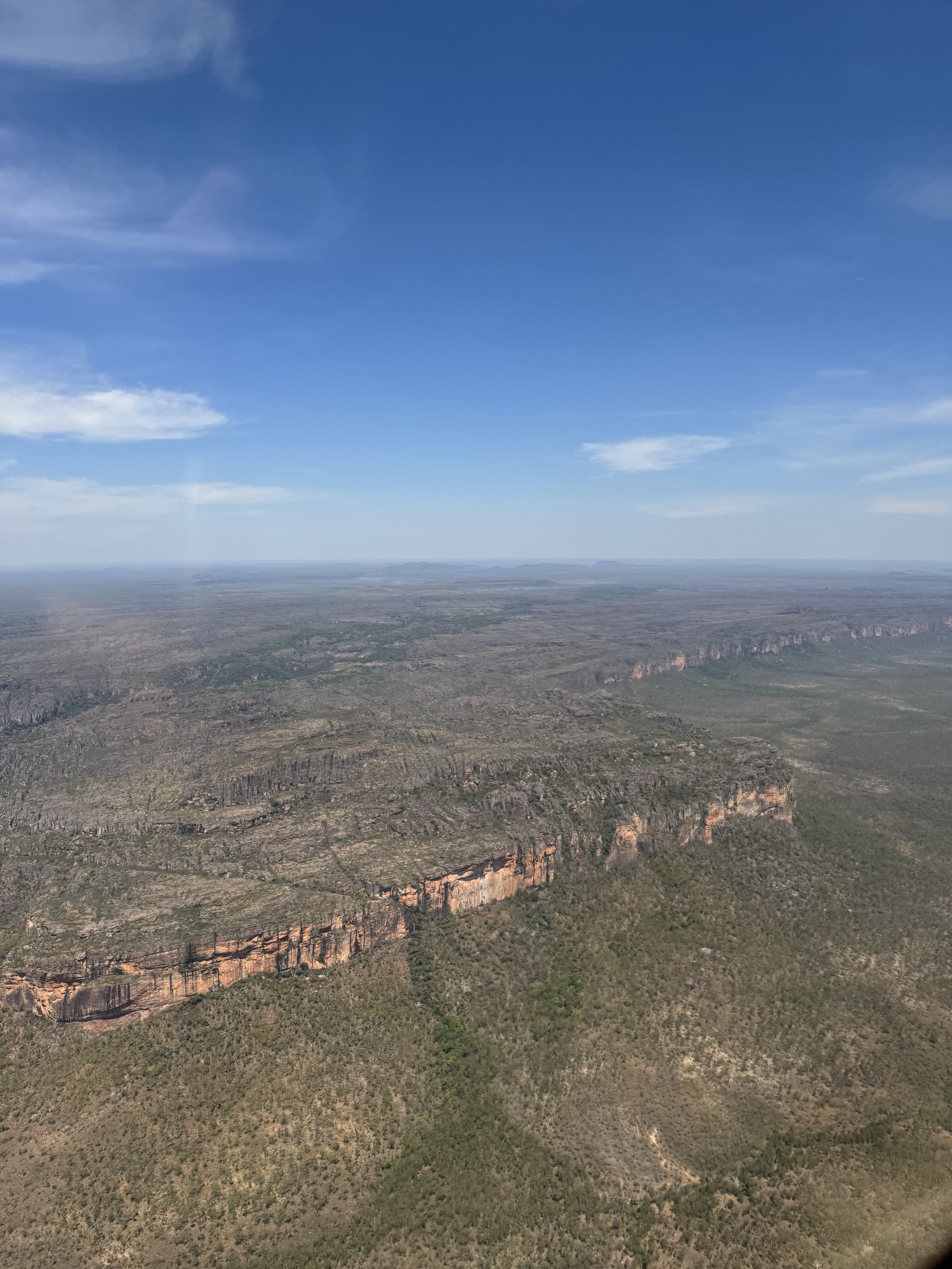
From there we followed the Arnhem Land escarpment.
Escarpment
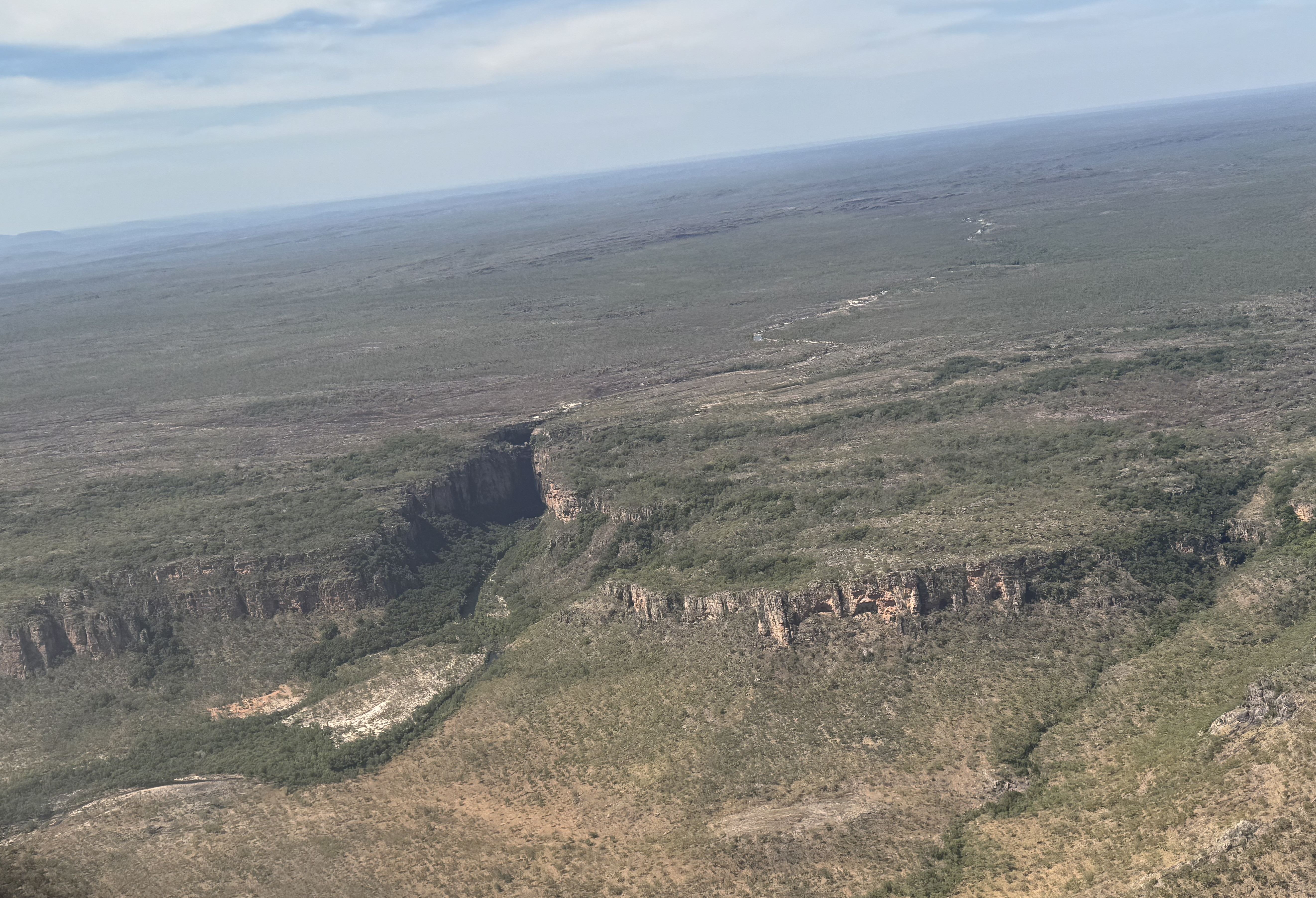
Our aim was to reach Jim Jim Falls and Twin Falls that are supposed to be very impressive in the wet season but given that it was nearing the end of the “dry” there wasn’t much water in them.
Twin FallsJim Jim Gorge (with no waterfall)
From there we backtracked to Jabiru where we stayed for two nights. We overflew the now decommissioned Ranger uranium mine on the way in.
We thought we’d be quicker getting to Jabiru than Mike and other non-flyers who were driving by car however we were “off the blocks” not long after they left and they arrived just in time to pick us up from the airport in Jabiru. We did spend a lot of time taxying and waiting for departure at Darwin and doing detours to interesting places and of course refuelling. But the old saying came to mind – “time to spare? go by air!”
Screenshot
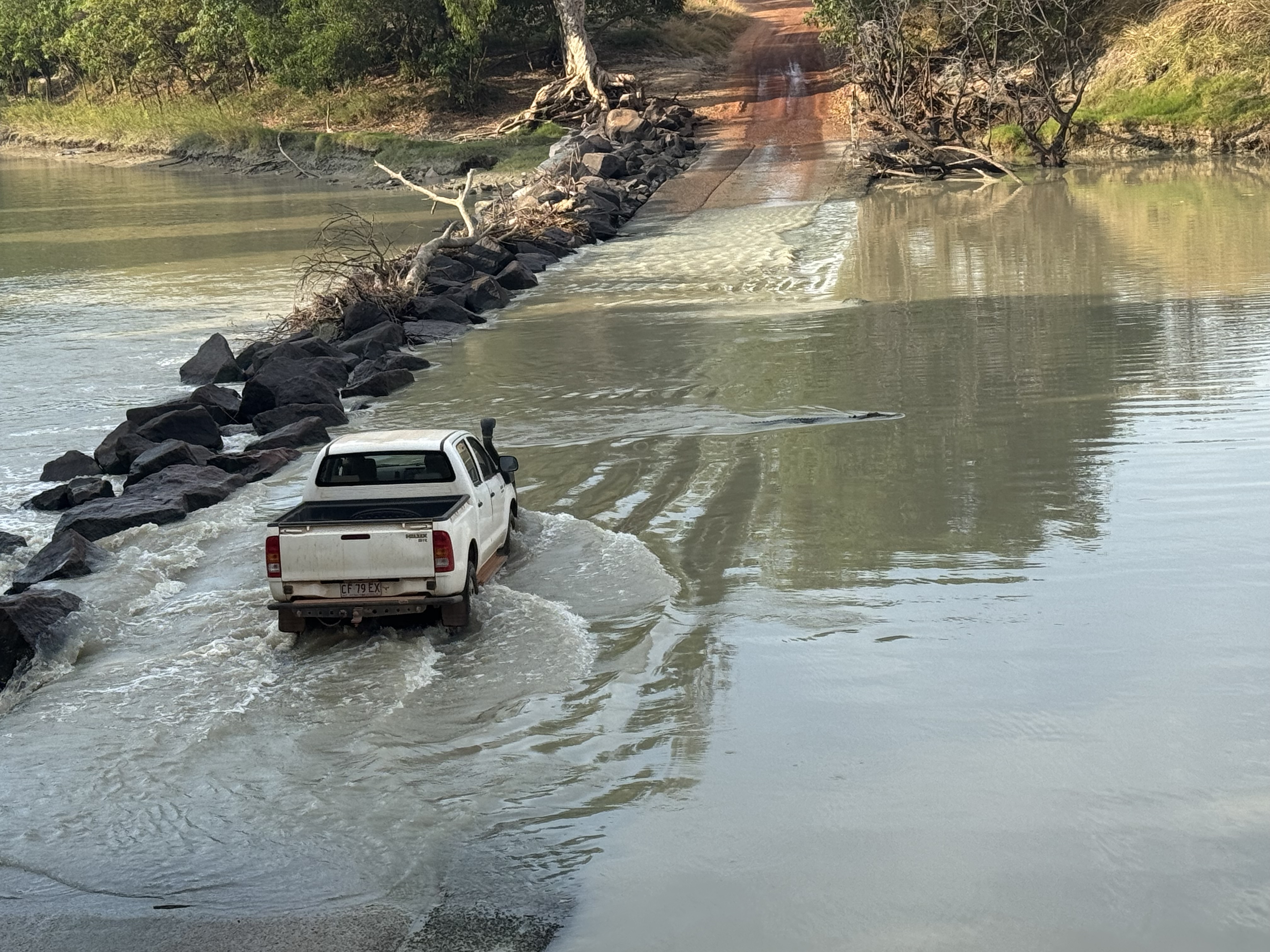
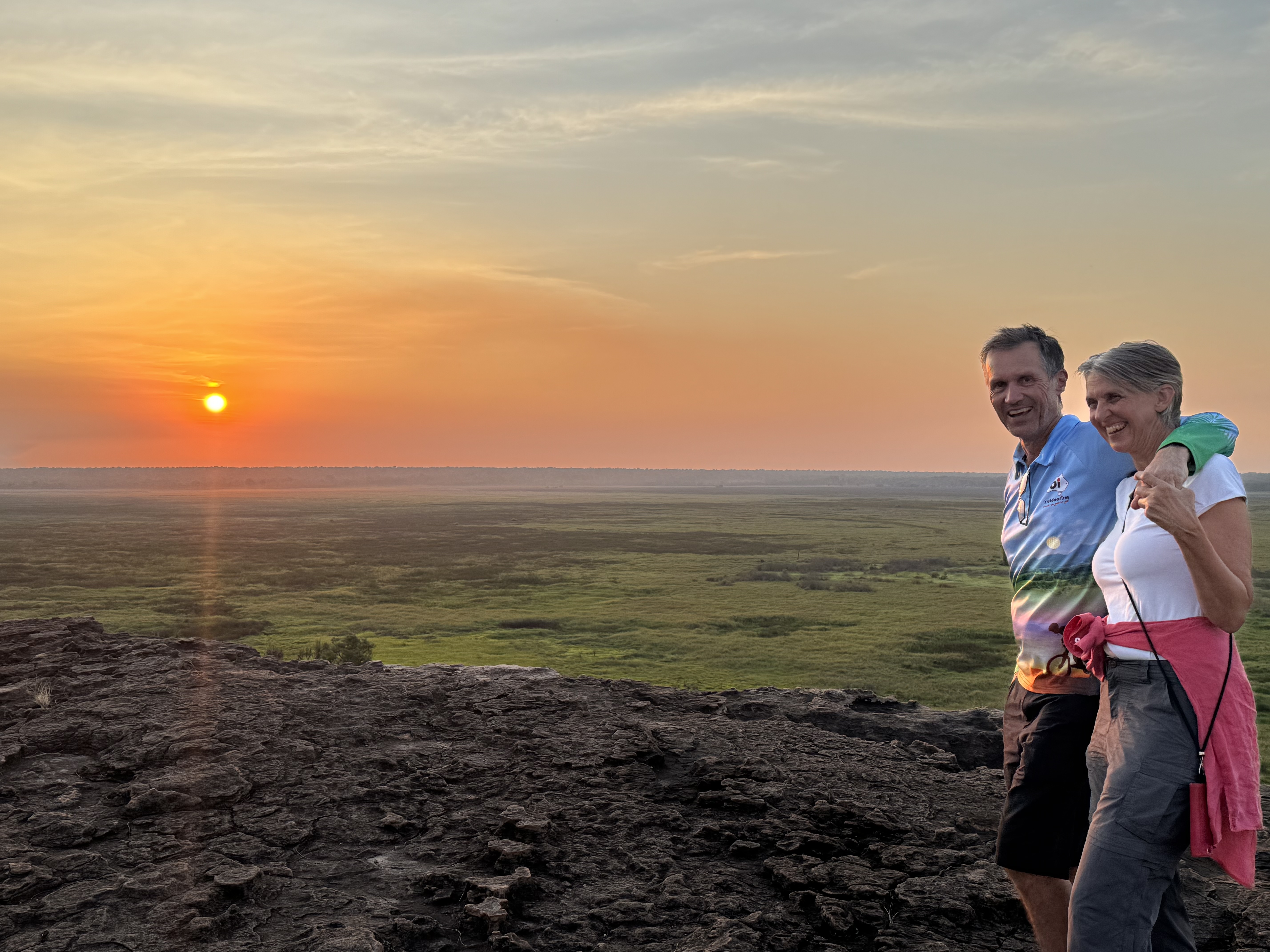
The next day we explored some indigenous cave art near the escarpment in the morning and late in the day headed out to Cahill’s Crossing, the entrance to Arnhem Land, and watched the man eating crocodiles waiting for a feed before driving over to Ubirr for some more cave art and a beautiful sunset.
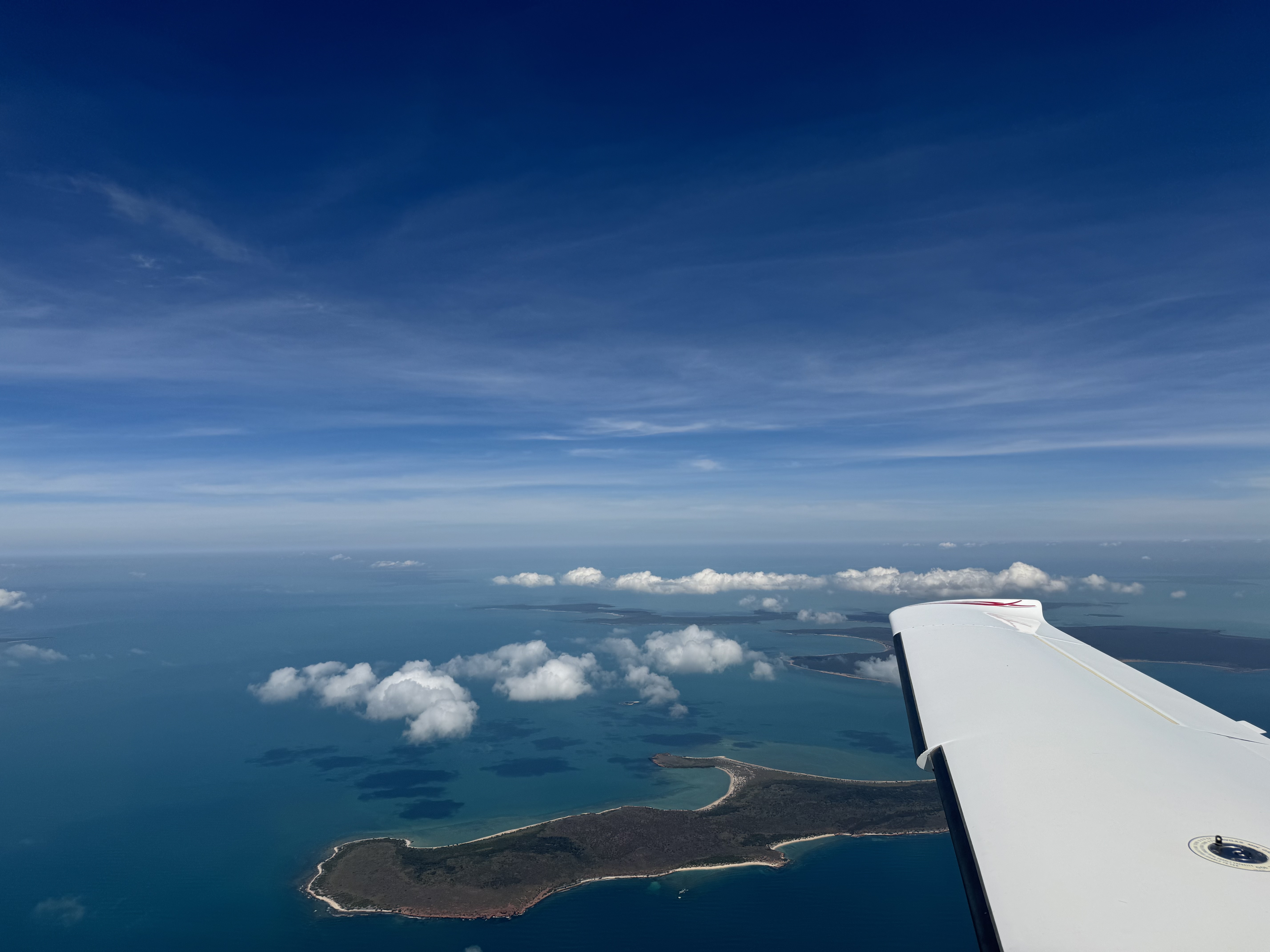
On Day 3 Brett and I said goodbye to the others and flew up to the north coast over Arnhem Land and followed coast before cutting down to Groote Eylandt off the east coast. Brett did a practice RNP approach that took us right out to the eastern edge of the island before turning west again for a 10 nautical mile long final.
Long final into Groote
By chance Brett had met the owner of the company that manages the airport at Groote Eylandt at Cirrus Life so he’d kindly organised one of his guys to run us into town and pick us up the next morning. The lodge was very pleasant. Recommended.
Screenshot
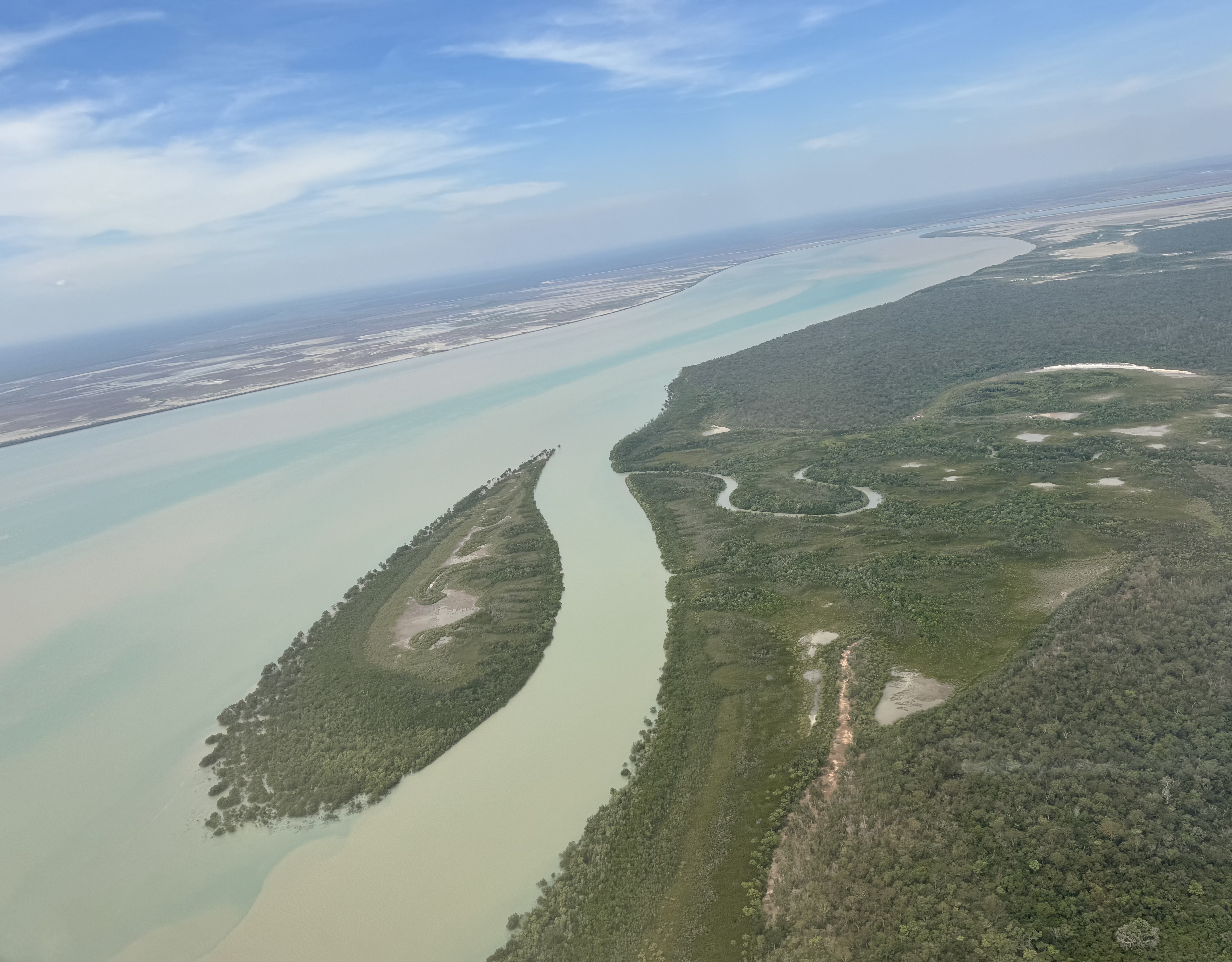
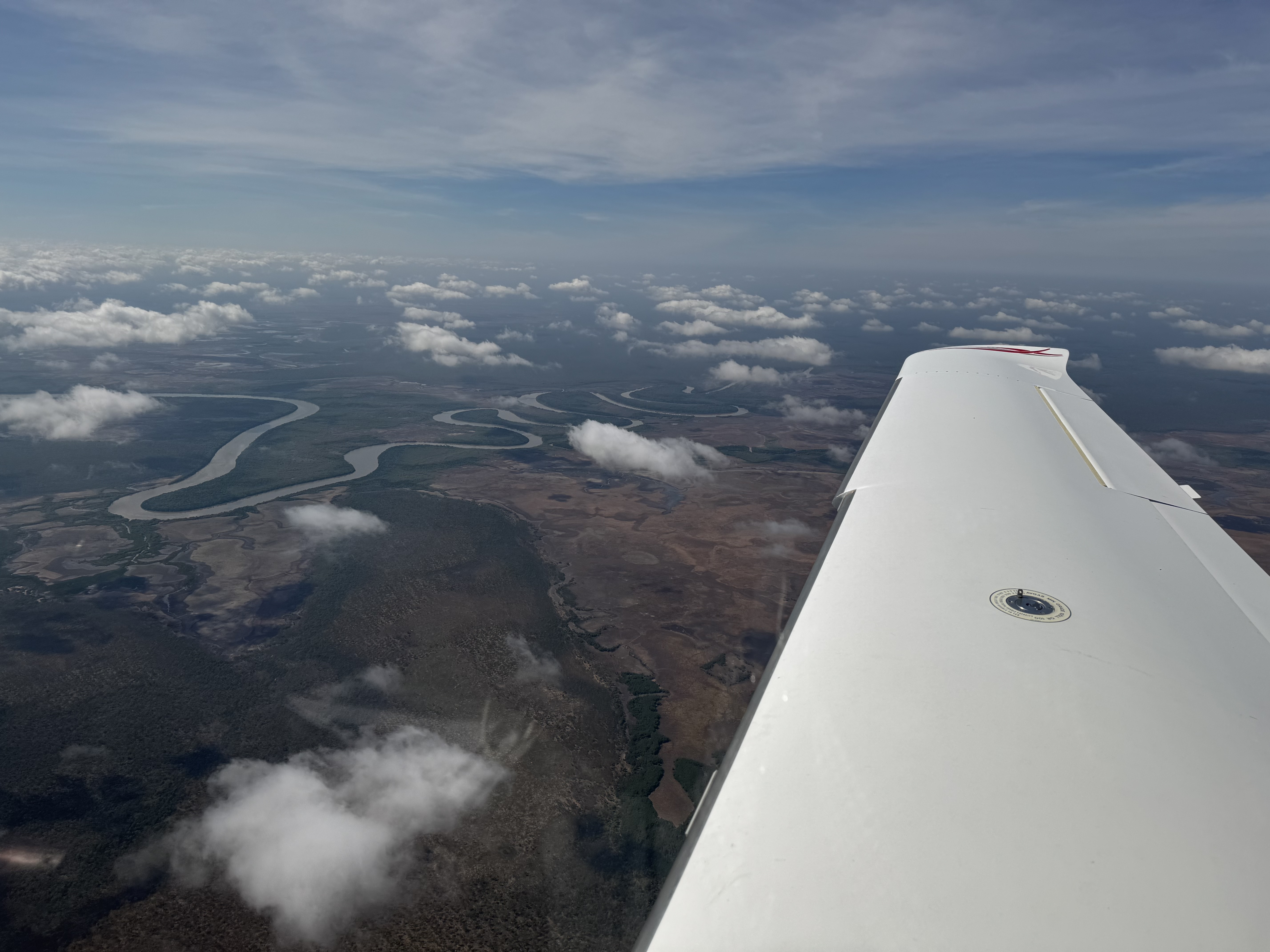
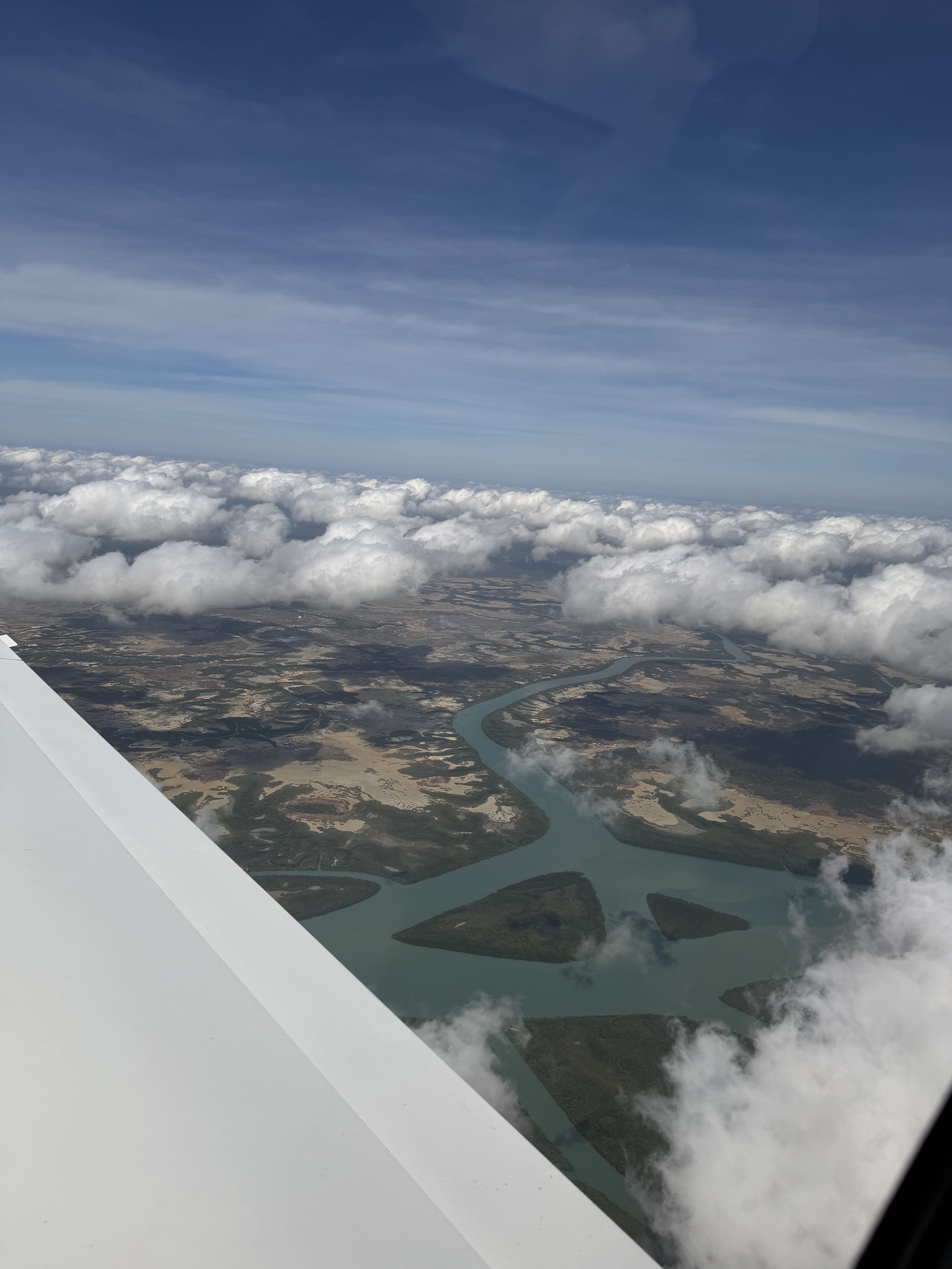
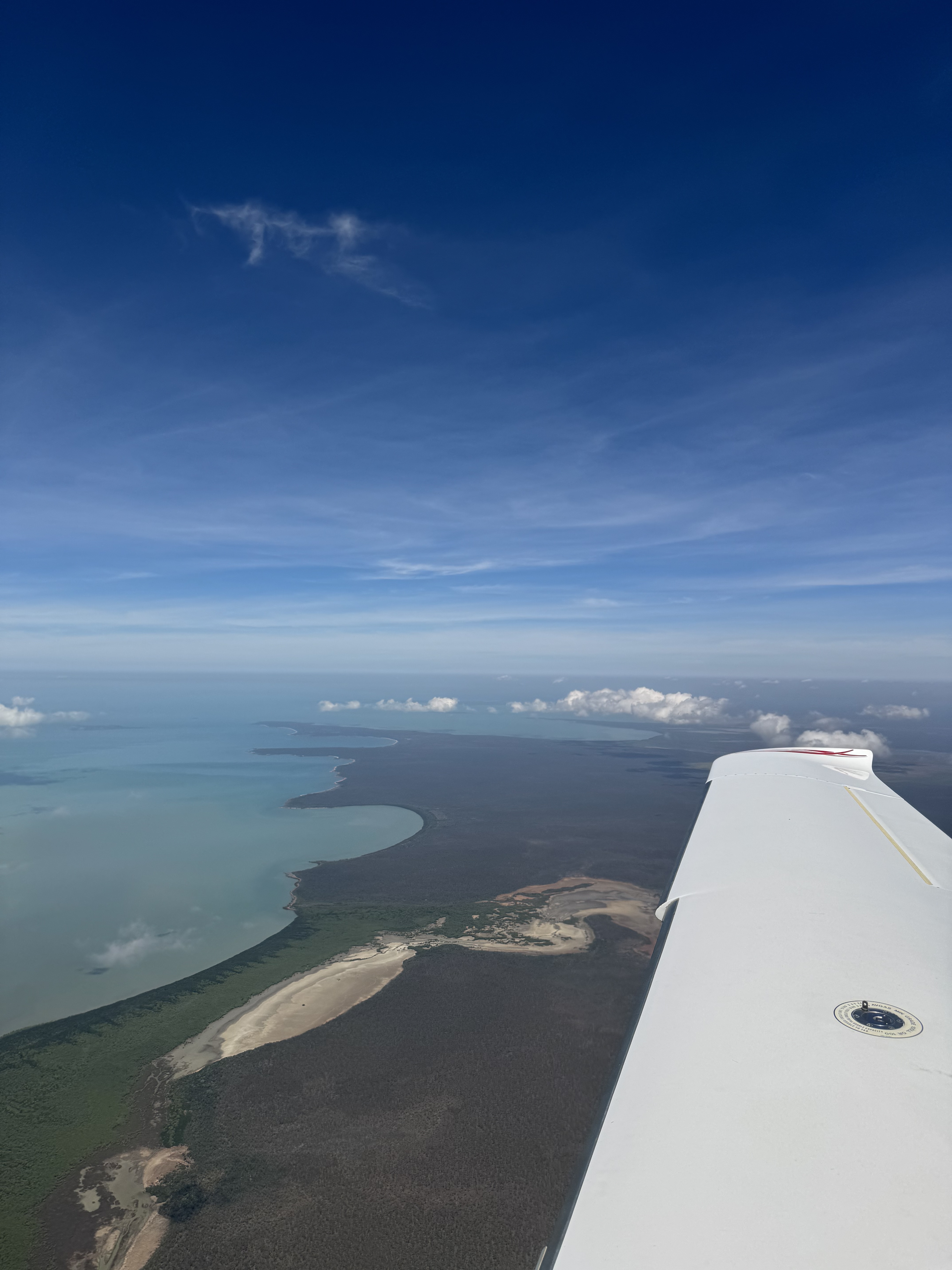
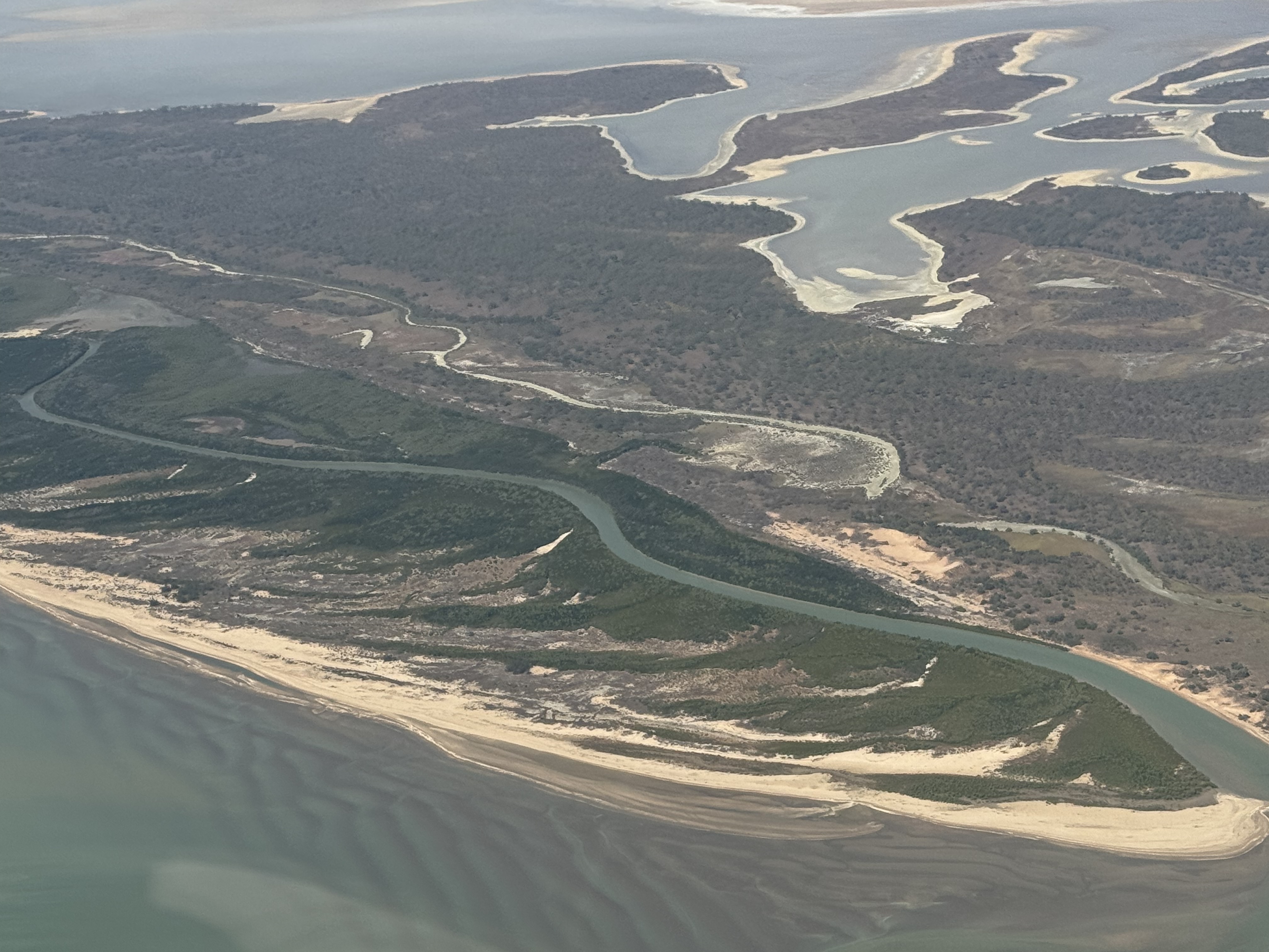
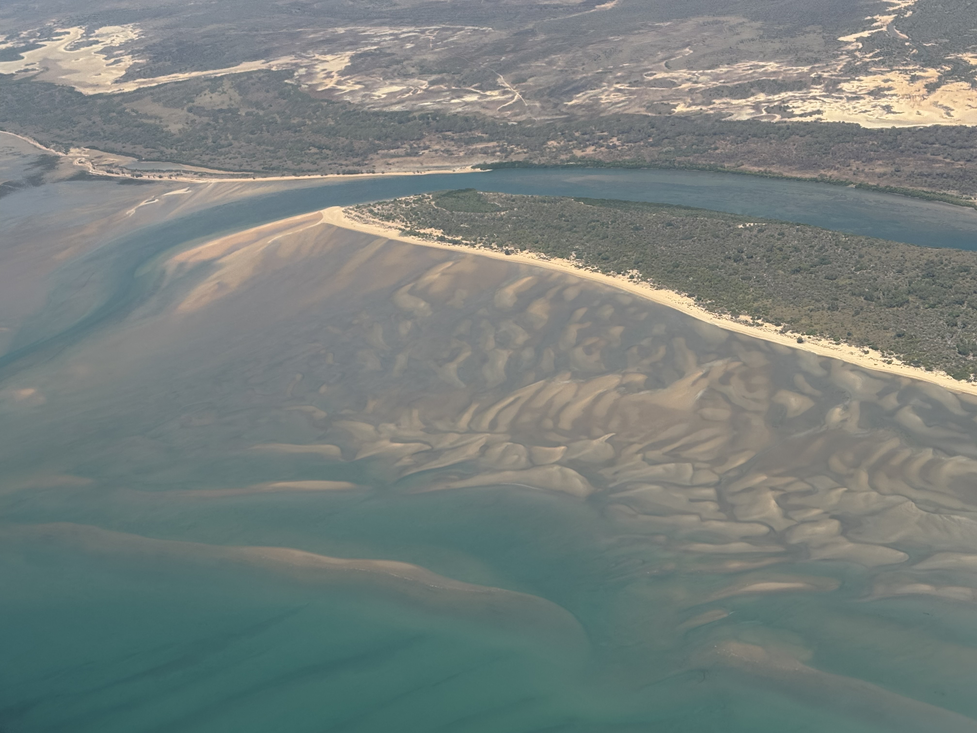
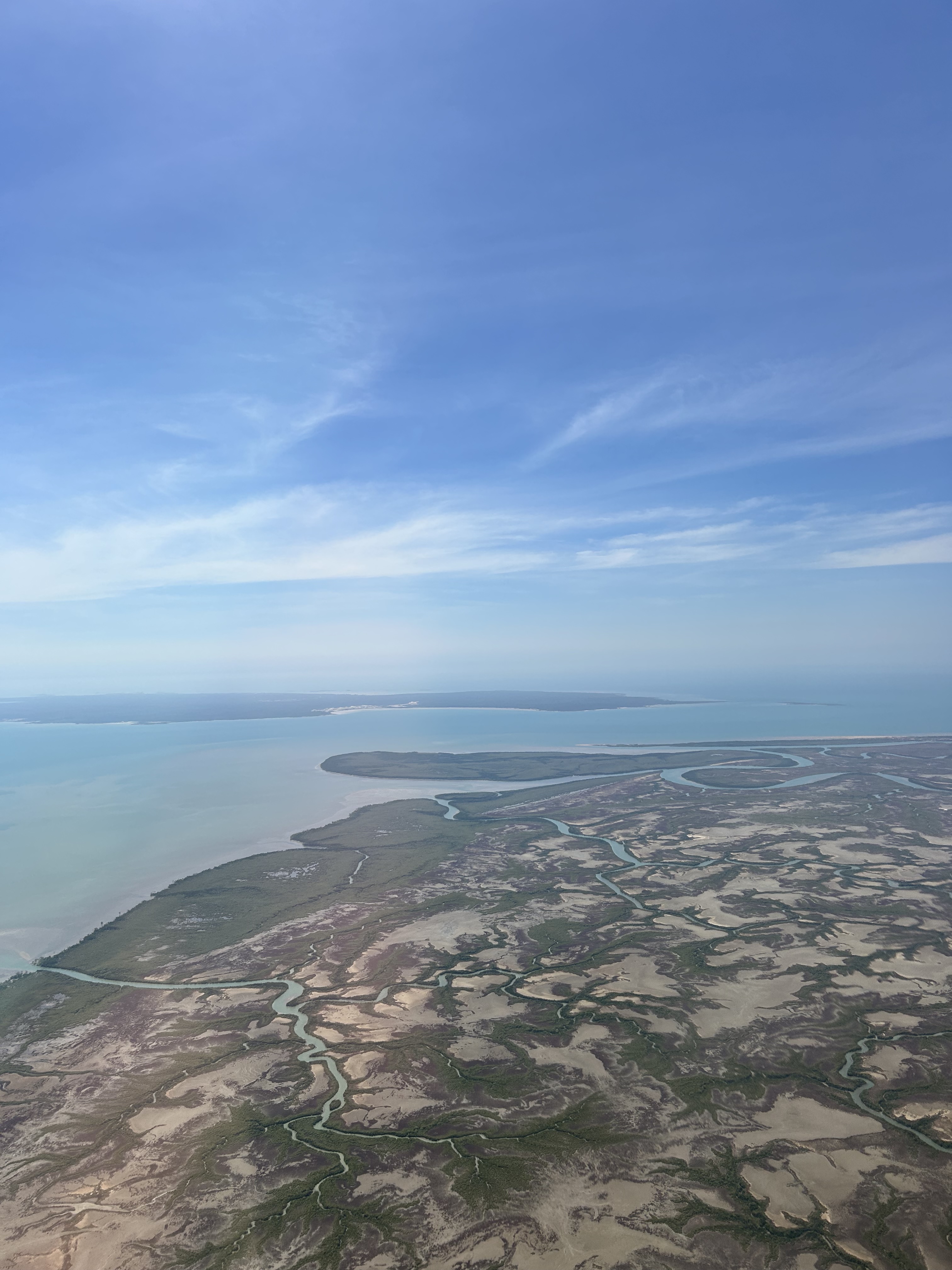
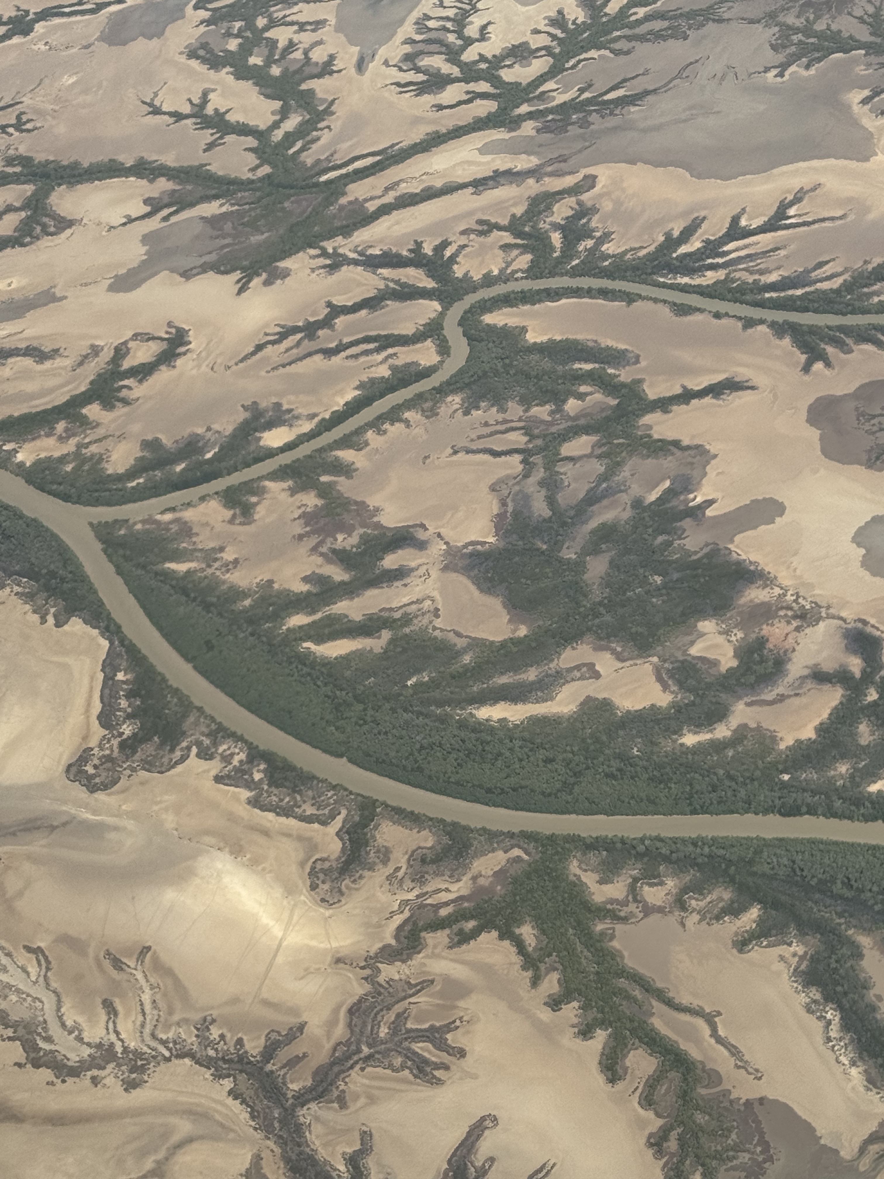
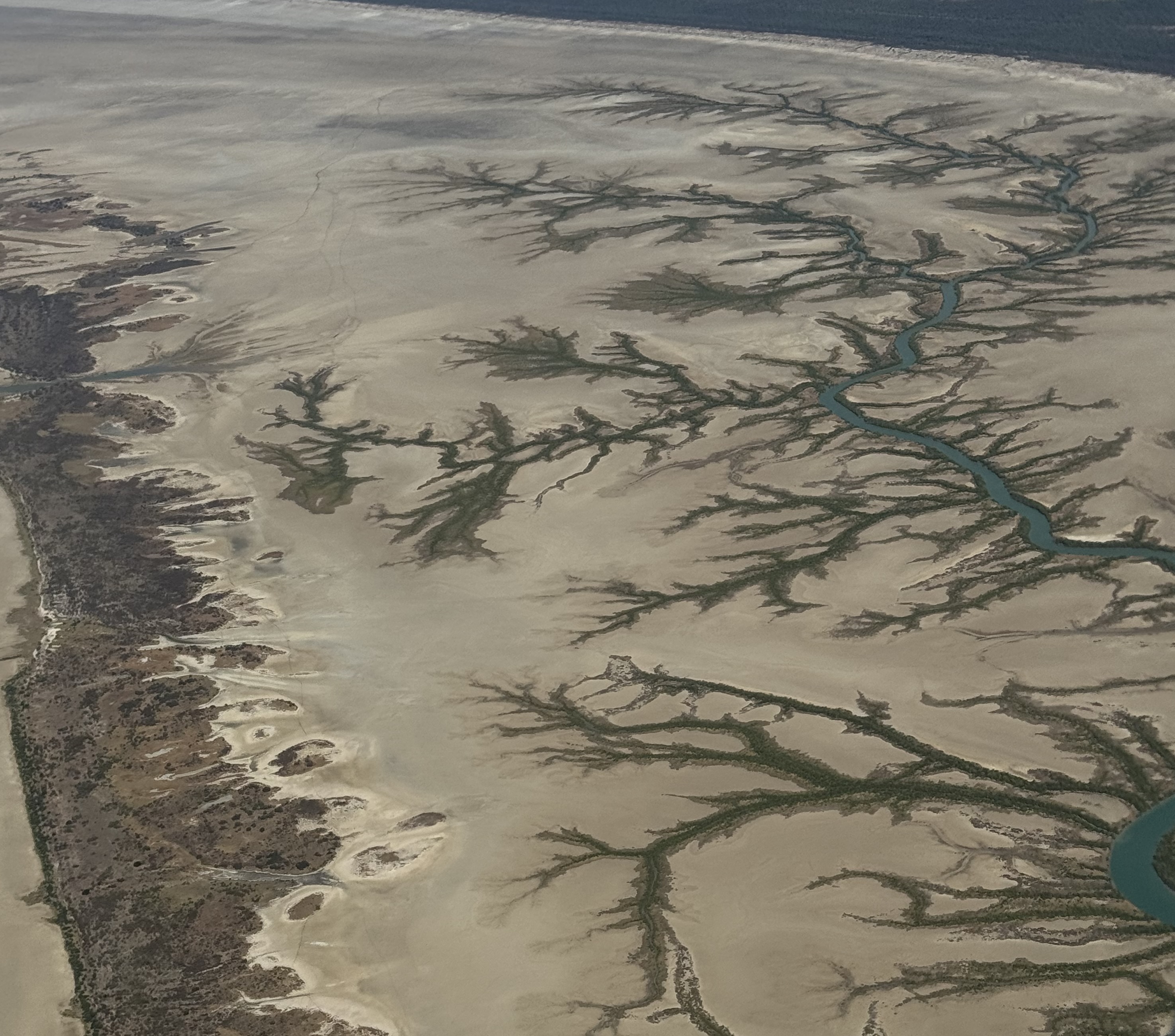
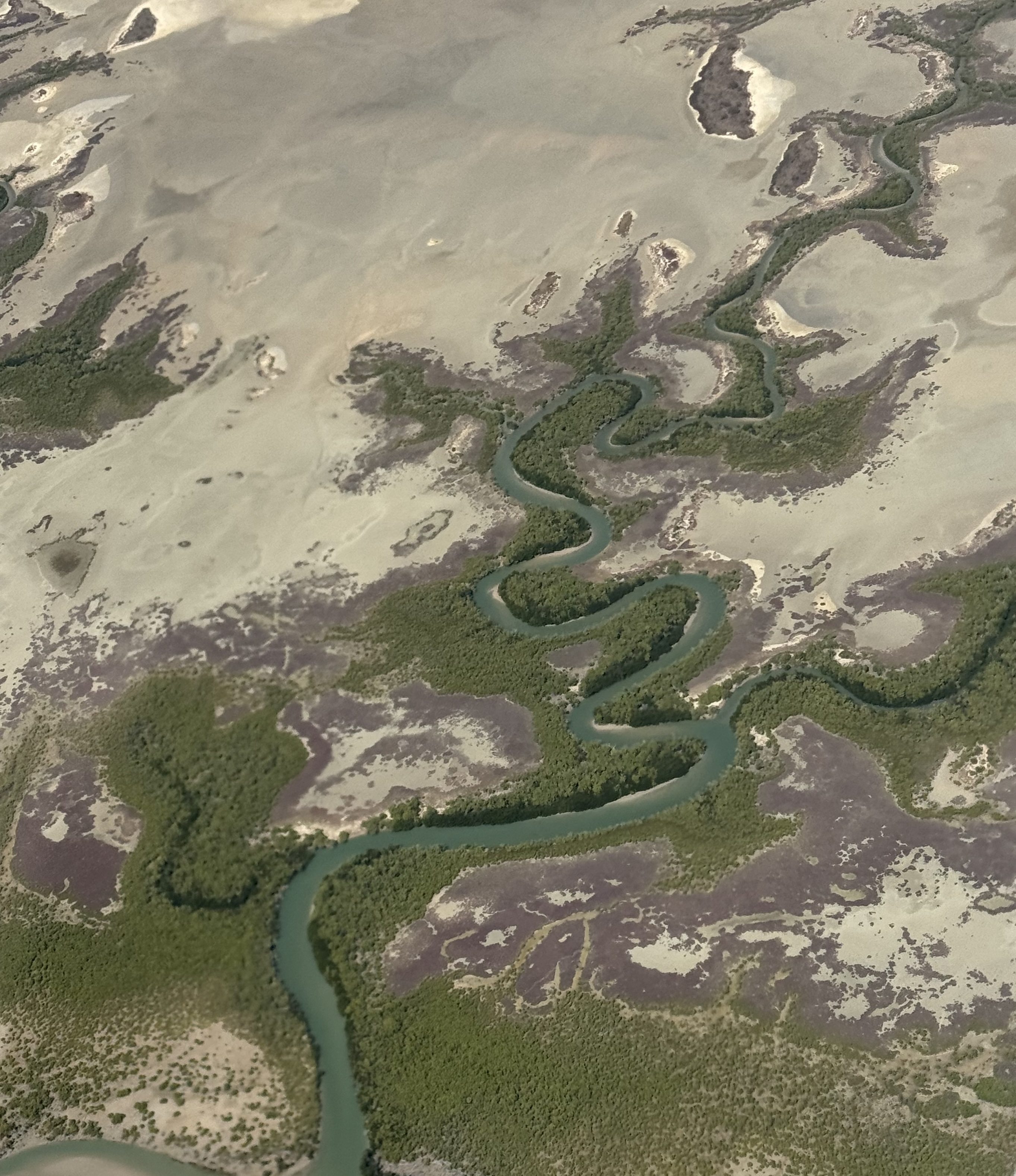
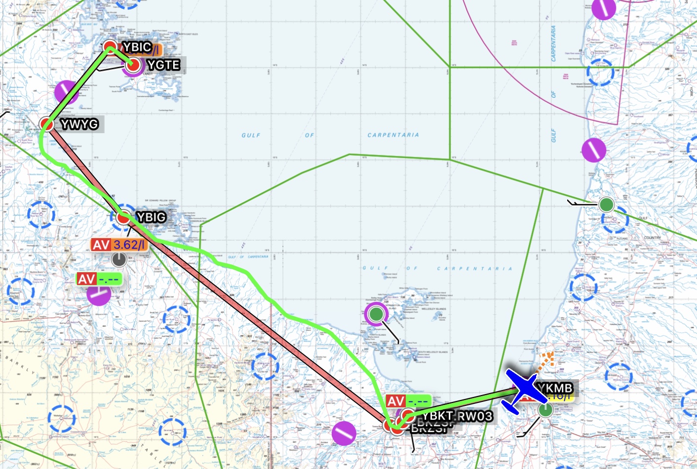
On Day 4 I flew us IFR along the coast of the Gulf of Carpentaria. This picturesque part of the coastline is known for the multitude of meandering rivers that make their way over the gulf country and empty into the gulf itself. Home of salties galore, this was the coastline that Burke and Wills were making for on their tragic transcontinental trek. You learn something every day on these trips and on this leg Brett, who was radio operator for the day, demonstrated how to fly with a bit more flexibility while flying IFR. He wanted to take photos of the coast from 2500ft and not have to fly straight lines between waypoints as you usually do under the instrument flight rules. He asked to fly “coastal not above 6000ft” and ATC cleared us a block of airspace basically from surface to 6000ft and 20 nautical miles either side of our planned IFR track. There was no one within a couple of hundred miles so we didn’t even need a discrete code. It allowed us to follow the coast all the way from near Groote down to Burketown and Brett snapped all of the photos below as we went.
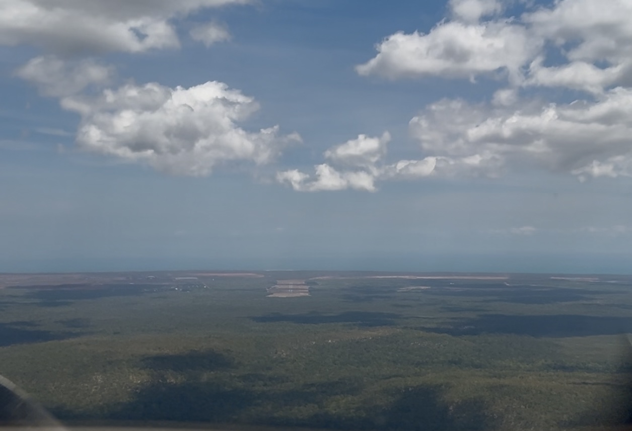
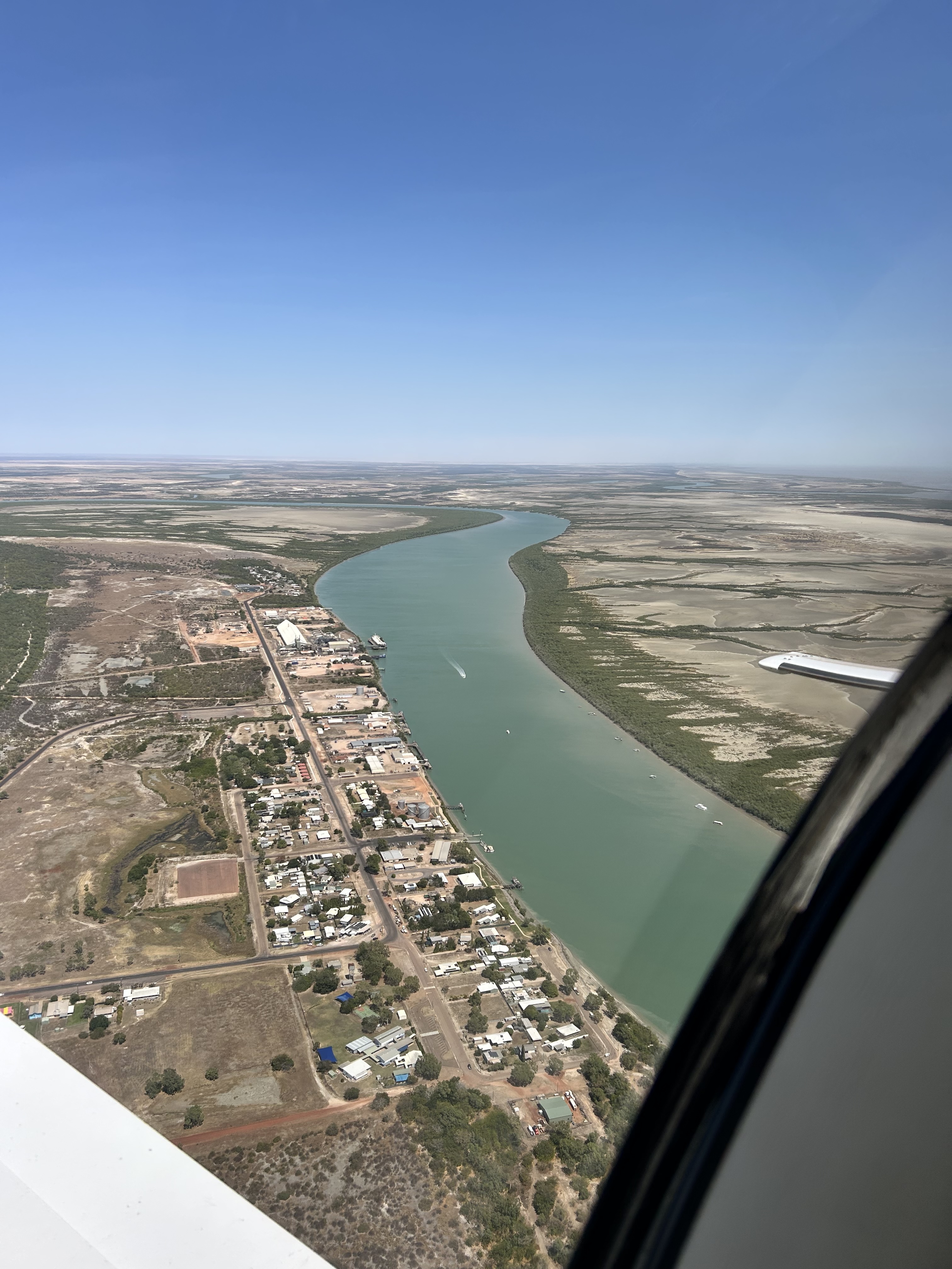
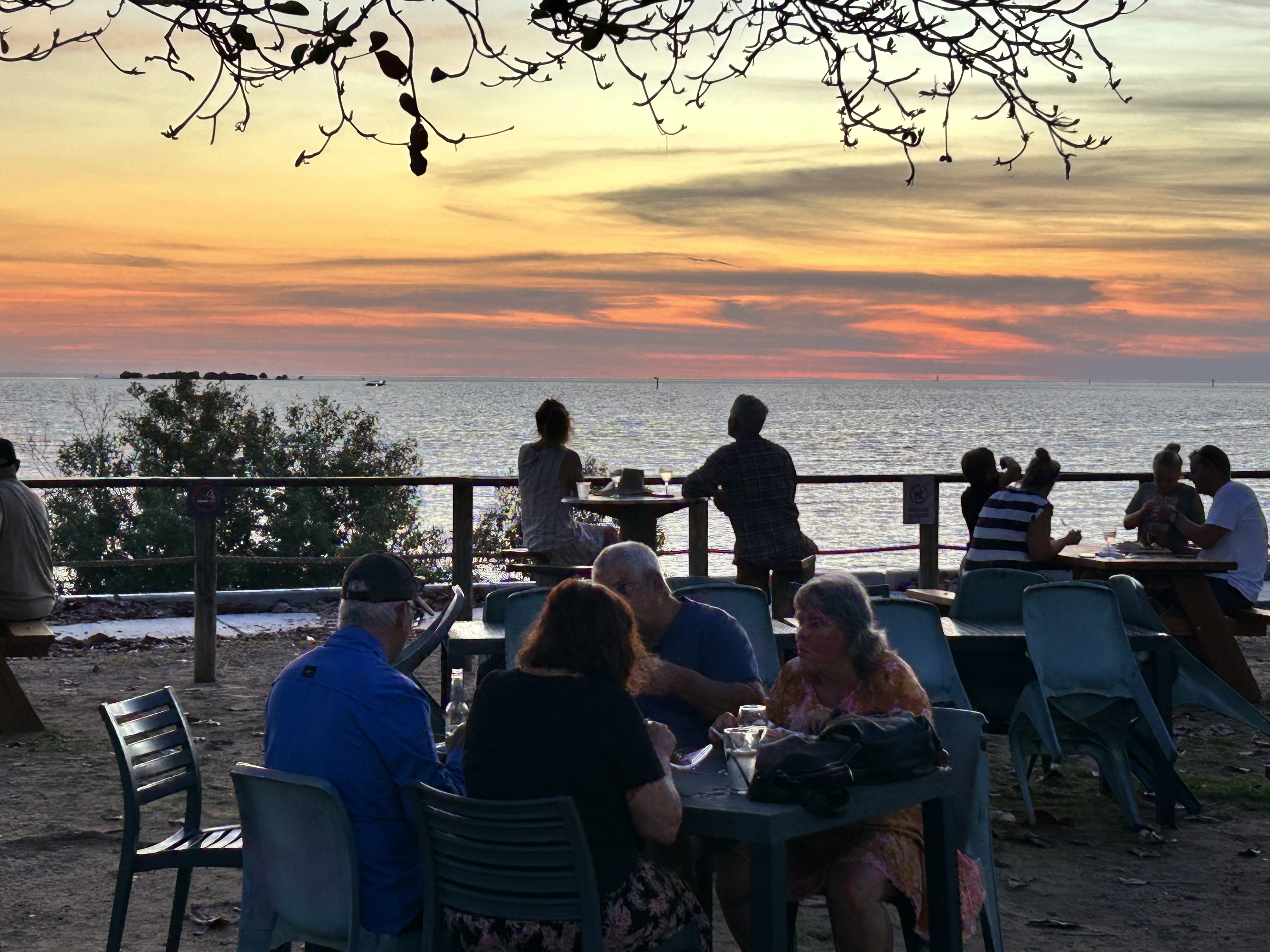
After about 2 hours in the air I made an RNP instrument approach into Burketown and we had a quick stop to stretch our legs before heading off to Karumba for the night. It was my second time in Karumba and the Karumba Sunset Tavern and Bistro next to the End of the Road Motel is a great spot to watch the sun go down.
Screenshot
On Day 5 we headed south for Emerald, with Brett back in the left seat as PIC, stopping only at Hughenden for some avgas. It was a pretty mundane trip flying over the outback and reconfirmed to me that I’ve really had enough of outback flying and will in future focus on flying coastal.
On Day 6 it was a quick flight back to Redcliffe, made more interesting by a couple of practice RNP approaches, one at Theodore and another one at Gayndah, each time carrying out a missed approach. The country became more interesting the further south we went and soon we were back in the old stomping ground close to Brisbane. We touched down in Redcliffe and put MSF away until the next trip that was to be to Sydney, Wollongong and the Hunter Valley and promised to be a good one.
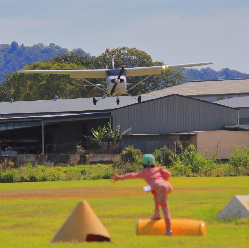
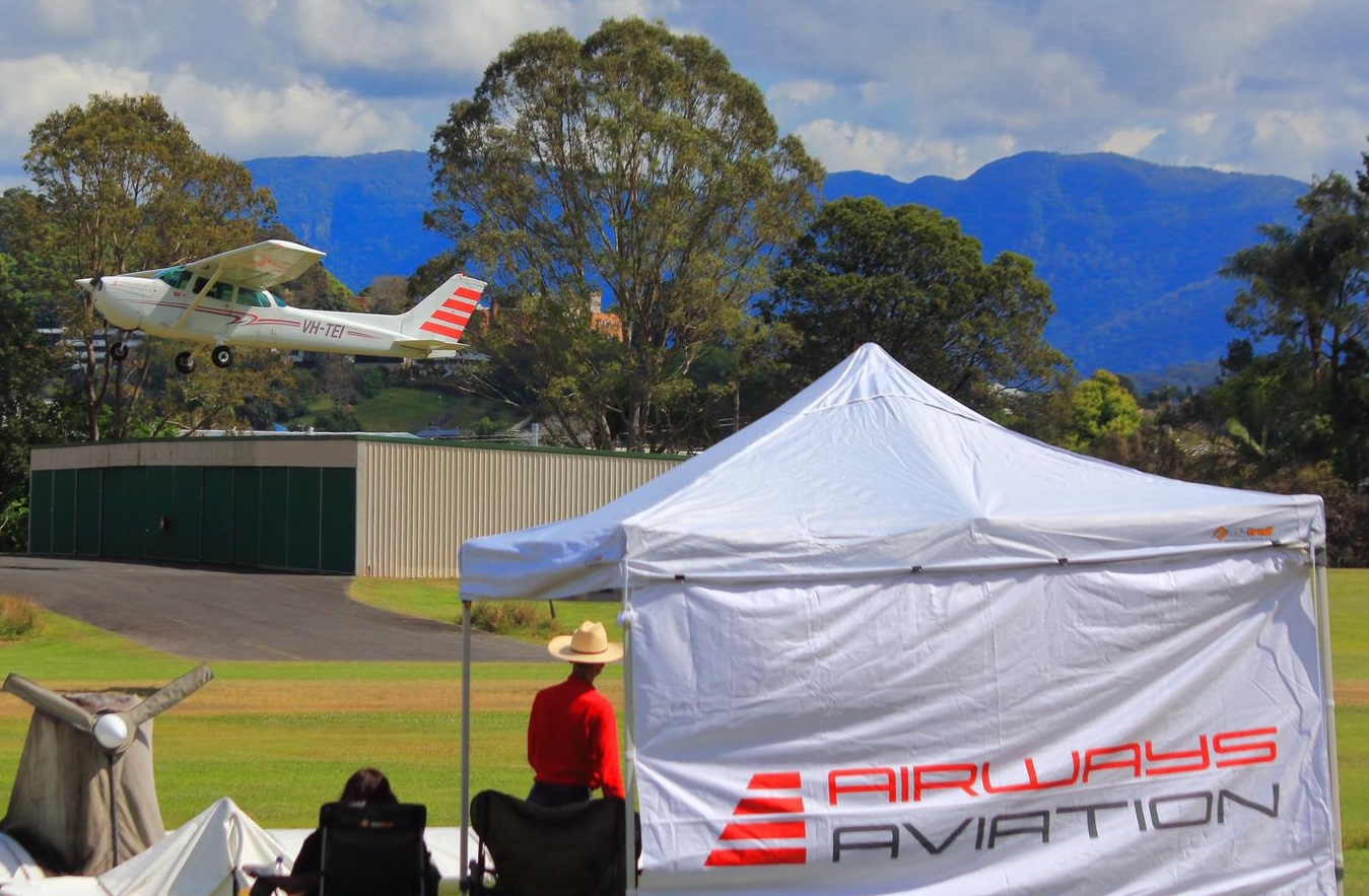
On Sunday September 14th 2025 the Murwillumbah Aero Club held its annual three-way inter-club competition. It was a fun and spirited day with perfect weather, where we showcased our flying skills and enjoyed some friendly rivalry with Airways Aviation and Air Gold Coast. Each competitor from the three clubs had to do three spot landings: a normal landing, a flapless landing and a glide approach. The aim was to touch down within a specified target zone. The closer you got to the “bullseye” the more points you received. A flight instructor from a rival club sat in the right seat in each case to assess the pilot on “airmanship”. In addition to the spot landings, we had a fun quiz to test general knowledge and gain some extra points (or not). And of course the breakfast barbecue was tasty as usual.
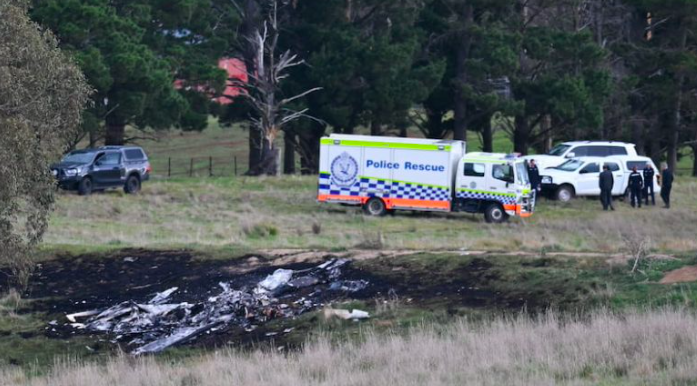
Friday 6th October 2023 seemed like a normal day. I drove out to Redcliffe to prepare for the monthly aeroclub barbecue. We needed a new bottle of gas for the barbie so I went down to Bunnings to pick one up. On my return to the club Paul Smeath was standing outside the clubhouse looking a bit strange. “Did you hear about MSF?” he asked. “No, what about it?” “It crashed near Canberra with all killed”. What? He was serious. Mike Cahill’s plane MSF, that I had flown for hundreds of hours, had indeed crashed. It had fallen from 9500ft in 60 seconds with one of our club members, and three of his grandchildren on board. All killed. The aircraft was incinerated.
What would you do in such a situation? I went into denial, tried to pretend it hadn’t happened and carried on with the barbecue in a bit of a daze. Some of the attendees had also heard. Others were blissfully unaware so why not let them stay that way? For tonight at least. Mike Cahill had been on his way to the club when he received the call from the police and was now heading home. I wouldn’t hear from him for a few days. He needed time to process what had happened. As we all did. Time to question what could have gone wrong, what could anyone have possibly done to prevent this tragedy?
I spent the next two weeks in a bit of a stupor. Not sure how I should react when people asked me what had happened. Eventually I decided it was best to explain to anyone who was really interested what I thought was the most logical explanation of what could have happened. It may not be right but I had to try to rationalise it. Could it happen to us? How could I avoid getting into a similar situation? How could I otherwise get back into another light aircraft? And take family and friends with me?
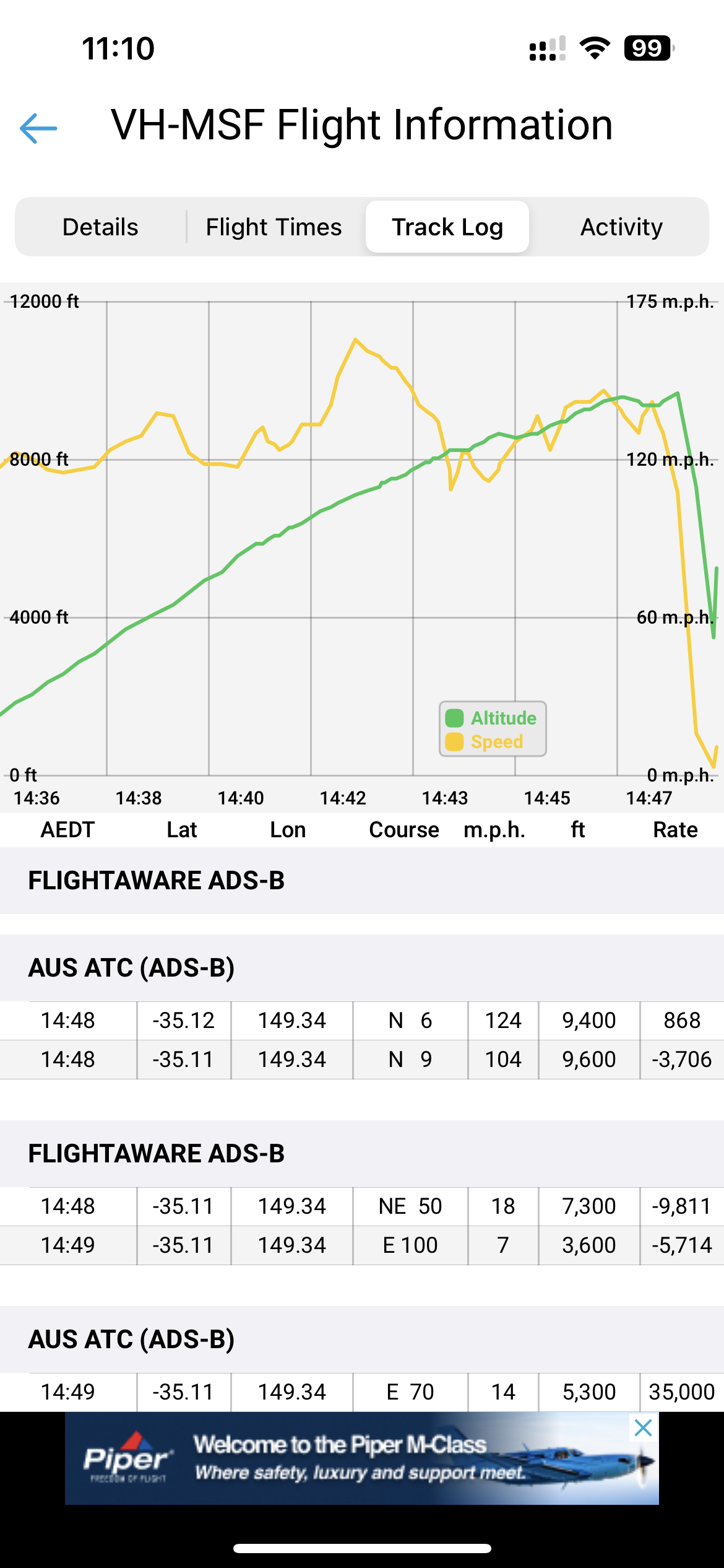
It sounded like an icing encounter to me. The flight tracker app showed they climbed out of Canberra to 9500ft and he’d obviously turned on the auto pilot. The flight tracks were too straight to be hand flown. He would have been in controlled airspace as he climbed and would have been given headings to fly by ATC. There were a couple of turns as they climbed and then when they were reaching about 9000ft the track appeared to weave, ever so slightly. Not straight any more. Then it made a sudden 180 degree turn before falling from the sky.
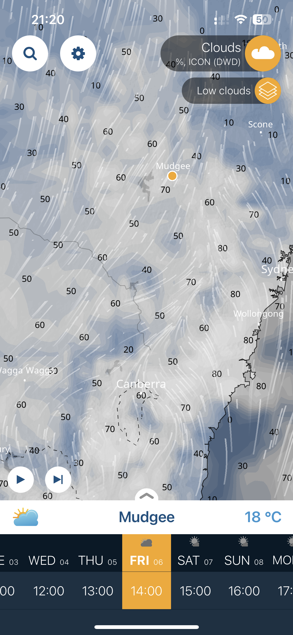
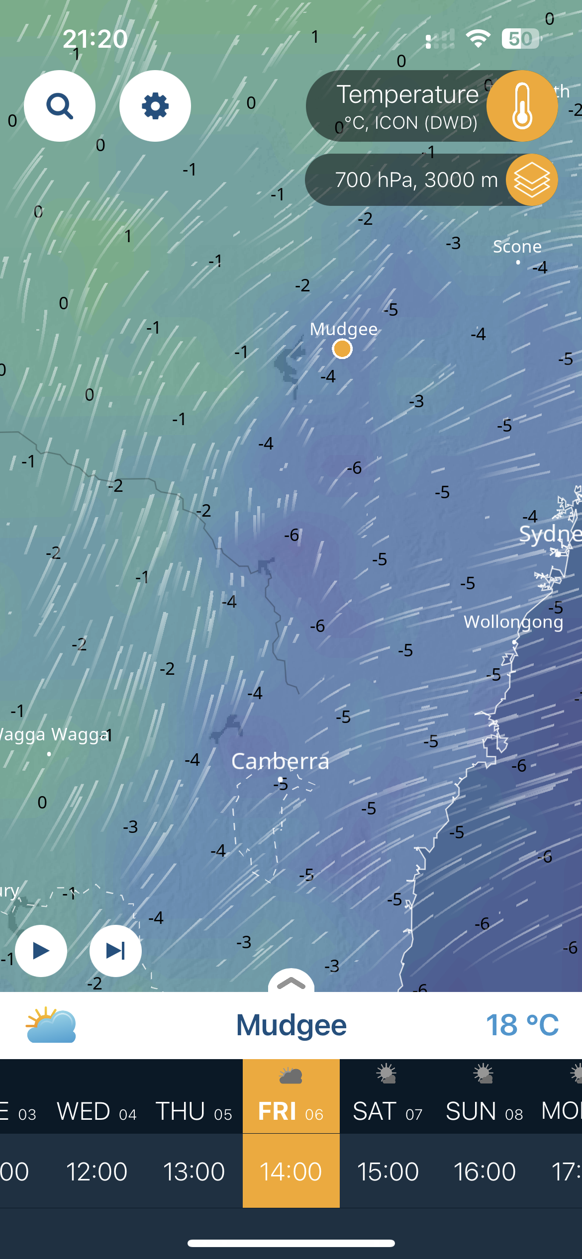
The Ventusky weather model that I use for weather forecasting (and which is not 100% dependable) shows how the weather was in the previous 24 hours. That day it showed that the temperature at MSF’s location and altitude at the time of the accident was -5C and that there was 50-70% cloud around. That reminded me of a podcast I’d listened to in 2019. It told the story of a Cirrus that had crashed due to suspected tail plane icing in the Rocky Mountains. I looked it up again and listend to it intently. There was a second podcast recorded a week or so after the first in which an aviation meteorologist explained how icing occurs and how quickly it can occur. It’s well worth a listen:
It turns out that -5C is probably the middle of the band for clear ice, the most dangerous sort of ice for airframe icing. Clouds can contain supercooled water droplets that are liquid at -5C but freeze on impact on flight surfaces and can quickly build up a layer of ice that significantly changes the shape profile of the wings and tailplane and increases the stall speed considerably. The thing that keeps aeroplanes flying is the aerodynamic shape of the wing. If that shape changes even slightly the resultant lift reduces significantly. Flight into known icing (FIKI) conditions are banned for that reason for aircraft like MSF that don’t have any anti-icing equipment on board. So the question was why would our friend have flown that high if the temperatures were in the icing range and there was cloud about?
My mind went back to my only icing encounter so far. I hadn’t had my instrument rating very long. I was PIC and was flying with Mike and Sigi from Redcliffe to Cessnock in the Hunter Valley in 2018. We were flying IFR over the Barrington Tops at 8000ft in IMC conditions, going in and out of cloud. All was going well. We had another 30 or so minutes flight time to our destination. Mike received a text from Rebecca Penny (from Cirrus) who had flown into Cessnock ahead of us. She wrote that the conditions in Cessnock were atrocious. Low ceiling of 8/8 cloud and rain. We may have to make a stopover at Scone where it appeared to be clear. Suddenly Mike said “I reckon I can see some ice forming on the wing”. I thought back to the graphical area forecast I’d checked that morning. The freezing level was forecast to be greater than 10,000ft in Brisbane but down south it was 8000ft. What was the outside air temperature probe saying? Four degrees! That’s too close for comfort. We had to descend to warmer air. Mike called ATC and said we were descending to our lowest safe altitude of about 6600ft. As we descended the temperature rose to about 7 degrees and the ice started to melt. But as we went further south the temperature started to decrease again. We could see clear air between the clouds out west near Scone so decided to head that way but before we were able to notify ATC of our intentions we burst out of the cloud and were in clear air again. We could see the landscape below us and could descend to an altitude where the ice would melt completely and no further ice would form as were were no longer in cloud.
I was fortunate in that case to have had Mike keeping an eye out for me. If Mike hadn’t been there it may have well ended differently. Since that day the freezing level is the first thing I look at on the graphical area forecast. It’s not often a problem in Queensland but it can be and you have to be sure, especially if you’re flying further south.
Recent model Cirrus aircraft are fitted with autopilots with an FLC (Flight Level Control) button for climbing and a VS (Vertical Speed) button for descending. An FLC button ensures that you maintain a set airspeed as you climb, so your vertical speed will decrease as you get higher and the air becomes less dense. A VS button maintains a constant vertical speed as you descend. MSF was an early model Cirrus and the autopilot wasn’t fitted with a FLC button for climbing. All it had was a VS (Vertical Speed) button. The VS can be used for climbing but the pilot has to monitor the airspeed and ensure they stay above the stall speed as they climb, reducing the vertical speed setting if necessary.
I can see how someone who is used to flying in Queensland and northern NSW could possibly overlook the freezing level on the Graphical Area Forecast as I did. As MSF didn’t have an FLC button, the airspeed would have decreased gradually as it climbed out of Canberra. He could have been distracted by the excited children and, having set the VS on the autopilot for a steady climb rate to 10,000ft, may not have noticed the airspeed decaying or the build up of ice on the wings, resulting in the stall speed gradually increasing to meet the ever receding airspeed.
Once it did stall, a sudden wing drop could have led to a spin. The only action to do in that situation is pull the CAPS handle. This would deploy the airframe parachute that is standard on every Cirrus and the plane could then float to the ground under the parachute. They’d land fairly gently and all would survive even if the plane may be a write off.
So why didn’t our friend pull it then? Maybe he had a medical incident such as a heart attack due to the sudden stress and wasn’t able to use the necessary force. Maybe he was too slow due the shock factor. That could happen to anyone. It could have happened to me. There but for the grace of God…
In the weeks following the initial 2 weeks of recovery from the shock of the accident I focussed on trying to get back flying again. I decided it was best to first have some flights with an instructor, as a bit of insurance and to “chase away the demons”. So first was a “check flight” with Brendan Power in IVW, one of the IFR rated 172s at Redcliffe, the one I usually hired for practising night circuits. We did a few daytime circuits on a sunny day with emergency drills thrown in, landing without power, flapless landings and the like. That all went well. Then it was a more challenging IFR flight with Adam Starr in a brand new Cirrus SR22G6 from Archerfield to Warwick and back with a night component and a couple of hand flown instrument approaches under the “hood” with partial panel (just to make it more challenging). They were not ideal but introduced some very useful lessons that you should only learn when a good instructor is sitting next to you. The 25 knot crosswind on the night landing into Archerfield didn’t help either. After arriving a bit high on the initial approach I did a go around and circuit. My original plan to fly a few night circuits was cancelled due to the wind and we called it a night after the first, somewhat hard, landing.
I decided I definitely needed some more lessons in the G6 to become familiar with the Perspective Plus avionics suite before I hired one to fly solo. However, I did feel confident enough to fly IVW again so got back to hiring aero club planes once again.
October 2025 – ATSB Investigation Conclusions
I wrote that first part of this post shortly after the accident, when all the thoughts and emotions were fresh in my mind. It was cathartic. Helped me deal with the thoughts that sometimes kept me awake at night. I parked it though, leaving it as a draft, wondering whether to post it or not, and deciding I’d wait until the final ATSB report was published.
Two years have passed since the accident and Mike has bought a new Cirrus and we have all moved on, but are still very cognisant of the accident. The ATSB took over two years to investigate. There were limited radio communications between the pilot and the ATC to analyse and no “black box” and not even much of the aircraft left to examine but the ATSB did have detailed weather data from the BOM and the flight tracker data from the aircraft’s ADSB transponder. On 6th October 2025 they published their final report. It summarises their findings as follows:
“The ATSB found that the flight track data showed that, at about 8,000 ft, the aircraft had begun to deviate from its flight track, with heading, altitude and airspeed deviations. Those deviations coincided with reports from ear witnesses located below the aircraft’s flight path of sounds consistent with engine surging.
The data also showed that the aircraft had a high rate of climb (up to 1,500 ft/min) coupled with a low and decreasing airspeed, which led to an aerodynamic stall and rapid descent. Recovery actions from the aerodynamic stall did not occur and the Cirrus aircraft parachute system was not deployed in-flight. It was also noted that no radio calls were received from the pilot to indicate there was a problem prior to the stall.
VH-MSF was not fitted with an anti-icing system and was prohibited from operating in icing conditions. Moderate icing conditions were forecast along the aircraft’s flight path from 7,000 ft to 10,000 ft when in cloud. It was likely that the aircraft had encountered icing conditions prior to the aerodynamic stall. However, the ATSB was unable to determine if these conditions were sufficient to have adversely affected the aircraft’s performance and/or handling.
The ATSB considered several scenarios to establish the reason for the deviations in flight track, subsequent stall and absence of recovery actions. These included in-flight icing, pilot incapacitation and possible aircraft issues. However, due in part to a significant post-impact fire, which limited the collection of evidence, the circumstances preceding the stall and impact with terrain could not be determined.
Although it could not be established that icing contributed to the accident, operating in these conditions in aircraft that are prohibited from doing so increases the risk of a loss of control event leading to an accident. Aircraft flying through cloud in sub-freezing temperatures are likely to experience some degree of icing. A pilot can reduce the chance of icing becoming an issue by selecting appropriate flight routes, remaining alert to the possibility of ice formation and knowing how and when to operate de-icing and anti-icing equipment if fitted.”
The accident was traumatic for all involved, not least of all for the family of those killed, and it affected many of us at the aeroclub who’d known the pilot and flown with him. We need to learn from mistakes however and, as a result of the accident, I gained an appreciation of the serious dangers of icing and certainly avoid going anywhere near cloud when temperatures are less than 5 degrees positive. I also keep a close lookout for ice formation when flying in IMC if the temperature is slightly warmer. Something that I should have done as soon as I started to fly under the instrument flight rules.
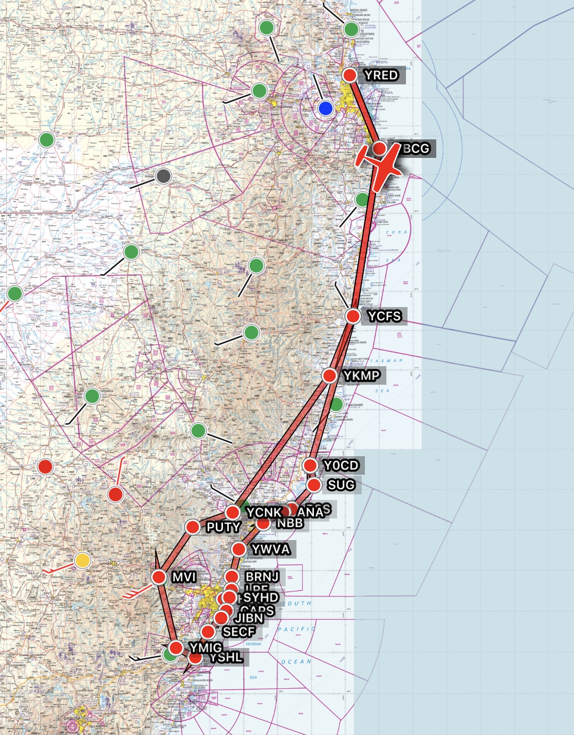
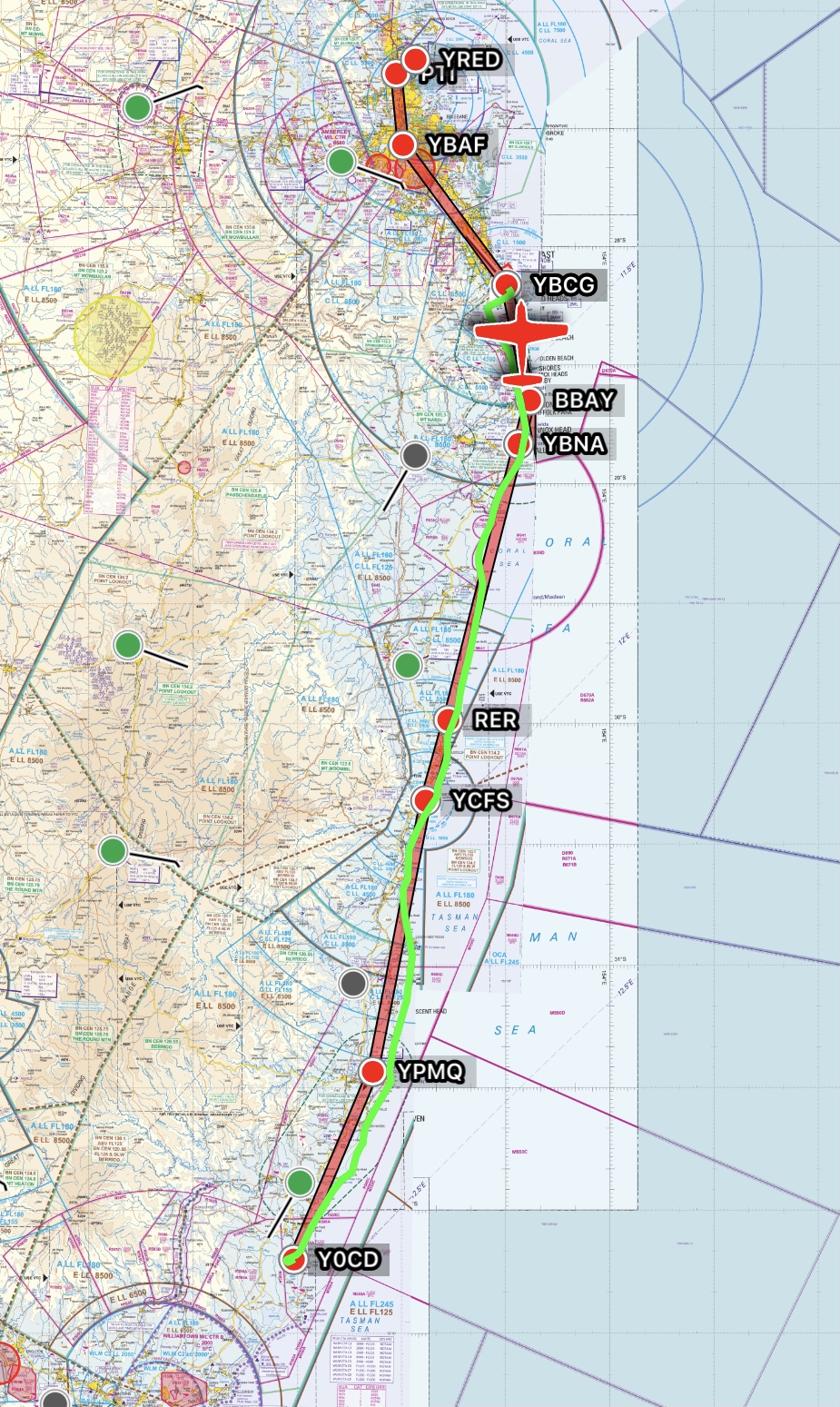
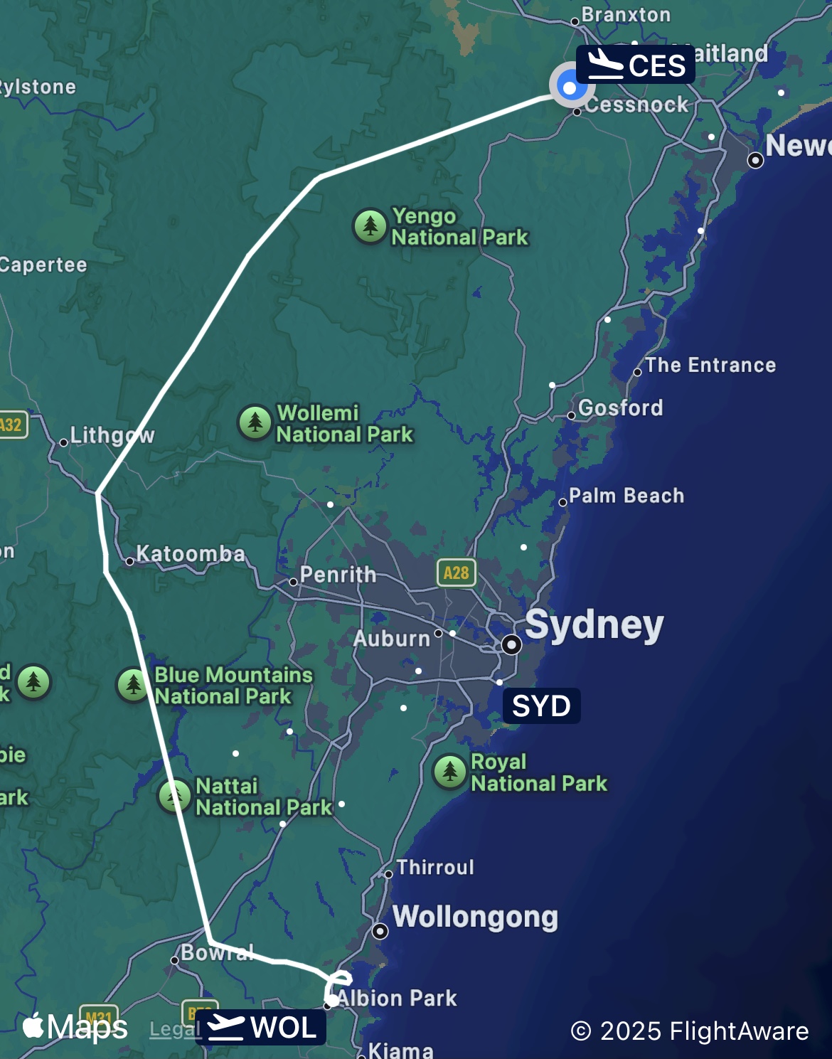
Gold Coast – Forster/Wallis Island – NSW coast – Sydney Harbour – Victor 1 – HARS Museum – Blue Mountains – Hunter Valley
On the morning of Sunday 21st September 2025 I was dropped off at the General Aviation area at the Gold Coast International Airport. I was due to meet Mike Cahill and Brad Green there who were about to arrive from Redcliffe in VH-MSF, as I was to join them on the annual Redcliffe Aeroclub flyaway. We’d land on an island, fly along the beach past the RAAF base at Williamtown, do orbits at 1500ft over Sydney Harbour, fly the “Victor 1” VFR route at 500ft along the coast past Bondi and Coogi beaches, spend a whole day marvelling at the collection of historical aircraft at the HARS museum near Wollongong, fly past the Three Sisters in the Blue Mountains and have a day of wine tasting in the Hunter Valley. What a program!
Flyaway Route
Five other aircraft with 12 other club members and families/friends had departed the previous day for Wallis Island, a grass airstrip near Forster, north of Newcastle, and we were to meet up with them there. MSF landed and after a short discussion of our flight plan we climbed aboard and, with Mike as PIC, took off to the south.
Gold Coast apron
It was a perfect blue-sky day as we flew coastal at 2500ft so we had amazing views of the beaches and river mouths and inlets, heading first past Byron Bay for Ballina.
Richmond River at Ballina
A few minutes later we were passing Evans Head.
The Evans River flows into the sea at Evans Head
The RAAF bombing range south of Evans Head was inactive so we could continue to fly low along the beach and were soon were passing Yamba.
Clarence River mouth at Yamba
The beaches and river mouths were just stunning as we headed further south past Wooli.
Wooli Creek
At Red Rock we obtained a clearance from Coffs Tower to transit the Coffs Harbour controlled airspace and passed Woolgoolga.
Woolgoolga with blueberry fields on the hills behind
Bringing us to Coffs Harbour, where we had a great view of the town and airport as we passed.
Coffs Harbour with airport on the left
The spectacular views just continued with Nambucca Heads being next on the list.
Nambucca Heads
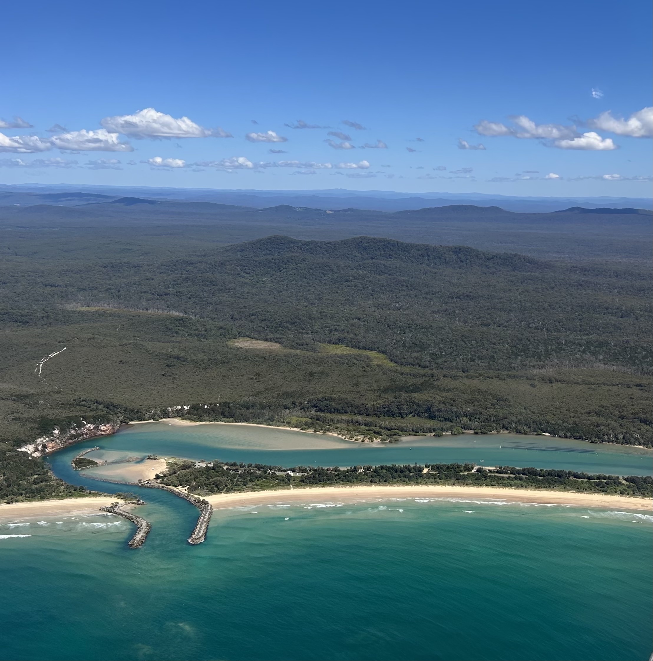
Further on we passed Port Macquarie and Diamond Head, one of the many picturesque headlands that jut out into the sea.
Diamond Head
There was virtually no wind and no clouds the whole way so we had amazing views of the coastline with its myriad lakes, rivers and inlets and just so many deserted beaches. We really are fortunate to have such a great coastline in New South Wales and Queensland.
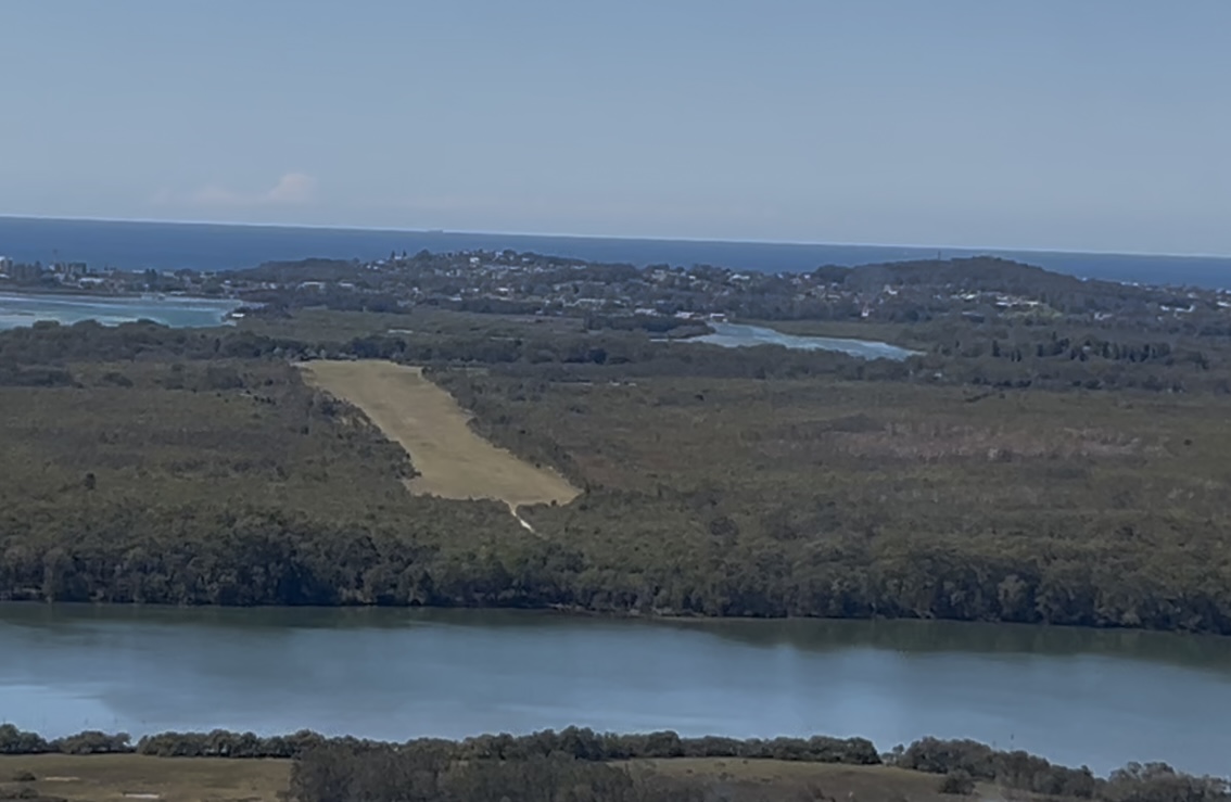
After about 90 minutes of simply amazing views we descended into Wallis Island, where we were planning to park the plane overnight.
On approach into Wallis Island with Forster in the background
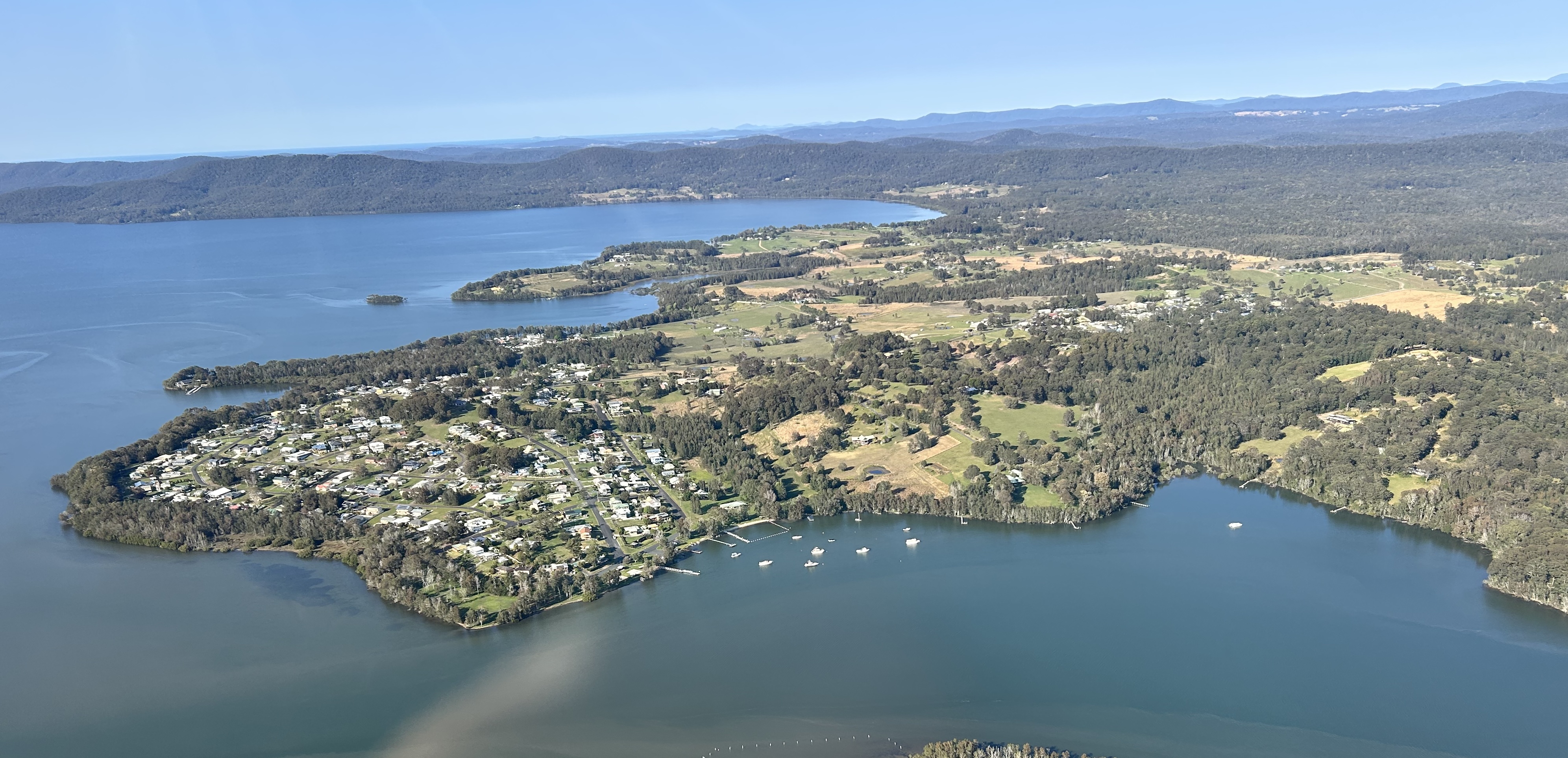
Landing on the smooth grass strip and were met by John Tkalec, the owner. John’s a builder/developer who lives in Cessnock in the Hunter Valley but is planning to develop the land on the island into a small resort/venue as a “retirement project”. He has a Beechcraft Bonanza that he flies between Cessnock and the island and has a small boat that he used to ferry us across to the Forster jetty. We checked in, explored the town centre and met up with the rest of our party surprise! surprise! at the local boutique brewery, later enjoying delicious Italian food at the Sicily Restaurant. A great start to the trip.
Screenshot
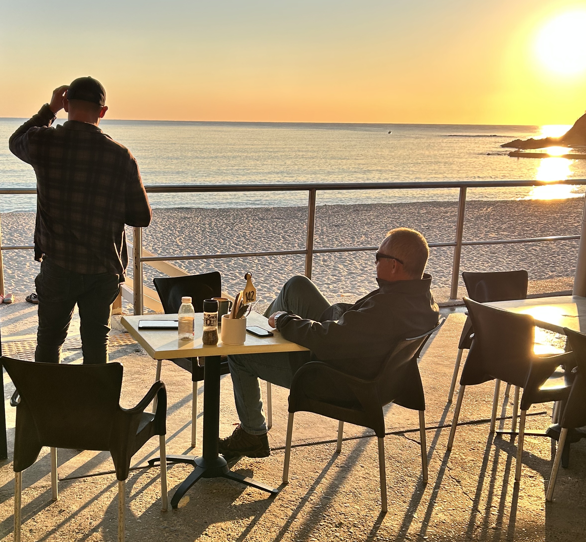
Monday 22nd September we watched the sun rise over breakfast at a Forster beachside café at 6am.
We met John at the town jetty at 7am for our 5 minute ferry transfer back to Wallis Island.
Once again, the weather gods were being kind and we had blue sky with minimal high-level cloud and not much wind. John delivered us to the airstrip and after preflighting the aircraft we we started the flight to Warnervale.
Wallis Island had commercial flights last century
Taking off we followed the coast to the south.
Departing Wallis Island
On this leg we flew past the Williamtown RAAF base so had to obtain a clearance to fly along the VFR route that begins at 2000ft at Sugarloaf Point. MSF was cleared to fly at 1500ft from Ana Bay to Nobbies Headland in Newcastle, that gave us a great view of the RAAF base and runway as we passed.
There was no obvious activity at the airport so I think the ATC were happy to have something to do and were very accommodating.
We flew along the wide Stockton Beach that led to the mouth of the Hunter River at Newcastle.
Leaving the RAAF’s controlled airspace we passed Newcastle.
Climbing to 2500ft we flew over Lake Macquarie Airport and the lake itself, touching down in Warnervale about 30 minutes after departing Wallis Island.
Short Finals Warnervale
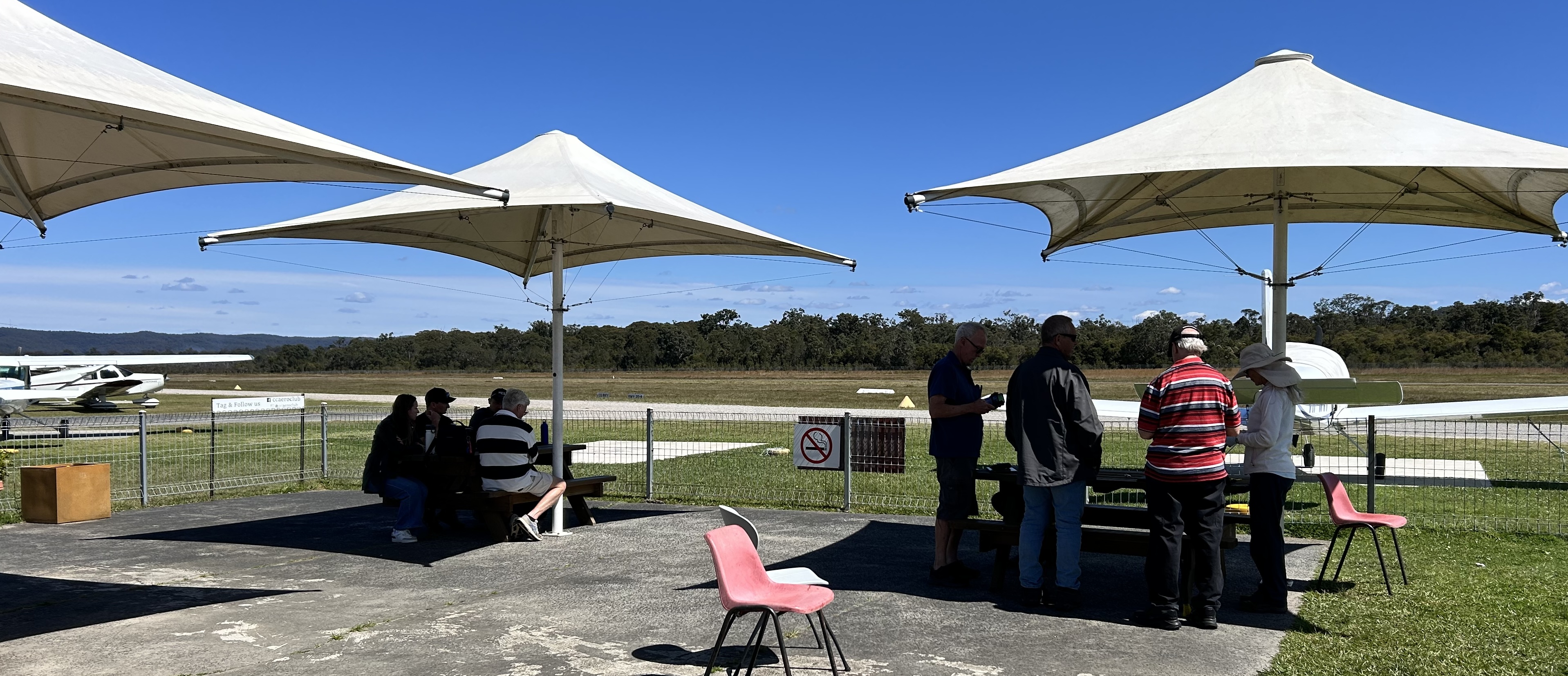
Our stop in Warnervale was an opportunity to add some fuel for the next leg to Shellharbour near Wollongong and to chat with the instructors and students of the local aero club.
Waiting at Warnervale
We were planning to ask for a clearance for the Sydney Harbour Scenic, which allows light aircraft to fly at 1500ft over the harbour next to the Harbour Bridge and the Opera House. Whether you obtain a clearance is dependent on weather, the amount of traffic in the area, the direction that the Sydney International jets are departing, and the workload of the air traffic controllers, so the planets had to align for all six of our aircraft to be cleared. If the jets are taking off to the north some can pass low over the harbour as they turn to the east, so ATC rarely let you do a harbour scenic in that case. It’s best to attempt the flight when the wind is from the south and the jets are departing to the south. Paul Smeath, who had organised the flyaway, had been talking to ATC in the Sydney tower for a few days leading up to our visit and in a phone call early that morning they’d advised him that the wind would change from northerly to southerly around 11am so if we arrived after 12 noon the jets would most likely be taking off to the south and it would give us the best chance of a clearance.
So, we unpacked and tried on our life jackets (needed for low level flying over water) sat in the sun outside the aeroclub office and drank coffee and chatted and waited until 11:30 when Paul confirmed that ATC had indeed changed the runway direction. That was the signal for MSF as lead aircraft to start up and taxi out.
We’d agreed the order in which the others would fly and that we’d delay take-offs to provide about 15 minutes separation between each aircraft. That would allow each aircraft to vacate the Harbour Scenic route before the next one asked for a clearance.
Brisbane Water near Gosford
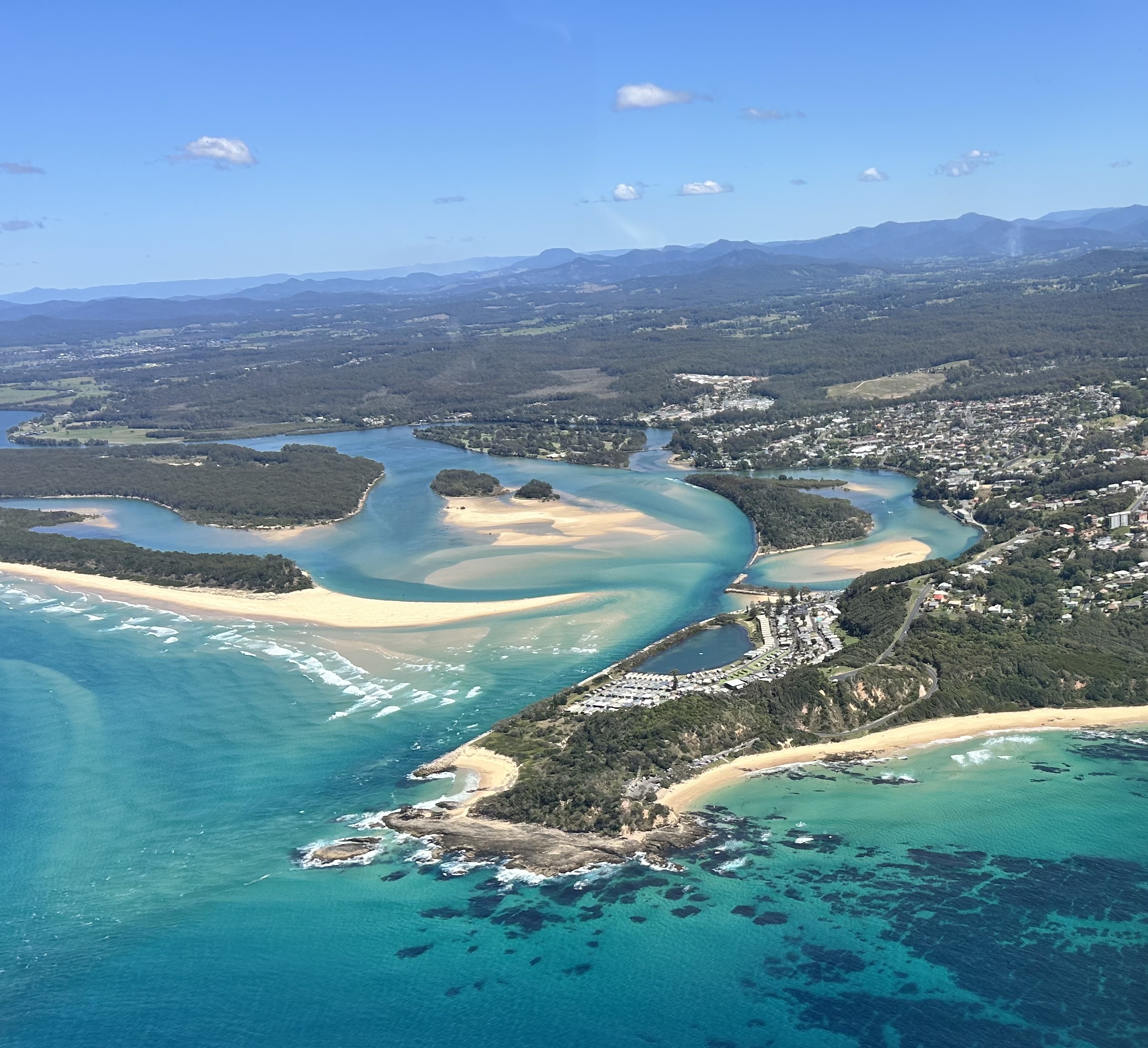
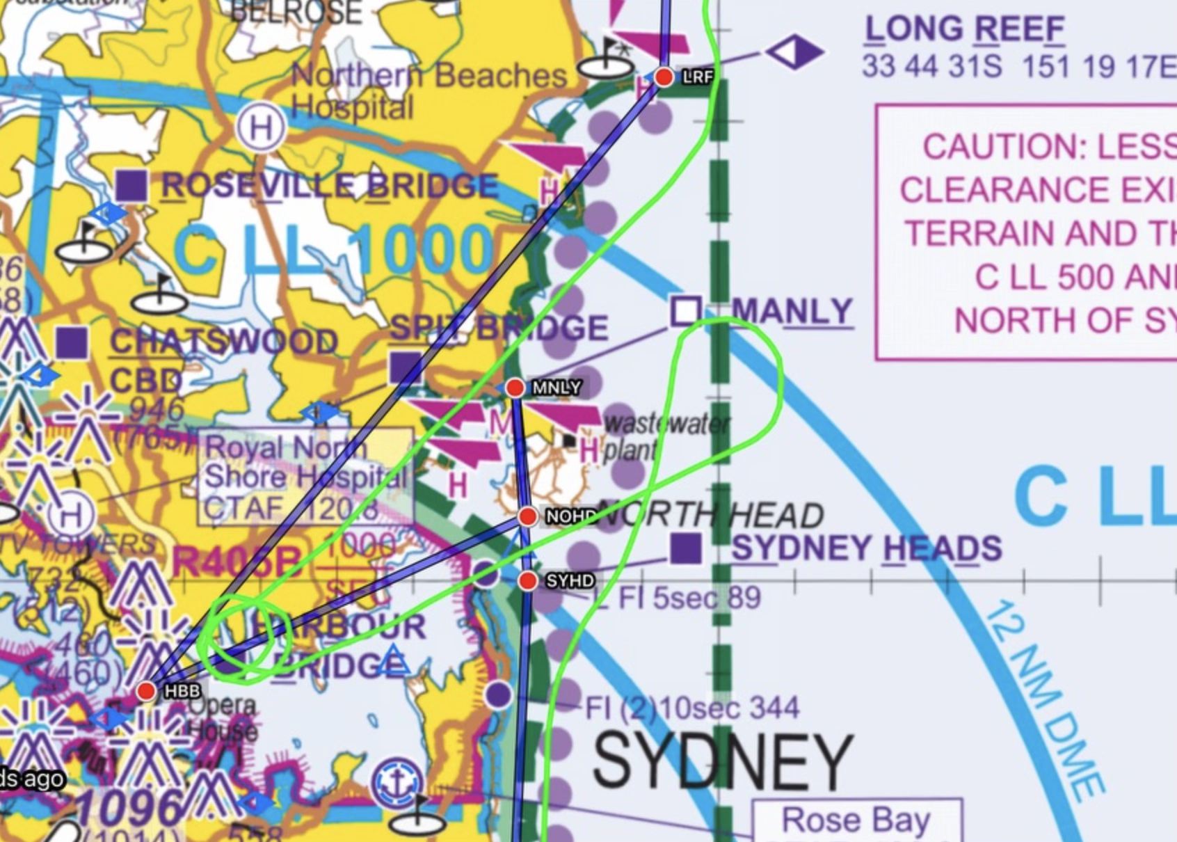
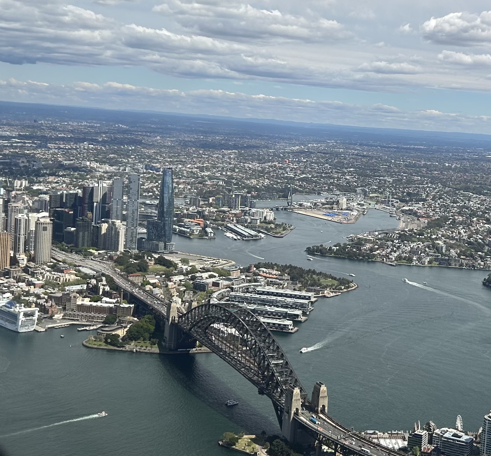
MSF took off at 11:45 and ten minutes later we passed over Brisbane Water and the mouth of the Hawkesbury River at Barrenjoey Head on our way to Long Reef where we’d ask for our clearance. Listening out on the Sydney ATIS we obtained the local QNH and then called up Sydney Tower for the clearance. They gave us a squawk code and then flicked us to Sydney Approach who almost immediately cleared us from Long Reef for Harbour Scenic 1. We’d done it!
Harbour Scenic Route
Tracking directly for the harbour bridge we passed over the Spit Bridge and were soon over Kirribilli and going into the first of two orbits. We had a spectacular view of the bridge, the opera house and the entire CBD.
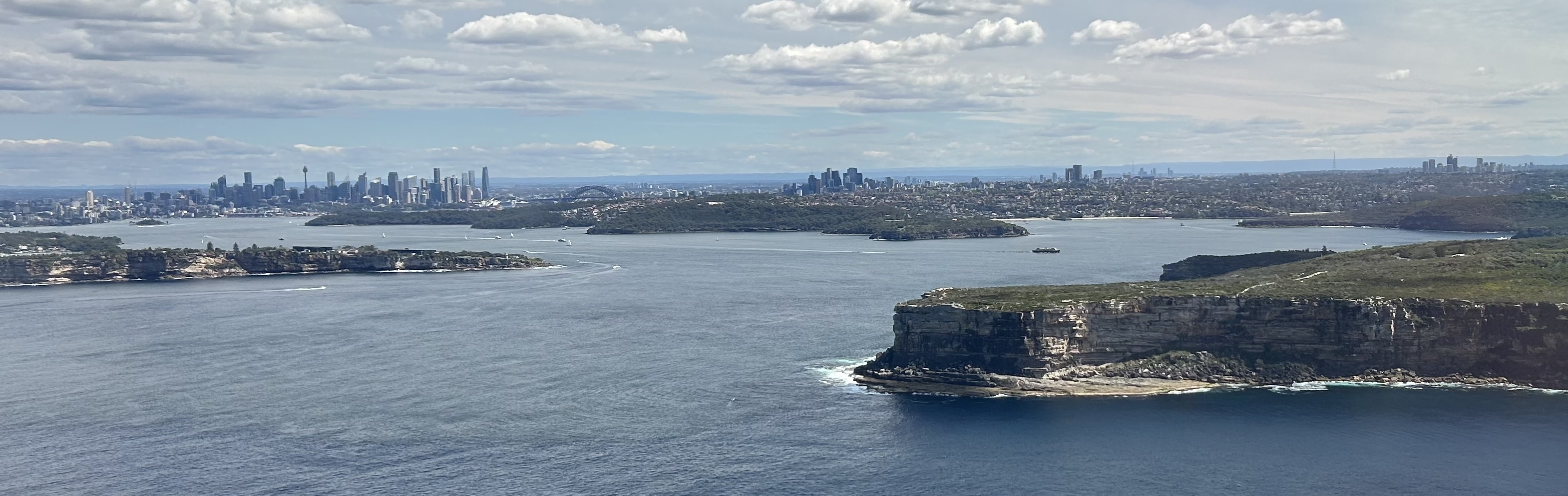
Just as quickly as we’d arrived, we were heading back out to North Head where we requested a clearance to leave controlled airspace on descent at Manly and turned south, entering the Victor 1 South at 500 ft at North Head.
North Head with view to the CBD
Next came South Head and some amazing houses in Vaucluse that are perched on the edge of the very high cliffs.
Vaucluse
Just around the corner was Bondi Beach, then Coogee Beach and eventually Botany Bay, with the big jets taking off overhead.
Bondi
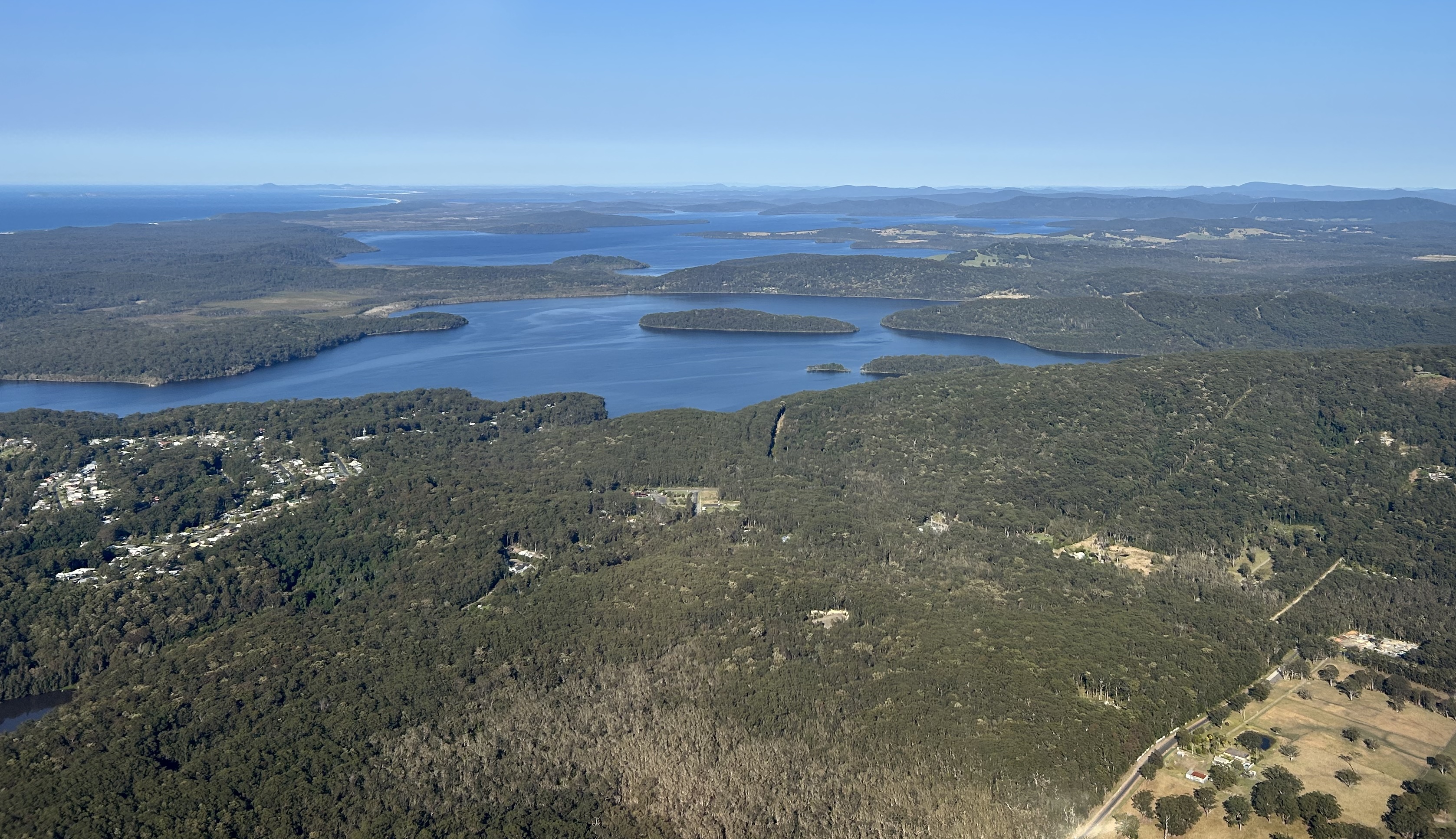
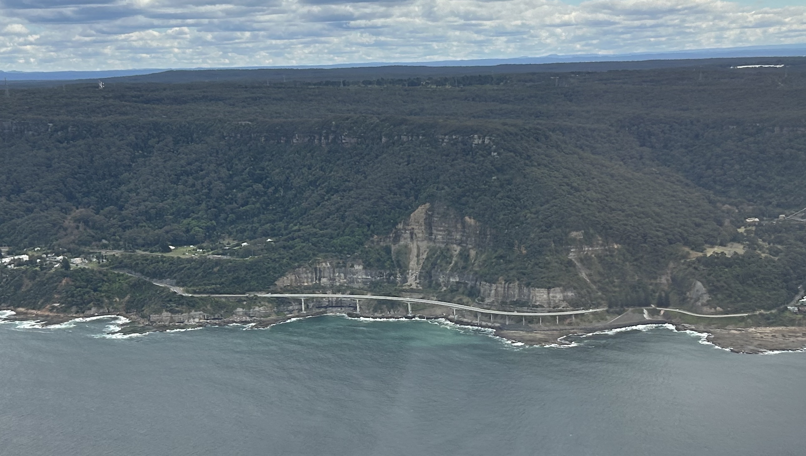
After leaving Victor 1 we could climb to 2500ft and had great views of the wilderness area that is the Royal National Park, Australia’s first national park, with its limestone cliffs and the Sea Cliff Bridge.
Seacliff Bridge
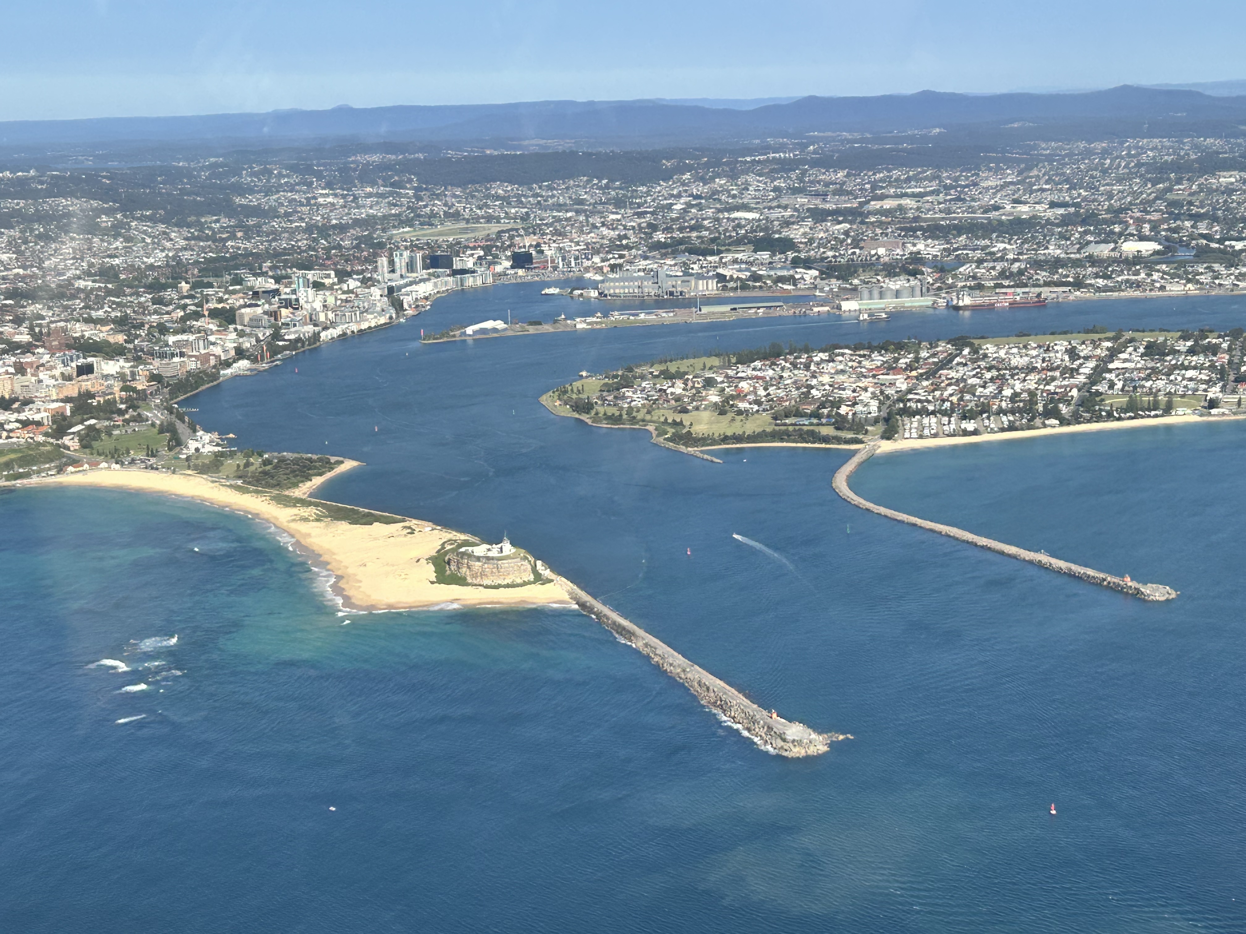
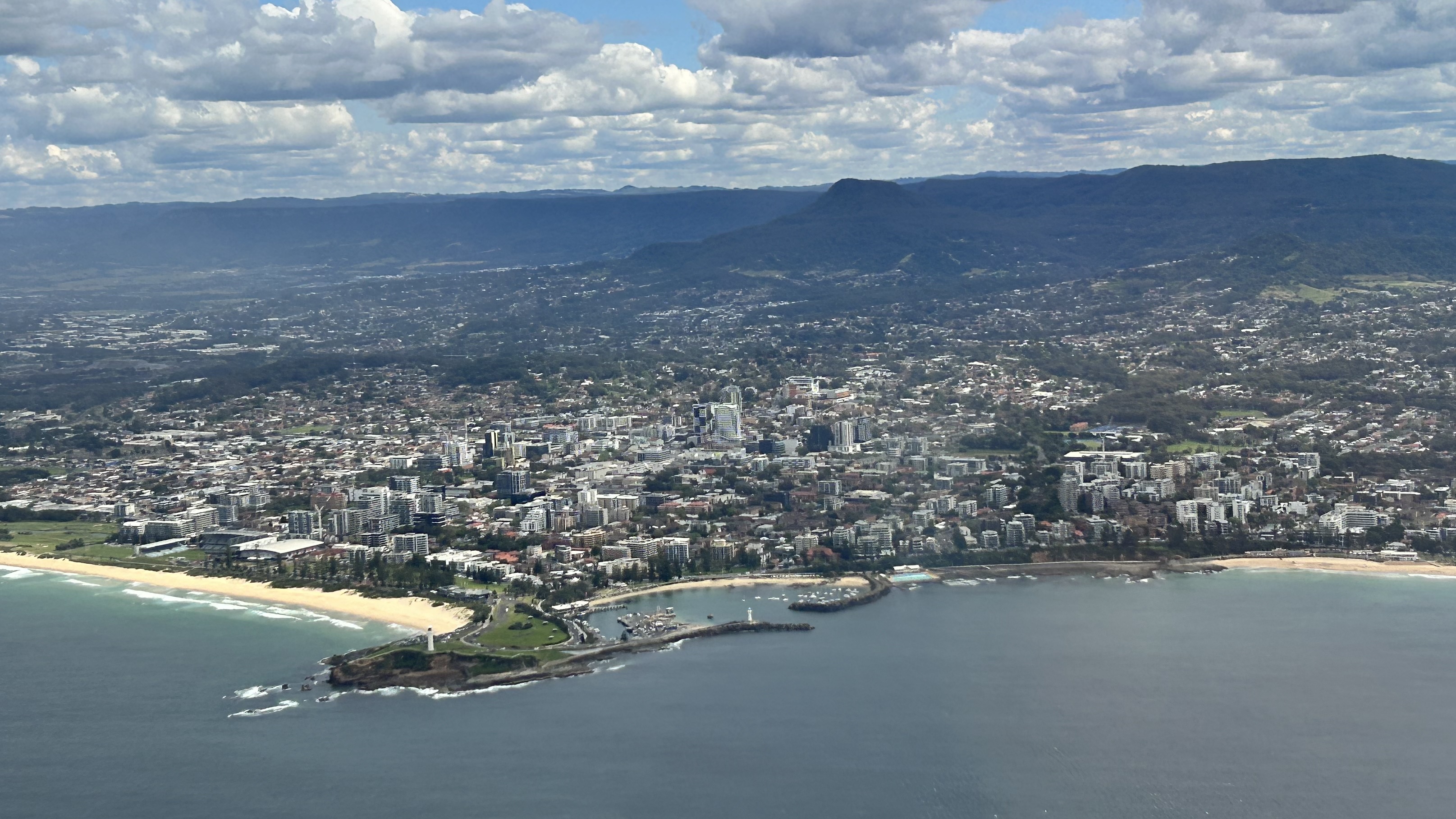
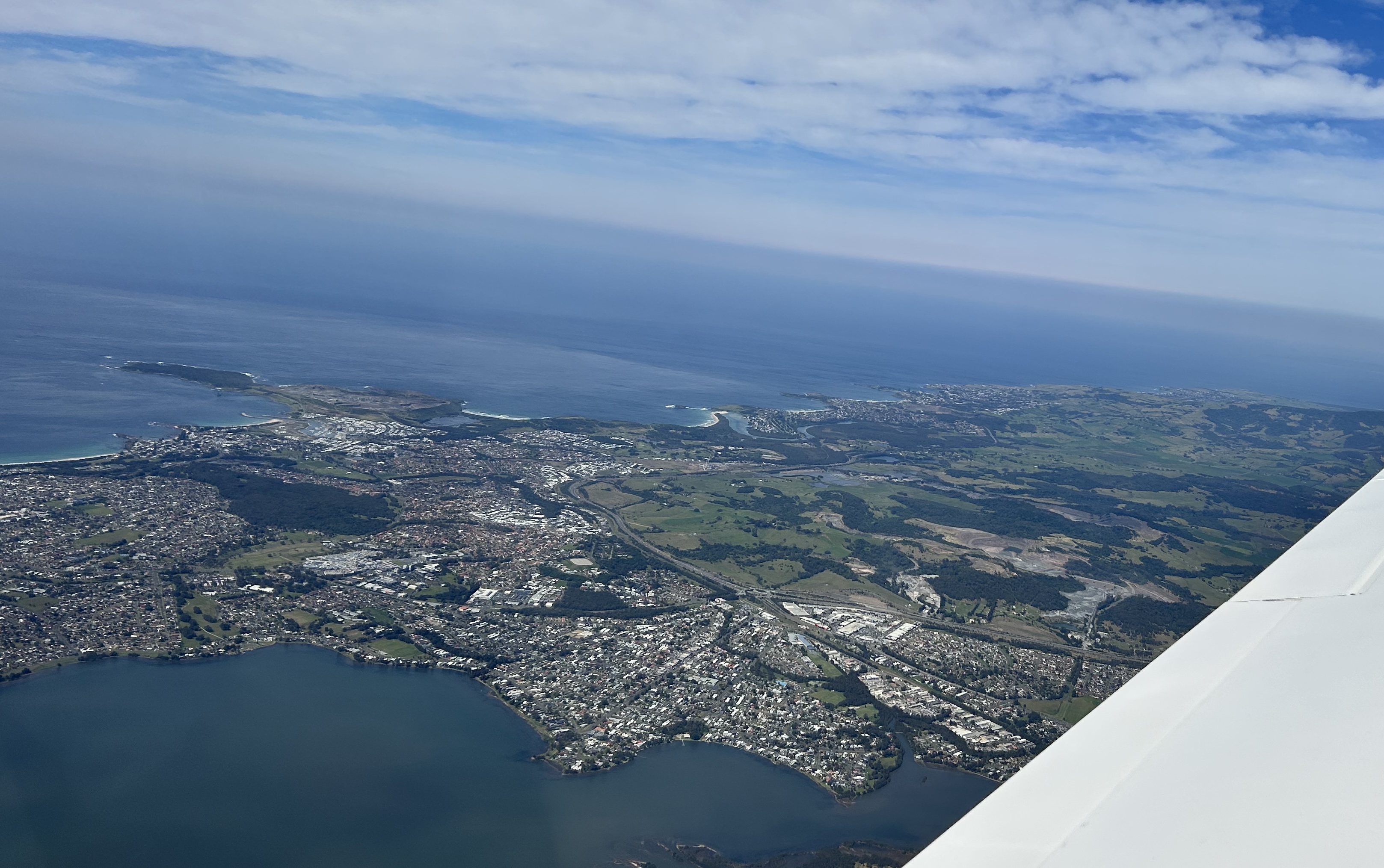
A few minutes later we were at Wollongong.
Wollongong
At Port Kembla we turned inland and headed for Shellharbour Airport, our final destination for the day.
Shellharbour Airport
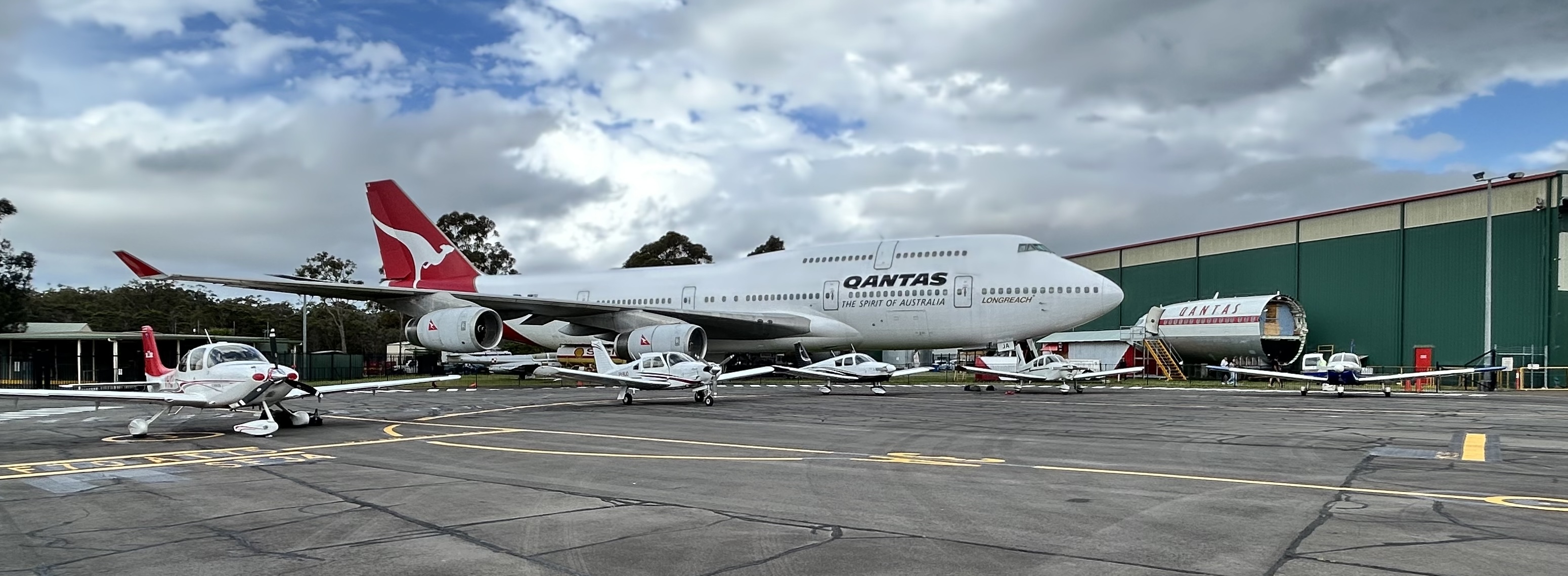
On landing we were met by Steve, one of the volunteers from HARS (the Historical Aircraft Restoration Society), who turned out to be retired Cathay Pacific 747 captain, and introduced ourselves to the local ARO who told us where we could park on the apron in front of the HARS museum and its 747.
One by one the other five aircraft landed and after a meet and greet we noticed the wind was picking up and some gusts and showers were forecast so we decided to move the aircraft and park on the grass where we could tie them down.
A two-minute Uber ride delivered us to the Oaks Motor Inn just down the road where in the evening we celebrated the fact that all six of our planes had made it not just down Victor 1 but had also all been cleared for the Harbour Scenic 1. What an achievement!
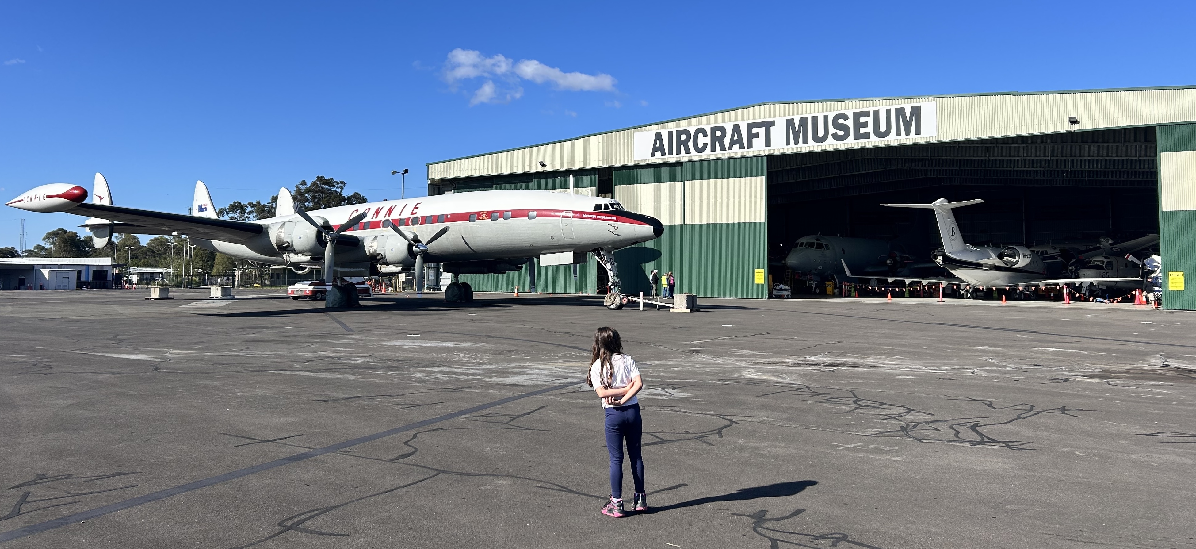
We had a lazy start on Tuesday 23rd as the HARS museum tour wouldn’t commence until 10am. It was only a 20-minute walk from the motel to the museum that is located right next to the Shellharbour airport terminal.
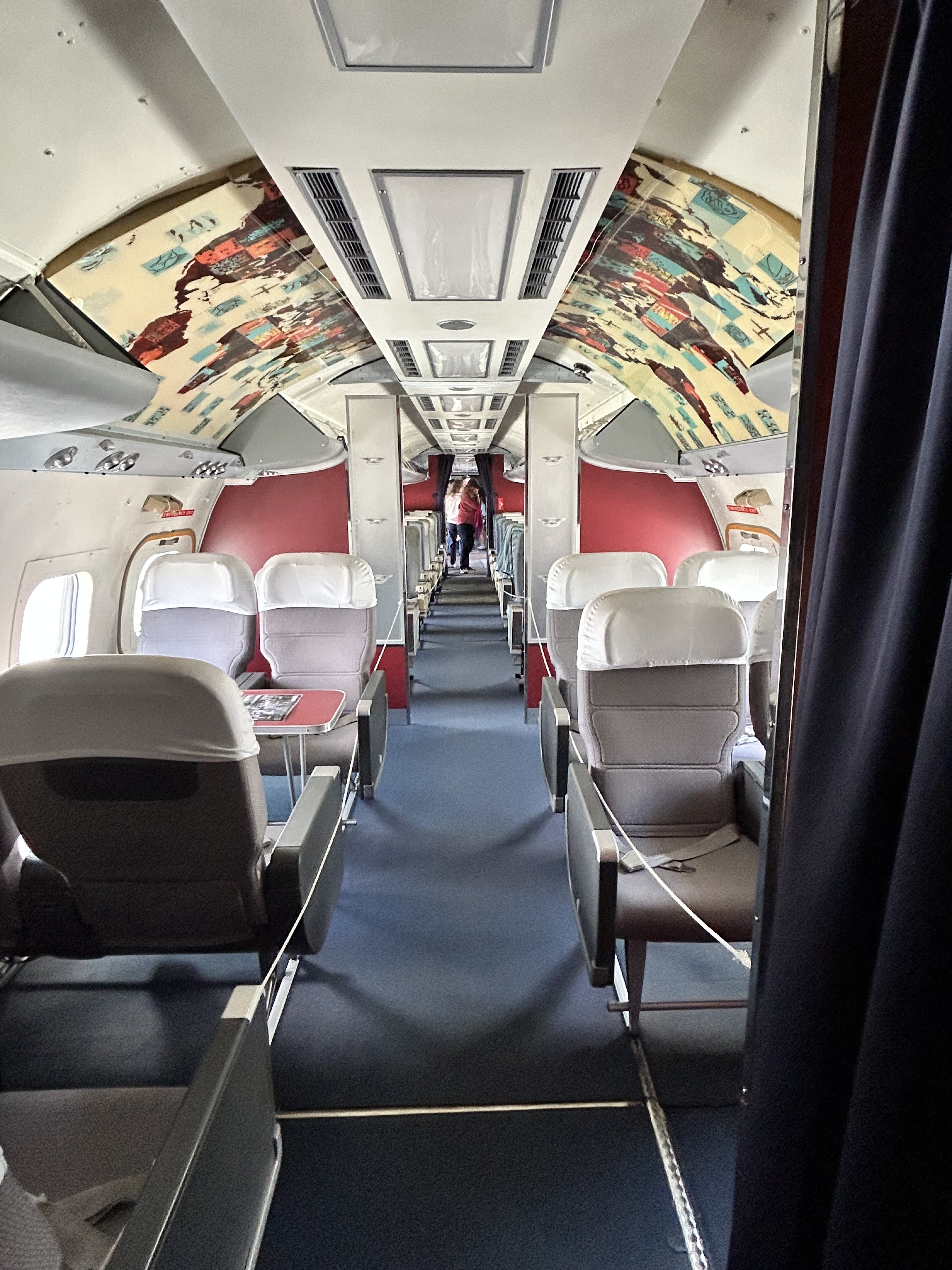
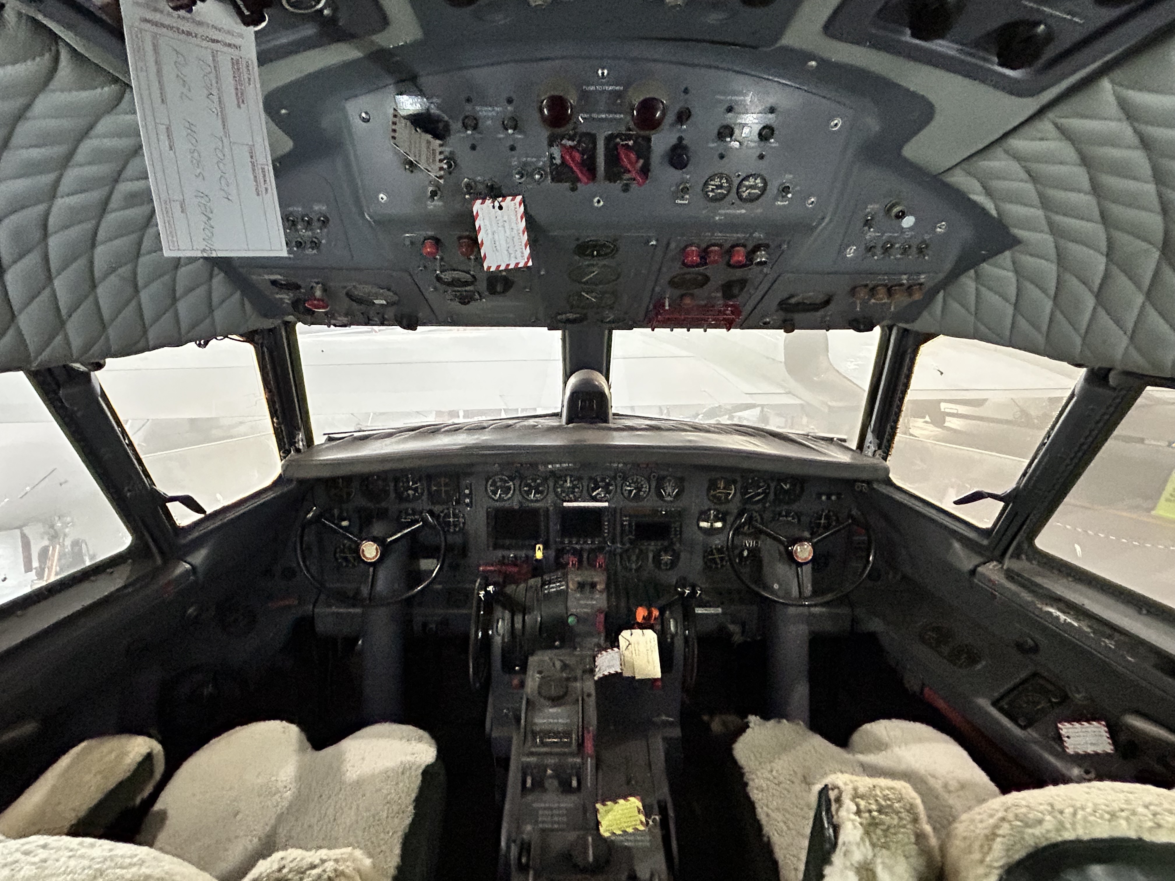
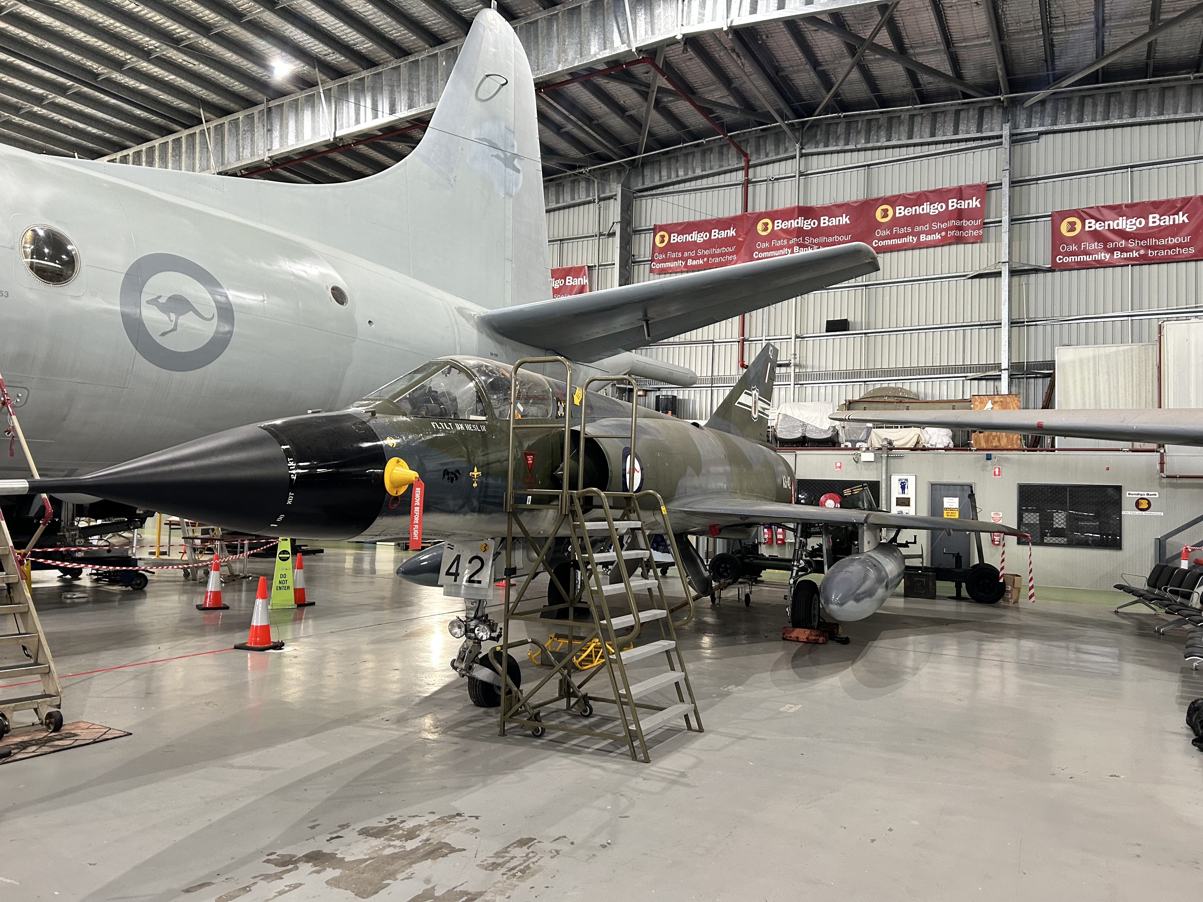
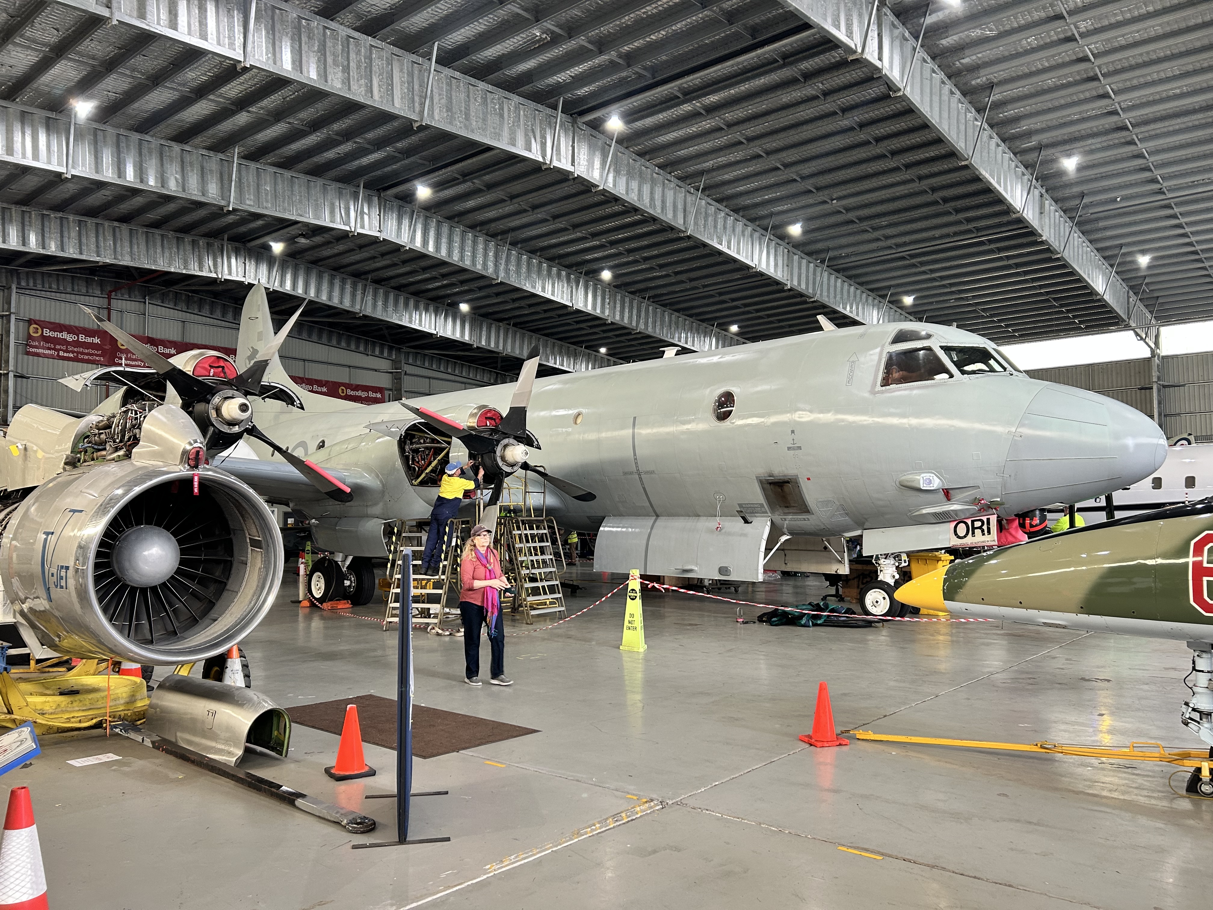
The HARS Aviation Museum is an all-volunteer group of aviation professionals and enthusiasts. Many are active or retired aviation personnel, but all someone needs to volunteer is dedication and a love of aircraft and history. They don’t receive any government funding and rely mainly on entrance fees and donations to fund the operation of the museum and the aircraft.
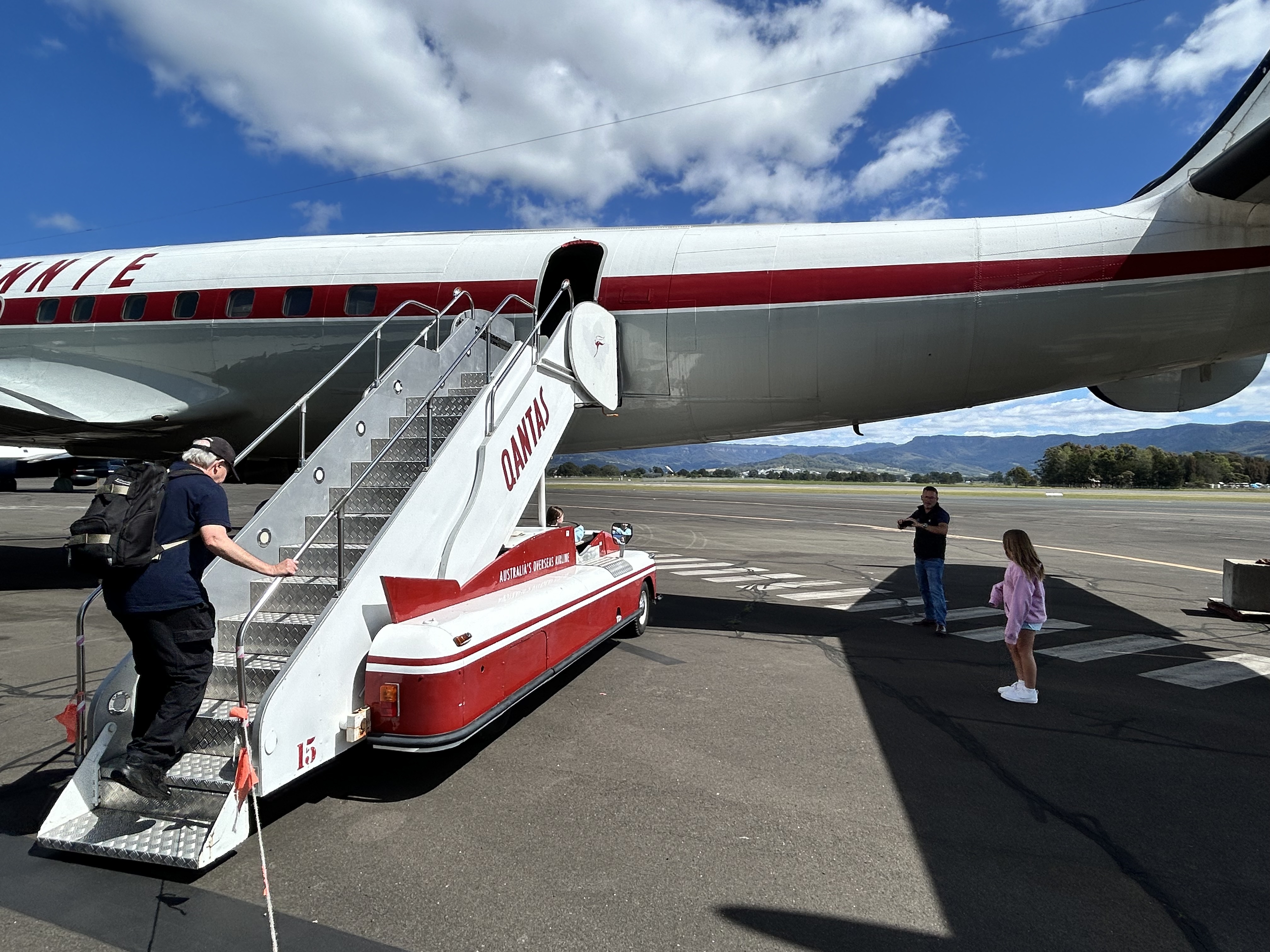
The idea for the museum originated in the 1990s when volunteers took a derelict Lockheed Super Constellation (Connie) from the Davis Montham aircraft graveyard near Tucson Arizona and restored it from almost nothing to beautiful flying condition and flew it across the Pacific to Shellharbour.
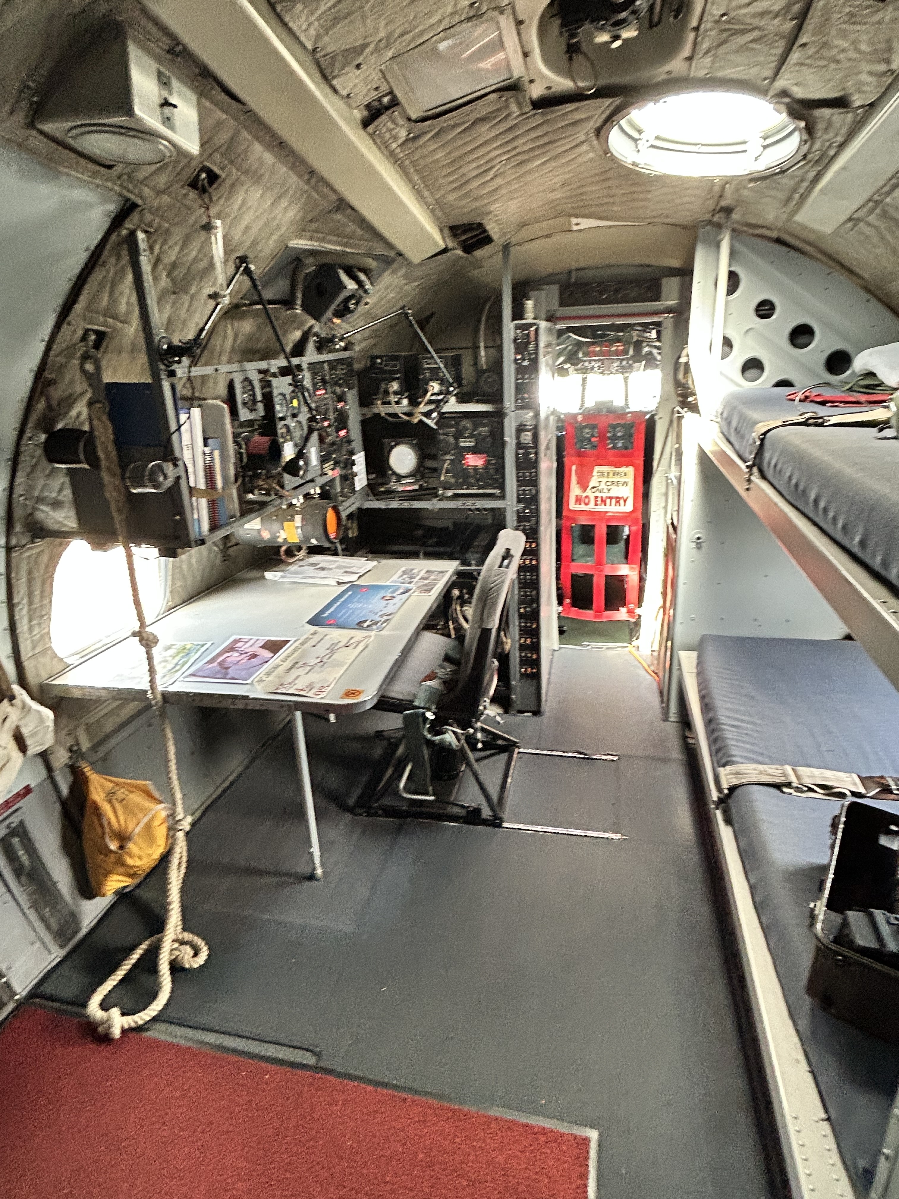
In addition to the Constellation the collection includes a 747-400 that flew both the longest flight and the shortest flight for any 747. The longest was its non-stop delivery flight from London to Sydney and the shortest was when it flew from Sydney to Shellharbour for its inclusion in the museum. And there are many other aircraft as can be seen in the photographs.
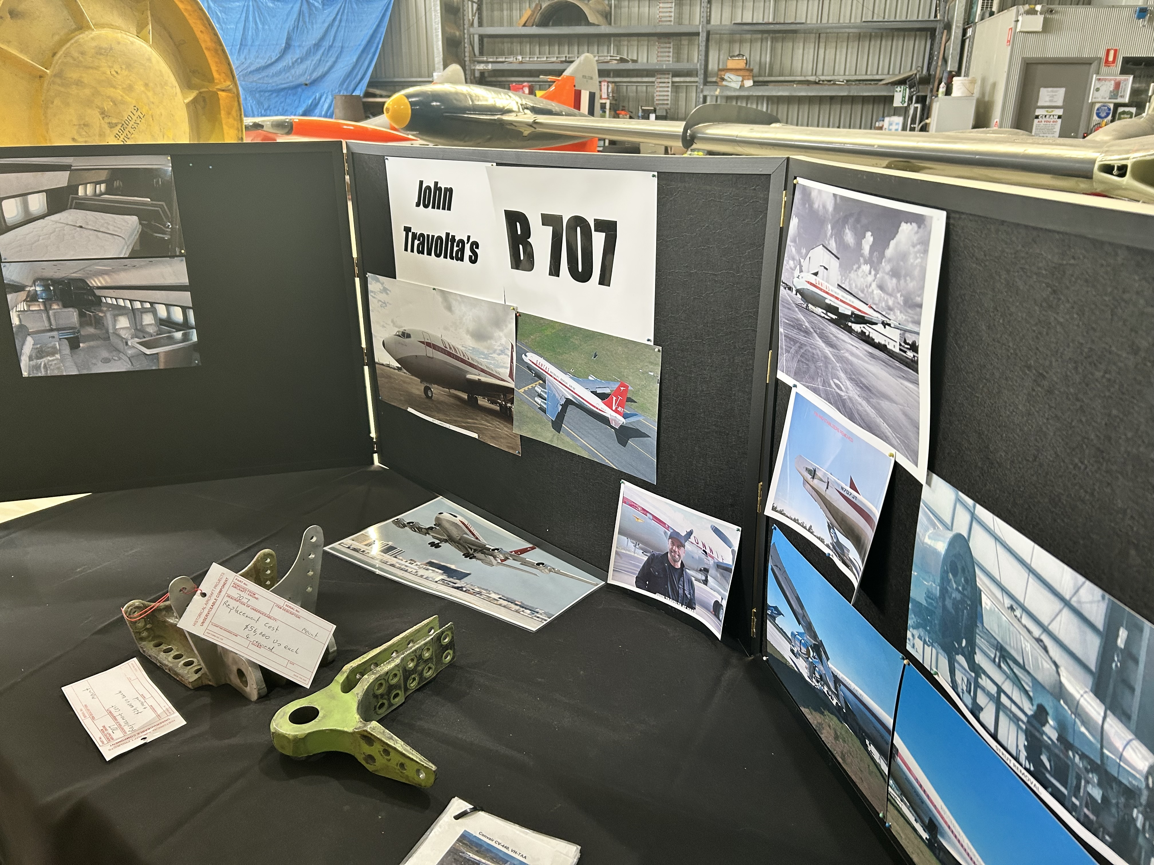
When we arrived, we were met by Peter Smith, who’d arranged the day’s tour for us and had just arrived back from the USA where he’d been dismantling the Boeing 707 that John Travolta has “donated” to the museum. It’s a big job but they hope to have it back in Australia sometime next year.
Our party was split into two groups. Peter led one and Steve led the other. What followed was a full-blown tour of the whole collection of restored and operating aircraft.
Two hours in we broke for lunch at the airport terminal cafe and then continued at 1pm for another two hours. What a day!
That evening was a quieter affair as we discussed the different routes we’d take to Cessnock the next day. Some would fly via Katoomba in the Blue Mountains while others would fly via the Richmond RAAF base.
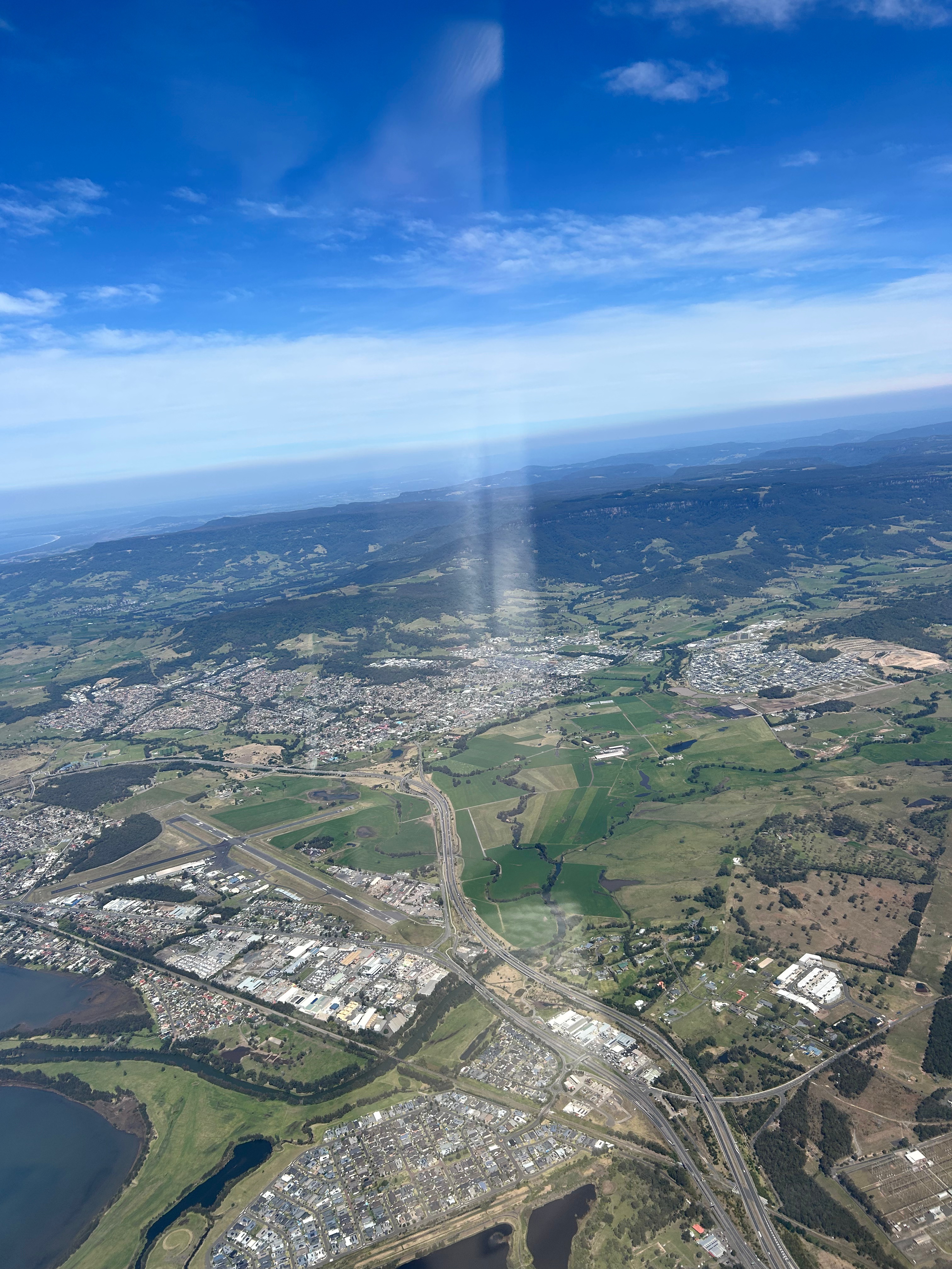
On Wednesday 24th the weather indicated winds of up to 40 knots over the Blue Mountains so we could expect to encounter turbulence and mountain waves if we were flying too low. So, I planned for 6500ft and we took off, climbing over Dapto to almost that level before heading west towards Mittagong.
Dapto
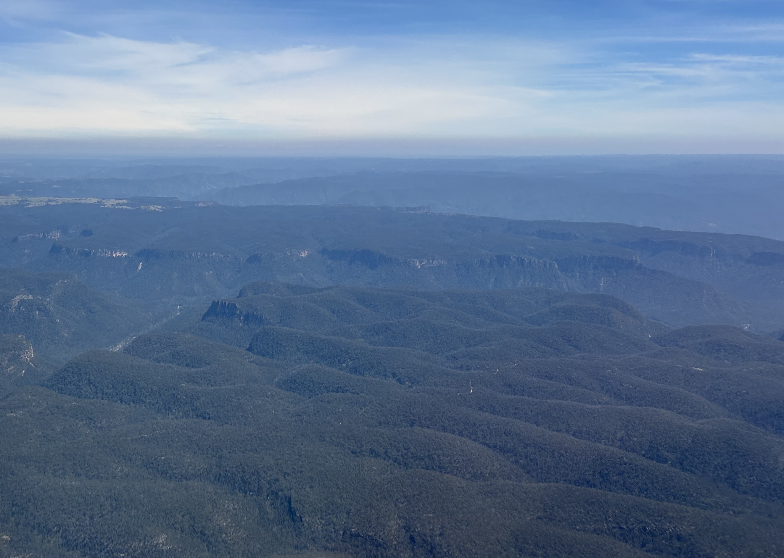
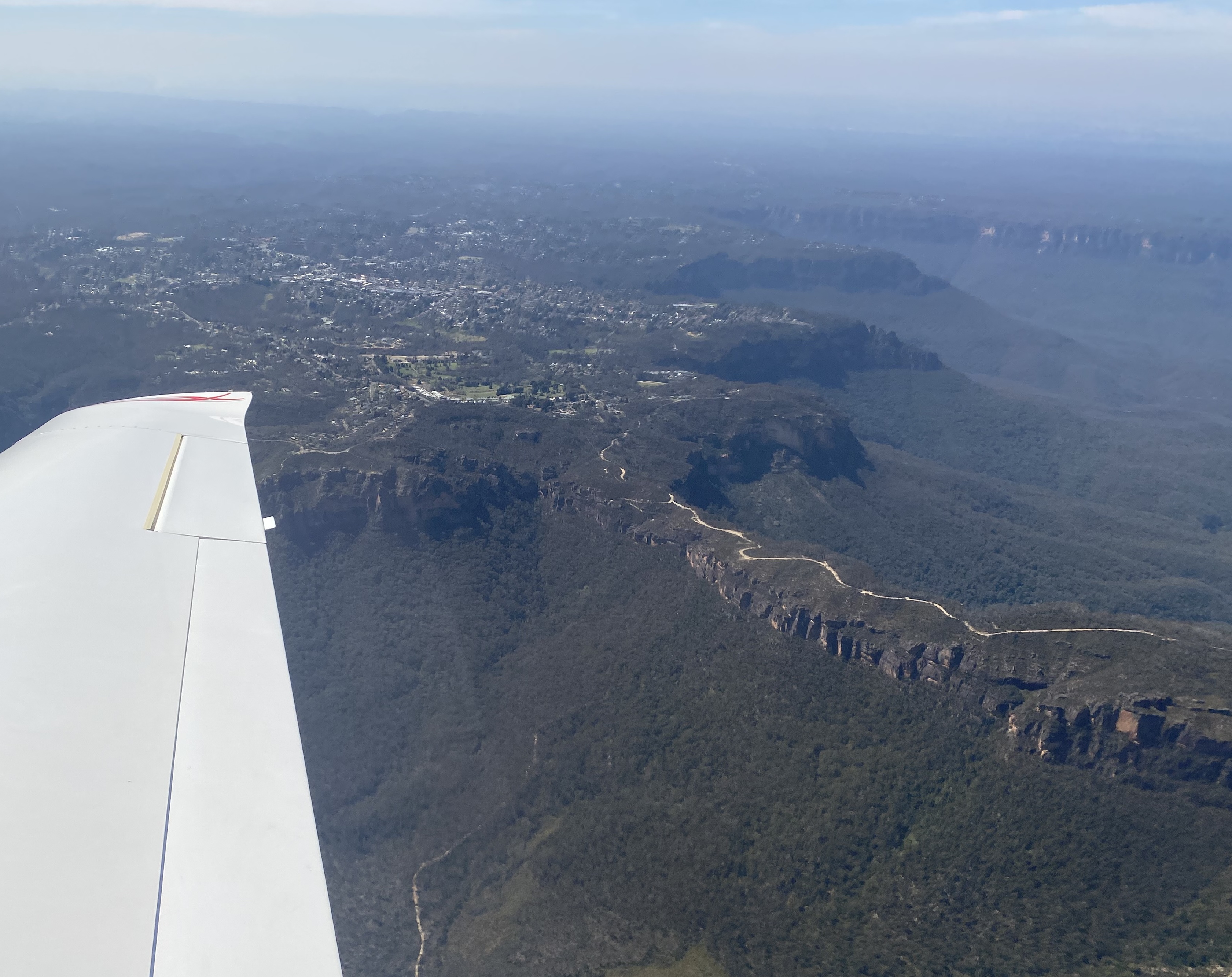
Turning north at Mittagong we flew over the Blue Mountains, with just a little bit of turbulence caused by the wind blowing over the peaks below us.
At Katoomba we tried, and failed, to spot the Three Sisters (but you may be able to spot them on the photo (thanks Sam). It was a bit bumpy but still a very scenic flight.
Katoomba
Tracking for Putty we continued over the Blue Mountains and were amazed at the extent of wilderness that is located so close to Sydney. The inhospitable country of the dividing range west of Sydney forms a real barrier and it became clear to us why it took the early explorers so many years to find a way through to the western plains.
Descending though the turbulence into Cessnock in the Hunter Valley we heard a bit of traffic that could have led to some conflicts but Mike was on the radios making sure that everyone else knew where we were and what our intentions were while we had some idea of what the other pilots were up to.
Screenshot
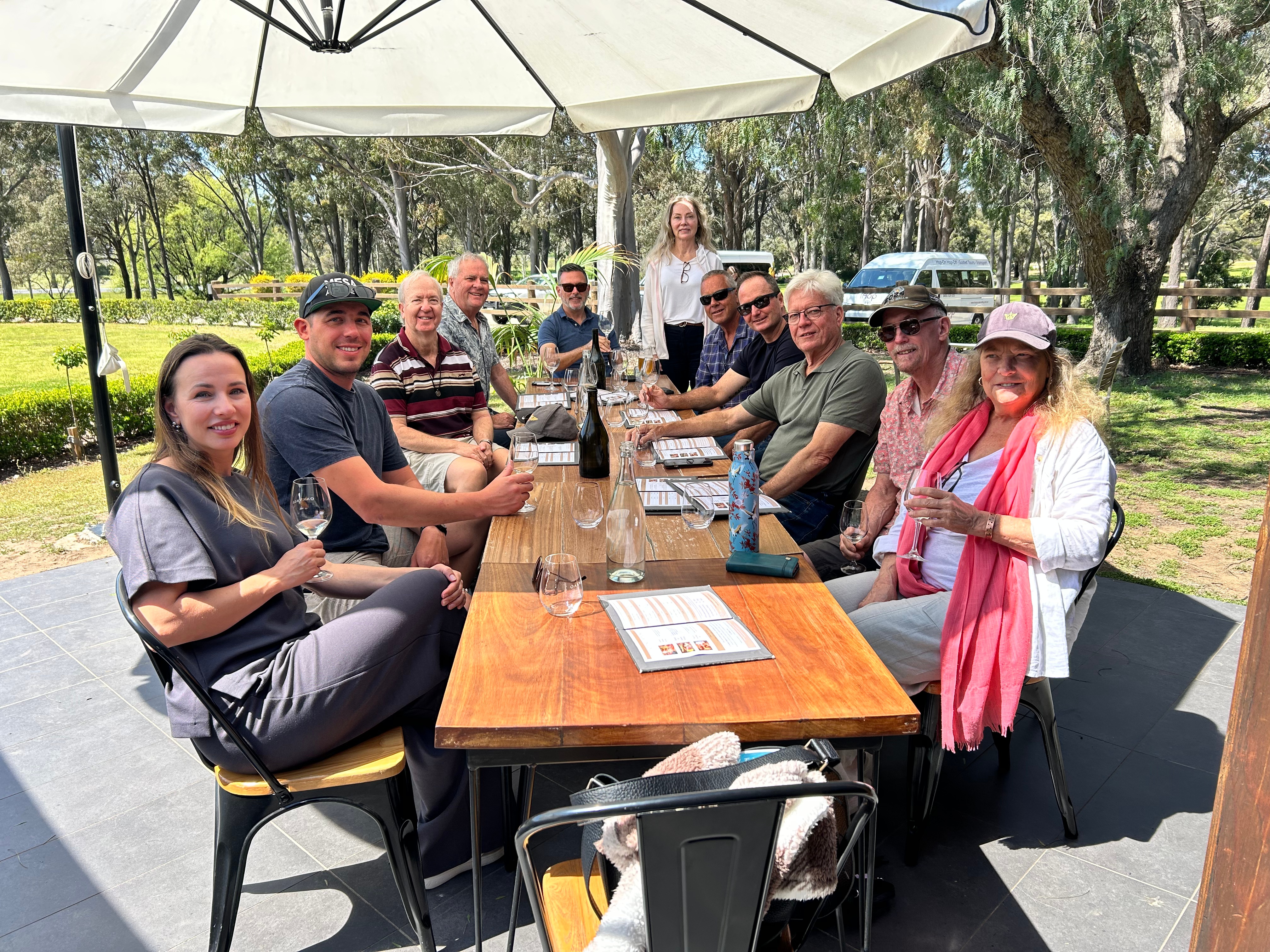
On approach there was a bit of turbulence and I decided to go around which was inconvenient given that there were already four other aircraft in the circuit or wanting to join it. But it is what it is and when you don’t like your approach/landing you just go around. The second approach was much smoother and we landed successfully. We’d made a booking at Peterson House Restaurant (thanks for the tip Len) about 20 minutes’ walk from the apron, and at 1pm we were sitting down to some glasses of local wine and what was undoubtedly the best meal I’d had in a long time.
Peterson House
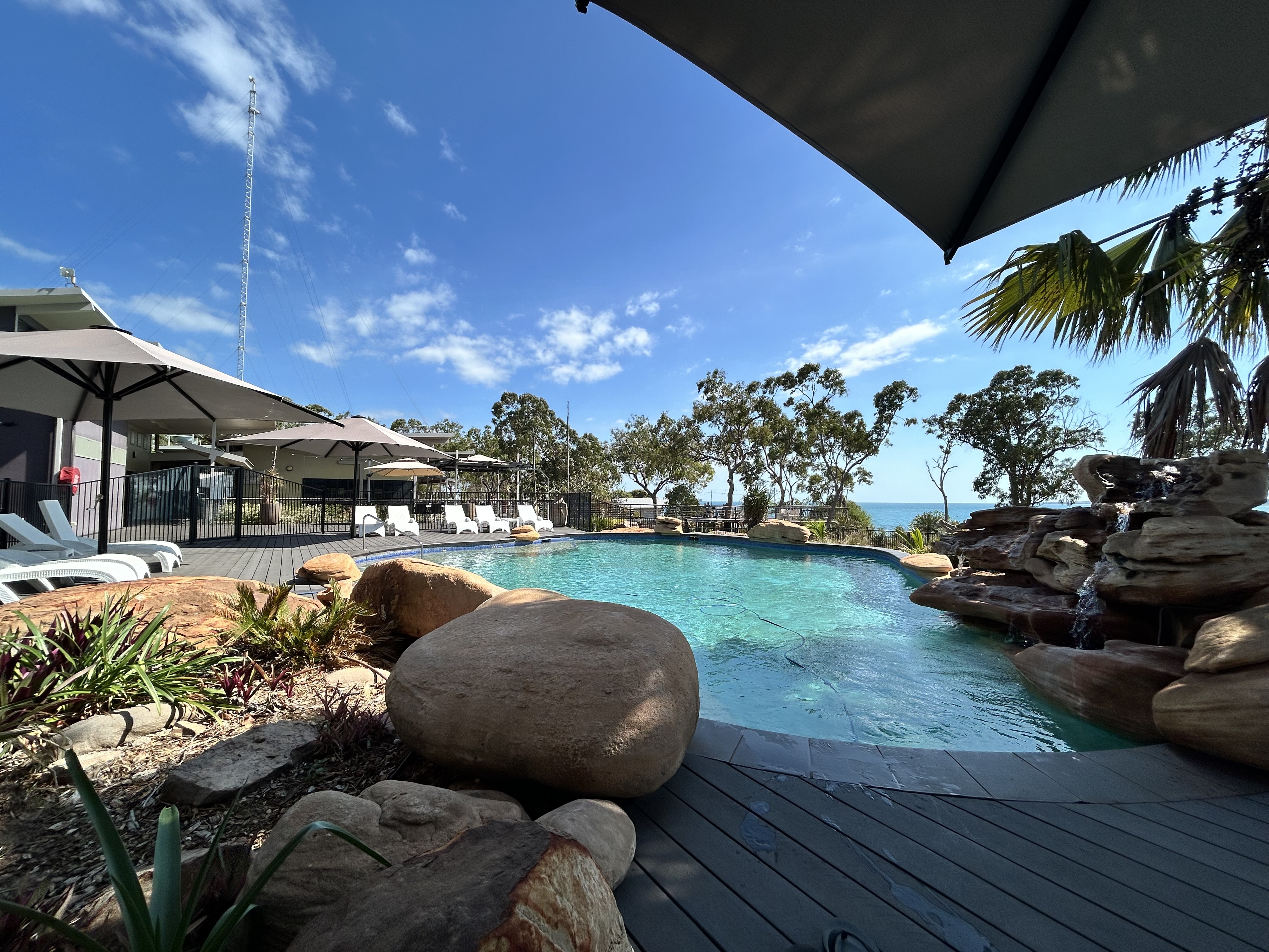
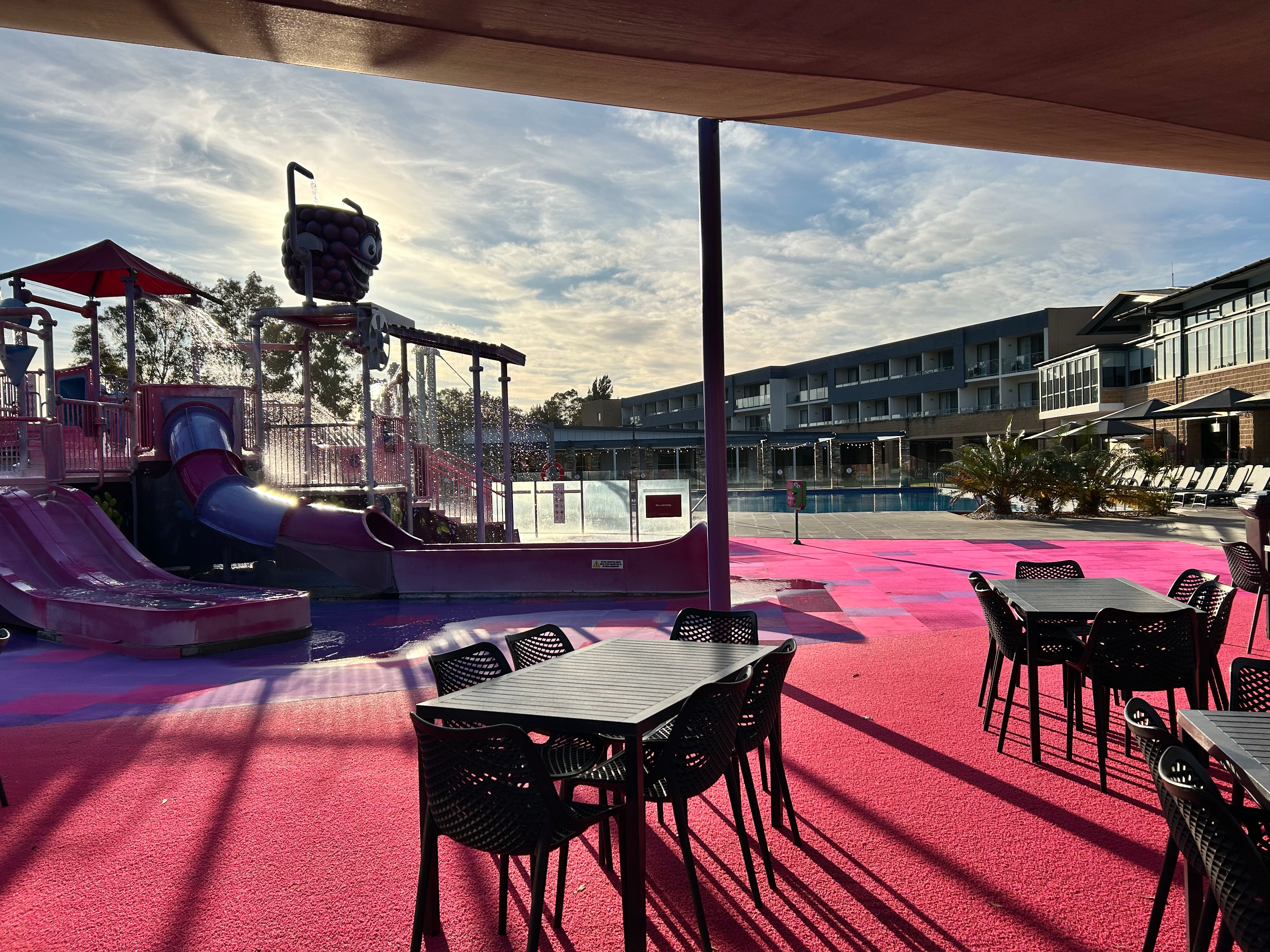
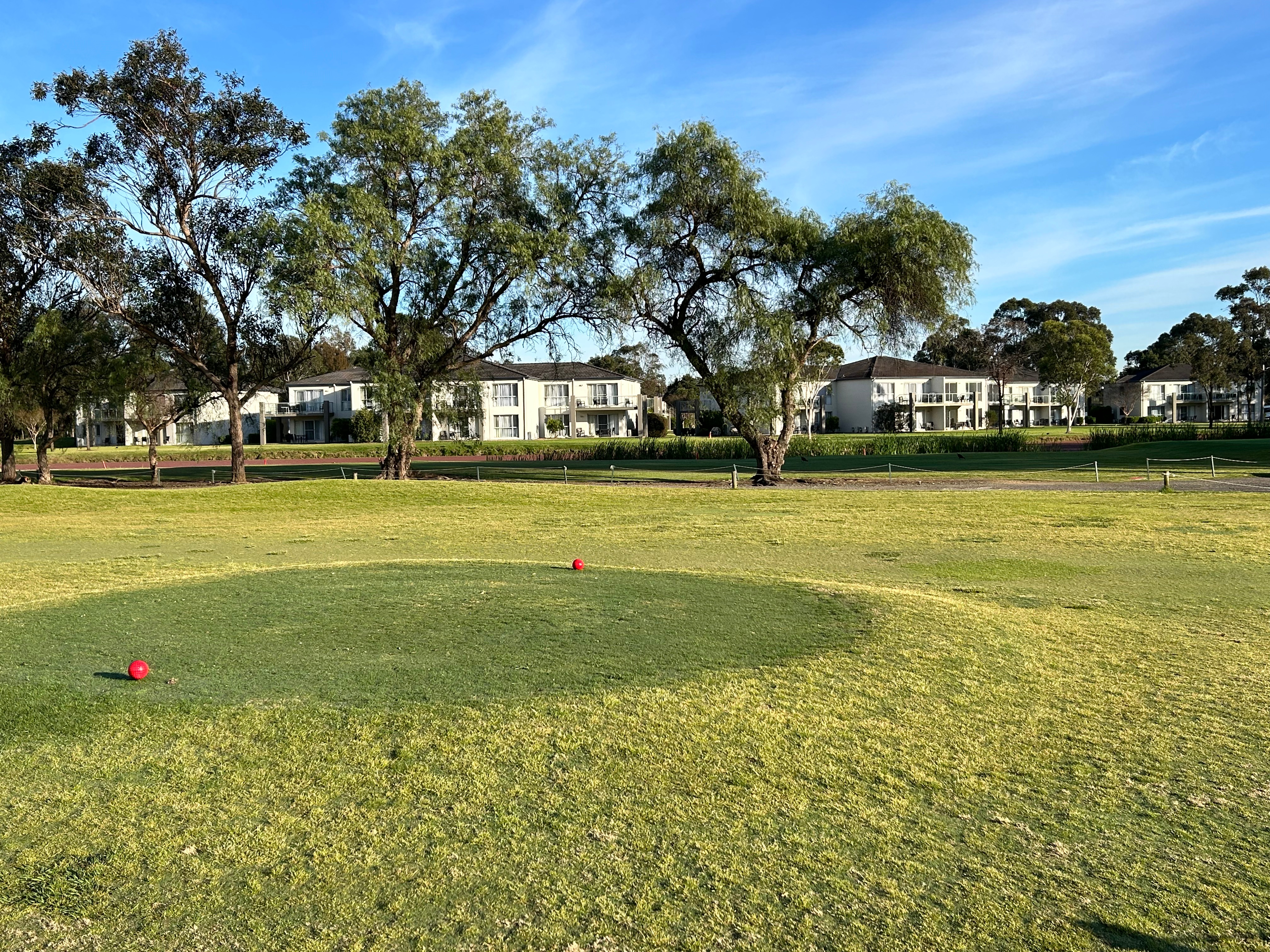
At 3pm we were transported to the Rydges Hunter Valley Resort, just across the road from the airport, where we spent two nights. It was great accommodation, a bit more upmarket than the Oaks in Shellharbour with a massive pool with kids water play area, an “adults only” lap pool, its own brewery, golf course, spa, conference rooms, tennis and pickle ball courts.
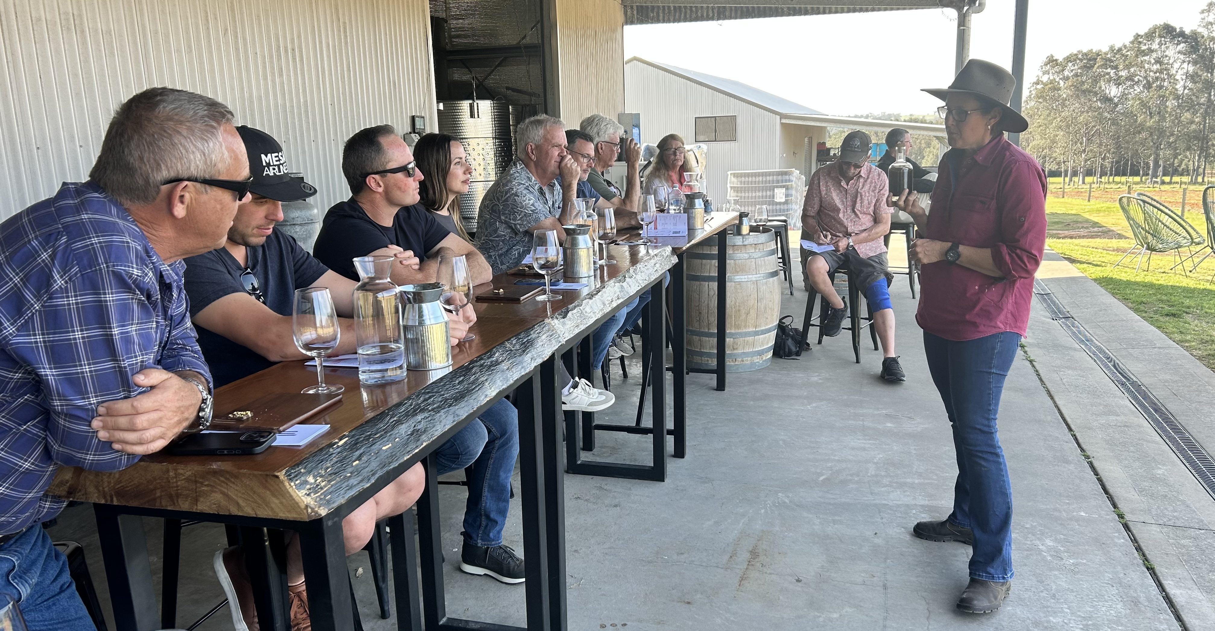
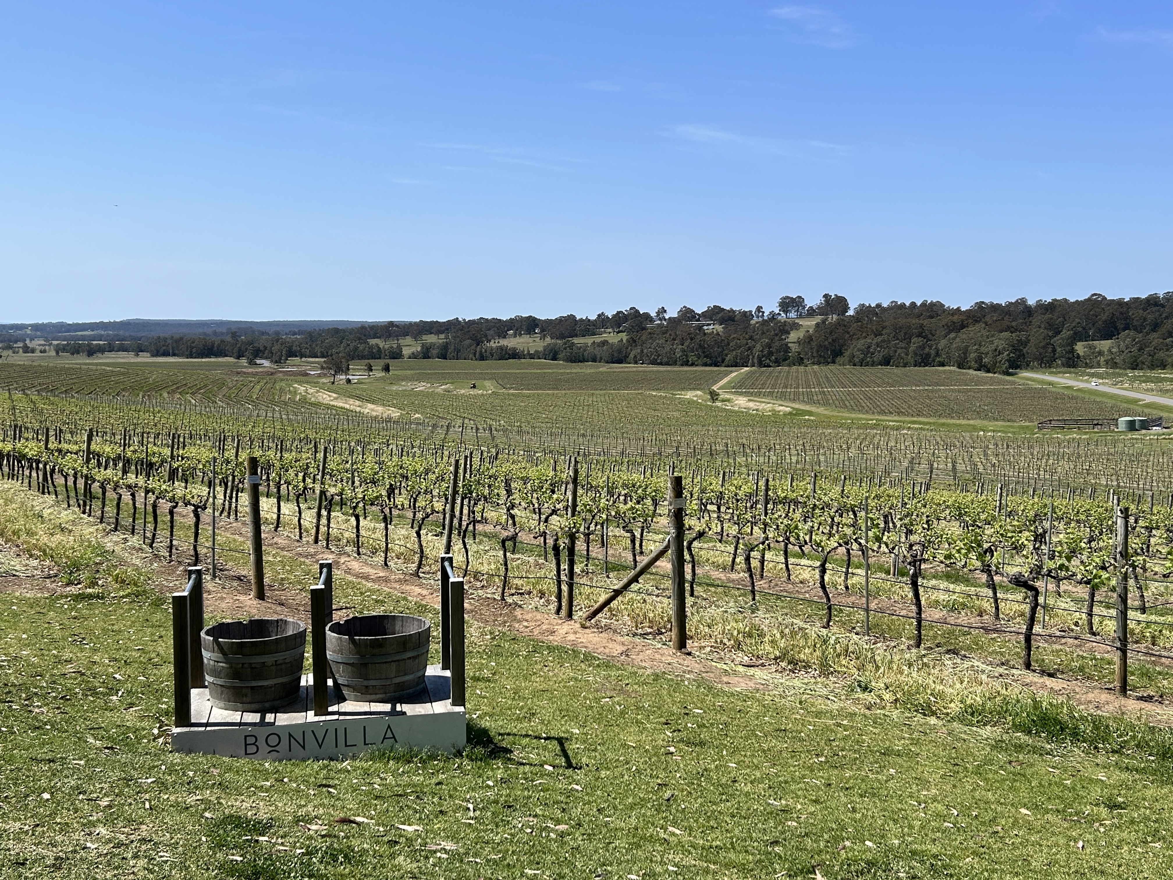
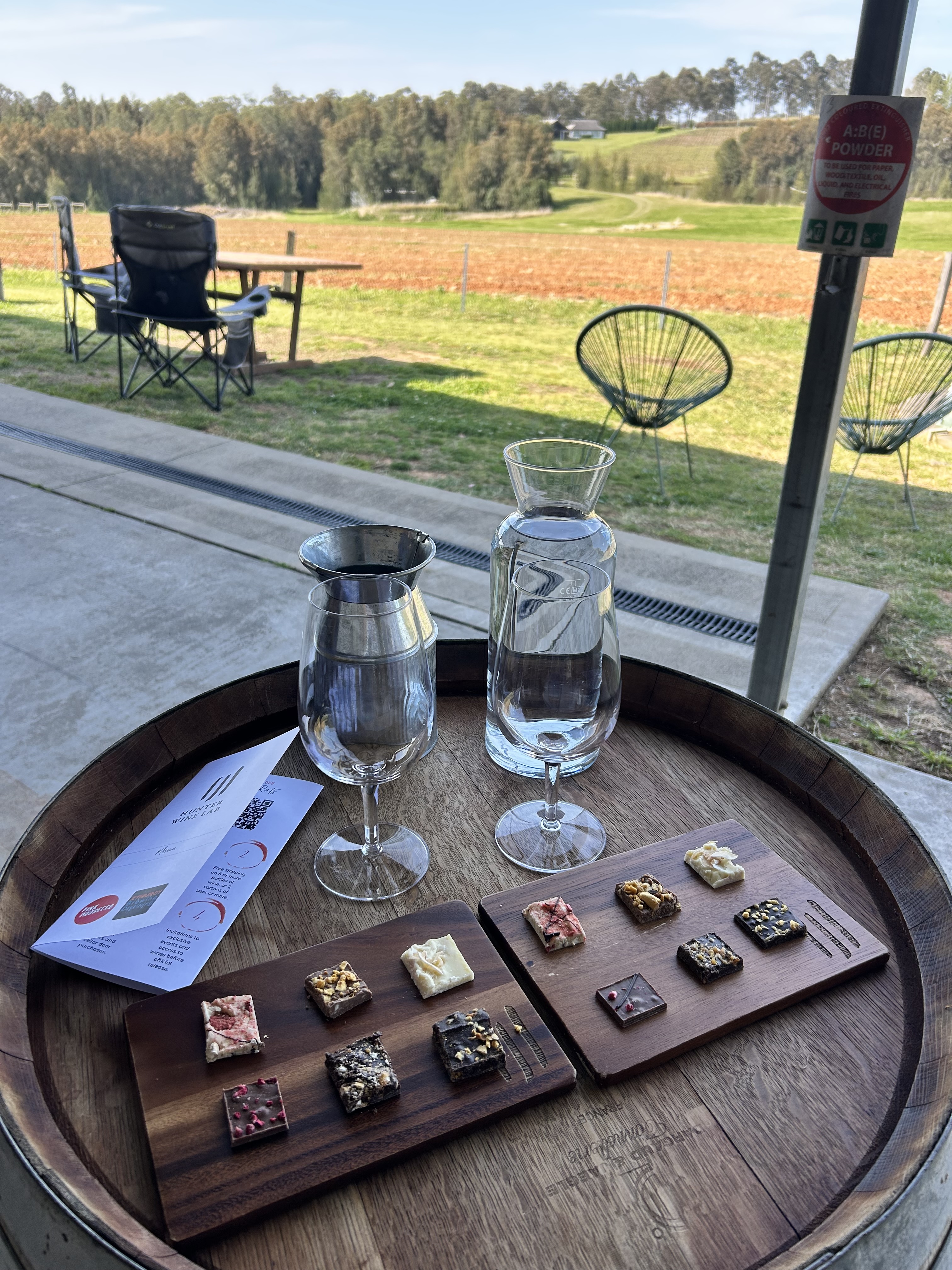
Thursday was a chance to sample the Hunter Valley wines on a winery tour in a bus. It was a lovely day enjoying the views in the sunshine of the Hunter Valley.
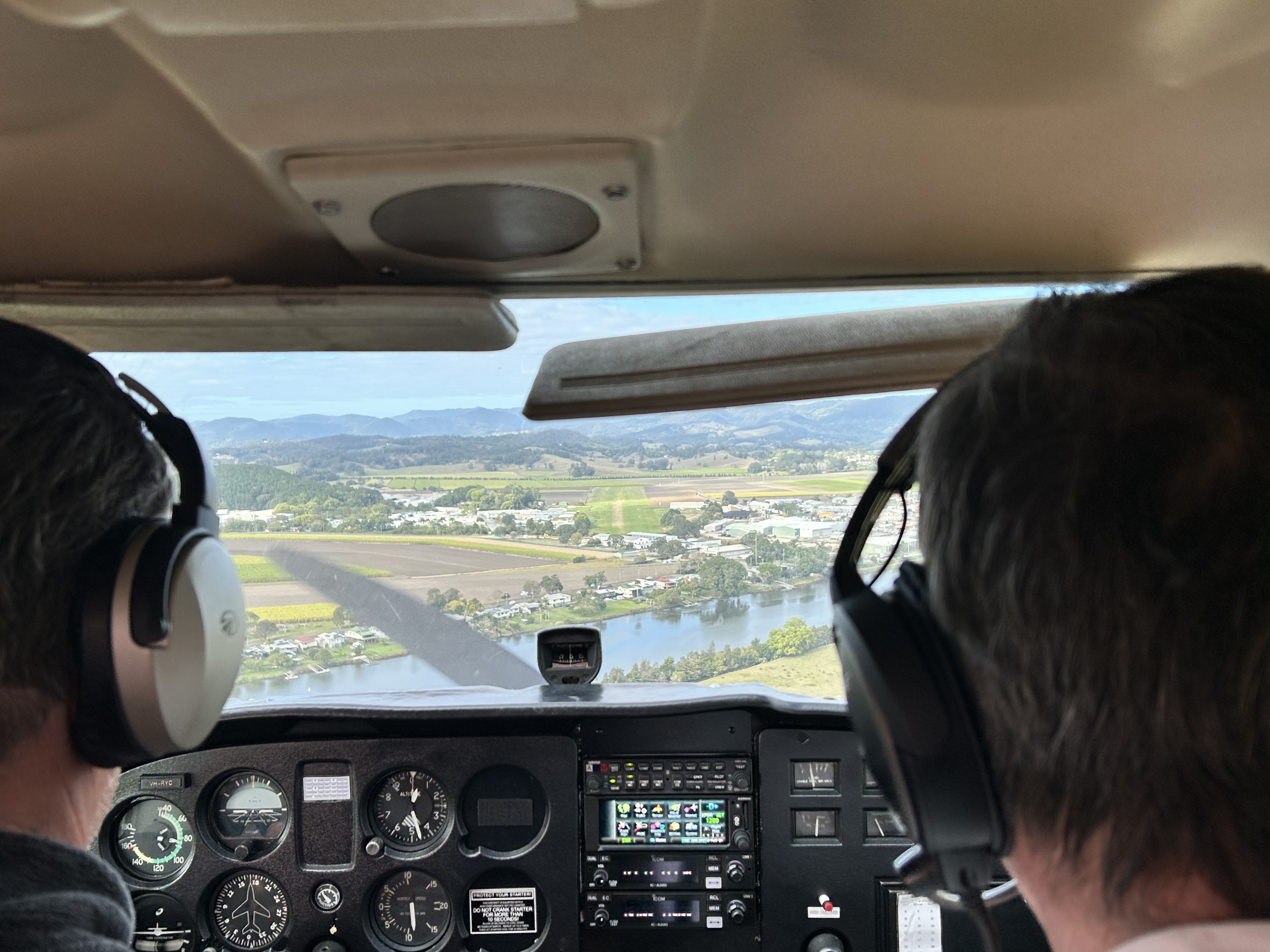
Friday 26th September it was time to head for home so we checked out early and were taking off from Cessnock by 9am. This time I elected to go IFR at 7000ft but first had to obtain a clearance to fly through the Williamtown RAAF controlled airspace. So we tracked towards Scone for about 10 minutes after take-off until the clearance became available and then turned and flew direct to Kempsey.
On this leg Louise Hoey had joined us, as her pilot Garry had decided to part company with the rest of the company and head for Rylstone Airpark where he’d meet his brother. So, with an extra passenger we couldn’t load more than 180 litres of fuel due to the weight limitations and had to stop at Kempsey to top up the tanks. A practice RNP approach led us straight in on RWY04.
Mike flew the last leg from Kempsey to Redcliffe via Coffs Harbour to Ballina and Byron Bay.
Cape Byron
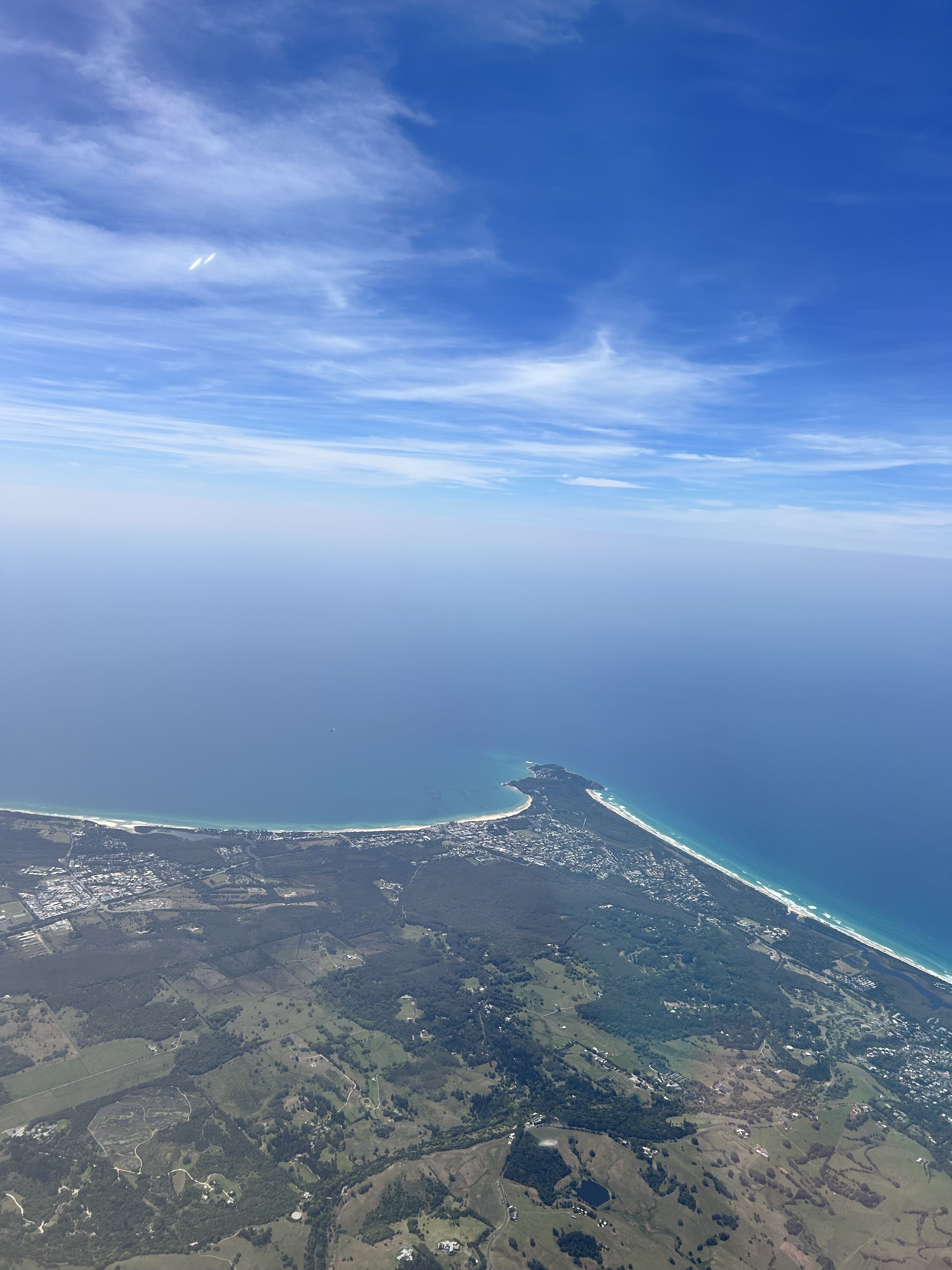
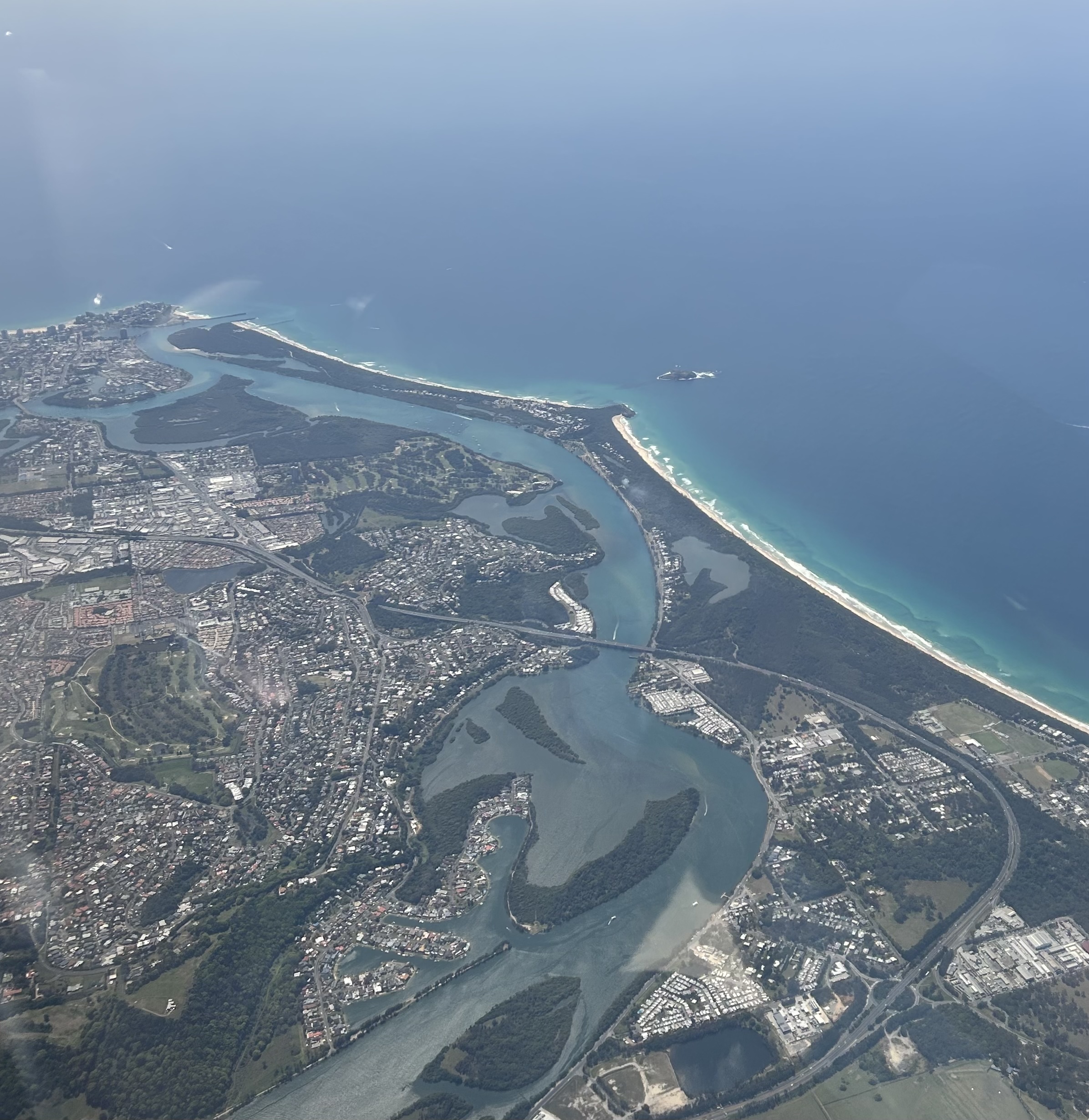
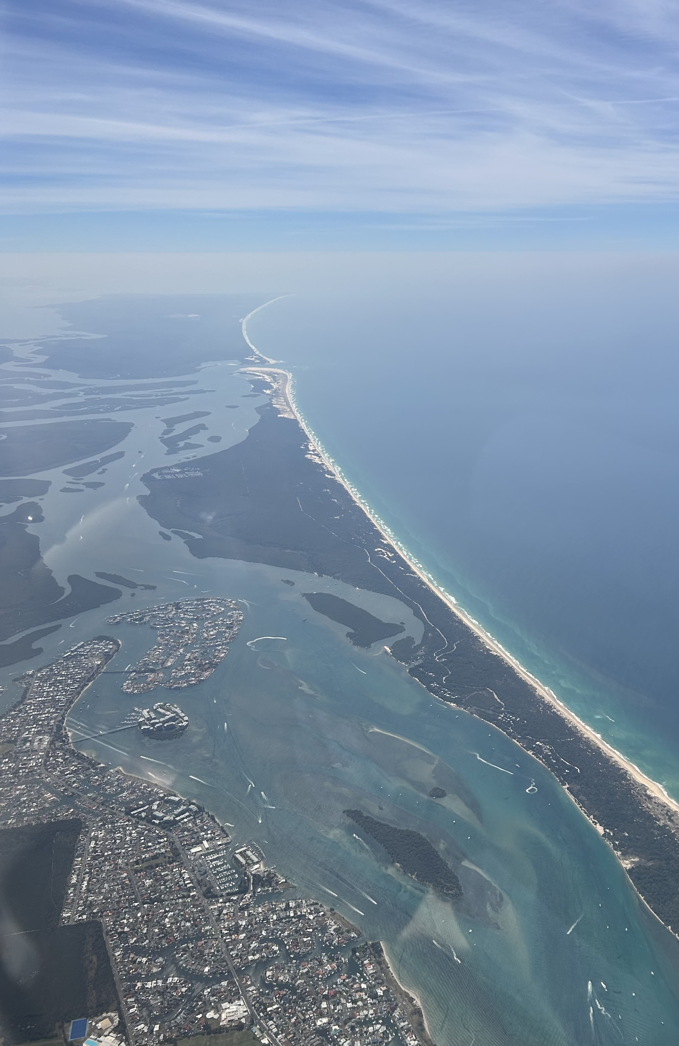
From there we flew over Pottsville and Tweed Heads.
A few minutes later we were over the Broadwater at the Gold Coast.
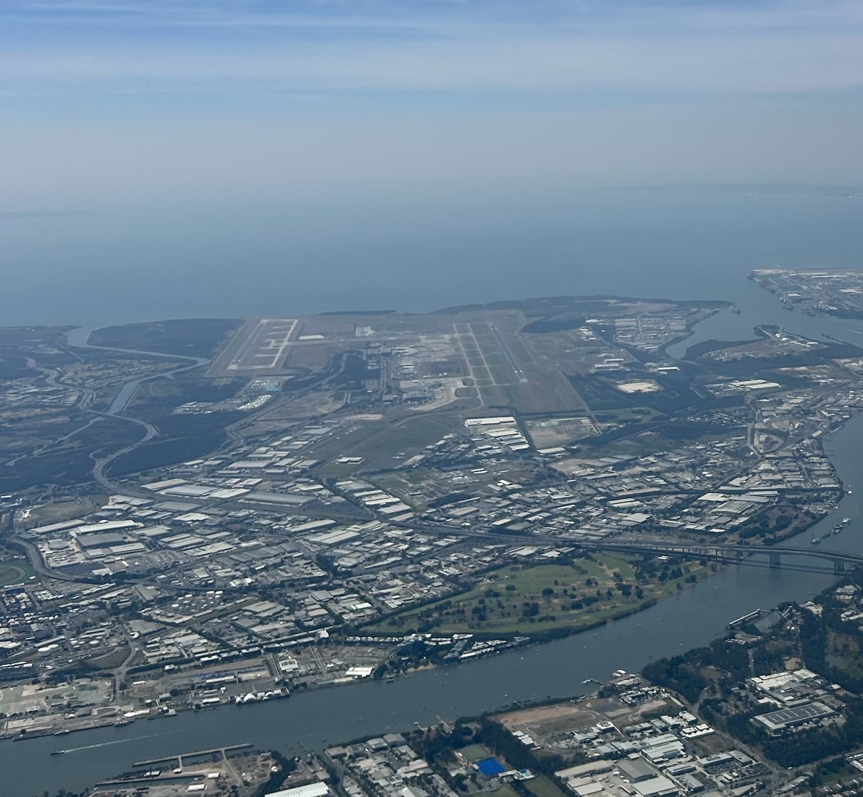
ATC cleared us to fly directly over the Brisbane CBD with view to the coast and Brisbane International Airport.
At 12 noon we touched down and put MSF away in the hangar. The end of another great flyaway.