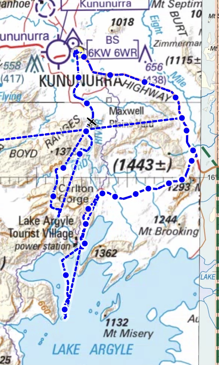
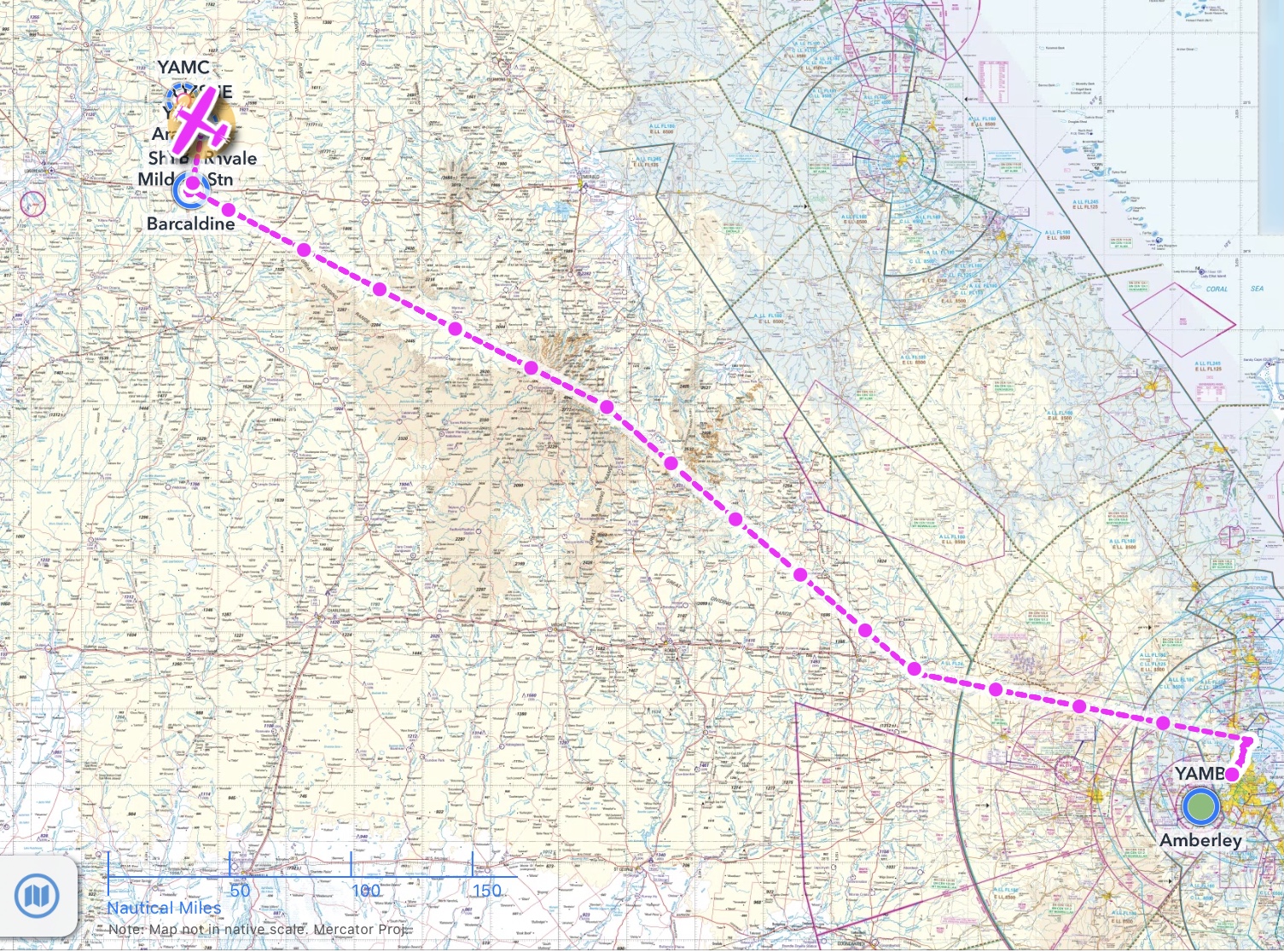
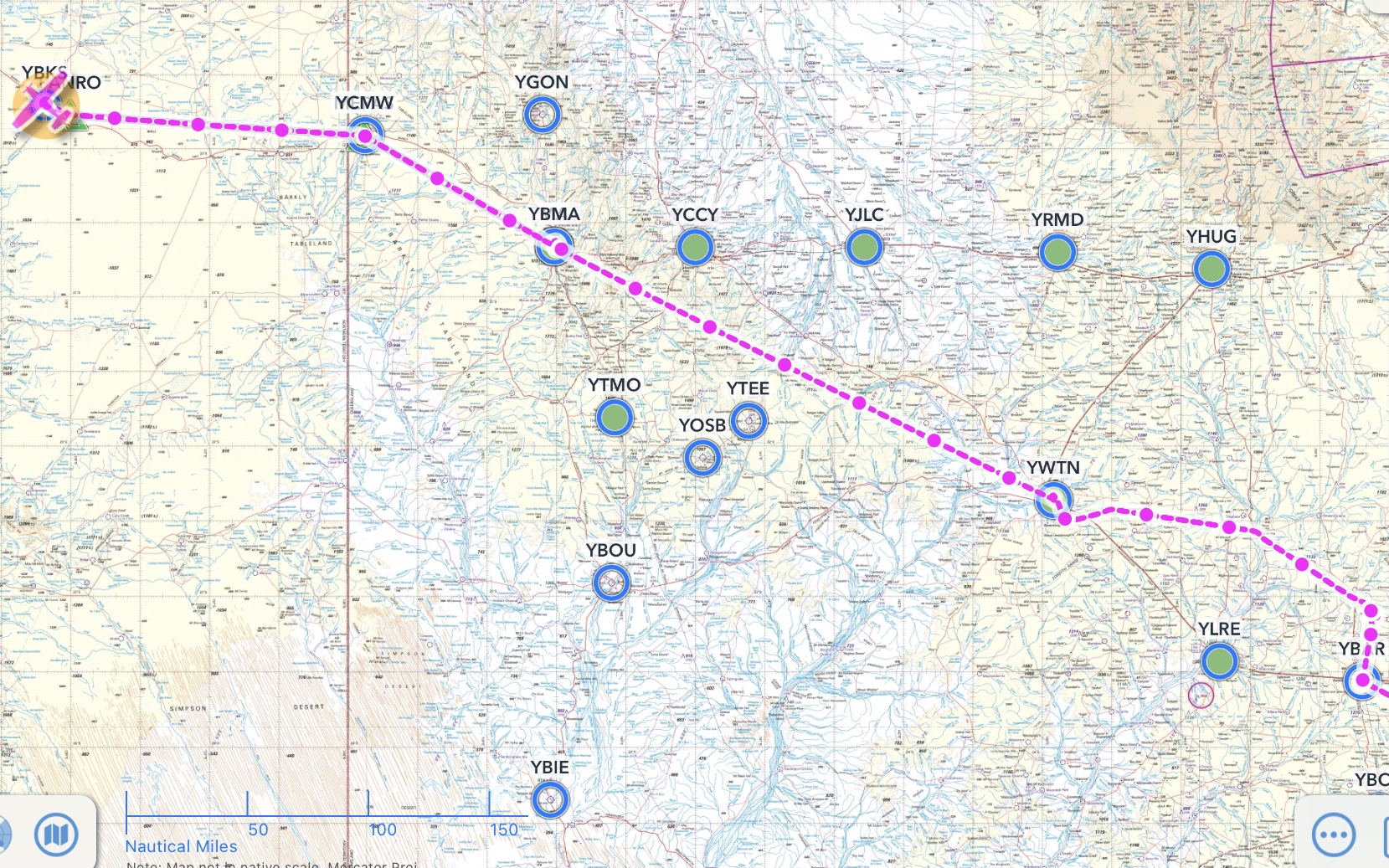
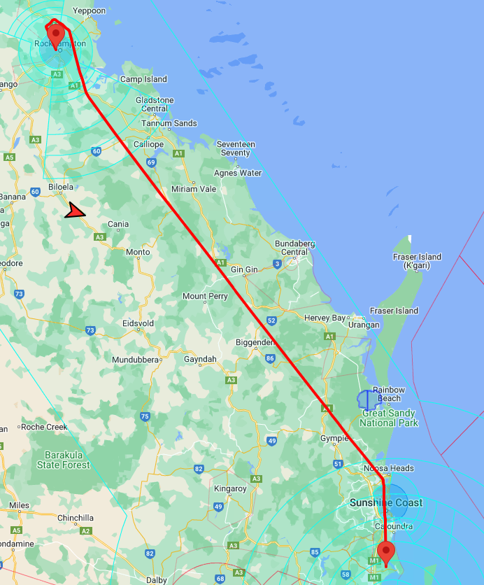
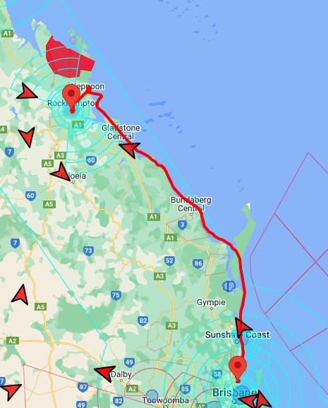
Purnululu (Bungles) – Hooker Creek – Tennant Creek – Barkly Wayside Inn – Mount Isa – Winton – Emerald – Agnes Water – Hervey Bay – Redcliffe
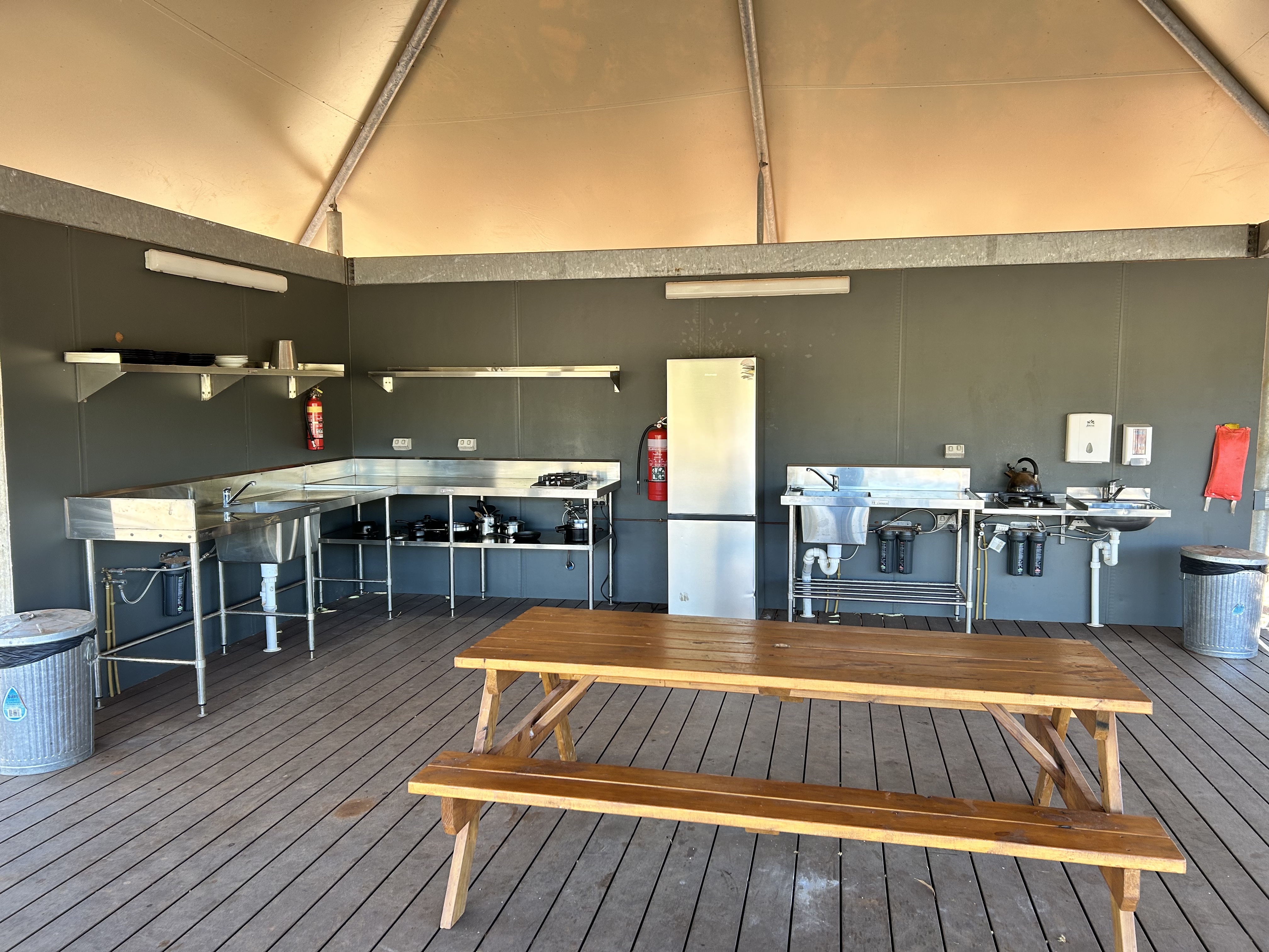
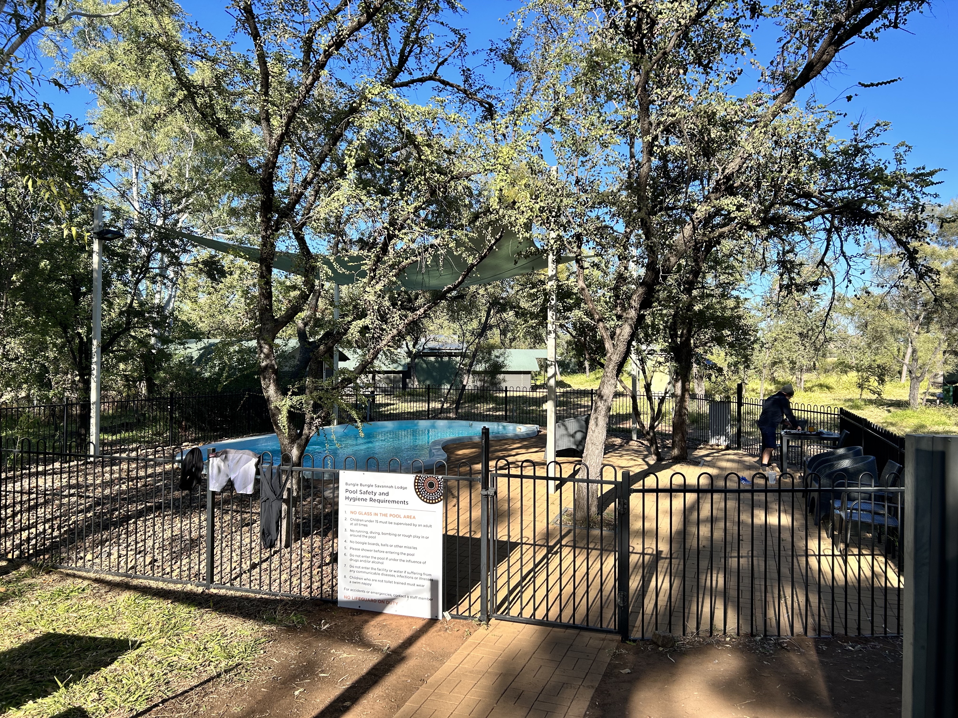
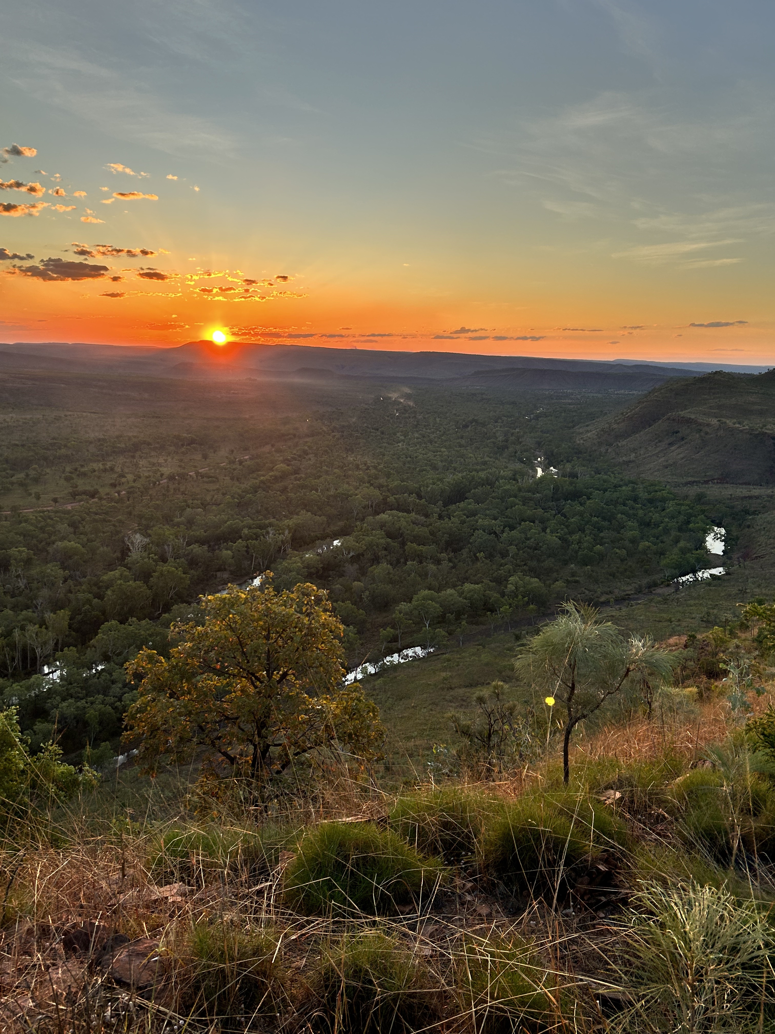
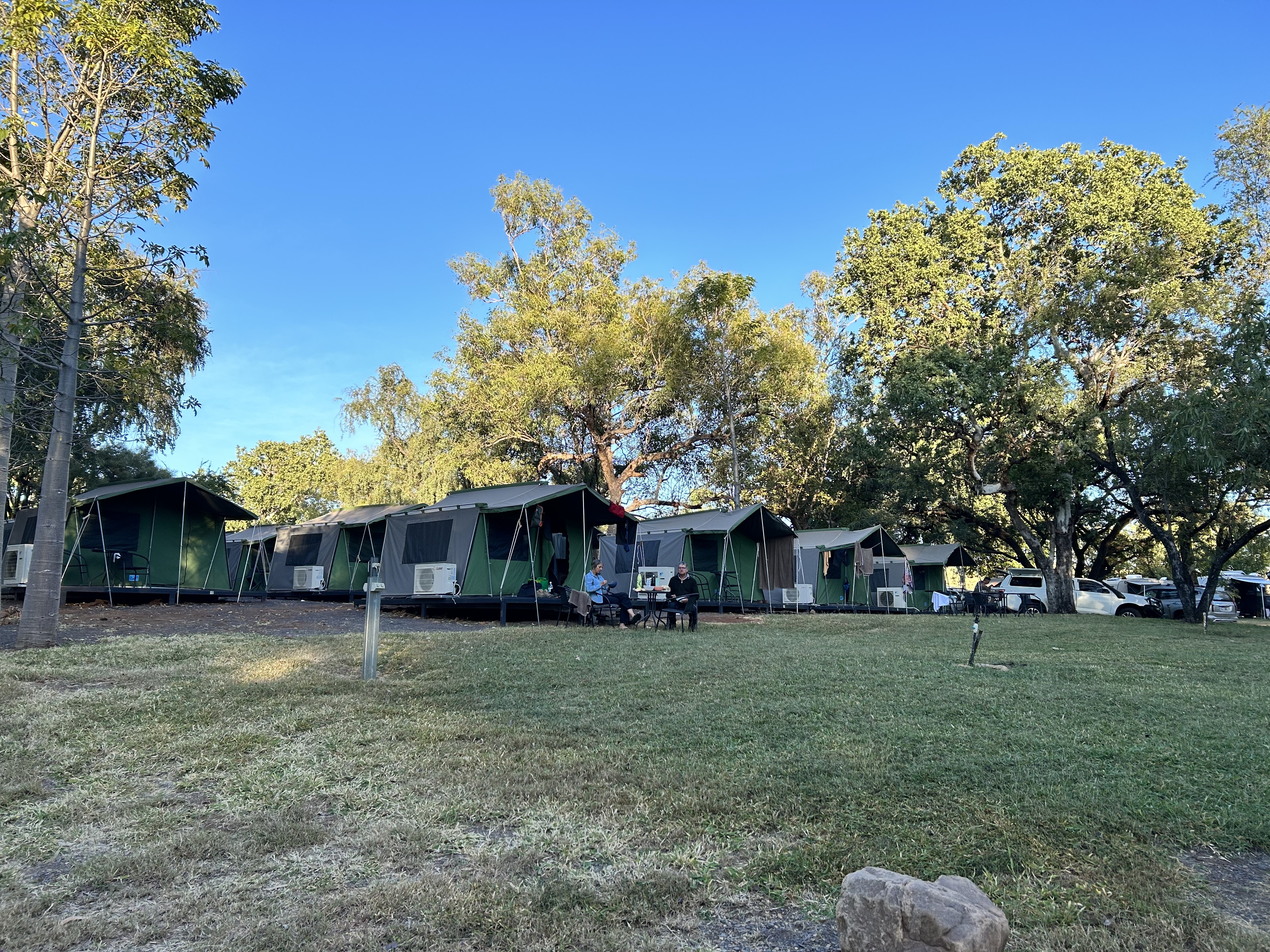
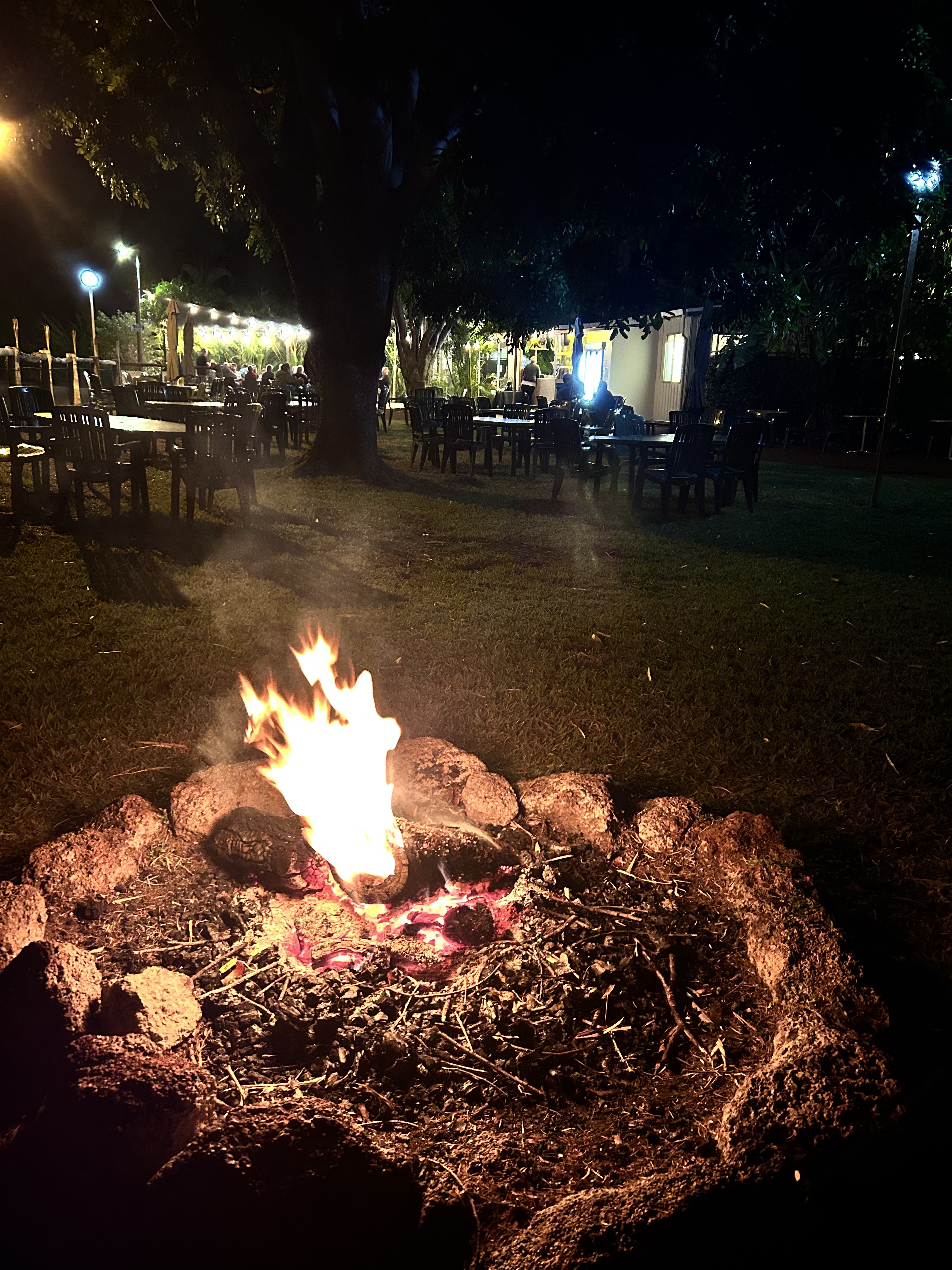
29th May 2023 dawned like all the other days in the Kimberley. Blue sky and not a cloud in sight. The only difference was the temperature. Being so far inland and with clear skies it had dropped to about 8 degrees overnight. So it had been a cold night at the Bungle Bungle Savannah Lodge and the cabins weren’t exactly warm. If you’re heading that way in May – September take some thermals with you for the early morning. A beanie and gloves will also be worthwhile. It’s a desert climate.
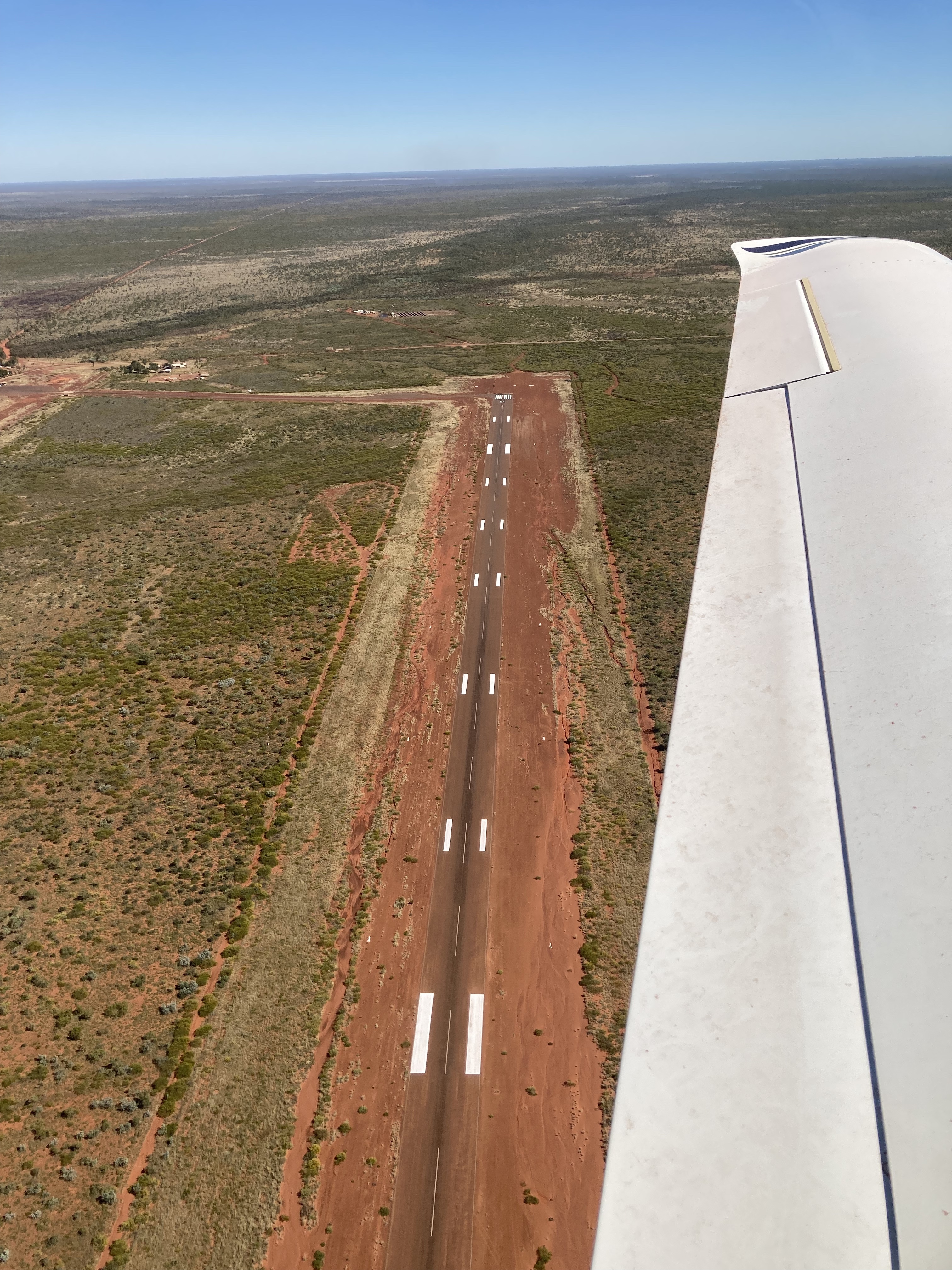
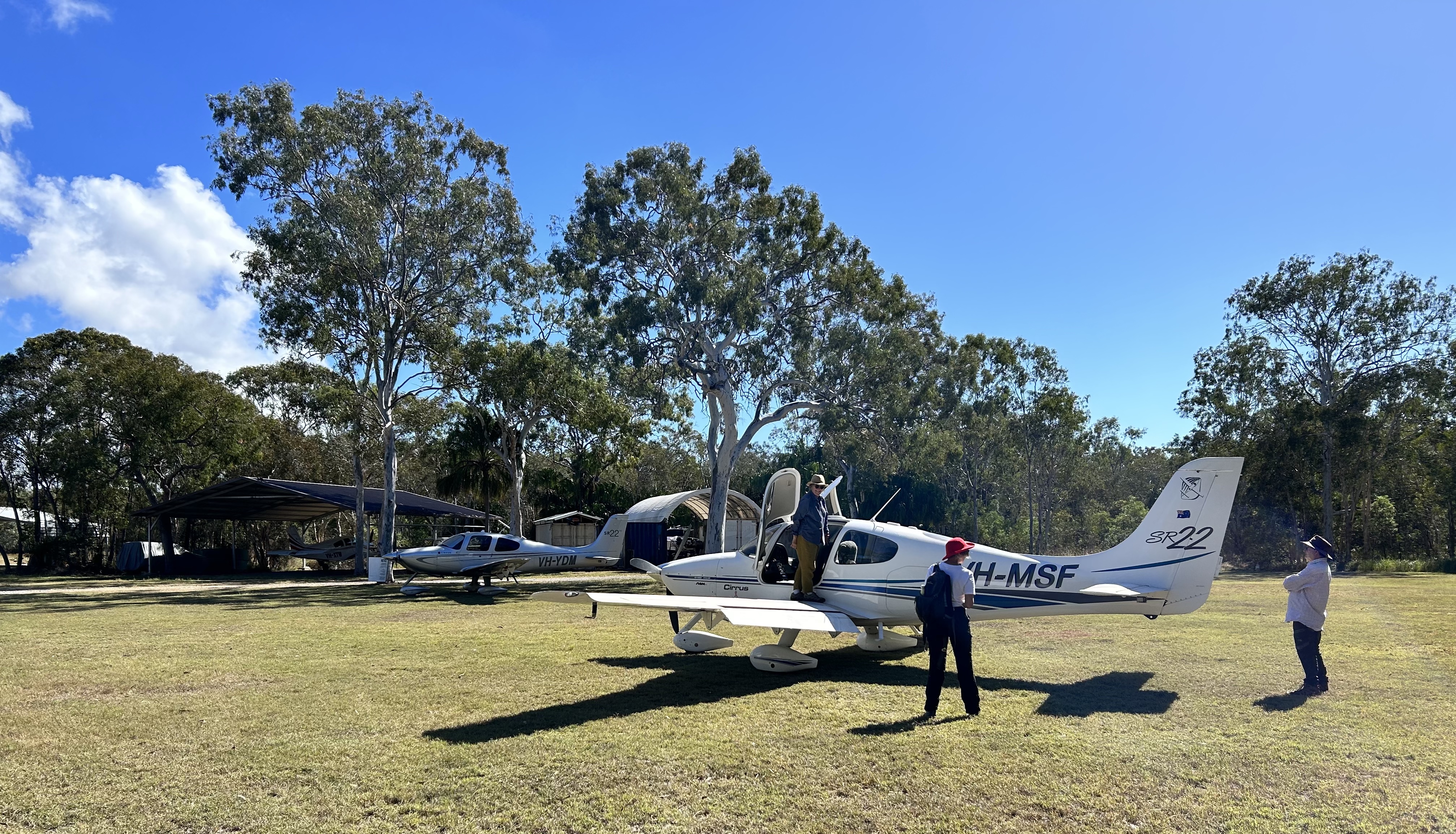
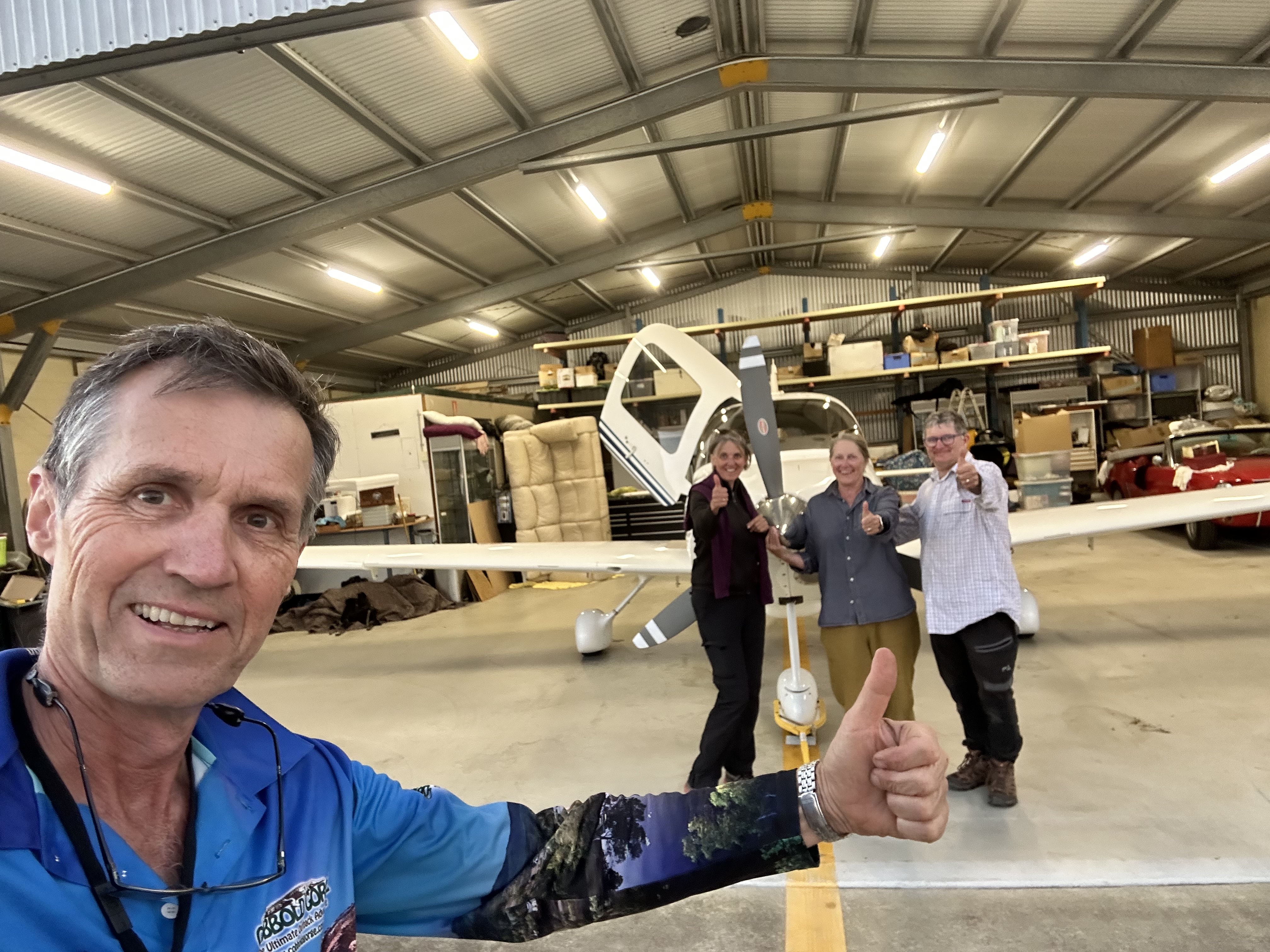
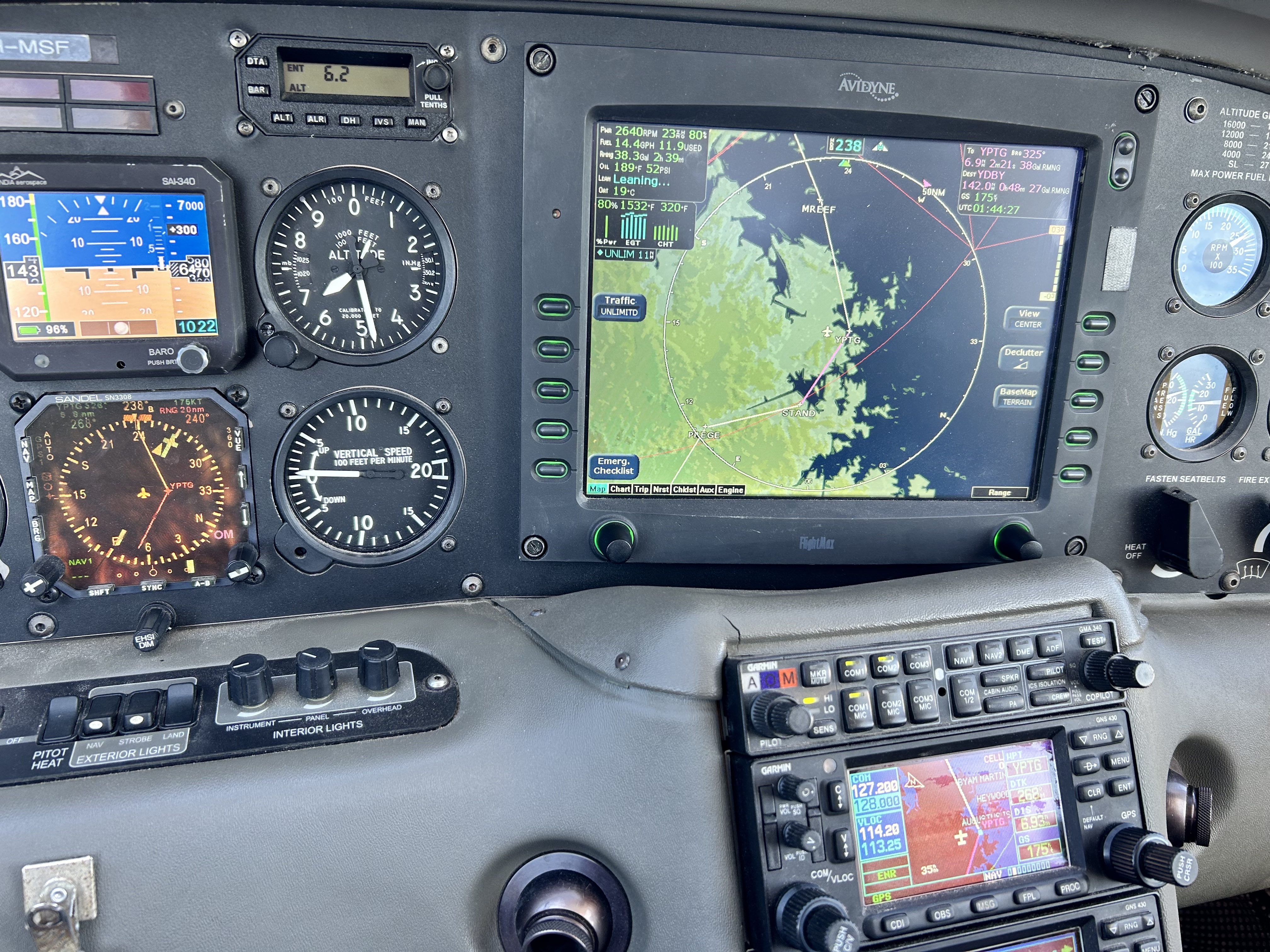
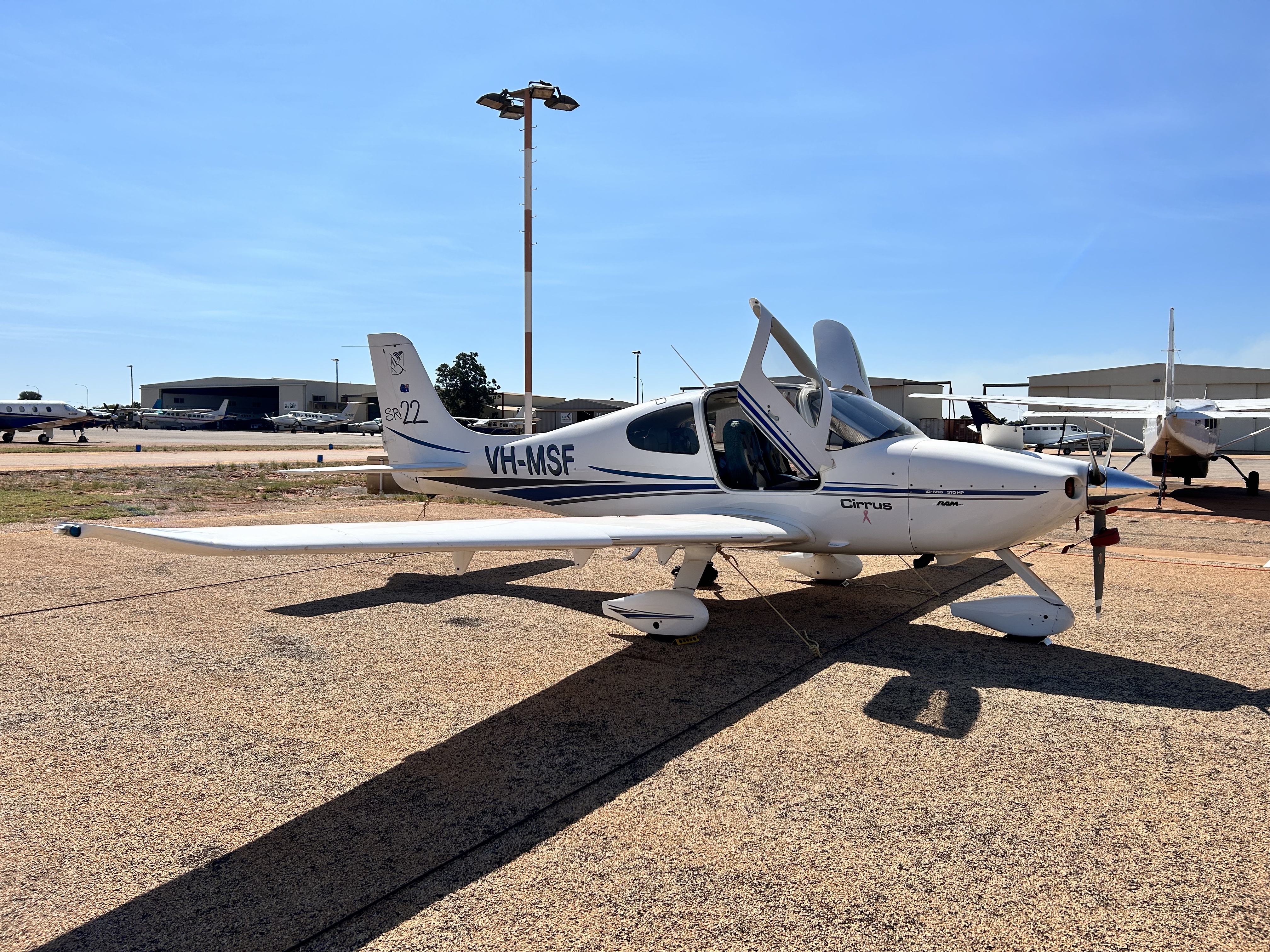
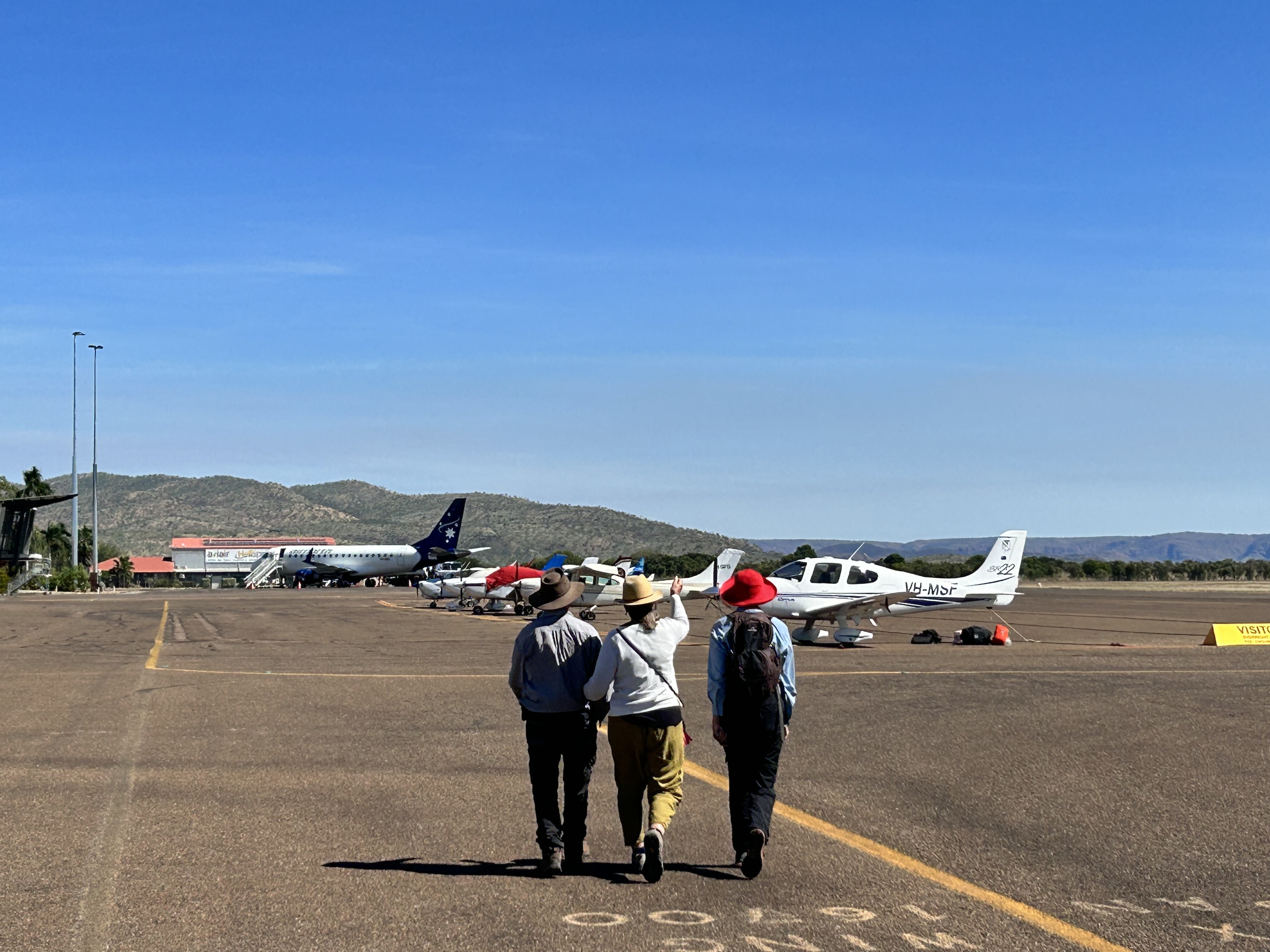
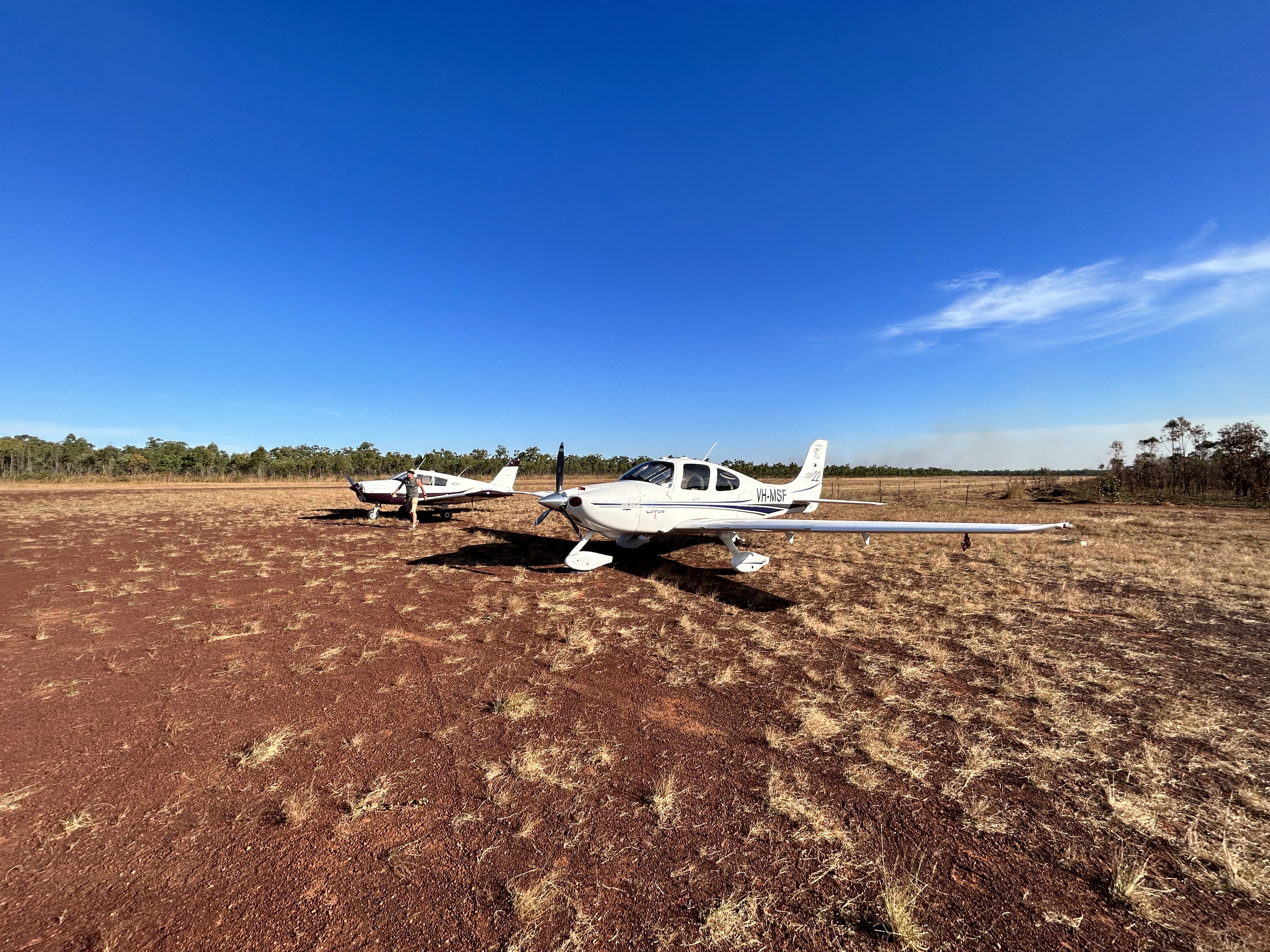
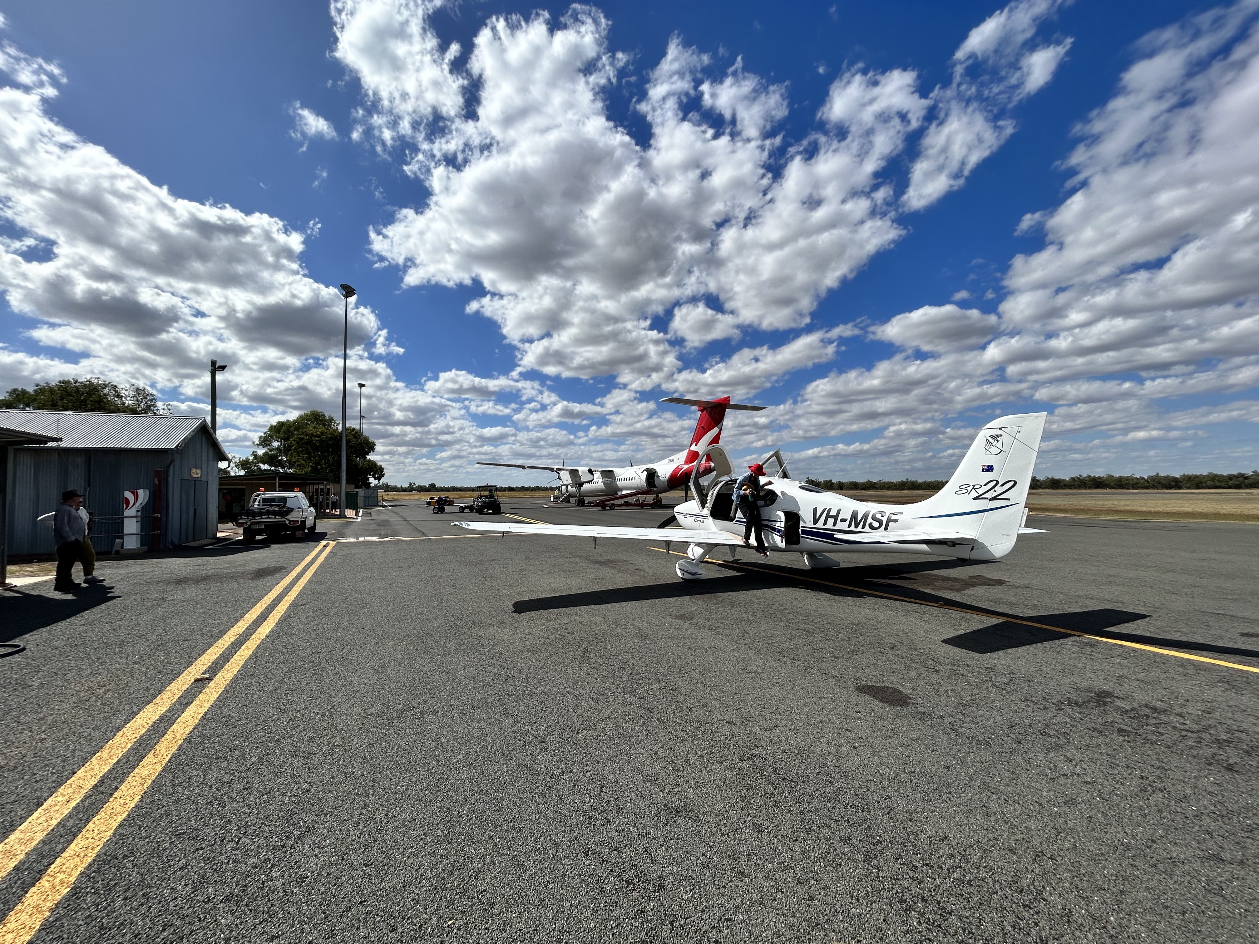
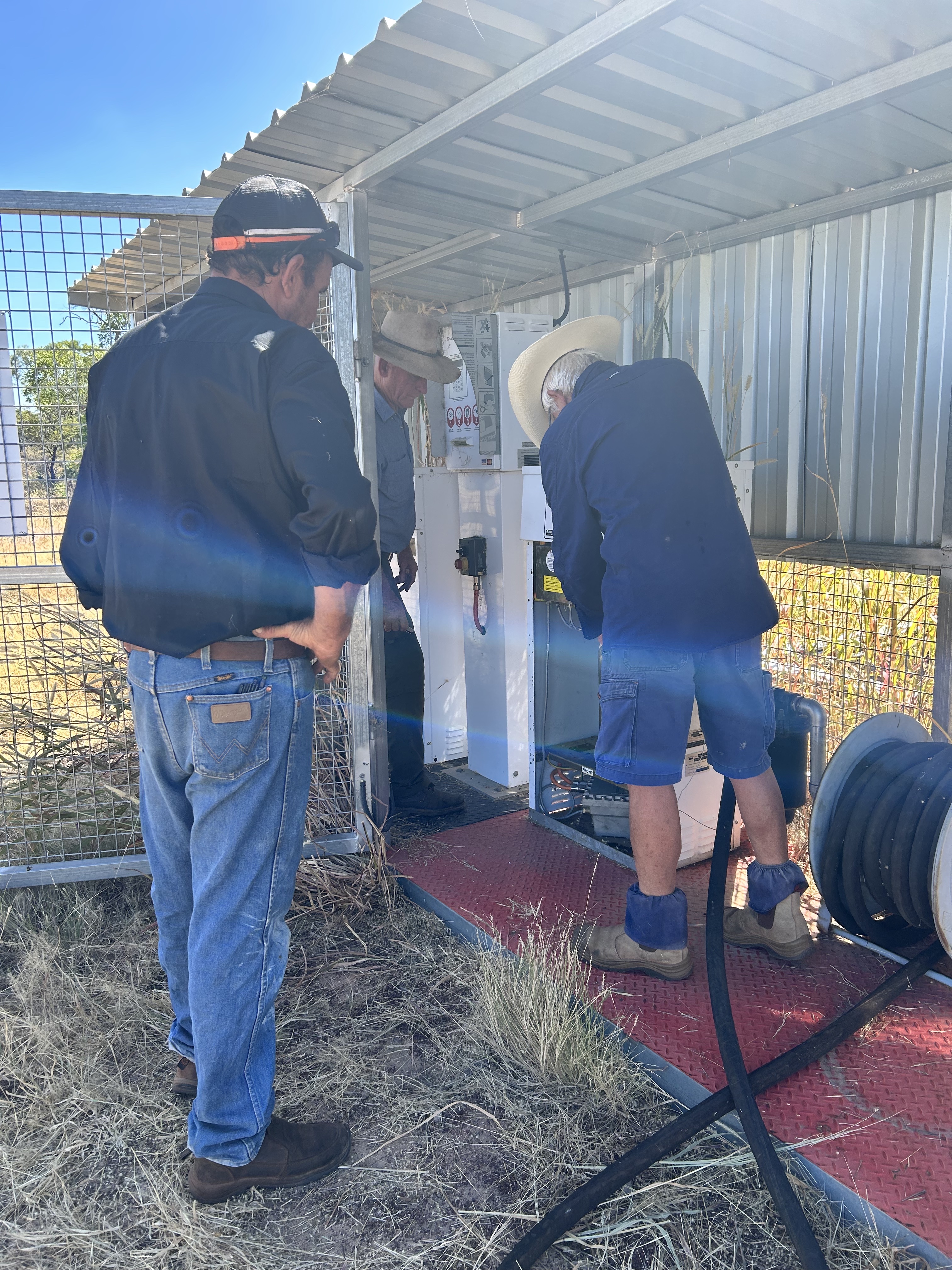
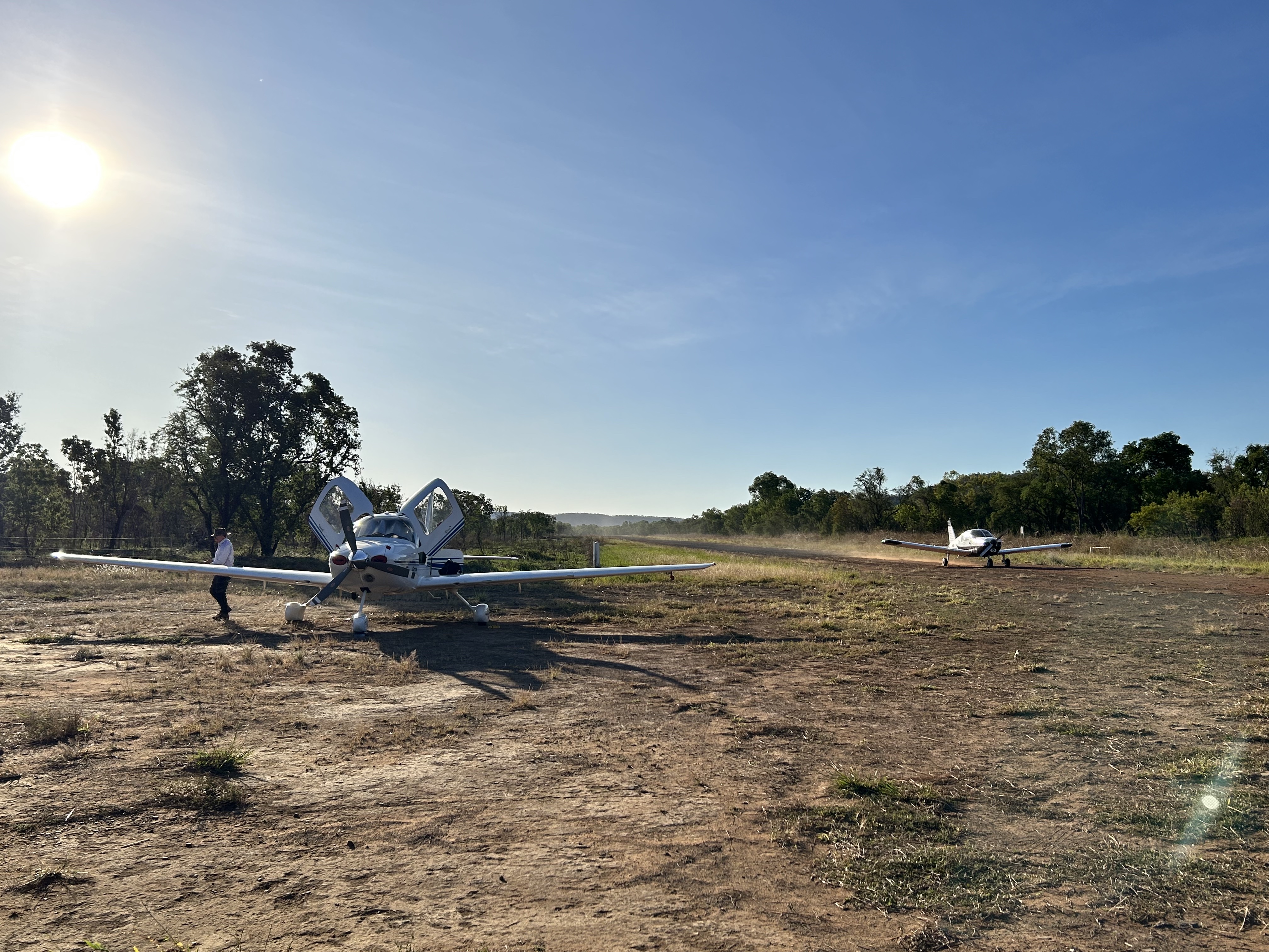
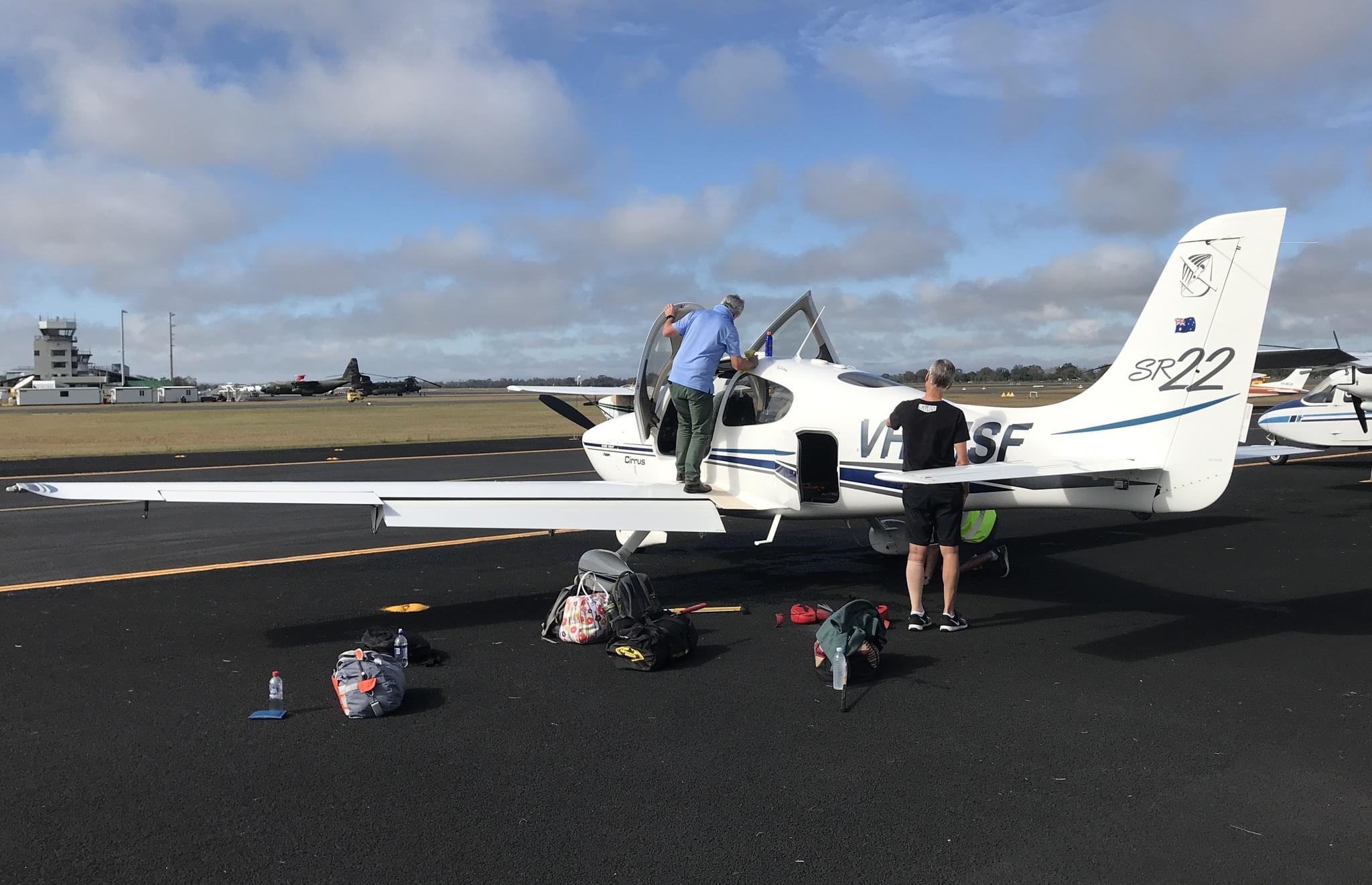
Anyway, the hot breakfast warmed us all up and at 8am we were transferred back to the Bellburn airstrip. MSF was a bit reluctant to start due to the cold but Luc’s tip of rotating the propellor to get the oil flowing and positioning the prop to ensure minimum effort required by the starter motor did certainly help.
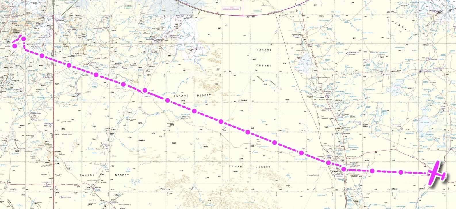
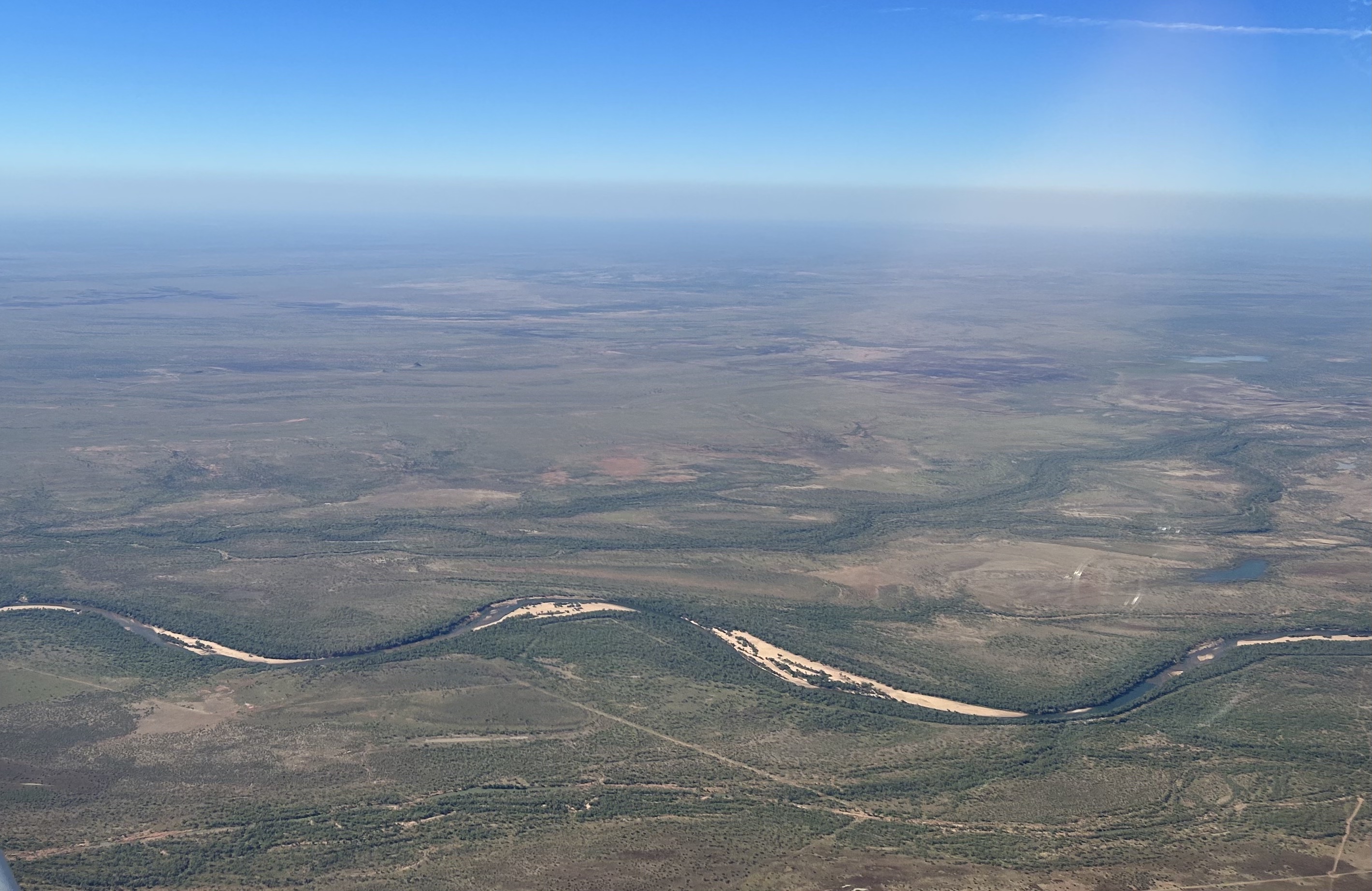
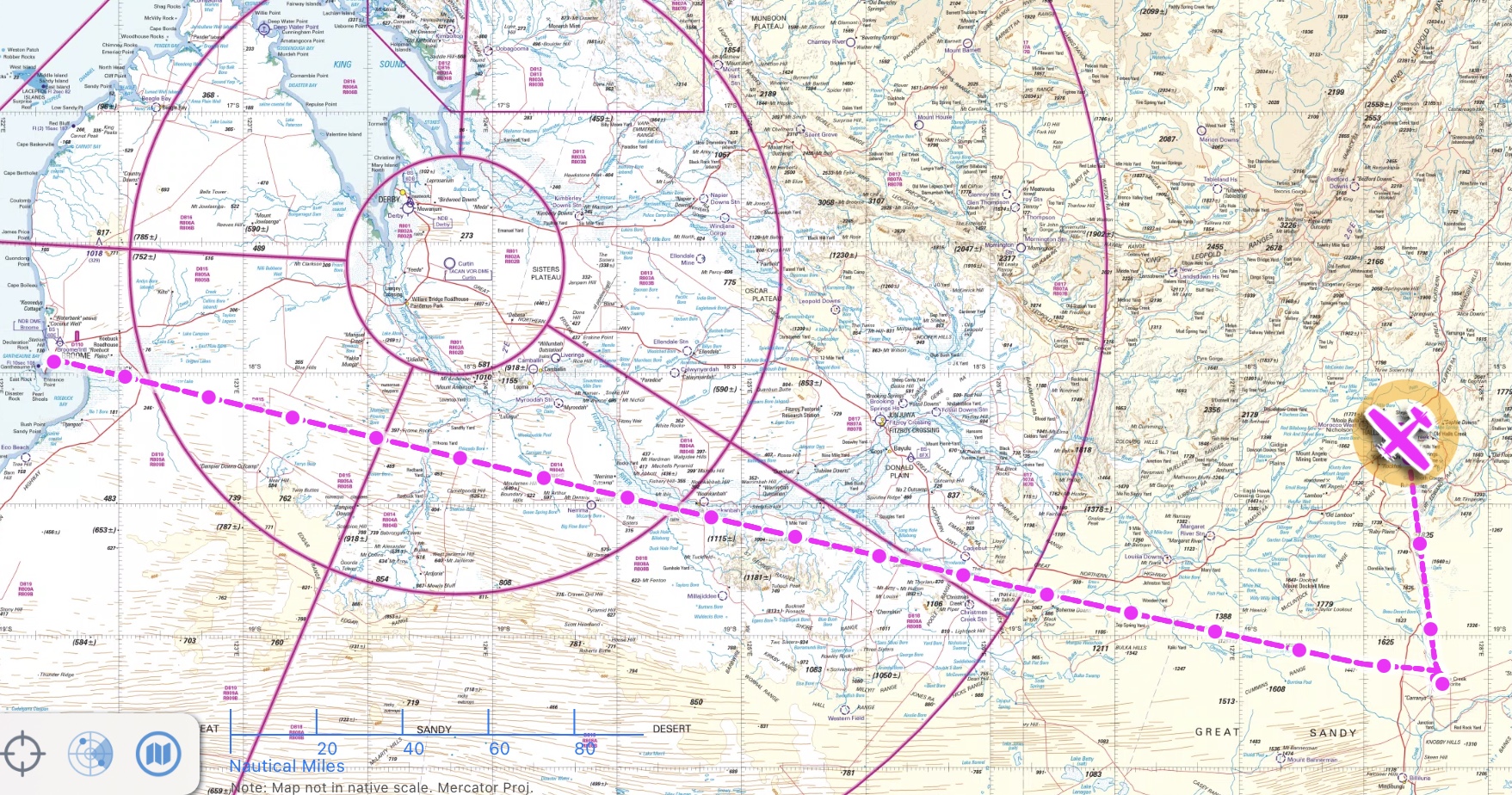
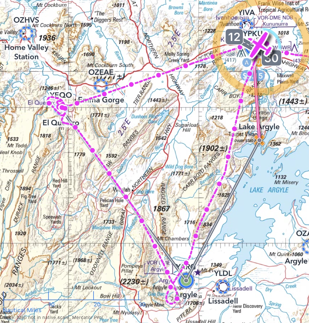
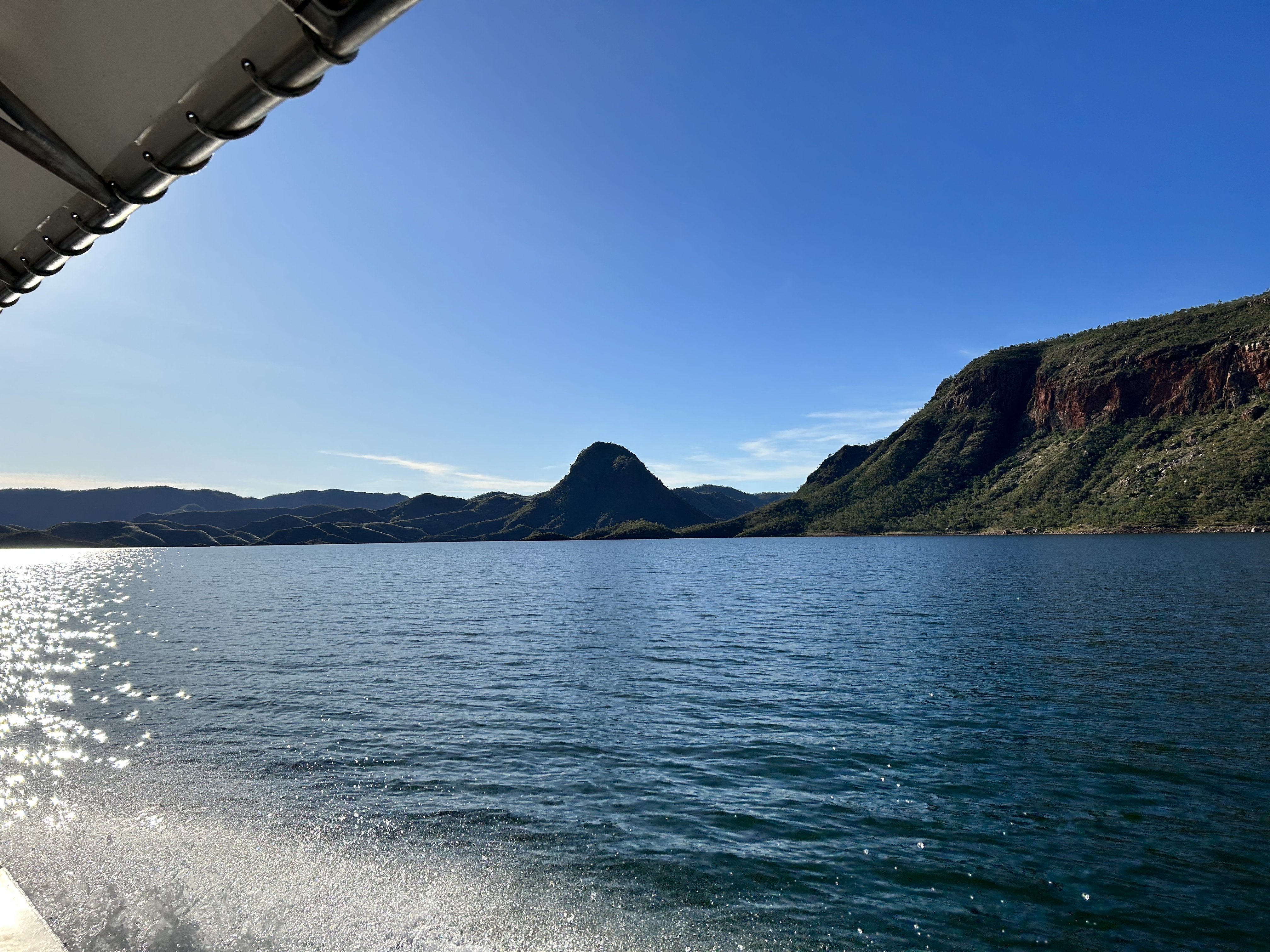
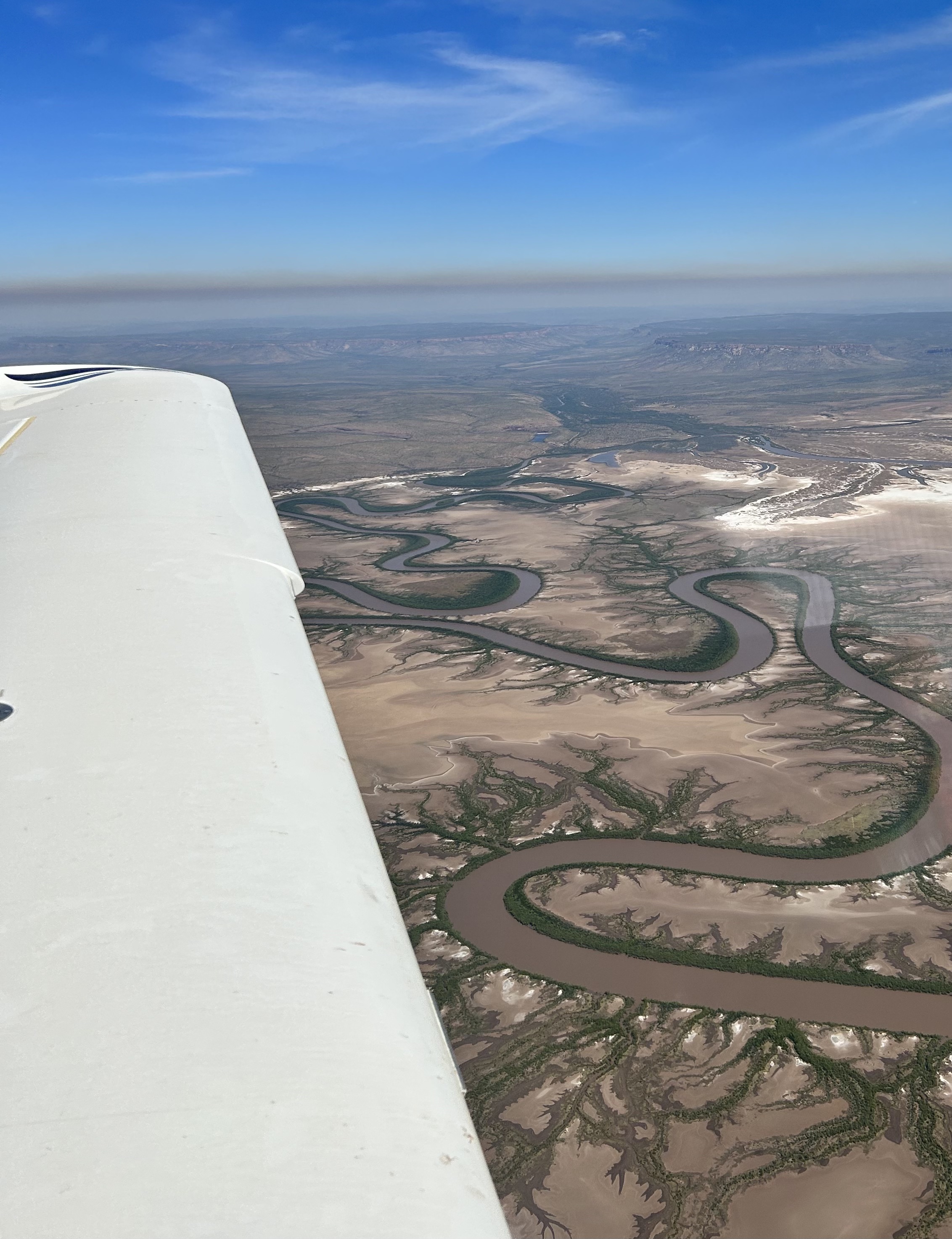
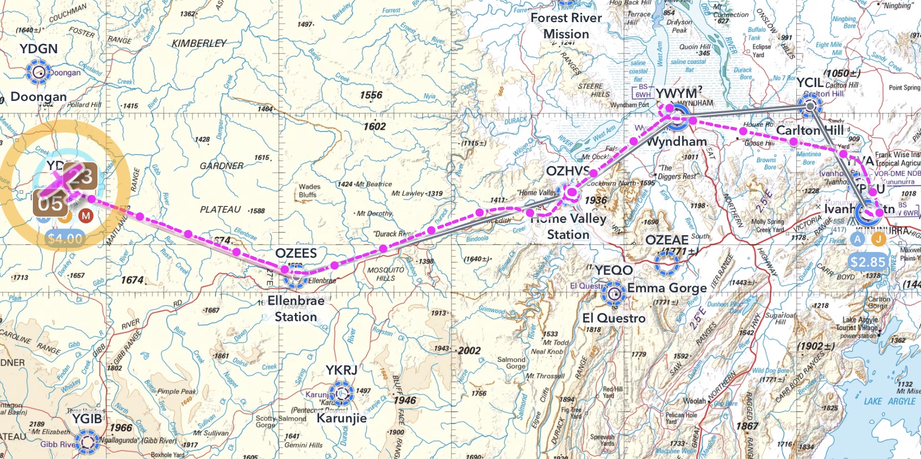
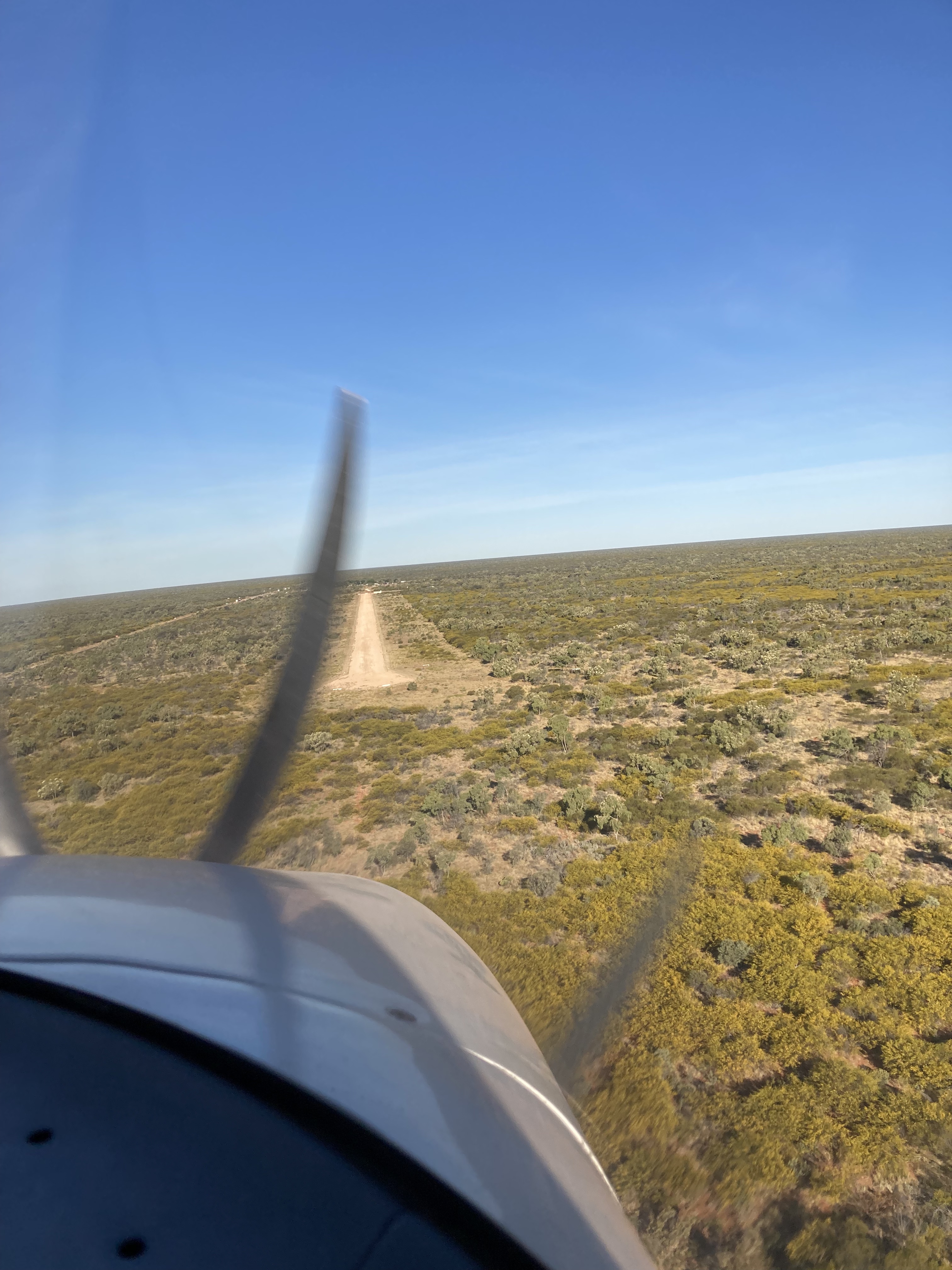
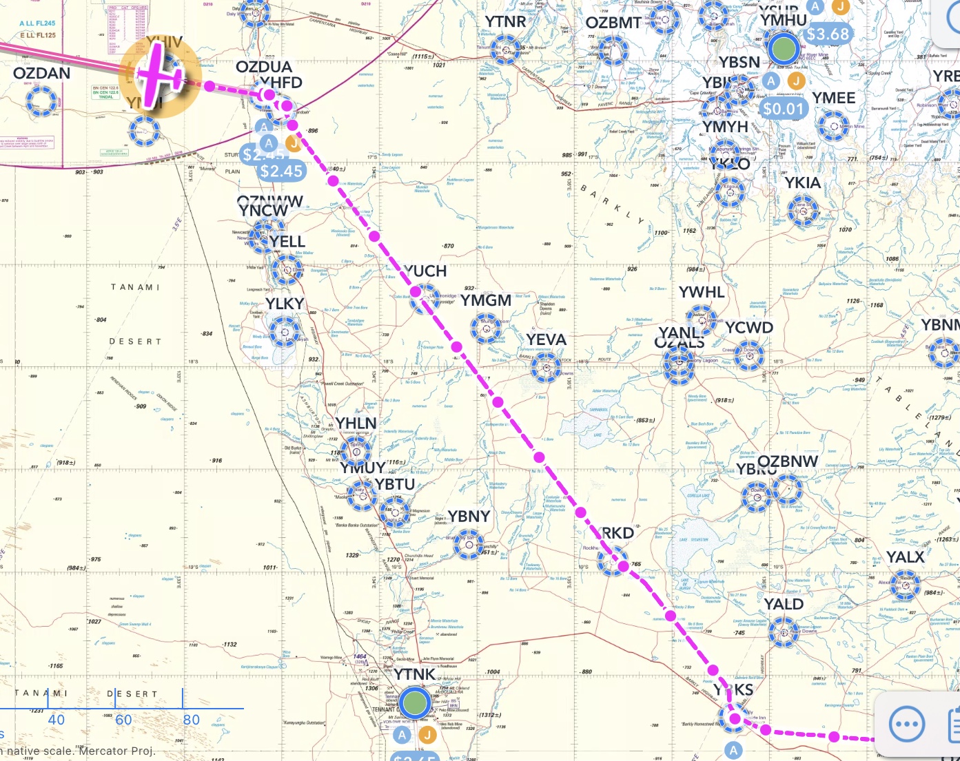
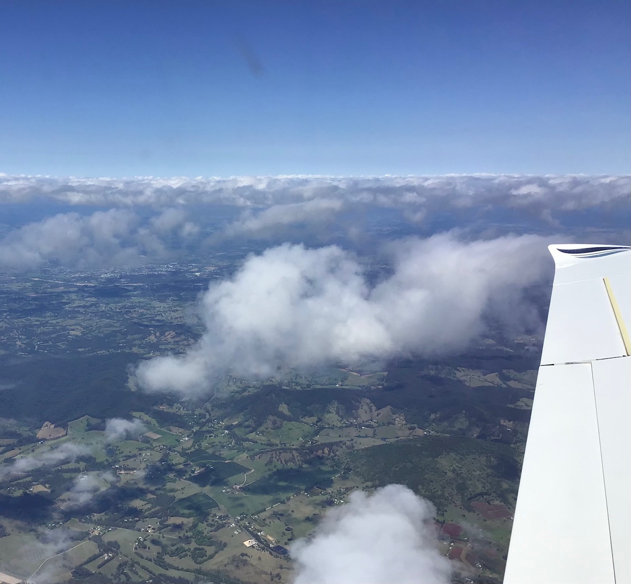
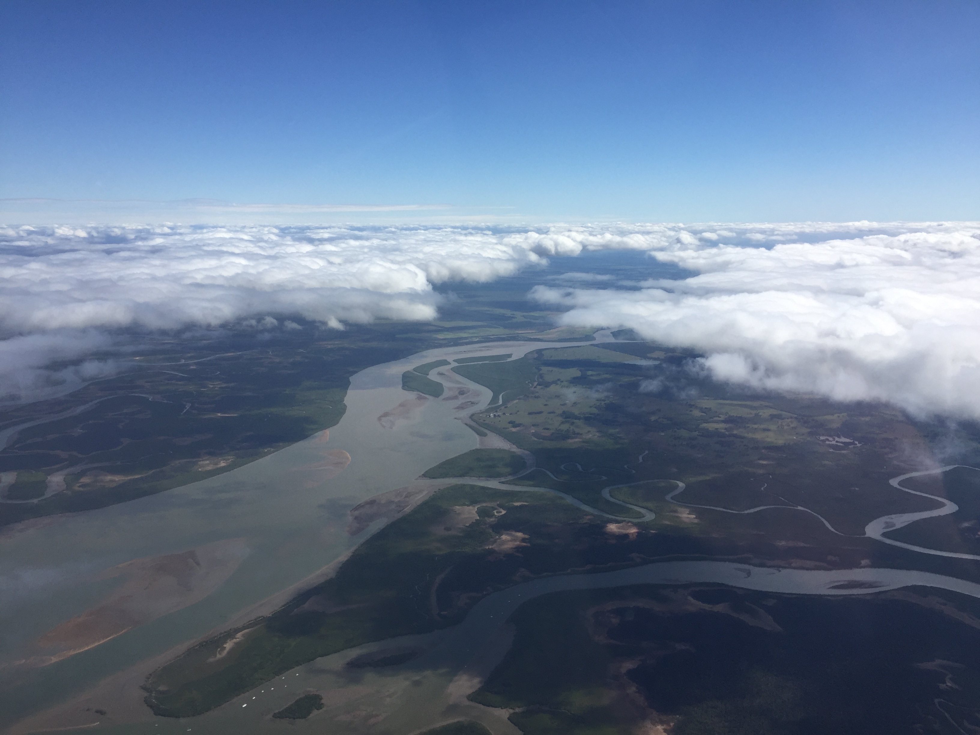
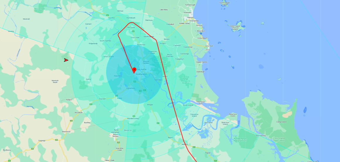
From Purnululu it was a “long haul” flight to Barkly Wayside Inn via Hooker Creek and Tennant Creek. We did a quick pass over the Bungles and then tracked direct for YHOO, losing 90 minutes as we crossed into the NT.
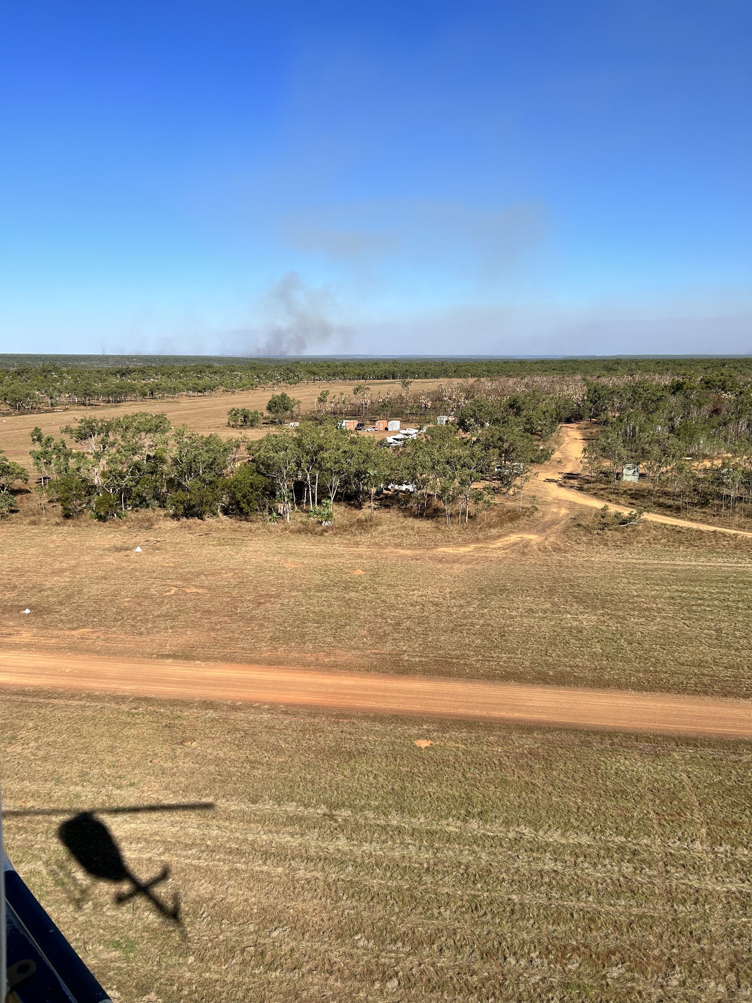
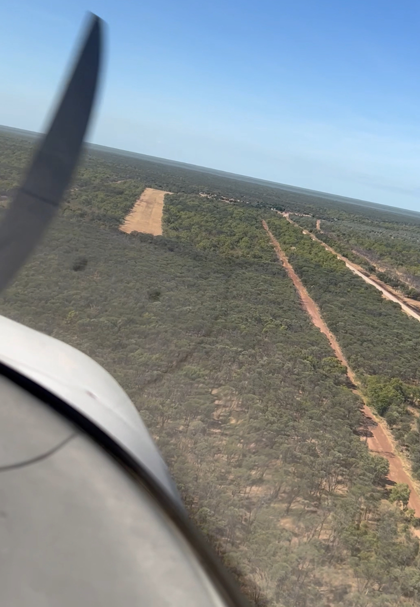
The first leg was 60 minutes with some smoky parts to fly over. At Hooker we had to queue for Avgas as possibly the only other customer for the day had landed ten minutes before us and then discovered his company credit card had no money on it. I presume he resorted to his personal card as he eventually filled up and pulled his Cessna out of the way.
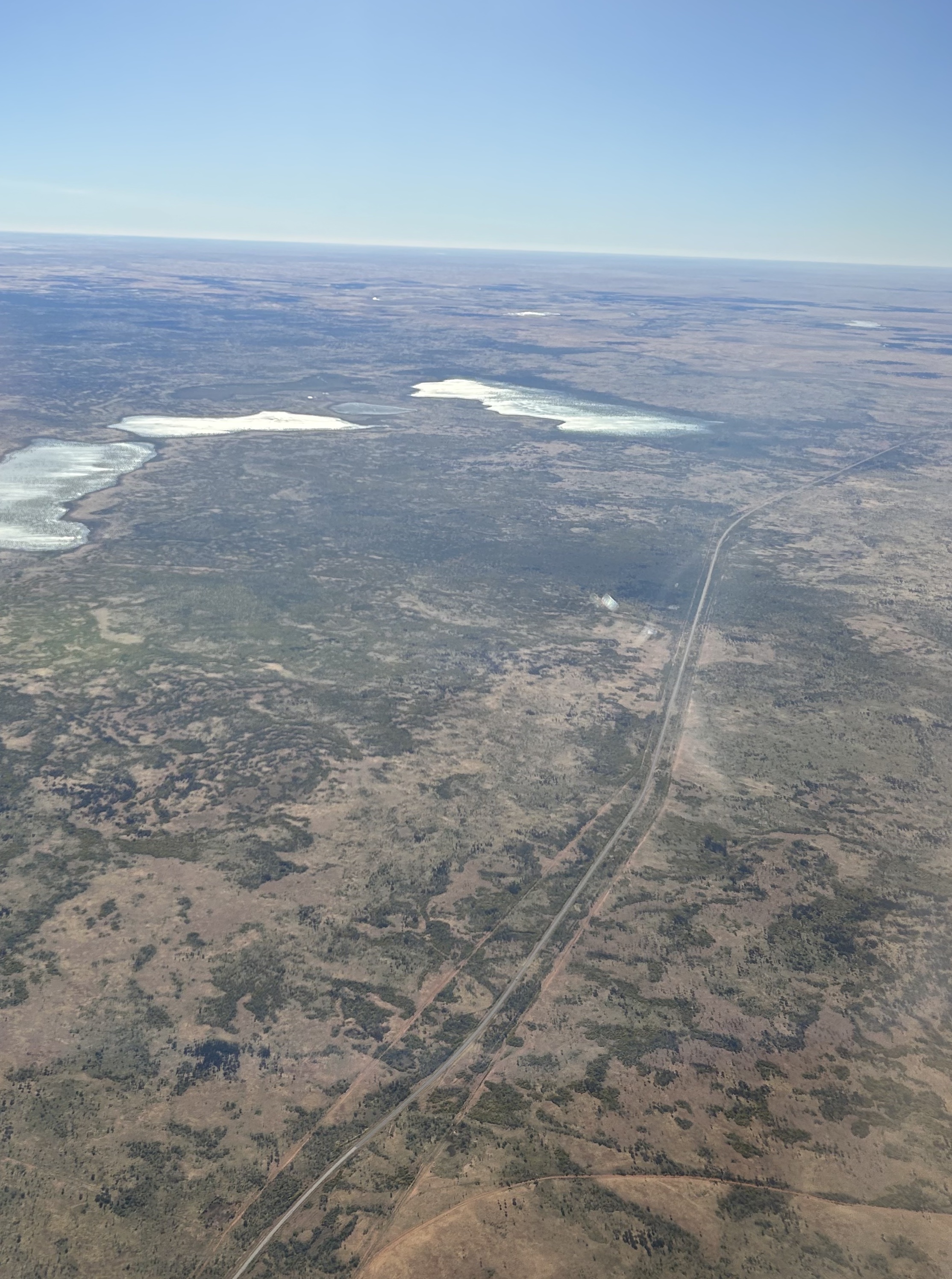
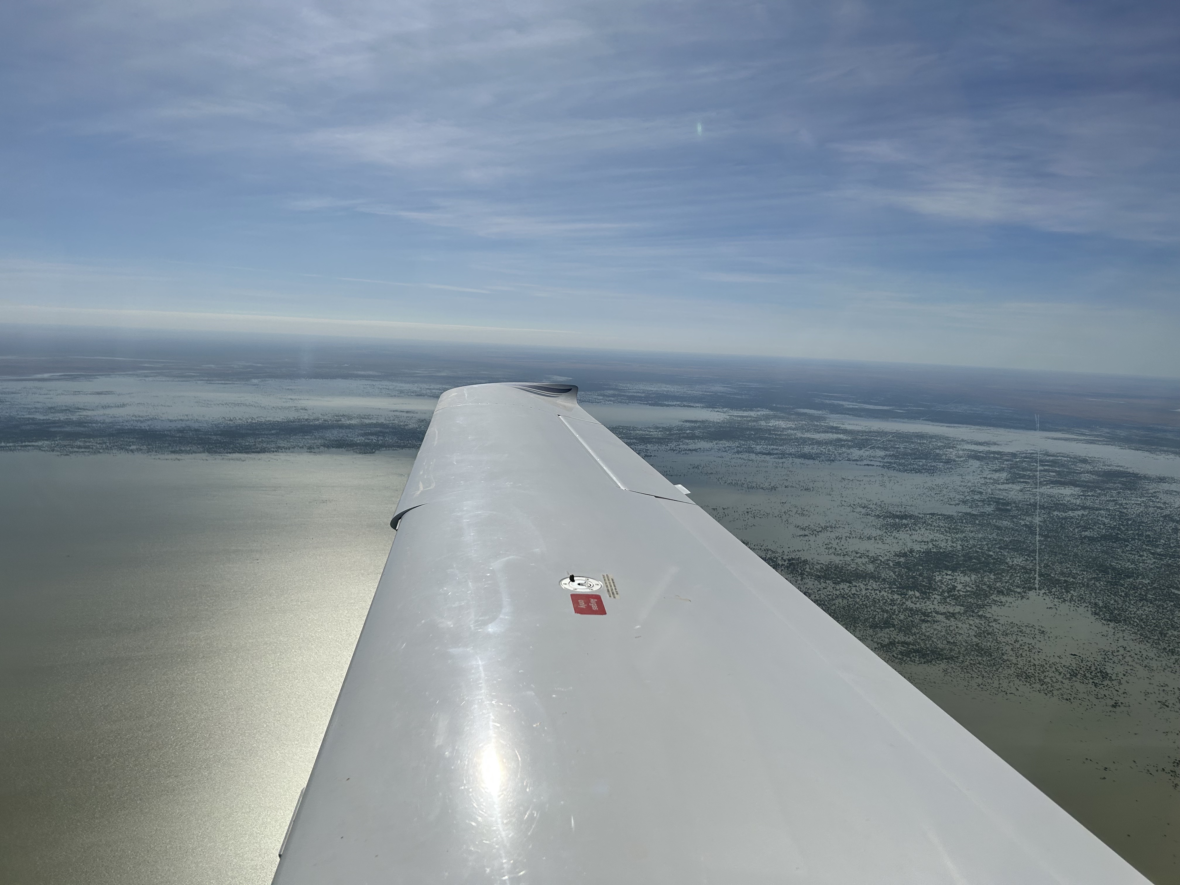
Meanwhile Sigi and Rita had bought sandwiches and salad at the community store so we were all set for a picnic at Tennant Creek. Taking off we spent the next 90 minutes flying over the northern end of the Tanami Desert that was uncharacteristicly green. They have had a lot of rain this past wet season. An Airnorth King Air was also planning to land at Tennant Creek so we let him land first while we did an orbit over the town.
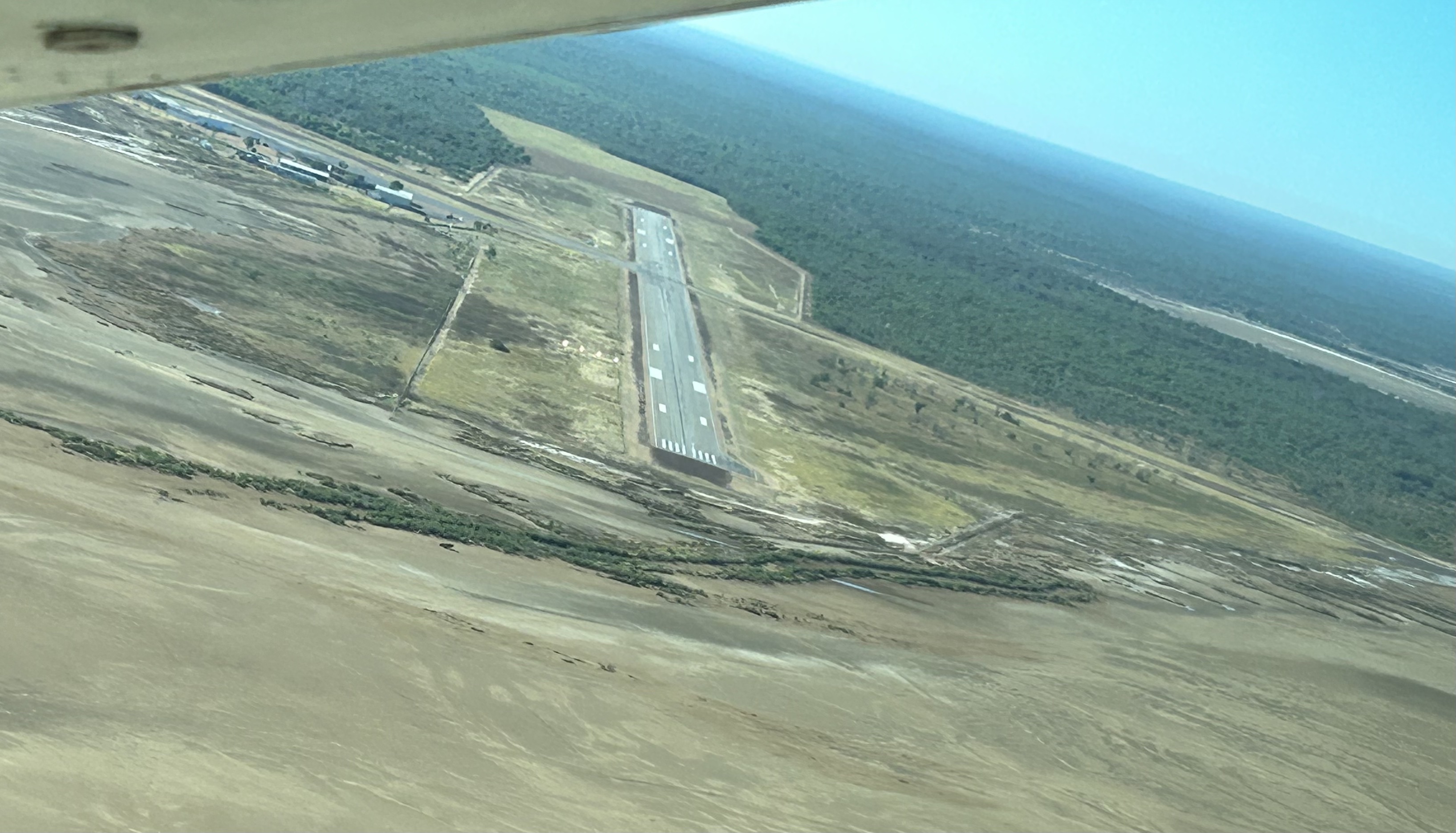
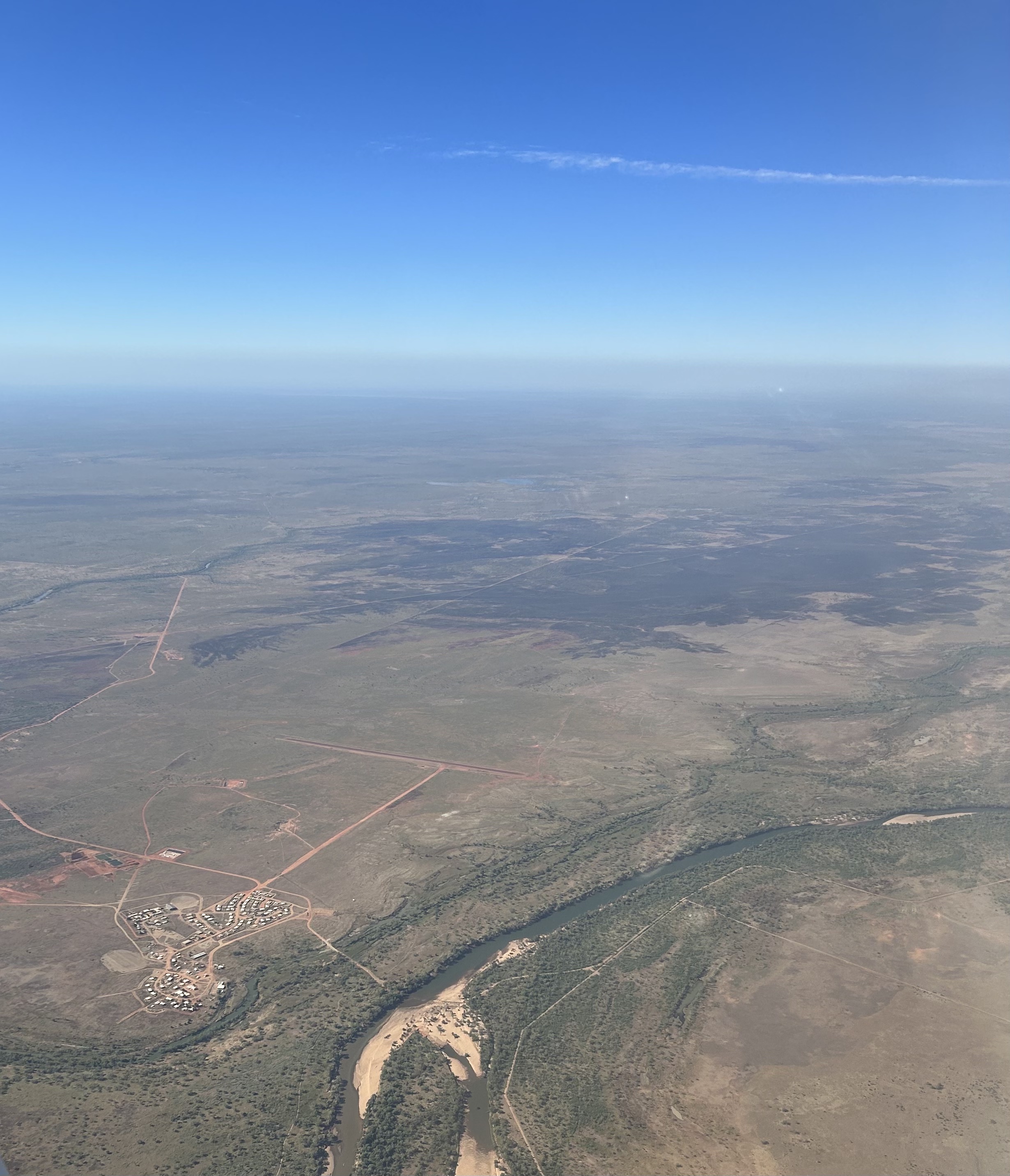
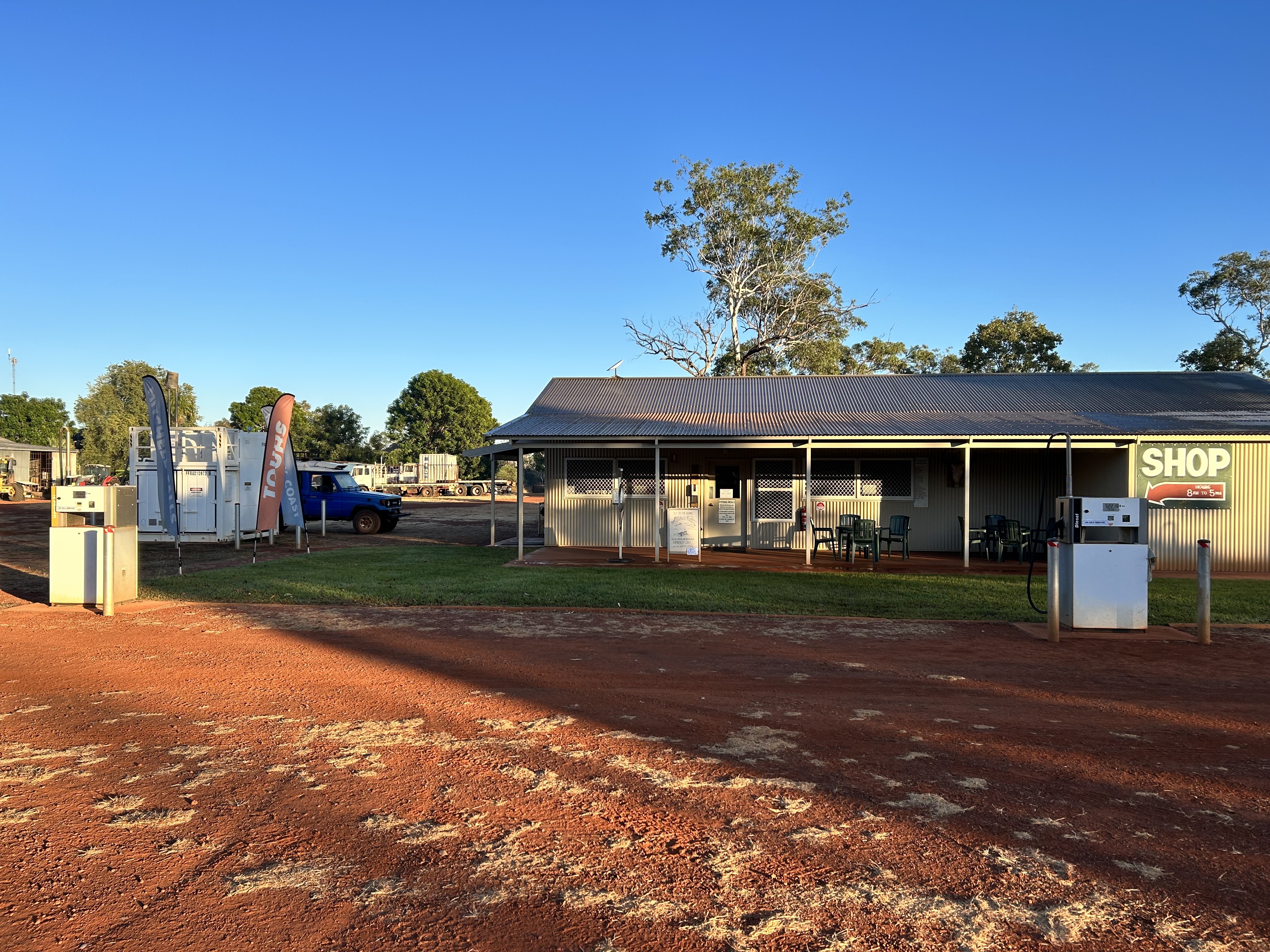
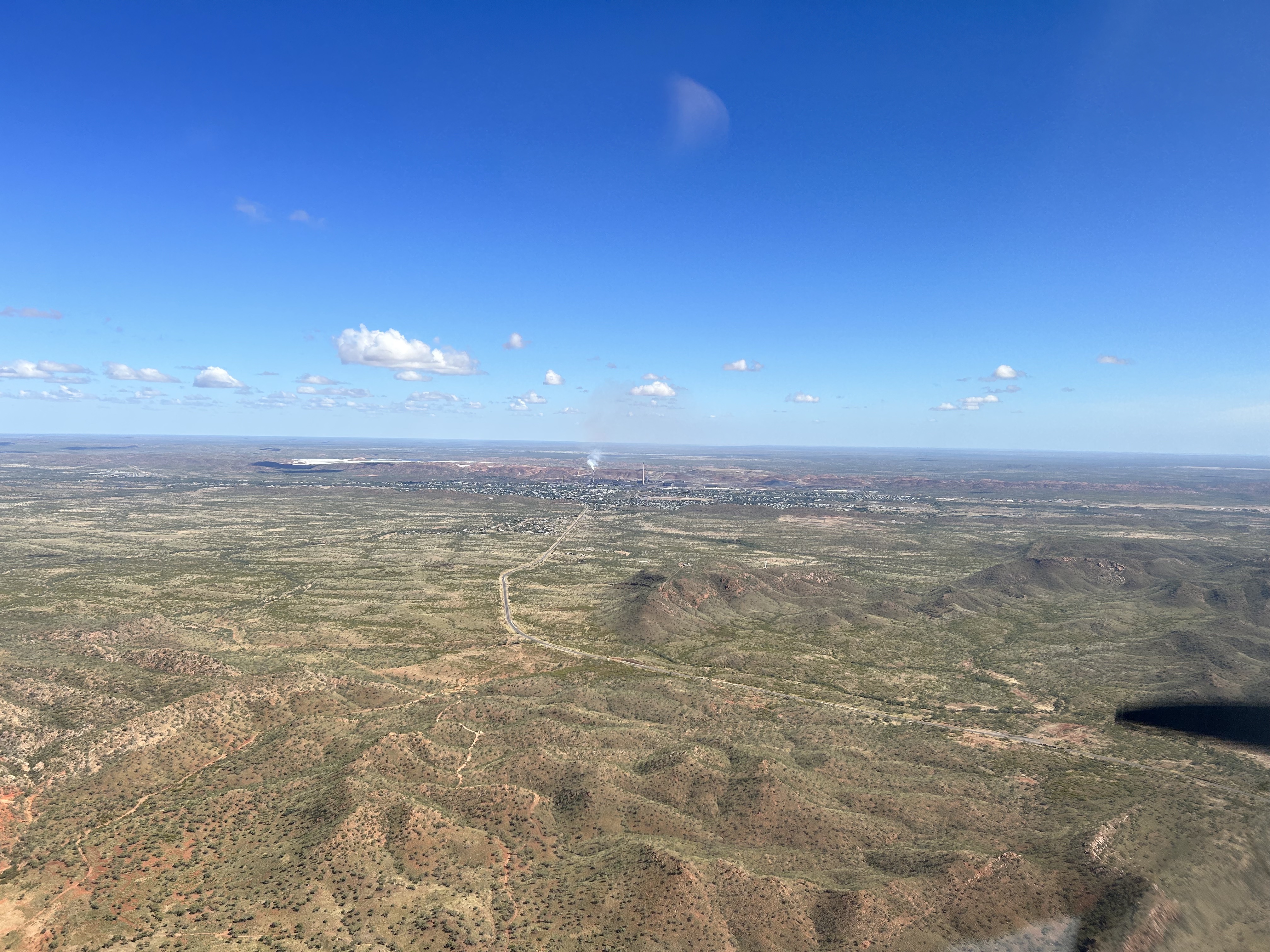
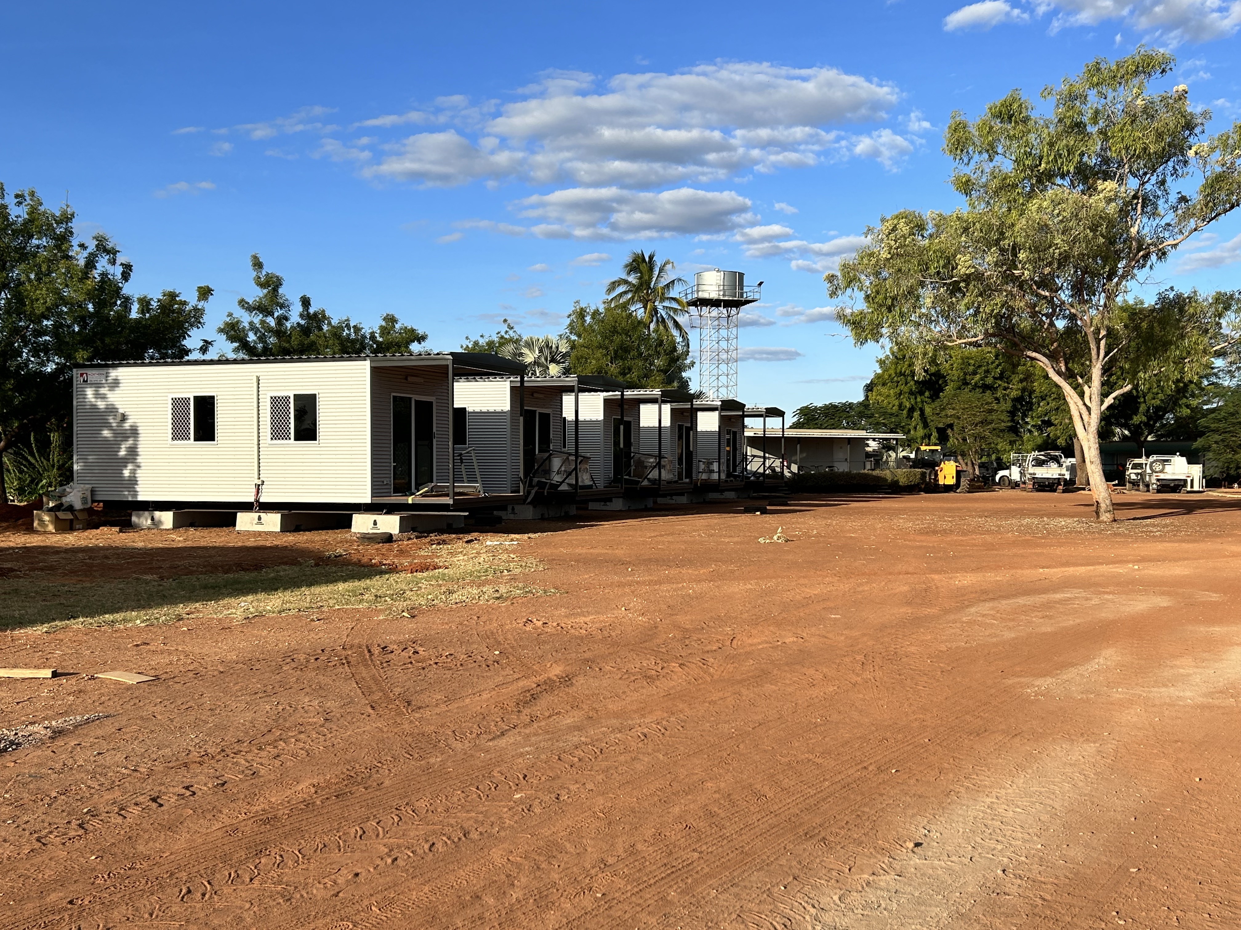
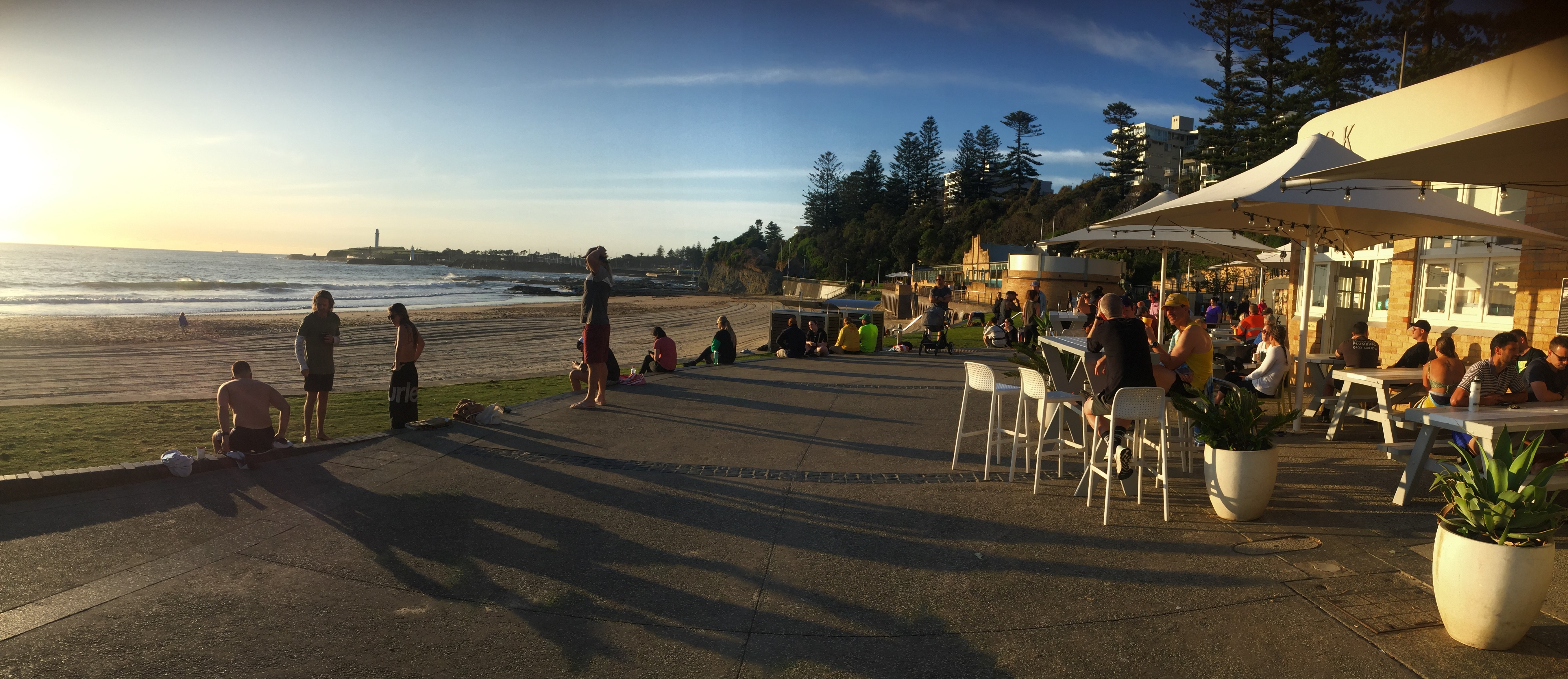
After refuelling we had intended on walking down town as it was only 1 km but decided we’d rather just get to Barkly as soon as possible as we were keen to see whether the new roadhouse had really been completed and was open for business. We were soon flying the last 30 minute leg. We landed and taxied towards the apron while an elderly couple watched in amazement. They didn’t realise they were standing in the middle of the taxiway! After a bit of furtive sign language they suddenly realised they were about to be sliced and diced if they didn’t move out of the way so our way was clear to the bowser once more. No cement mixer this time and no wayward trucks and the apron looked a little bit less like a scrap yard.
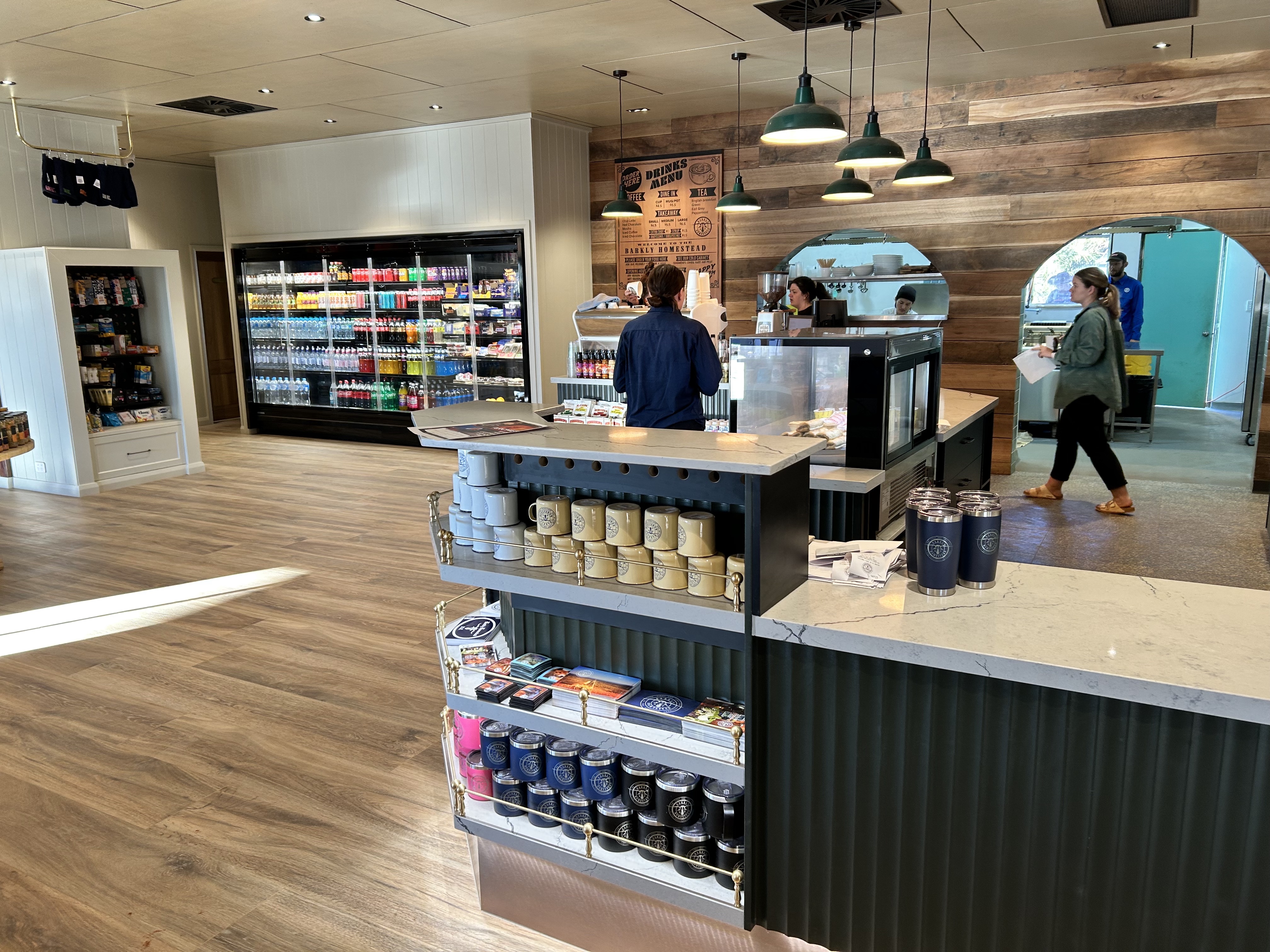
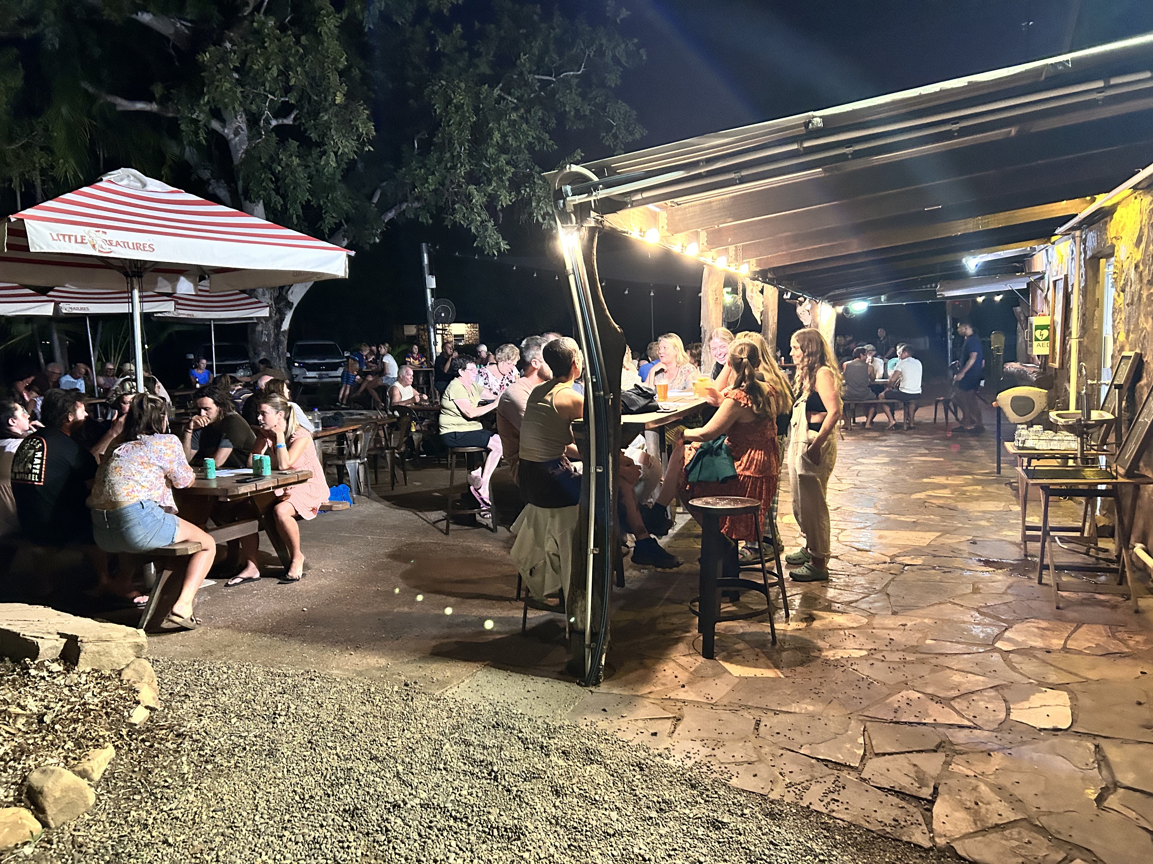
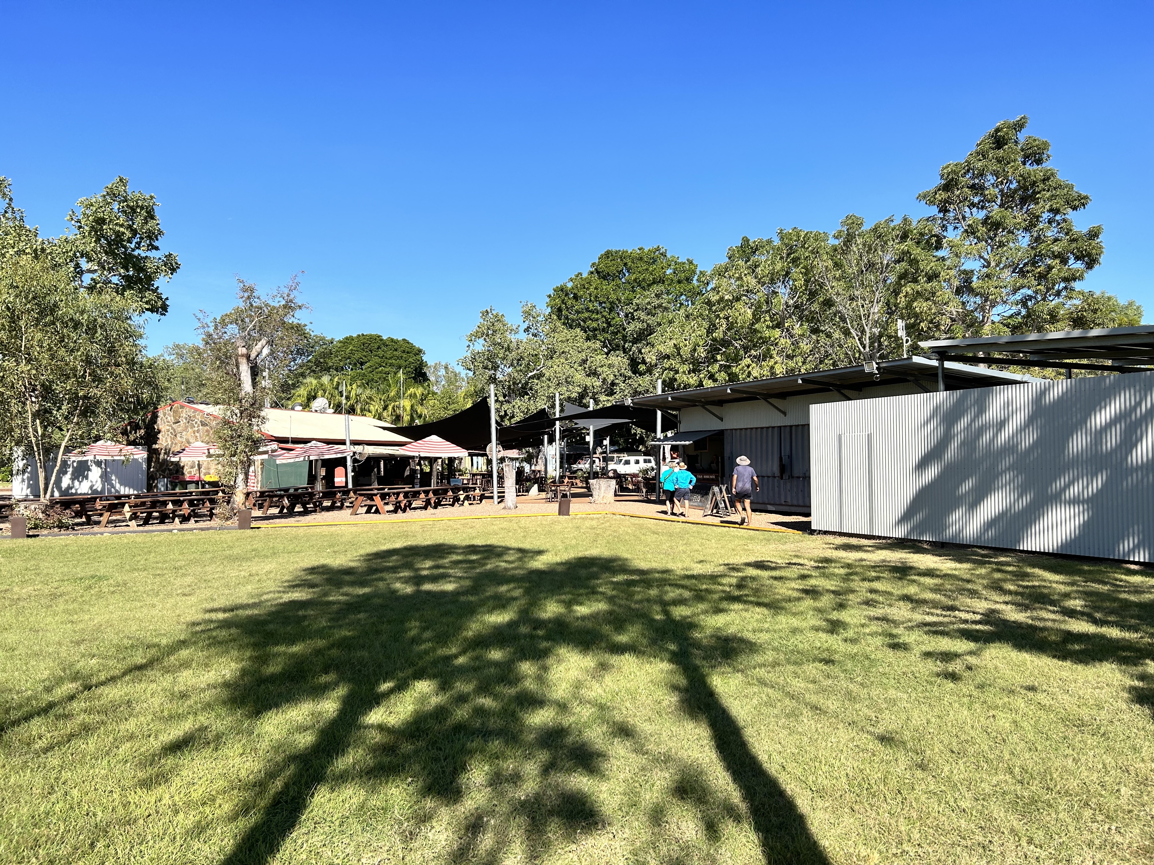
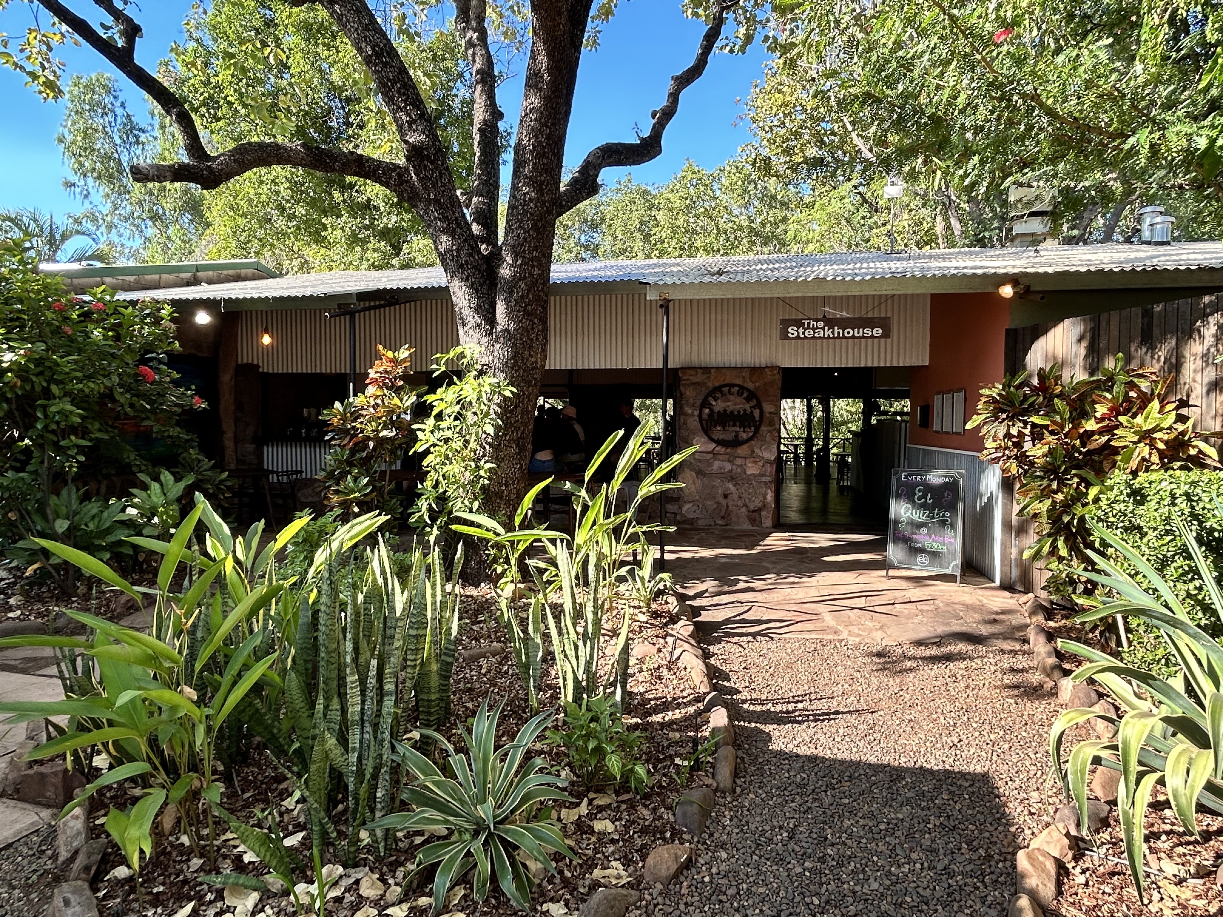
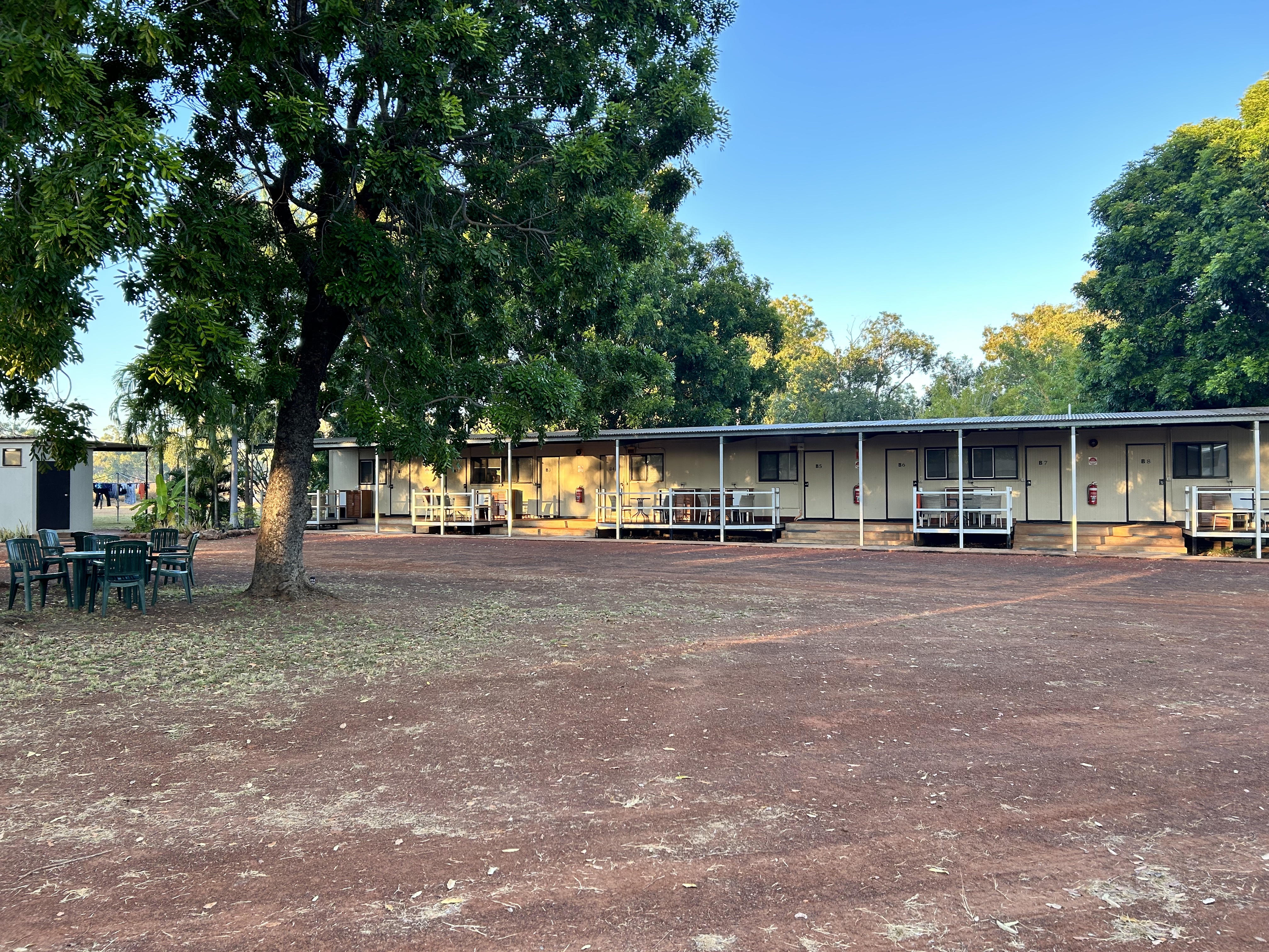
After filling up again we pushed MSF back into a gap between the building materials that covered the lay down area. And were we impressed by the new buildings? You bet we were. A great new roadhouse complete with live music and all completed in 4 months according to the manager. Quite an achievement.
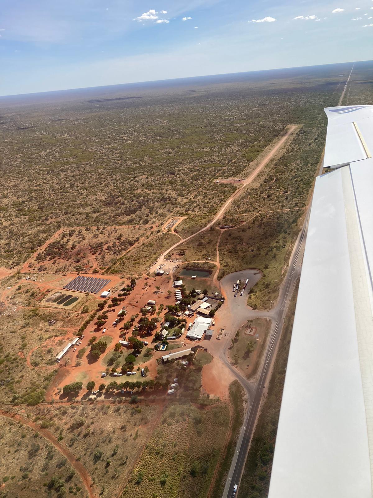
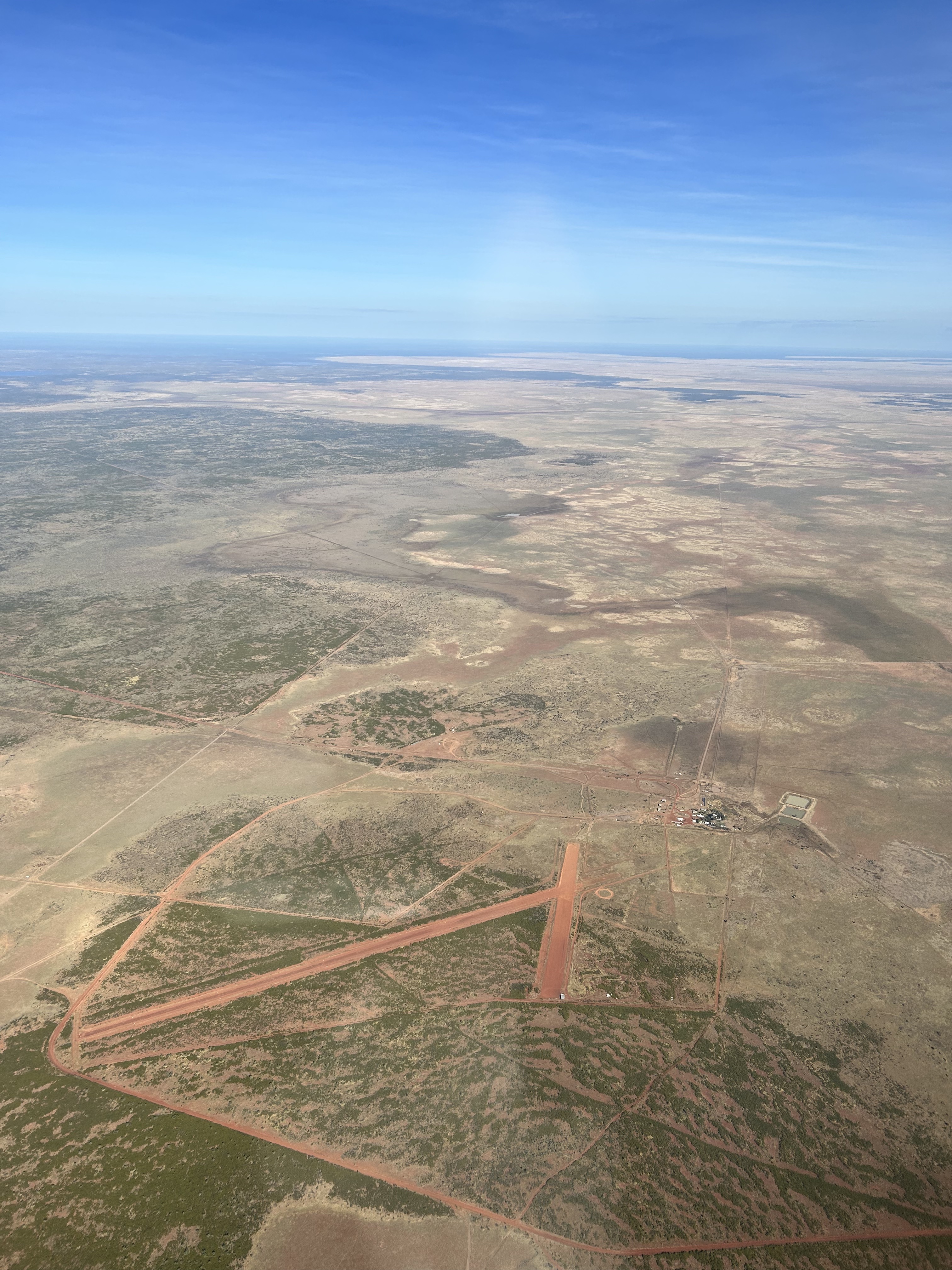
It was another big day from Barkly Wayside Inn to Winton. It is a big country isn’t it? At only 10 degrees it meant we needed to rug up again until the sun got up a bit. MSF required a bit of coaxing again to get going but after a few attempts the engine fired up and we taxied out of the lay down area to the strip, avoiding pedestrians on the taxiway as we went.
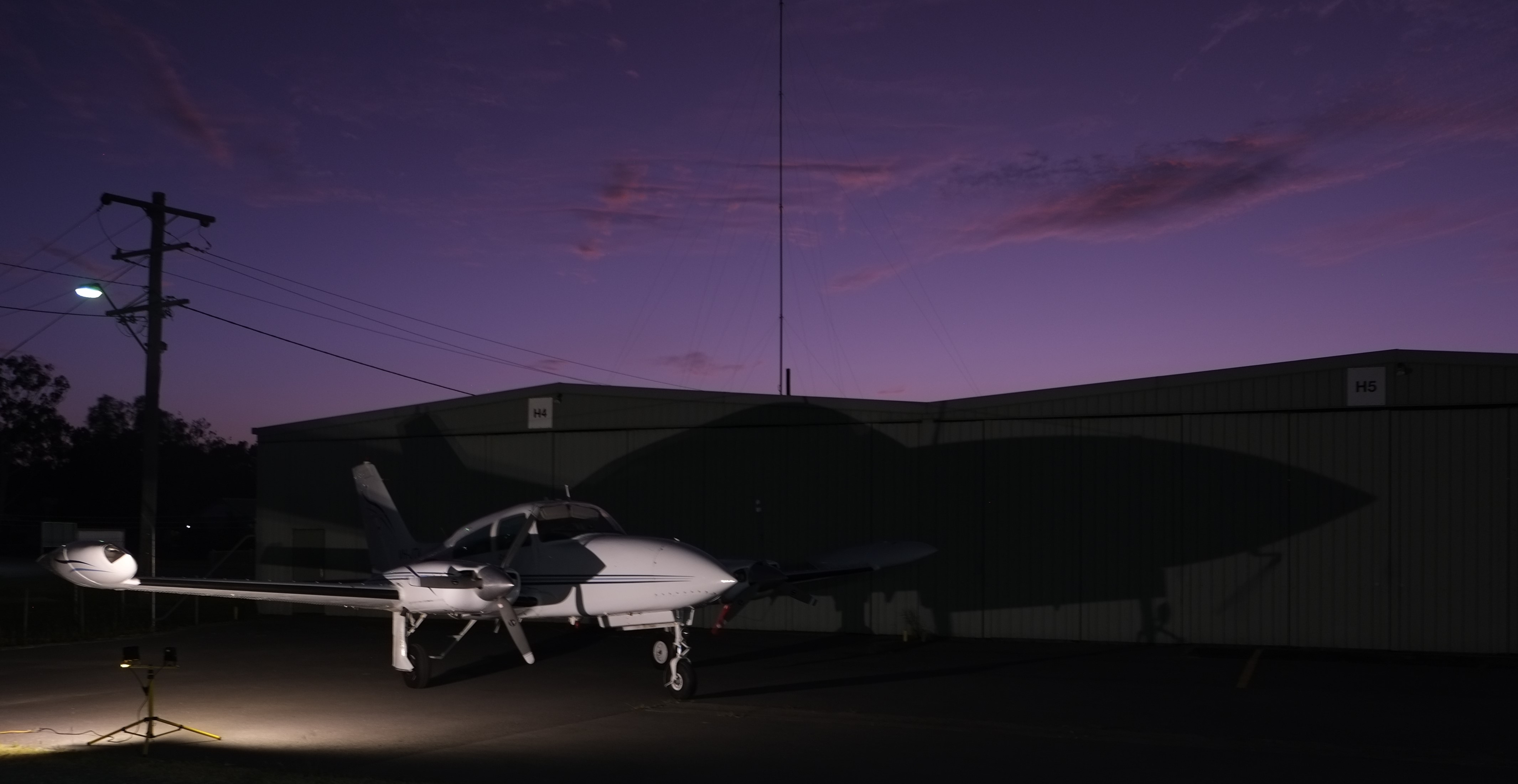
Departing Barkly Roadhouse
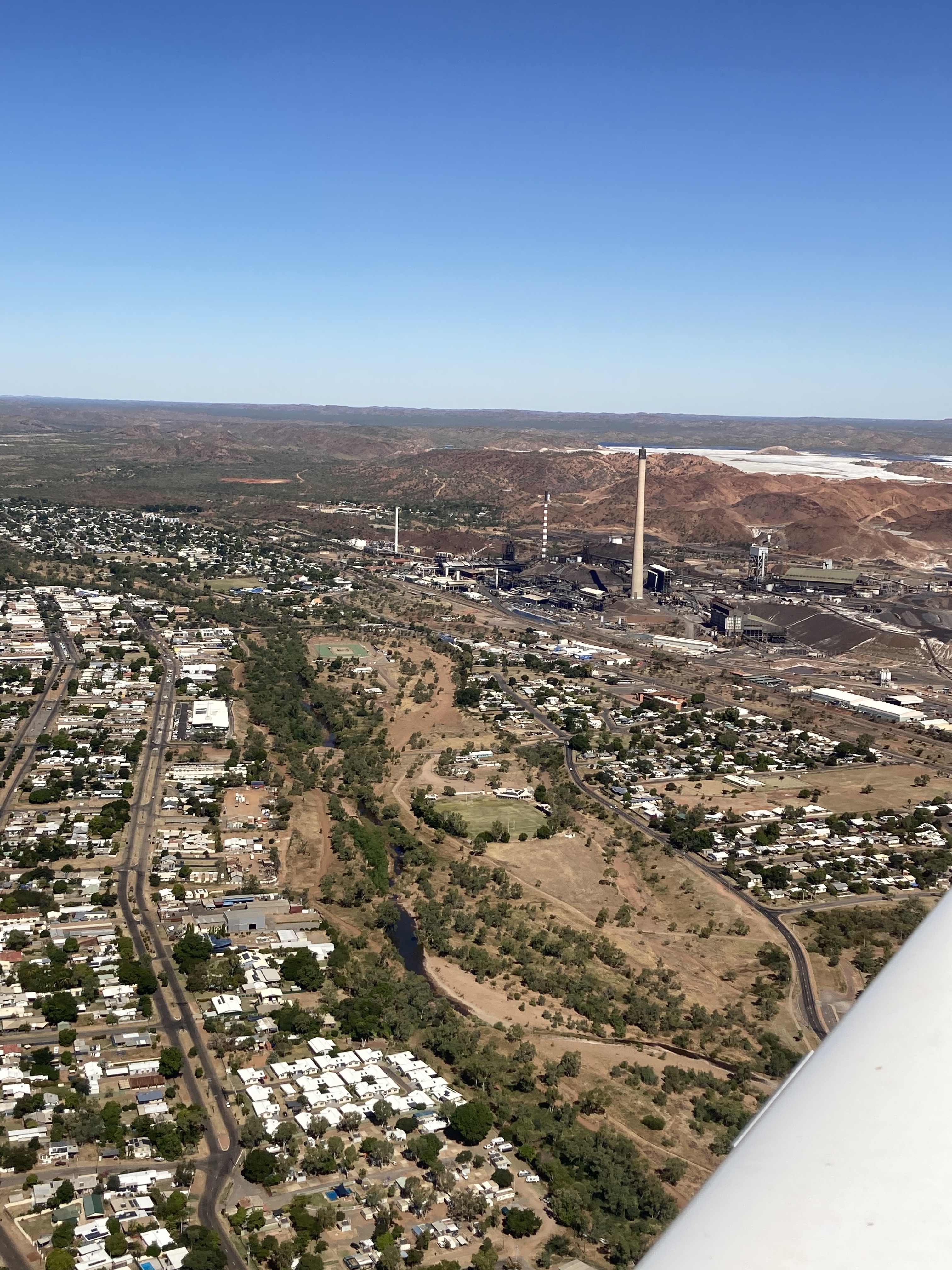
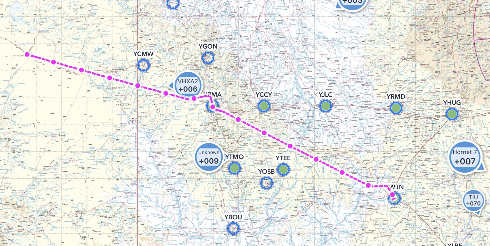
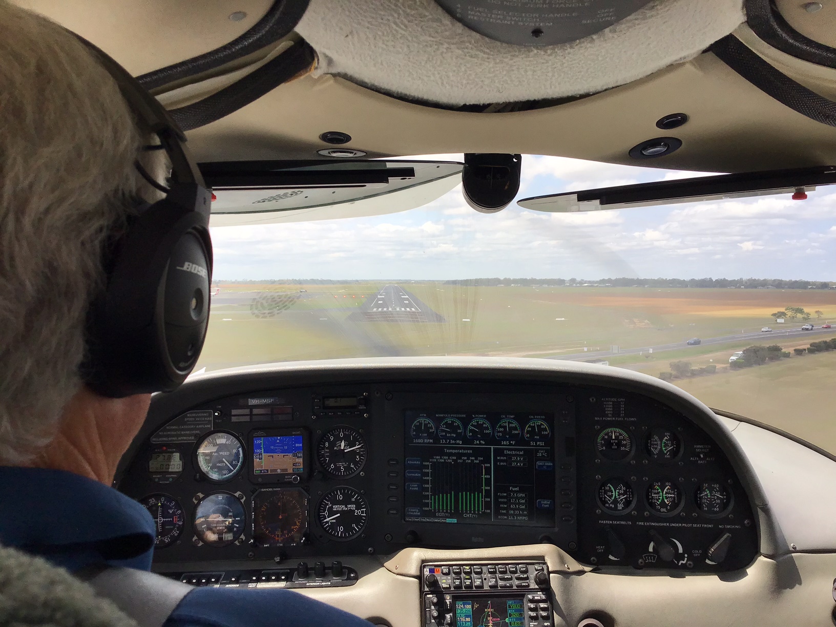
It was over an hour VFR to Mt Isa where I did a practice RNP instrument approach. The terminal was open and the cafe was selling coffee so we struck the jackpot.
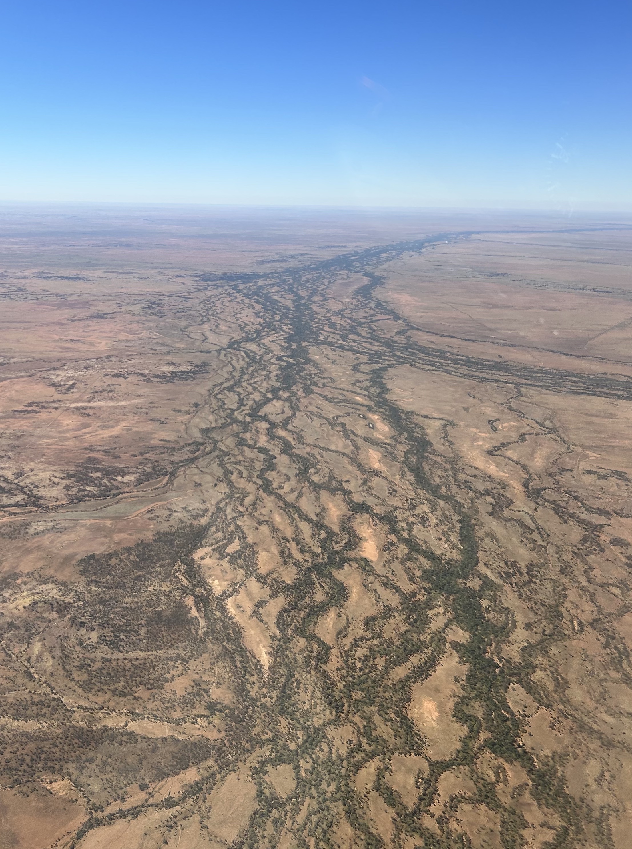
There was VHF coverage from there on so we were IFR to Winton, passing over the Diamantina River on the way.
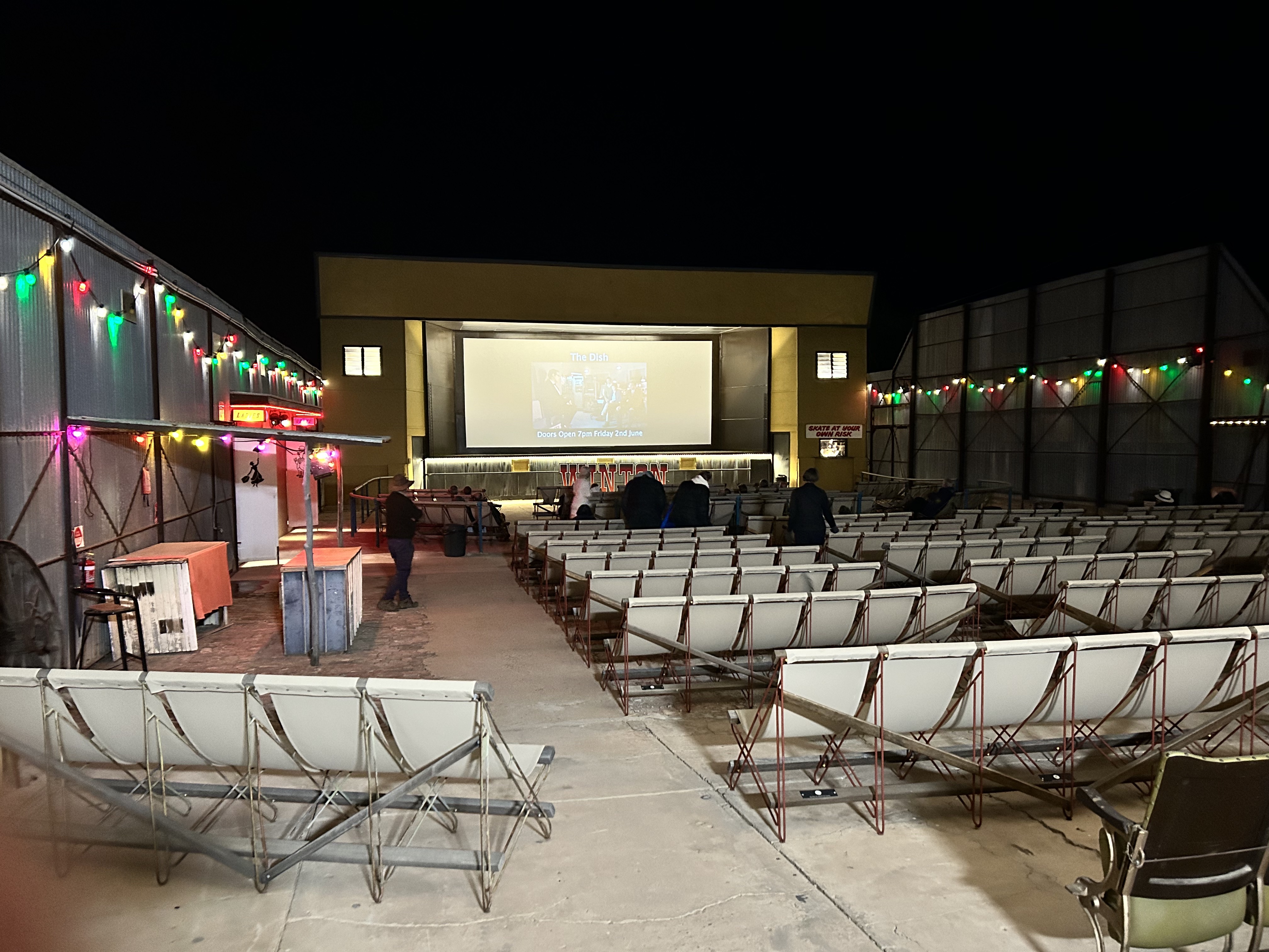
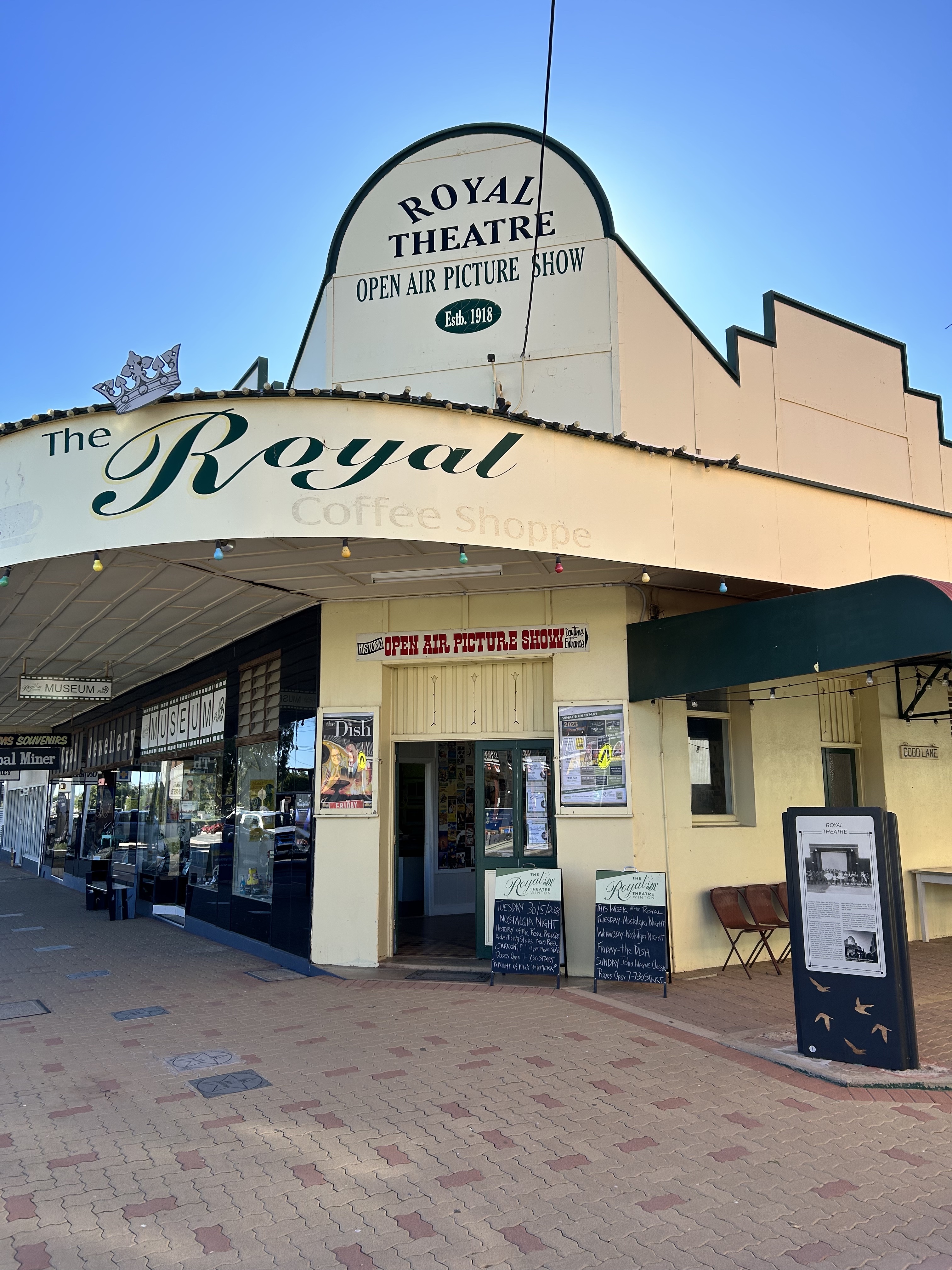
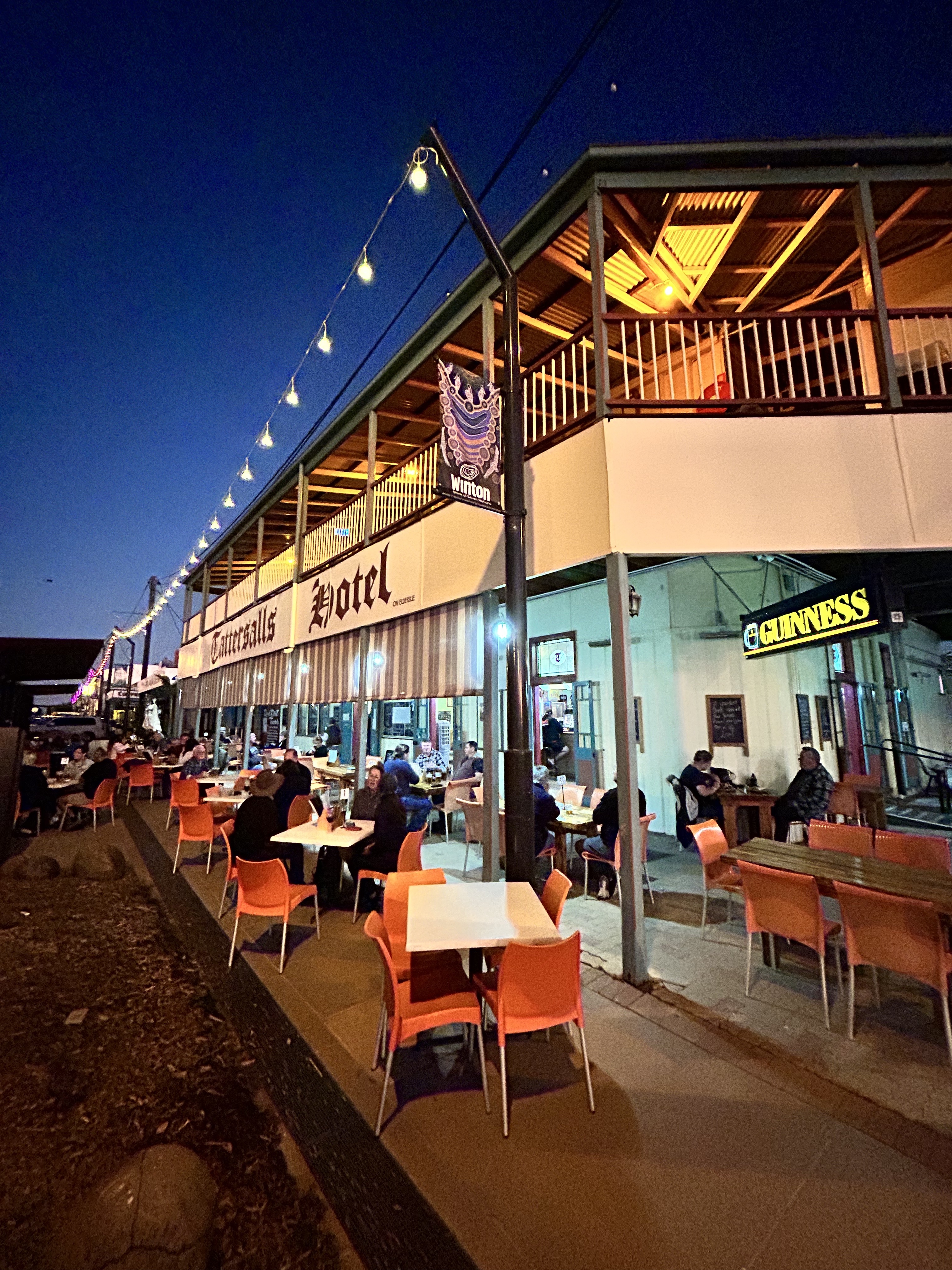
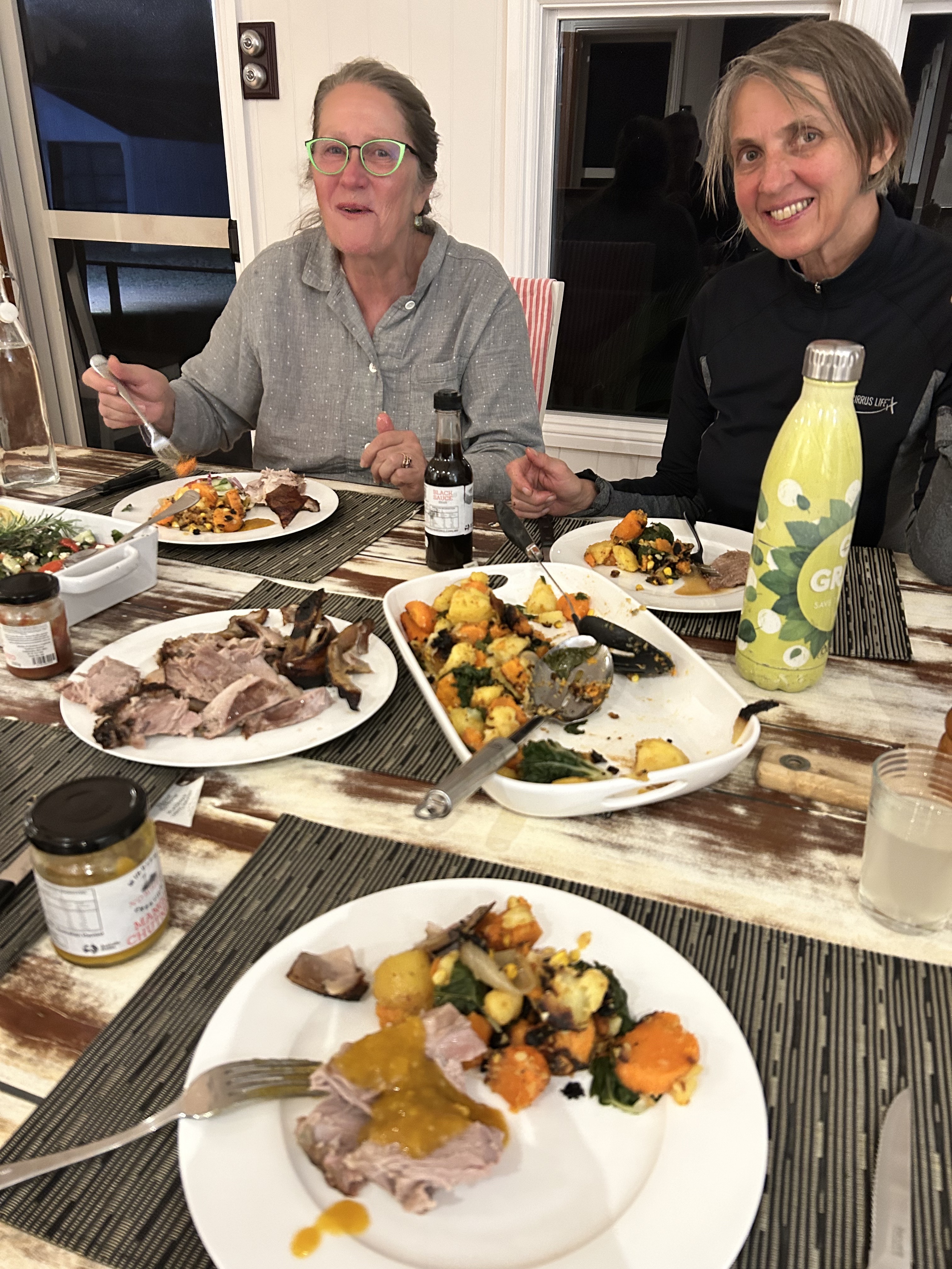
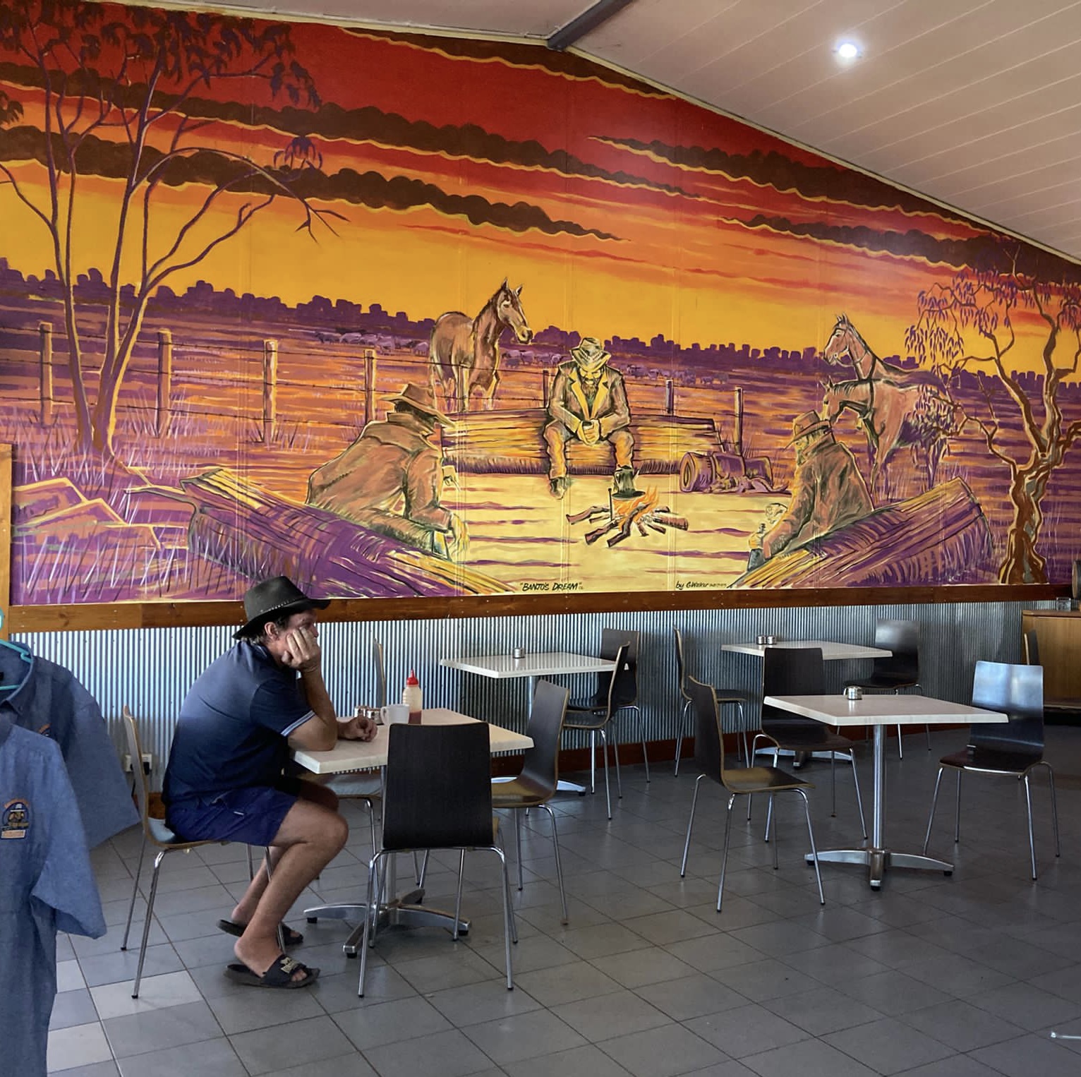
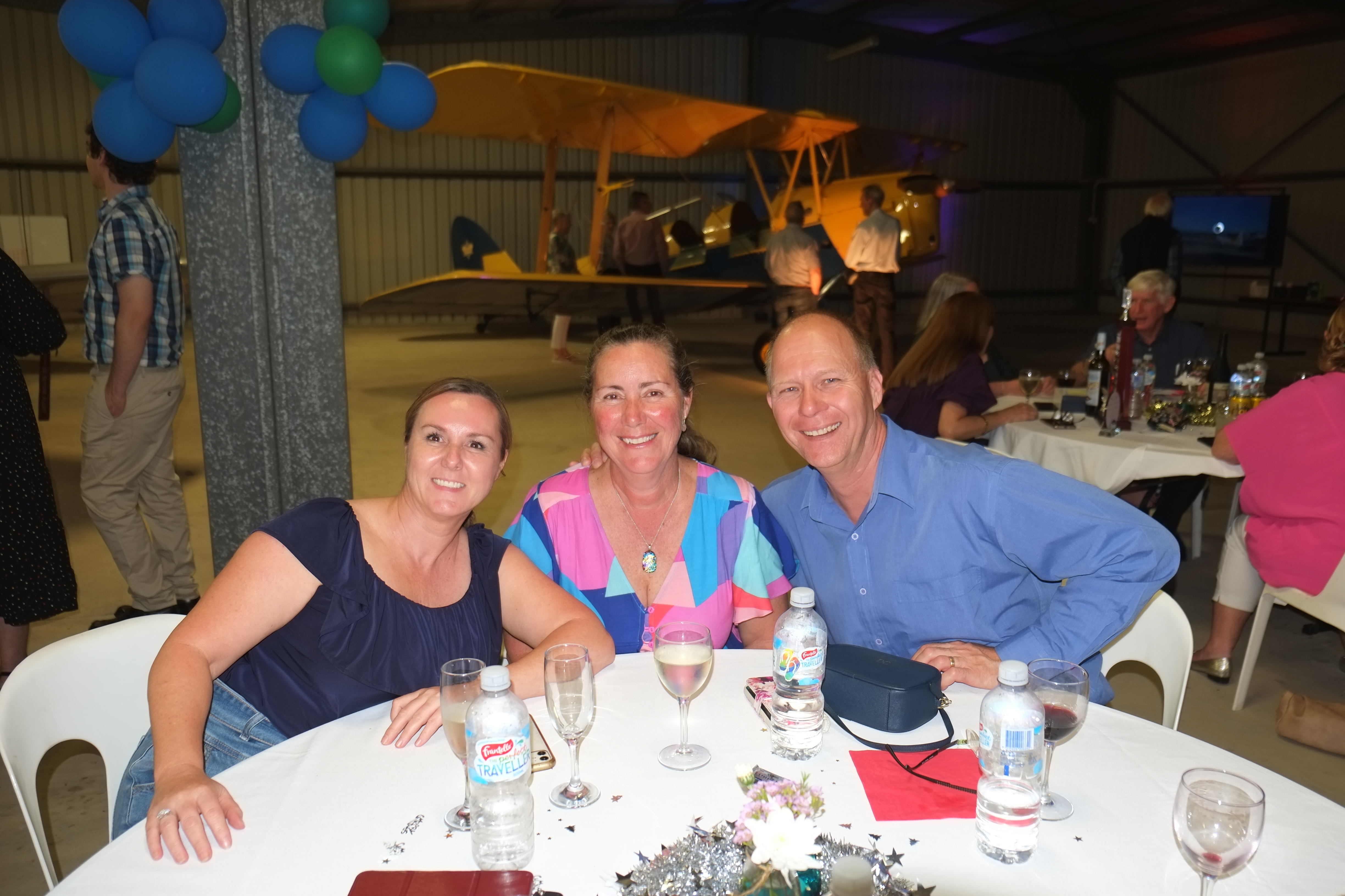
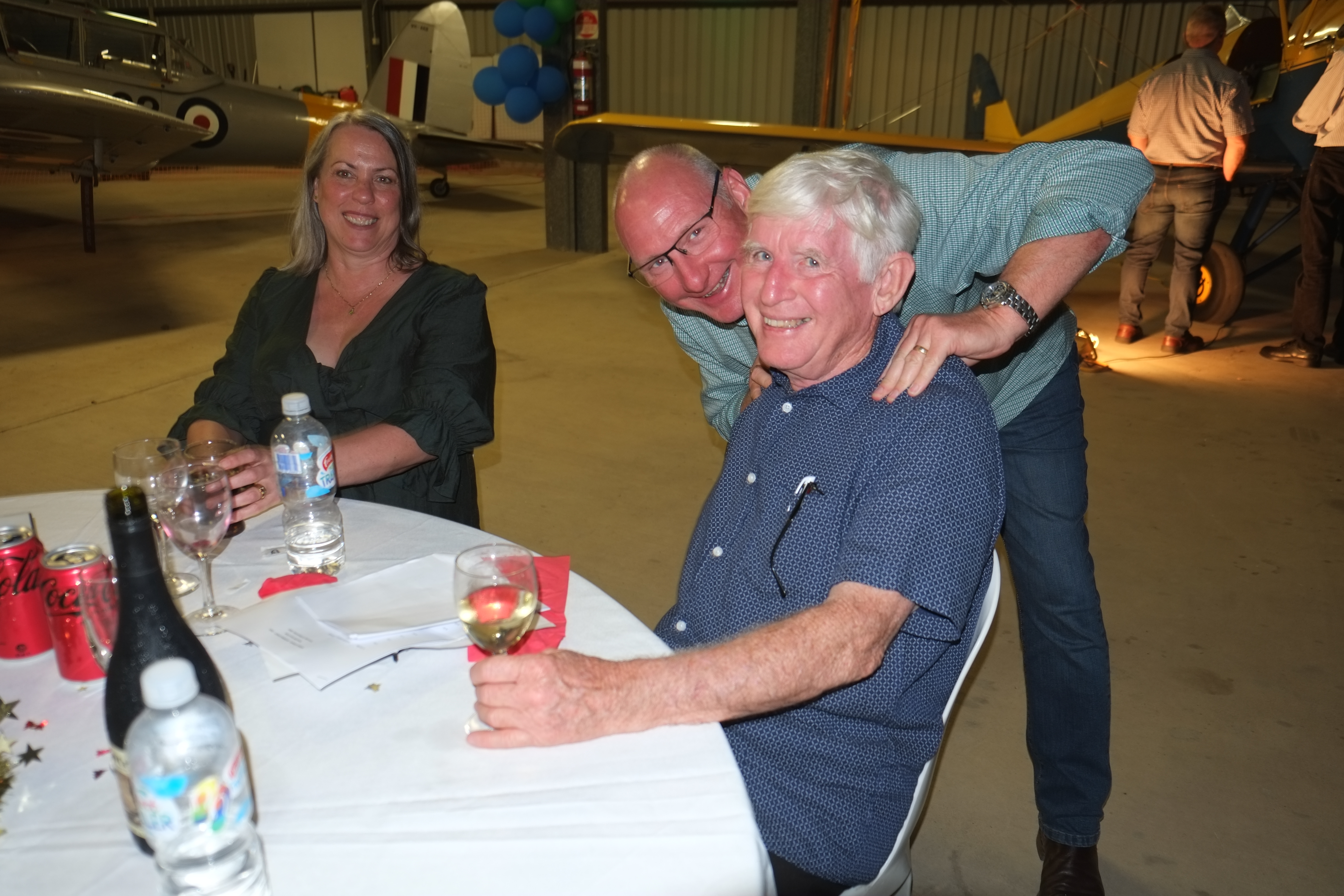
After another RNP approach we tied down for the night. Adam from the Outback Motel was waiting for us and before long we were taking in the wonders of Winton. There was a poetry recital by Gregory North at the North Gregory Hotel followed by dinner at the Tatts Hotel as the sun set. We finished the day with a nostalgic movie night at the open air Royal Theatre. It’s one of only two open air cinemas in Australia. Where’s the other one? You guessed it – Broome. As the temperature dropped to 10 degrees we watched newsreels from the 50s, old adverts, cartoons and silent movie skits. Very funny. And we could remember many of them from our childhoods.
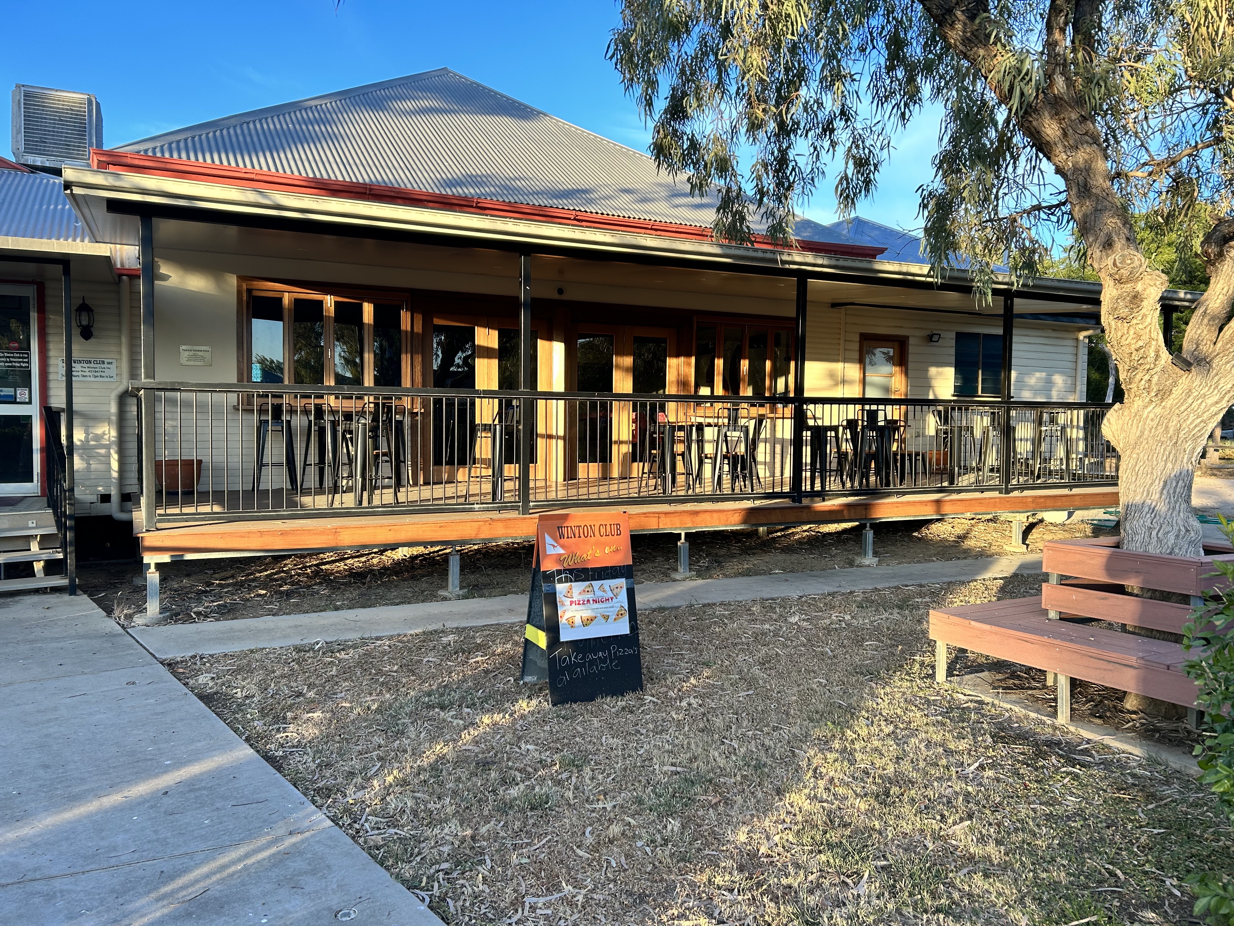
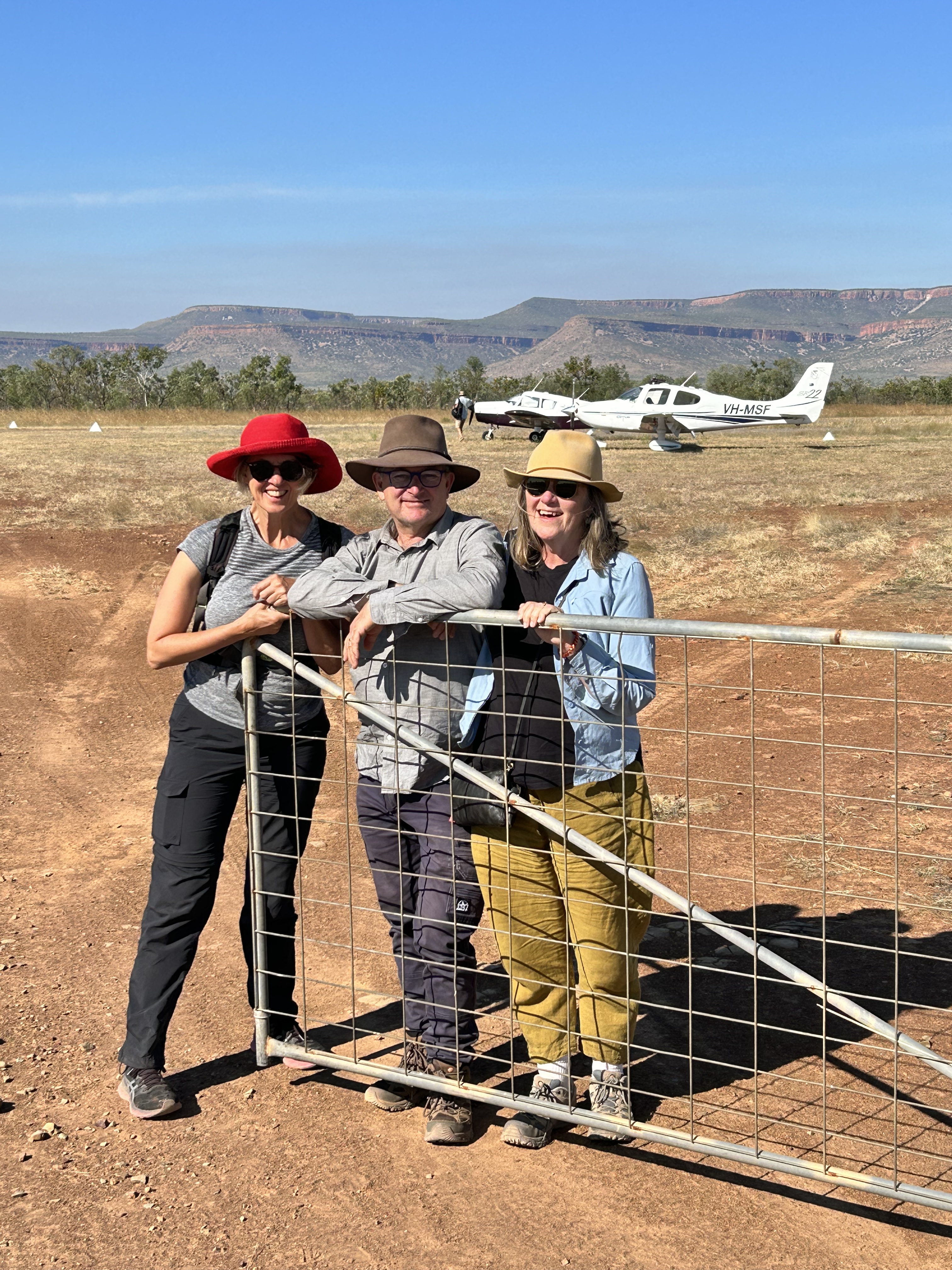
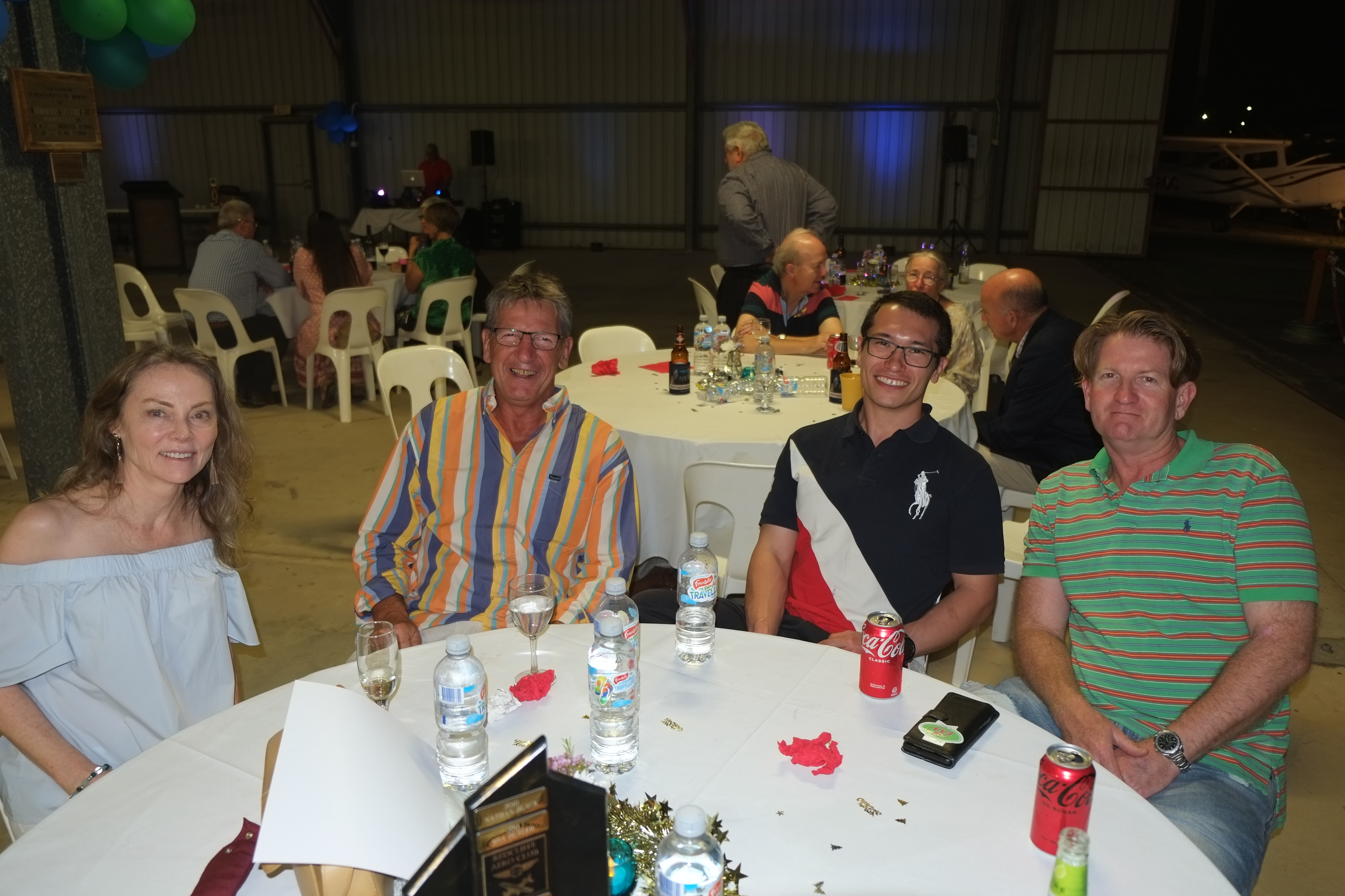
ur Kimberley Krusade was drawing to an end and it really was time to head for home. Another cold morning start at Winton meant we had time to observe the feeding of the Brolgas at the Outback Motel and do a quick walk around town before breakfast. We checked out the Winton Club, site of the first QANTAS board meeting.
After breakfast Adam dropped us back at the airport. Our track to Emerald had us passing directly over Shandonvale so we couldn’t resist a couple of orbits at 5000ft to say G’day to Deon and Lane.
Another opportunity to practise an RNP instrument approach led to a straight in approach at Emerald.
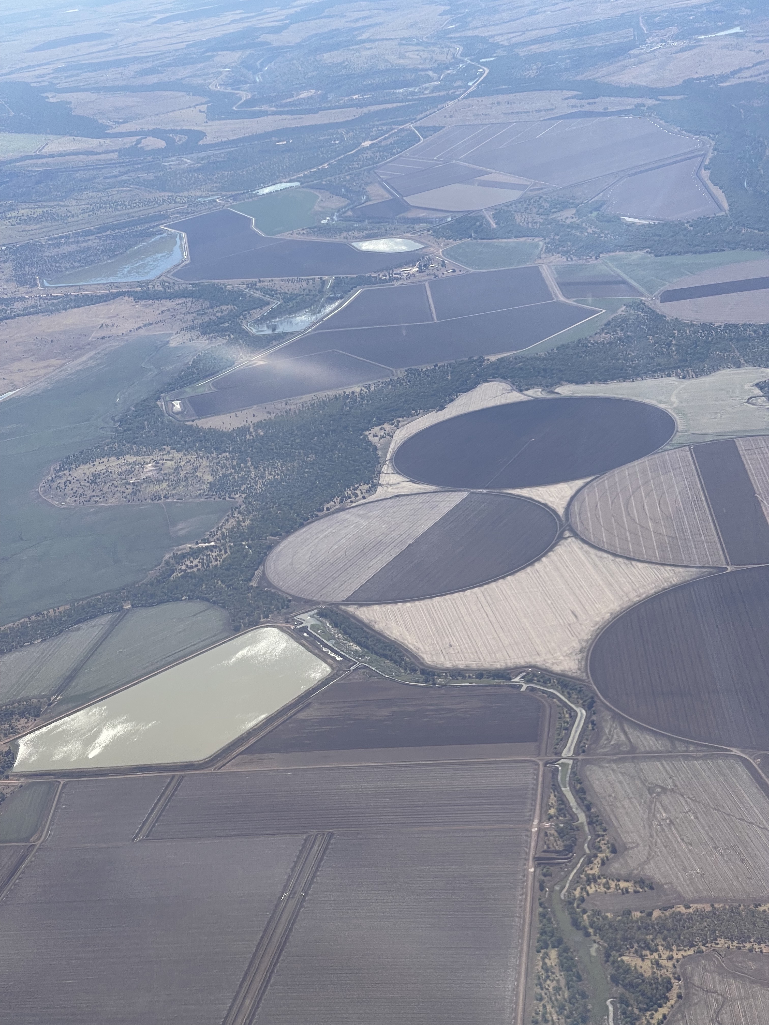
We where we did a quick refuel and ate a sandwich before we were off further east, passing over a cotton gin, some irrigated fields and a Blackwater coal mine.
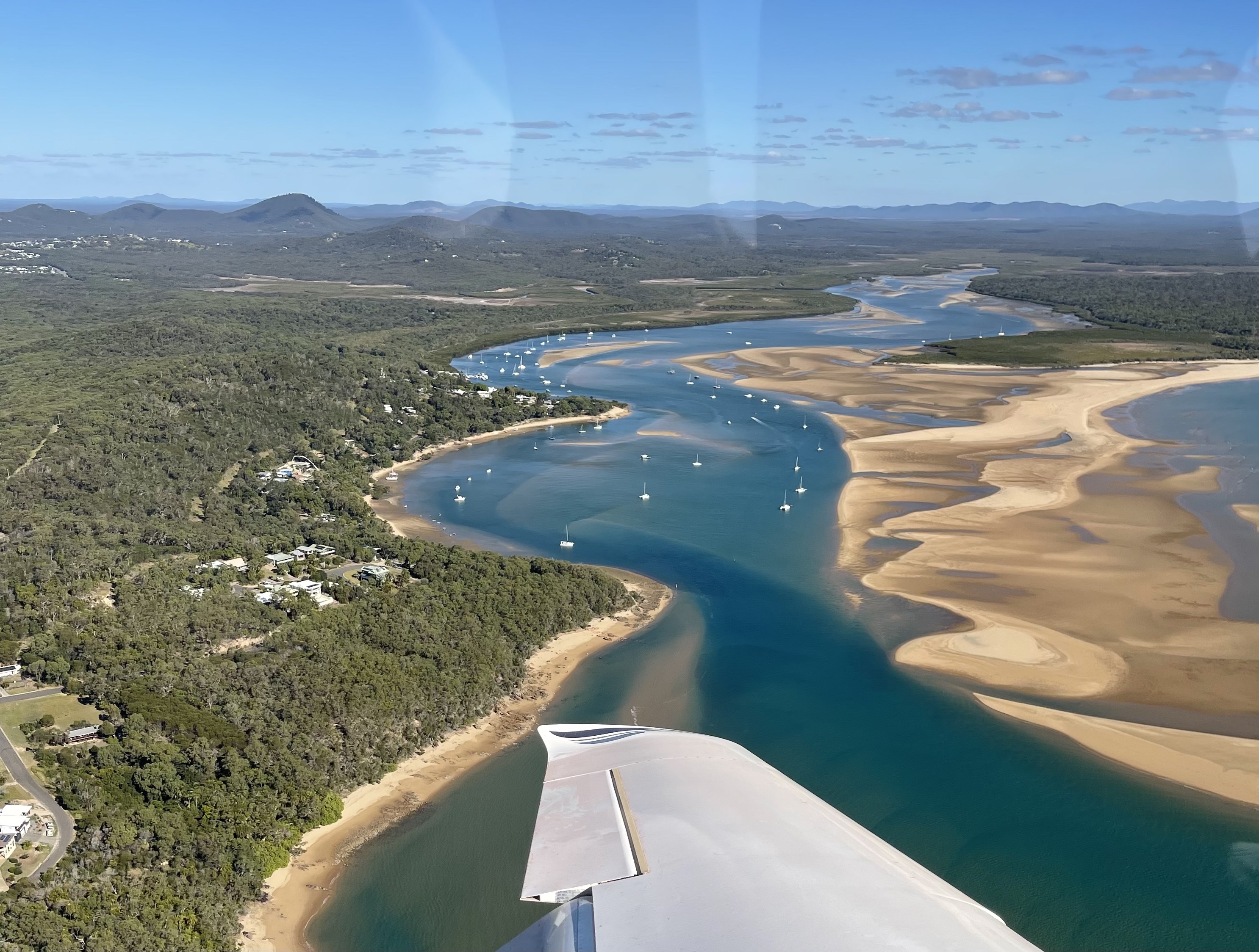
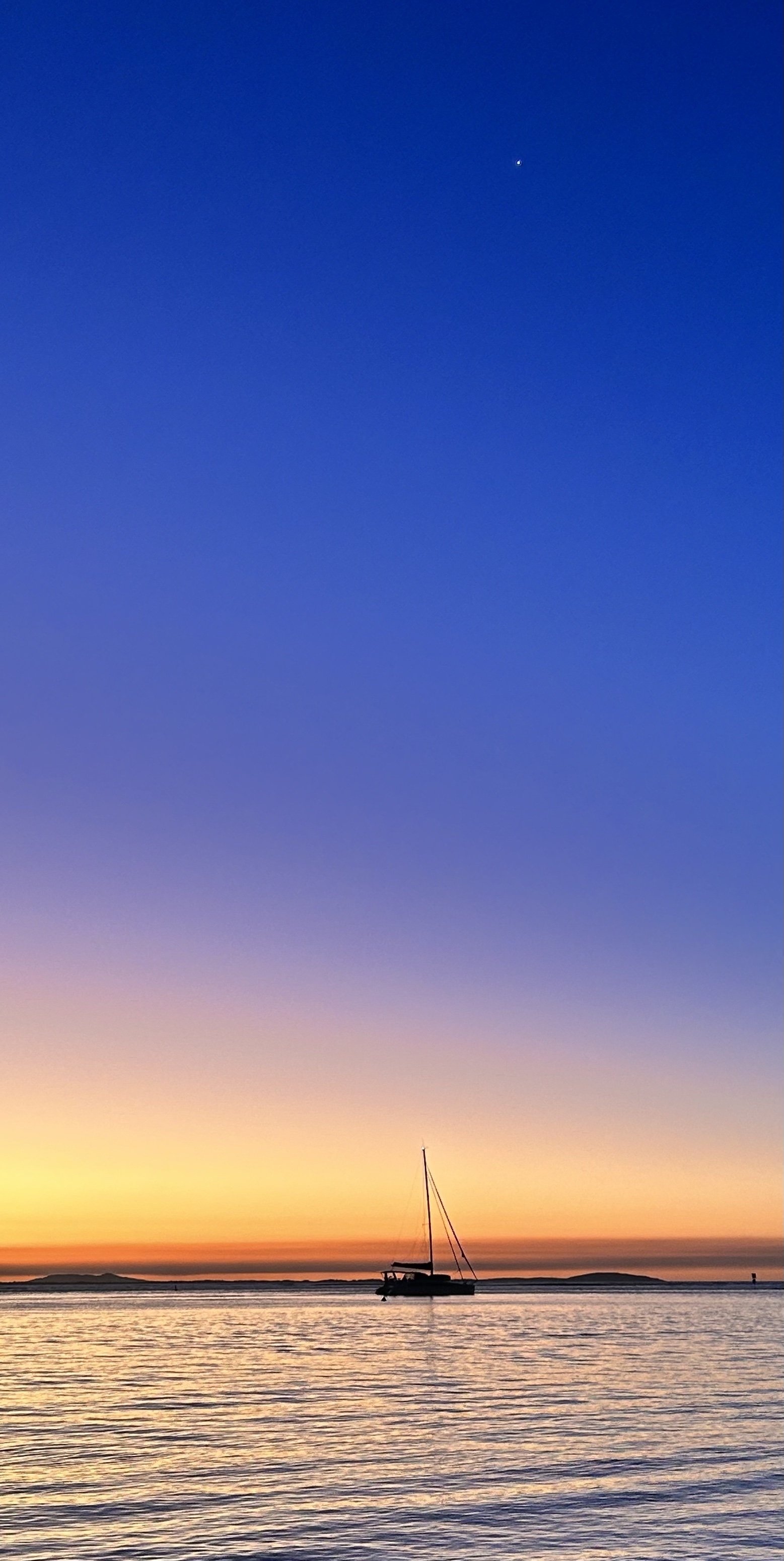
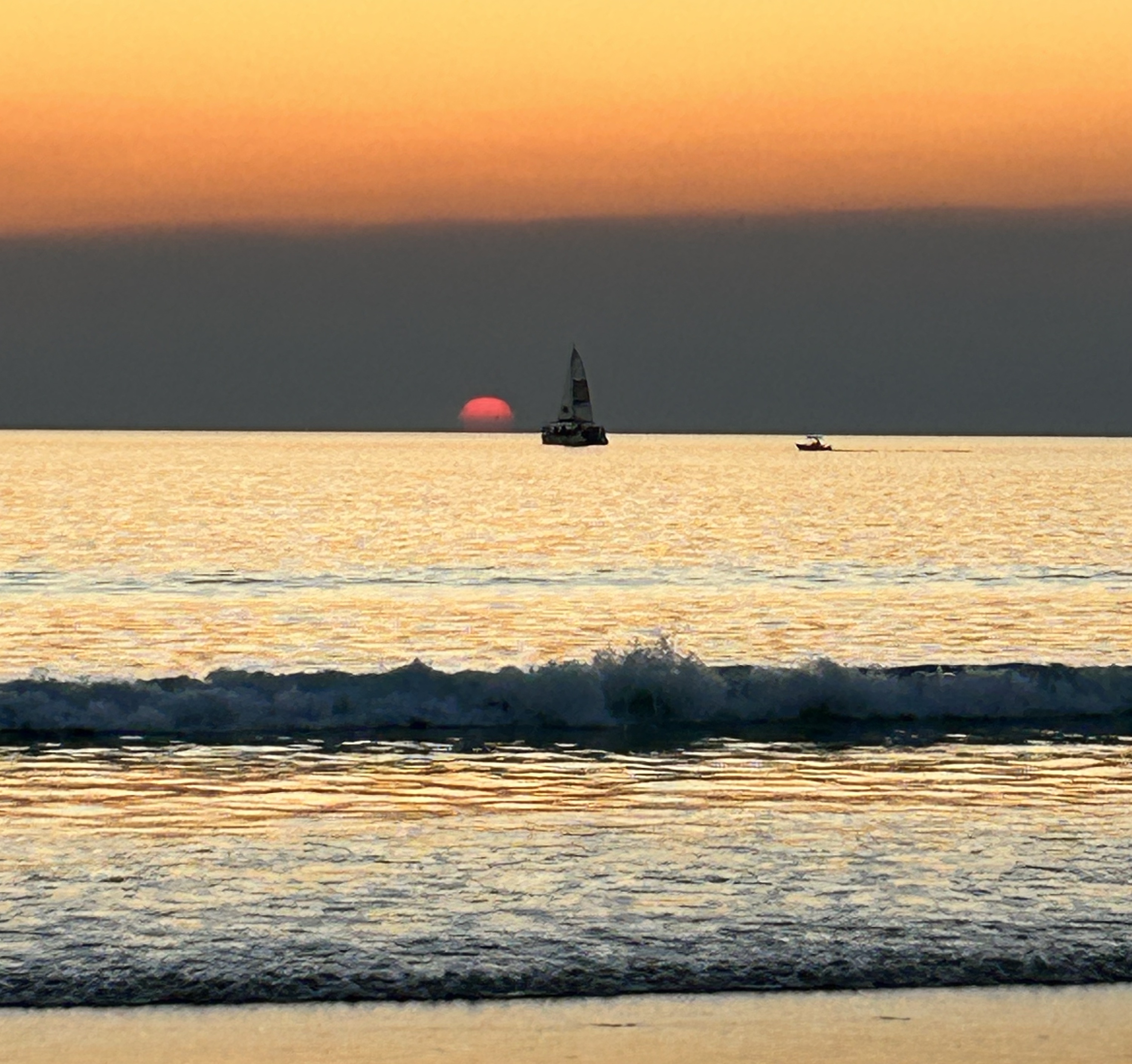
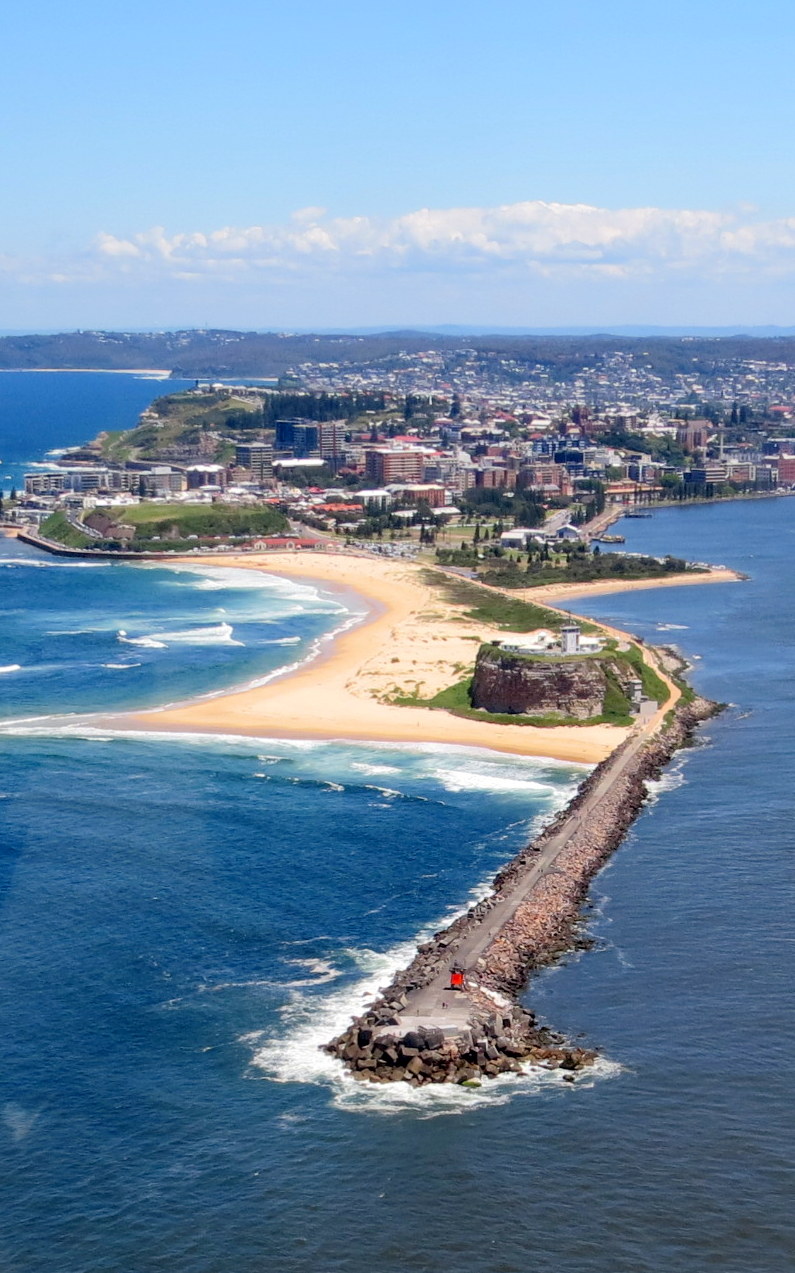
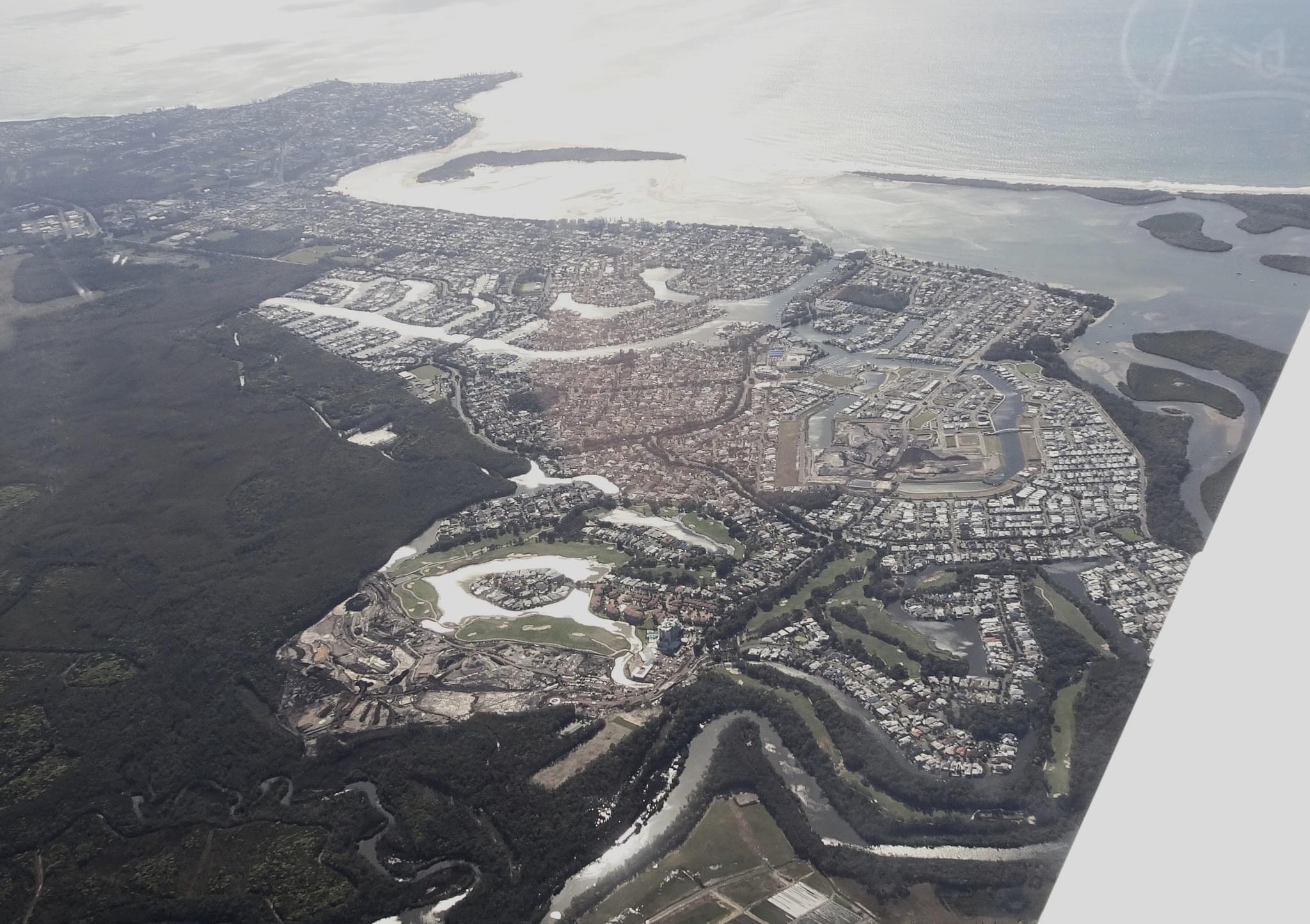
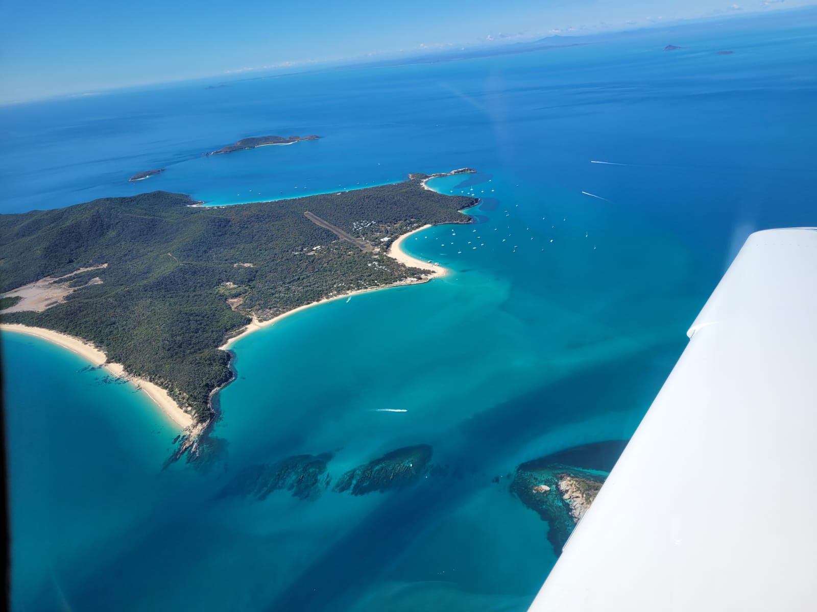
We descended into Agnes Water, still our favourite beach resort, where we’d decided to spend the last two nights of the trip. A few stratocumulus clouds met us as we approached the coast. The first real clouds we’d seen for nearly three weeks. As recommended by resident “ARO” Woody, we did a 300ft overfly to chase away any lingering kangaroos and then returned for a full stop. It was time to relax and enjoy an east coast sunset and sunrise for a change.
One last day at the beach before returning to normality. We made the most of it, enjoying the sunrise, then coffee and breakfast at the Holidays Cafe.
A few walks and a couple of swims and a bit of lazing around filled in the day. Then we caught a taxi to 1770 to enjoy a picnic while watching the sun set.
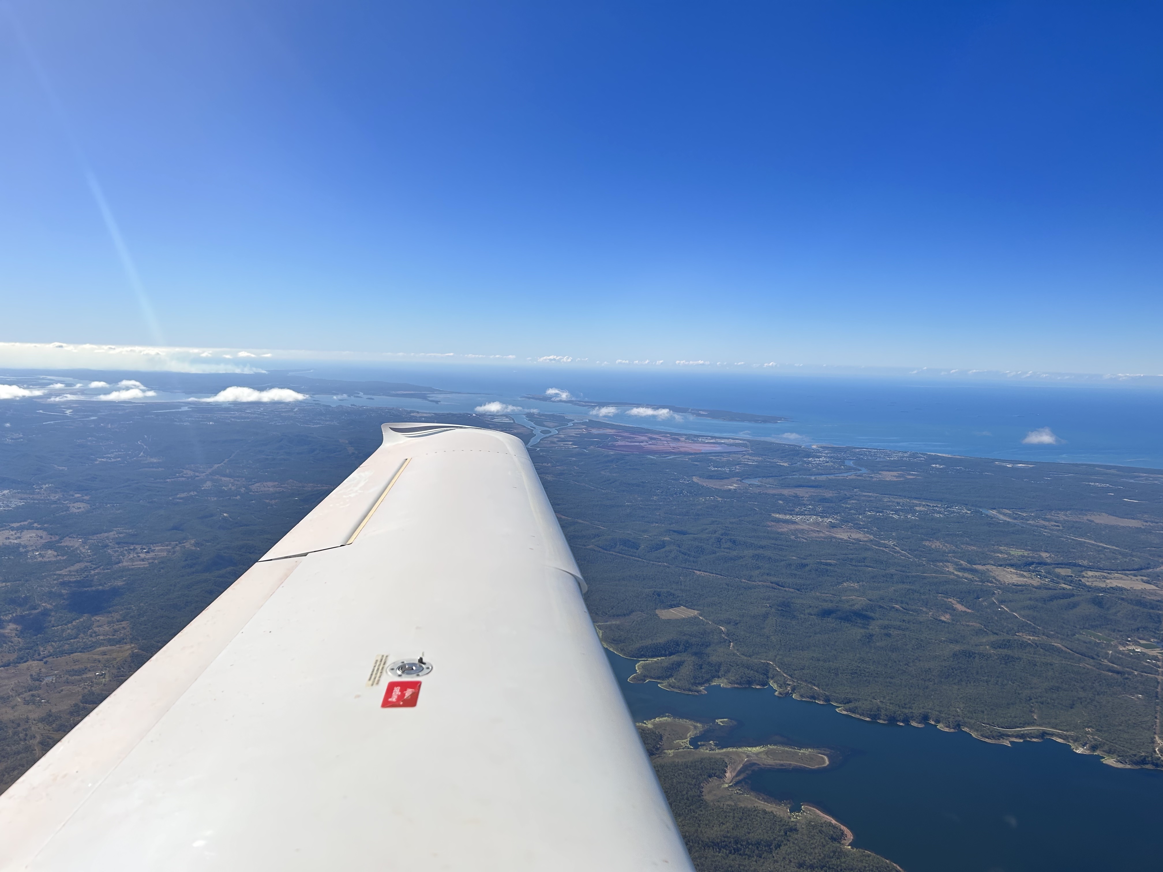
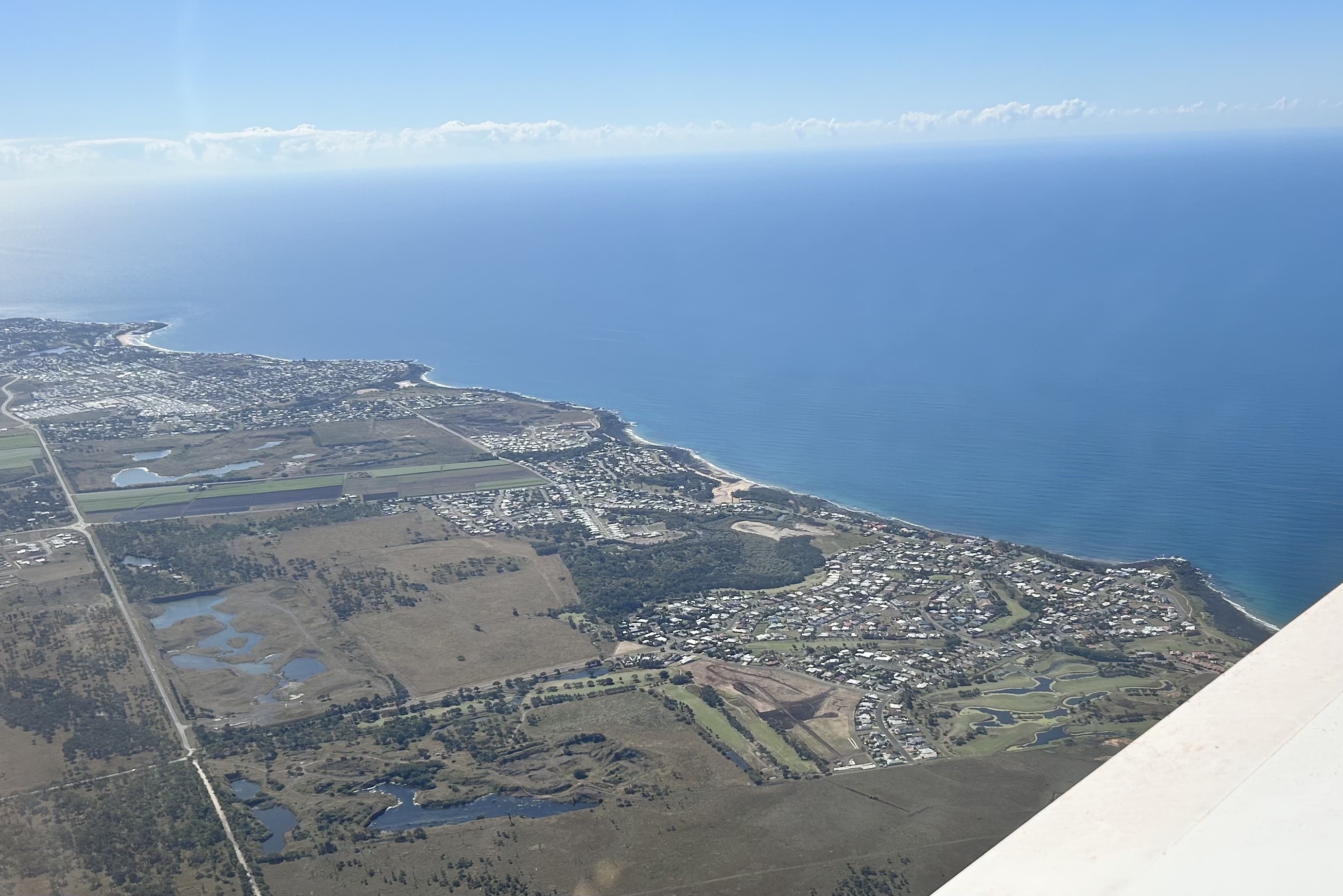
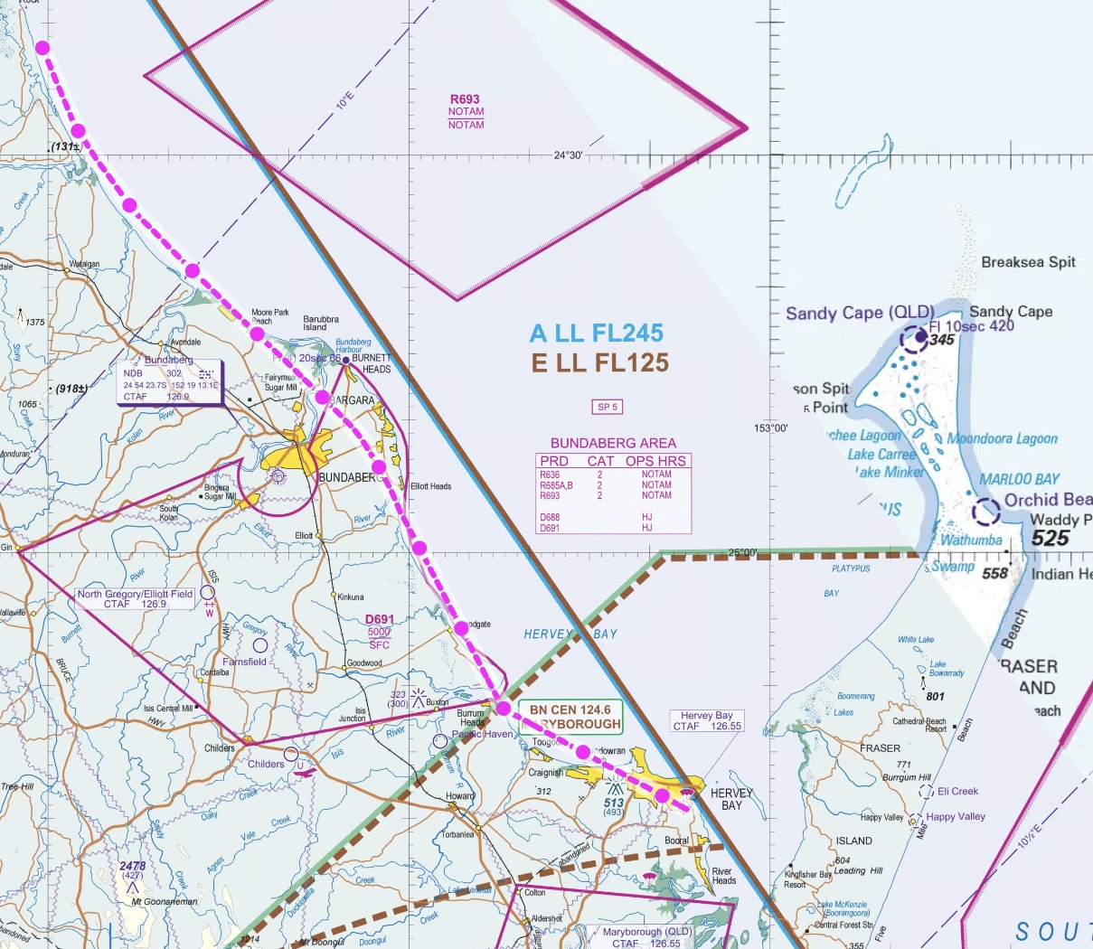
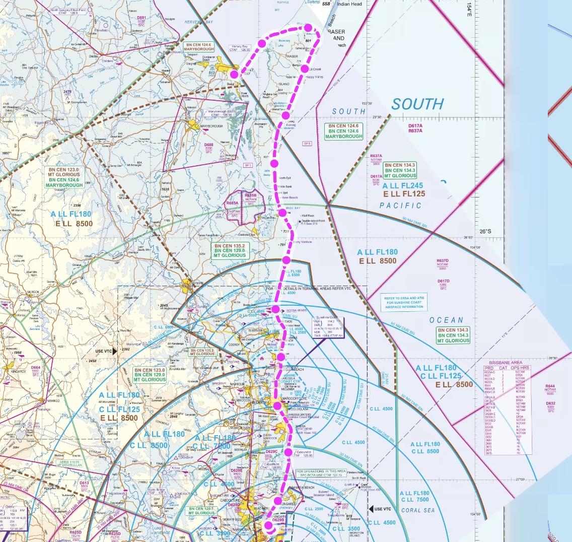
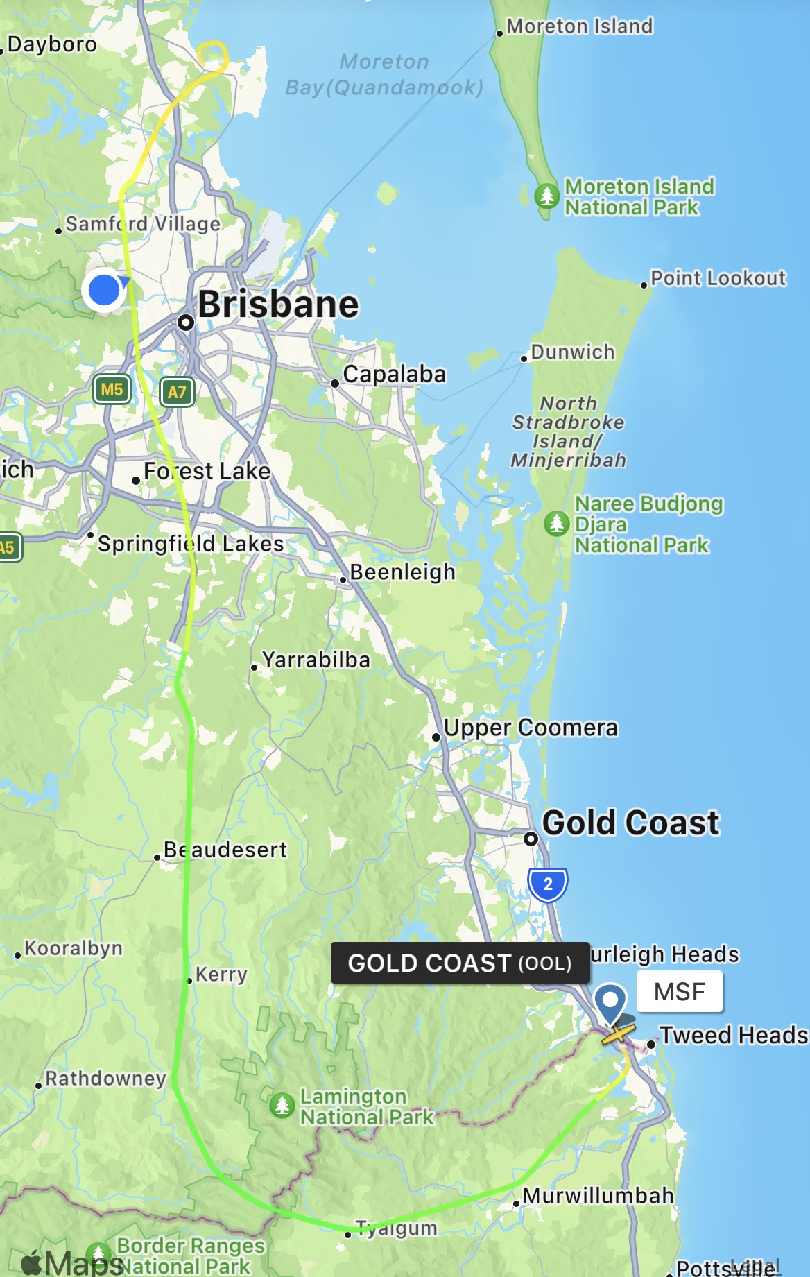
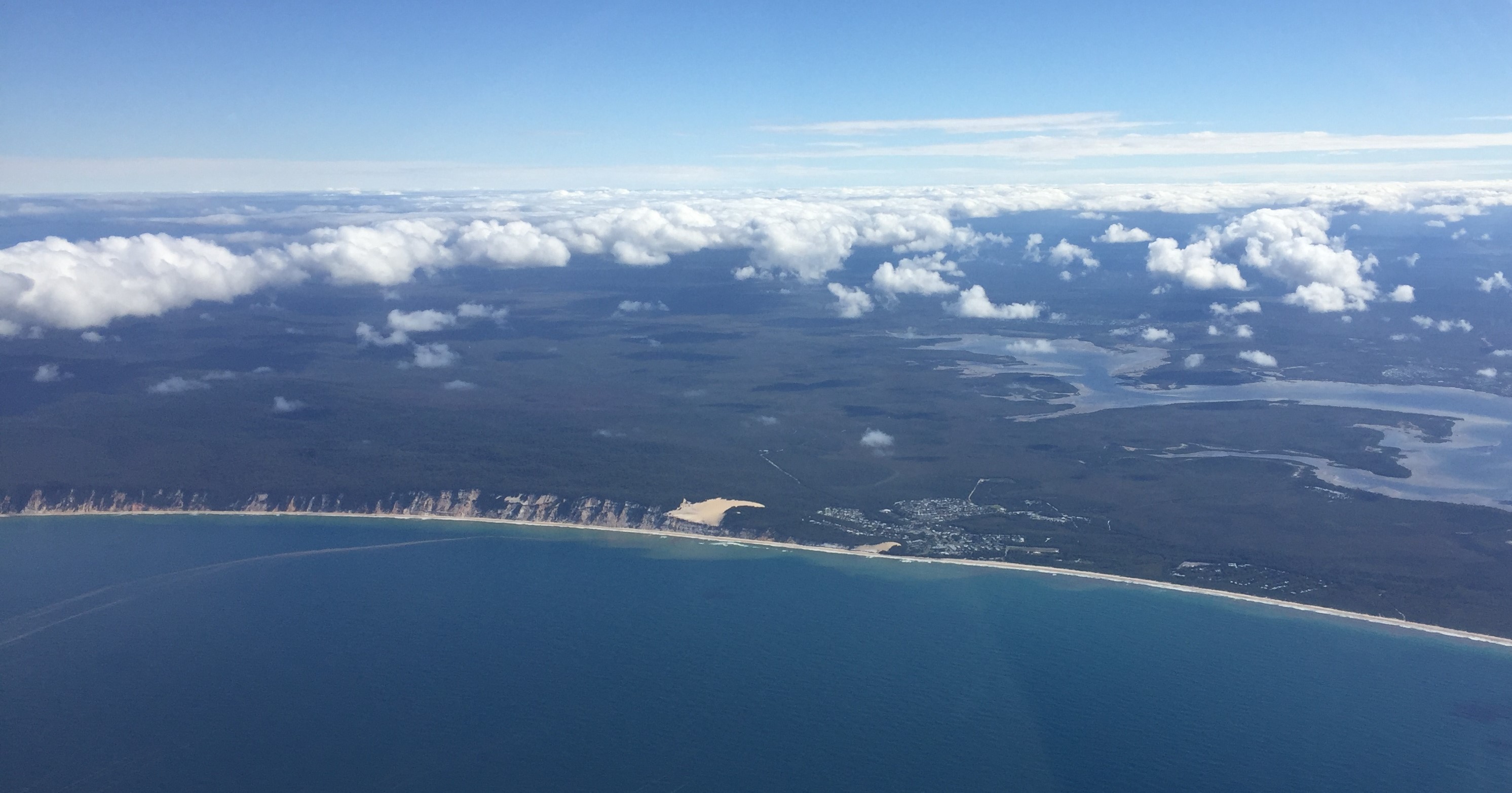
Following a relaxing day at the beaches of Agnes Water and The Town of 1770 we had to refuel once more for our flight back to Redcliffe to finish our Kimberley trip. The decision was to refuel at Hervey Bay so we could have lunch there. We took off and headed south along the coast.
It was another perfect day as we flew along the coast past Bundaberg and Bargara.
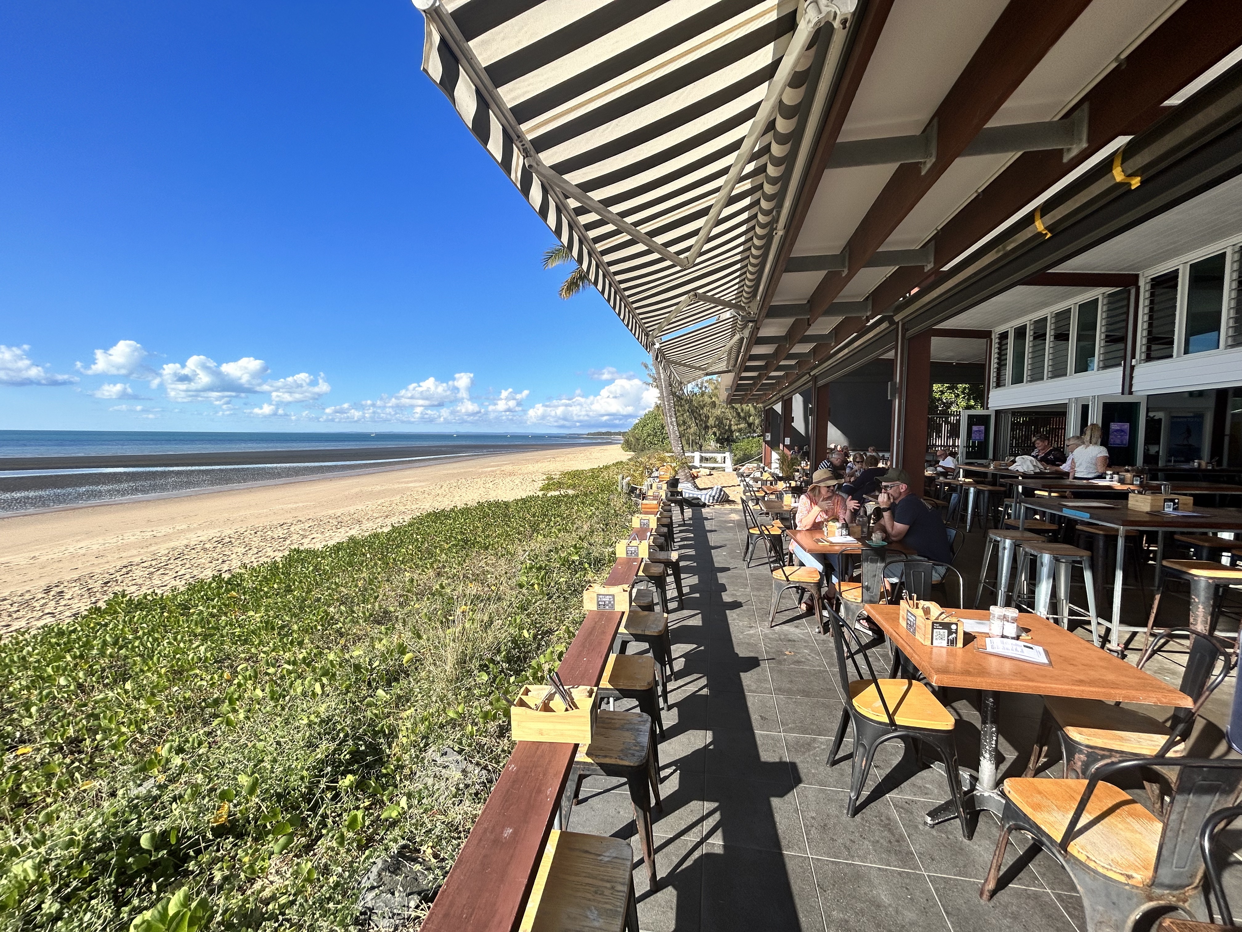
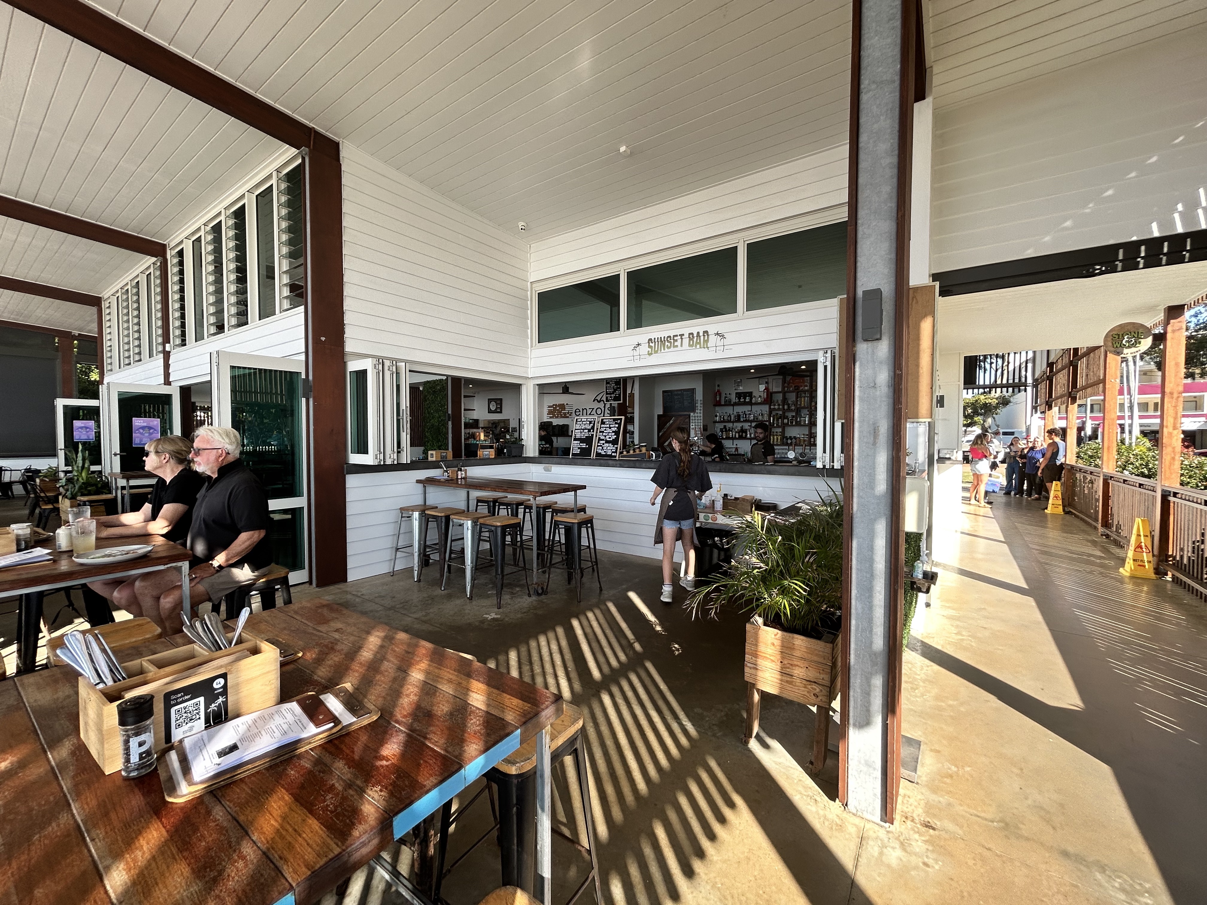
A short taxi ride brought us to Enzo’s on the beach, a great little lunch spot where we could enjoy fish and chips while gazing across the water to K’Gari Fraser Island.
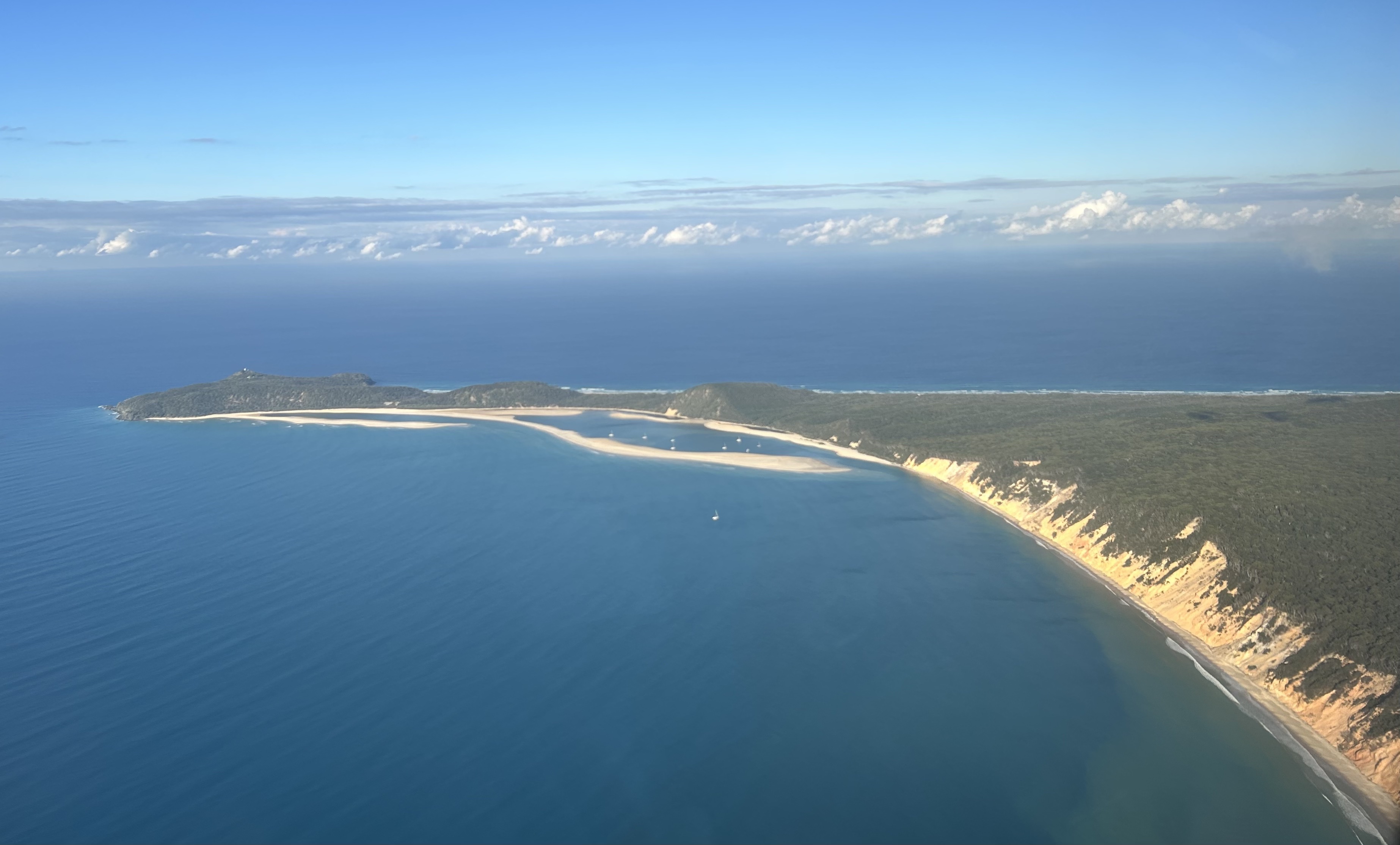
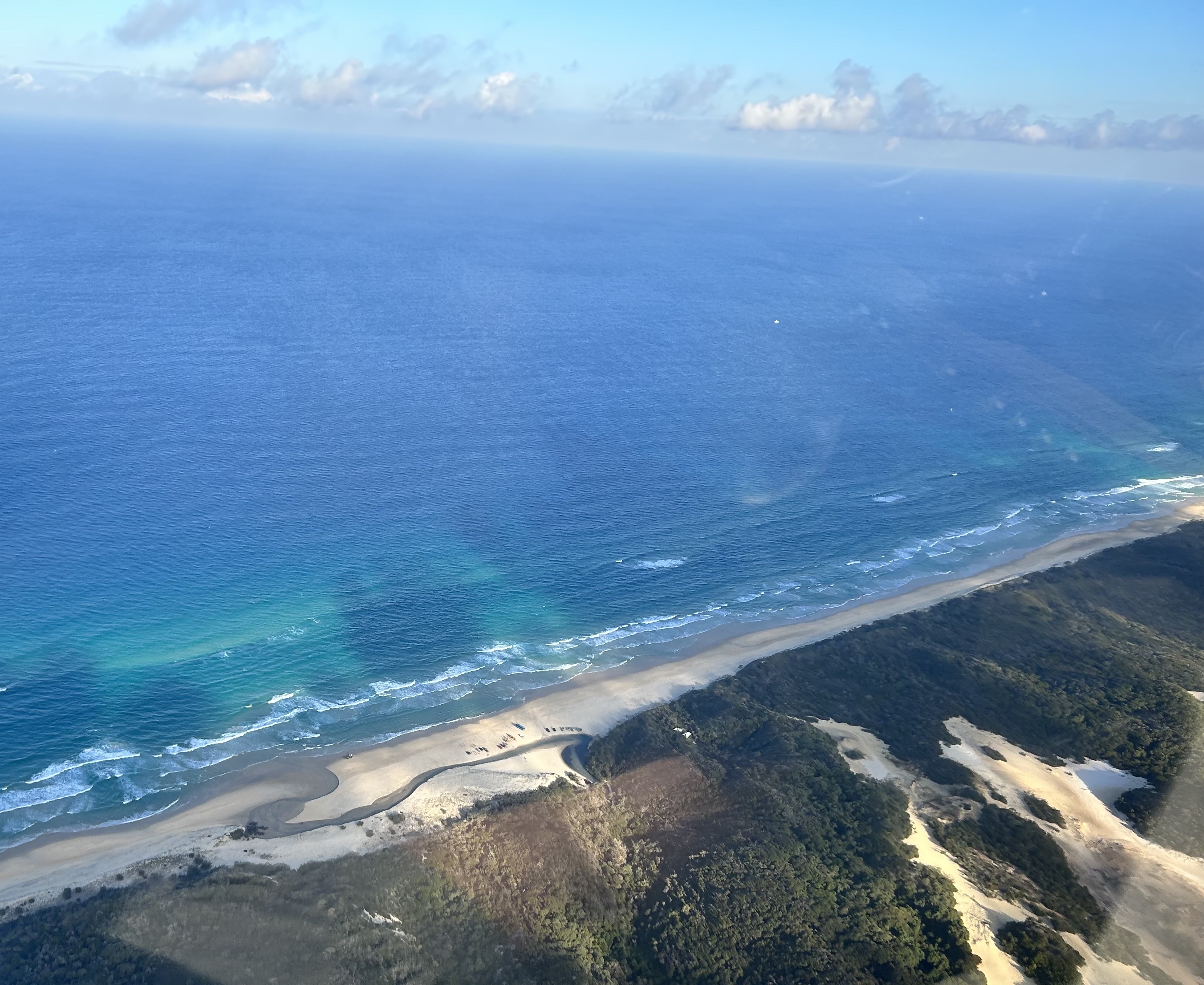
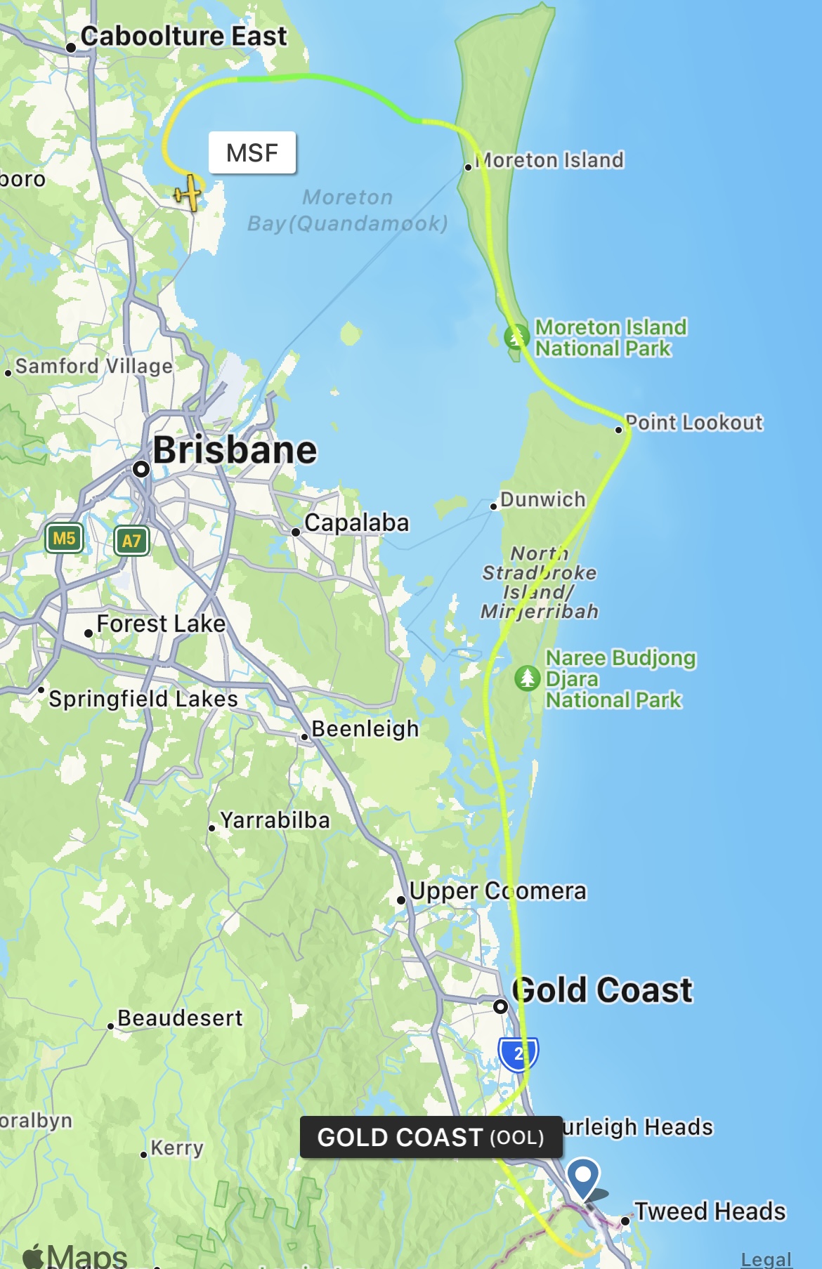
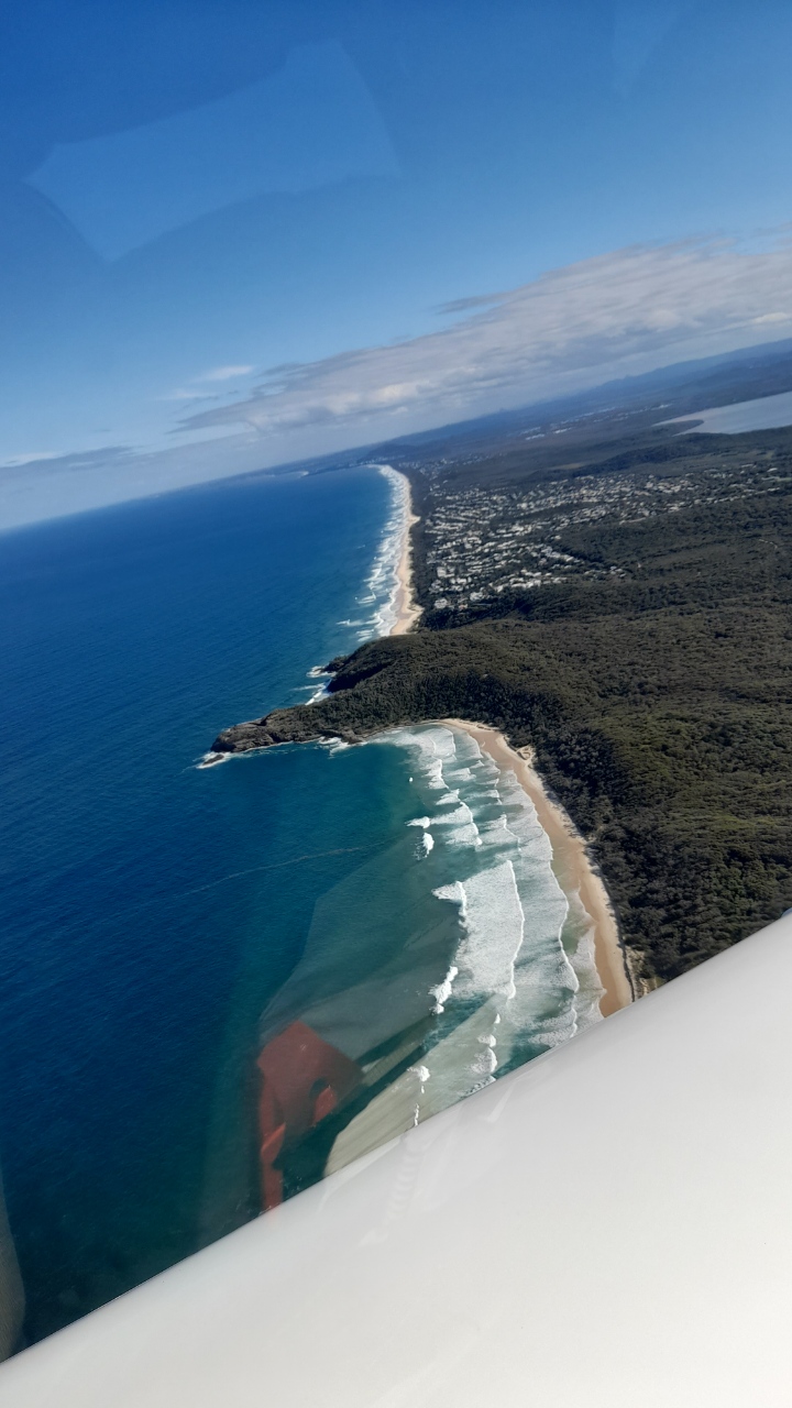
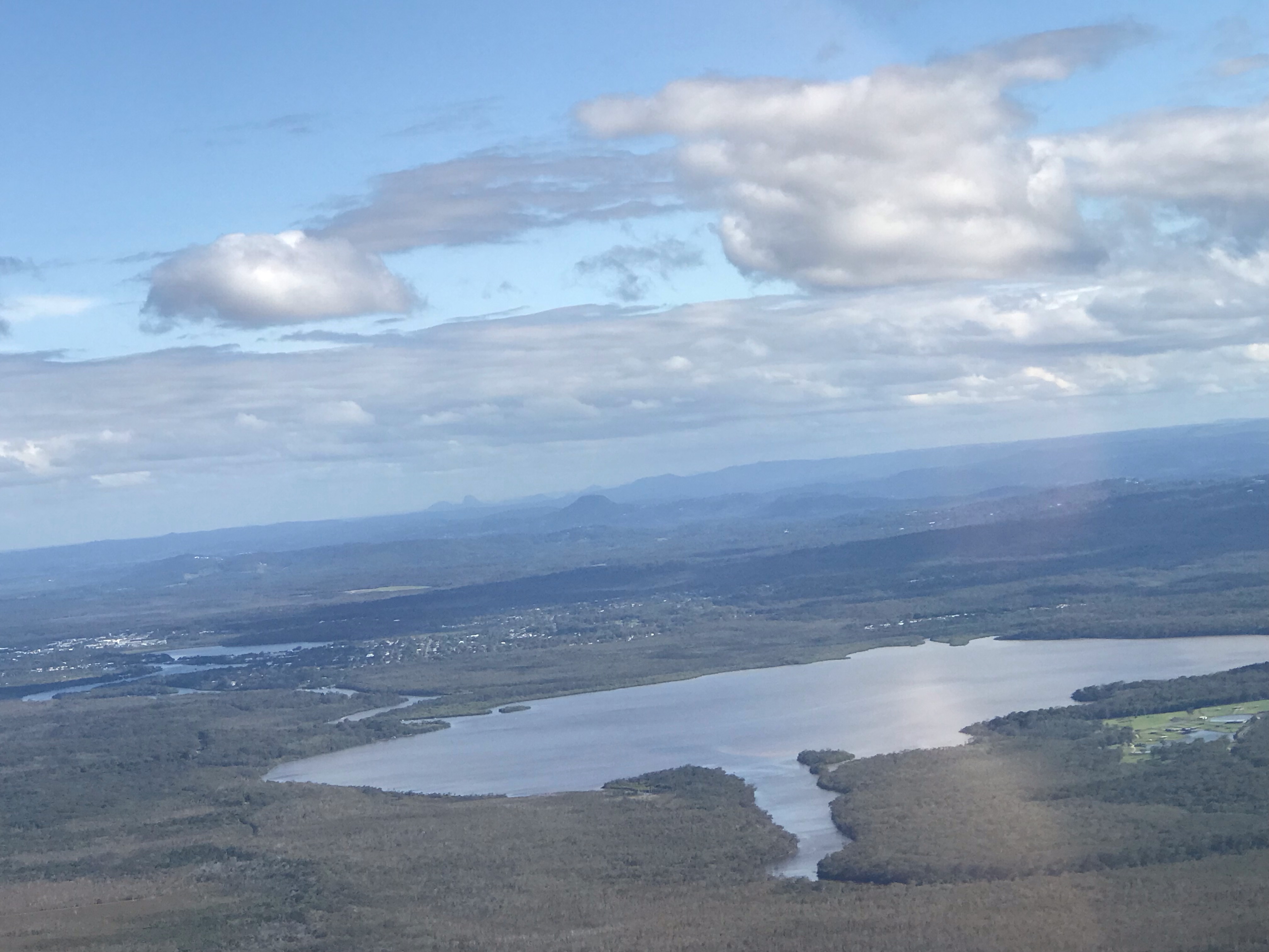
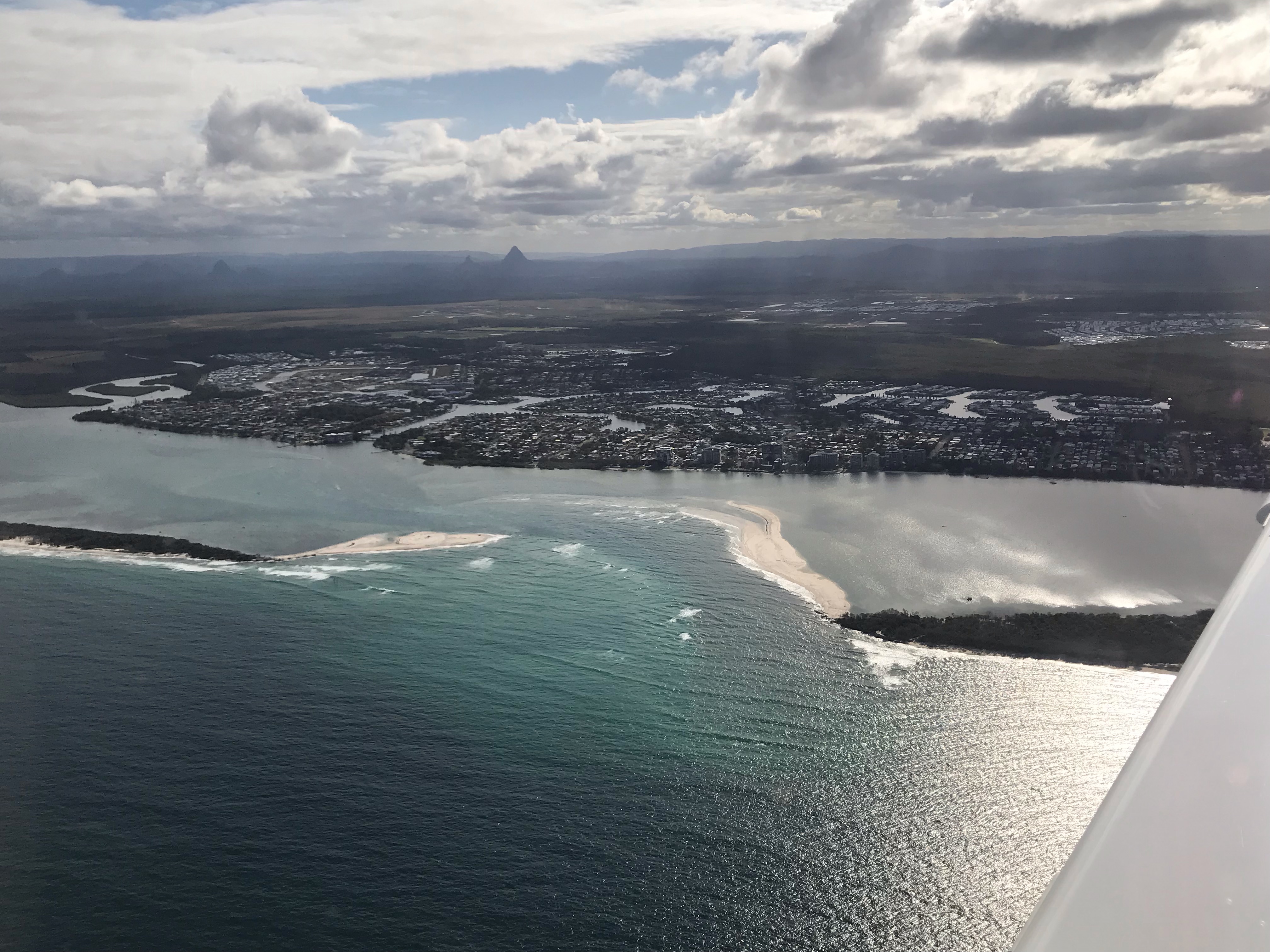
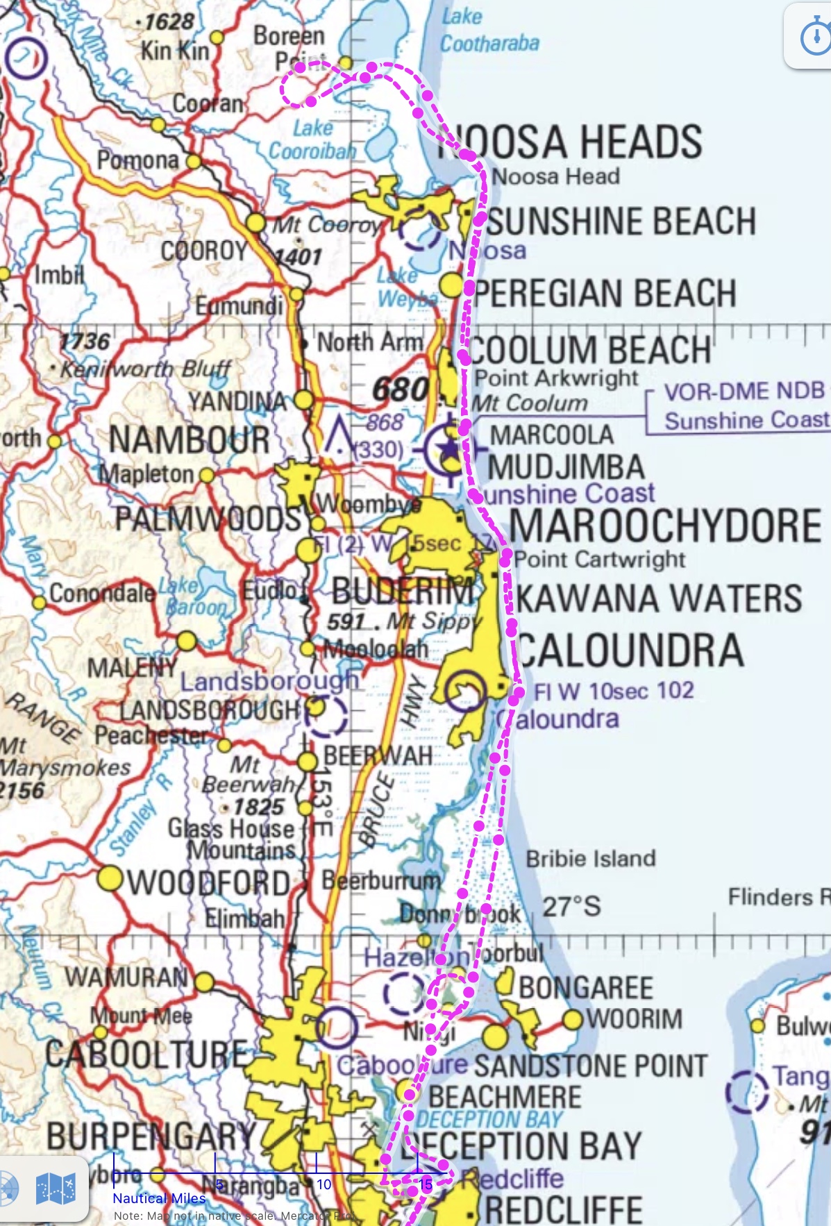
Taking to the air again we tracked for K’gari Fraser Island and flew down the coast at 2000ft past Cathedral Beach, Ely Creek, Eurong and on to Double Island Point before reaching Noosa. A Virgin 737 was taking off from Sunny Coast so we had to fly over the top of the airport to avoid his wake turbulence then on past Caloundra and over Bribie Island to Redcliffe.
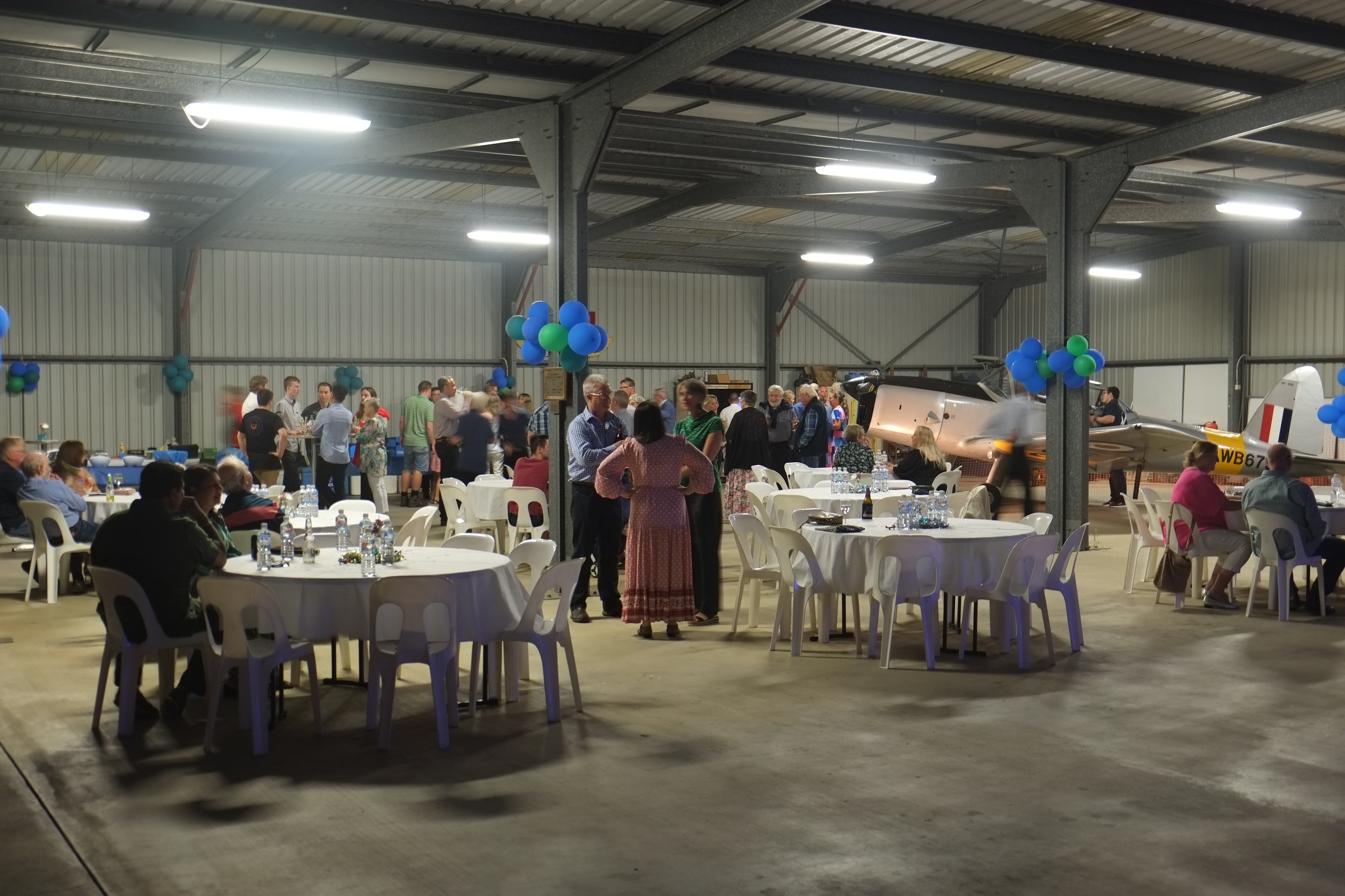
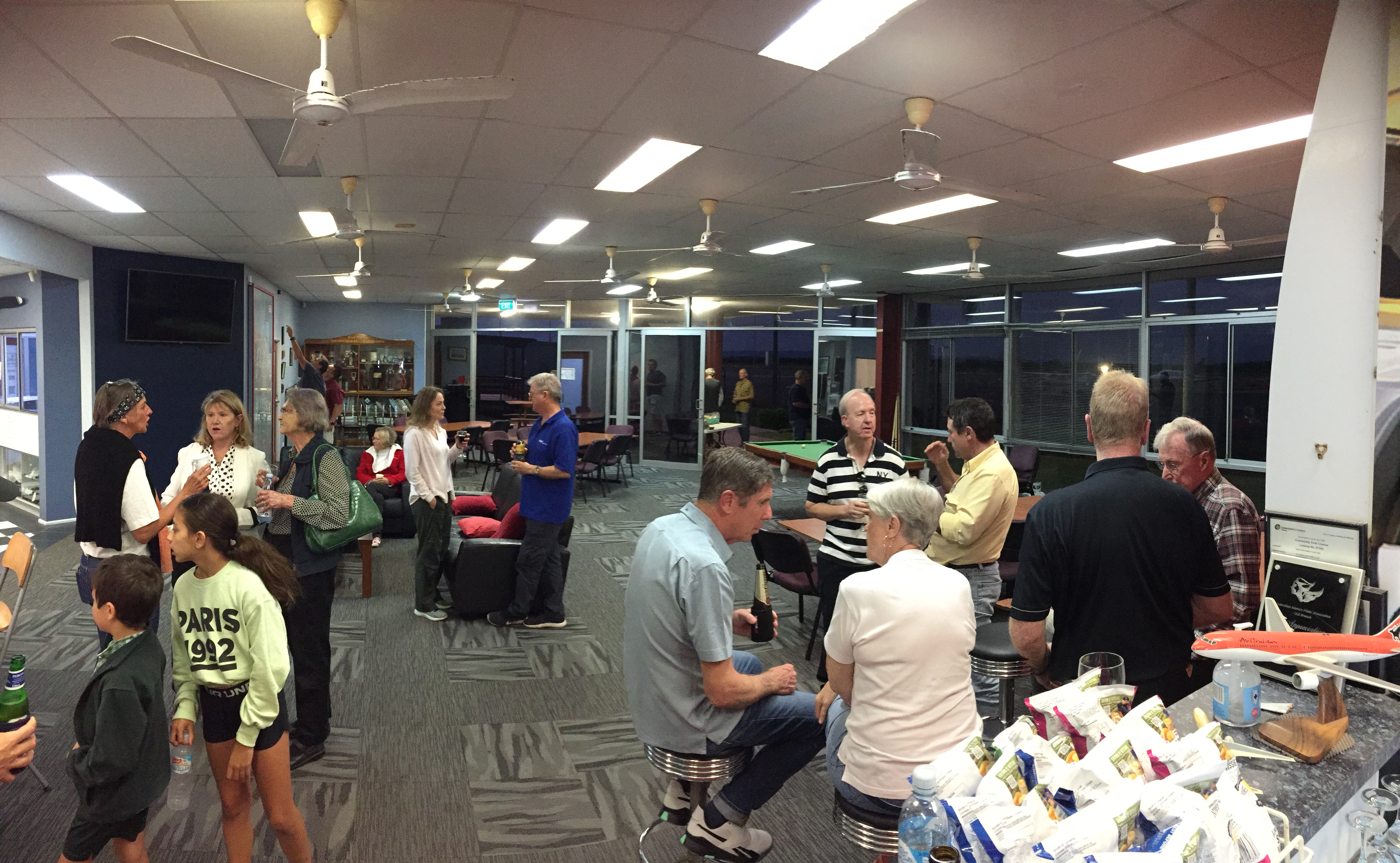
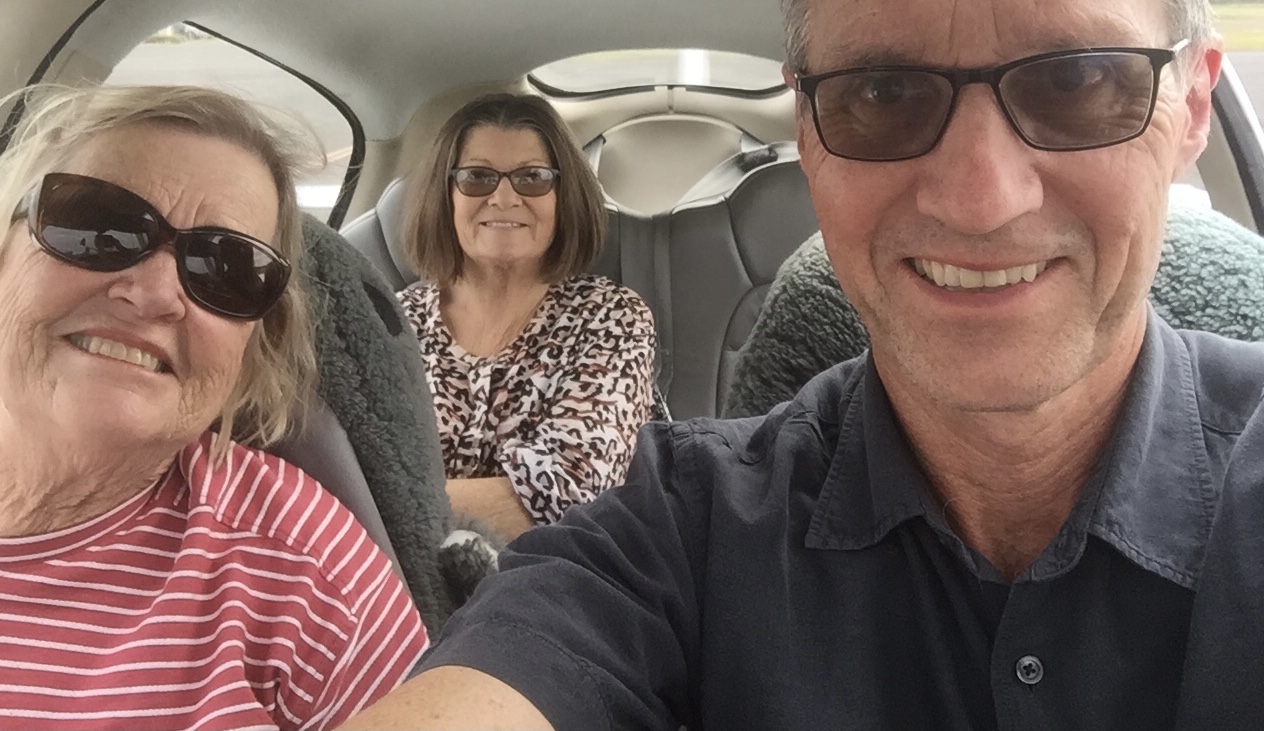
We were home. Just in time for our monthly aero club barbecue.
It had been an amazing trip of over 4700 nautical miles and 33 tacho hours over 22 days. The Kimberley is definitely one of the most scenic parts of the country, even if you have to fly a long way to get there. I must give a plug for Birgit Bradke’s excellent downloadable pdf travel guide “Destination Kimberley”. At $32.70 it is a bargain. I bought it online in 2019 when I was first planning this trip and it was extremely helpful in identifying the best places to go. Once you buy it Birgit updates it annually for free so you have up to date information whenever you finally get to go (in my case almost 4 years later). And I’d also like to give thanks to Alec Munro from AviAir who was so willing to share his knowledge of the Kimberley with me both before and during the trip. The guys at the Tower in Broome were also very kind. I recommend a trip to Kimberley to anyone who can spare the time and the resources to get there.
Drysdale River – Derby – Horizontal Falls – Cygnet Bay – Broome – Halls Creek – Purnululu Bungles
It was the 22nd May 2023 and the start of the second week of our flying safari in the Kimberley. Just when we thought the trip couldn’t get any better, it did.
Departing Drysdale River Station
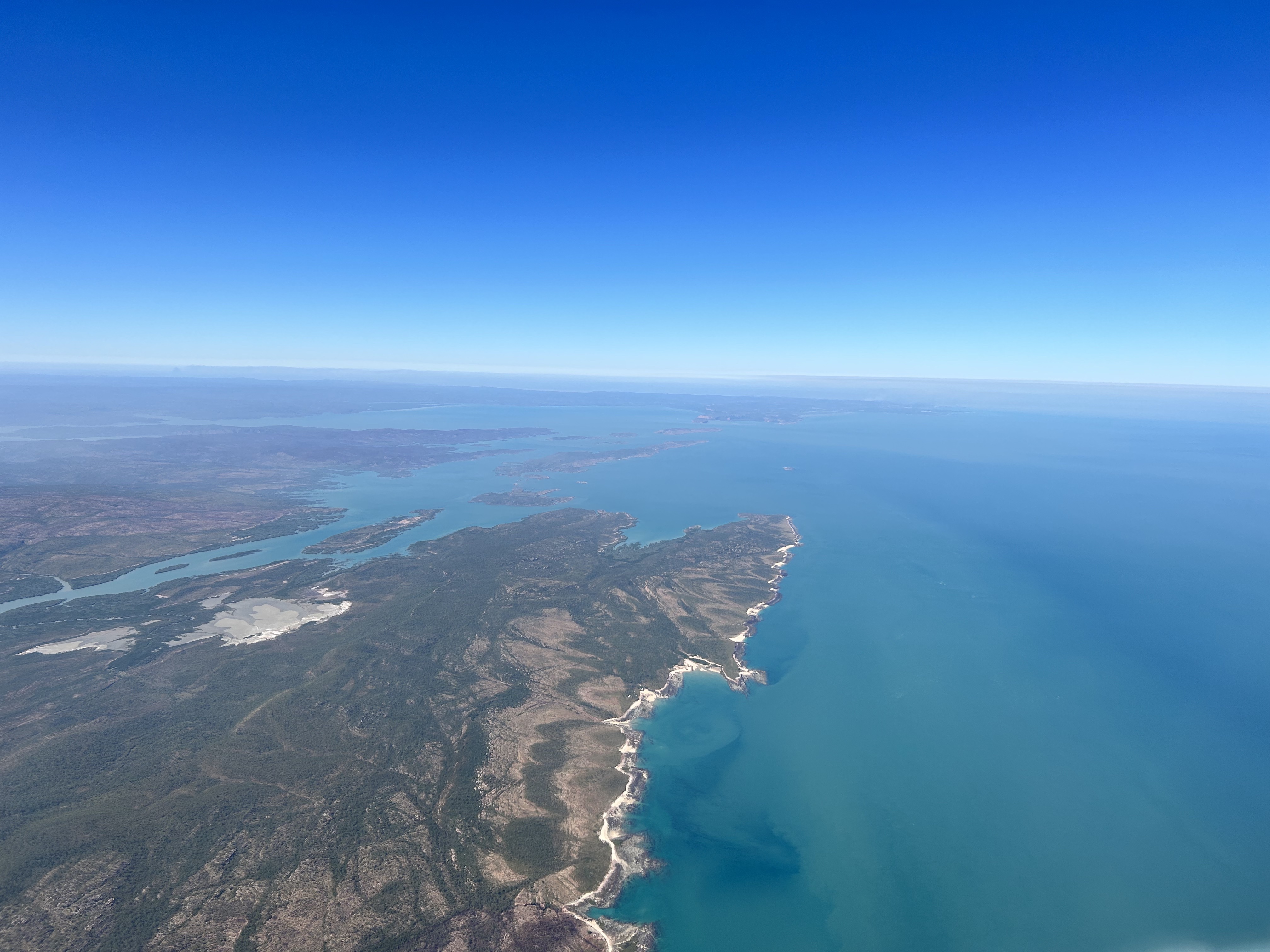
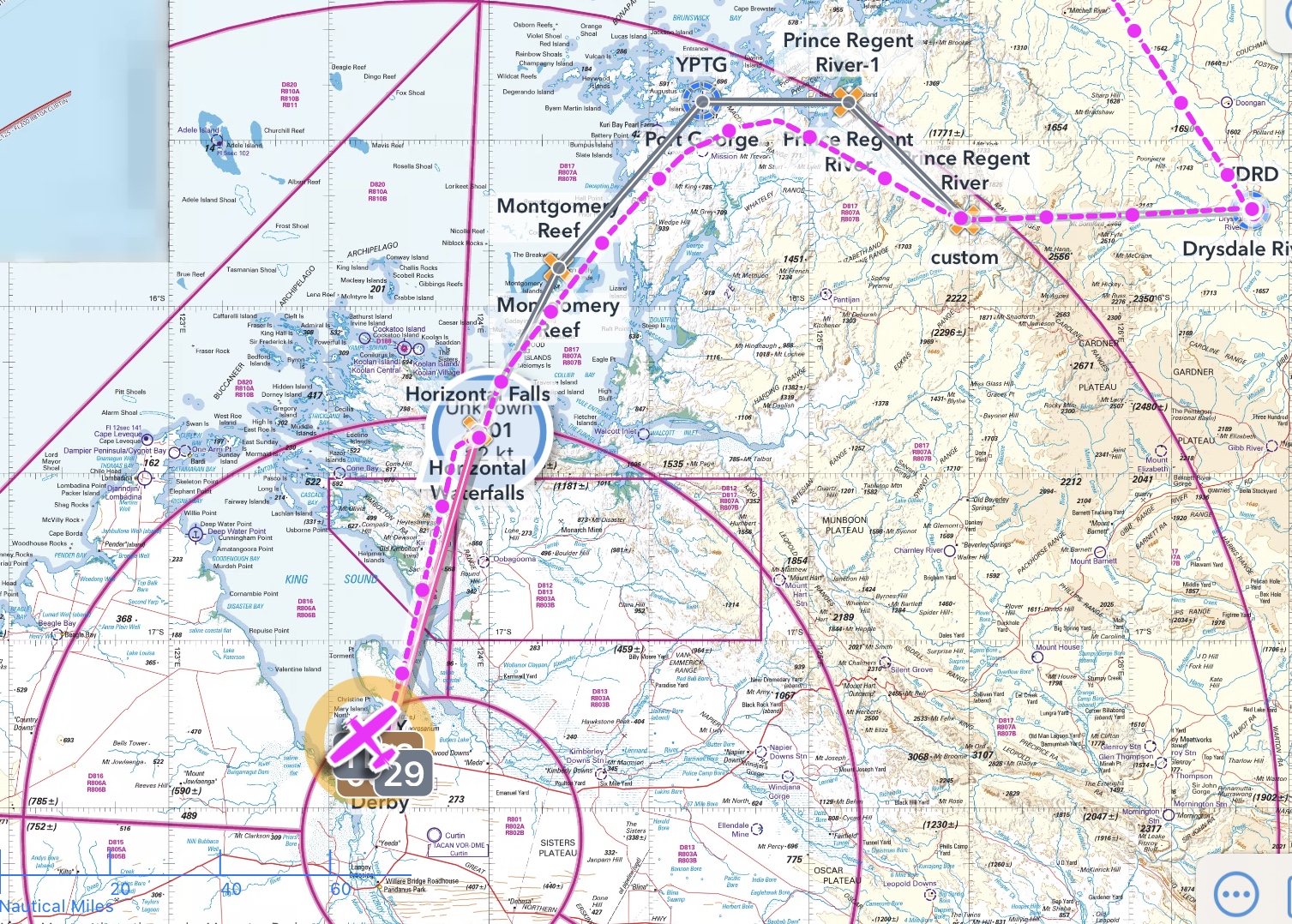
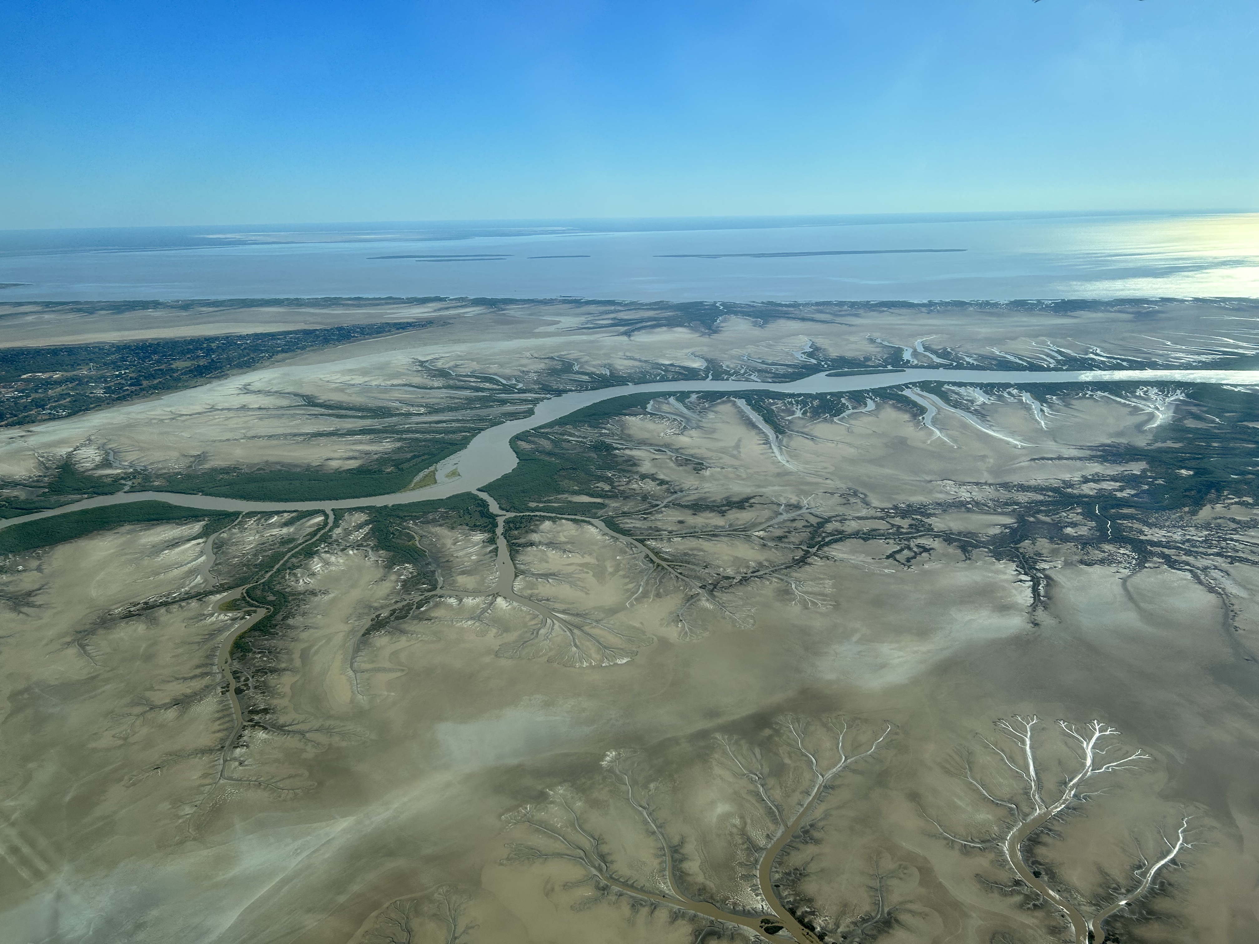
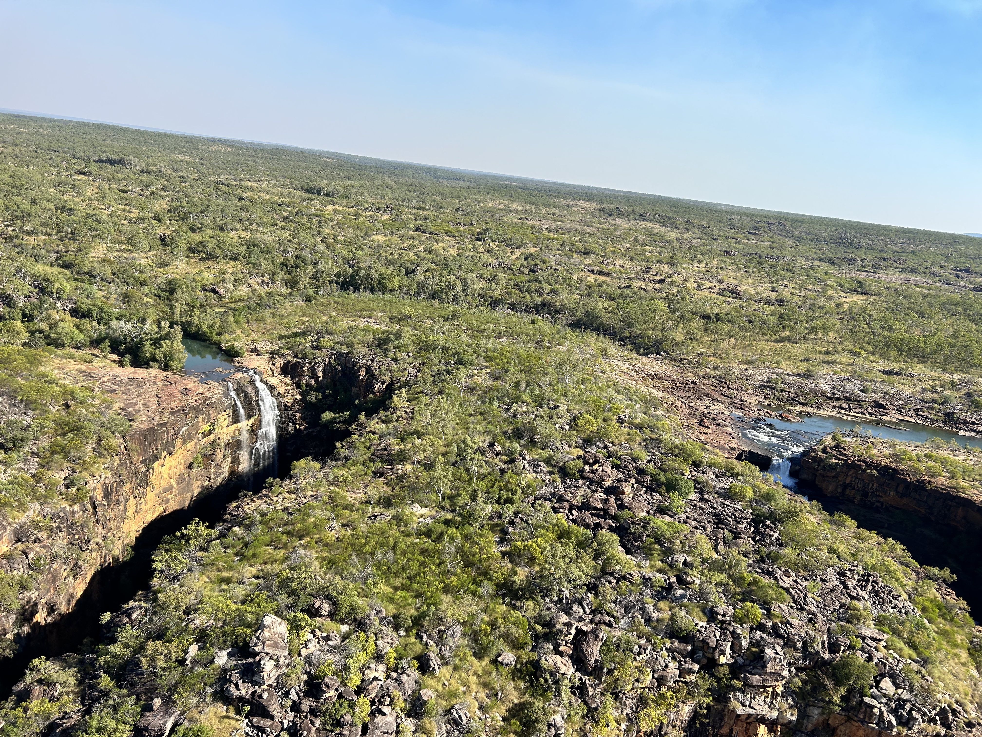
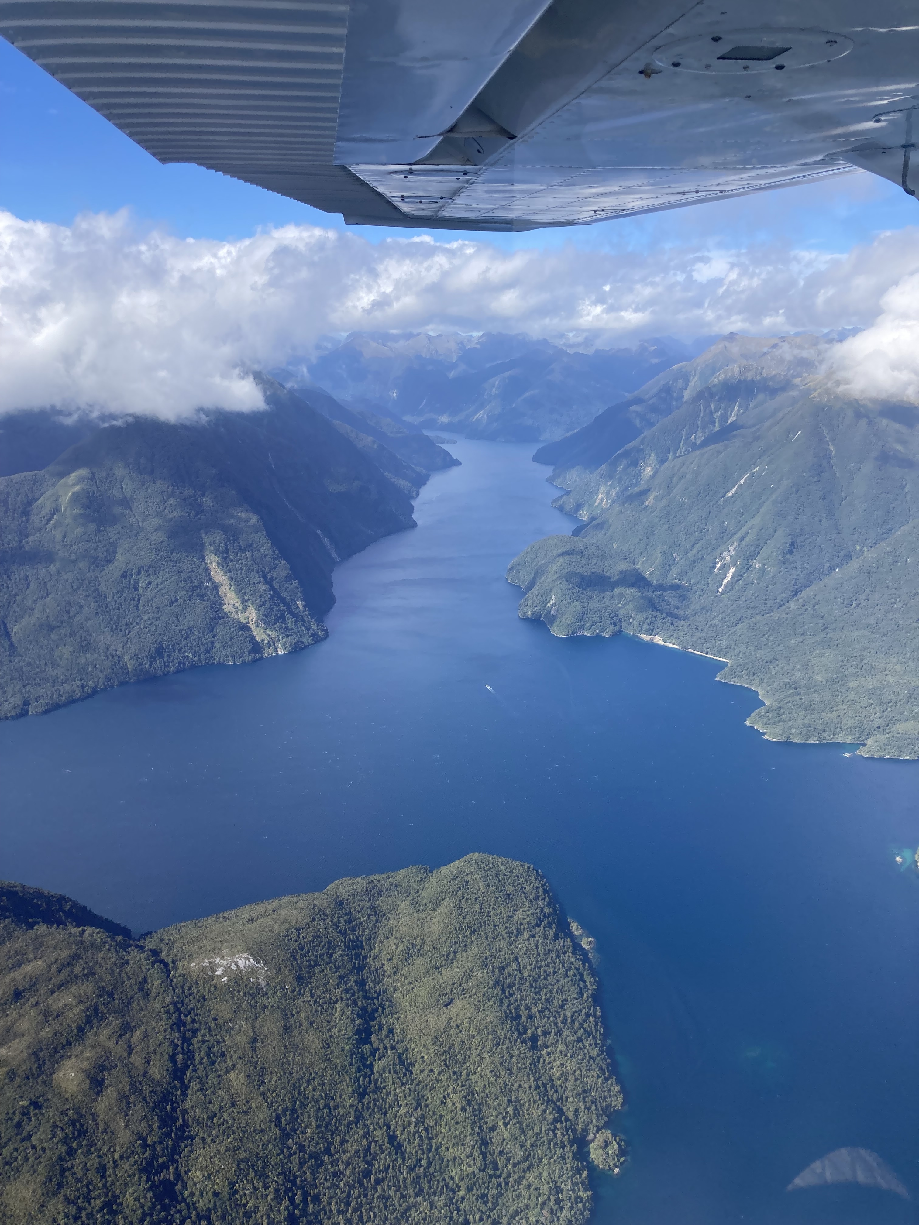
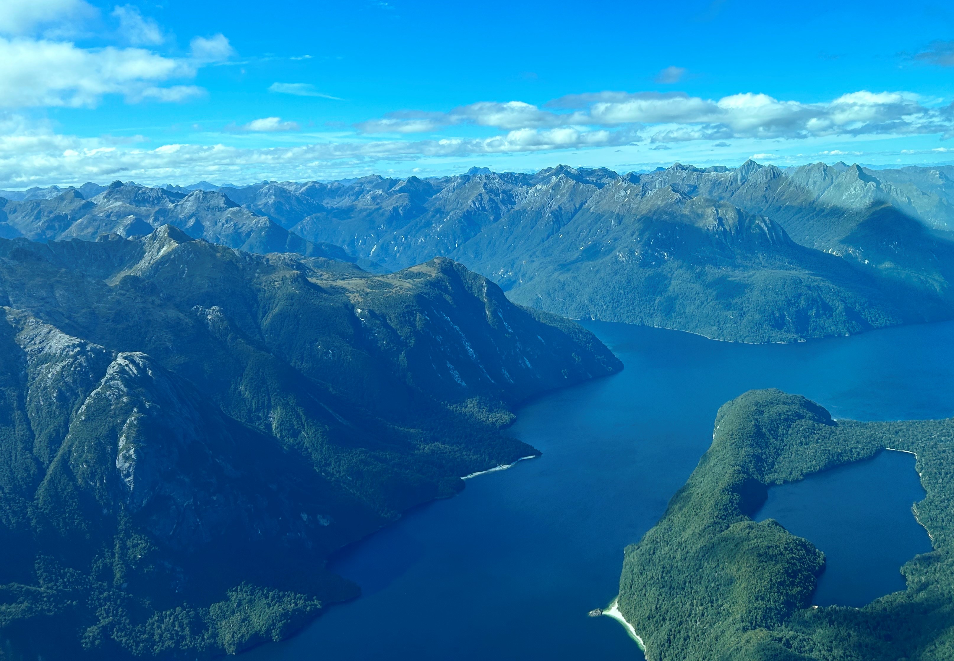
From Drysdale River we had an exceptionally scenic flight over the Prince Regent River and along the coast to Horizontal Falls. The Prince Regent River bed is in a fault line that runs NW to SE for some 50 or so miles in a pretty straight line. It delivered us to the Bonaparte Archipelago with its hundreds of islands and waterways.
The coastal part passed over Montgomery Reef before reaching Horizontal Falls where we did an orbit over the top to check out where we’d be staying that evening. From there it was a 20 minute hop to Derby.
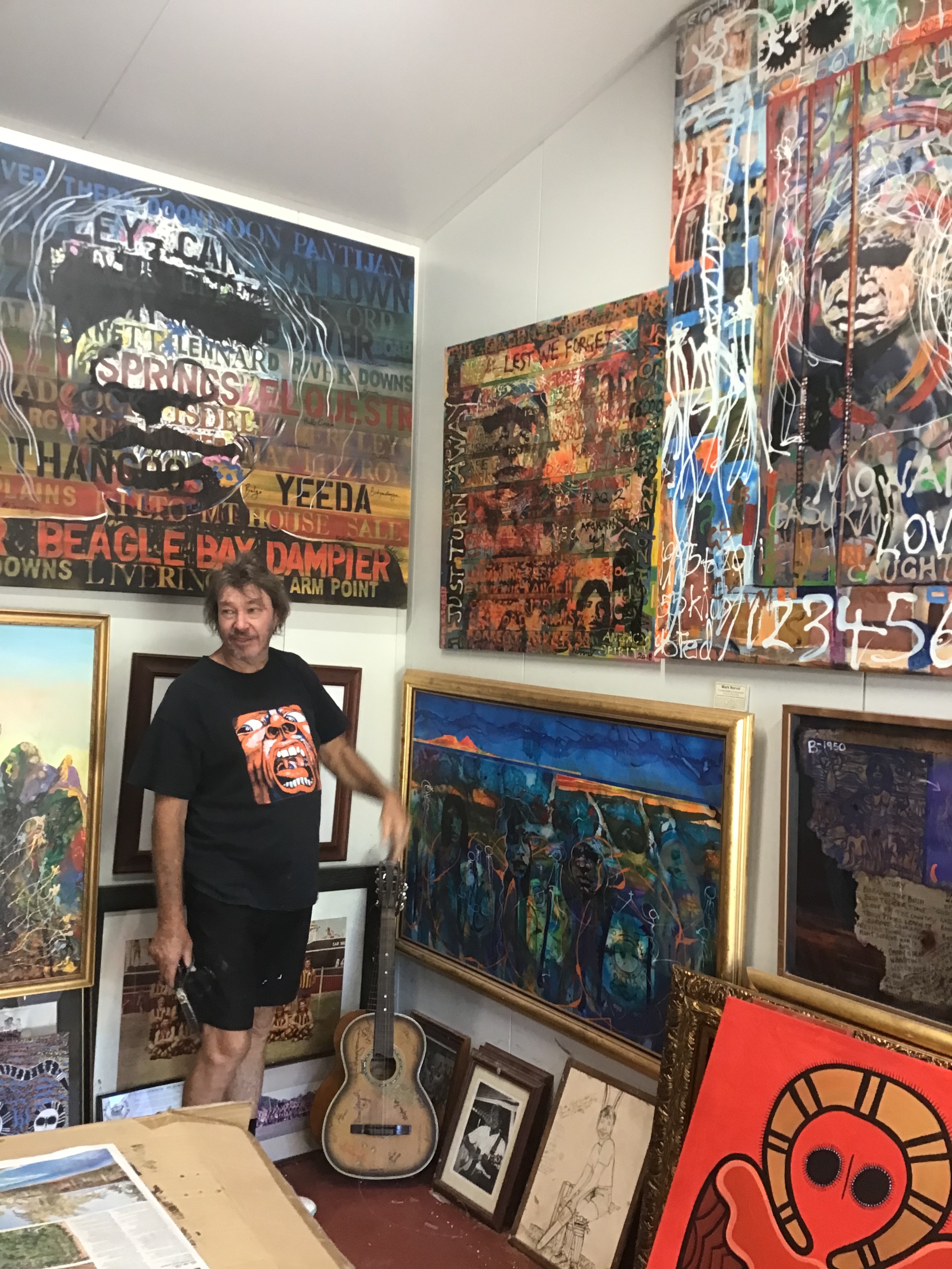
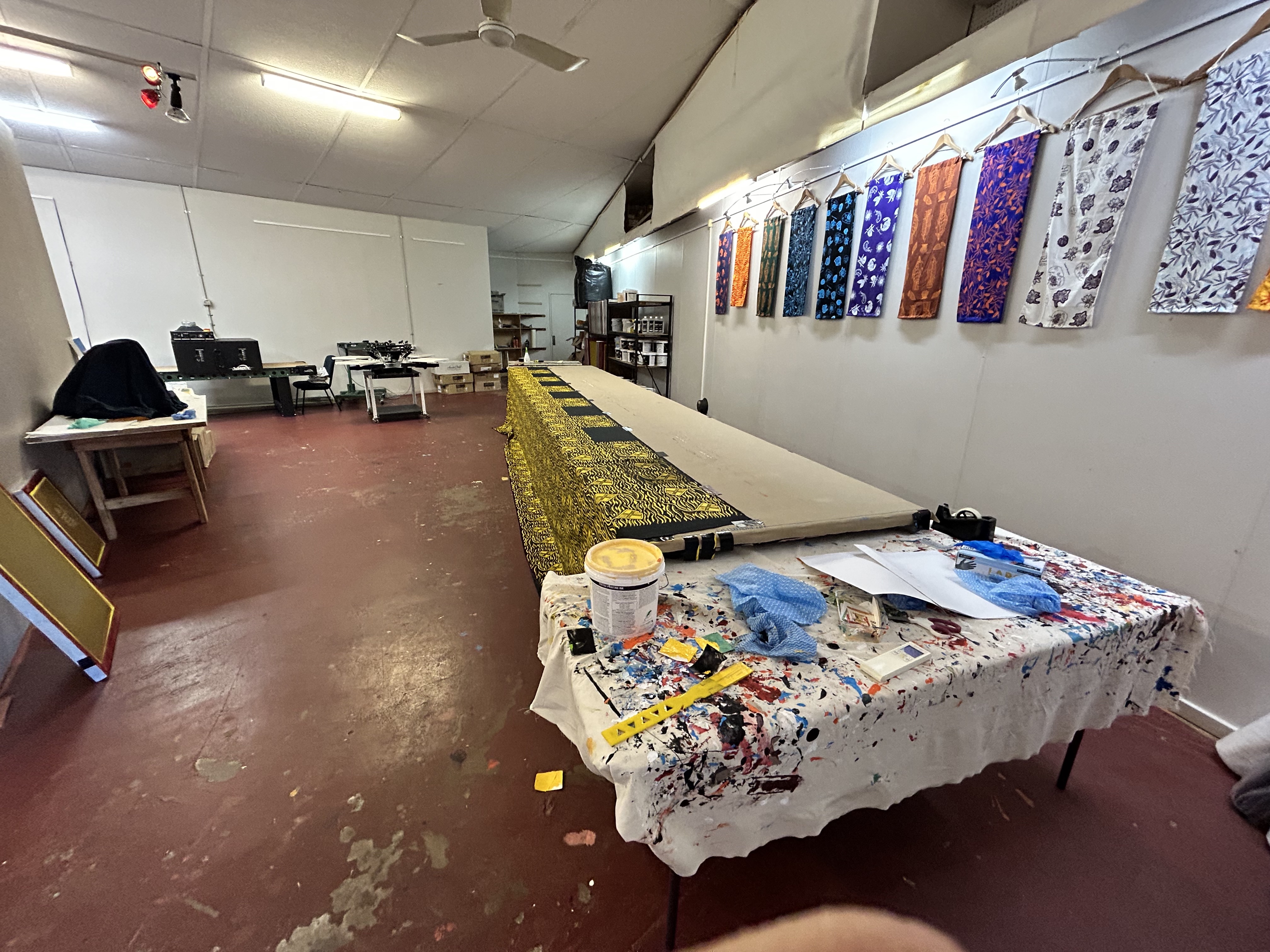
We had a few hours to kill before we’d be delivered to the Falls by seaplane so called a taxi (thanks to “DLA” in OzRunways notes for the phone number) into town and visited the Mark Norval Gallery. Mark is an art teacher who has lived in Derby with his wife Mary for 40 years and has helped develop the artistic talents of local indigenous people. His gallery has an amazing array of traditional and modern art by artists from all over the north of WA. He also has a huge collection of vinyl LPs.
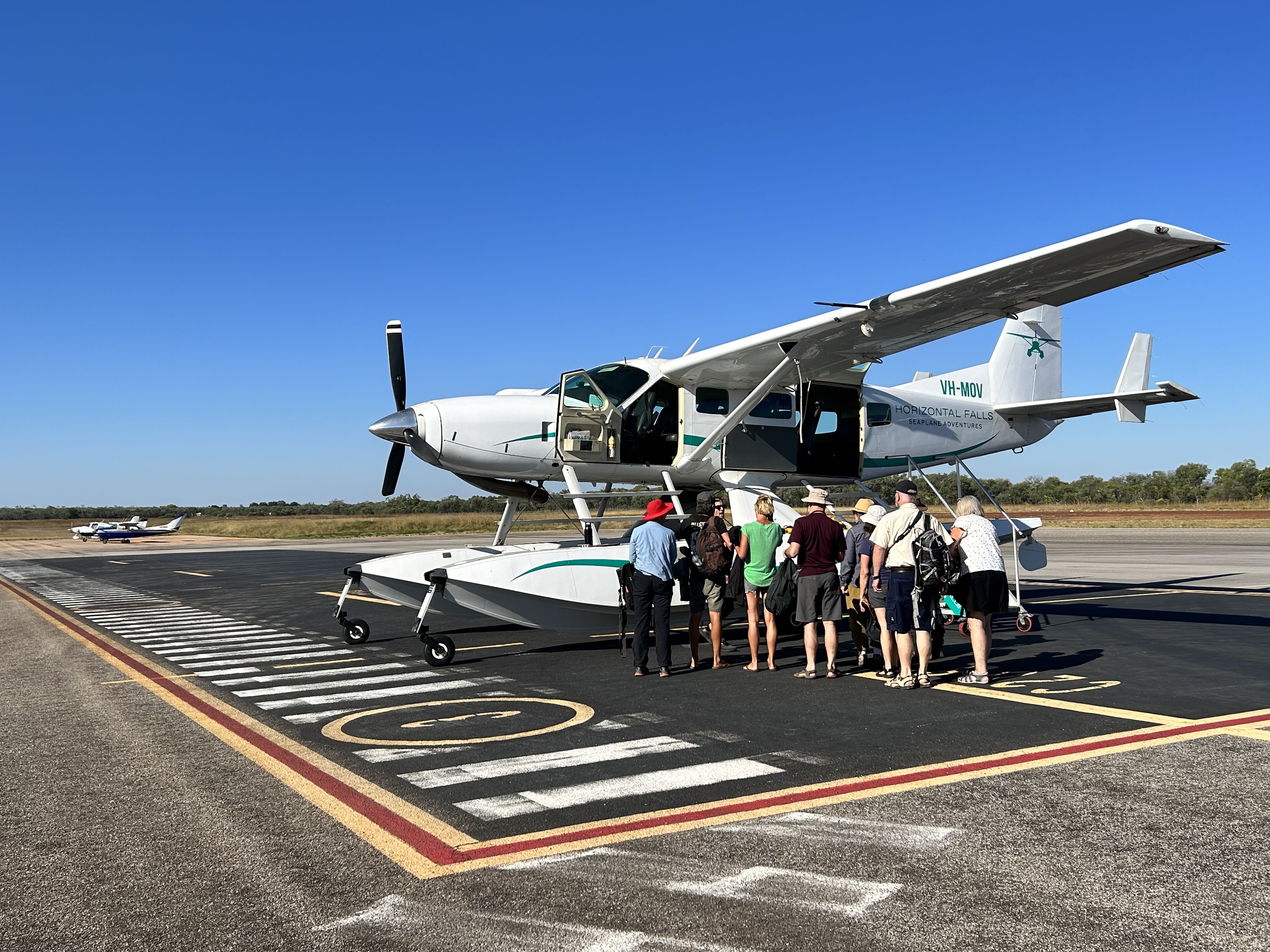
Back at the airport Izzy our seaplane pilot helped us aboard the amphibious Cessna Caravan for the 30 minute flight back to Horizontal Falls. With the sun lower in the sky and a prime window seat for all on board we had spectacular views of the country north east of King Sound with its thousands of islands and promontories.
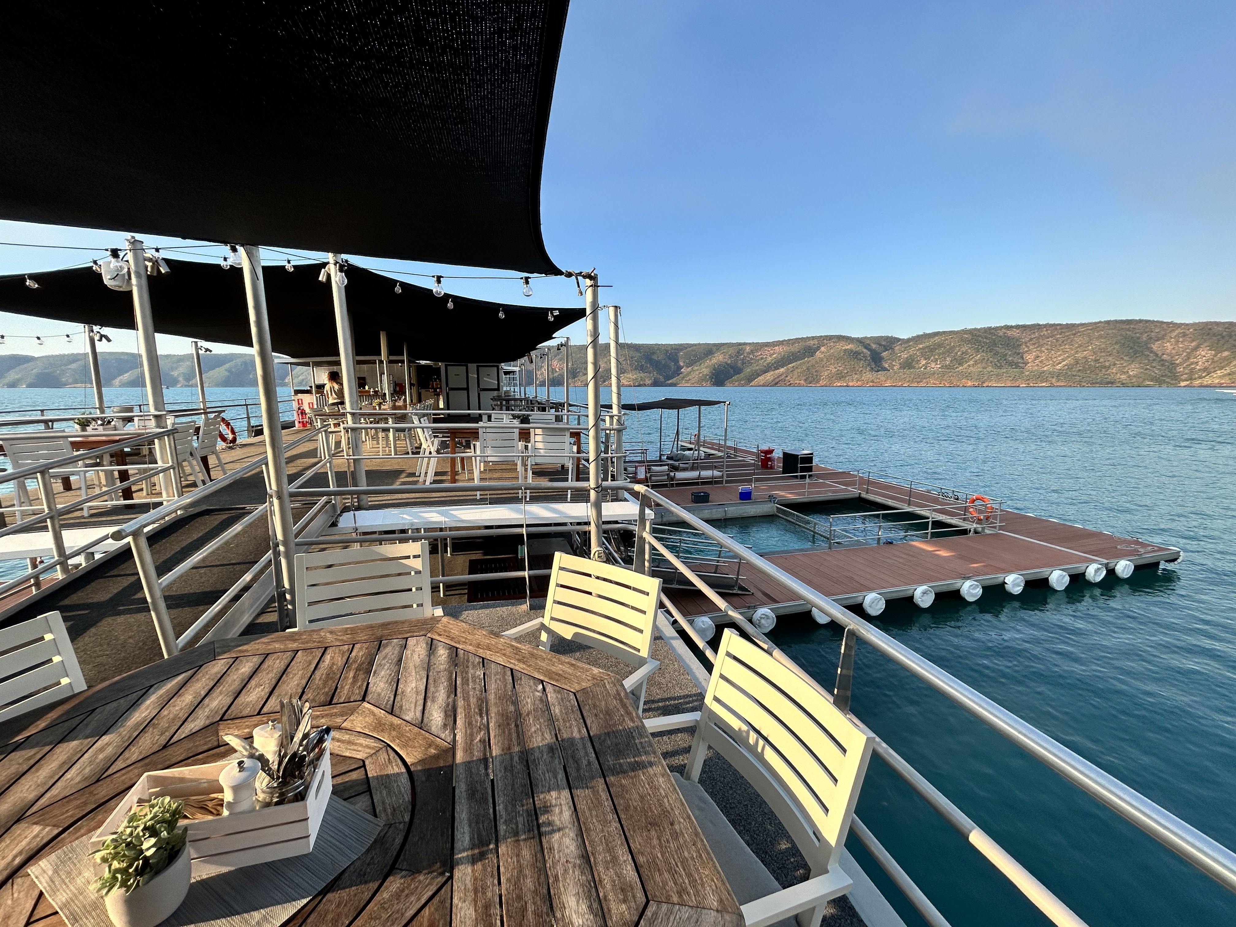
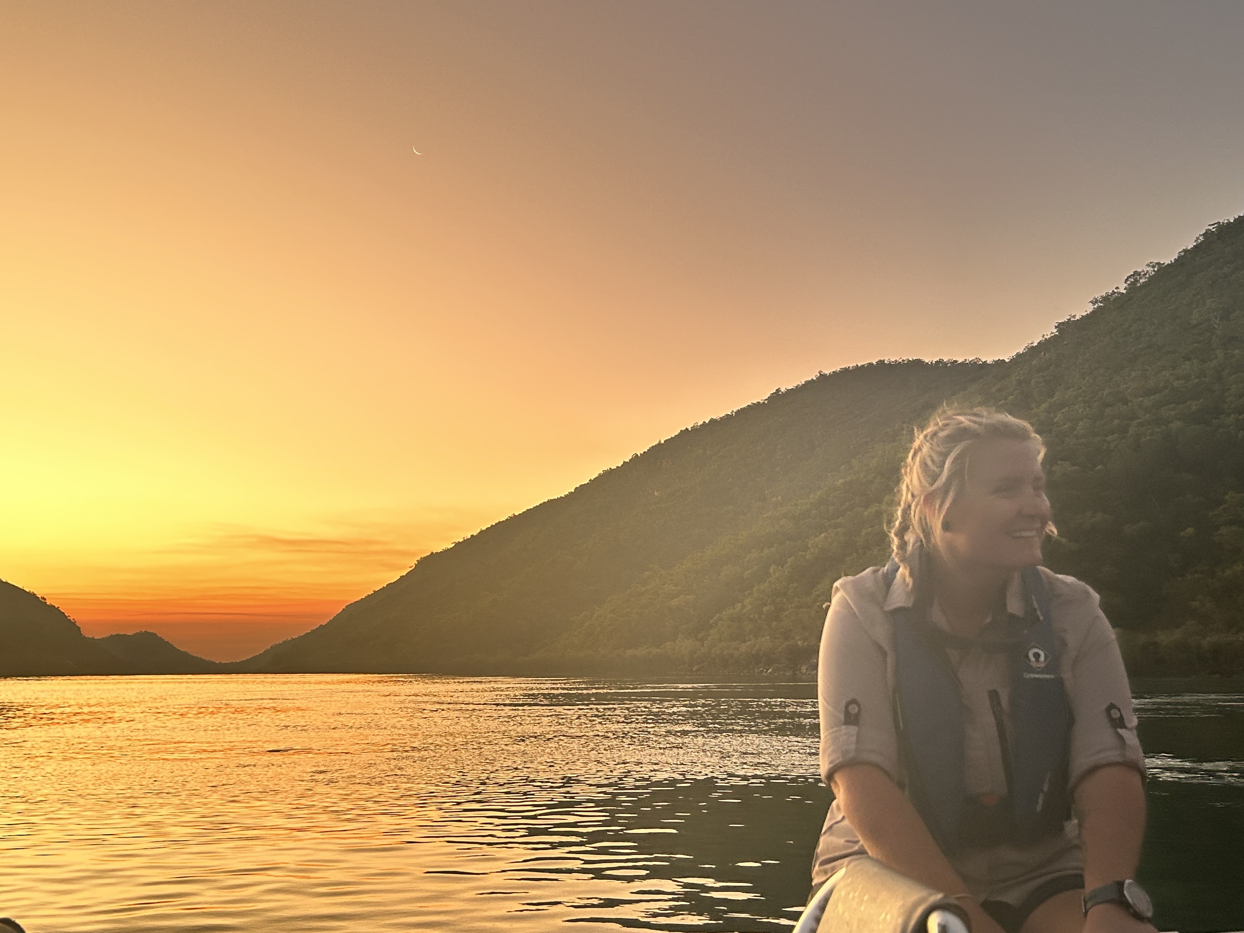
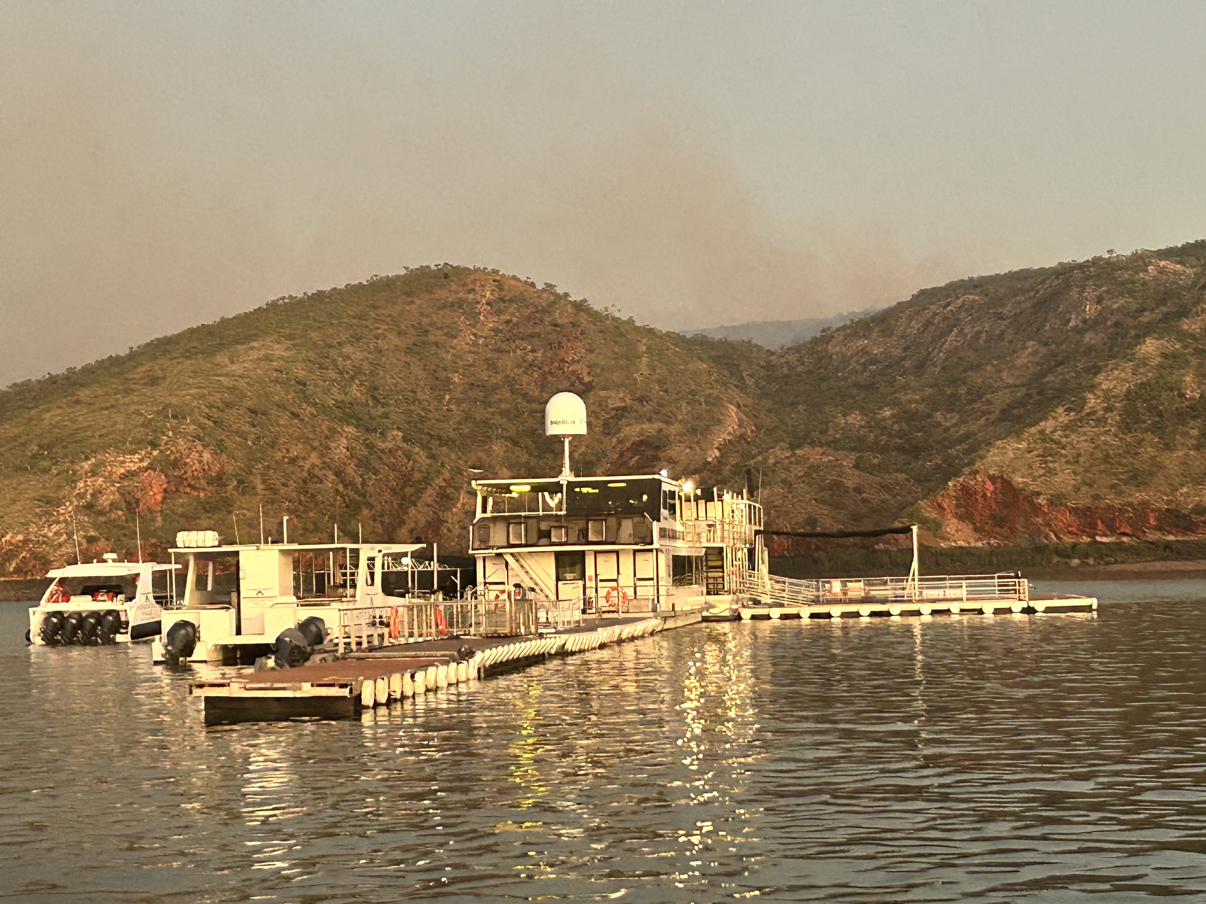
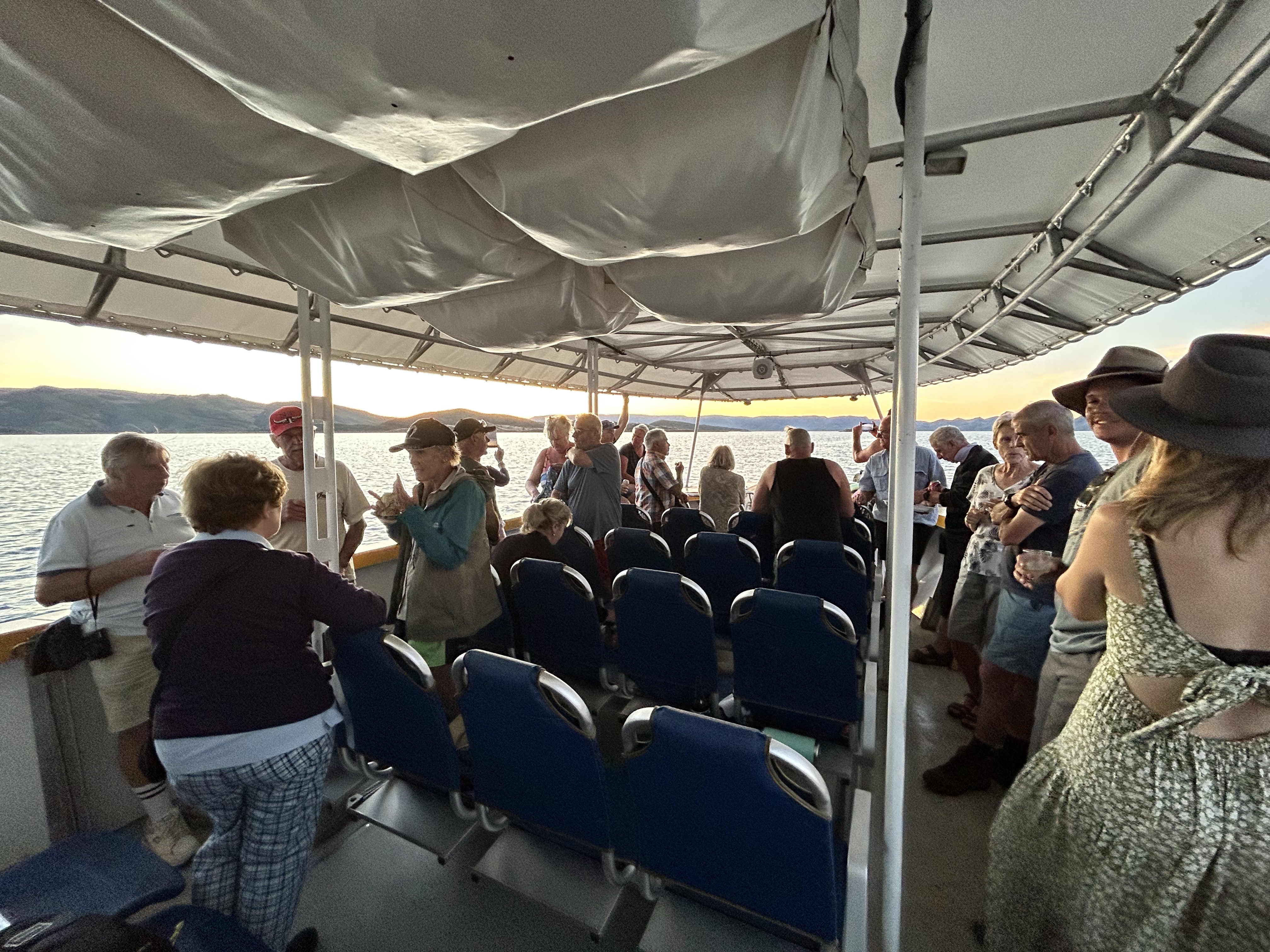
Landing on the water next to our floating hotel we felt like we’d entered some sort of James Bond movie. It was populated with smart young girls whose hospitality skills surpassed anything I’ve seen for a while. It felt pretty special as the 10 of us who were staying overnight were greeted as the day visitors departed on a couple of sea planes bound for Derby. The check in was followed by a shark feeding demonstration where we could swim next to the sharks (separated by a metal grill).
With Swiss precision we boarded a fast boat for a trip out on the water to explore the surrounding bays and delivery to the Horizontal Falls for a few passes at high speed just as the sun set in the west. Hayley our skipper couldn’t help but burst with enthusiasm as she explained the geology and history of the region.
Back at the mother ship the cheese and nibbles was followed by a meal of freshly caught barra, cooked skilfully by a couple of the other girls. Those girls were all a credit to their employer. It was just fascinating how they all worked together seamlessly. After a very satisfying meal they left us to enjoy the sunset and chat with our new friends while they retired to their own cabins at the far end of the mother ship.
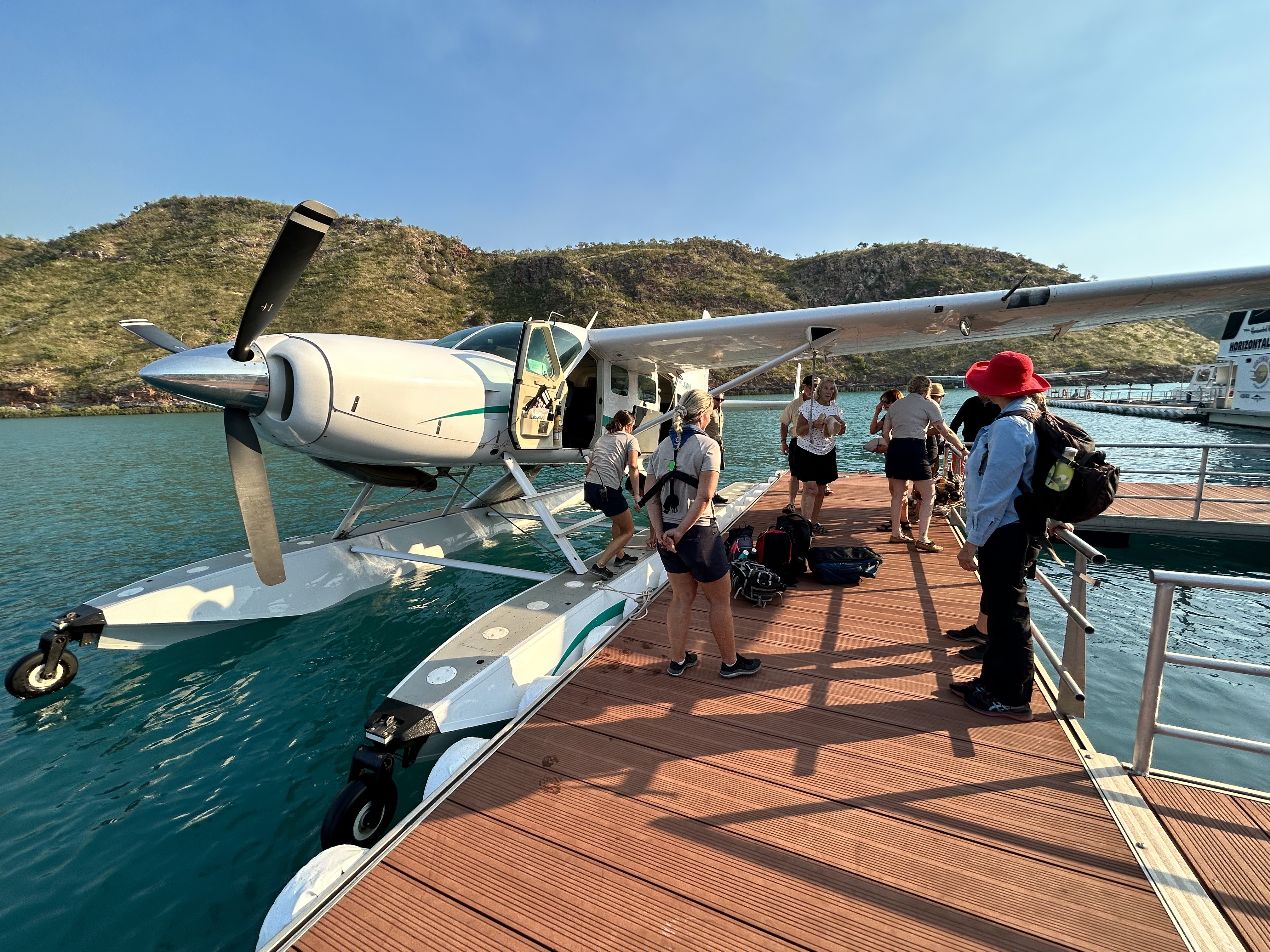
The Bond girls had our hot breakfast ready at 6am on the dot. We packed our bags and vacated our rooms and Hayley was ready and waiting in the speed boat as we climbed aboard at 6:30. It was off for another few passes through the wide gap as the sun rose. Hayley is a bit of a rev head so was clearly enjoying shaking us up a bit. We arrived back at the mother ship as four amphibious aircraft landed, full of day visitors. Climbing on board one of them we took off and did a couple of orbits over the falls as the day trippers whizzed through the falls below us.
On the way back to Derby we passed over the Cone Bay barramundi farm that had supplied our dinner the night before.
Landing back at Derby the bus took us into town for a coffee and a visit to another gallery who do silk screenings of local art. The wharf at Derby is pretty famous because of the 11 metre tides so we had to walk out there to have a look, passing some larger than lifelike sculptures on the way. Afterwards the Jila Gallery provided lunch and coffee.
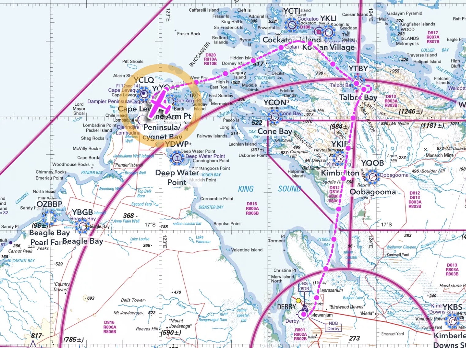
Back at the airport we took off in MSF for one last pass over Horizontal Falls before tracking along the coast past Cockatoo Island and its iron ore mine. We landed at Cygnet Bay at the north end of Dampier Peninsula. The dirt strip is bull dust over a clay base apparently. No good when wet but fine when it’s dry. It was time for a refreshing swim in the Pearl Farm’s infinity pool. Sigi noticed she’d left her favourite Cirrus pullover at the Jila Cafe in Derby. Don’t panic! A quick phone call and the cafe owner arranged to post it to us in Brisbane free of charge. And it arrived a couple of days after we got home. Now that’s service! https://www.jilacafe.com.au
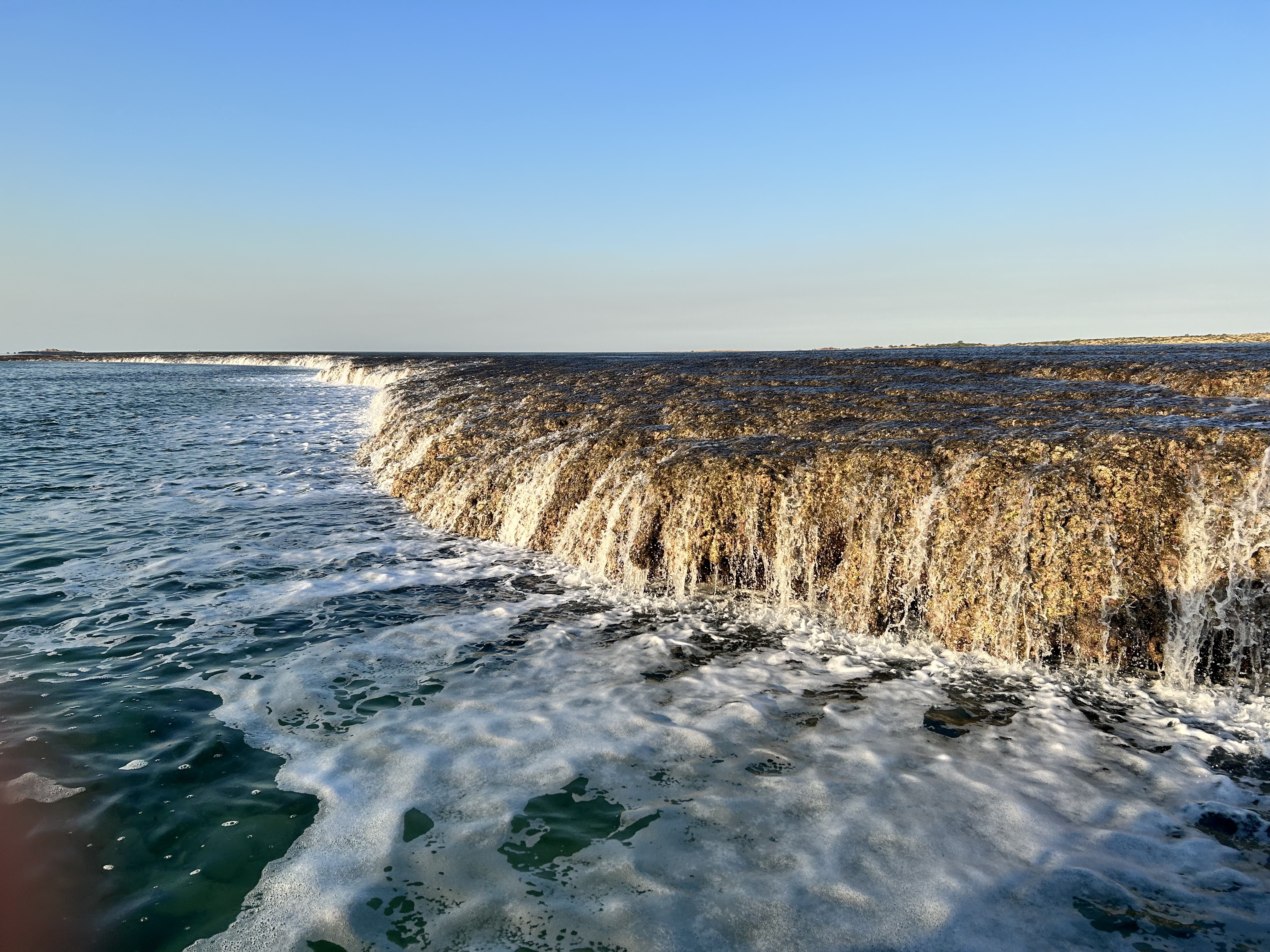
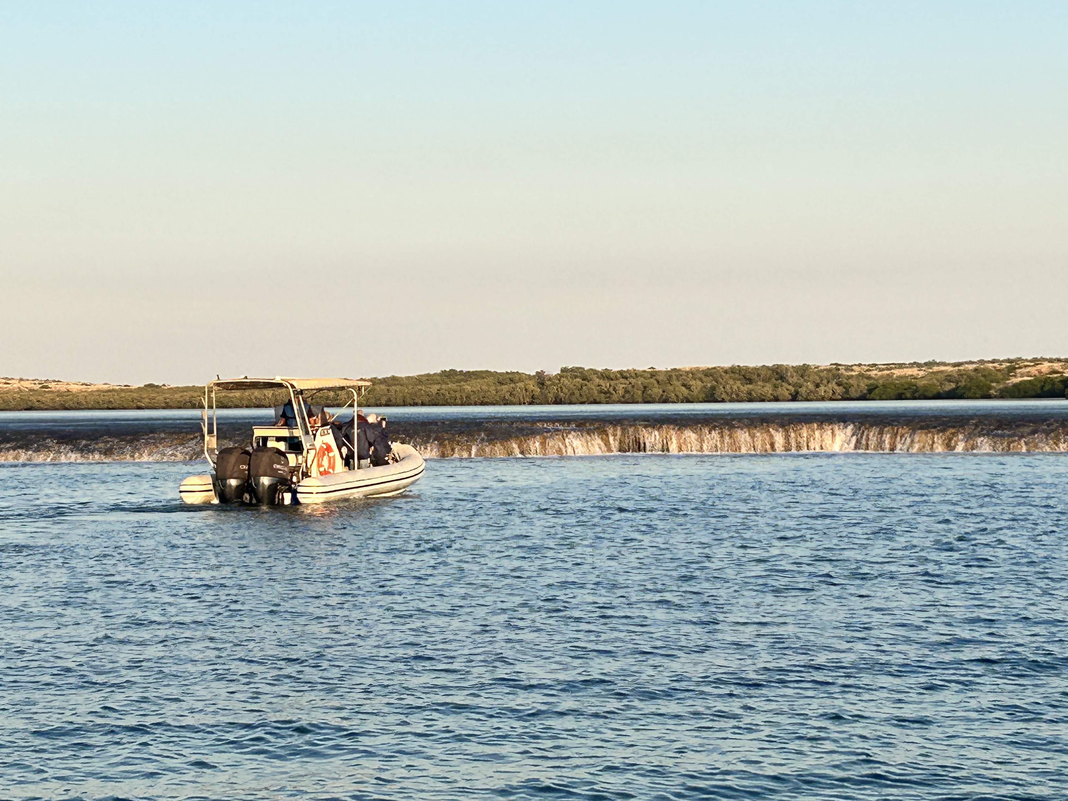
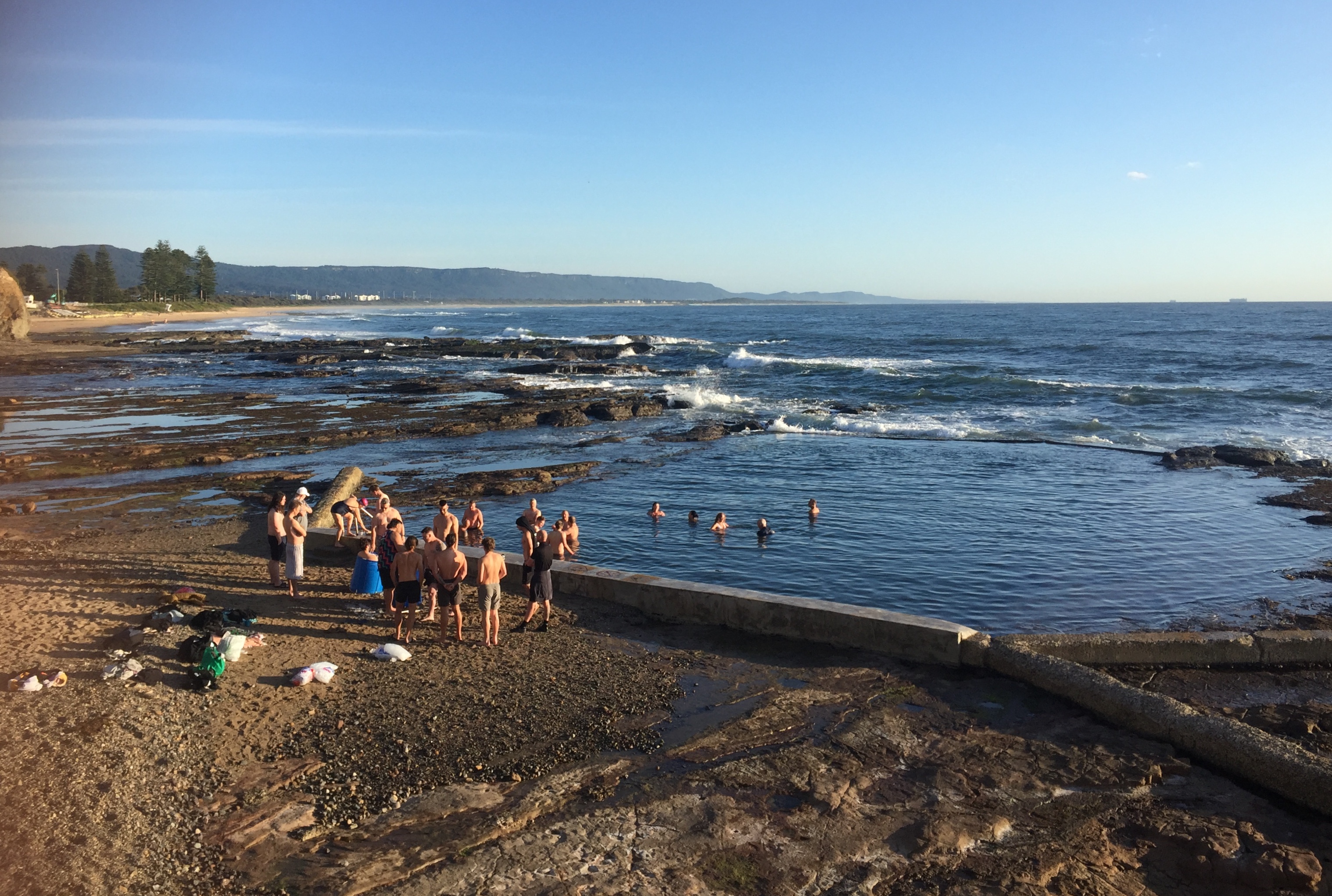
The next day in Cygnet Bay started with a 6:15 departure on an amphibious boat to the Waterfall Reef about 30 minutes away. The 11 metre tide was on the way out so there was plenty of water cascading over the edge. Flocks of terns were busy diving for fish that were being swept along by the rushing tidal waters.
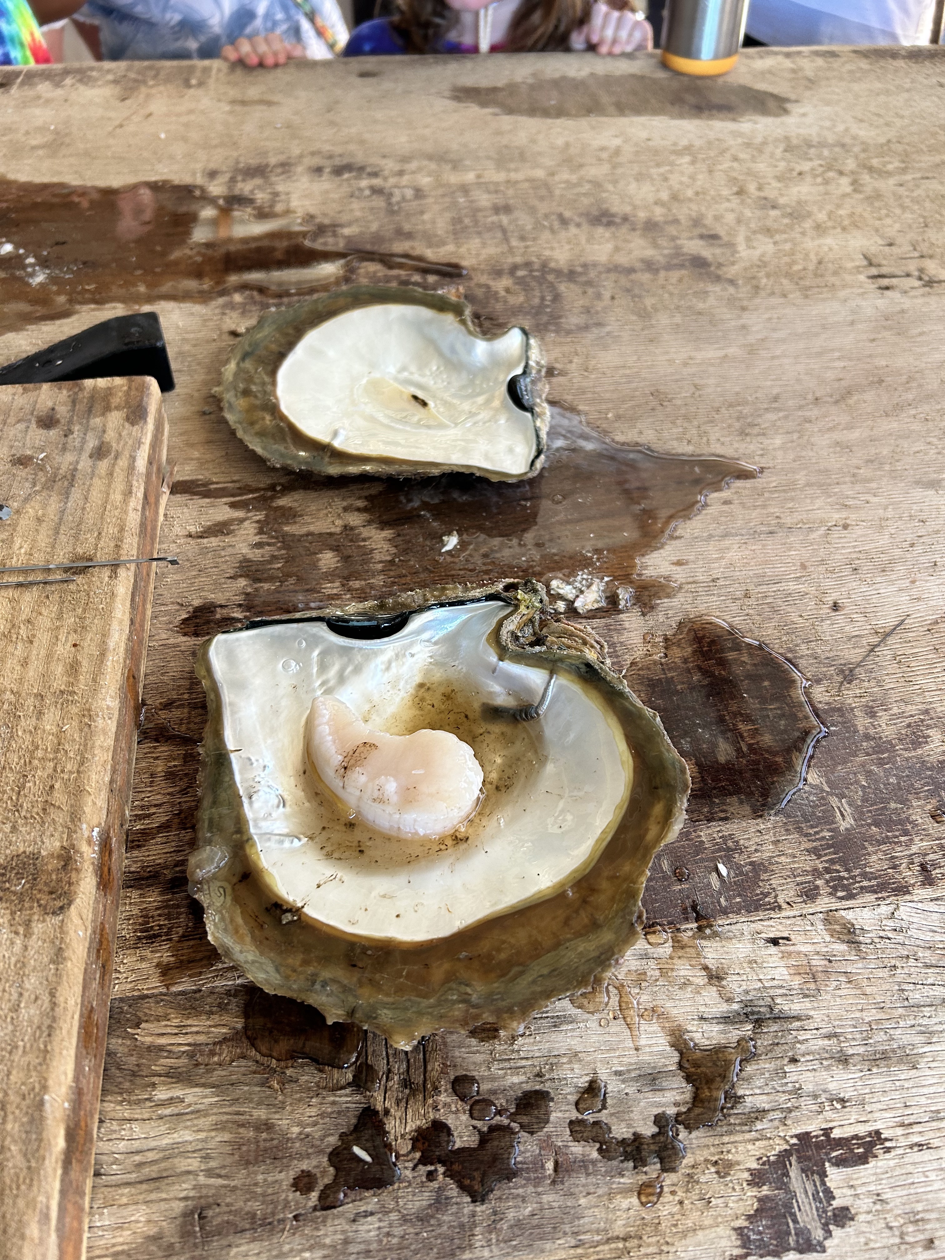
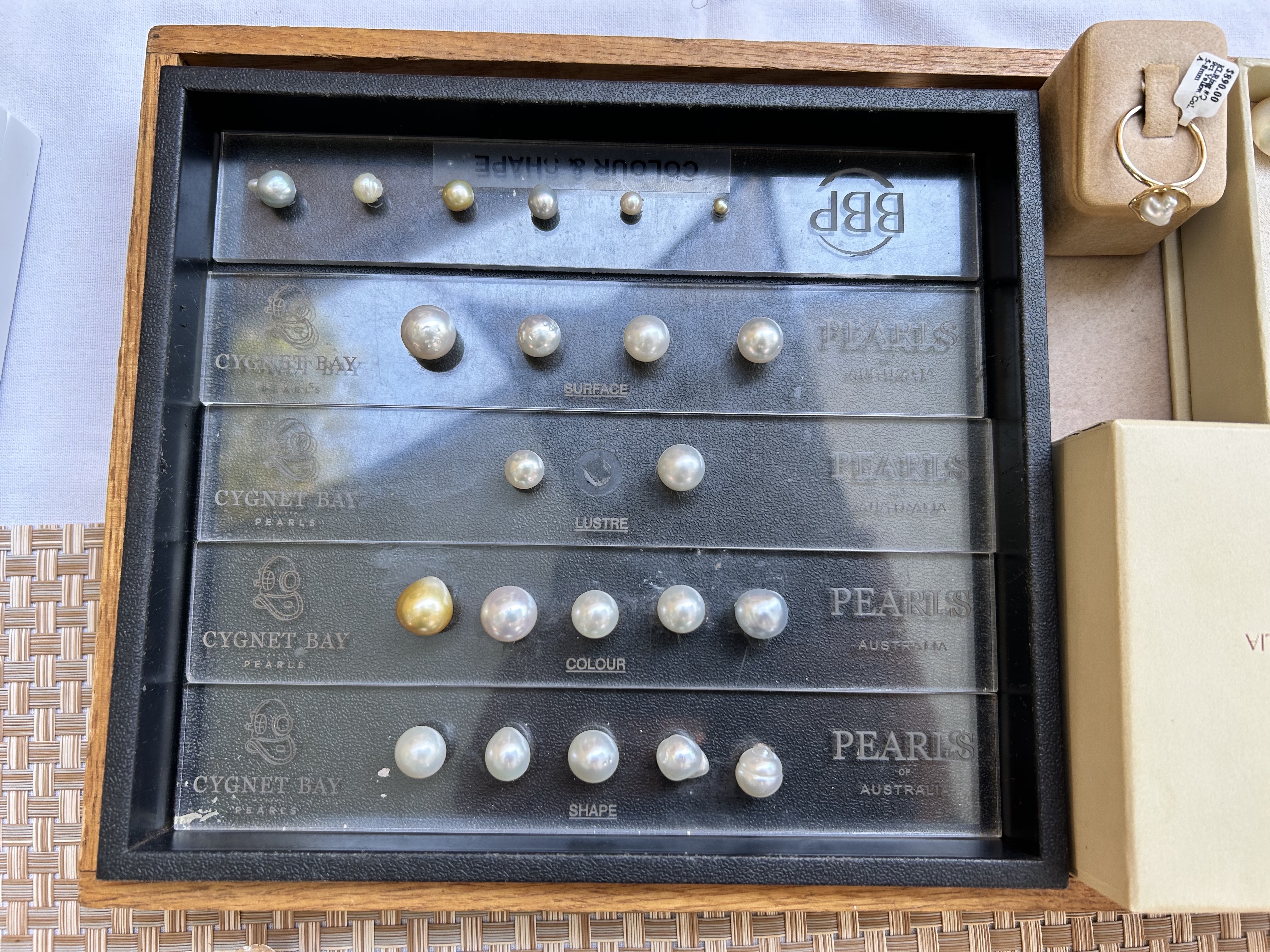
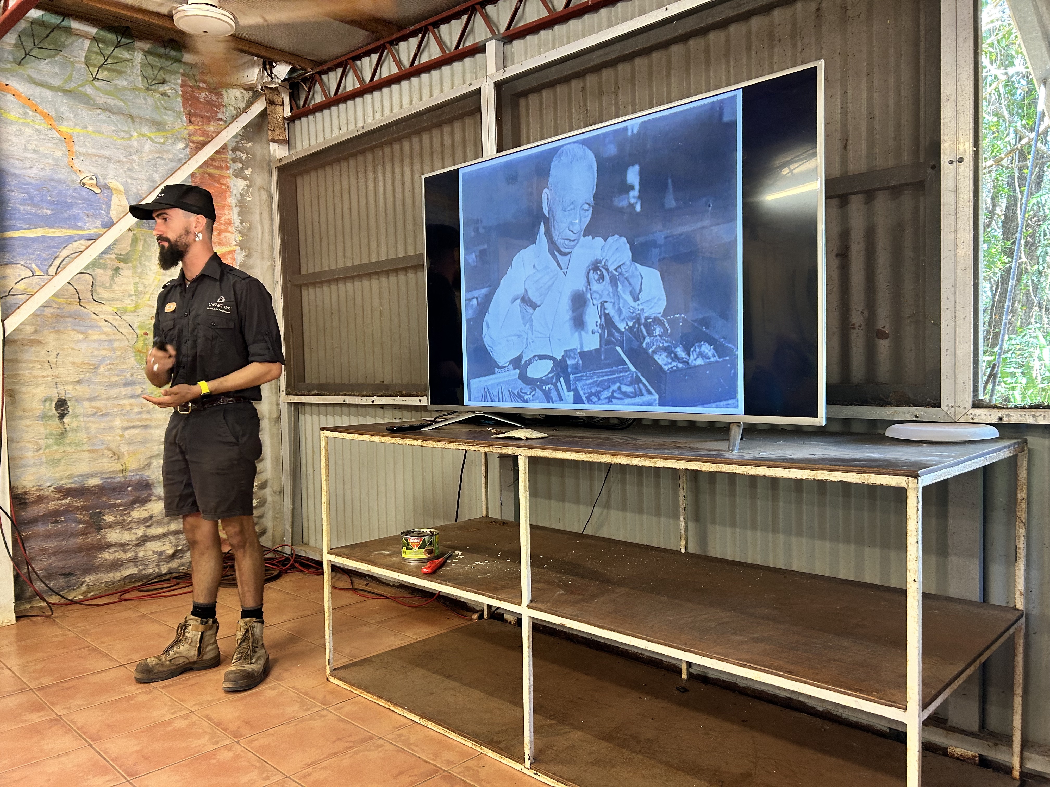
Back at the Pearl Farm we took part in a tour of the operations where our guide went into great details of how pearls have been cultivated since the place was set up in the 1970s.
The accommodation at Cygnet Bay varied between bare campsites to refurbished pearler cabins to luxury glamping tents. They had a great communal kitchen for the campers and a great restaurant/bar/cafe overlooking the infinity pool. The only real negative was the $50 each way transfer fee from the airstrip. A bit steep for what it is. The deck restaurant and bar area were well designed and the food was good and reaonsably priced. The kitchenette was well fitted out so that we could make our own breakfast easily. We enjoyed both dinners there while having our breakfast out the front of our glamping tent.
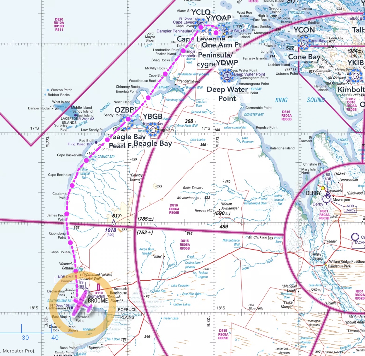
After a morning walk to explore the local area we were driven out to the Cygnet Bay airstrip just after 11am. There was a bit of traffic around so I was glad to have my Ping USB device that identifies all the ADSB transmitting traffic in the vicinity and displays them in OzRunways on the IPad. Turning left past One Arm Point we headed west initially in an attempt to spot the Cape Leveque airstrip that has been decommissioned. Couldn’t spot it.
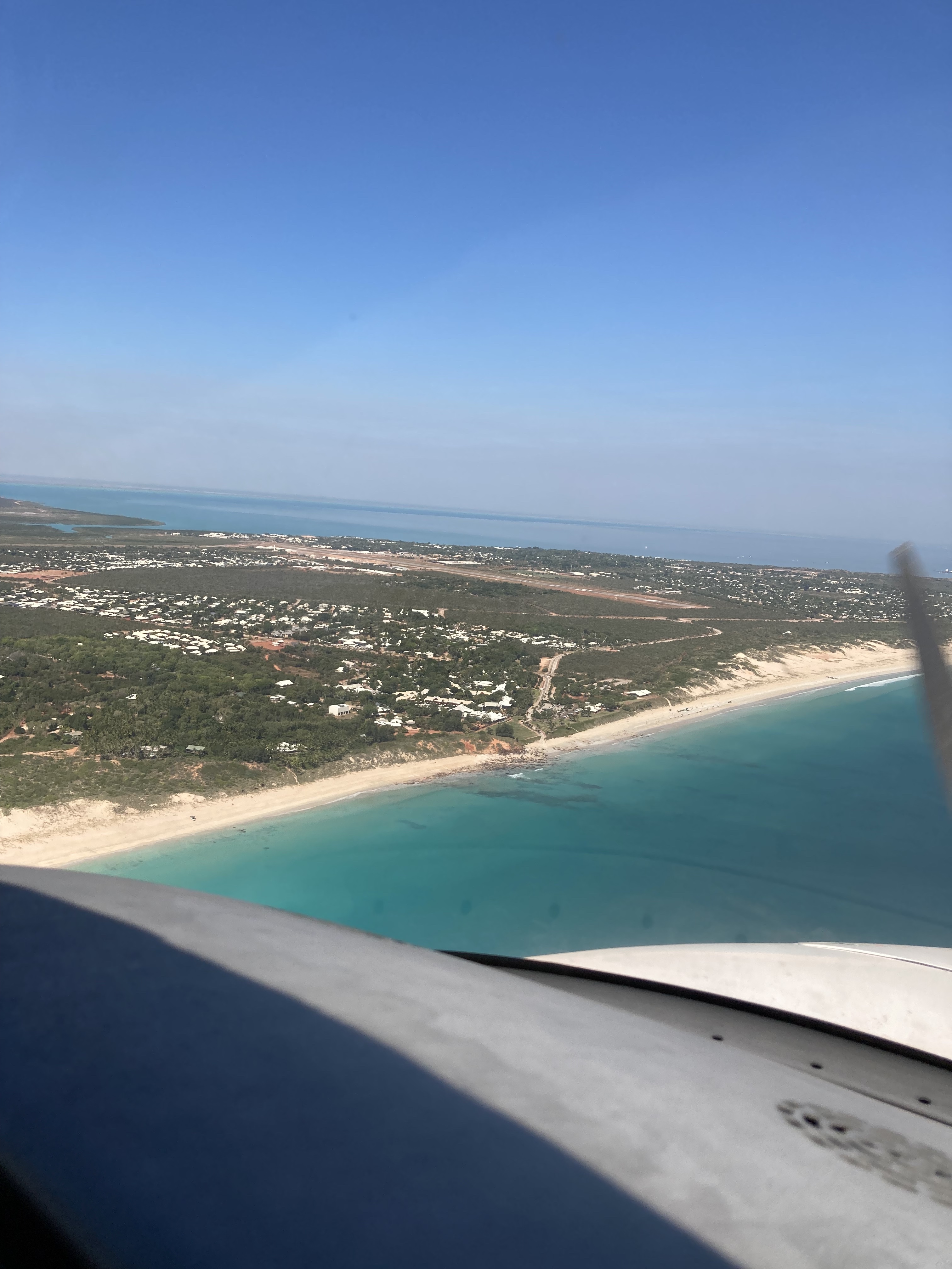
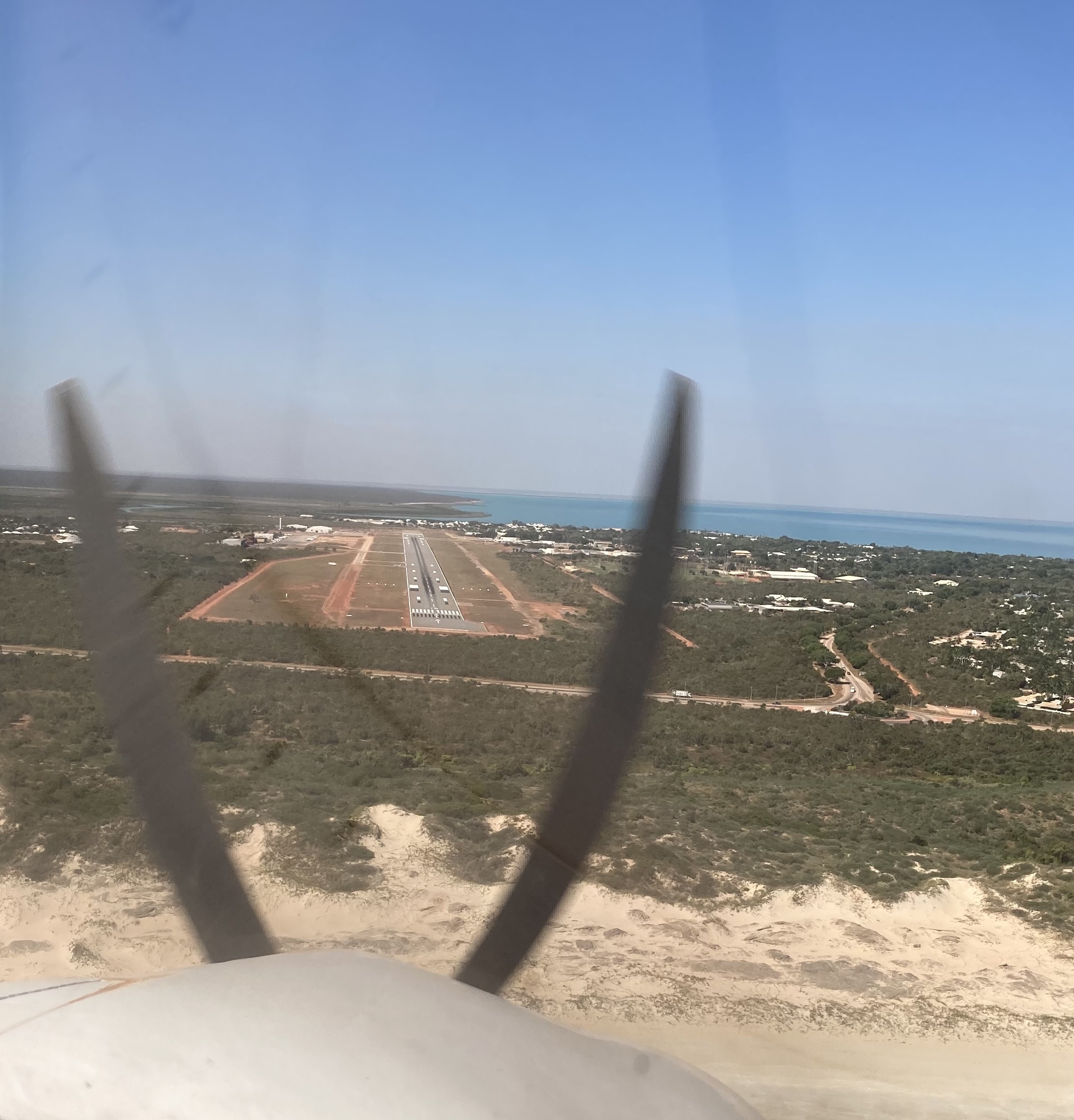
So we continued down the coast at 4500ft, passing Luc in his Cherokee, who was further inland at 2500ft. The sealed strip at Lombadina, used by the offshore oil and gas traffic as a refuelling base, stood out, as did the dirt strip at Beagle Bay. There were lots of fires burning inland so the visibility was not ideal due to the smoke but was still greater than 25km along the coast. Descending to 1500ft by James Price Point we were cleared by Broome Tower and followed a Cessna in to join base on RWY10. It’s a big runway.
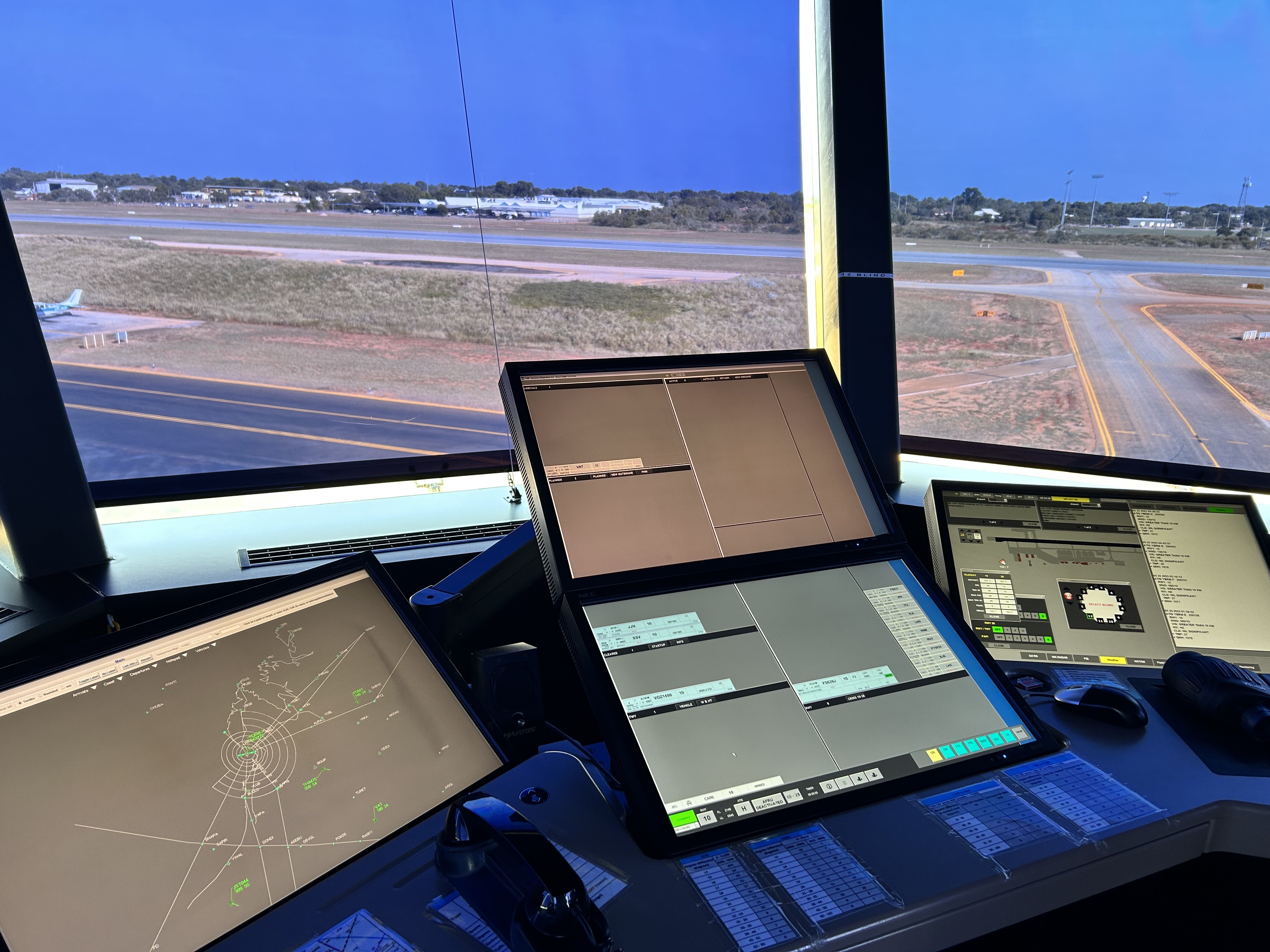
After tying down and arranging transport for our passengers to the BNB, Luc organised a minor repair to WKE and we walked over to the tower to have a chat with the air traffic controllers. They were happy to show us around and explain their procedures and systems.
The Courthouse BNB turned out to be an oasis not far from Chinatown. The owner had it on the market as she wanted to retire.
After a quick cool off in the pool we caught the very good bus service out to Zander’s at Cable Beach for a sunset aperitif. It was stunning as expected. After another ride back to Chinatown we grabbed the last table at Johnny Sausage, an upmarket Italian restaurant for a great meal with great service. Highly recommended.
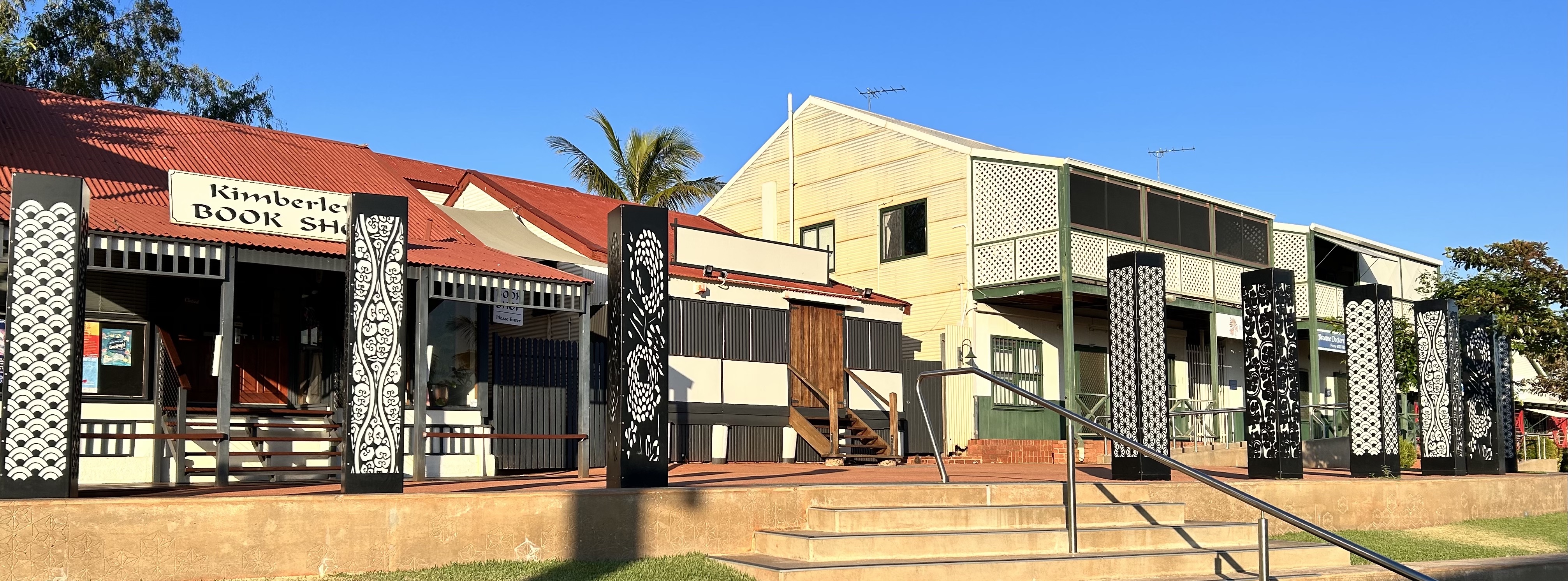
There’s a lot to see in Broome and plenty of history. The Courthouse BNB was a great central base for exploring. Friday started with an early morning tour of the “big art” around Chinatown with Chris from Salty Plum walking tours. The Chinatown and Town Beach precincts were upgraded for $30m a few years ago and part of it was installation of numerous sculptures and other artworks. Chris spent an hour and a half with us explaining the history of the town.
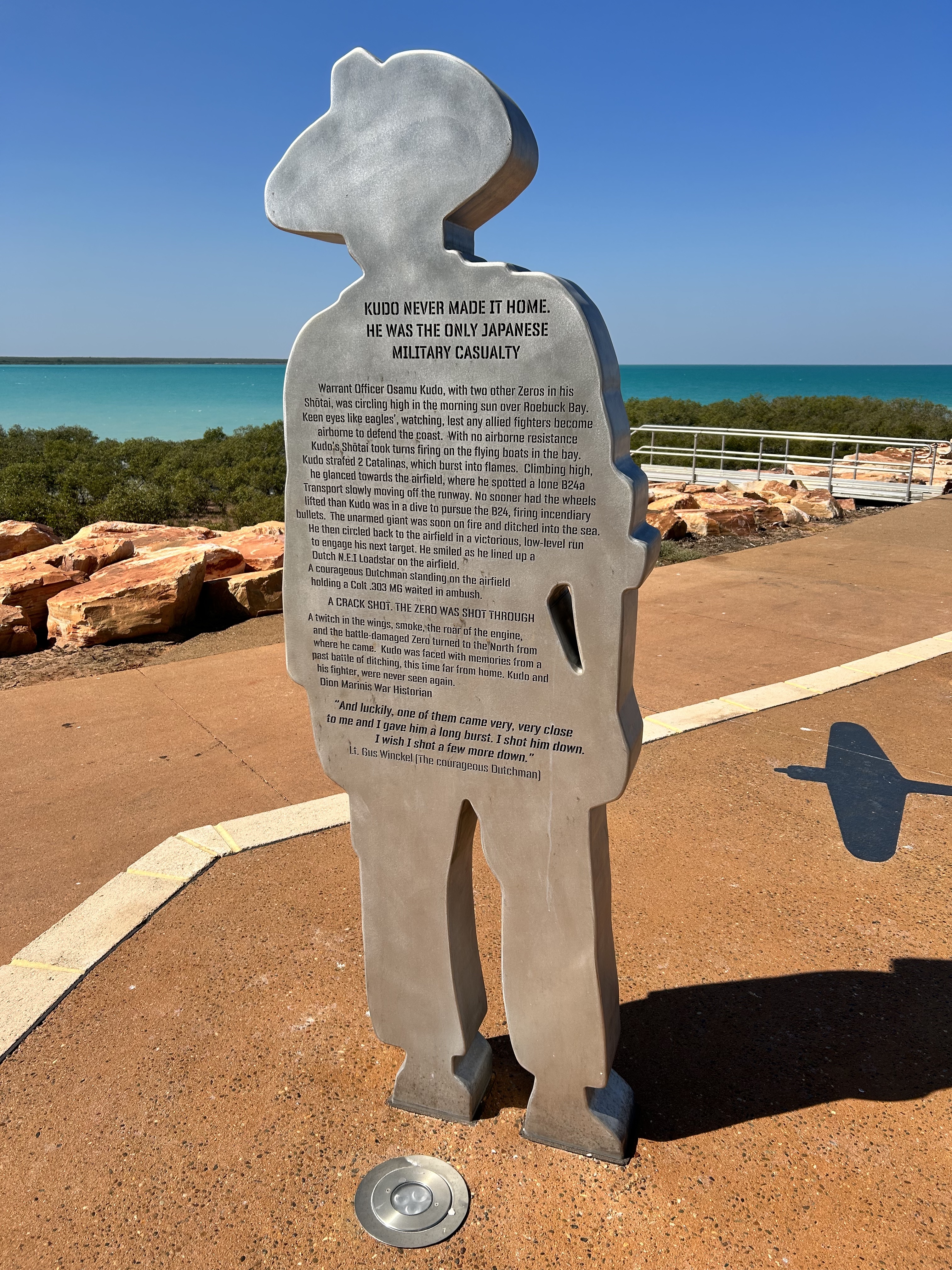
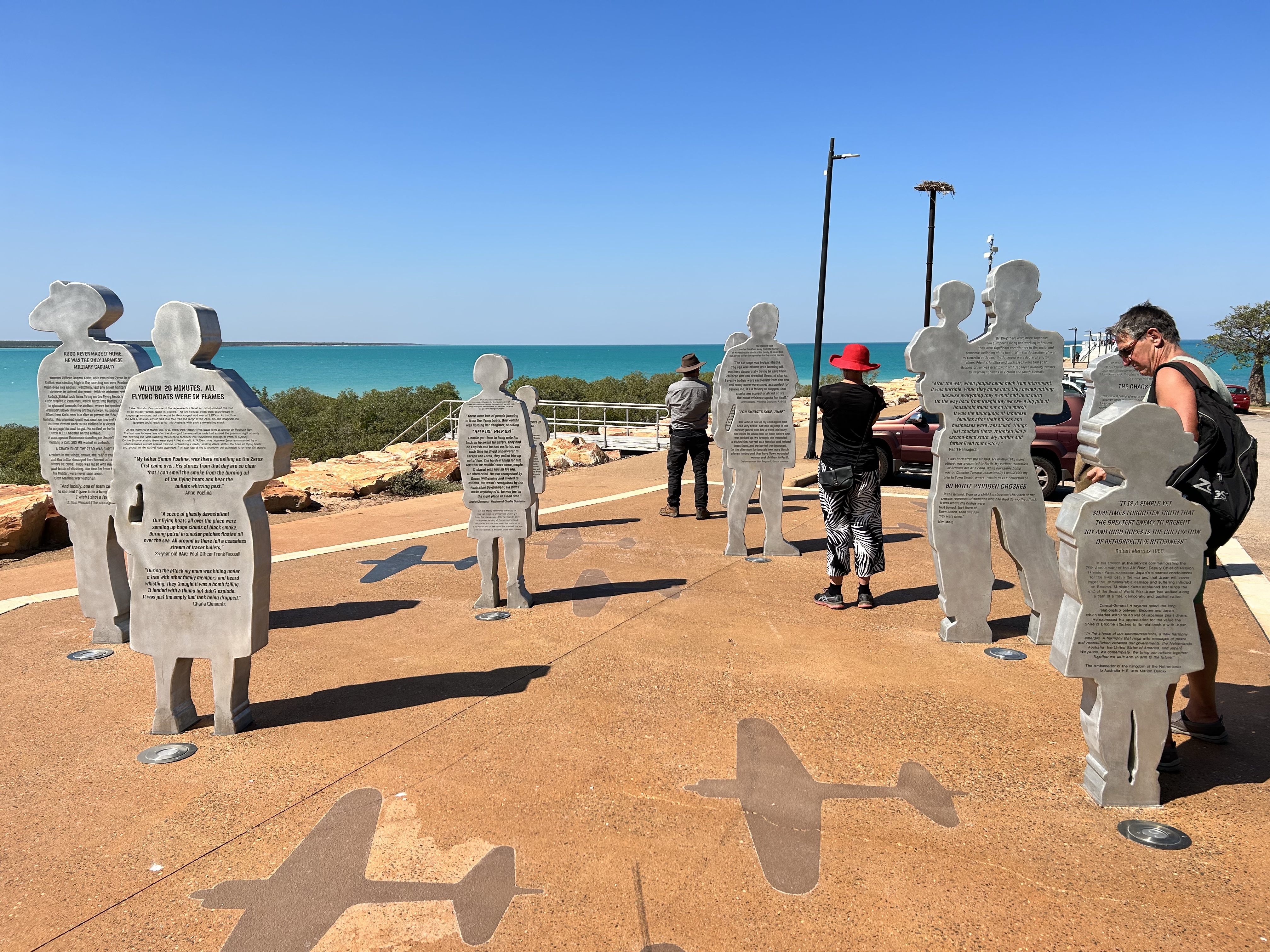
After breakfast we walked along to the town beach jetty where there are sculptures in memory of the victims of the Japanese aerial attack on Broome during WWII. We were totally unaware of this attack and how many people were killed, mainly refugees escaping Indonesia. We watched a young guy pluck a number of fish out of the water at the end of the jetty. No bait required! Who needs a boat?
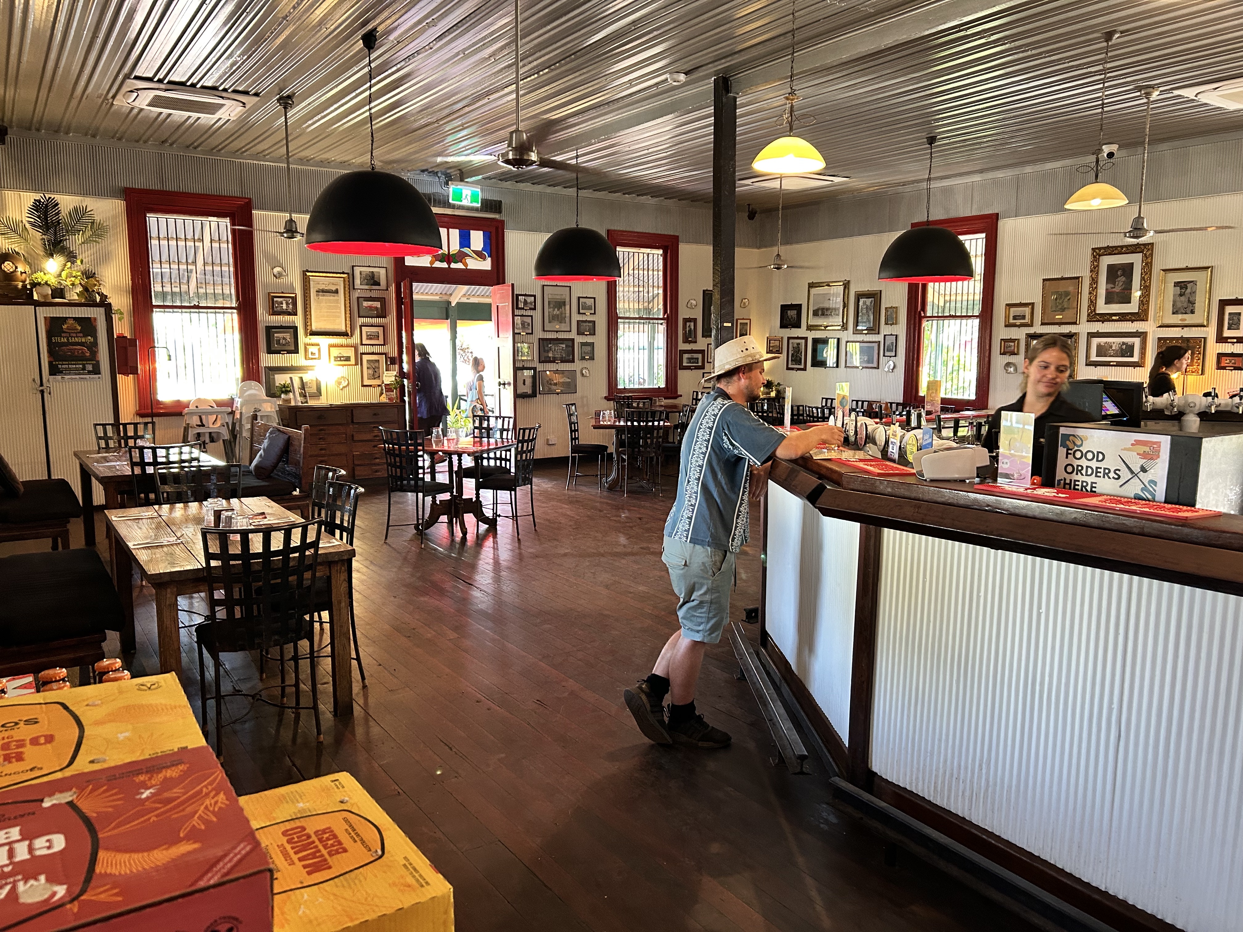
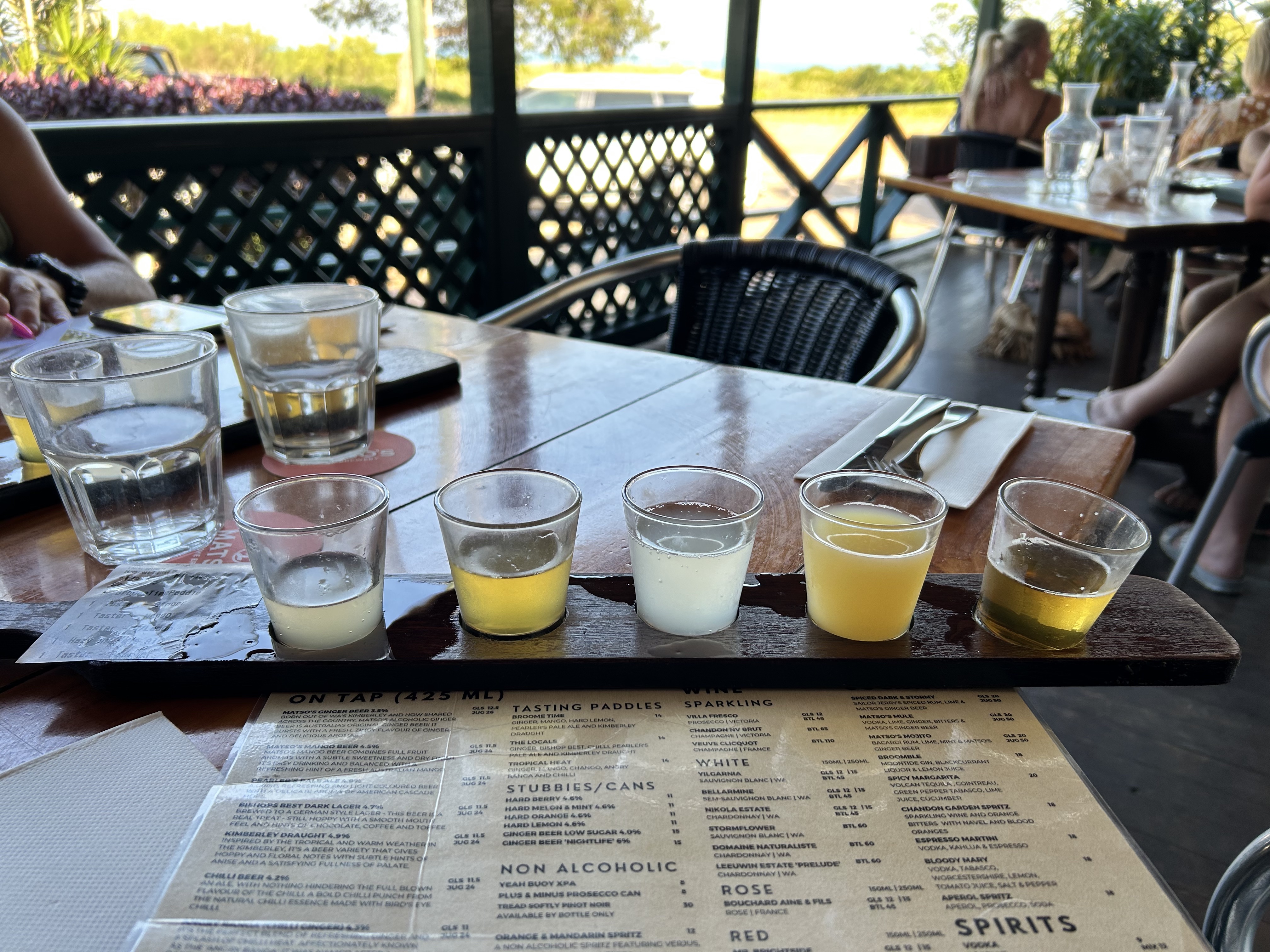
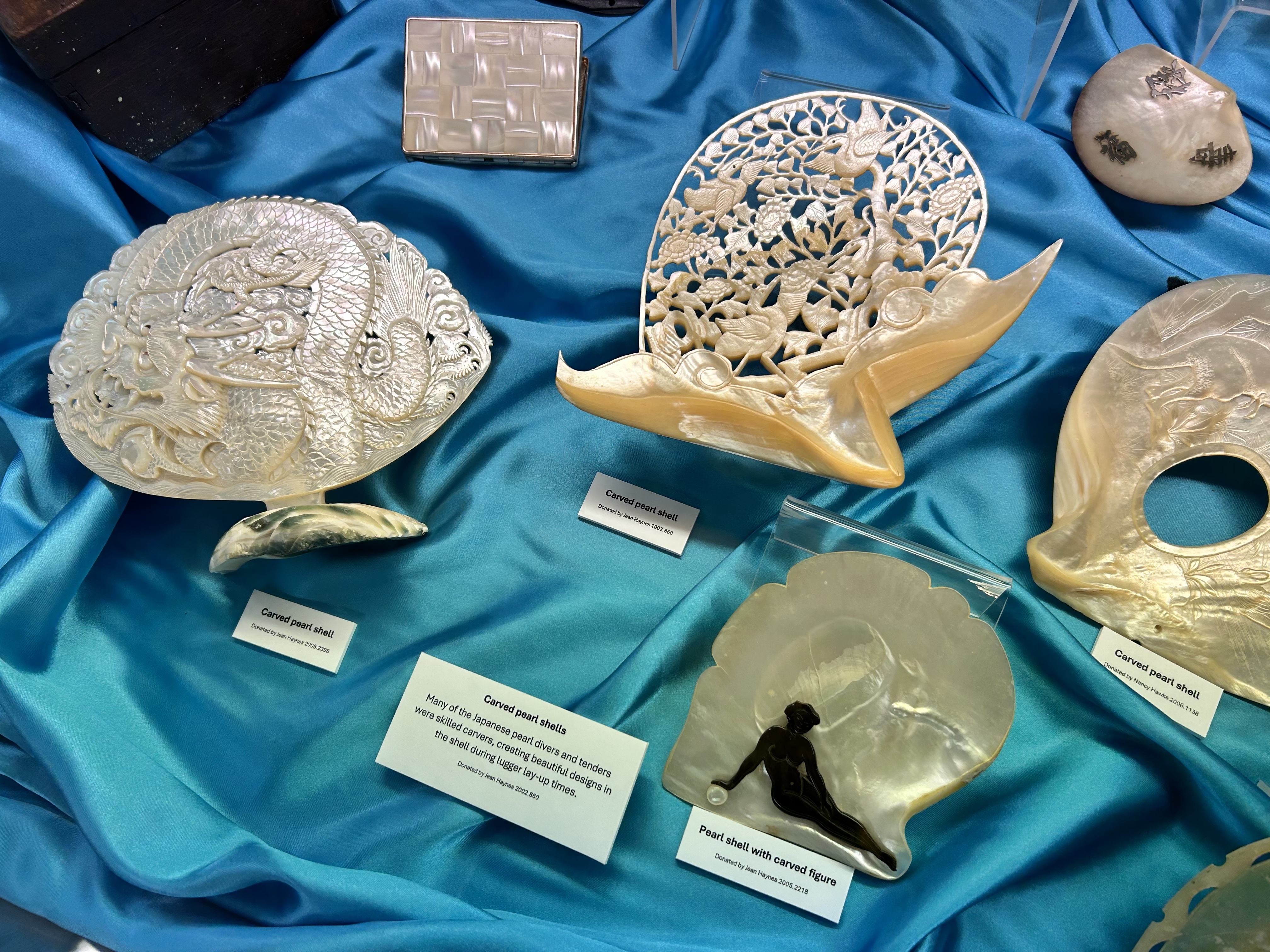
The museum nearby gave us a bit more info on the pearling industry over the years while Matso’s Brewery introduced us to mango beer over a Bibimbap.
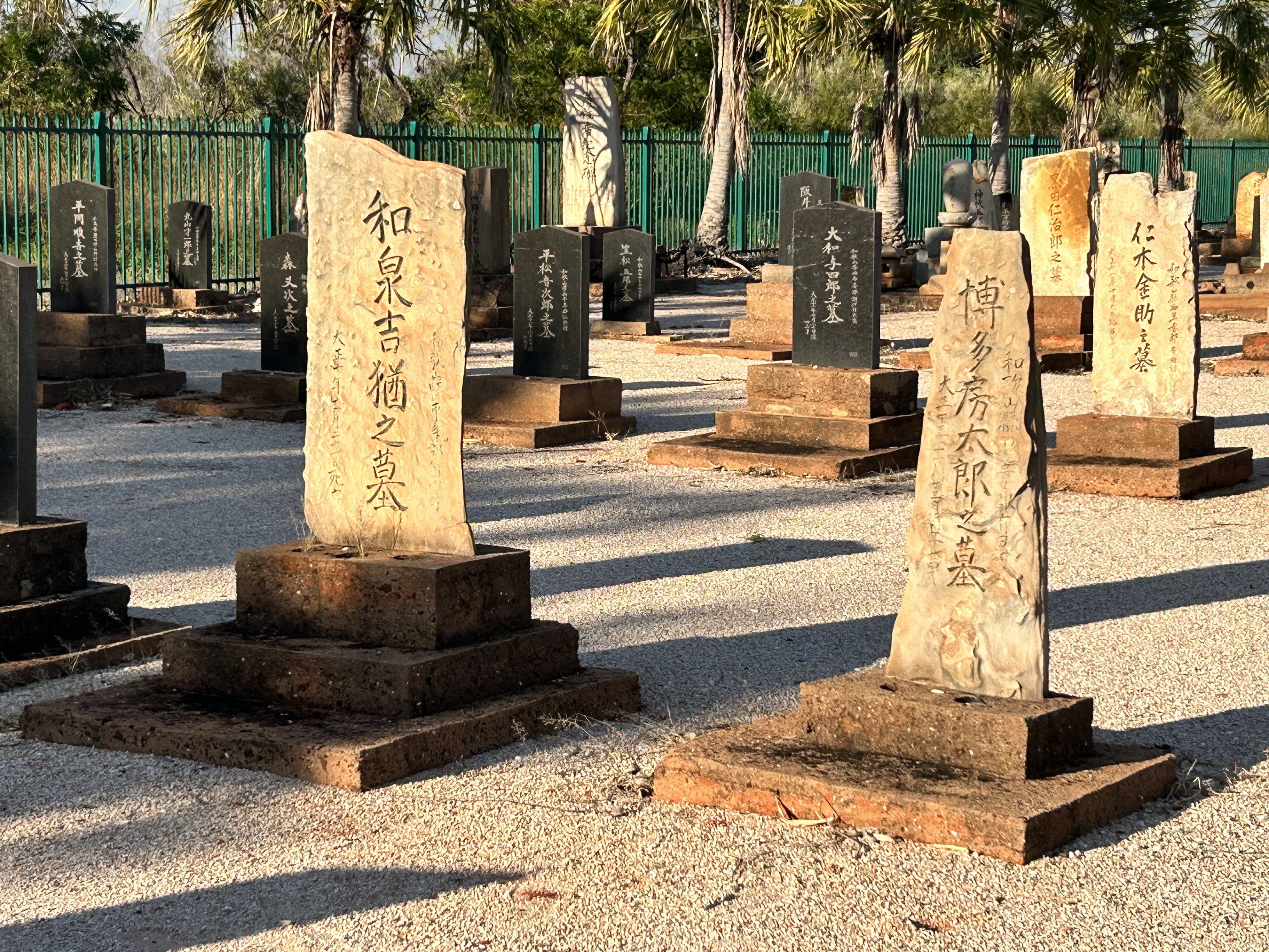
A short ride on the superb Broome Explorer bus brought us to the Japanese cemetery and from there it was only a couple of km stroll to Cable Beach to see the sun slide into the Indian Ocean one last time. At 22,000 steps for the day it made our hike to Mitchell Falls pale into insignificance.
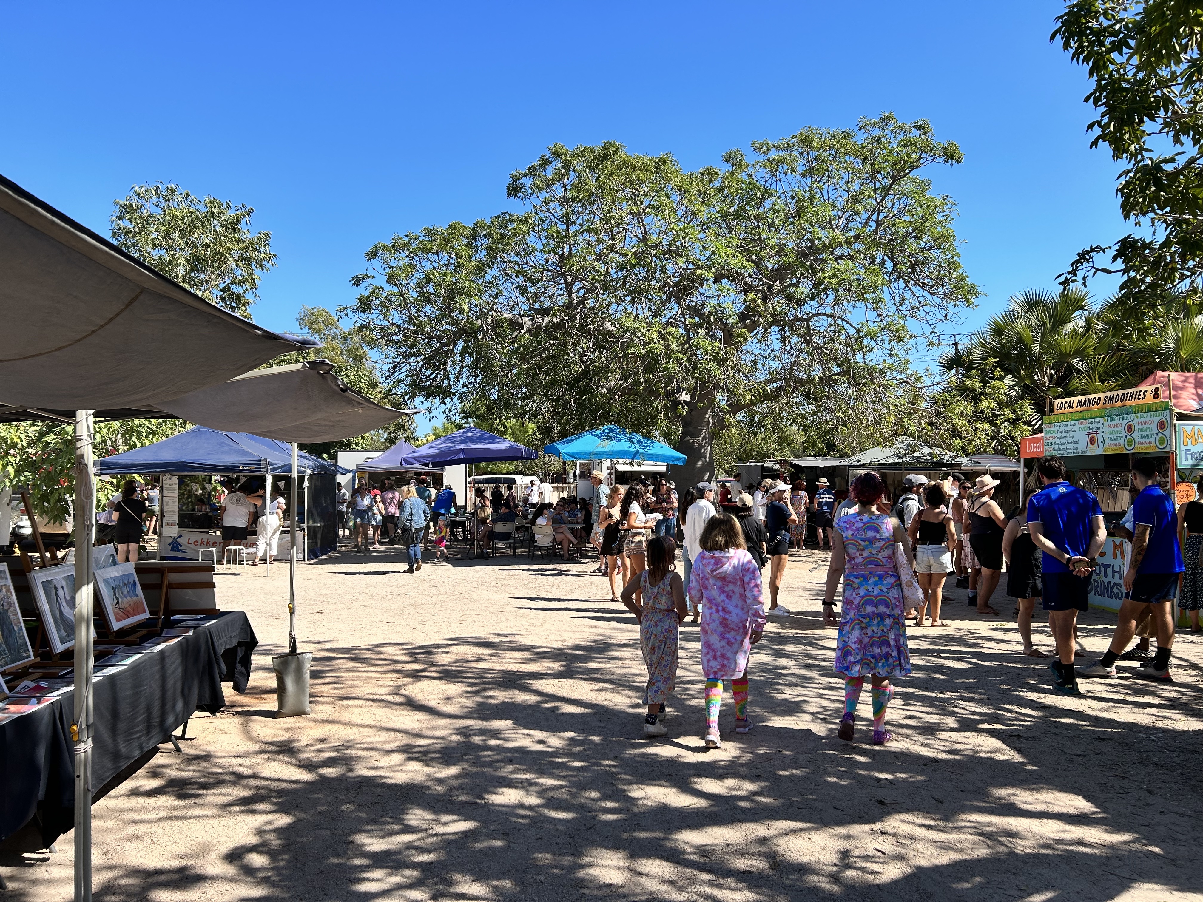
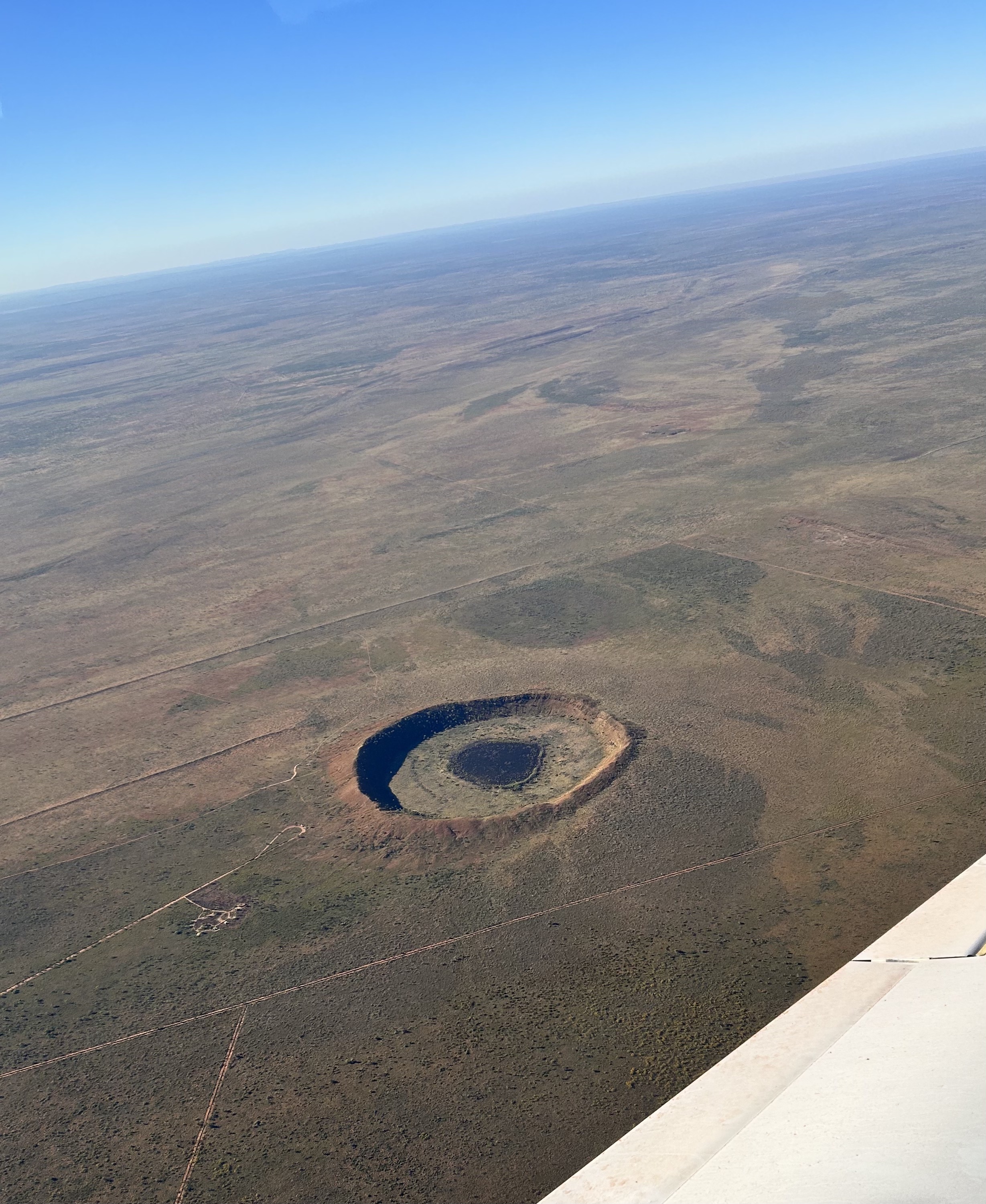
It was time to head east once more. From Broome it was more than a two hour flight to Halls Creek via the Wolfe Creek meteorite crater. But first another sunrise walk and visit to the Saturday markets.
Then it was Broome Broome out to the airport for an IFR departure from RWY10. Our track was 101 so straight ahead for just over two hours at 7000 feet over the southern reaches of the mighty Fitzroy River. There was a fair headwind (our first for the whole trip!) and some smoke so we climbed to non standard 8000 for the second half.
As we approached Wolfe Creek we descended to 6000 ft and ATC anticipated our requirements by asking what our air work would be over the crater. “Two orbits please. One right, one left.” “No IFR traffic for air work”. All good. The crater is impressive even if “only” 1km in diameter. Must’ve made quite a bang on the day.
It was only 20 minutes from there to Halls Creek where the local ARO jogged past and showed us the best spot to tie down. A refreshing plunge in the pool at the Kimberley Hotel 5 minutes walk down the road was followed by a great steak at the Sportsman’s Bar. Being asked to blow in a breath test at the entrance to the bar was a first. Apparently they have a lot of problems with preloaded patrons. You can’t enter if you’re over the limit. And they don’t discriminate. Everyone has to blow. As a result the place was a very pleasant venue.
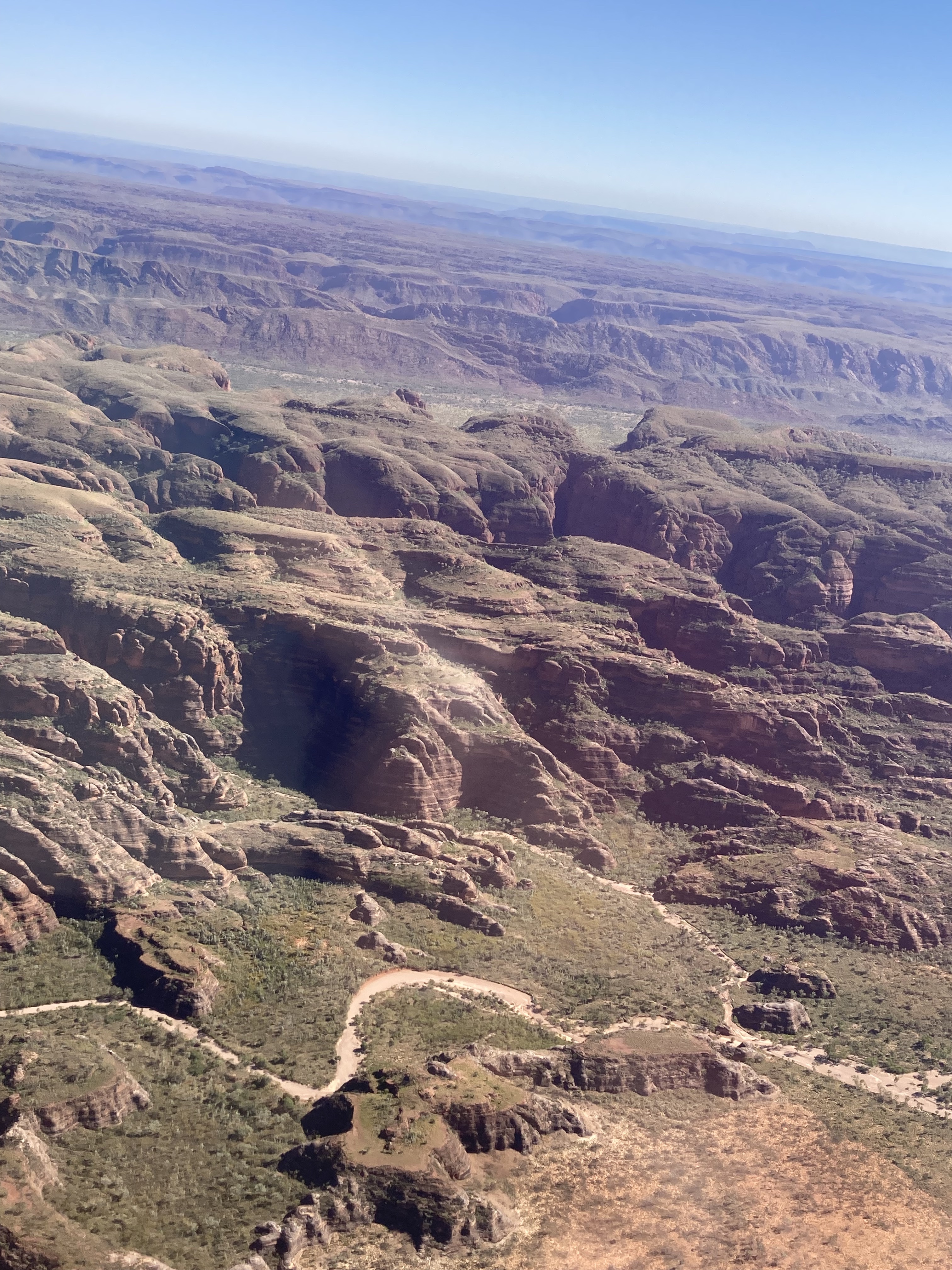
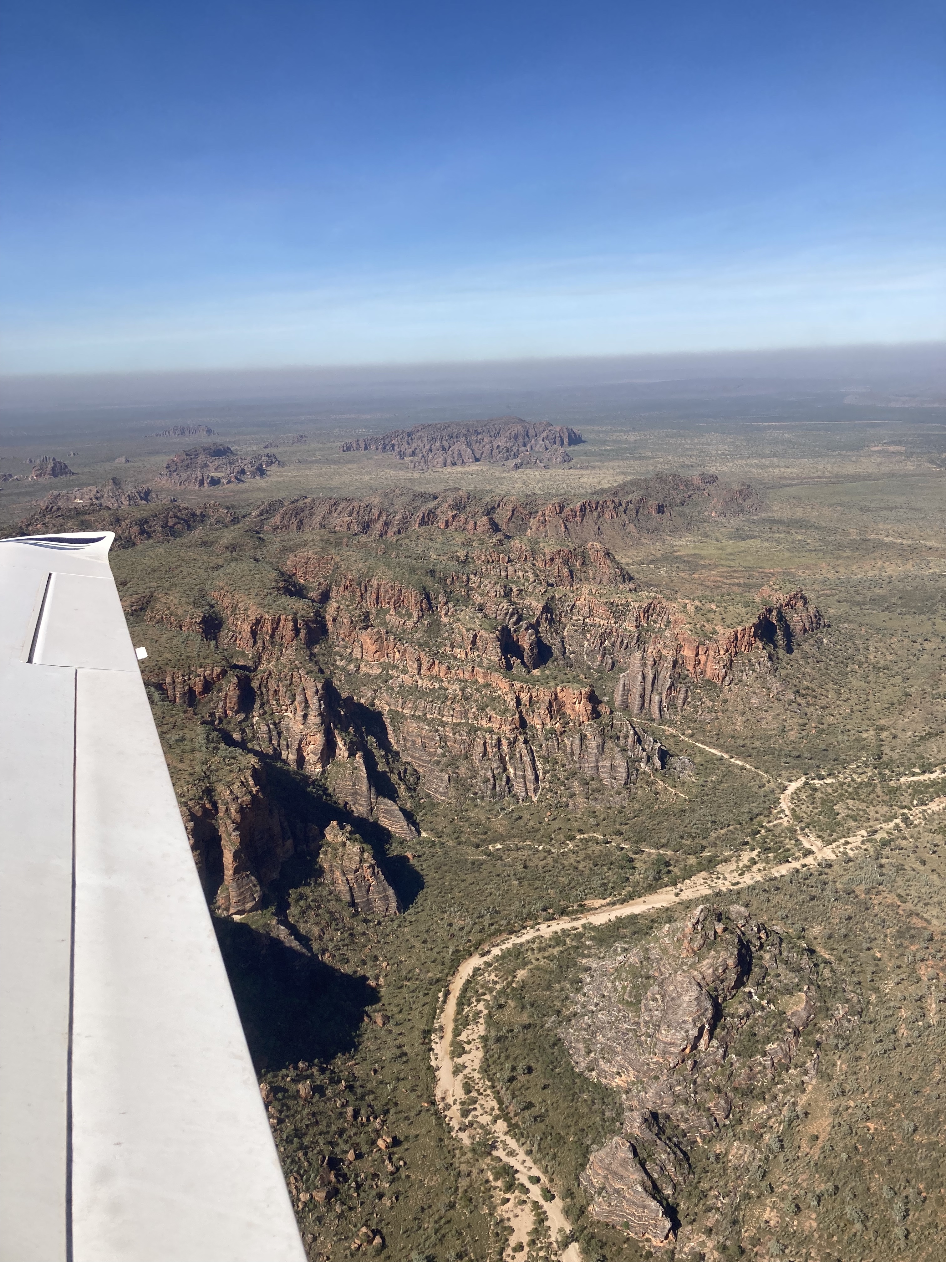
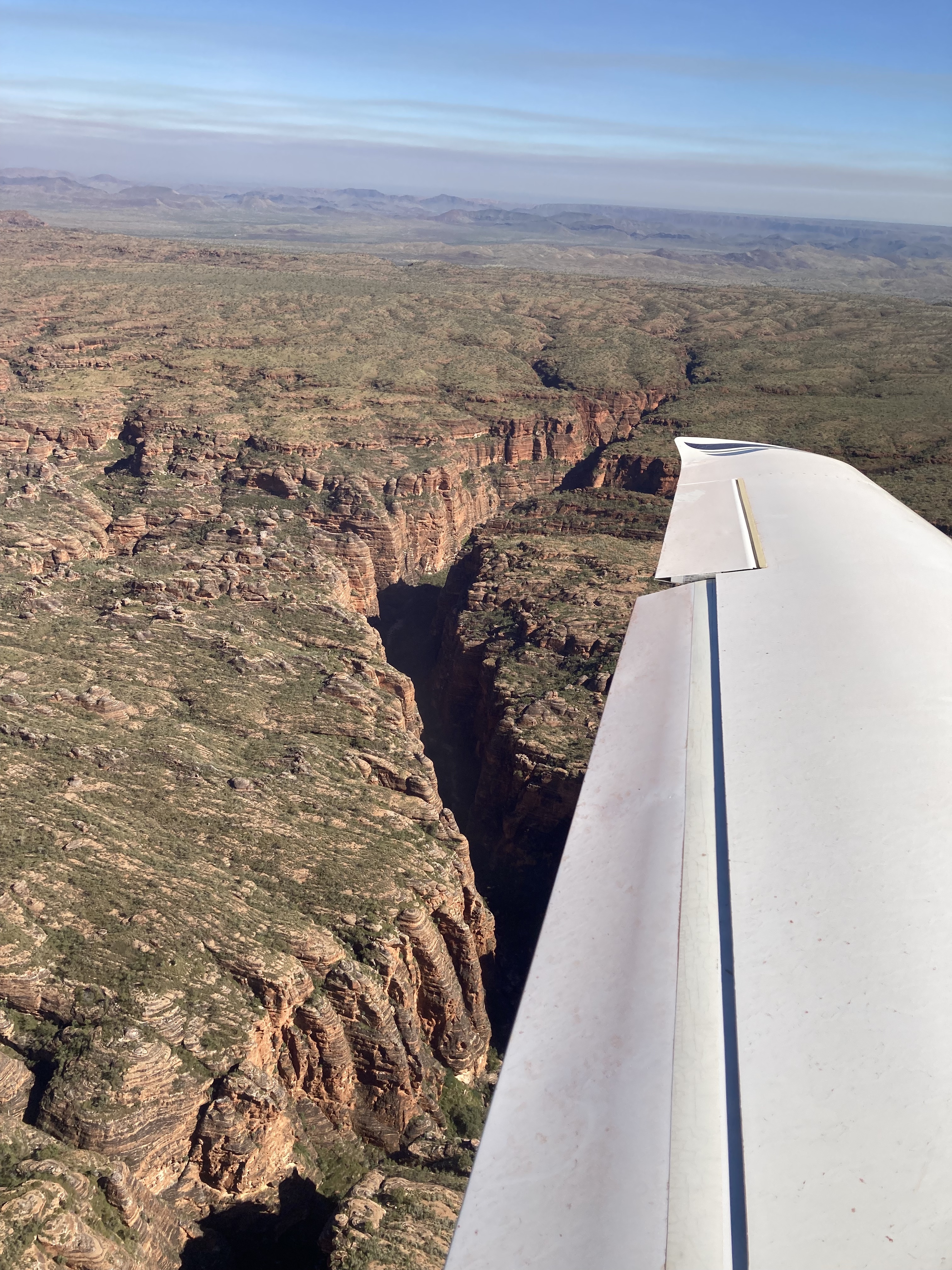
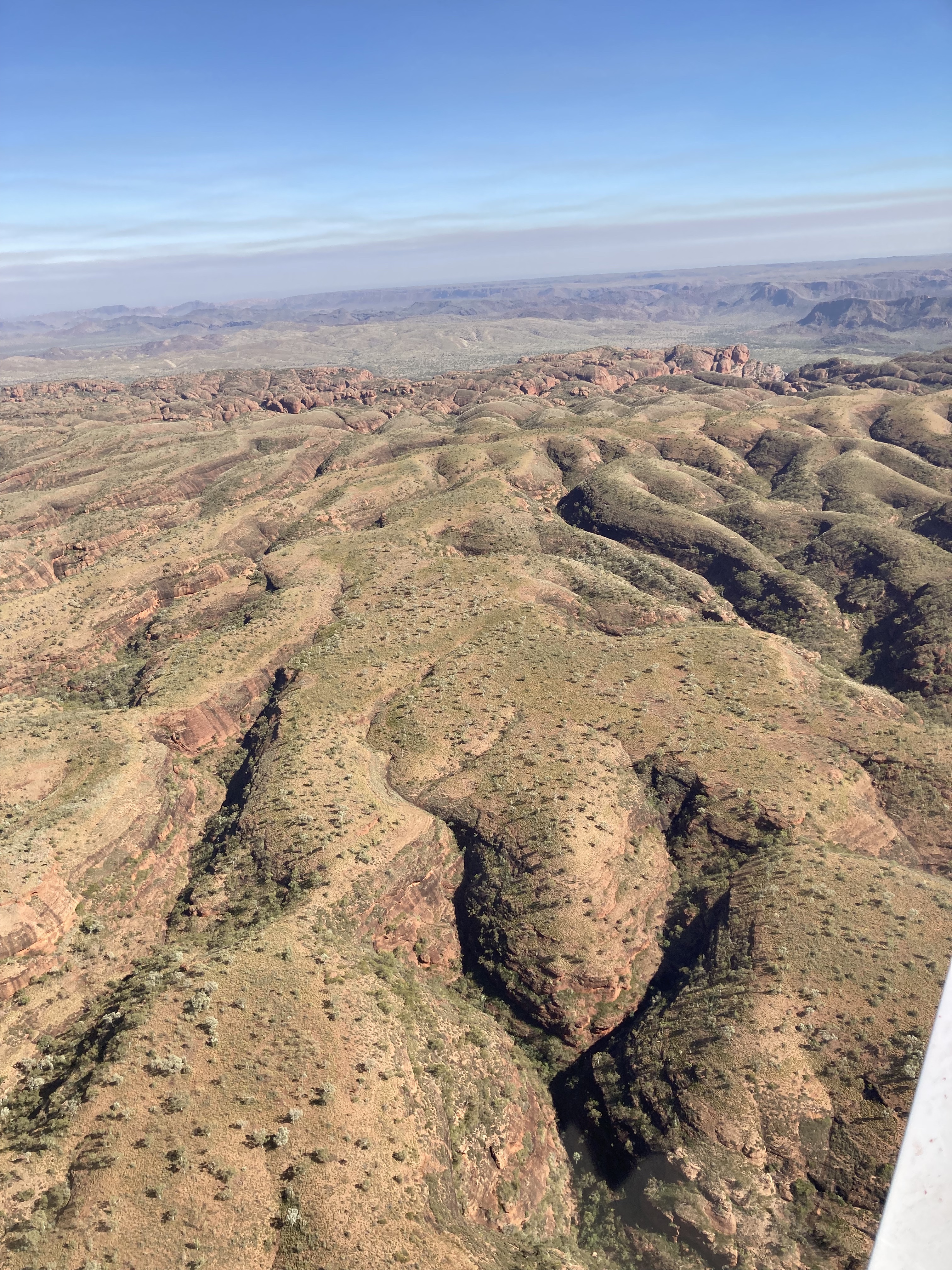
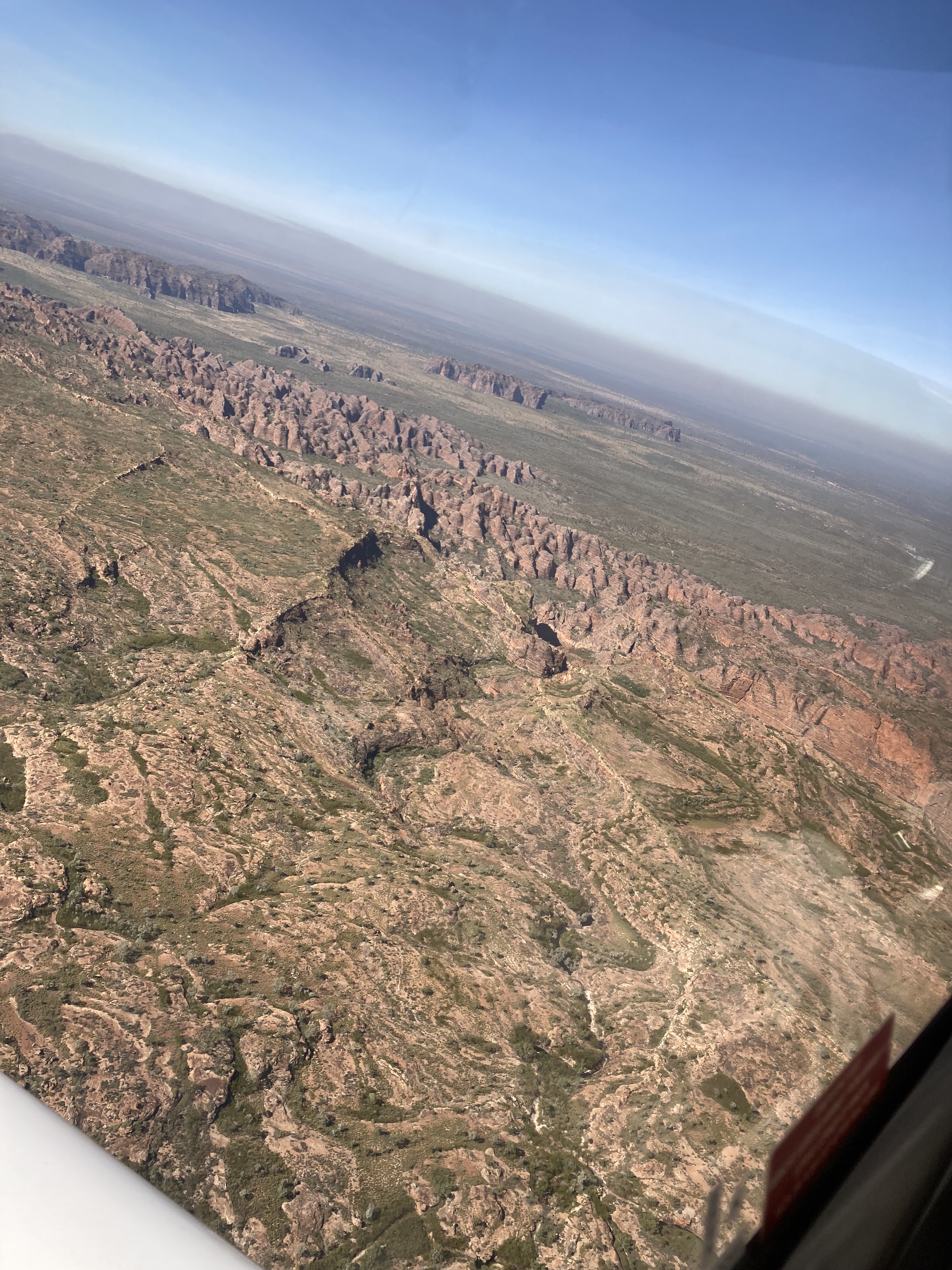
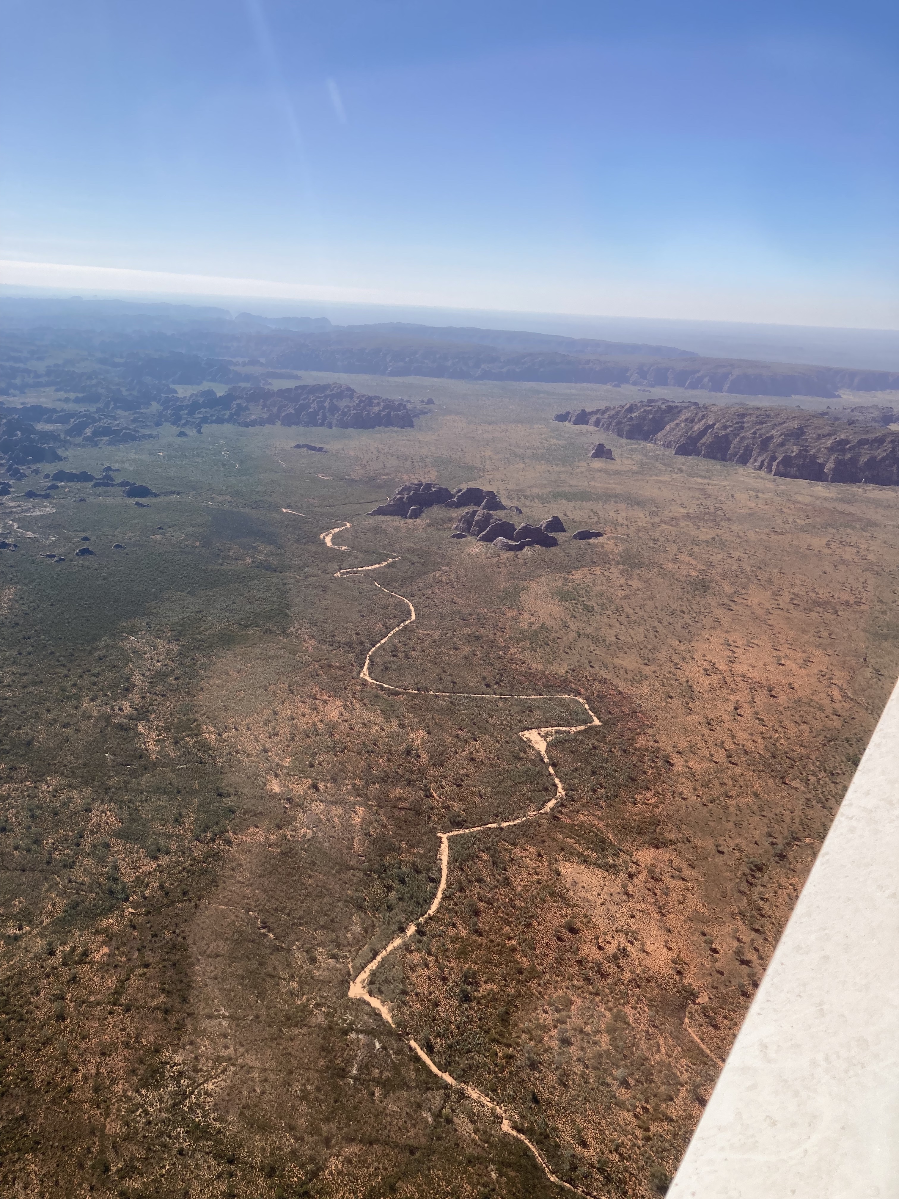
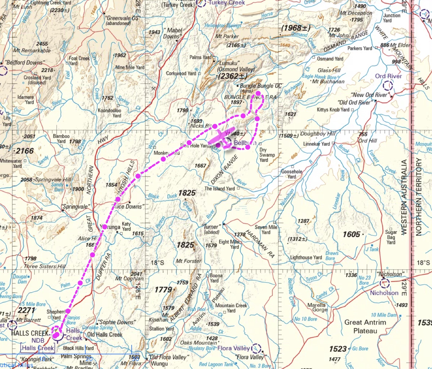
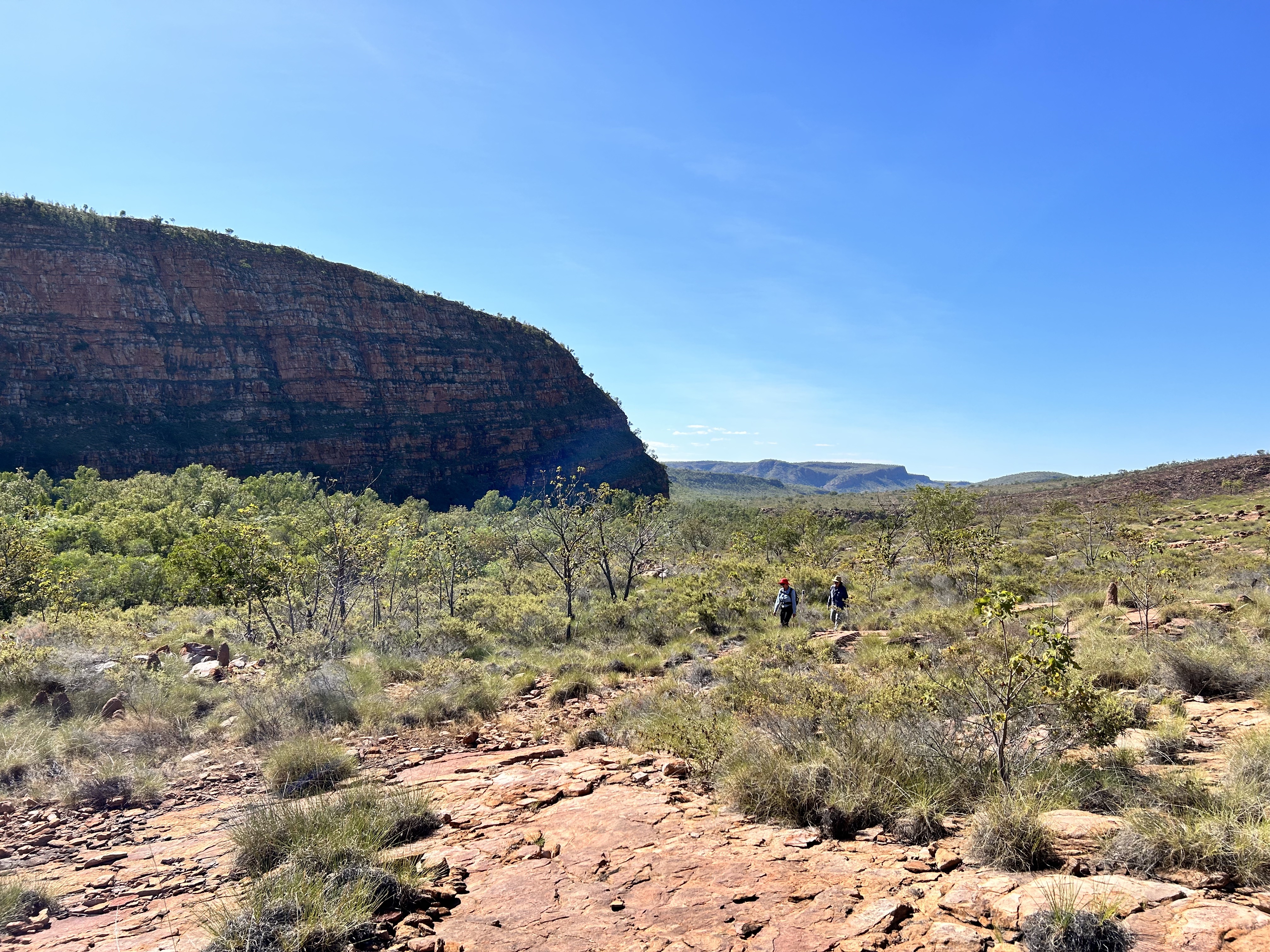
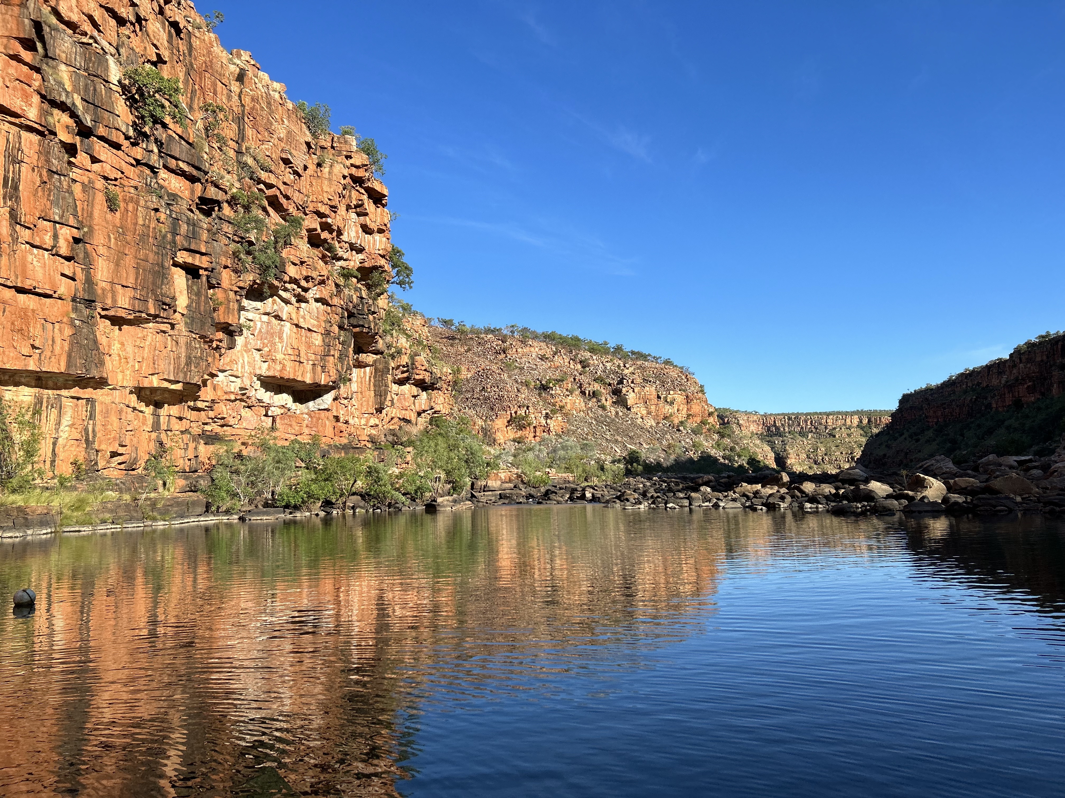
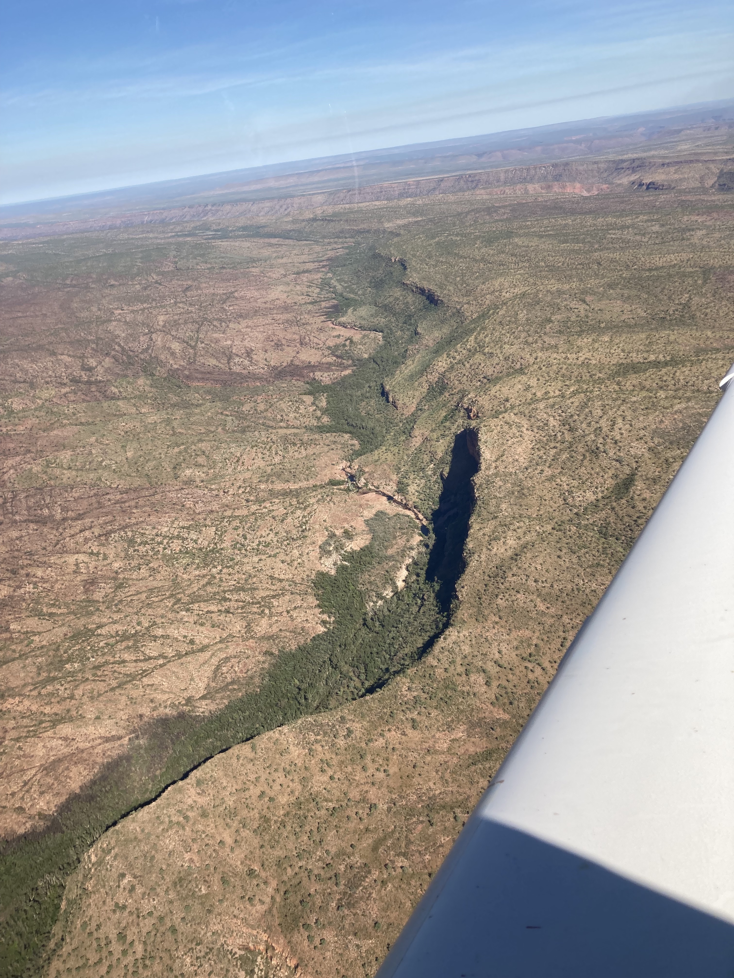
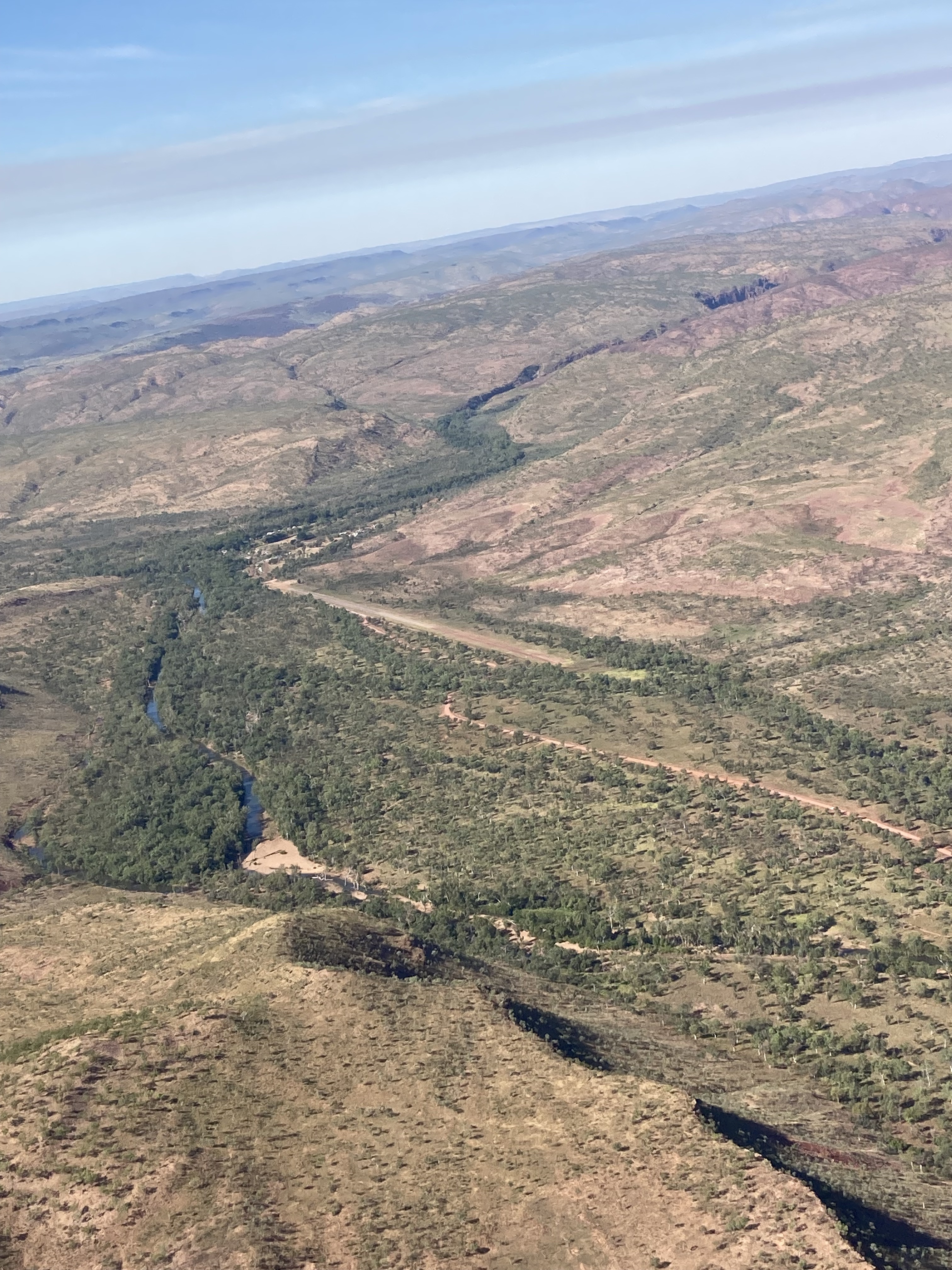
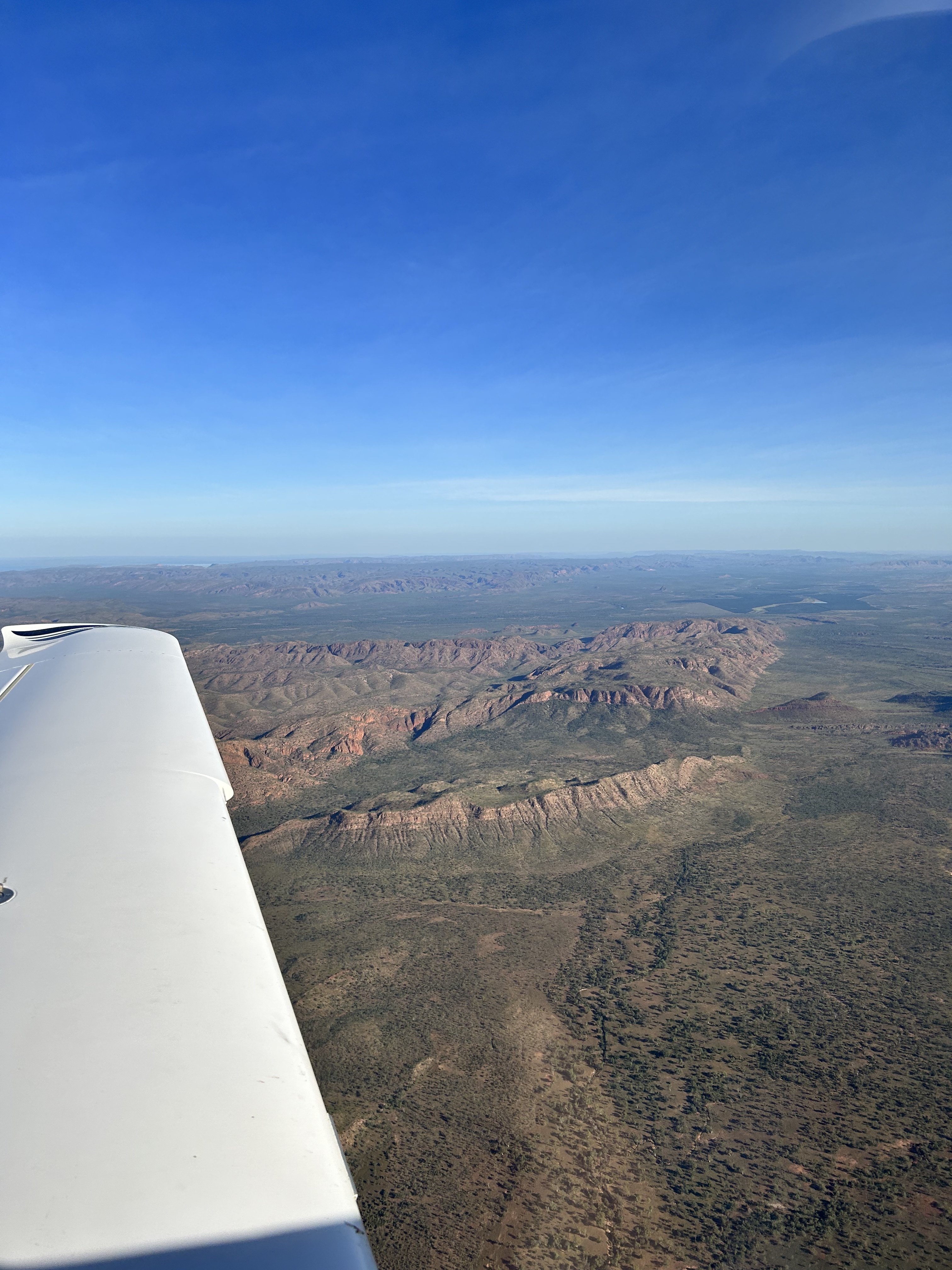
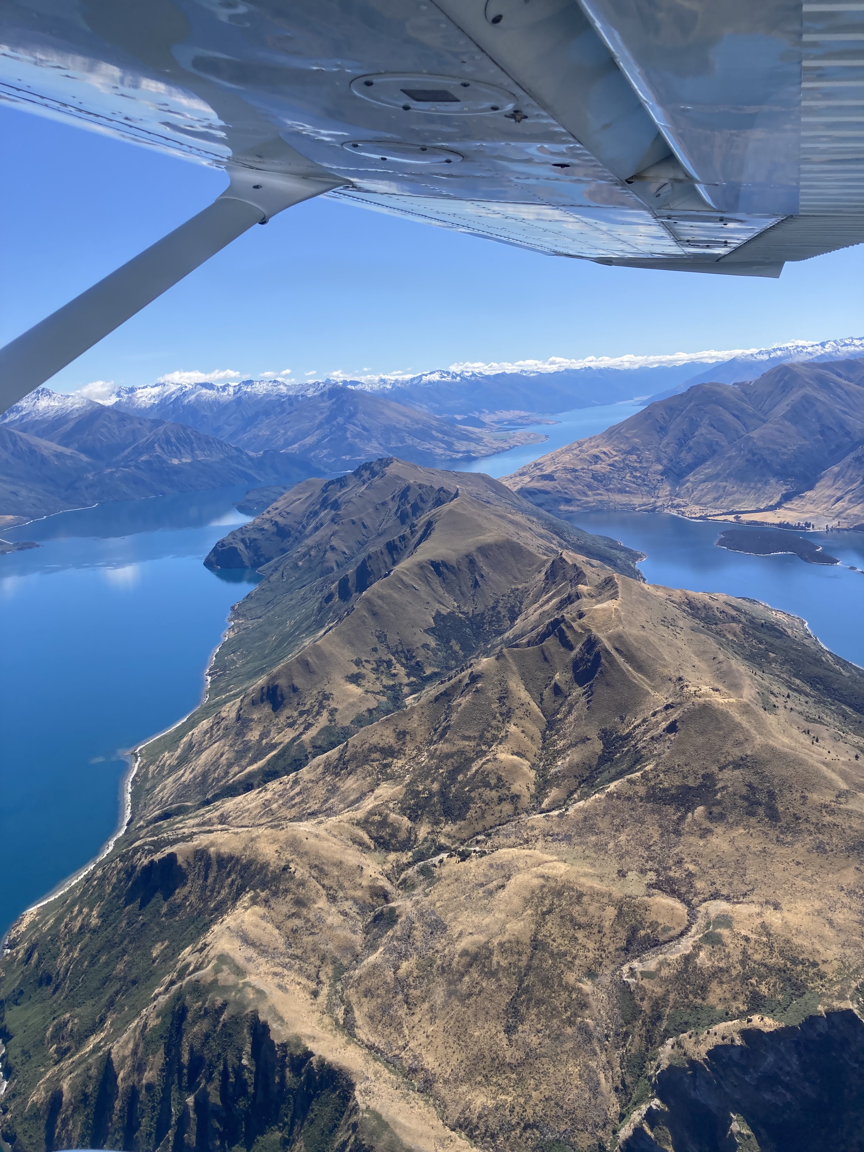
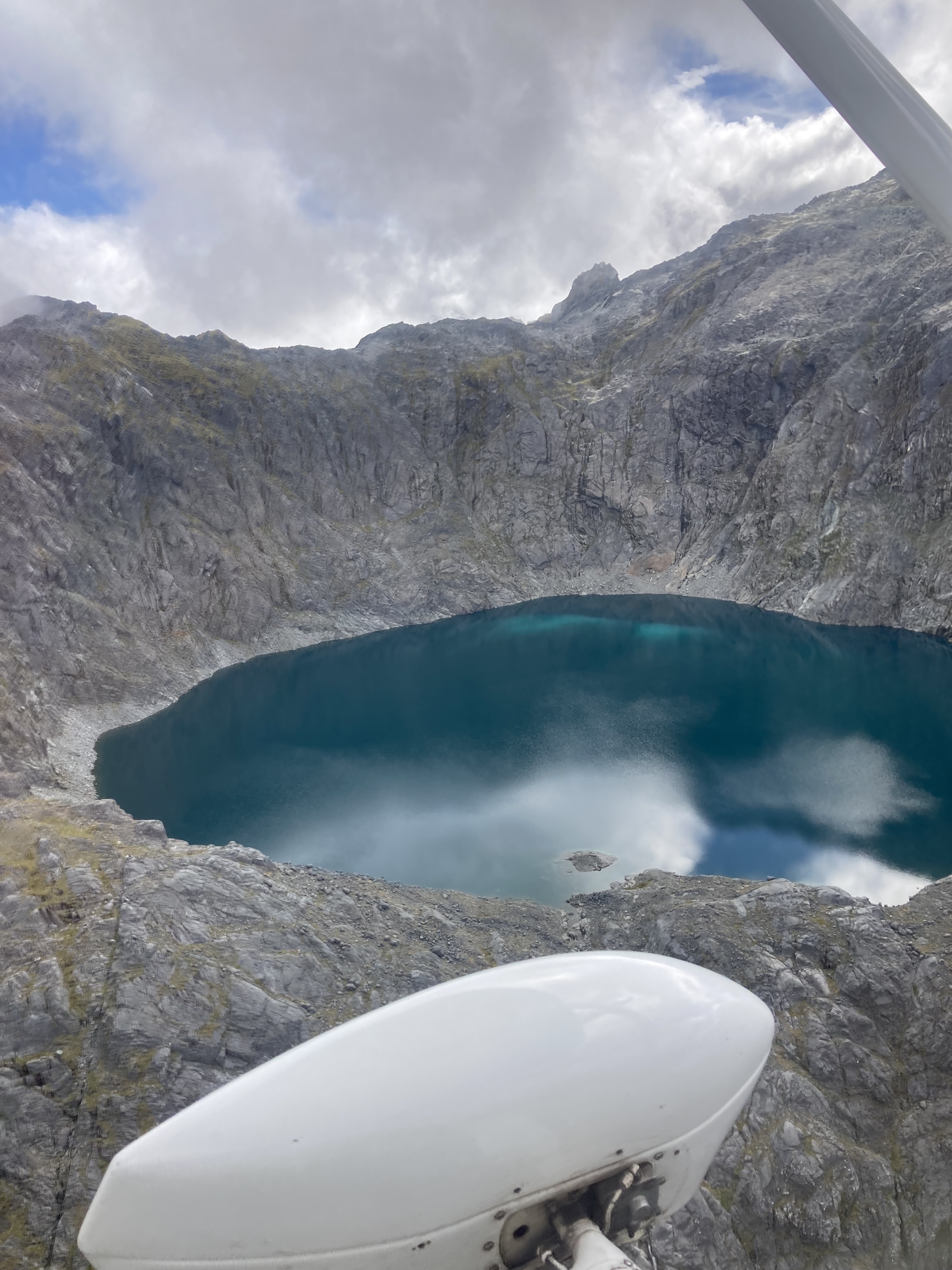
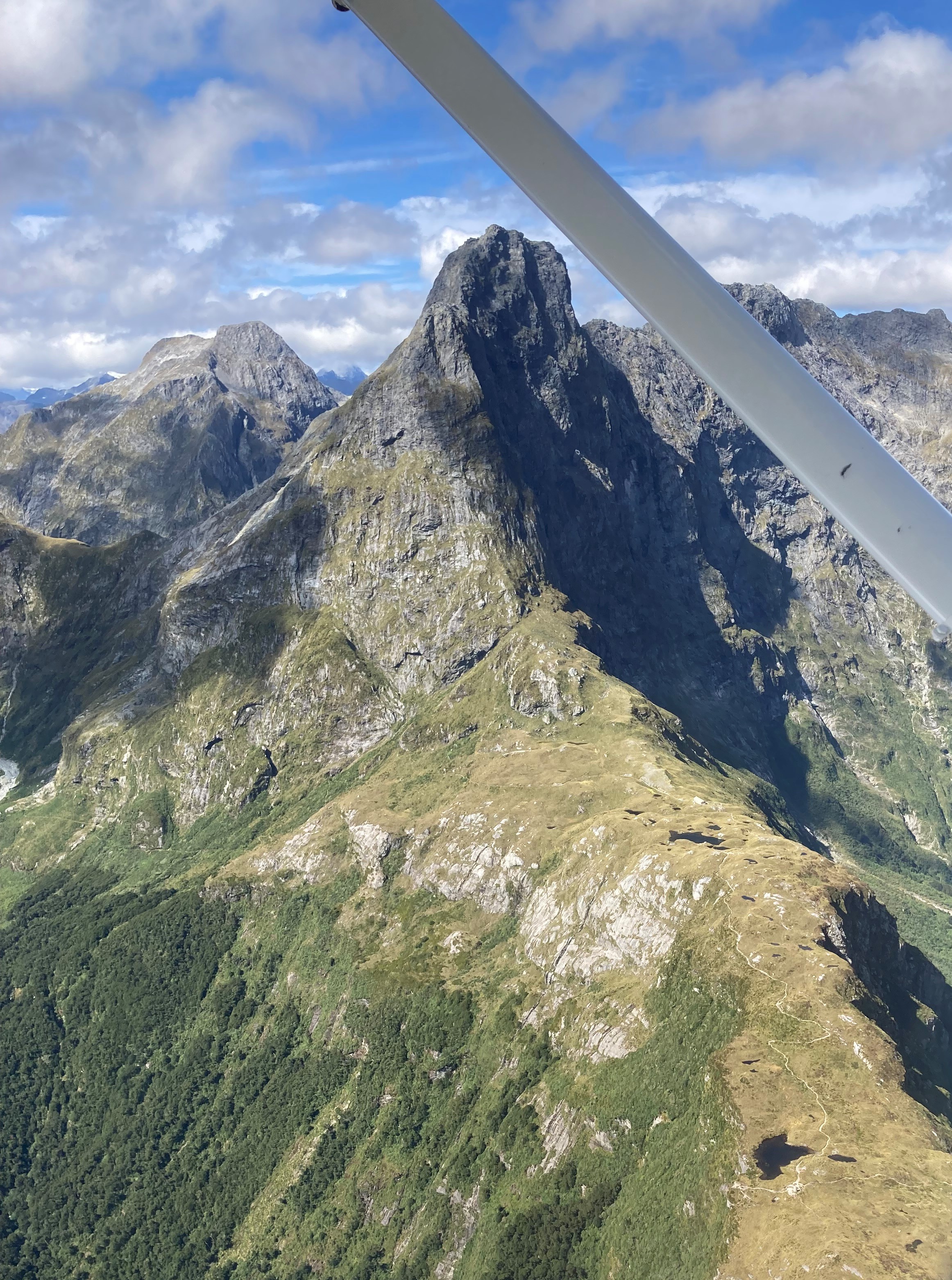
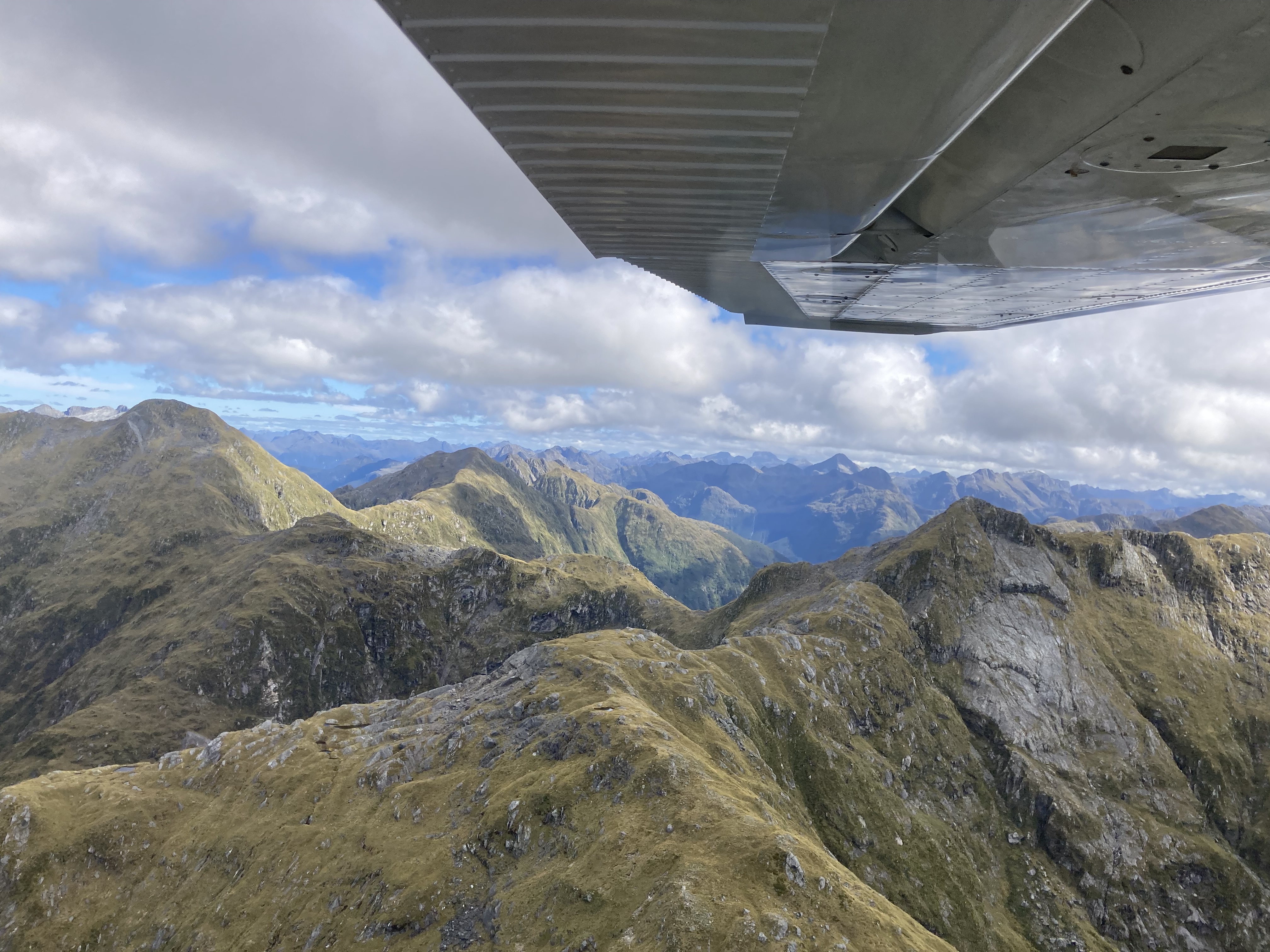
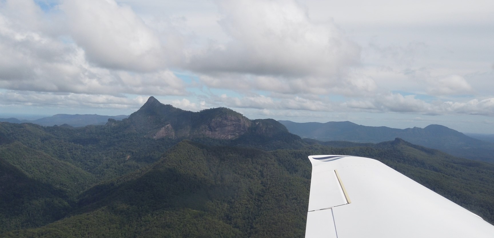
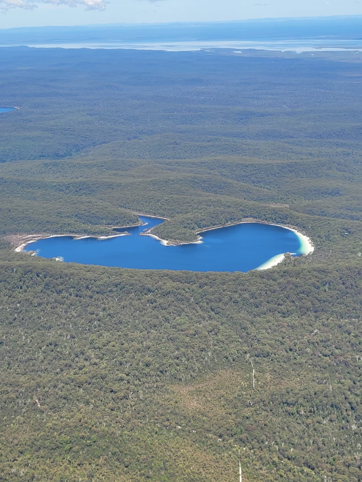
It was an early-ish start from Halls Creek to Purnululu National Park (Bungles). We lifted off at 8:30 and tracked via the Macintosh Hills then on towards the south west entry for a spectacular scenic flight around the Bungles at 3000ft, as described in ERSA. It was a maze of gorges in between plateaus for the most part, with the iconic stripy mounds mainly concentrated on the south eastern edge.
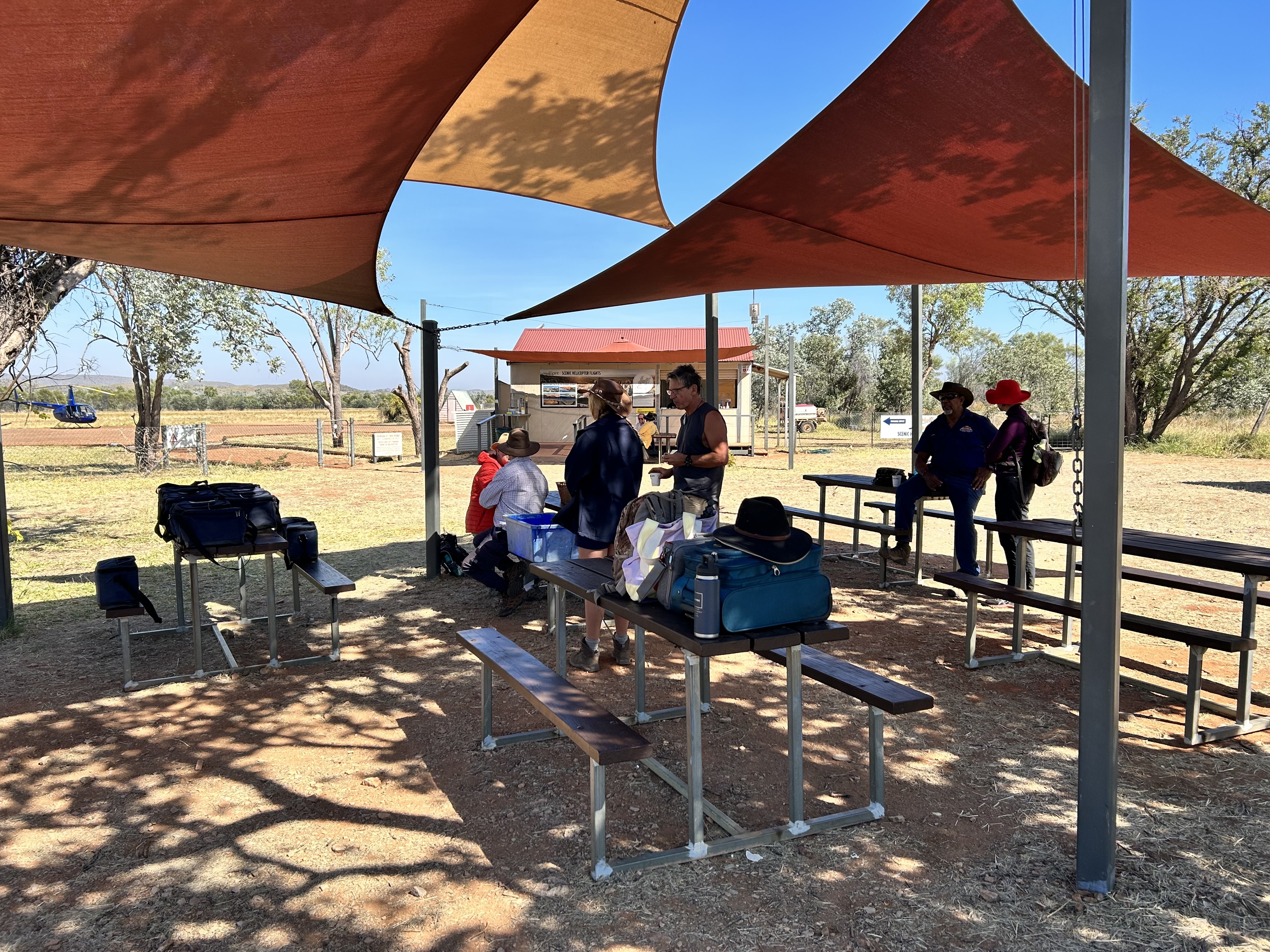
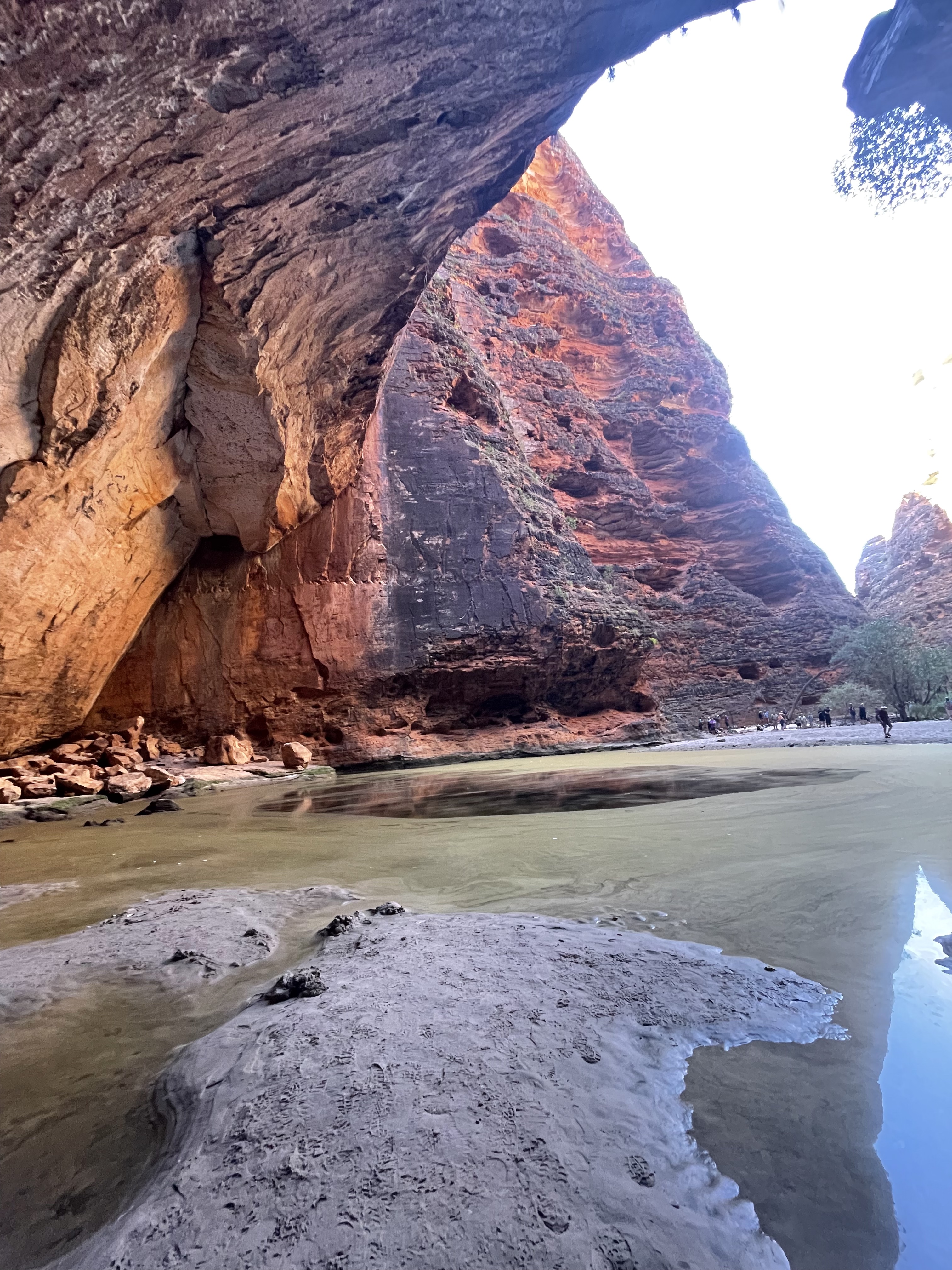
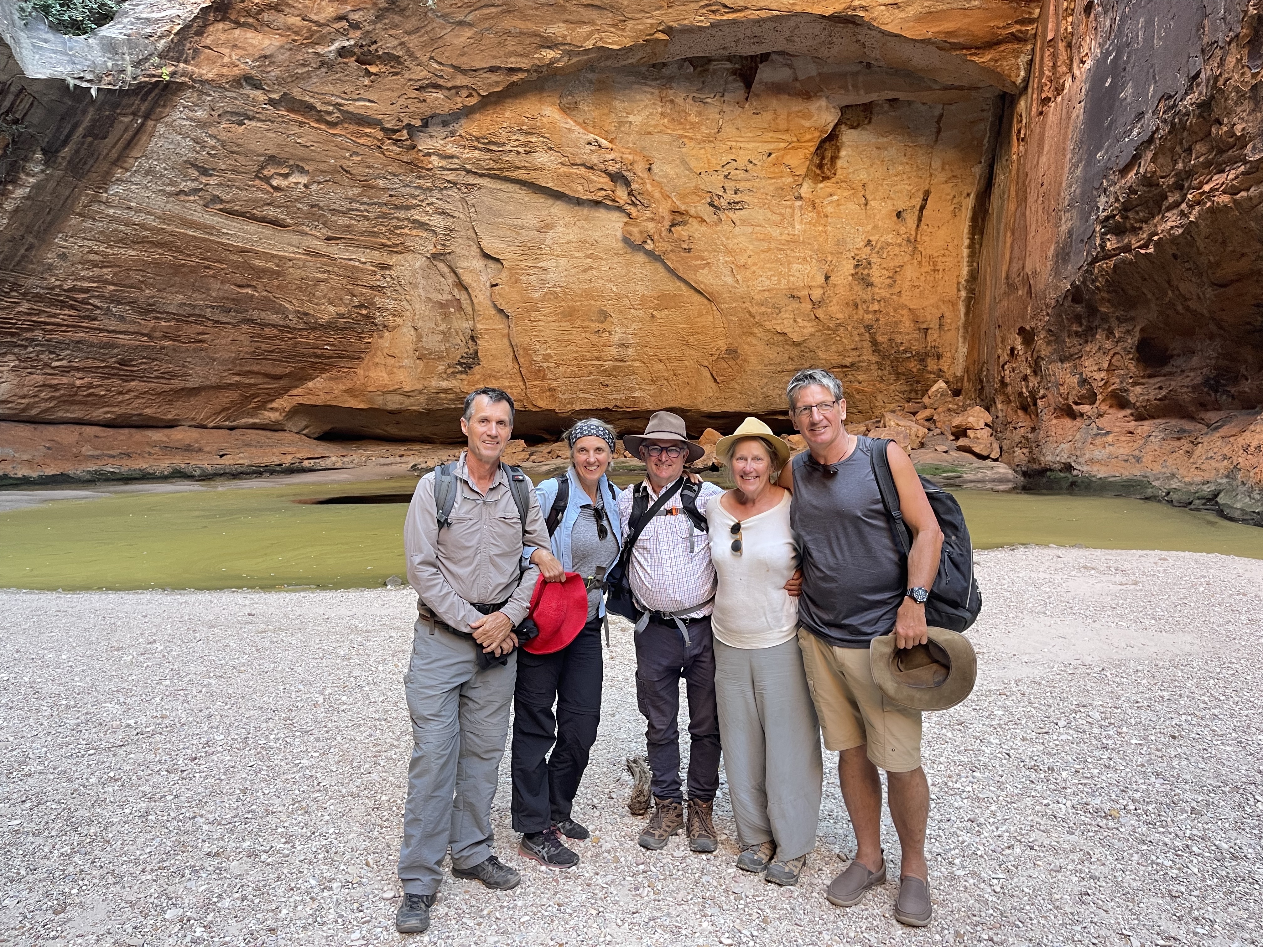
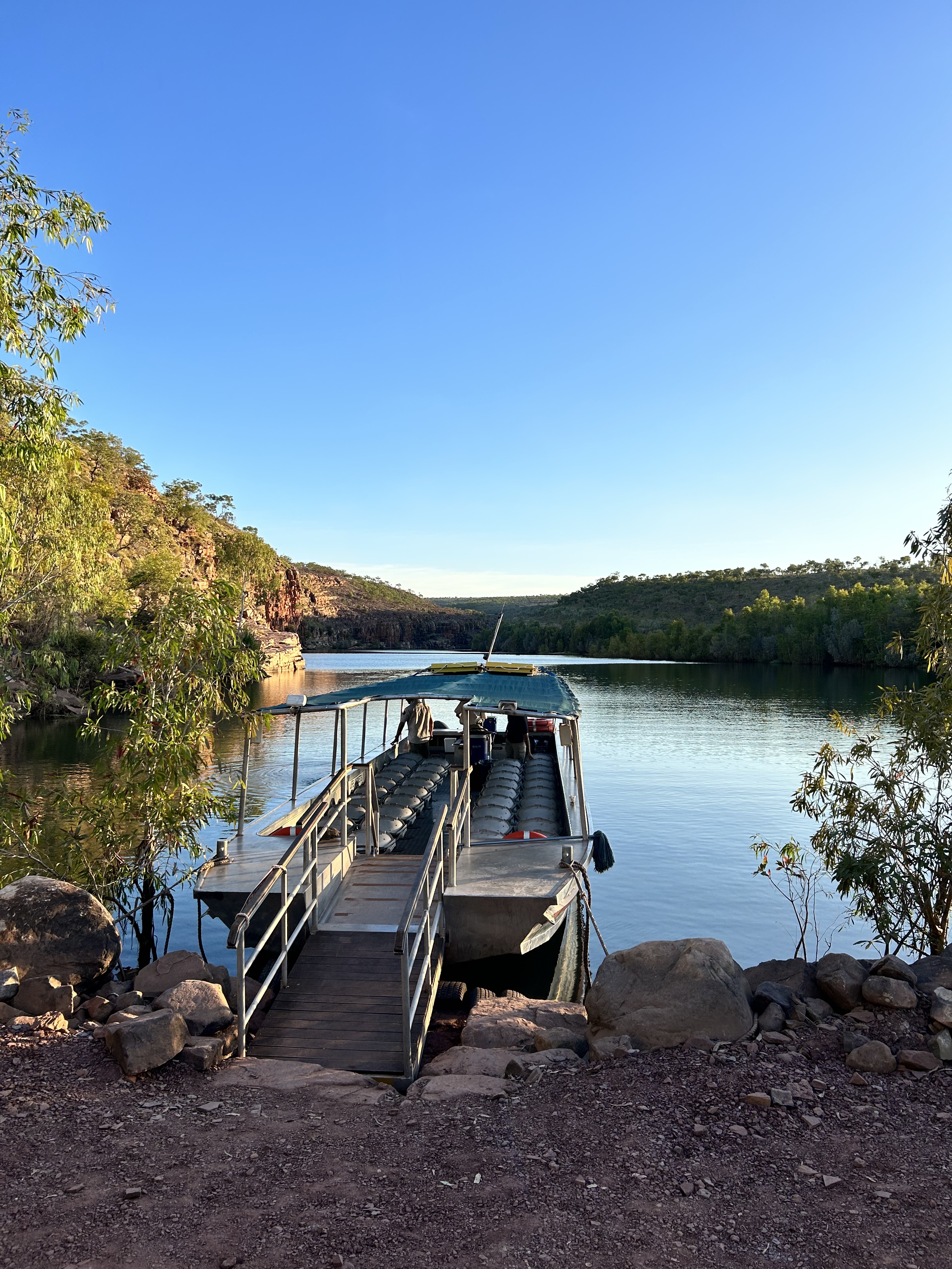
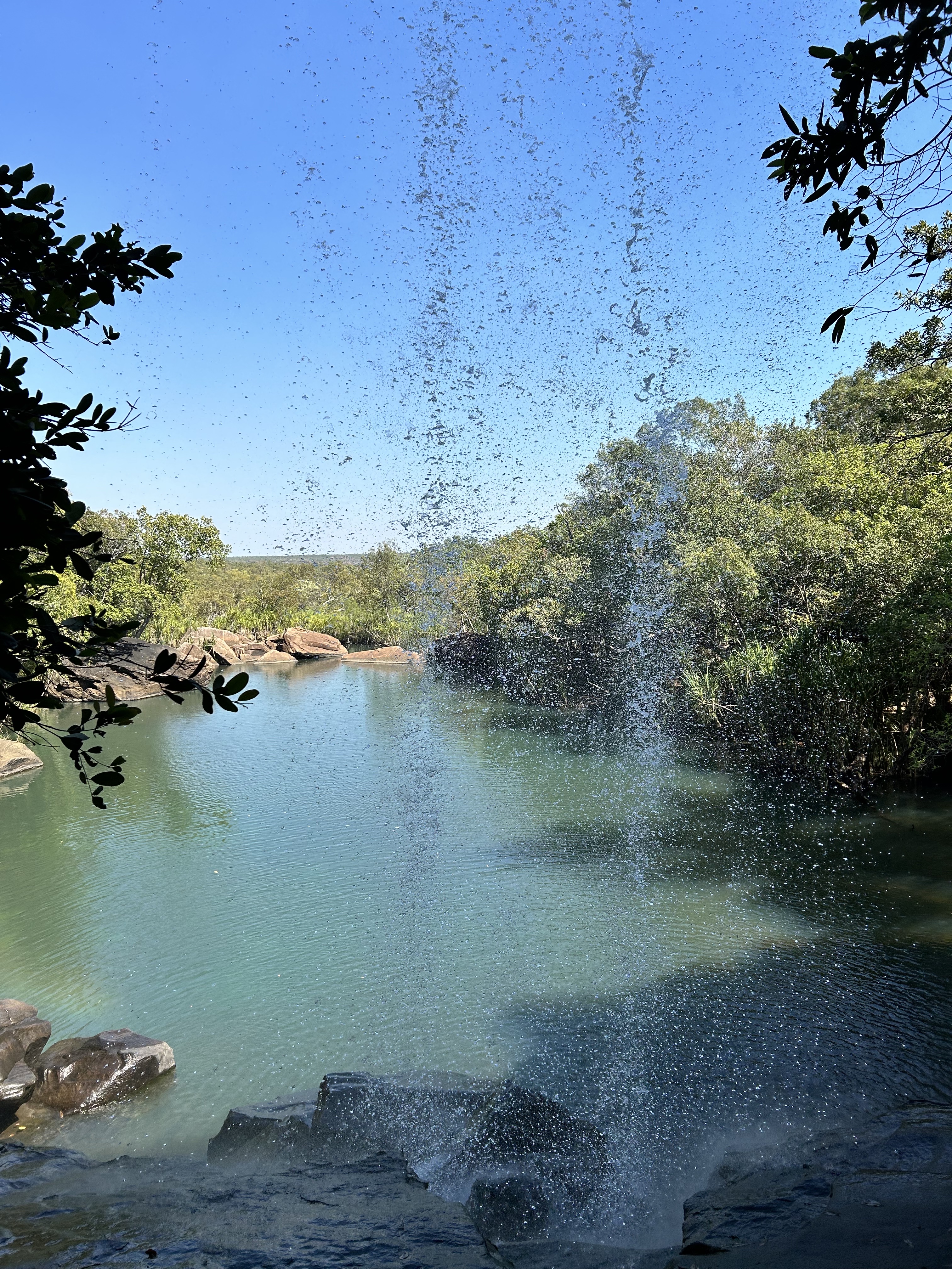
Landing at Bellburn airstrip at 9:30 we were greeted with morning tea before bring whisked away on a Bungle Bungle Guided Tours bus for a walking tour to Cathderal Gorge.
It involved about a 4km stroll through the park with lively descriptions of the geology and history by Gabriel and Wesley, two local Gidja people. Gabriel put on quite a show with his banter and clear descriptions while Wesley was more measured in his explanations. Lunch was in the bottom of the Cathedral Gorge itself.
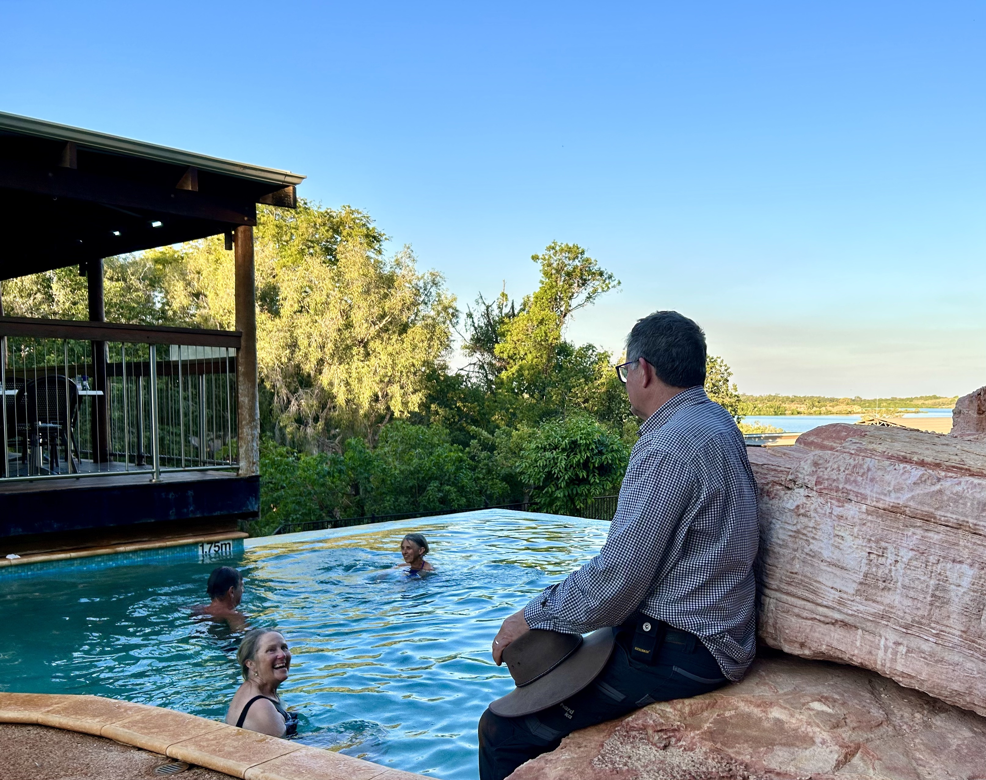
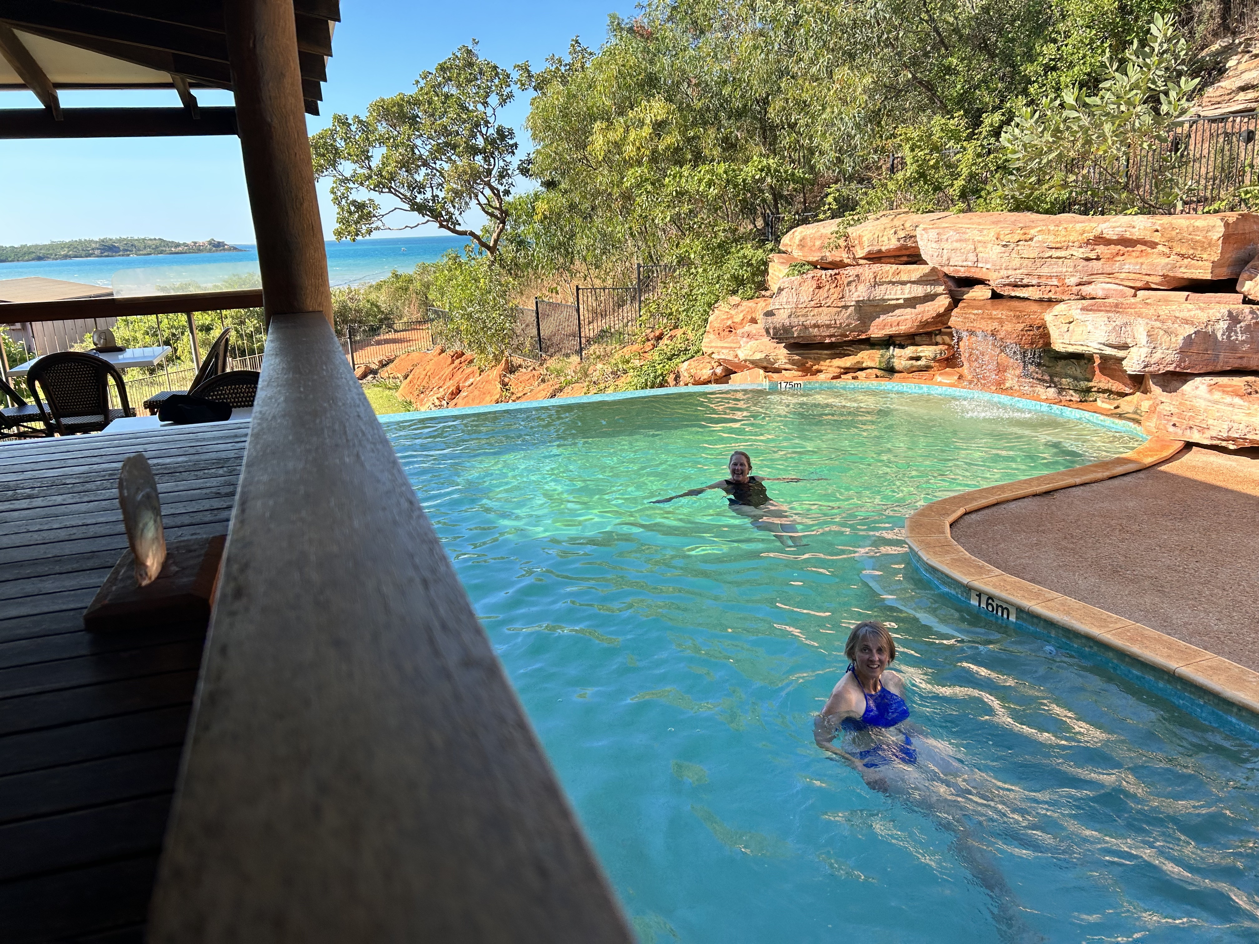
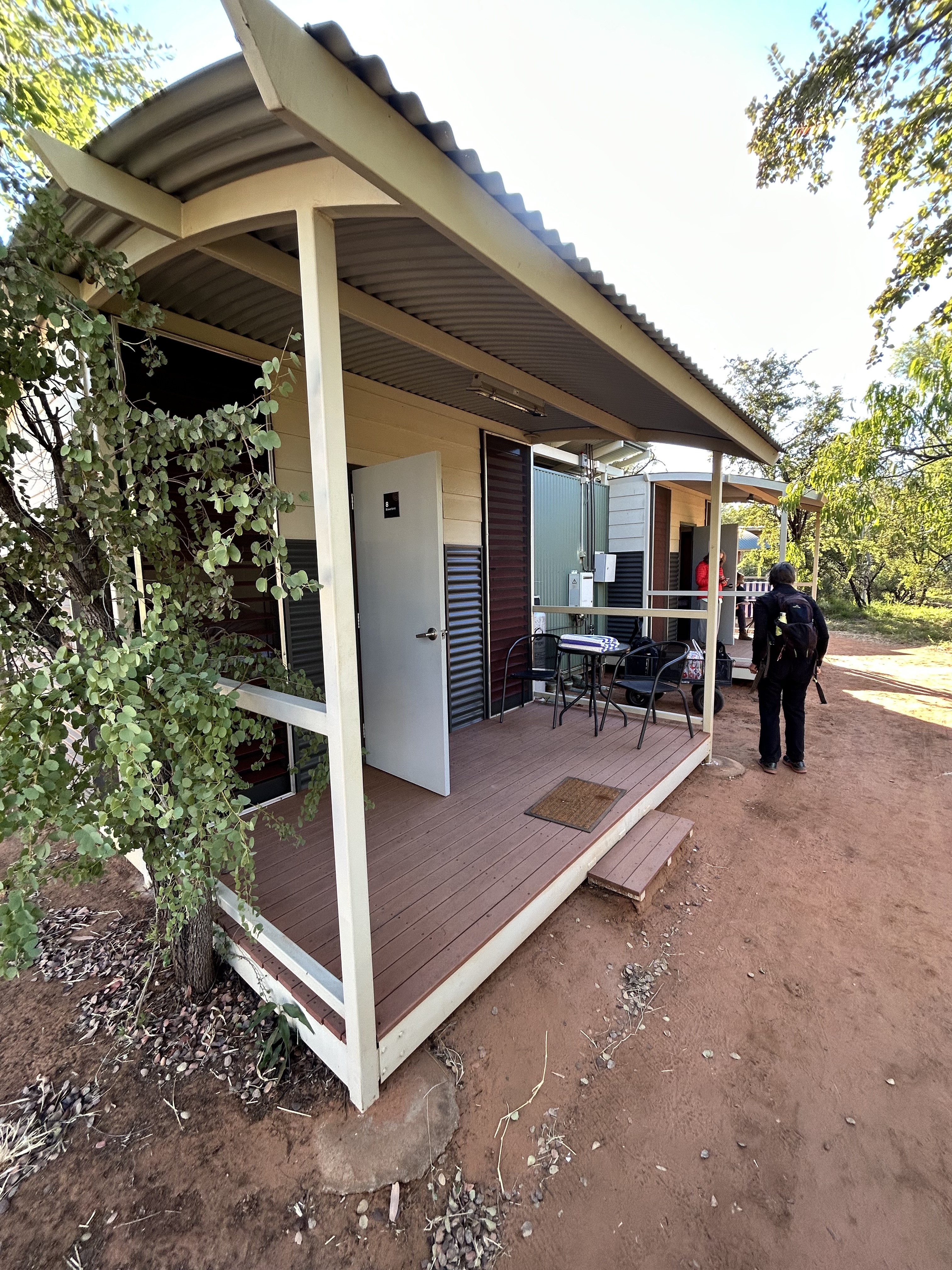
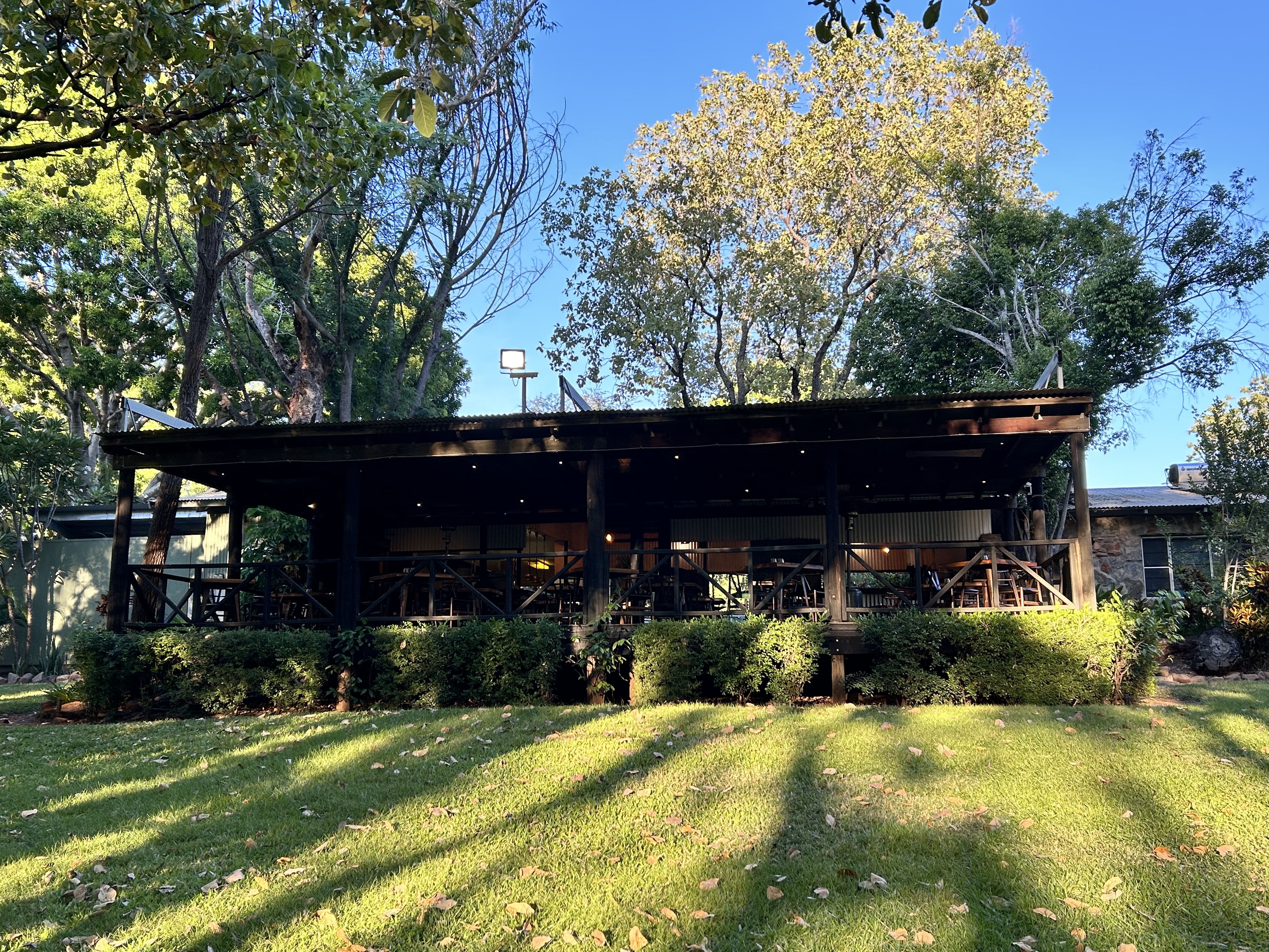
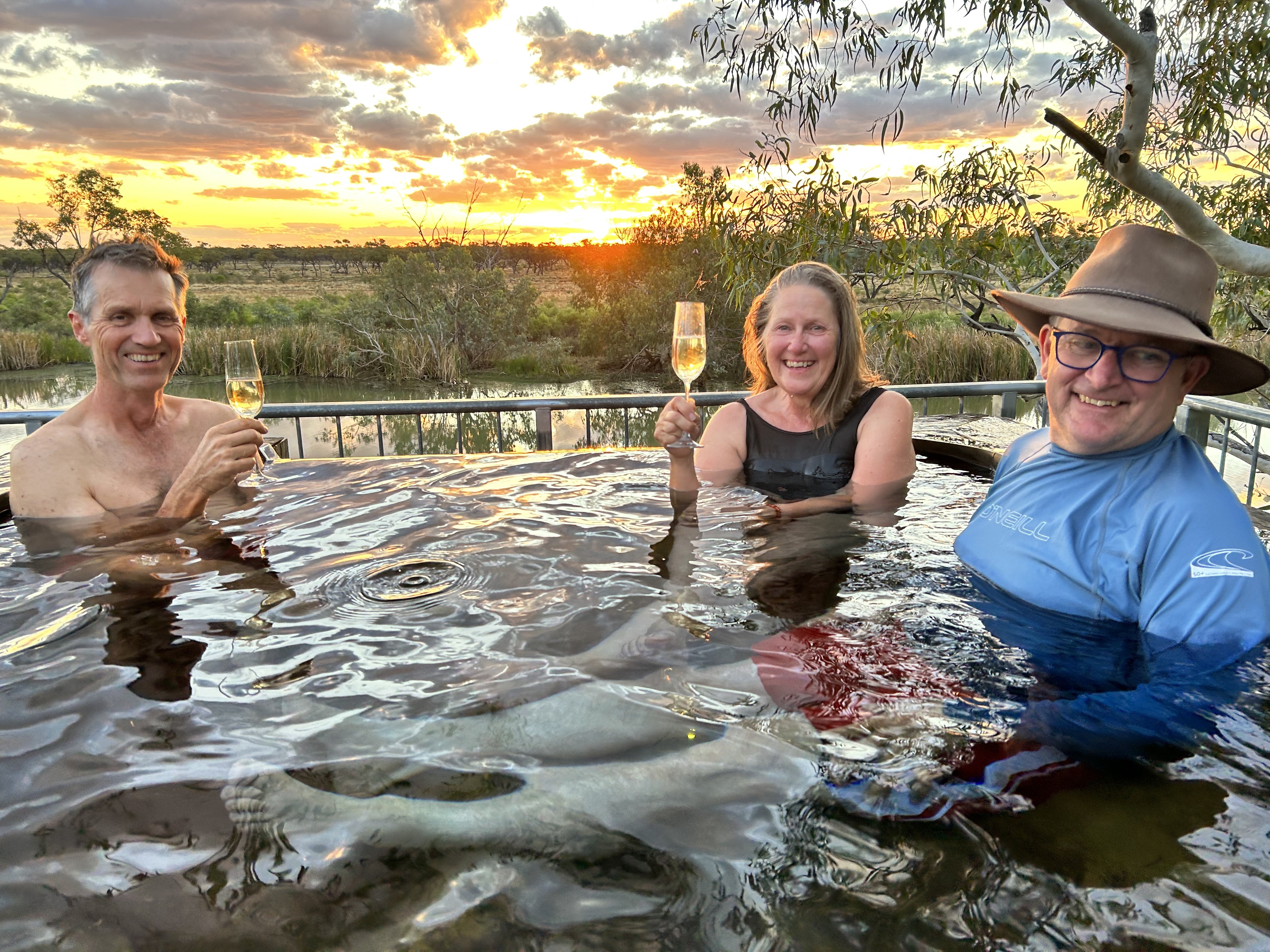
The bus took us back to the Bungle Bungle Savannah Lodge where we checked in, had a quick dip then enjoyed the sunset on the opposite rock faces of the surrounding hills before enjoying dinner on the deck. Our tour of the Kimberley had come to an end and it was time to head for home.
The story concludes under “Destinations – Heading home from the Kimberley”
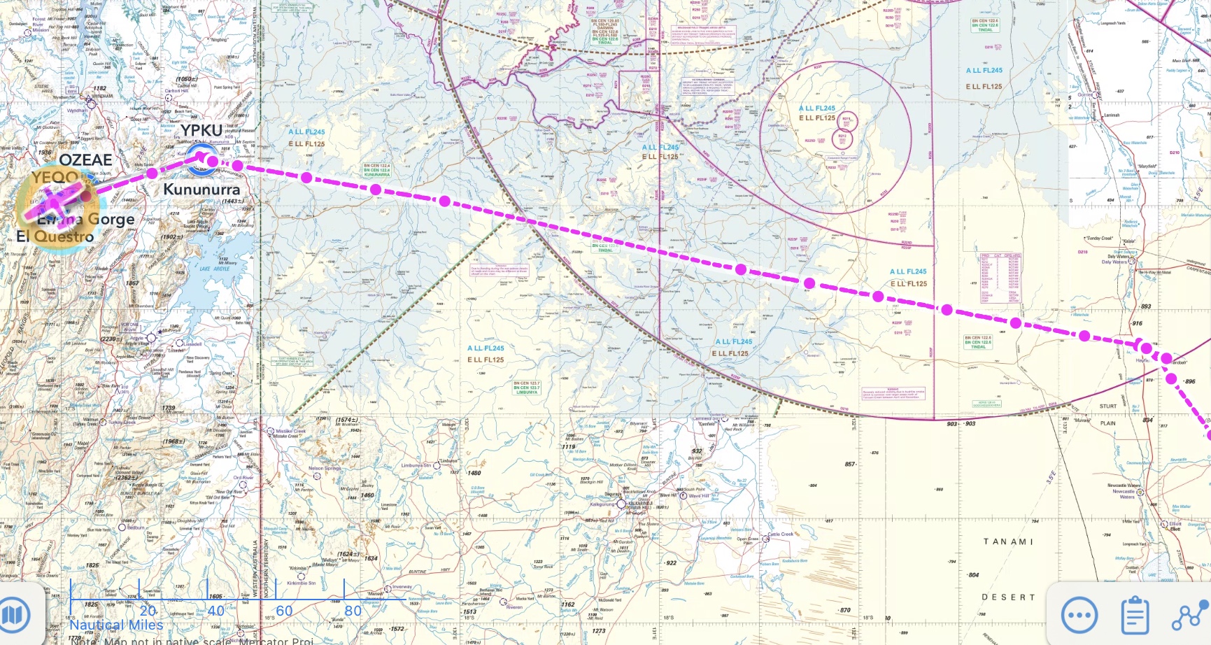
ElQuestro – Kununurra – Lake Argyle – Ord River – Home Valley Station – Drysdale River Station – Mitchell Falls
It was 15th May 2023. We’d made it to the Kimberley after flying all the way across Queensland and the Northern Territory. We were at ElQuestro, a slightly upmarket resort place not far from Kununurra but far enough to be like a completely different world. Nature at its finest. The first day at ElQuestro was a chance to relax after our long journey. Settle in. Swim in the waterhole, explore the facilities, move MSF to let some aircraft from Tyabb in Victoria out so they could depart the next day and source some oil from Broome for our visit next week. There was a great steakhouse with very good food and reasonable prices. Live music at the bar. A few things needed to be fixed however. The glamping tents had a/c but were missing a fridge and kettle. There wasn’t one in the communal kitchen either. We needed to talk to management.
Elquestro day 2 we had an early start to avoid the heat of the day. By 6:30 we’d had breakfast and were hiking to Champagne Springs. We passed a ginormous Boab tree on the way and were held up for an hour when the creek crossing was poorly signposted. Nevertheless, 3 hours after setting out we were swimming in the pools. Very refreshing. We needed a siesta before heading back to the resort.
The well earned siesta was disturbed by a Longranger helicopter that flew in from Kununurra. We walked back to the station in time for a late lunch and another swim in the waterhole.
After a short break Peter, one of the Elquestro tour guides, drove us up to Saddleback Ridge for the sunset over the Pentecost River.
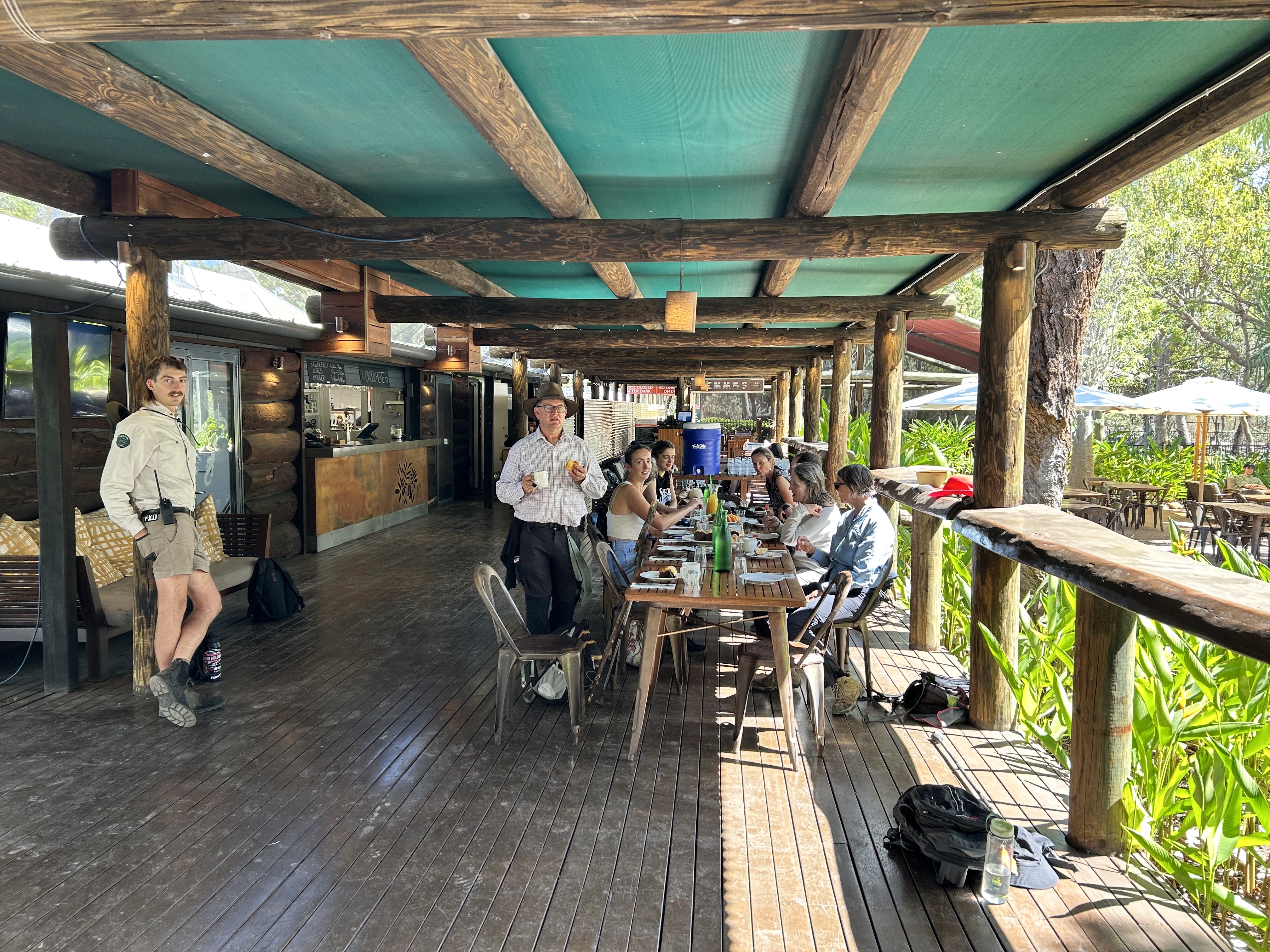
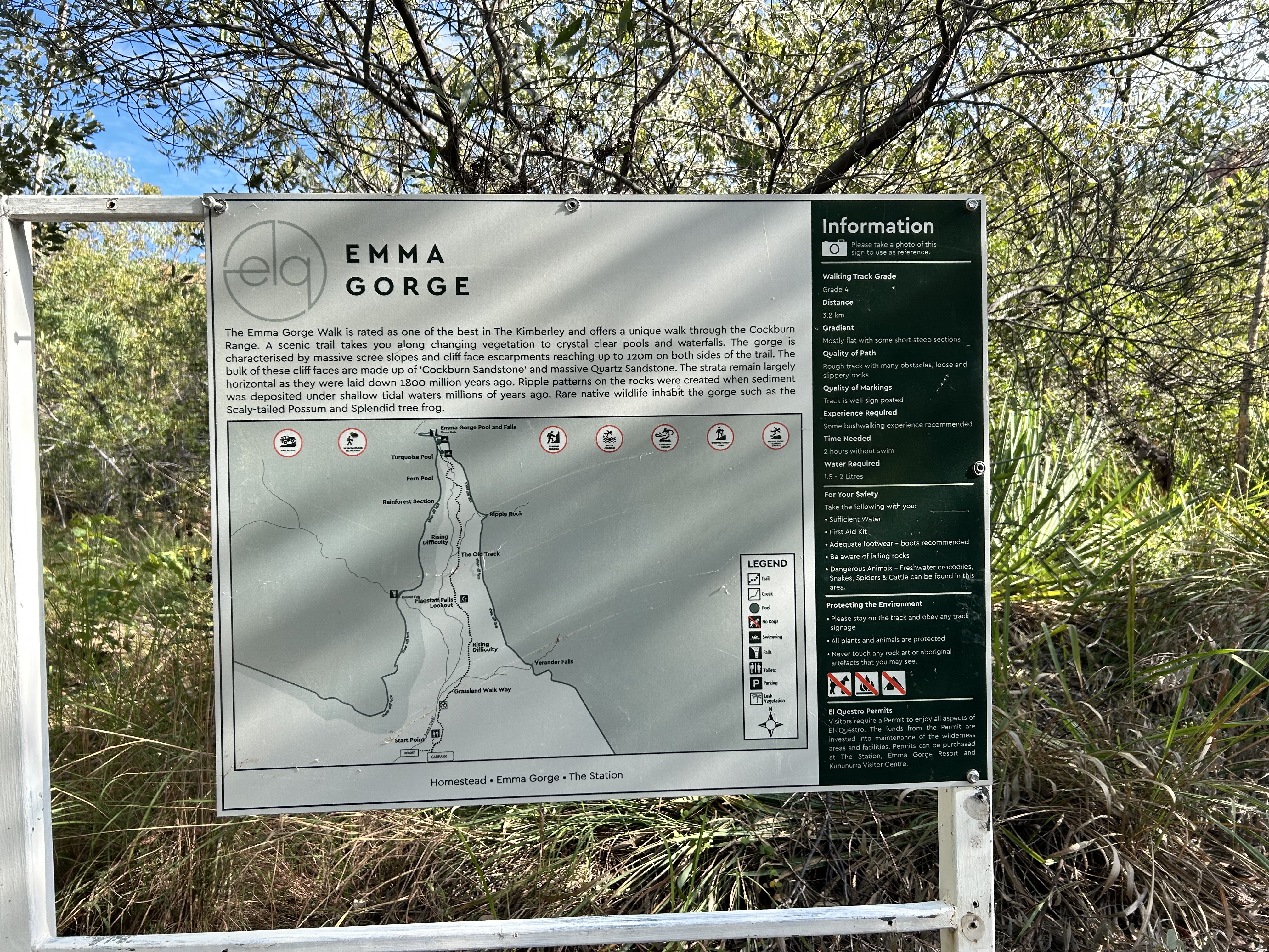
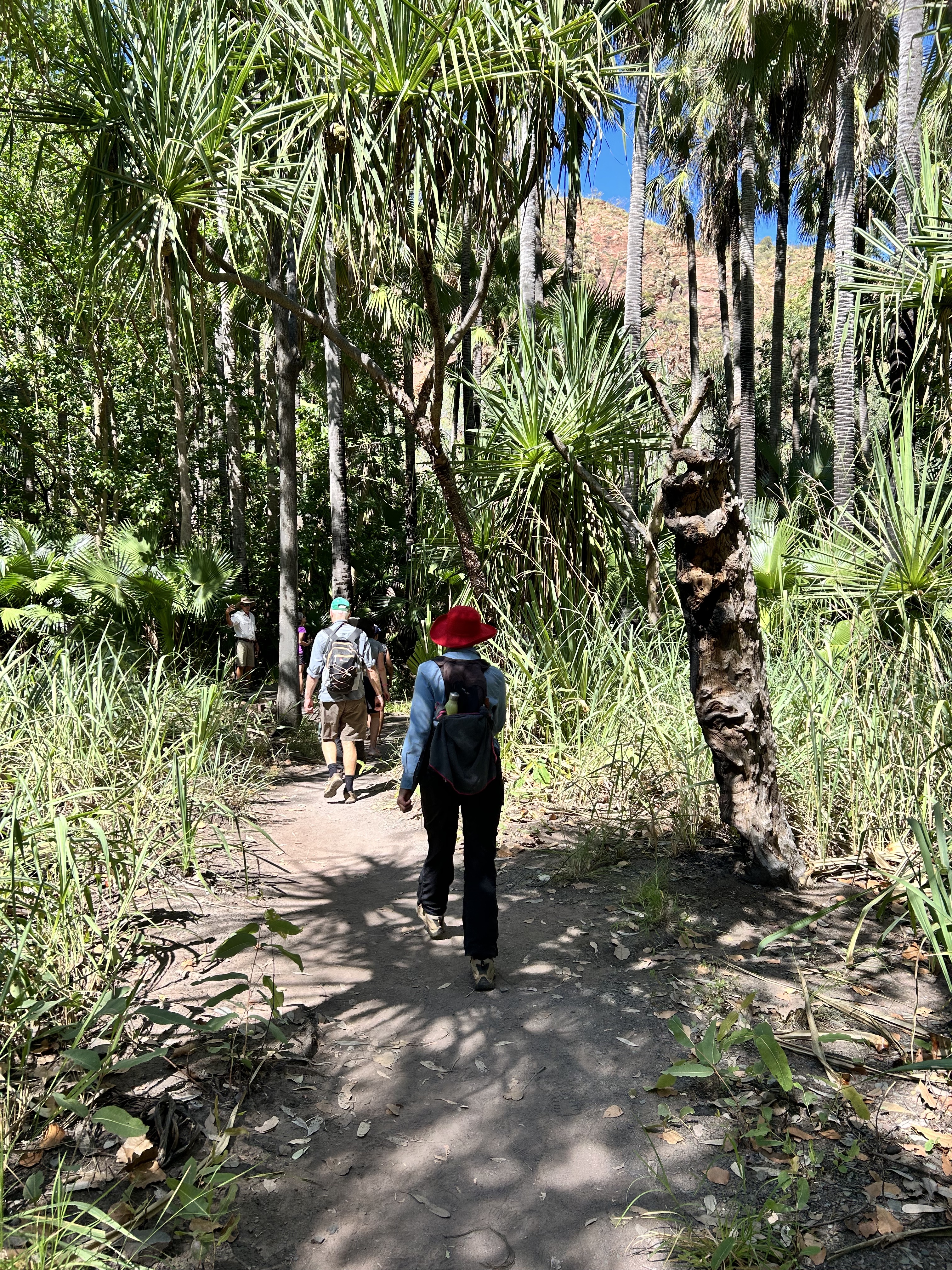
Day 3 at ElQuestro we did the full day tour. Starting at 7:15 we were driven over to Emma Gorge where Peter the guide led us up the gorge to a refreshing water hole with a 35 metre high waterfall. It was a bit over one hour each way.
After morning tea at Emma Gorge reception we were driven to Zebedee Springs (ala Magic Roundabout) for a warm bath in the 30 degree water. That was only a 5 minute walk. Lush tropical vegetation surrounds the numerous swimming holes.
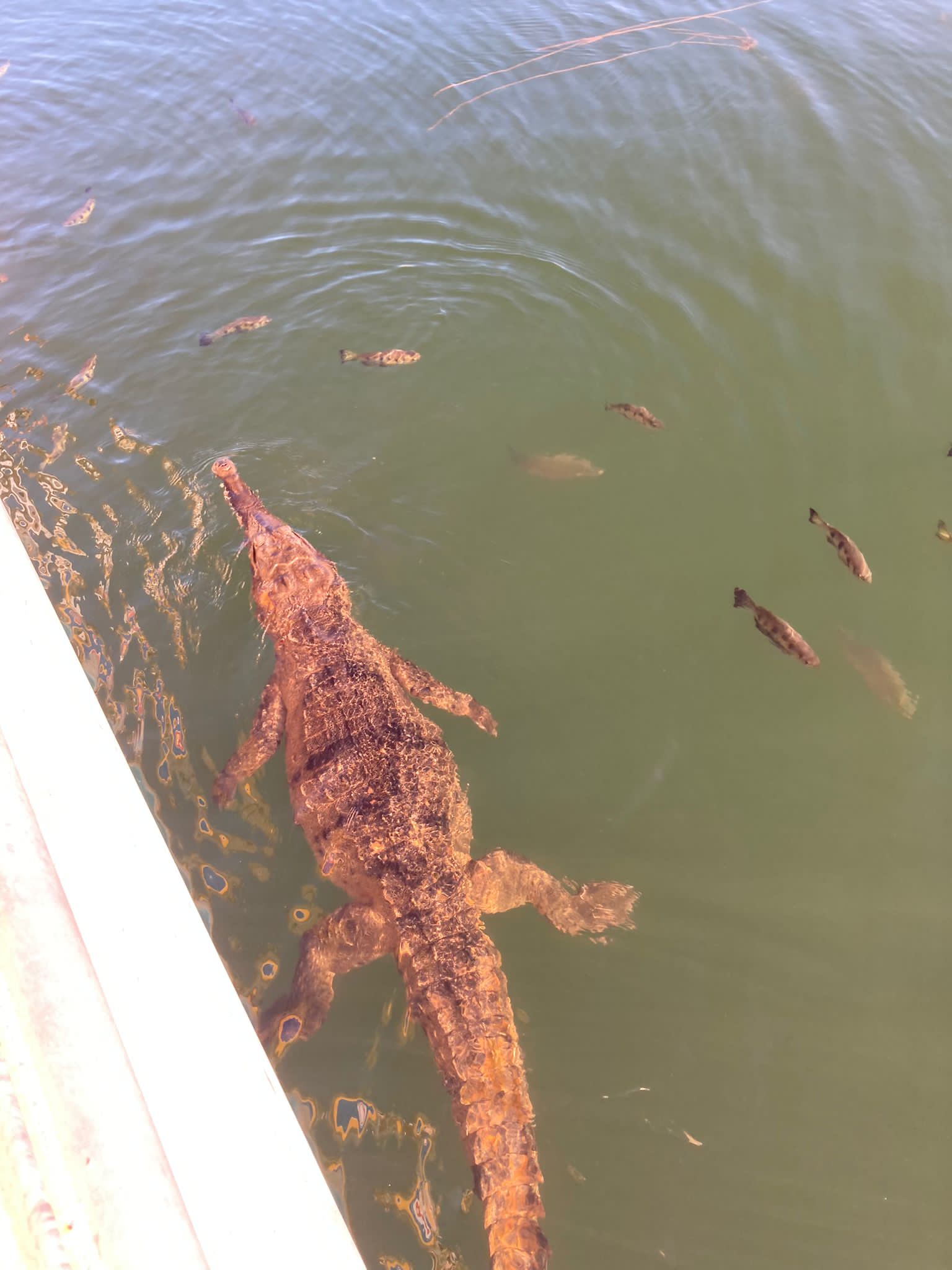
This was followed by lunch at the steakhouse and a cruise up the Chamberlain River where we saw a 3 metre salty sunning himself on a ledge and fed some clever little arrowfish that spit water at you. They use this technique to hit insects flying past and make them crash into the water.
Back at the Station we had drinks with new friends from London and then finished the day with a farewell dinner for Louise who was leaving us the next day to head back to work in Brisbane.
The next day it was time to depart ElQuestro. It’s a great spot with great facilities and very helpful staff and you can camp or glamp or stay in the motel rooms. The water hole in the Pentecost River (Creek) is a great place to cool down after a walk. It’s overlooked by the Steakhouse.
We had one last breakfast in front of the glamping tents, packed up and headed to the airstrip.
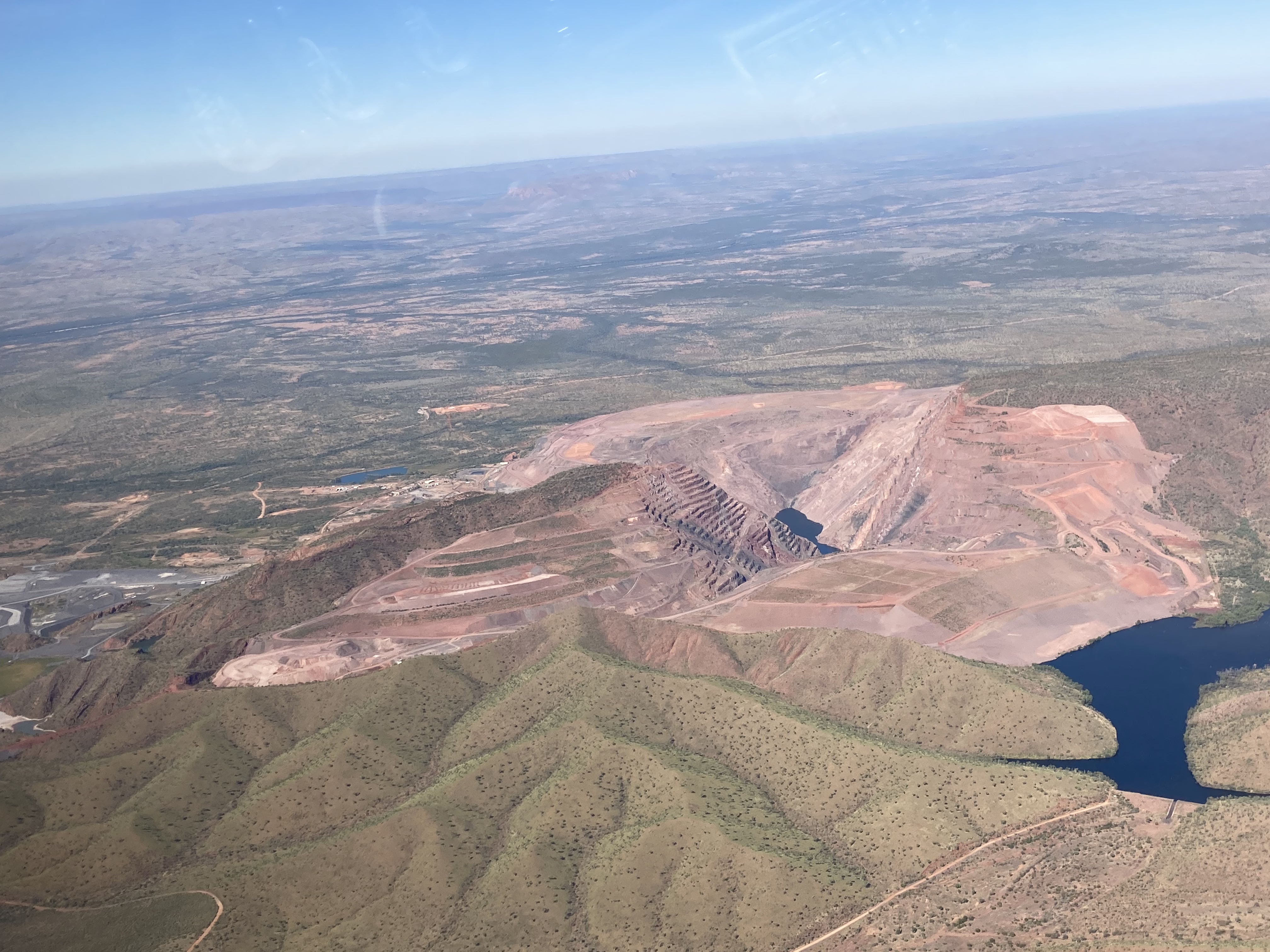
We took off at 8:30 and after a pass over the station and the exclusive ElQuestro homestead we climbed to 5500ft over Champagne Springs and set course for the Argyle Diamond mine.
I’ve been following the mine’s progress since the 1980s so although it’s now shut down it was impressive to see it from the air.
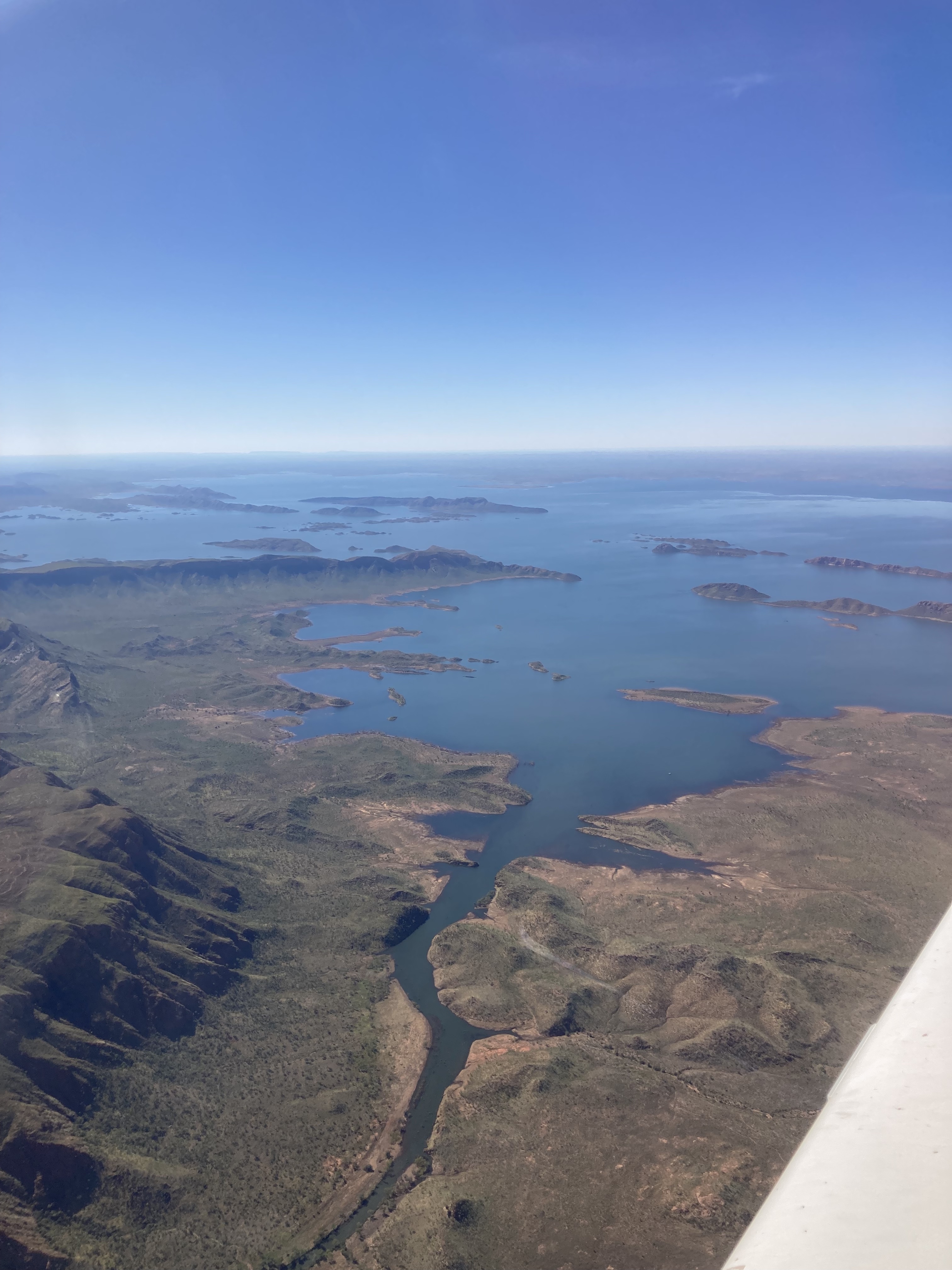
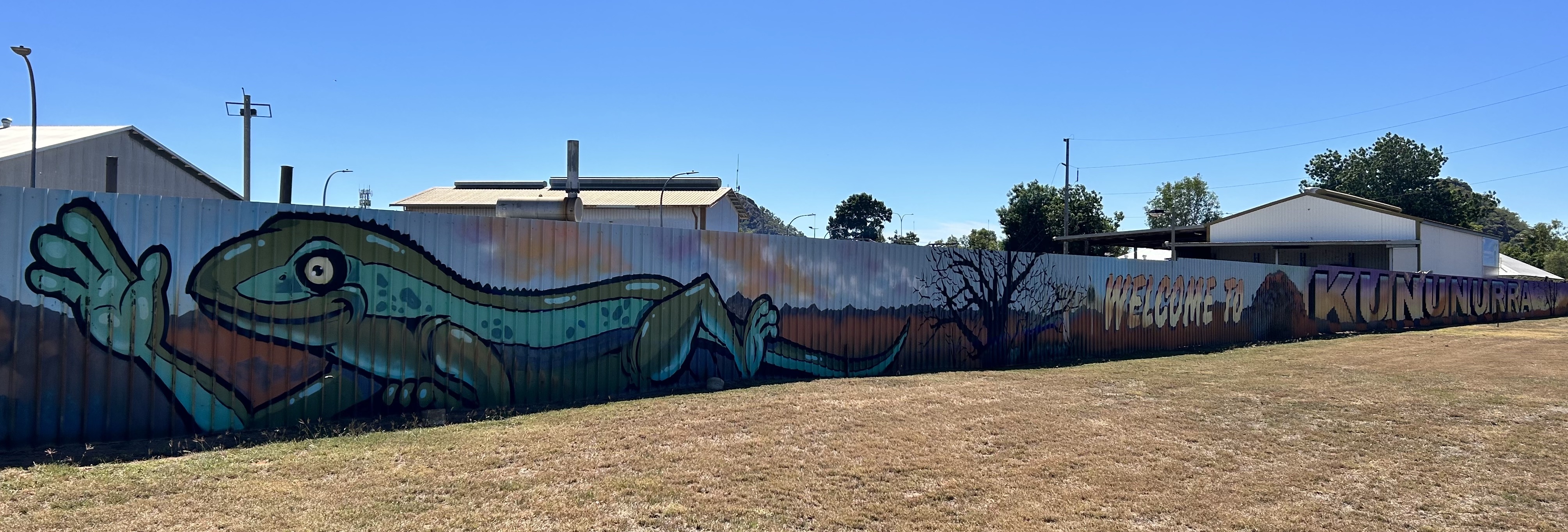
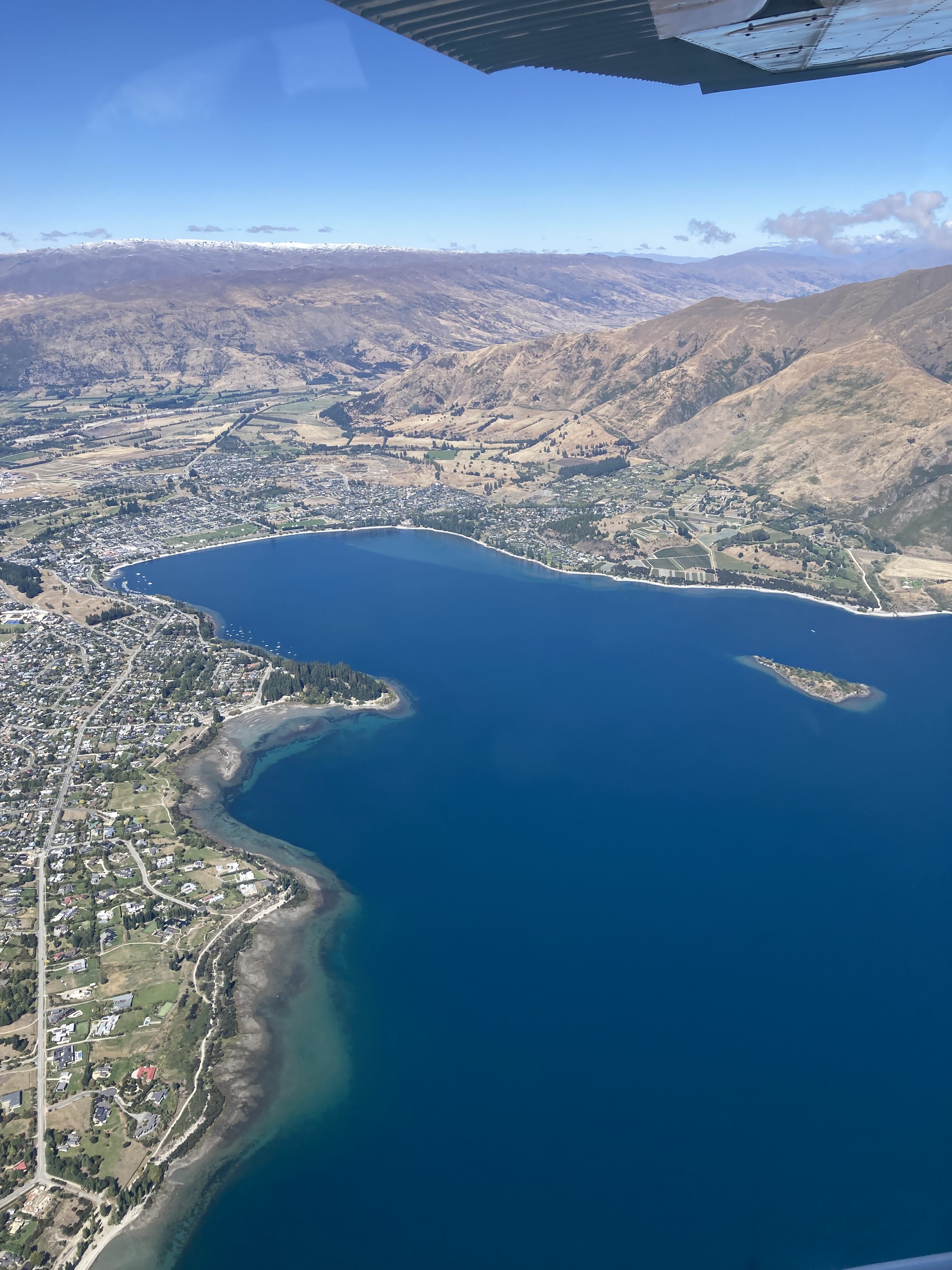
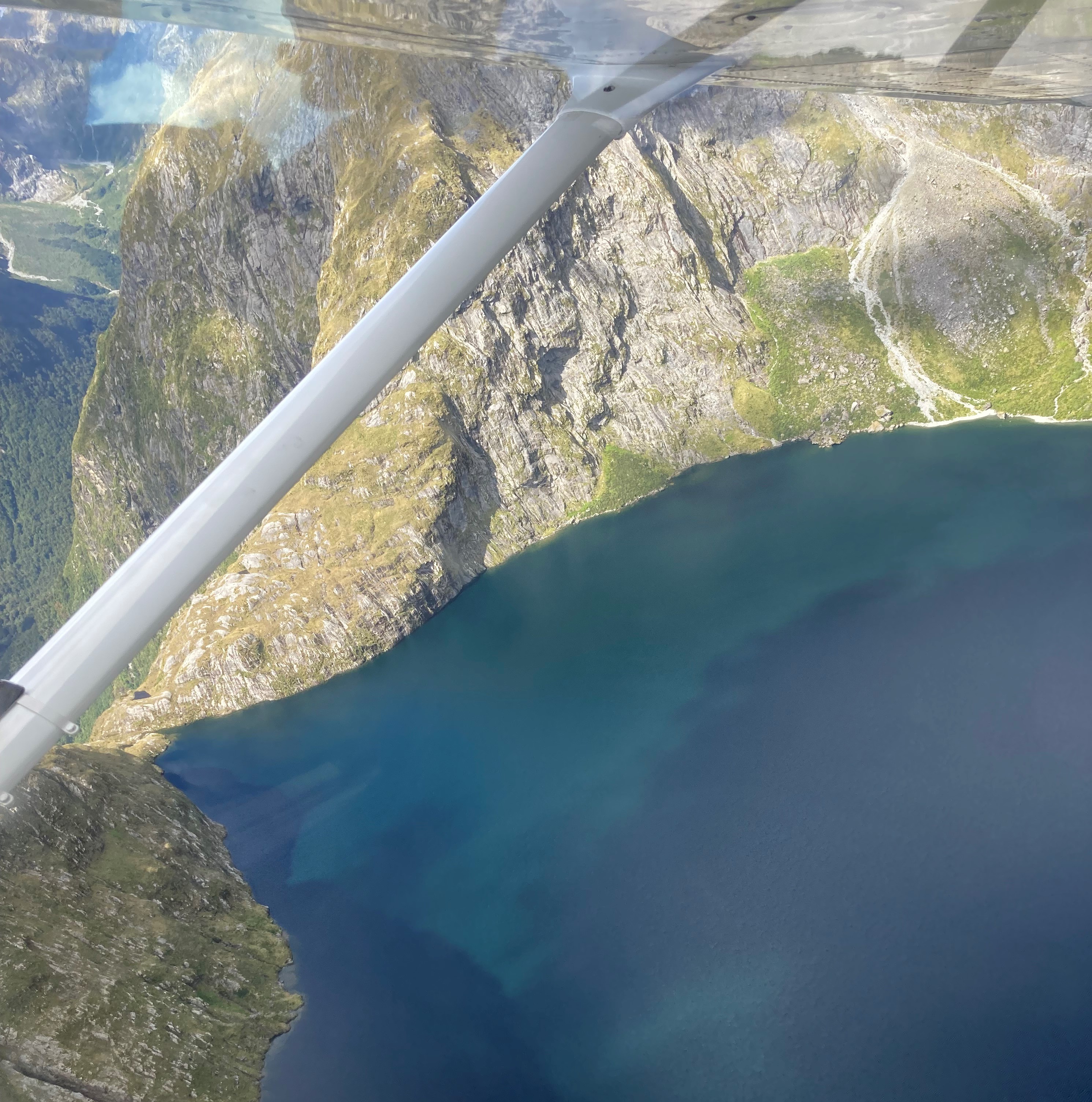
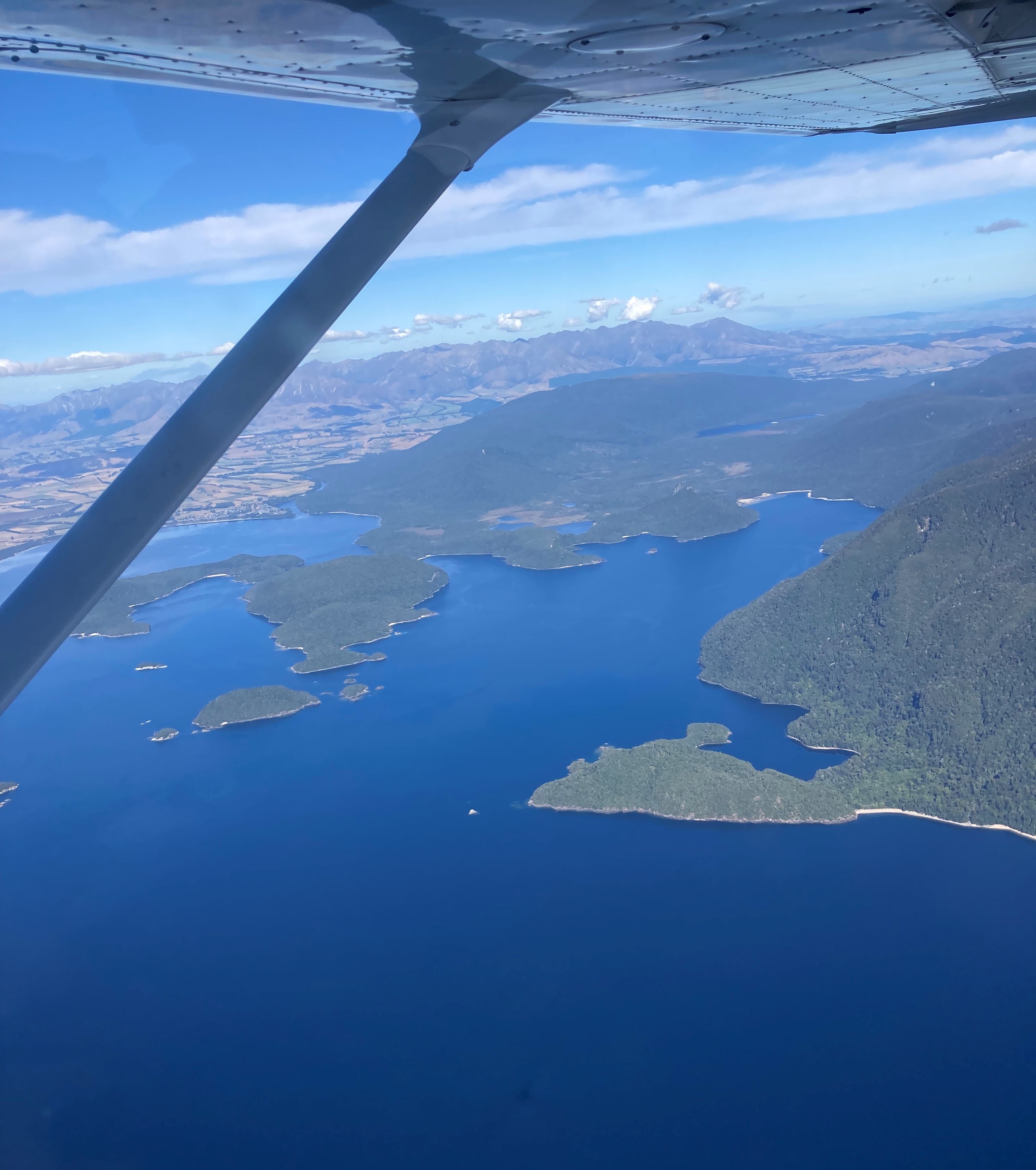
Next we tracked up the west coast of Lake Argyle to Kununurra. That lake is a huge expanse of water. 20 times the volume of Sydney harbour and 2000 square km in area.
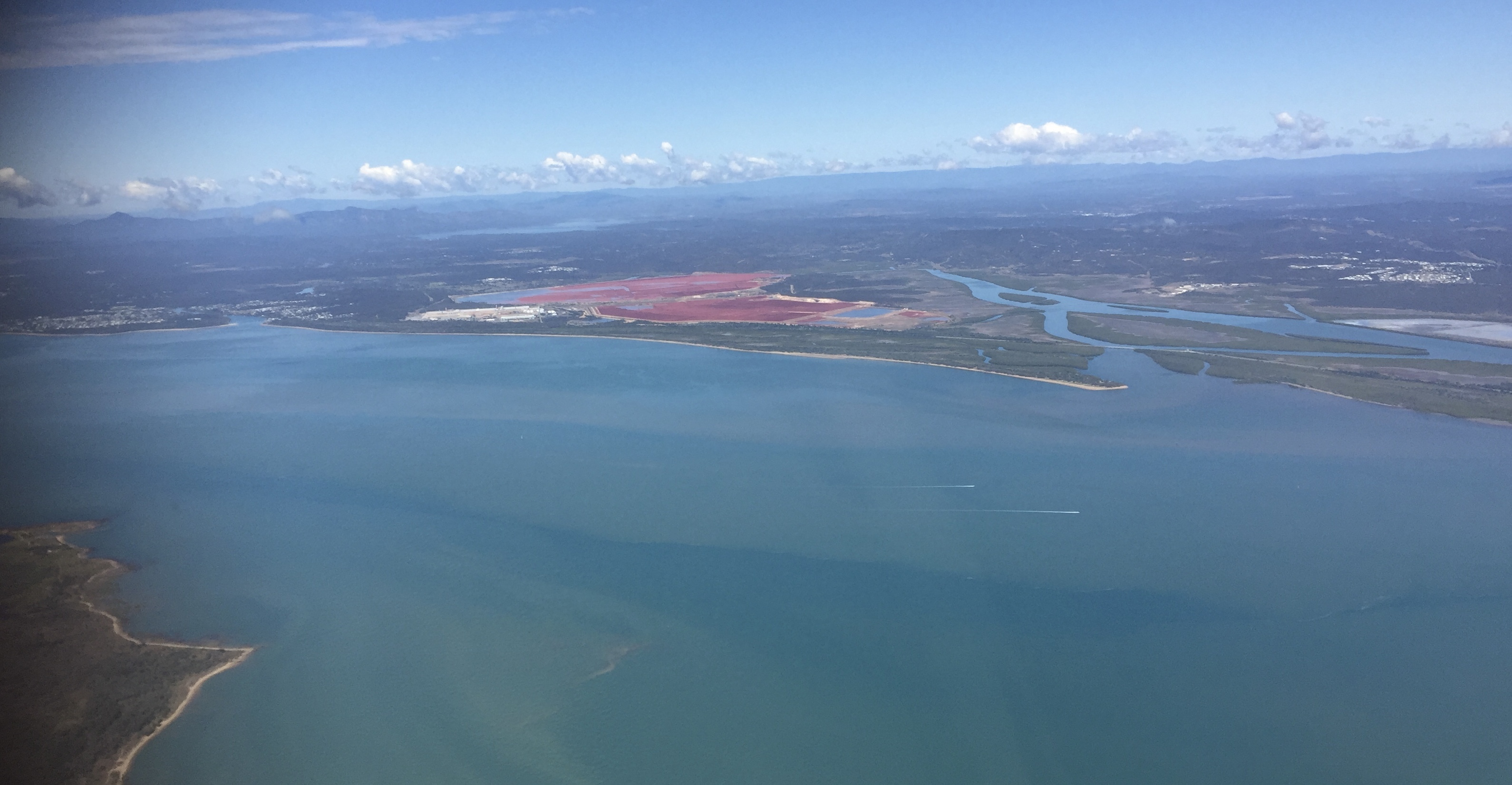
On descent into Kununurra we passed over some of the fields that are irrigated by the Lake Argyle water. On landing we refuelled and were picked up by a shuttle that took us to the Kimberley Croc Motel.
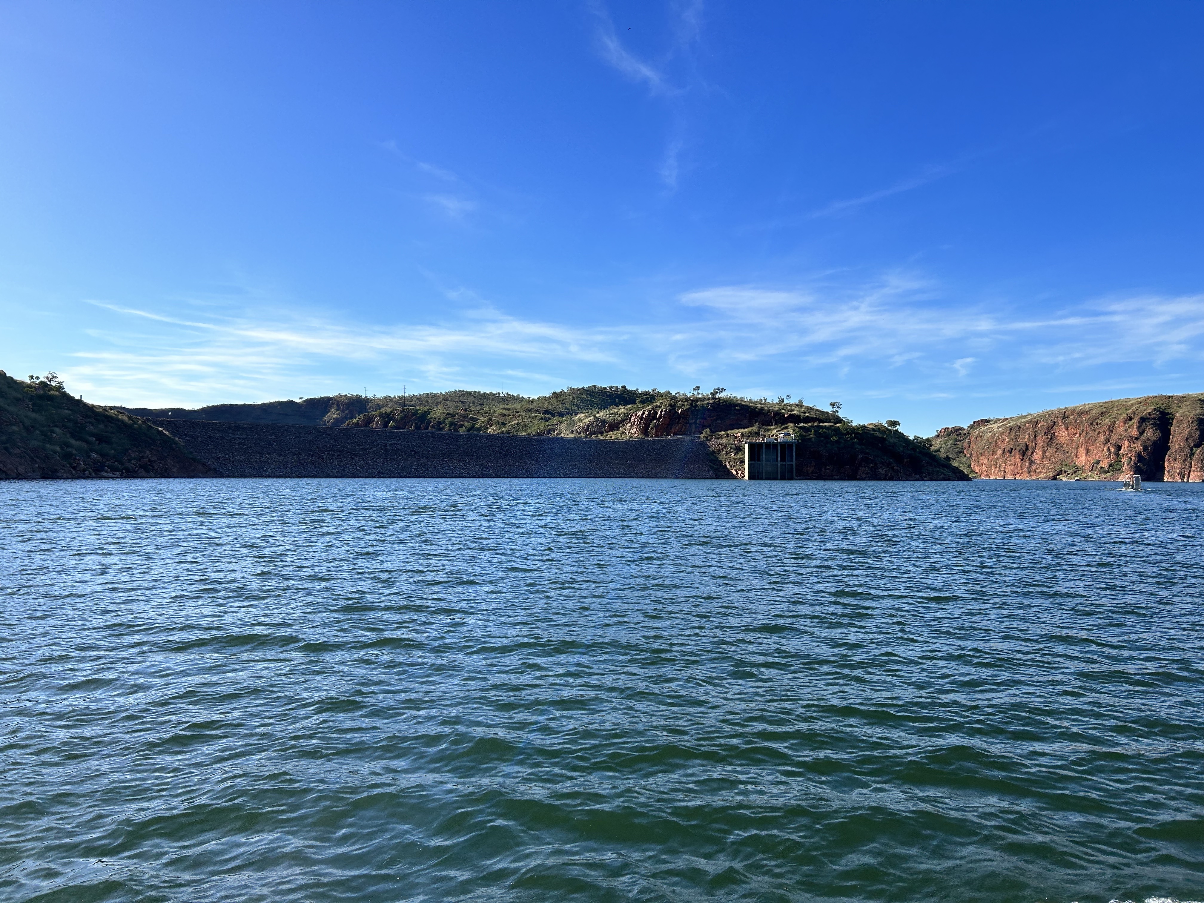
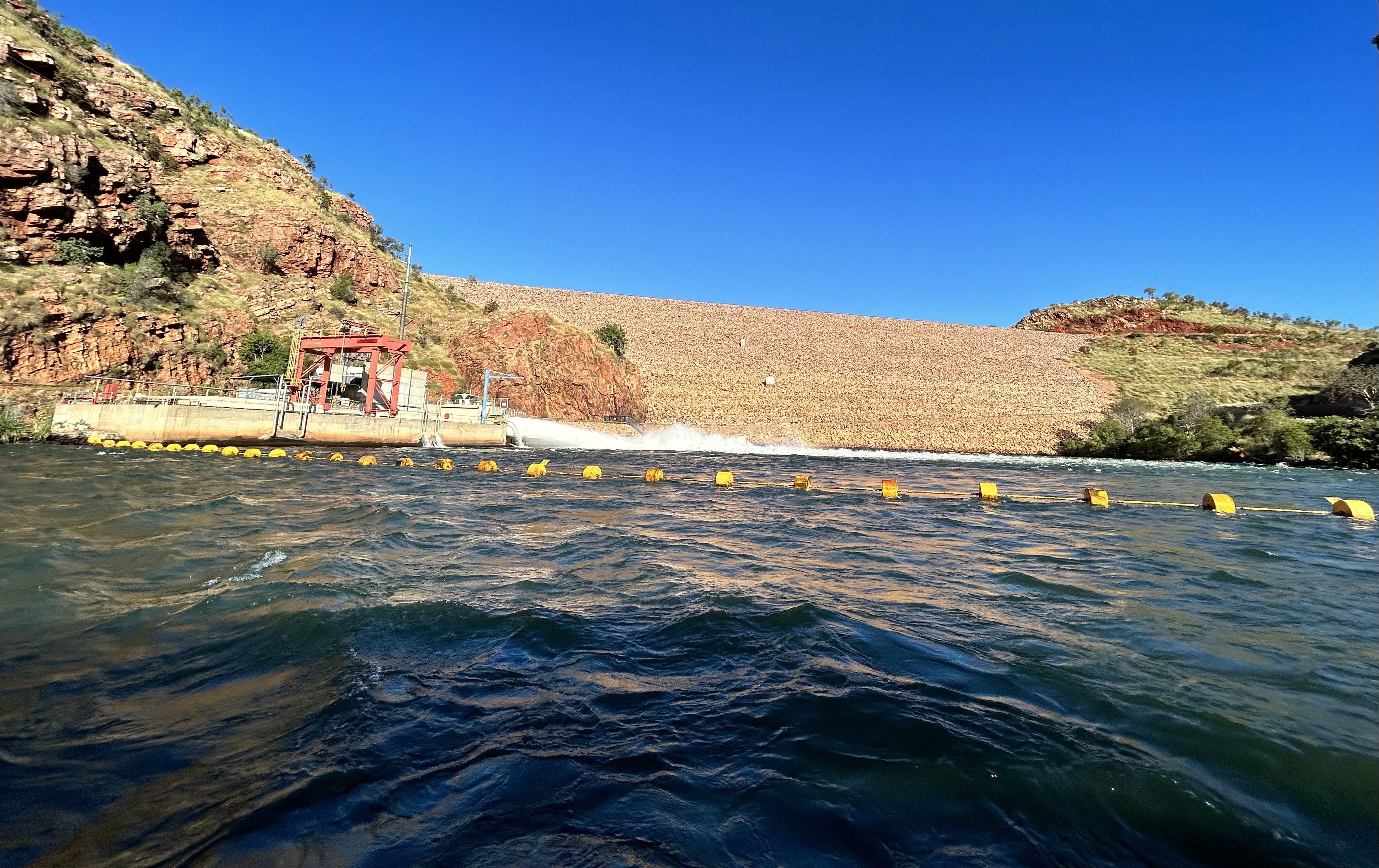
The motel is a great casual place right in the middle of town. A quick sandwich and farewell to Louise, who had to catch her plane to Darwin, was followed by a bus trip out to the Lake Argyle cruise that helped us appreciate all the more this engineering marvel. At a cost if $22m in 1971 it must’ve been the best deal in WA history. There’s a 30MW hydro power station that’s now running at about one third capacity since the diamond mine shut. And sooo much water. Why not build a pipeline to Port Hedland and develop a hydrogen/green iron making hub?
We saw more fresh water crocs than ever before and then went swimming not too far away as the sun set over the hills. What a day! Definitely recommend the Lake Argyle cruise for anyone visiting Kununurra.
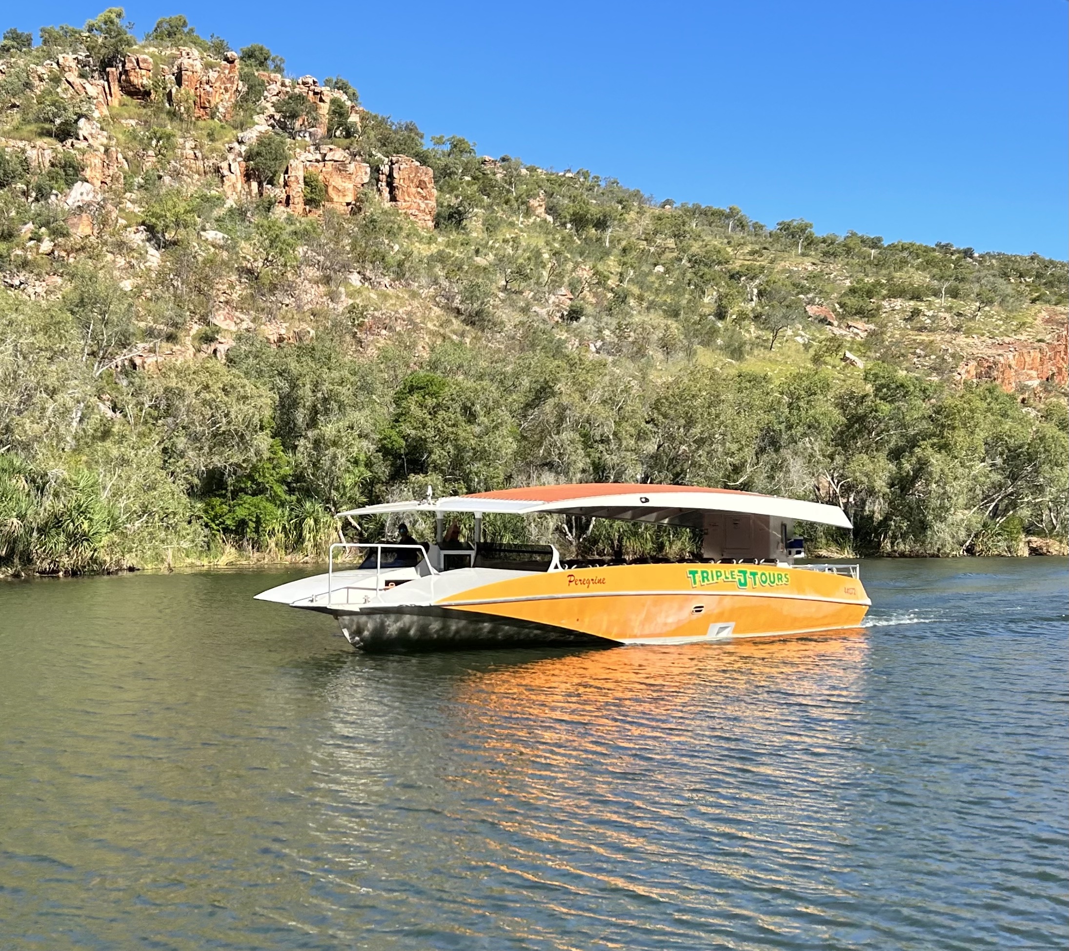
Lake Argyle was formed by damming the Old River in the 1970s. So, having spent a day on Lake Argyle, the next day we had to do a boat trip up the Ord River downstream of the dam wall to see what it was like before the lake existed. First though Sigi and I did walk to Lake Kununurra to get a bit of a feel of the town.
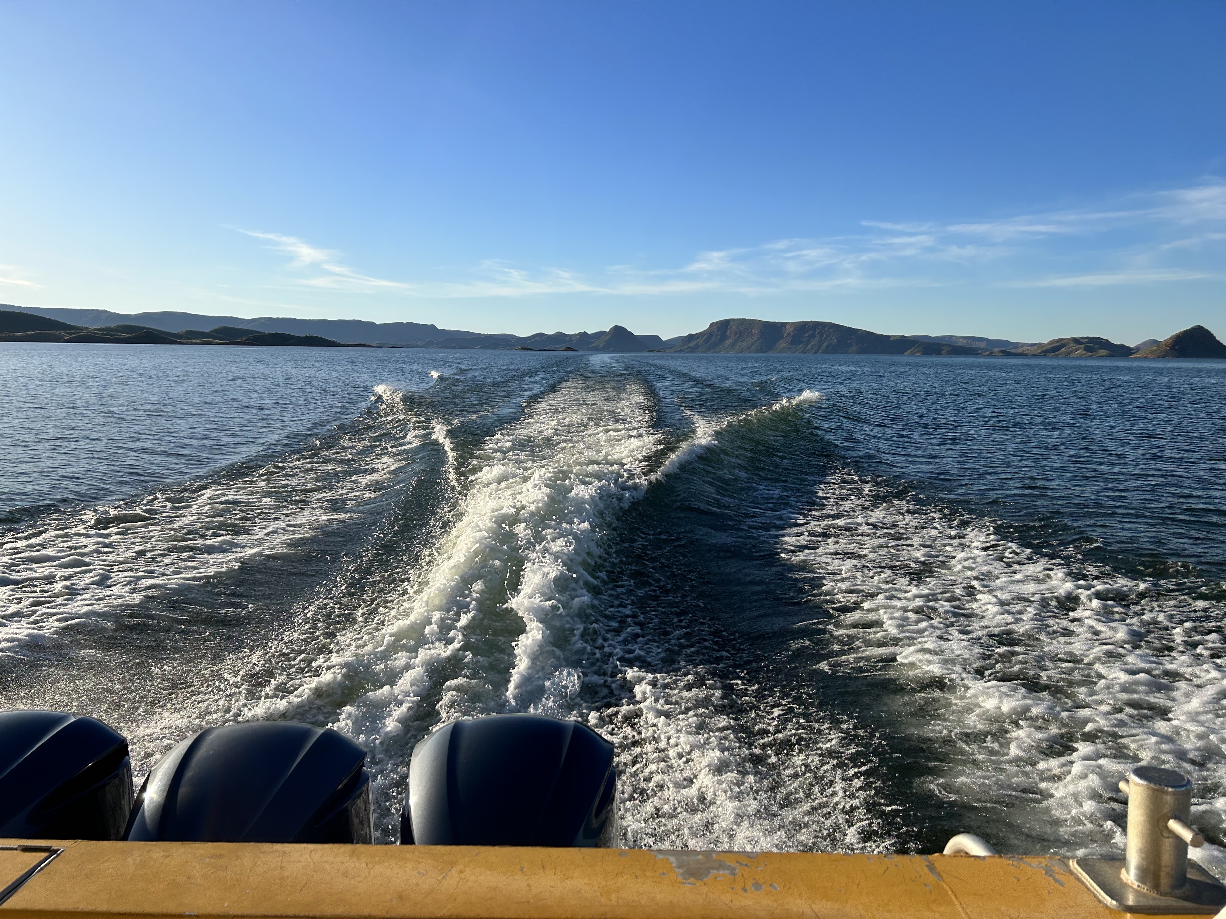
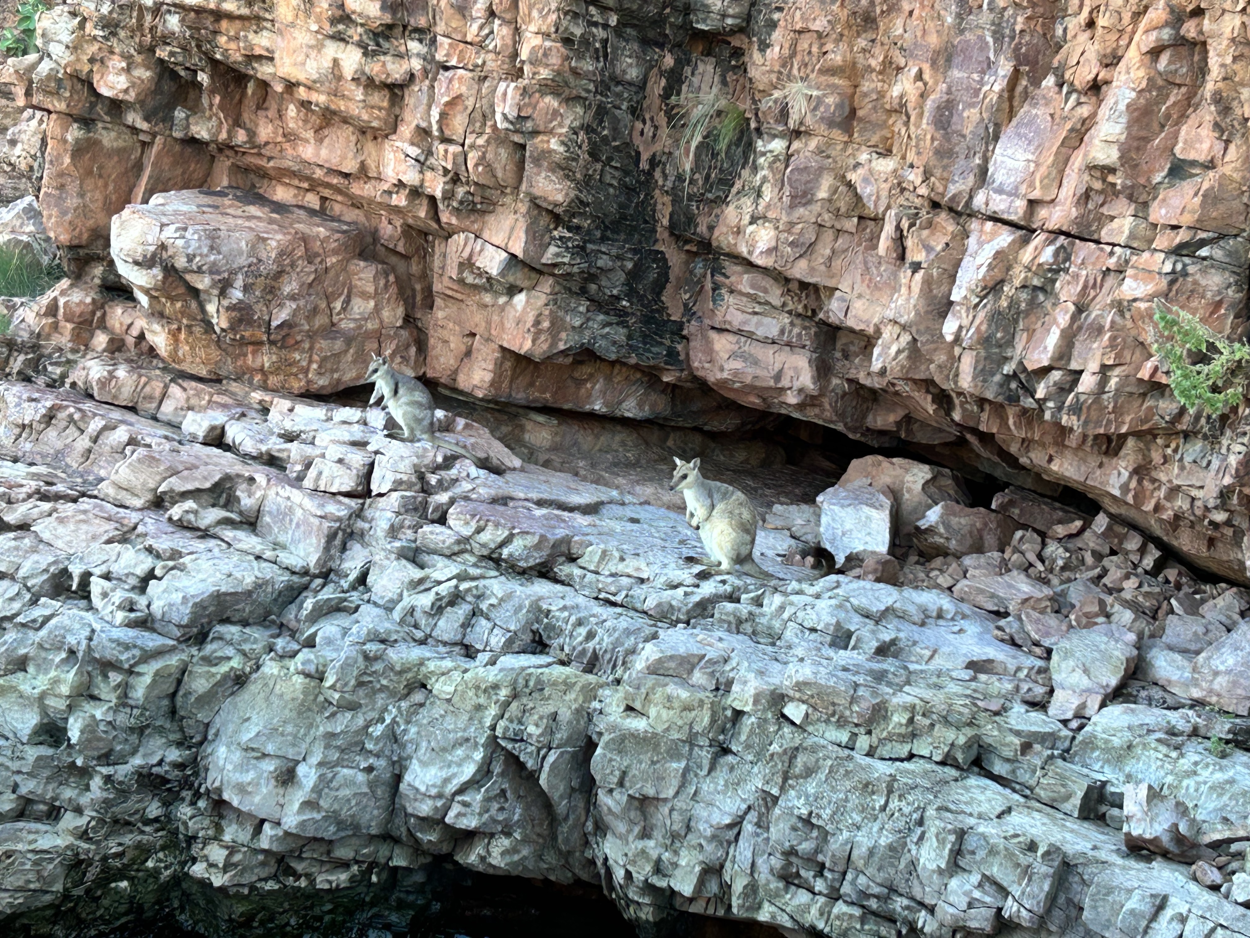
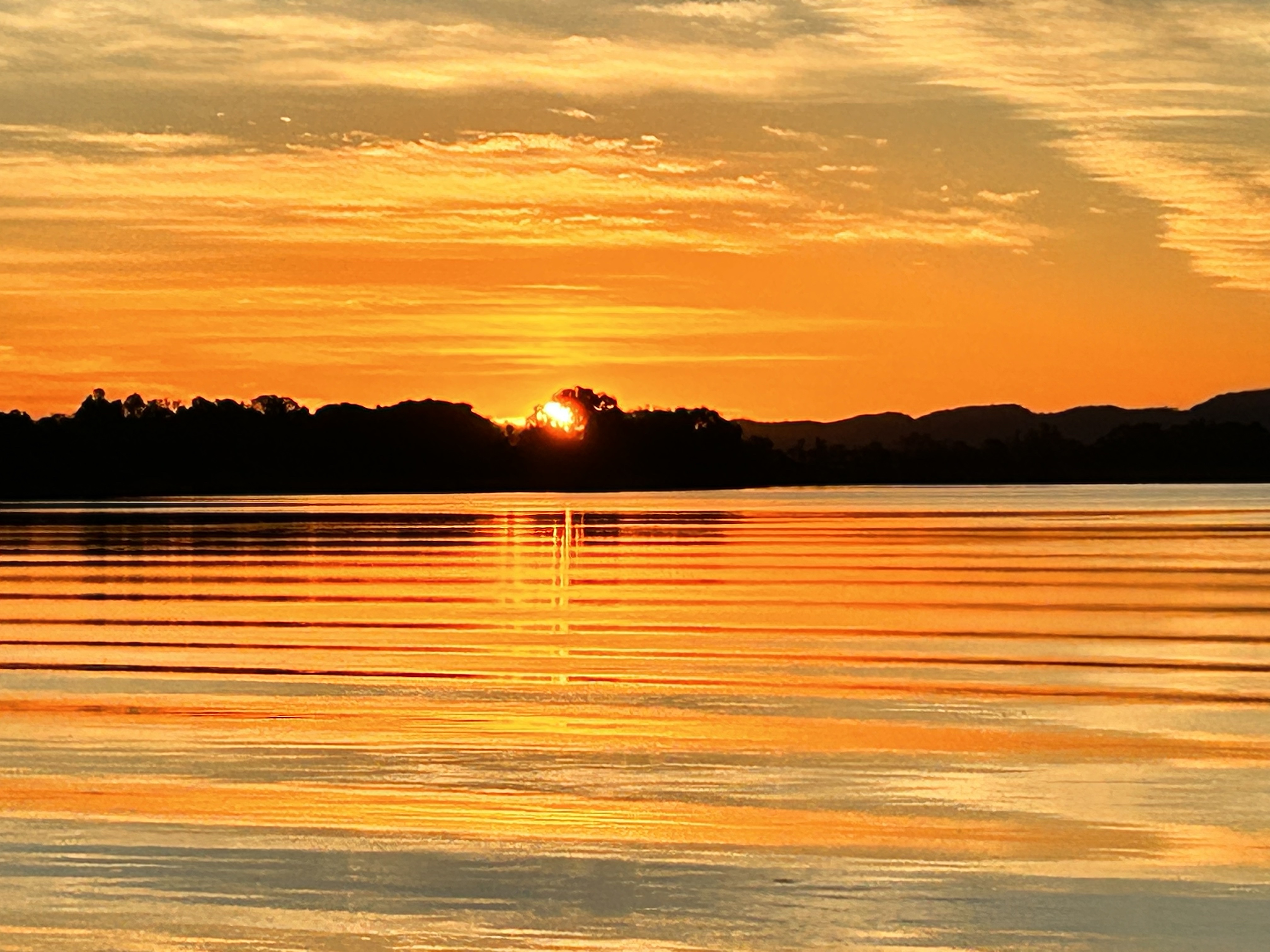
The boat trip was with Triple J Tours and skipper Justin was cruising at up to 50km/h. The first 40km upstream from Kununurra is called Lake Kununurra as it’s the level held back by the lower “diversion” dam that’s located at Kununurra. The remaining 15km to the Lake Argyle dam wall is essentially the original Ord River. Along the way we stumbled on rock wallabies, fresh water crocodiles, mountains that formed silhouettes of famous people and animals and even some pumpkin scones, as well as the dam wall itself and the outlet pipes from the hydroelectric power station. Beautiful landscape and another stunning sunset.
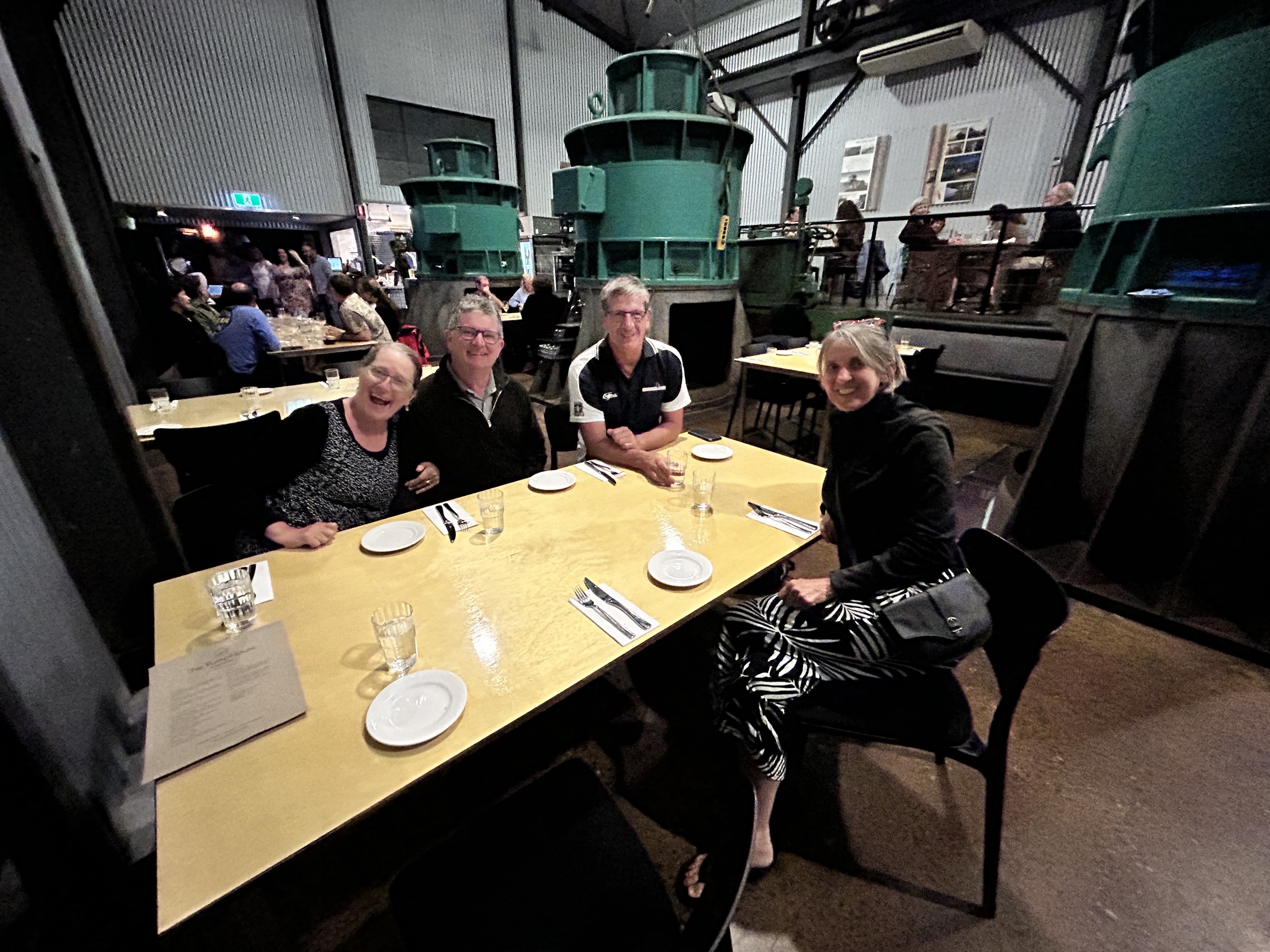
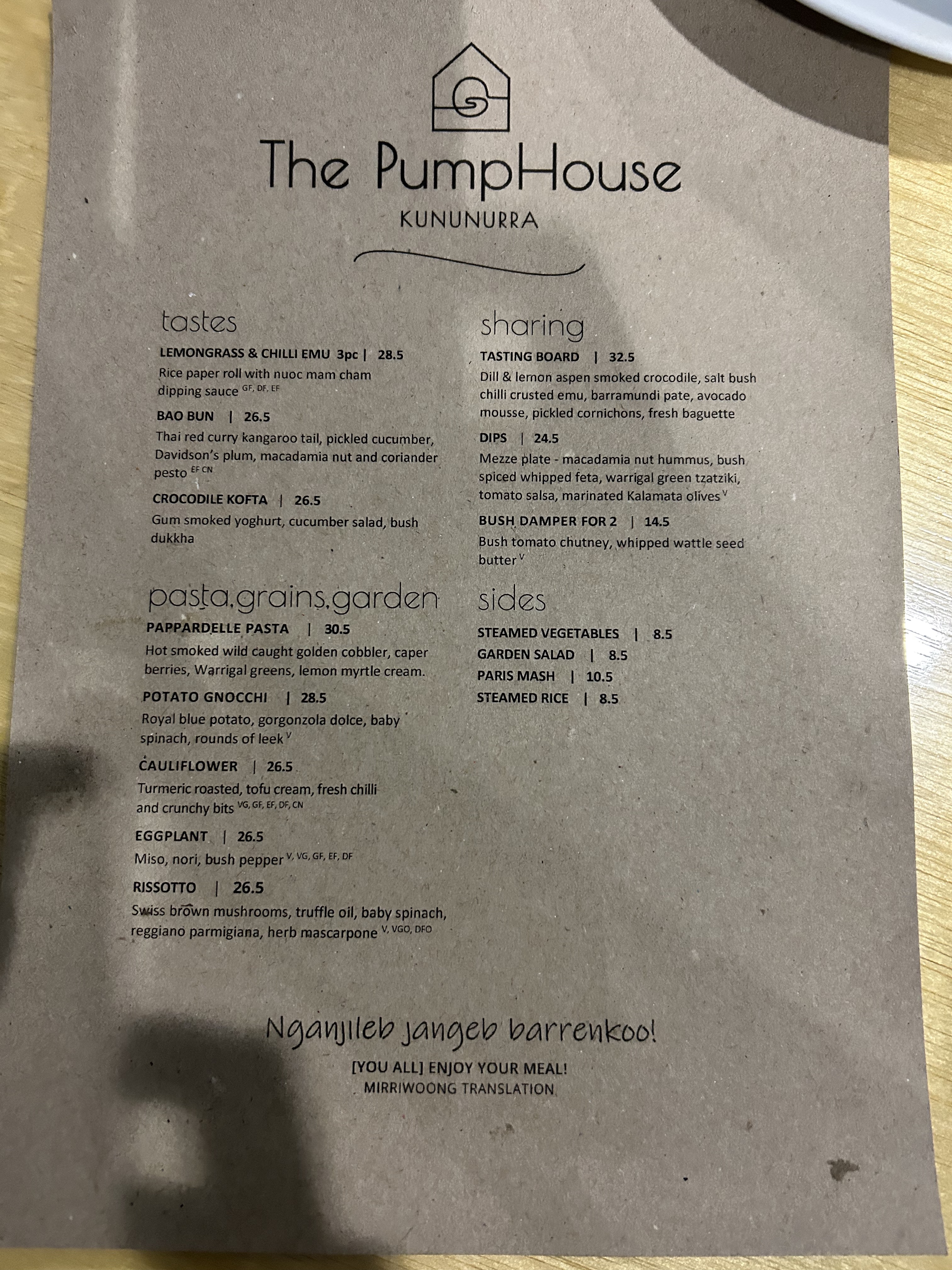
We saw thousands of fruit bats take to the sky over the recently reopened Pump House Restaurant.
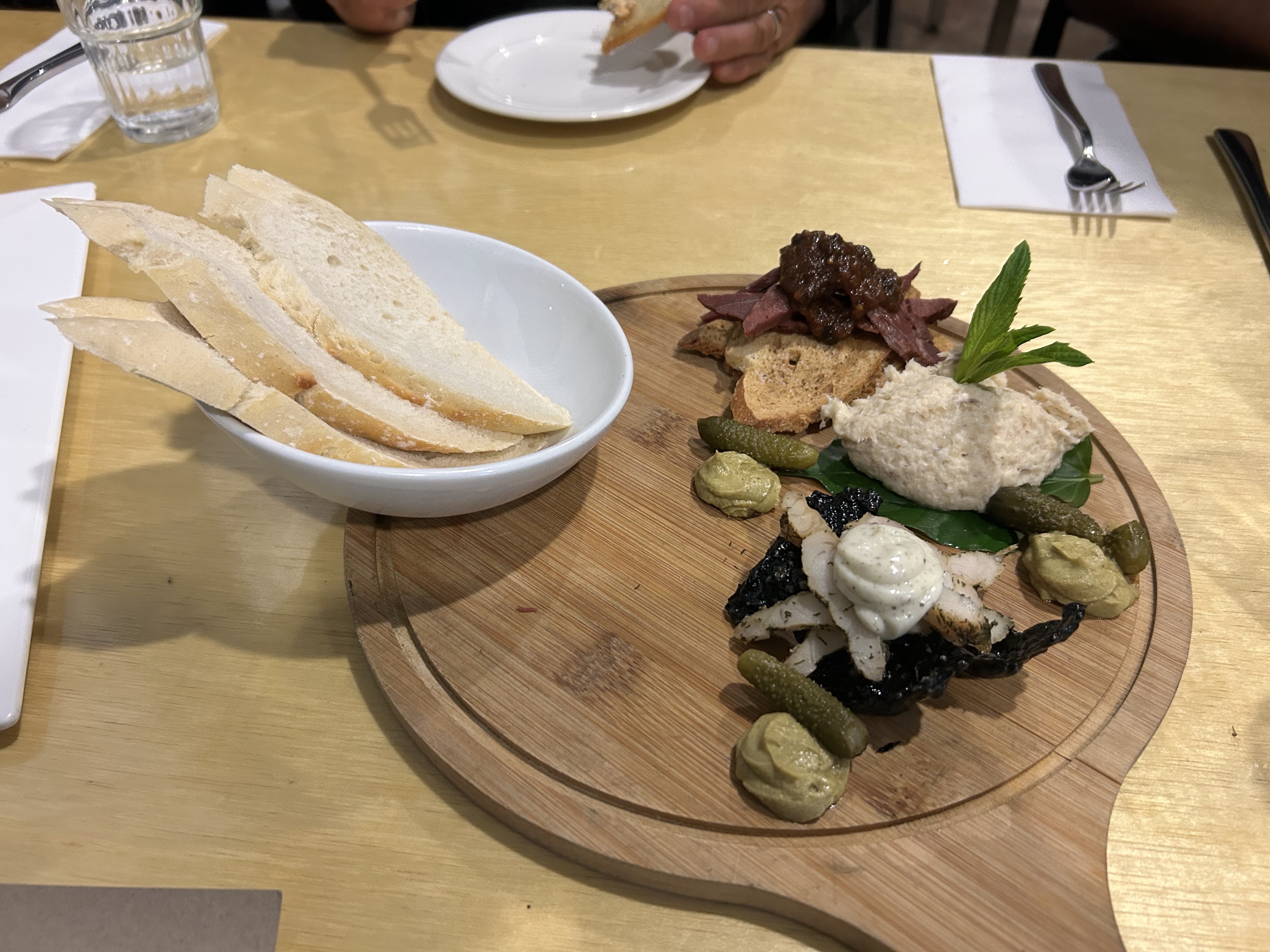
Rita had been told by someone local to Kununurra that the Pumphouse was pretty special so she’d booked us in there for dinner a week or so before. Lucky for us because the food was impressive. After a quick stop at the motel we were whisked back to the Pumphouse where we subsequently settled in for an impressive array of culinary delights.
Sigi and I woke up to another perfect day and decided to do an early morning walk up to Kelly’s Knob Lookout for a view over the irrigated areas around Kununurra.
After breakfast Luc and I met with Chris, a pilot from Aviair, who, over a coffee, gave us some useful tips about flying in the Kimberley. Then we packed up and headed out to the airport. Around 11:30 we lifted off and followed the Ord River to the coast as far as Wyndham where we had a view of the King River and Pentecost that flow into the sea nearby, then followed the Pentecost River inland to Home Valley Station.
King River
Home Valley Station sits at the eastern end of the Gibb River Road and they put on a pretty good lunch. Trish the manager texted me an airstrip report before we left Kununurra that was very useful. It’s the only place that supplied such report. It was a 10 minute walk from the strip to the homestead where they had a pleasant restaurant that had just opened for the season. You can stay there too. It’s surrounded by some stunning escarpment type scenery.
Recharged by lunch, we walked back to the strip, took off and followed the Gibb River Road to the west as far as Ellenbrae Station, another place we could’ve stopped for lunch or stayed overnight but we overflew at 2500ft and continued on to Drysdale River.
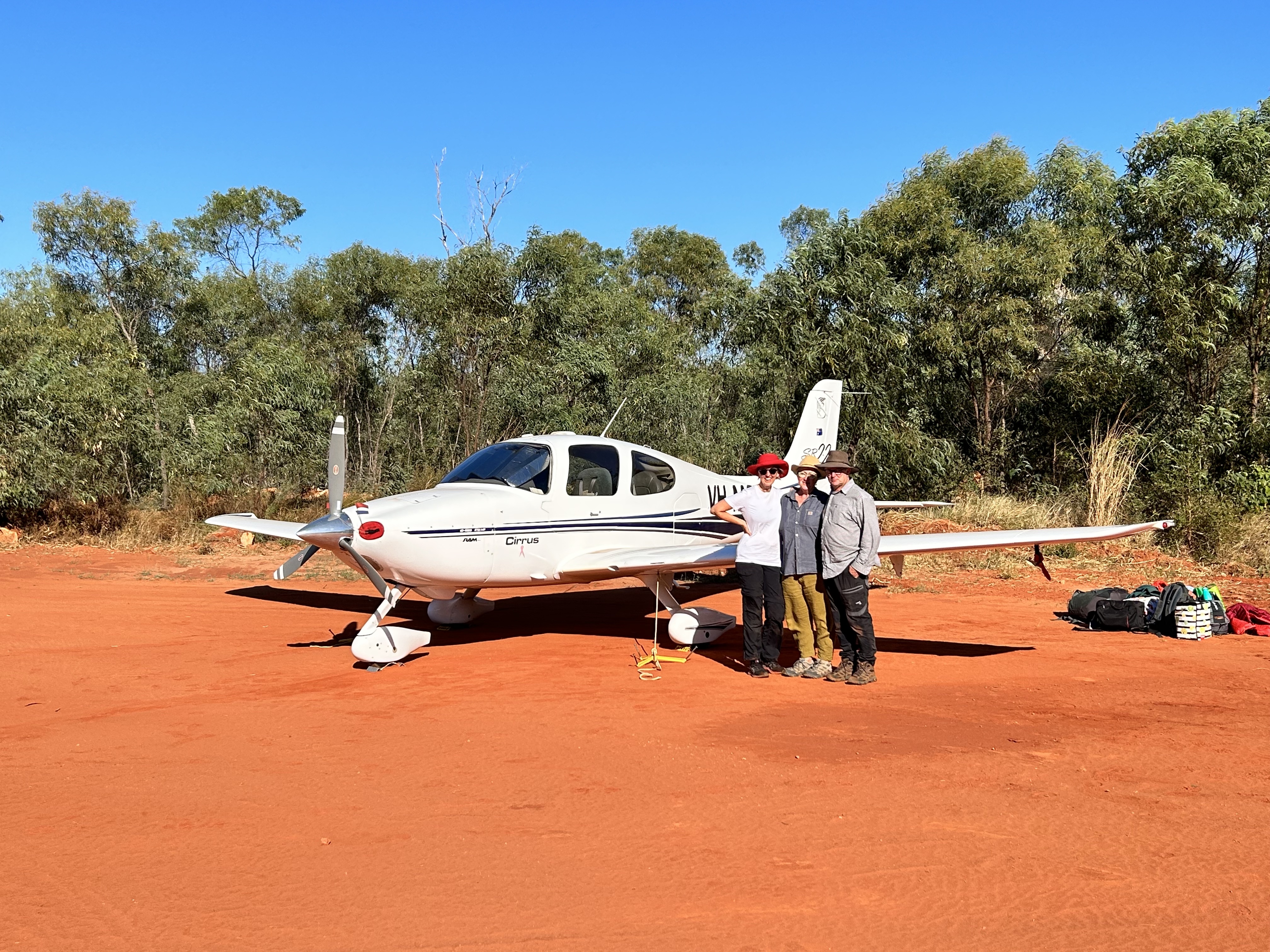
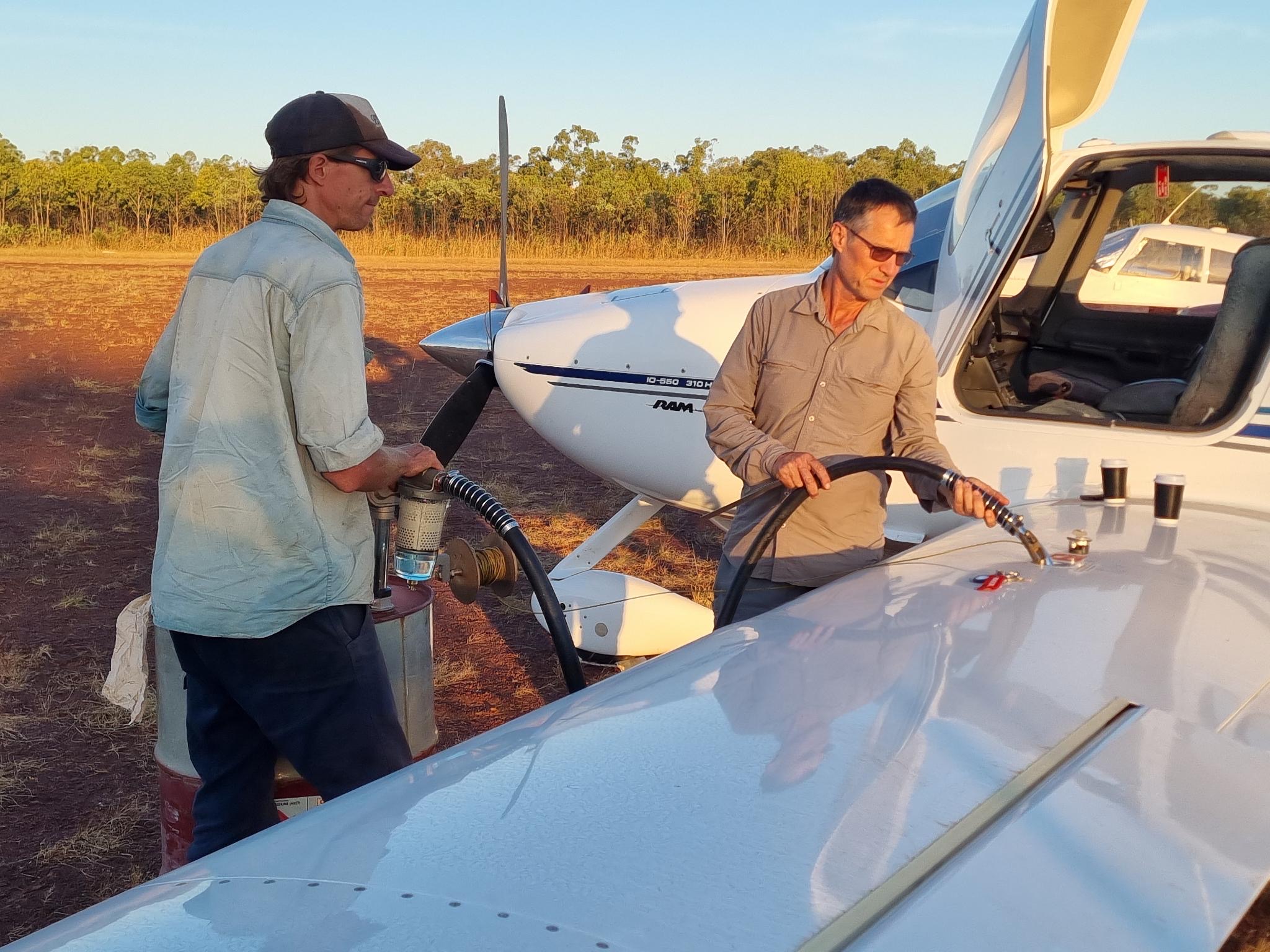
Drysdale River Station has a good airstrip and they can arrange avgas but you have to buy it by the 200L drum and order and pay in advance. So I’d arranged with Anne the owner to order a drum for us at the special price of $5 per Litre. Liquid gold. Her son Paul had invested in a new hand pump so he pumped 120L into MSF and about 60L into WKE. 20 L remained to add to WKE the next day. With tanks filled it meant we were all ready for our flight to Mitchell Plateau and Mitchell Falls.
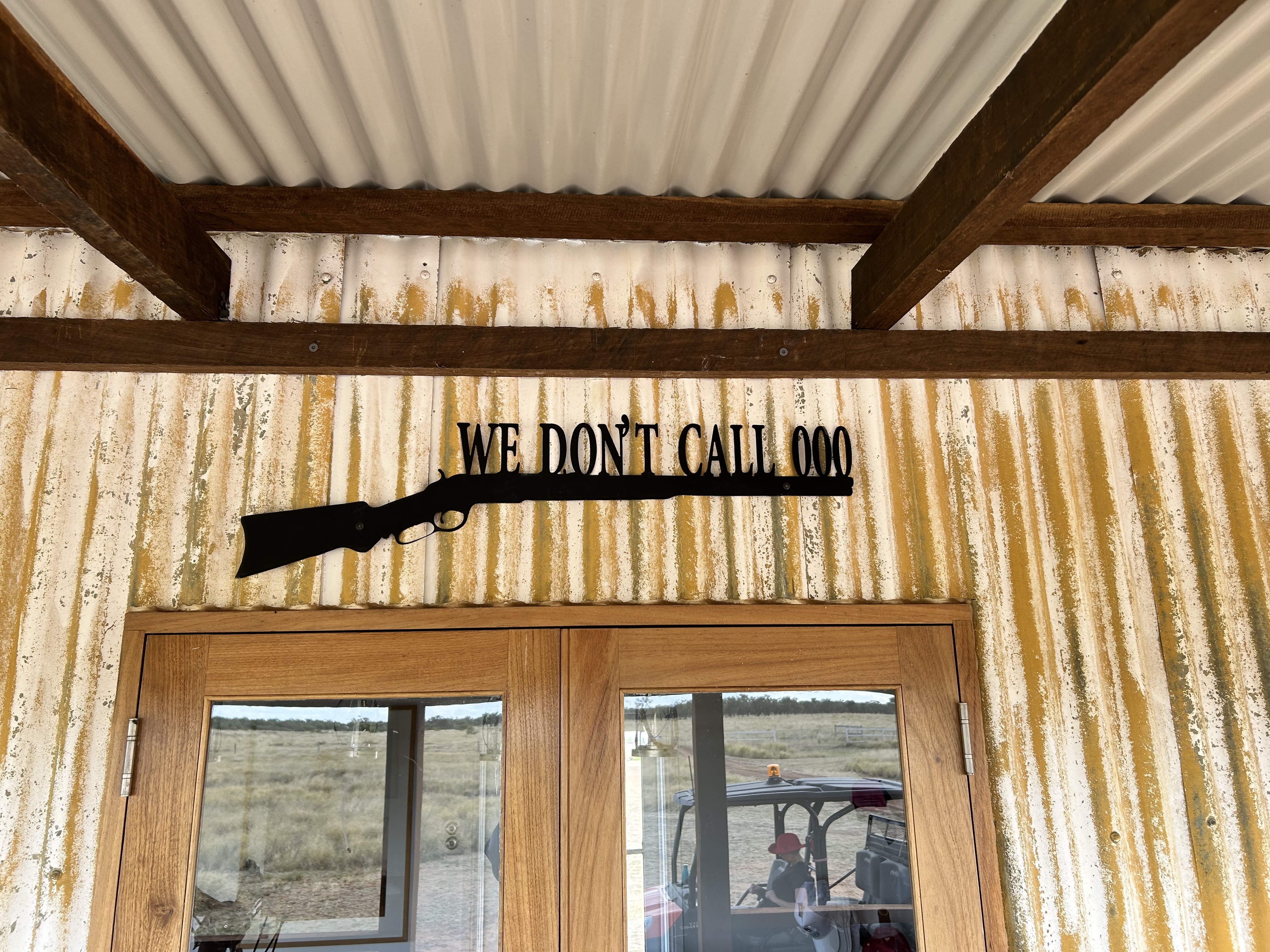
Drysdale River is a great jumping off point for Mitchell Falls in the central Kimberley. The accommodation is basic but clean and well equipped for independent travellers. There’s free washing machines, fridge, toaster and kettle in the communal kitchen. There is also a shop with basic groceries. The beer garden is a great setting and the restaurant/cafe does reasonable pub food. Continental breakfast is included in the overnight rate. Cereal and toast, tea and coffee. Hot breakfast is extra. Owners Anne and Alan are looking towards retirement so leased management of the accommodation to Outback Spirit in 2022 for two years so the new management are still settling in. Steve the manager is a good guy and provided free transfers to the strip with lively banter along the way. The strip is well maintained. Anne and Alan still run the shop and fuel service. They also still run cattle on the property.
Dinner was in their beer garden under the fairy lights as the temperature dropped suddenly to a chilly 15C or so. At about 1200ft AMSL Drysdale River does not retain the heat of the day.
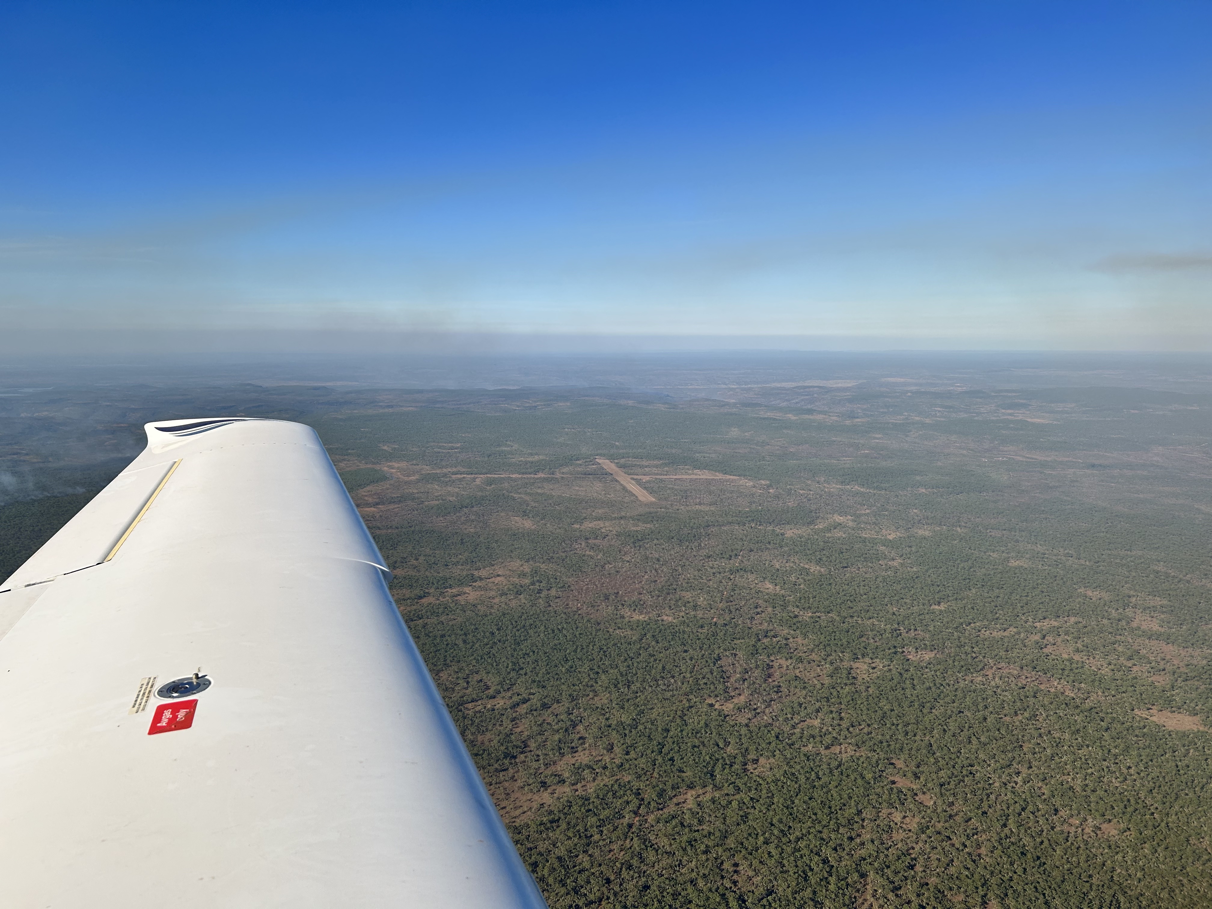
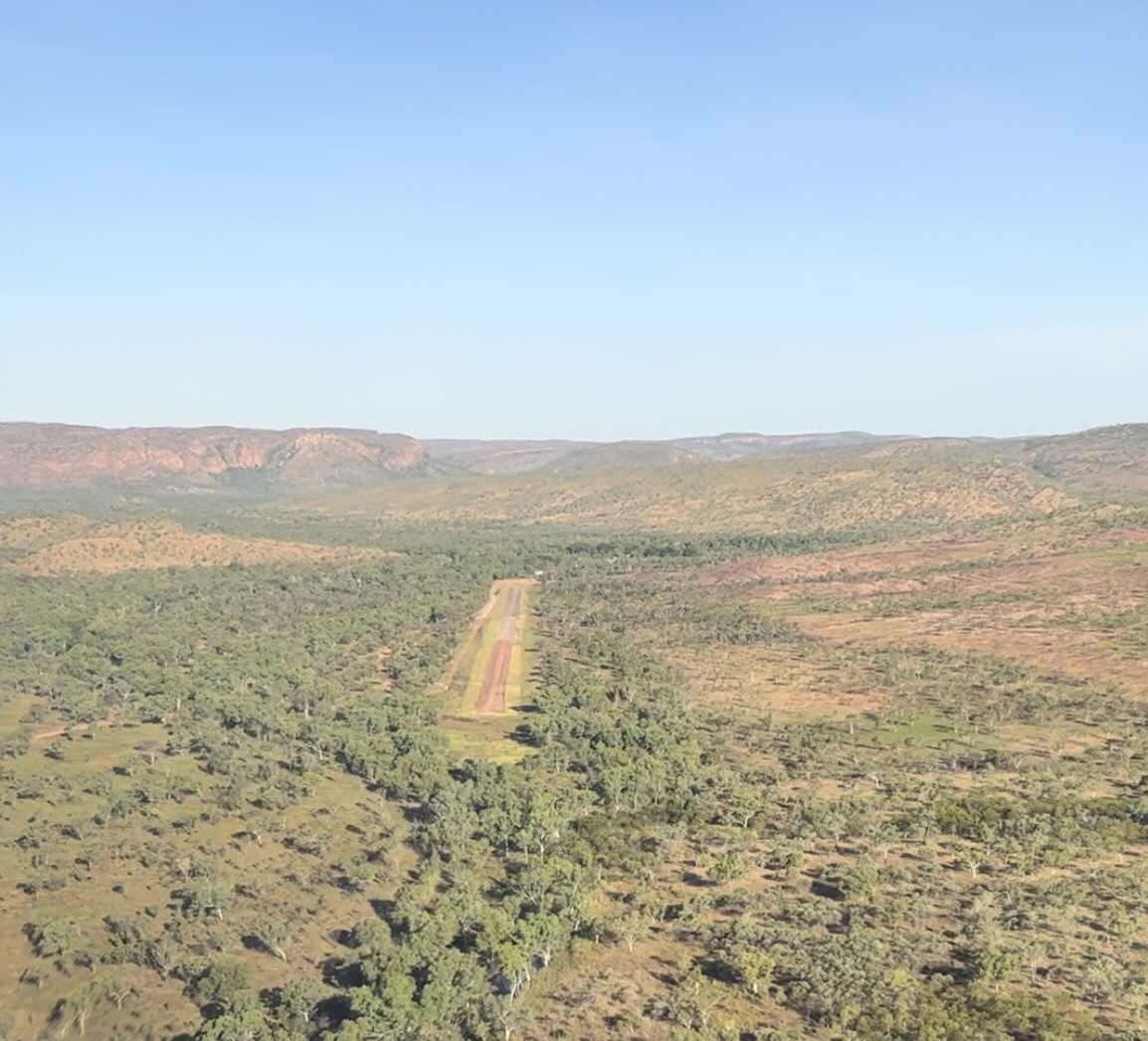
Breakfast at 6:30 the next day meant we were lifting off shortly after 8am for Mitchell Plateau. The forecast was for strong winds so we expected a bumpy ride but at 4500ft it was pretty smooth. Landing at the plateau it was a bit gusty but we had a smooth landing nevertheless. A kind bystander videoed our landing and came over for a chat and airdropped the file to me.
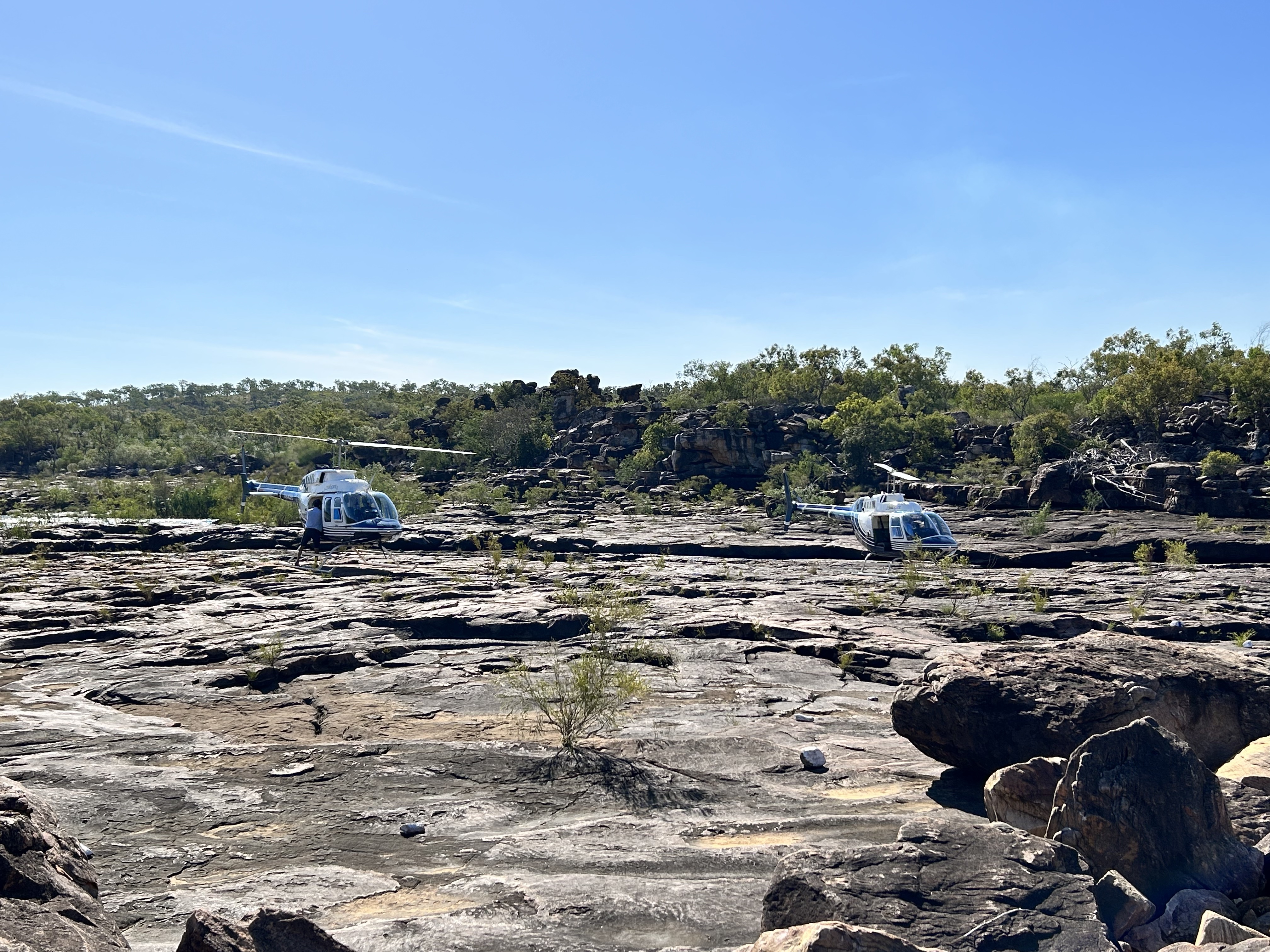
There were a few rocks exposed on RWY 06 but we managed to avoid them and were tied down and waiting for our chopper by 9:15. The Longranger arrived at 9:30 and took us to the Mitchell Falls campground where the 3 hour hike to the falls starts.
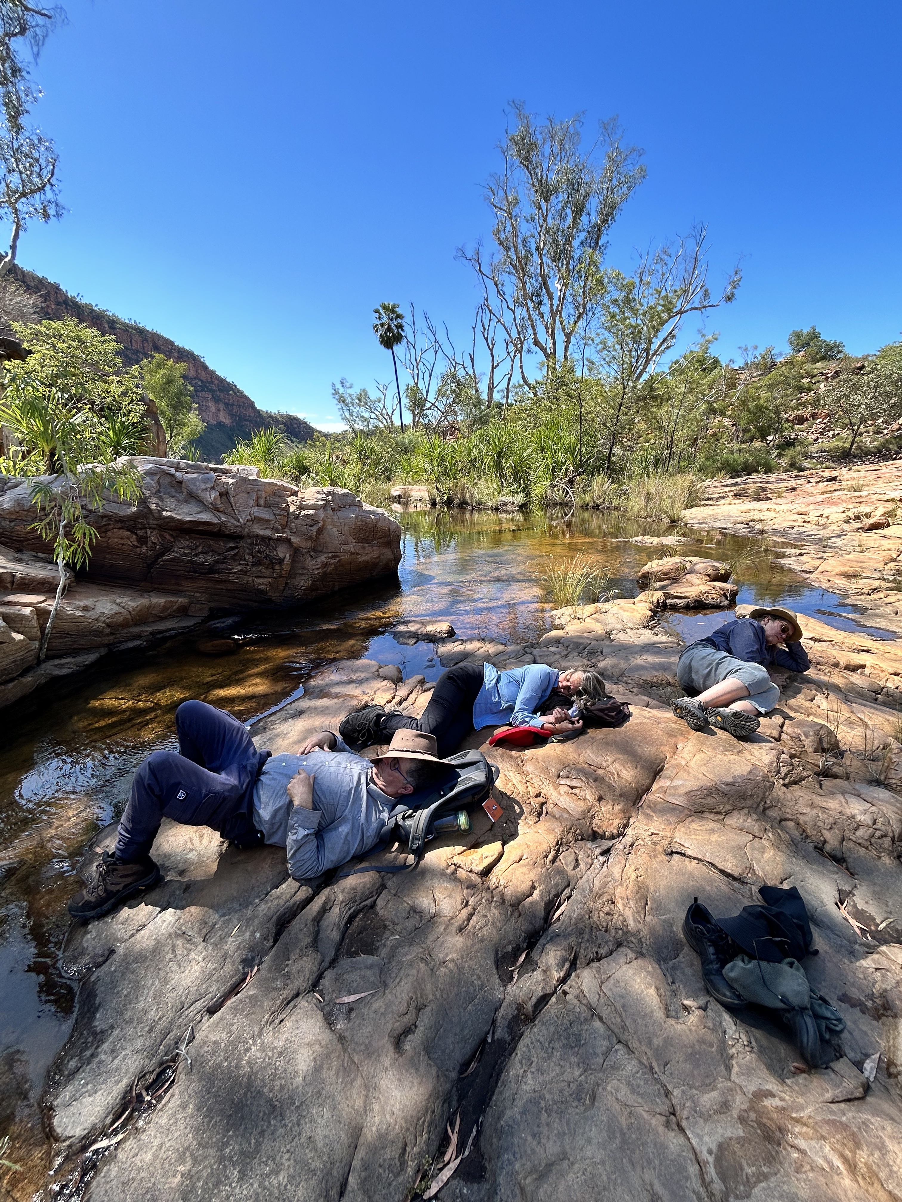
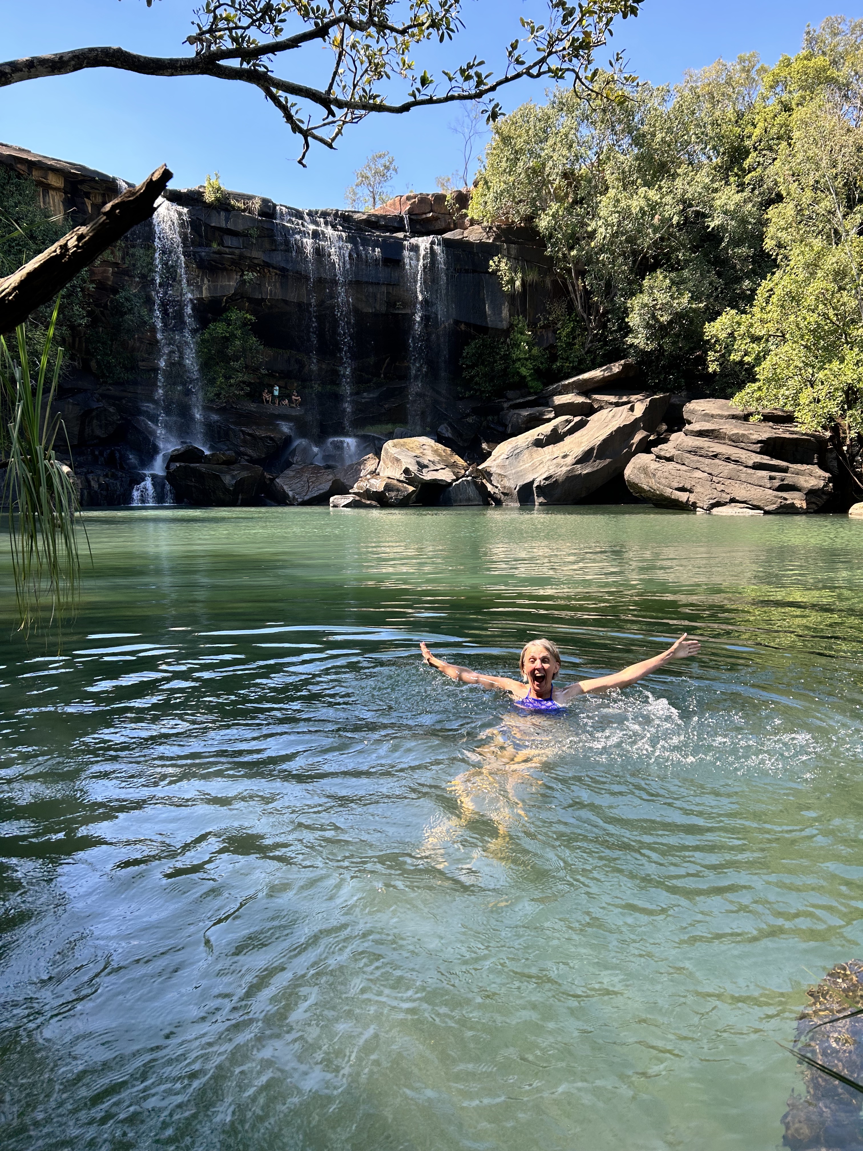
It was a great walk with a stopover at Little Mertens Falls where there are some indigenous rock paintings behind the falls. We had a swim first in the pools at the top of the falls and later in the water hole at the base.
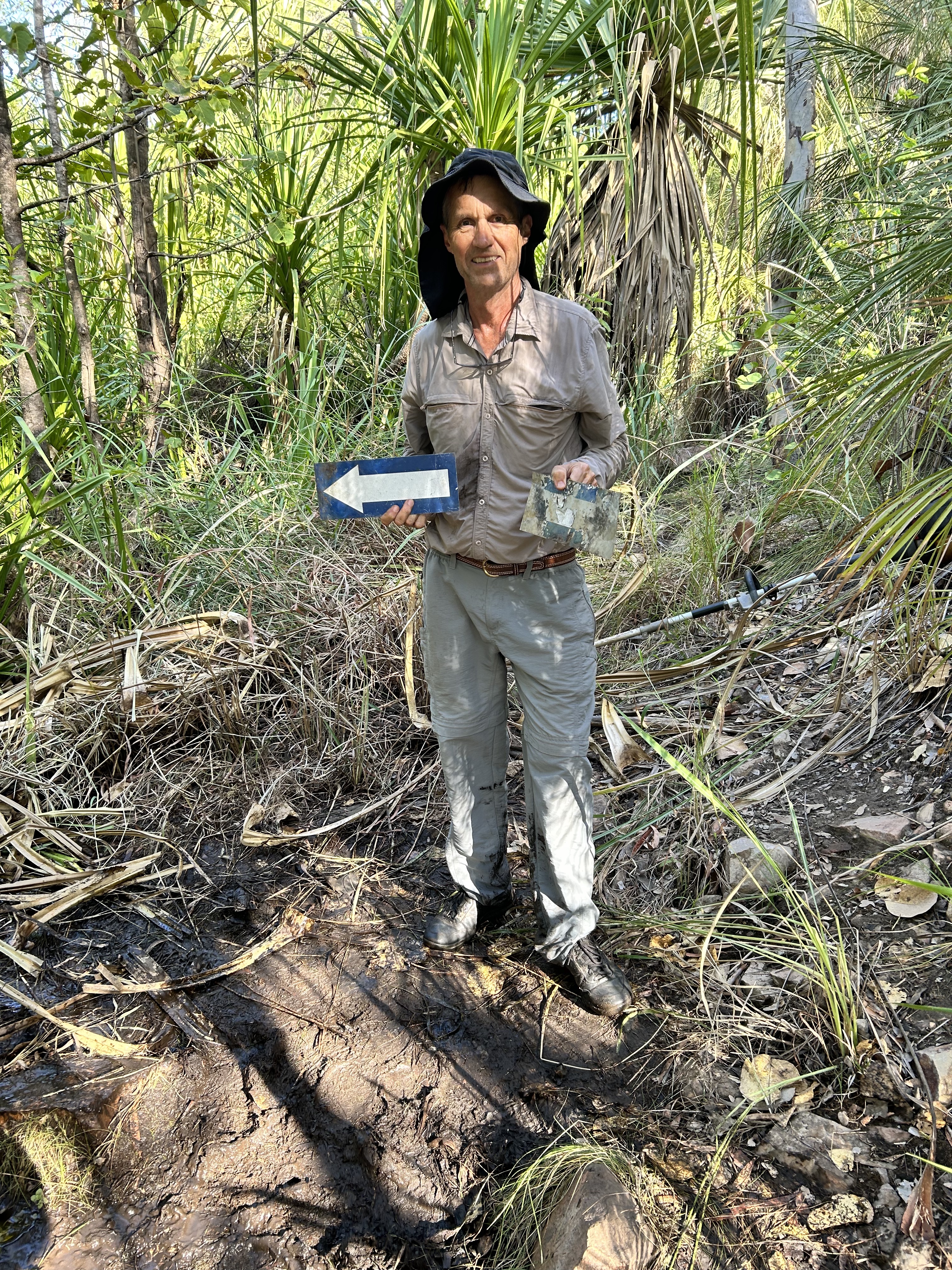
We passed Mertens Gorge before reaching the Mitchell River where we waded knee deep across the river just upstream of the falls. We learnt the socks trick. Take off your boots but keep your socks on. Less chance of slipping.
Our picnic spot overlooking the falls completed the walk.
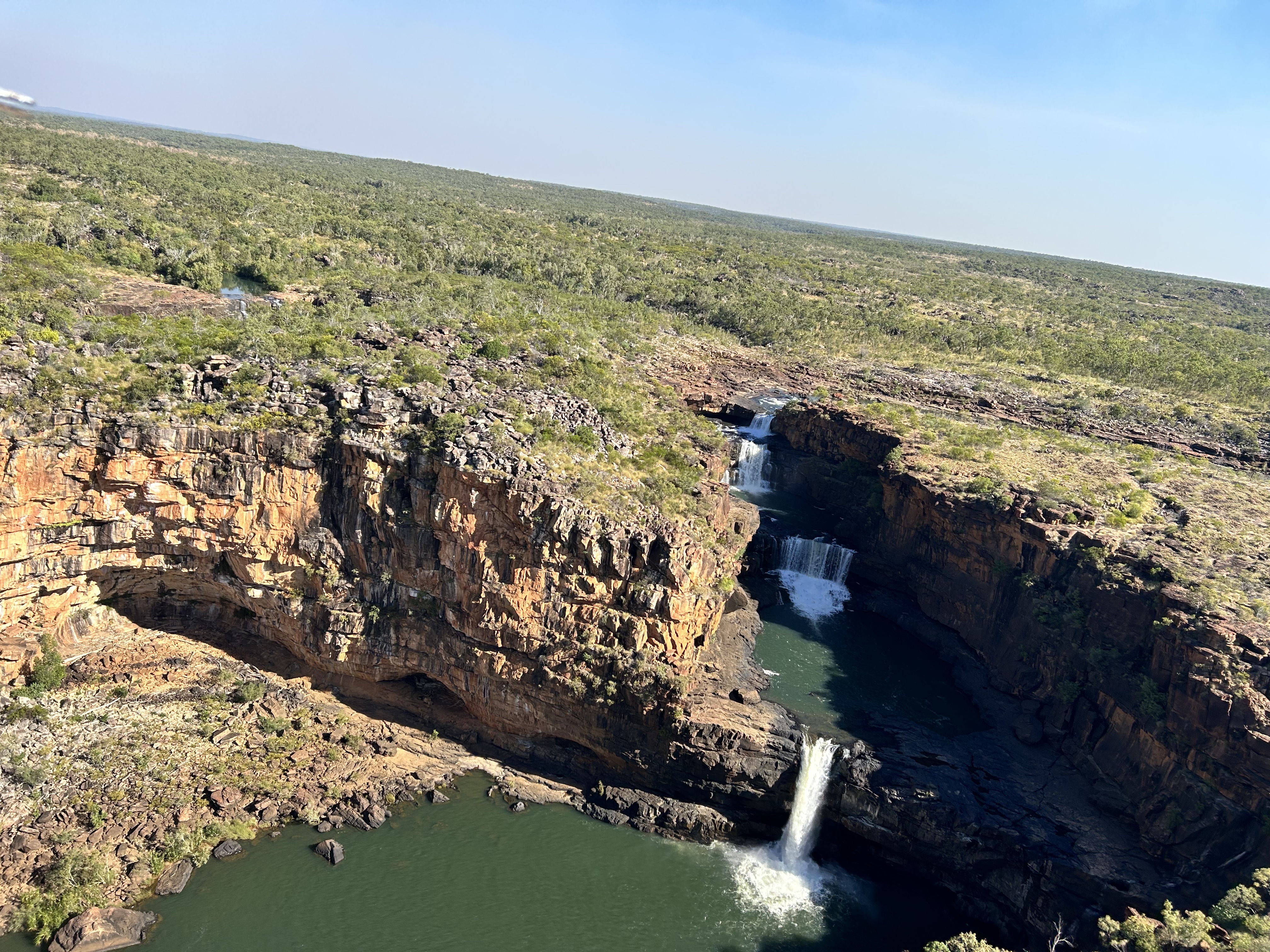
Then at 2pm the Helispirit chopper picked us up for a couple of low level laps over the falls and a birds eye view of our hiking route on the way back to the airstrip. After taking off in MSF we did another couple of passes over the falls before heading back to Drysdale River.
Dinner in the beer garden was followed by chats around the camp fire. What a day.
So ended the first week of our flying safari around the Kimberley. But the best was yet to come!
The story continues under “Destinations – Kimberley Flying Safari Week 2”
Chinchilla – Barcaldine – Shandonvale Station – Winton – Mt Isa – Barkly Wayside Inn – Dunmarra – Kununurra – Elquestro
It was 10th May 2023. The next day we were setting off on our Kimberley trip. 4600nm in 21 days. 4 years in the planning. Two aborted attempts due to Covid restrictions. Finally it looked like we were on our way. Blue skies were on the forecast.
David and Rita had arrived after driving up from Stawell in their 4WD camper. That would stay in Mike’s hangar along with the Boxster while MSF was out and about. David and Rita accompanied me to Redcliffe to check out the hangar and so that I could prepare the aircraft. Our maximum fuel would be 220L with all our bags so I needed a way to check how much we had. At Drysdale River we’d have to fill from a drum without any calibrated flowmeter. A dipstick was required. So we made one. There and then. Using the bowser at Redcliffe to measure the amount we were adding to the tanks.
The next morning dawned clear with blue skies. Rita and Sigi drove out to Redcliffe in the Boxster while David and I took the 4WD. We pulled MSF out and parked the cars. David erected the roof top tent so that it’d air while we were away.
MSF was loaded, we climbed in and off we went, heading west, first stop Chinchilla.
The bowser at Chinchilla gave us a bit of grief at first but after a quick call to the aero club president we had it sorted and were winging our way to Barcaldine, via the Carnarvon Gorge. It was a bit cloudy and turbulent over the gorge area but we soon arrived in Barcaldine for refuelling and our first lunch stop. There was a QantasLink Dash8 on the apron so a few locals were around dropping people off or picking them up. Two of them offered us a lift into town and one even gave us a lift back one hour later.
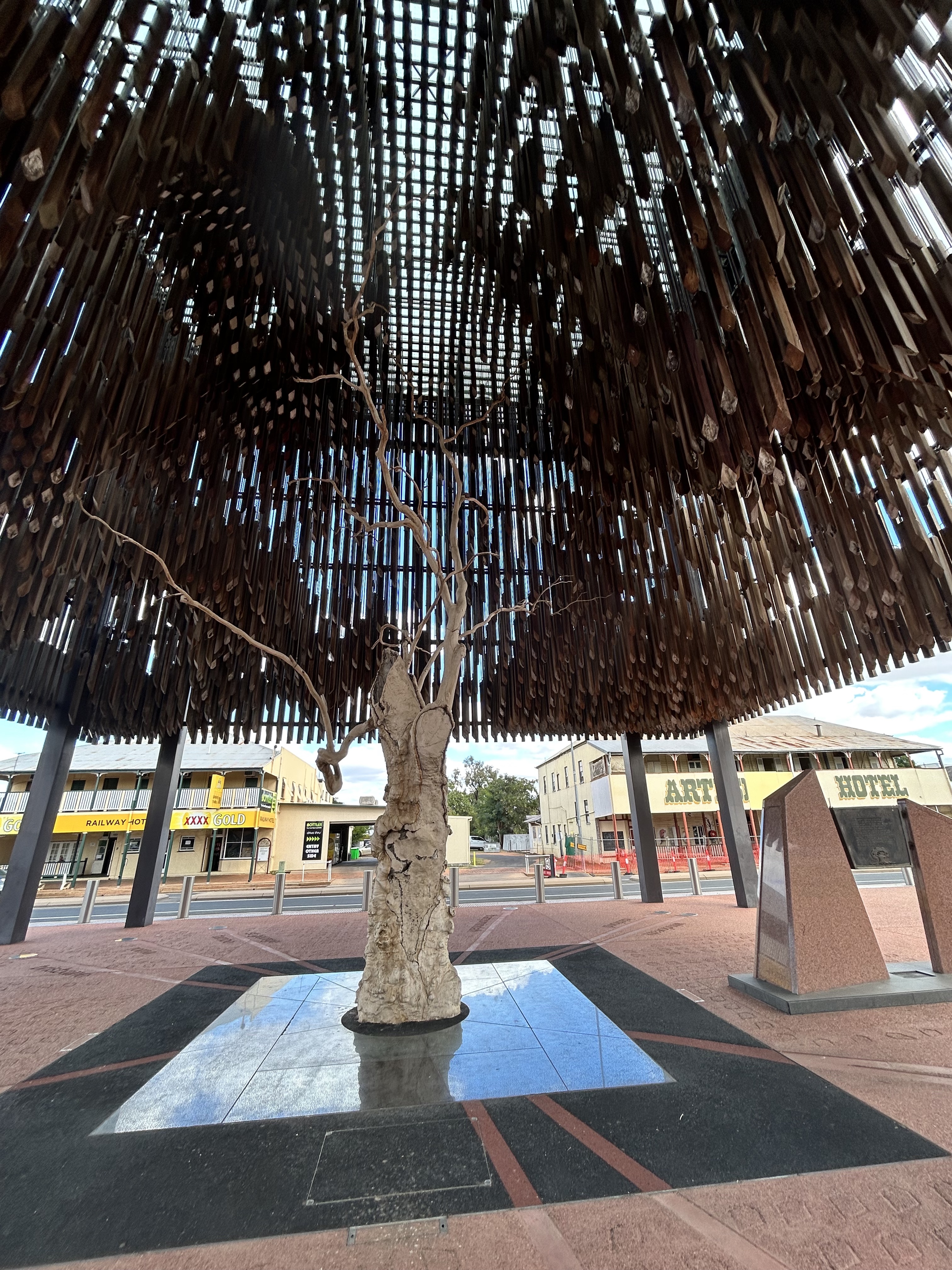
We checked out the Tree of Knowledge and then found a bakery to buy some lunch.
It turned out our friendly husband and wife drivers, Bevan and Allison Doyle, had both been pilots and were keen to know what we were up to and where we were going. Bevan drove us back out to the airport and checked out MSF as he hadn’t seen a Cirrus before.
Then we were off again. This time a 20 minute hop to our first overnight stop. Shandonvale sheep station. It would be Sigi and my second stay here after we visited with Anne and Harpur in 2021. David and Rita were in for a nice surprise however.
The owners Deon and Lane were away in Townsville so we were looked after by Deon’s parents Alan and Laurel. Deon had supplied the food for us however so we were well catered for. Alan was waiting for us at the airstrip with the 4WD vehicle we could use during our stay to get around. Driving over to reception we enjoyed a cool beer then headed over to the Shearers Quarters where we would be staying.
We had to unpack but first things first. The sun was going down already so it was off to Aramac Creek to check out the jetty and go for a champagne laced dip in the spa water tank at sunset.
After a good night’s sleep in the luxurious shearer’s quarters we were ready for breakfast of camel sausages and home cured bacon from Deon and Lane’s own production.
Alan had asked us to be over at the homestead by 9am so we could start our day exploring and relaxing at Shandonvale. He took us on a 2 hour tour of the property after which we were free to explore further on our own.
The day ended with a roast pork dinner supplied by Deon and masterfully slow cooked by Rita and a few yarns around the fire pit.
After another good night’s sleep it was time to continue on our journey. We were going to the Kimberley after all. We headed off for Barkly Wayside Inn via fuel stops at Winton and Mt Isa. On the way to Winton we passed over Muttaburra, home to the Muttaburrasaurus.
They have a great little terminal building at Winton, the town of many firsts.
But we couldn’t stop there this time. We were off to Mt Isa where the terminal was exactly that – terminal. Shuttered and devoid of life. Not even a toilet open. Luckily the BP guy kindly let us use their toilet. Hopeless that Glencore can’t even organise a dunny for the passing traveller. Am I surprised? Not really.
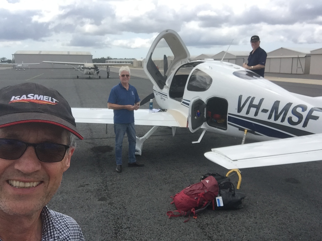
We met up with Luc and Louise at Barkly Wayside Inn. They’d had a couple of days at Roma and Winton on the way while we’d been slumming it at Shandonvale. Meanwhile Barkly Wayside Inn was undergoing a major refurbishment so the aircraft parking area was doubling as a laydown area for the builders. It was a great gravel strip but the taxiway was blocked by a grader at first, then a cement mixer. Finally after the cement mixer was towed away we taxied to the bowser that was surrounded by numerous trip hazards.
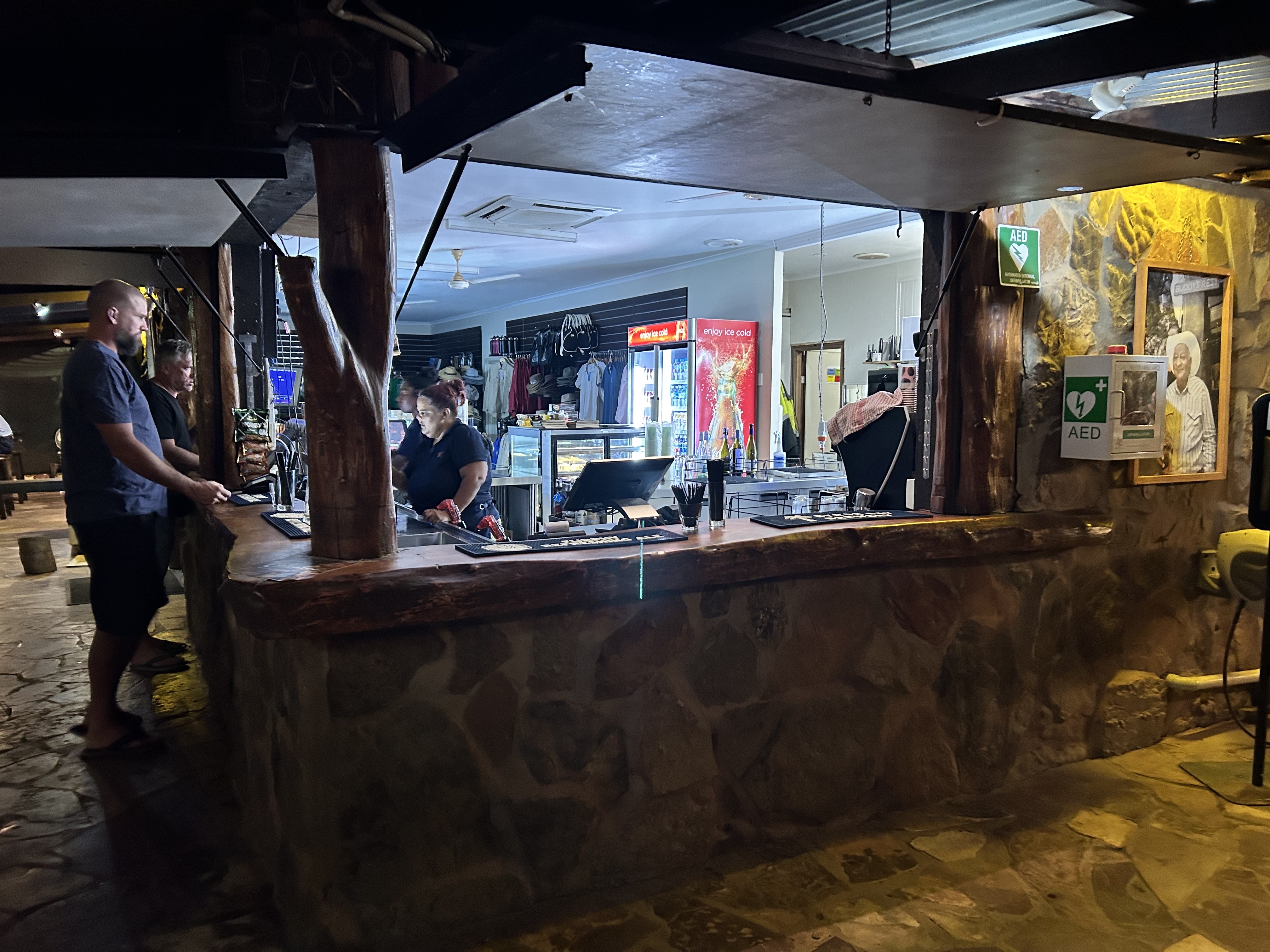
The pool was very refreshing and the rooms were great and the new pub looked like it would be great too when it’s complete. They told us that it should be working by the time we returned in 3 weeks. Meanwhile though they were working out of a container as takeaway only.
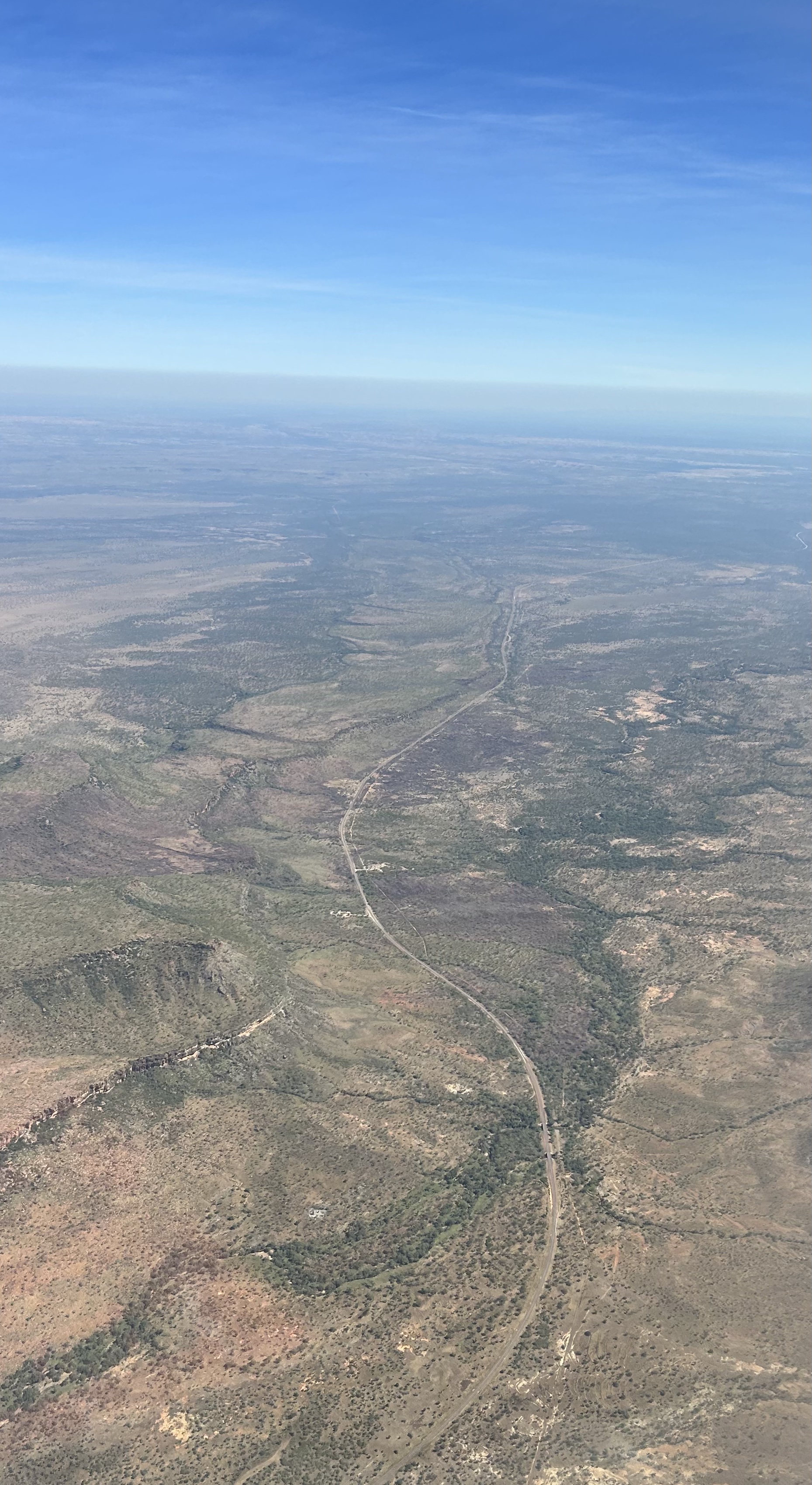
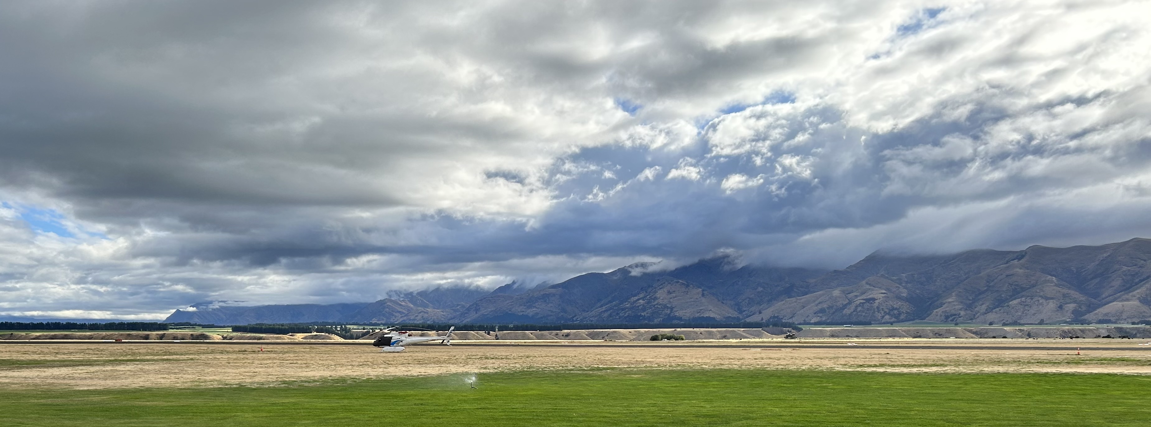
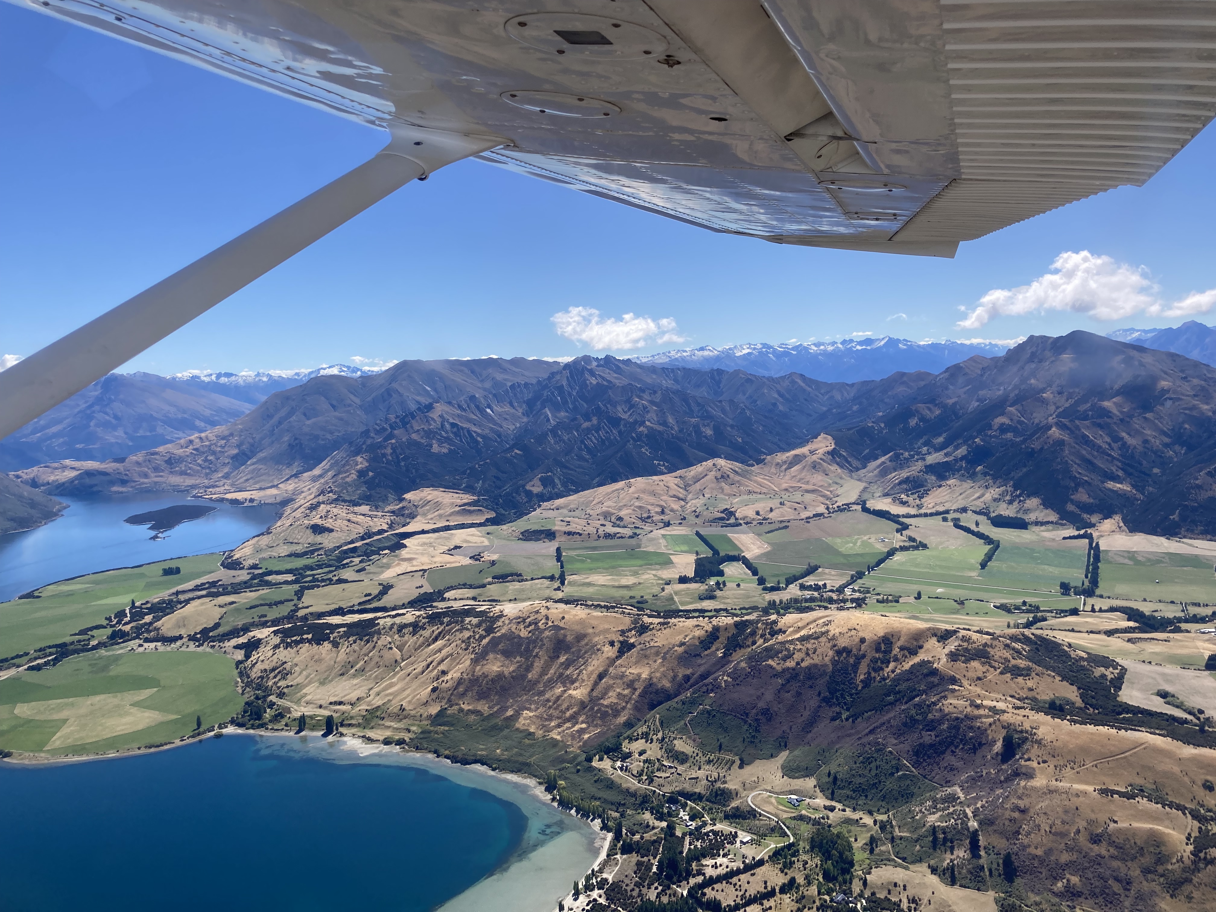
The next day we flew from Barkly Wayside Inn to ElQuestro via Dunmarra and Kununurra. Heading northwest from Barkly we flew over Rockhampton Downs Station. There was so much water lying around from the recent rains and the country was much greener than expected.
Dunmarra was interesting. They weren’t sure whether the bowser would work so we first did an overfly of Hayfield to check out their strip. They were our Plan B for refuelling. Great strip. Five miles away we landed at Dunmarra where the strip was a bit overgrown but still ok.
Gary Frost the owner needed about half an hour to get the bowser working but finally with the help of two mates plus David he succeeded. Then shouted us a coffee. He is setting up a microbrewery that should be amazing.
Flying on to Kununurra we passed over Victoria River area with some really spectacular country with gorges and escarpments and rivers. And we met up with the Victoria Highway that connects Darwin with Kununurra.
At Kununurra we refuelled again then hopped over to ElQuestro where we were to stay for four nights. Finally after three years we had made it to the Kimberley.
The story continues under “Destinations – Kimberley Flying Safari Week 1”
In March 2023 Sigi and I flew to the South Island of New Zealand for a holiday. The original idea was just to join a group of friends on a cycle trip along the Central Otago Rail Trail but it gave me the perfect opportunity to tick off a bucket list item.
As a private pilot I’m always on the lookout for challenges that both improve my flying skills and are fun. Some years ago, Dan Pearson, a member of the Redcliffe Aero Club, did a one-day mountain flying course at a flying school called “Learn to Fly NZ” in Wanaka, about one hour from Queenstown. Dan contributed an account of his experience for a 2017 edition of AirChat and I thought at the time that’d be a great thing to do one day. I’d visited the South Island numerous times for work during the 1980s and 90s and had good memories of the area and thought how cool it would be to fly there and see it all from the air. So, after being invited on the cycling holiday in Otago, I referred to Dan’s story in the old edition of AirChat and contacted https://www.learntoflynz.com/. I booked myself in for a three-day mountain flying course. We had plenty of time and it seemed that three days would give me enough time to learn the basic skills for flying in the mountains and visit a few spectacular spots while not costing the earth. Little did I know that it would exceed all my expectations.
Karl Hillary, my contact at LTFNZ, emailed me a link to some documents I should download and read before heading to NZ. They included useful information about mountain flying techniques, and the Queenstown and Milford Sound airspace. https://www.aviation.govt.nz/safety/education/good-aviation-practice-booklets/
We landed in Queenstown on 1st March. We knew we’d arrived because the Virgin pilot provided us with a rather “firm” landing, as they say, and I said to Sigi “I hope I don’t do any like that while I’m on the course.” Picking up our hire car we headed straight over the Crown Range to Wanaka, where we’d booked a motel for four nights. As we climbed up the Crown Range we had a view back down the valley and straight down the runway at Queenstown Airport and of the town nestled on the banks of Lake Wakatipu
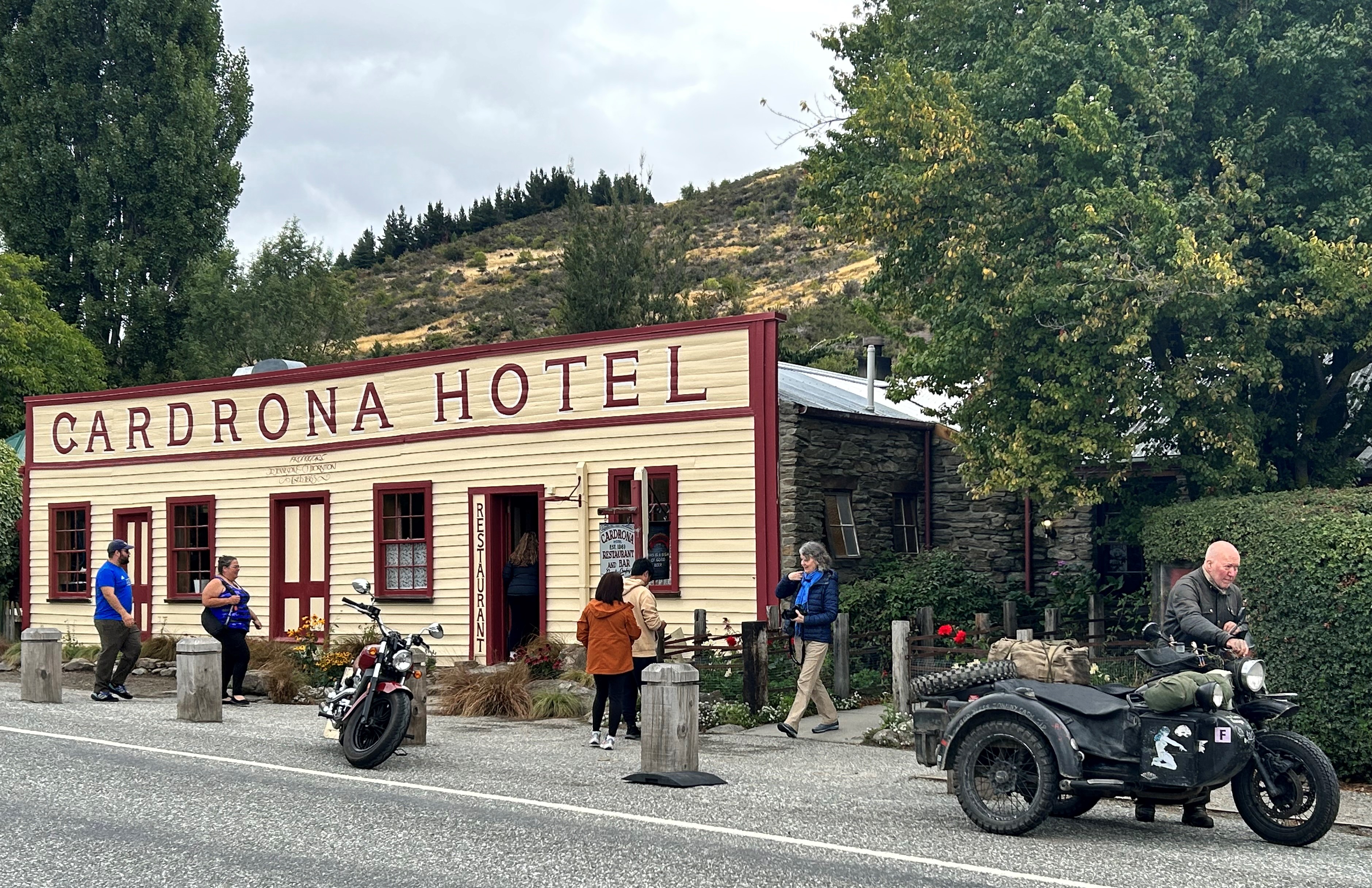
Even though we’d landed around 5pm, it was light until about 9pm, so we had a great drive over the mountains and down the Cardrona Valley past the famous old Cardrona Hotel. I’d travelled this way on a motorbike in 1981 when it was still a corrugated gravel road but now, 40 years later, the road is sealed and is a much more pleasant drive.
The next morning Day 1 of the course had arrived. We woke to a wonderful sunrise lighting up the hills on the opposite side of Lake Wanaka.
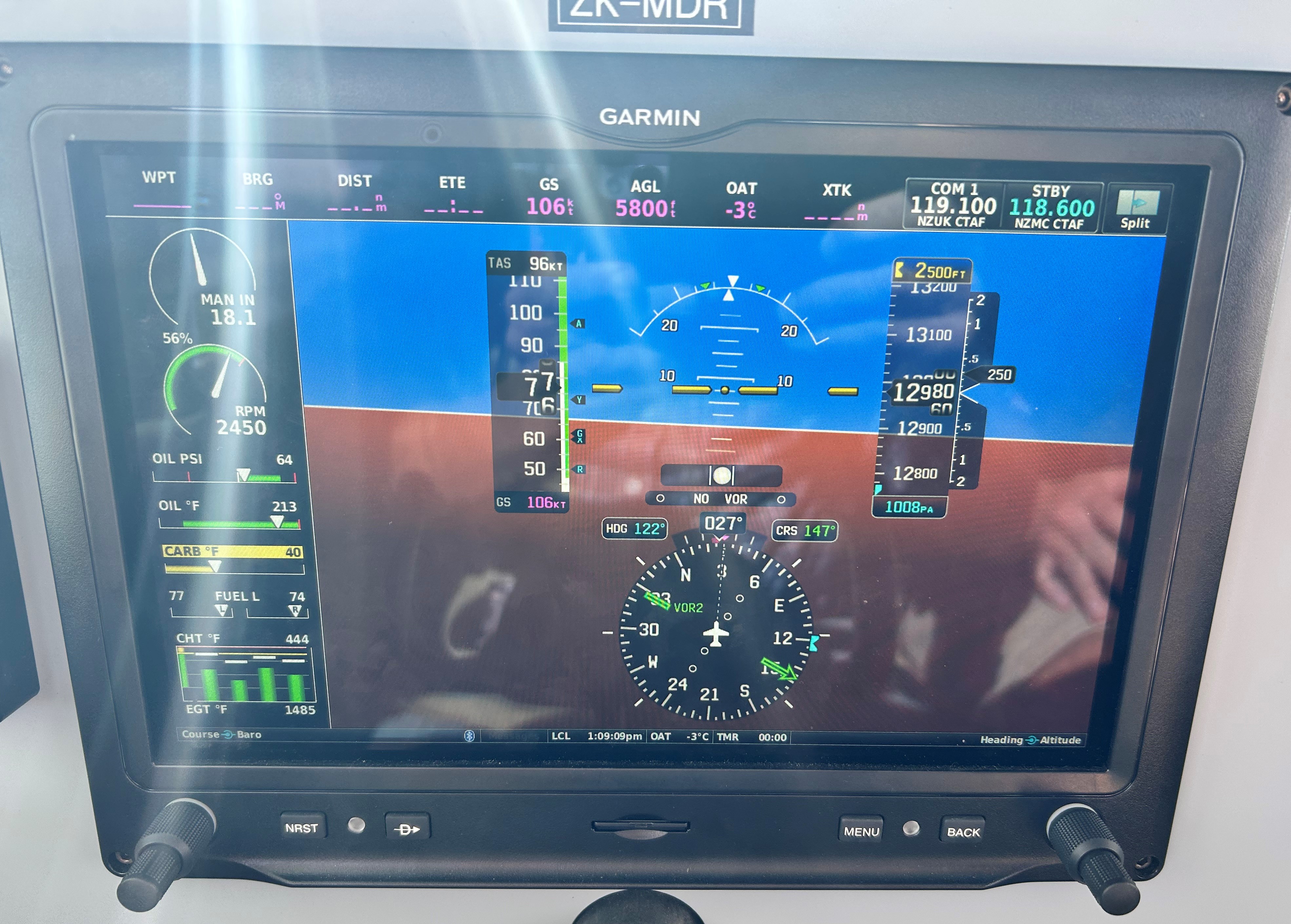
I left Sigi to explore Wanaka while I drove the 10 minutes out to the airport and met up with instructor Karl at 8:30. Karl was a local who’d been working for the company for only 12 months but appeared to know a bit about mountain flying as he took me through an interactive PowerPoint presentation. He explained basics like never fly up the middle of a valley, keep to one side (preferably the right but it depends on the winds) so you have as much room as possible if you want to turn around. Fly on the side with the updrafts to give you additional lift and watch out for turbulence and rotors on the lee side when you fly over a ridge or pass. Approach a ridge at 45 degrees so you can turn and fly away from it if you decide you might not make it over. And so on. There was about an hour of classroom instruction before we headed out to the aircraft, a Cessna 172N ZK-MDR with a STOL modification on the leading edge of the wing and a touch screen Garmin G3X glass cockpit.
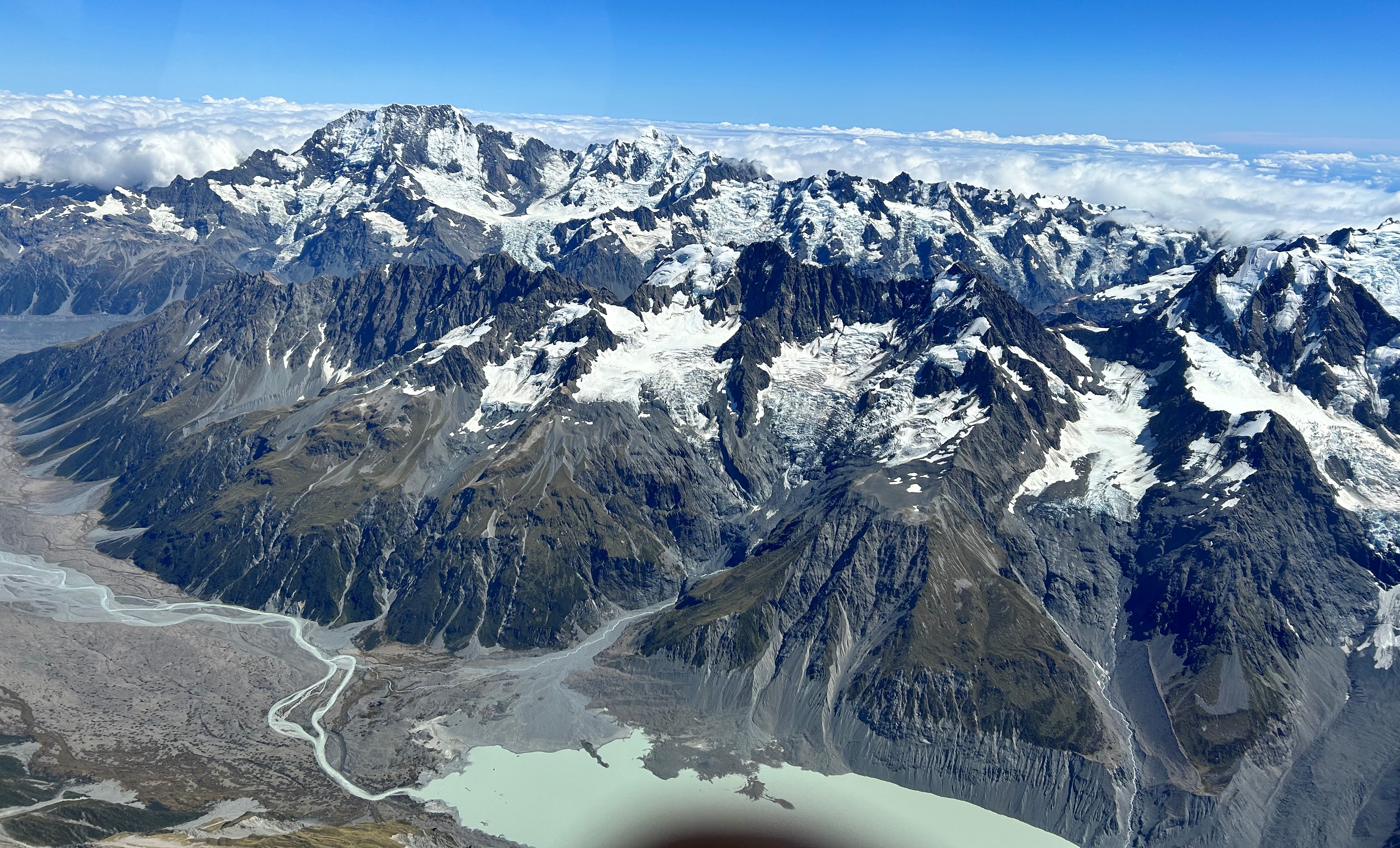
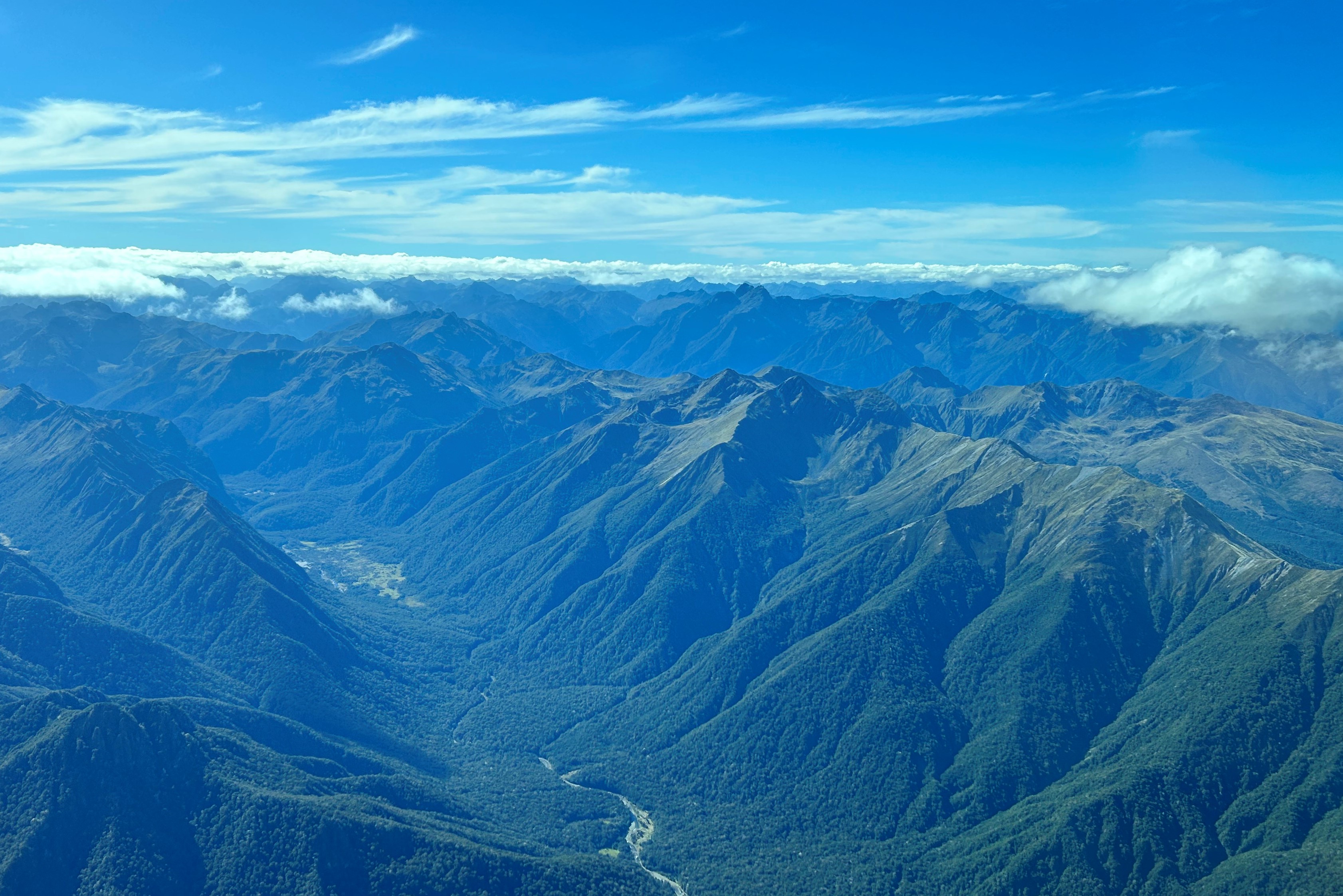
After a short taxi out to RWY29 we took off and turned to the east, where we tried some basic turns. Karl was illustrating how tightly a 172 can turn at 100 knots so I had a bit of an idea how little room we’d actually need in a narrow valley. Then it was off to said narrow valleys where I practised flying as close as possible to the right-hand wall and then turning 180s and 360s. From there we flew north over a couple of passes and Lake Pukaki to Mount Cook. It was perfect conditions. Clear blue sky and a bit of wind to create some updraughts and downdraughts.
Lake Pukaki with Mt Cook up the far end
As we approached Mt Cook, Karl told me we could legally fly above 10,000ft and up to 13,000ft without supplementary oxygen for up to 30 minutes and asked whether I’d be fine with that. It would allow us to fly higher than the peak of Mt Cook (12,218ft). Of course I said yes and soon we were climbing, climbing, climbing up over the Mt Cook airstrip and past the Heritage resort to get a magnificent view of the mountain and its glaciers.
Mount Cook peak is on the left
It was spectacular. We managed to get up to just under 13000ft before it was time to turn and descend via a neighboring valley to our somewhat late lunch stop at Glentanner at the northern end of Lake Pukaki.
Taxiing up the paddock we parked outside the visitor centre and cafe. We had a great coffee and munched on our sandwiches while enjoying the spectacular view of Mt Cook in the distance.
Parked at Glentanner with Mt Cook on the horizon
It was a pleasant flight back from Glenntanner, following a variety of valleys and crossing a number of passes, approaching Wanaka from the north over Lake Hawea. End of Day 1. A great day, surpassing all my expectations.
Day 2 Karl was off on leave, so I had another instructor, Austin. Austin Jones had been flying out of Wanaka for about eight years. Karl had told me that Austin knows every valley and mountain pass intimately so would be my best guide for the following two days. I met Austin at 8:30 after first stopping at the neighbouring Warbirds and Wheels Cafe for a decaf flat white. It’s a somewhat retro inspired place with furniture dating back to the 1960s.
Austin outlined the plan for the day. There was a bit more cloud than on Day 1 which would be good for learning how to judge which valleys to fly down and which passes we could (or couldn’t) make it over. We’d fly west, over the famous Skippers Canyon and the northern end of Lake Wakatipu, and head south over Lake Te Anau to Manapouri. After a lunch stop we could fly over to the west coast and up the coast to Haast and then try to fly back inland over the Haast Pass. Great plan.
Austin also introduced me to gopreflight.co.nz, the local flight planning tool. It allowed me to check the area weather, TAFs etc. https://gopreflight.co.nz/
I also logged into aip.net.nz, where you can find the NZ version of ERSA, aerodrome diagrams, instrument approaches and departures and other operational data. https://www.aip.net.nz/
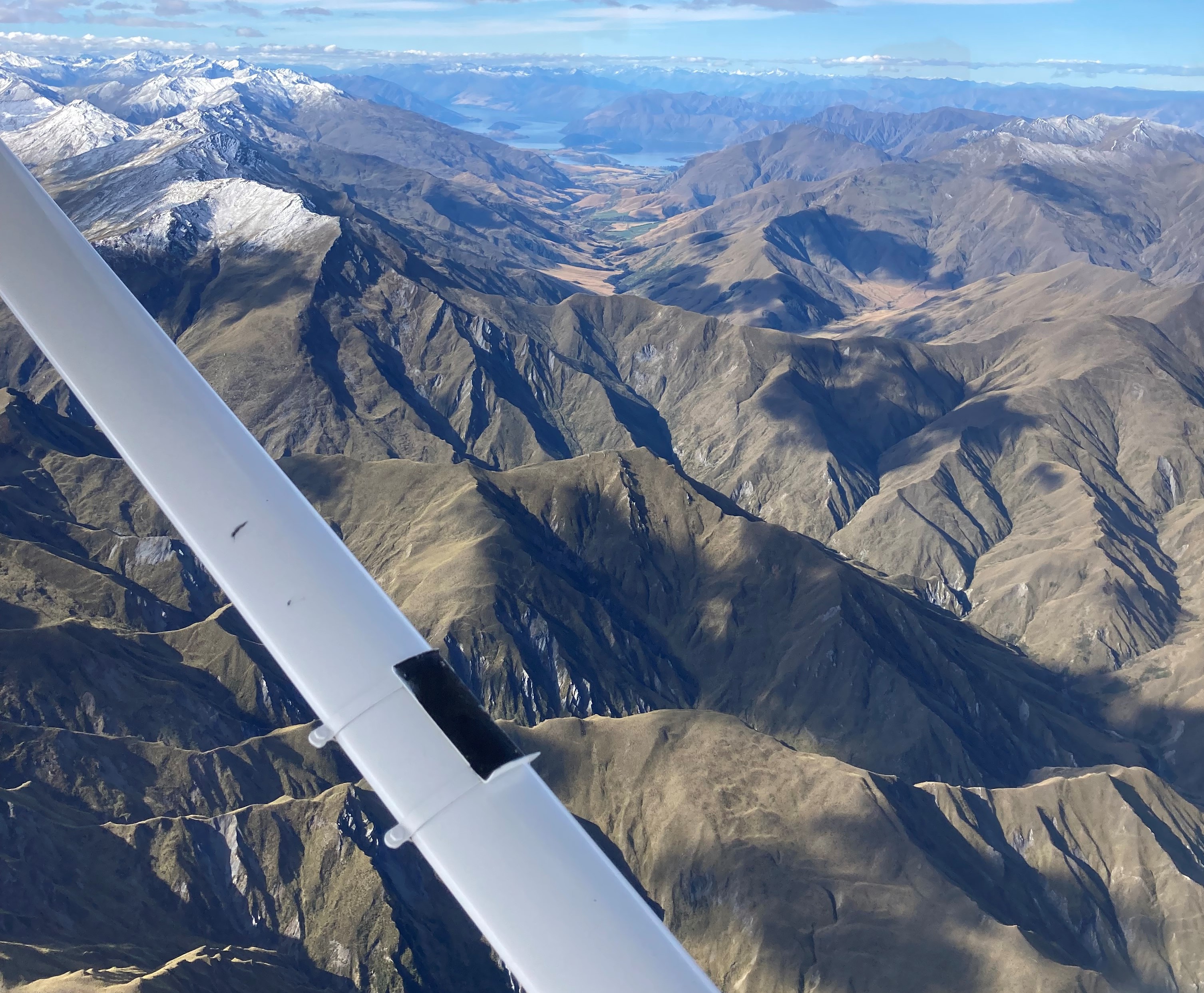
Taking off over Lake Wanaka we had spectacular views of the town and the surrounding mountains and were soon at about 5000ft over Skippers Canyon and the Shotover River with a clear view of the southern arm of Lake Wakatipu in the background. The Skippers Canyon road, off limits to hire cars, is notorious for its sheer drops to the river below as you can see in the photo. It was originally built to allow access to gold mining areas in the canyon.
Skippers Canyon with road – Lake Wakatipu in the background
From there we dodged some cloud and avoided another light aircraft that was climbing through the valley below us and were soon passing over Glenorchy at the northern end of Lake Wakatipu.
North arm of Lake Wakatipu
Avoiding the controlled airspace around Queenstown we flew via various valleys and passes to Lake Te Anau and Lake Manapouri where we landed for lunch. The clouds were gathering by now so it appeared the afternoon flying and navigation could be more interesting.
Taking off to the north, we flew to the northern end of Lake Te Anau and then followed the Hollyford Valley to the coast.
It was one magnificent view after the other even with the increase in cloud cover. It was in fact becoming gradually more difficult to avoid the clouds but Austin was confident that we’d find our way so on we went and popped out on the west coast at Martins Bay, home to a rather exclusive fly-in resort for people who want peace and quiet and maybe a bit of fishing.
Flying north along the coast Austin pointed out Big Bay and the inlets that pepper the coastline and in about 20 minutes we were over Haast, a small settlement on the coast. It is at the base of the road over the Haast Pass, the only land-based route from Central Otago to the west coast. The clouds were BKN at about 2000ft by now, so we cautiously flew inland, up the valley, following the road, searching for a gap in the clouds. Finally Austin decided it was a lost cause and announced we’d fly back along the coast and find another valley to head inland. Retracing our steps, we made it to the Hollyford Valley and climbed between the clouds and finally made it over a pass. On the eastern side the sky cleared. We were back in SCT to FEW descending back over Lake Wanaka. The end of another perfect day.
The weather on the following day, Saturday, was not so good. There was a strong westerly wind blowing when I arrived at the airport. This would mean turbulence. We wanted to fly into Milford Sound and Austin said that’d be impossible with so much wind, so he suggested we delay our flight for two days until Monday, when the weather was forecast to be ideal. That was fine with us. We found numerous other activities to keep us busy over the weekend.
When Monday dawned, the clear blue sky beckoned as Sigi and I drove to the airport. Austin was ready and waiting. He told us the plan was to fly via a number of valleys and passes to the coast and then south to Milford Sound. We’d land there for lunch and then consider where to from there.
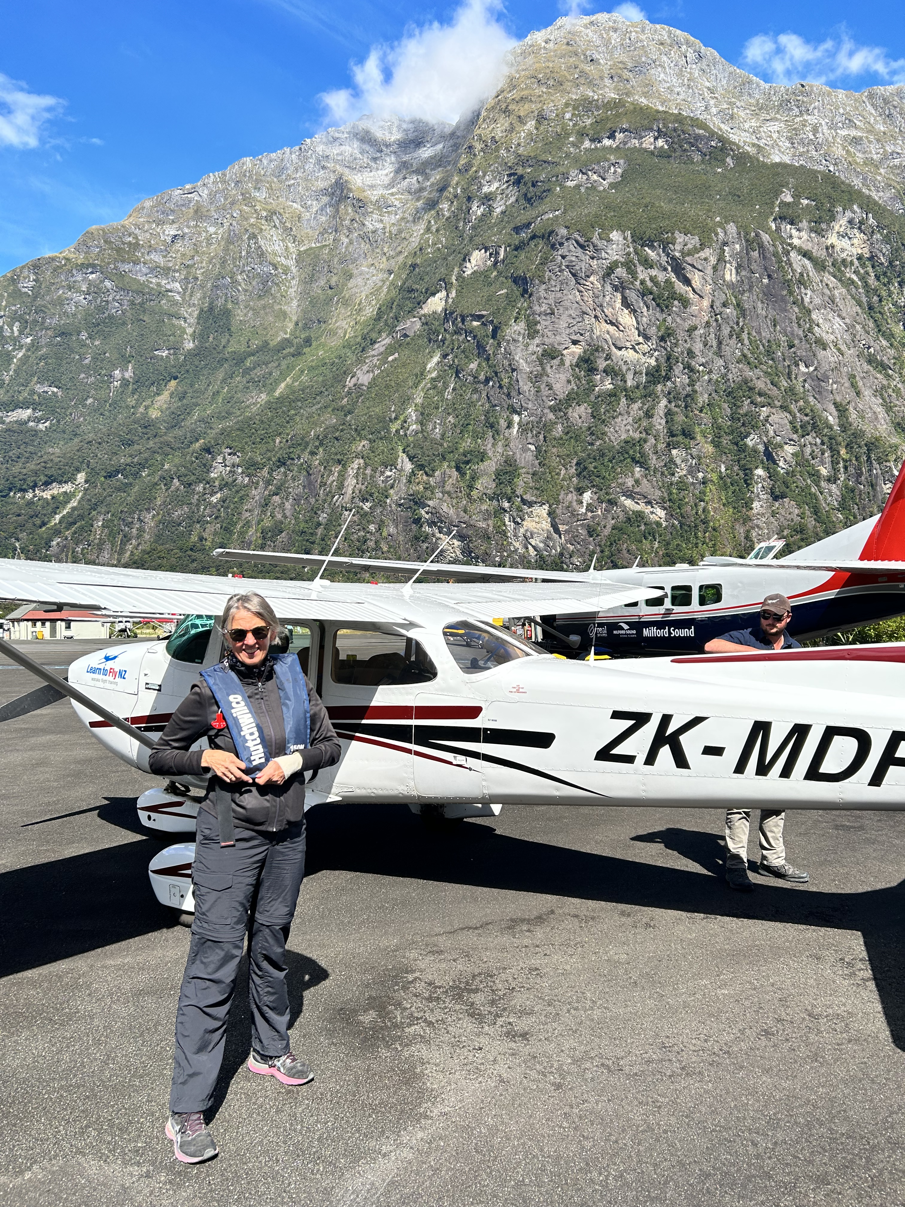
Sigi asked whether she could fly with us this time, as she was keen to see Milford Sound. Austin was fine with that so soon all three of us were climbing out over Wanaka once again and heading to the west coast, this time wearing Hutchwilco life jackets. These are made in NZ and are probably the most comfortable ones I’ve worn. We needed them as we would be landing and taking off over the water at Milford.
We had amazing views of Mt Aspiring and various glaciers as we headed west.
Mt Aspiring
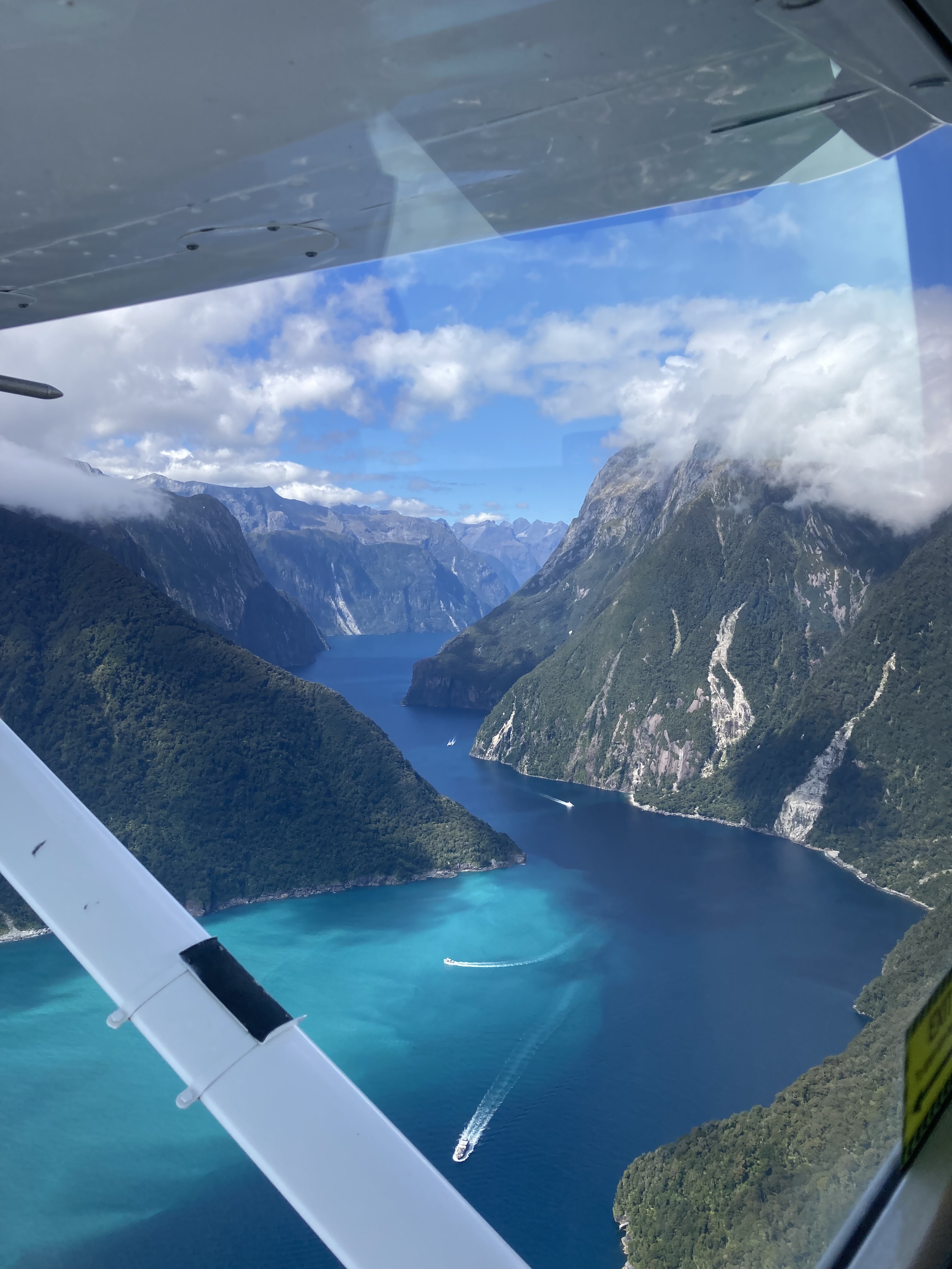
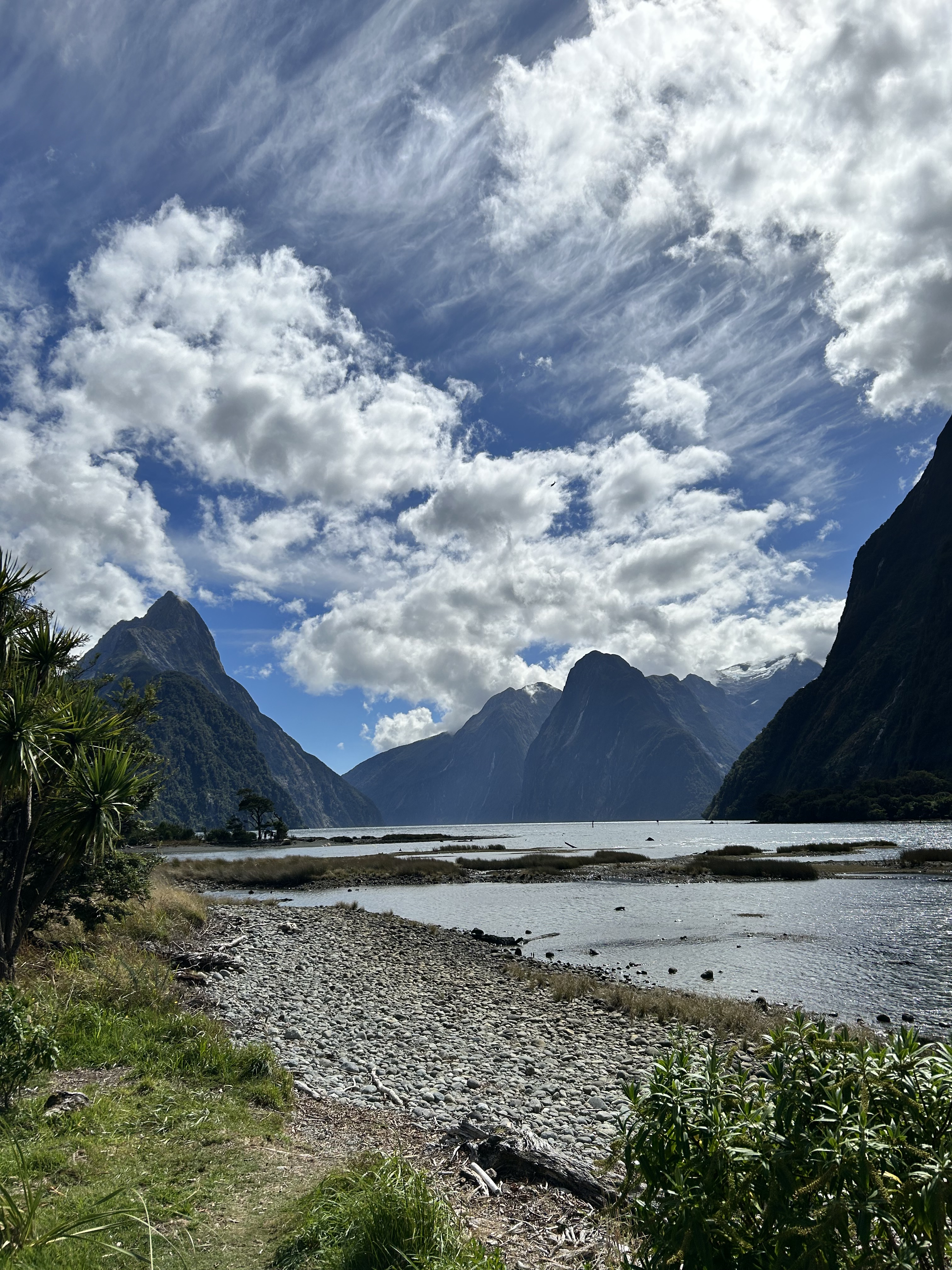
After negotiating numerous valleys and passes we reached the coast where, after flying a further ten or so miles south, we descended to 2500ft for the flight into Milford Sound. We hugged the southern side of the valley past Mitre Peak and descended to 1000ft.
Entering Milford Sound from the coast
With an easterly wind blowing up the sound from behind, we’d have to turn and land into wind from the mountain end.
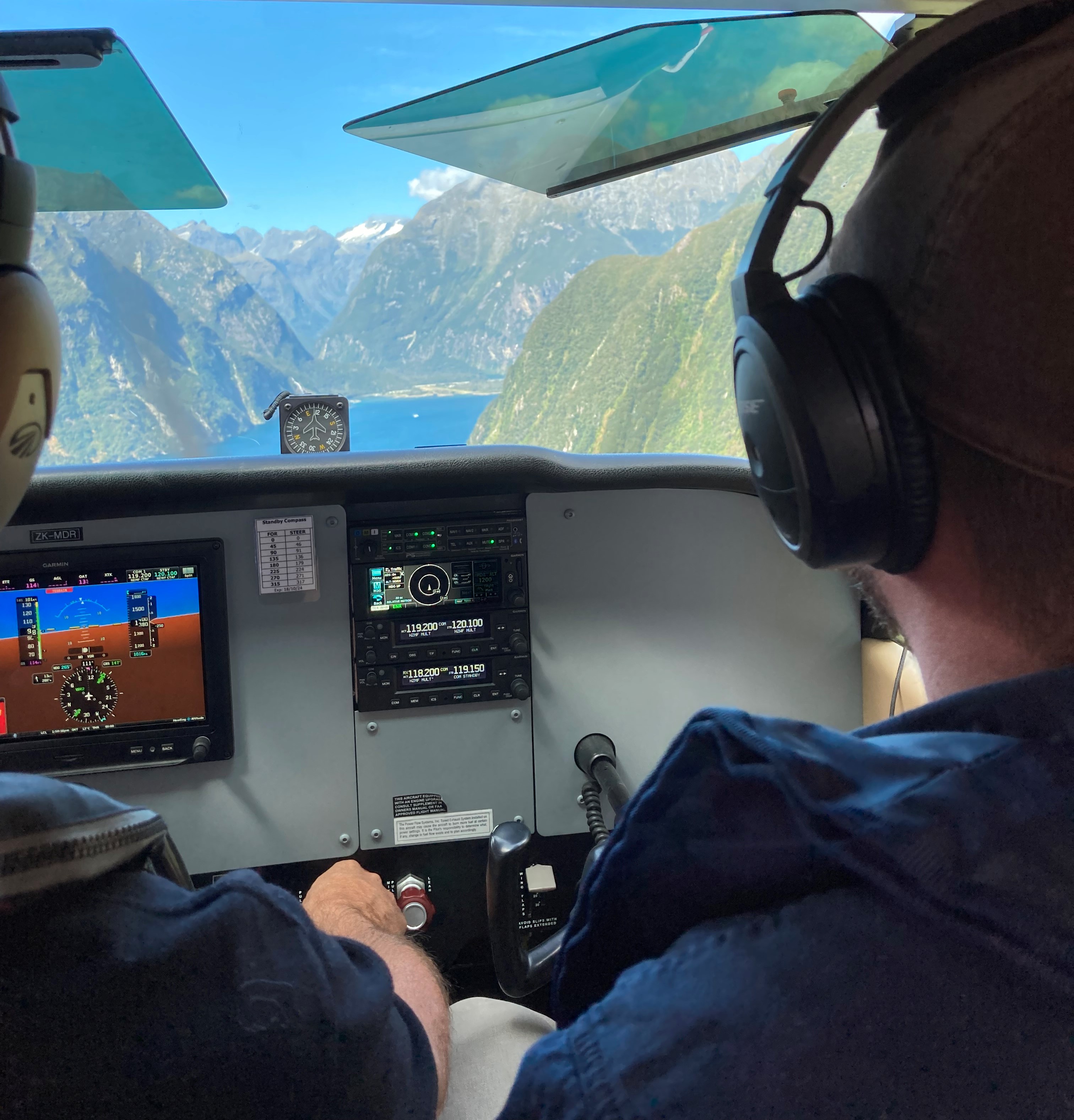
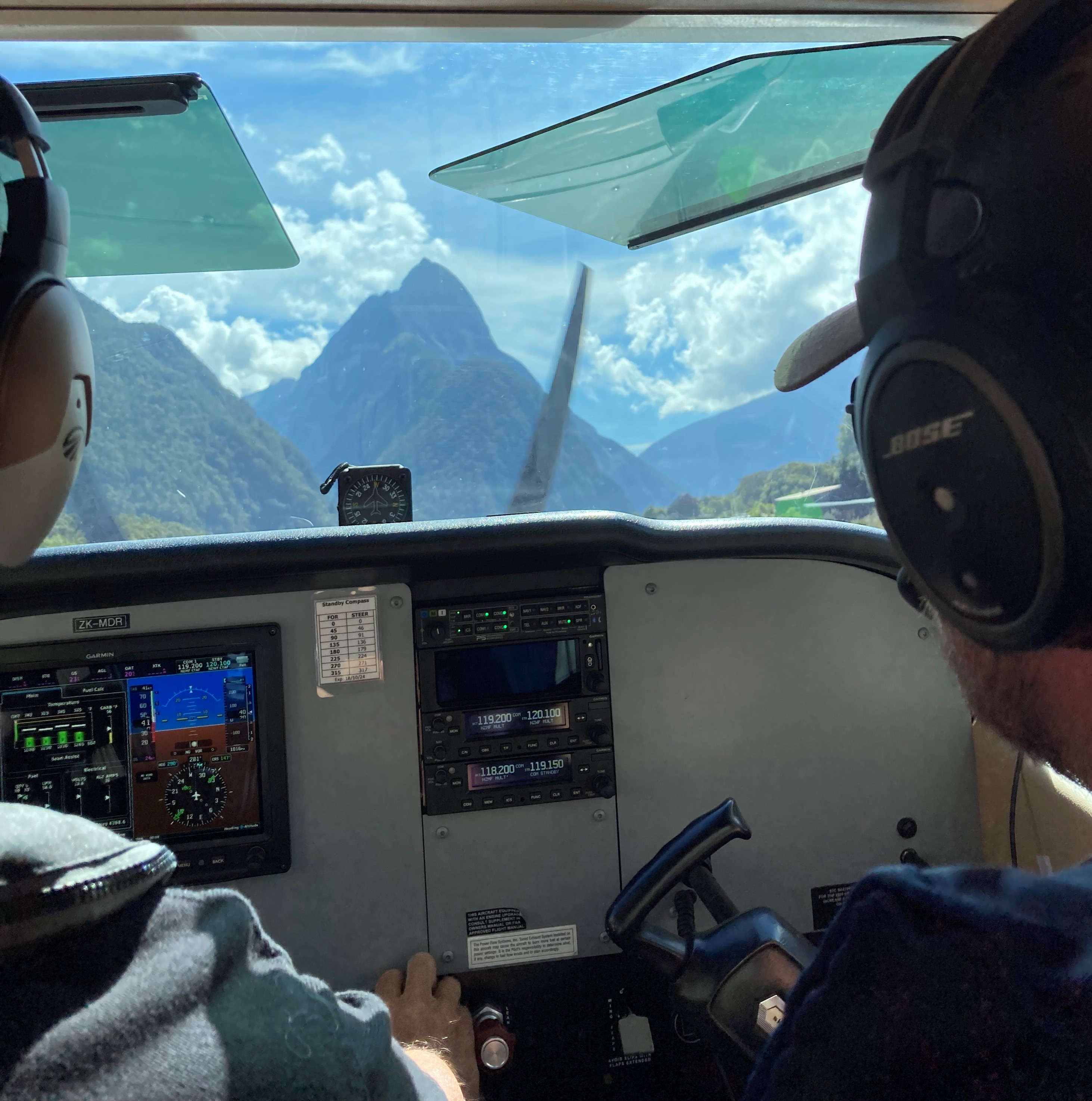
Austin described how I’d have to join downwind just to the right of the Milford strip and head directly for the mountains, then turn 180 degrees in the valley behind and align ourselves with the runway to land to the west. He coached me all the way through the approach, while Sigi did some Hail Marys in the back seat.
It was a bit gusty as we came into land, so with some slight turbulence the landing was breathtaking in more ways than one. Nevertheless, we had a soft touchdown. Much better than the Virgin landing in Queenstown. When we told Austin the story he said “Oh those Aussie pilots often have problems in Queenstown”.
It was the sort of day that pilots dream of. It’s why I learned to fly. The approach and landing was an intense experience but very satisfying.
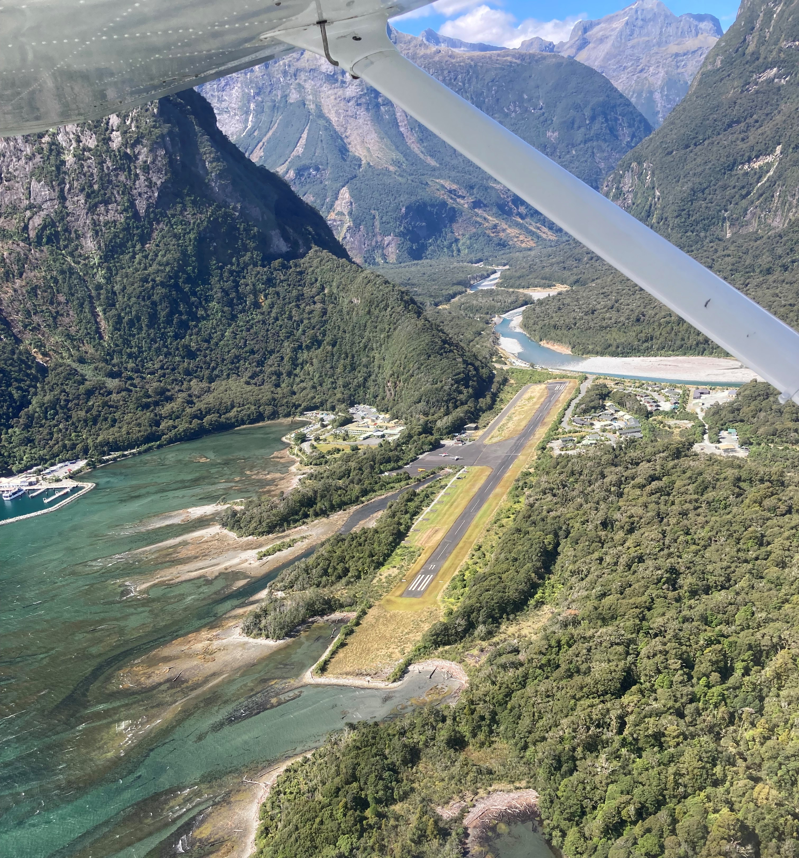
It was a 5-minute walk to the cafe where we could eat our lunch and observe all the other day trippers who had mostly come in by ground transport and felt very fortunate to have been able to fly in. A perfect day for Milford Sound, which is renowned for its not-so-perfect days.
Soon we were back at MDR, donned our life jackets and started to prepare for departure.
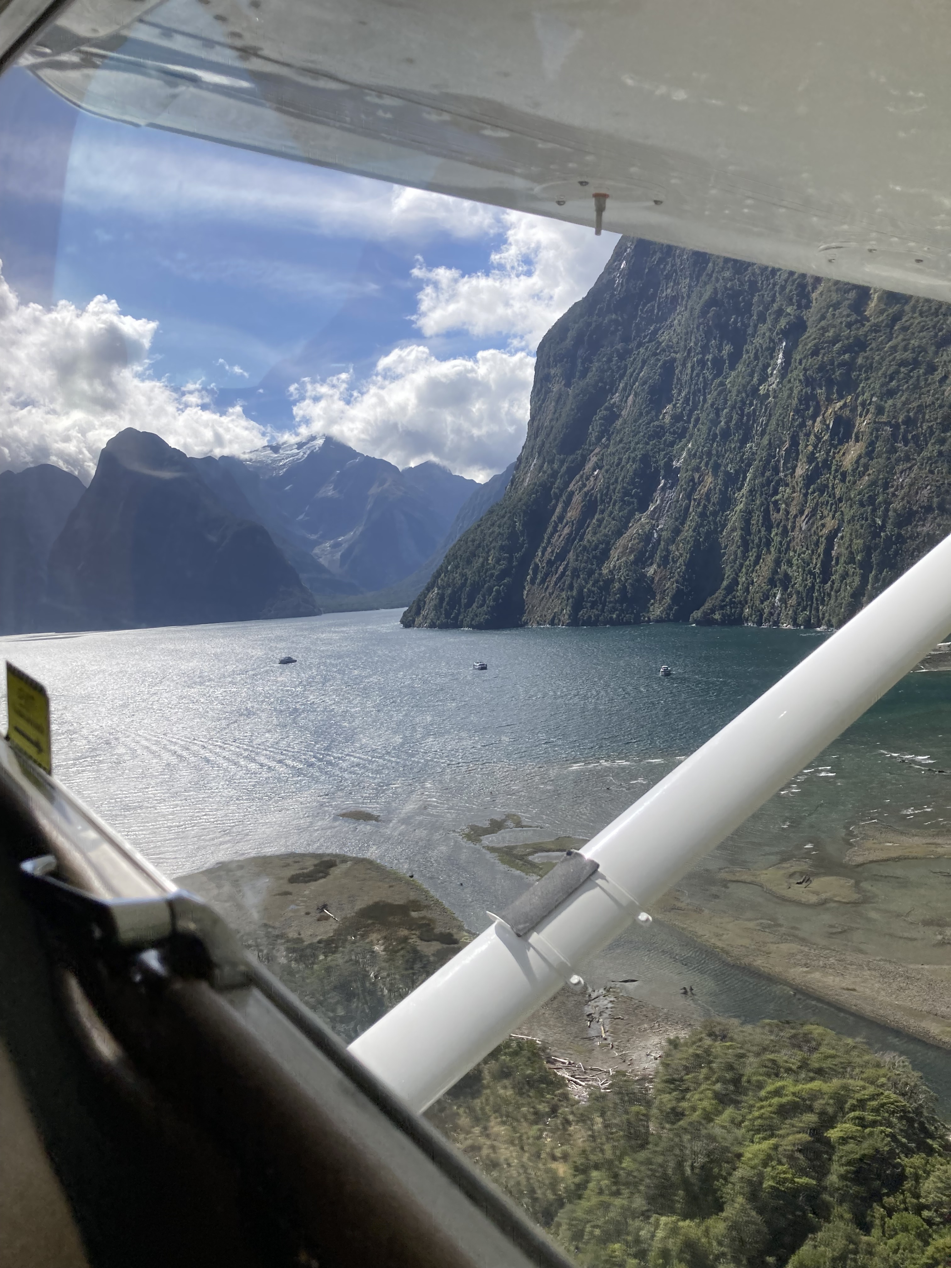
Austin told me that after takeoff I should stay close to the mountain on the right side of the sound and we would experience the most lift we’d ever known in a 172. We taxied out to RWY29 again and took off over the water.
I managed to “hug” the cliffs on the right-hand side of the sound, having now become fairly used to flying close to mountain sides, and we caught an updraft that had us climbing at 2000ft/min. Not bad for a 172.
Reaching 5000ft we banked left and passed Mitre Peak and entered the Arthur River Valley. This is the valley that the Milford Track runs through and Austin had promised something special at the top of it.
Arthur River Valley
Climbing steadily, I could soon see a waterfall that was spilling out over a ledge before us. It was the 580 metres high Sutherland Falls. Continuing to climb, we passed over the top of the falls and entered a circular crater that contains Lake Quill, a brilliant blue alpine lake.
Austin wanted to demonstrate how good the 172 is at getting out of tight corners in the mountains so he told me to aim for the left-hand cliff and wait for his command before starting to turn. When we were really close to the cliff (Sigi saying more Hail Marys in the back seat) and a couple of “wait for it”s from Austin, he said “Ok, start a gentle bank to the right”. I banked right and put in some rudder but as I tried to turn the yoke a bit further noticed I couldn’t bank any more – Austin’s knee was (purposely) blocking his yoke (and therefore also mine) from turning any further. We were doing a 30-degree bank already and he didn’t want me to bank any more. He said that was plenty and sure enough we managed to stay far enough away from those cliffs to our left as we circumnavigated the lake, passing another smaller lake that was spilling into it from above.
Smaller crater lake that spilled into Lake Quill
Completing the 360 degree turn, and having thus proven Austin’s point, we headed back over the edge of the Sutherland Falls as the ground dropped away to the valley floor 600 metres below.
Turning right, we headed over the Mackinnon Pass (3,800ft) where we could just make out one of the huts used by walkers on the Milford Track perched on the ridge. That’s a huge climb up to the ridge on either side.
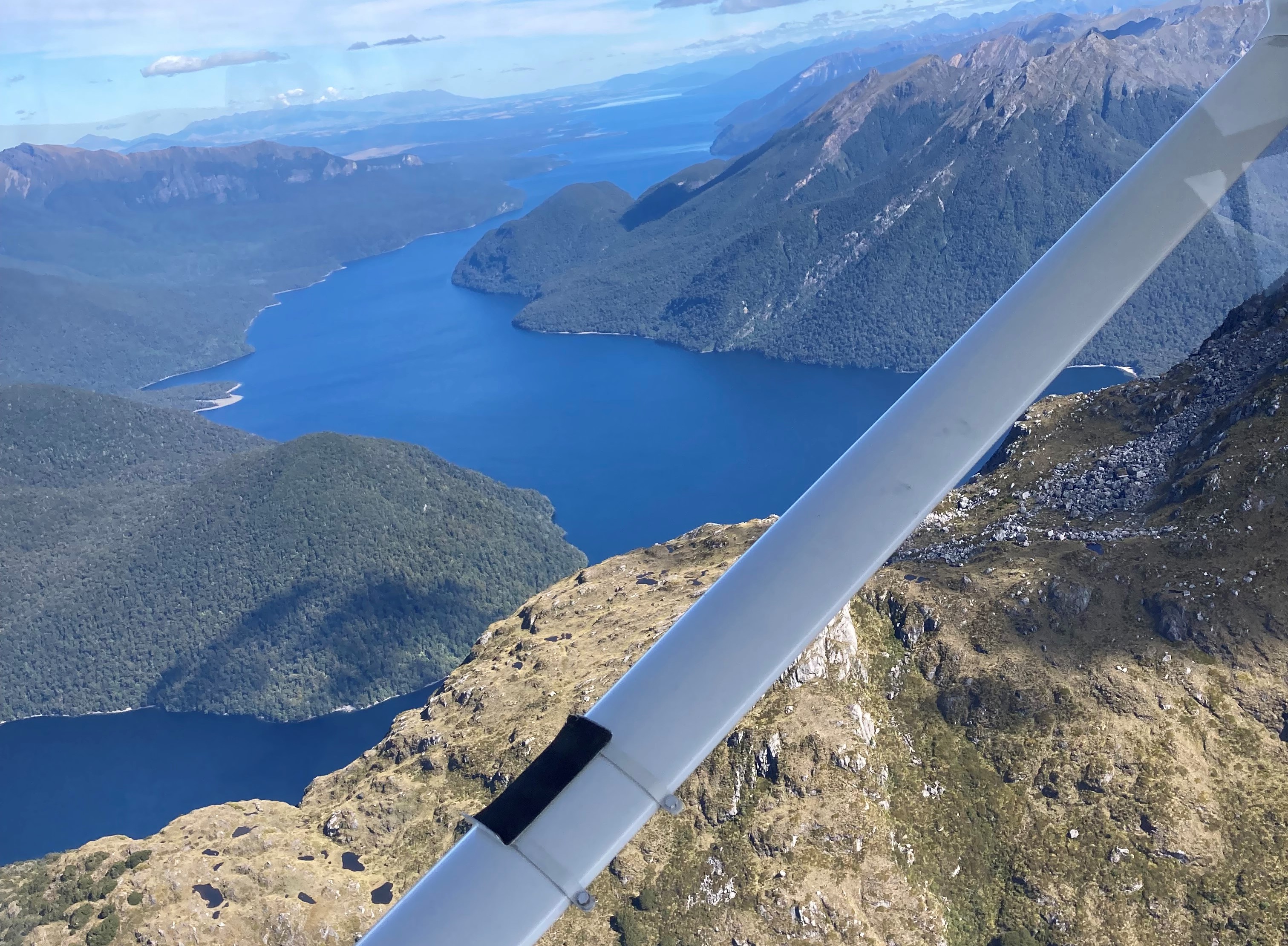
From there it may be a hard day’s walk on the Milford Track, but for us it was only a few minutes to the northern end of Lake Te Anau.
Sigi had originally wanted to catch a bus to Doubtful Sound that day but they’d been booked out, so she’d decided to come flying with us instead. Austin suggested we fly on to Doubtful Sound so she didn’t miss out. He gave me the task of planning a route through the valleys west of Te Anau to the coast, while avoiding clouds and mountains. I chose one with a pass height of about 2000ft at its end and made our way up and over, dodging clouds and staying on the windward side of the valleys to catch the updrafts as we went.
Fifteen minutes later we were at the coast heading for the entrance to Doubtful Sound. That was another dramatic spectacle as we hugged the right-hand side close to the mountains.
Flying over Deep Cove at the far end we were soon over the pass into a valley that leads to Lake Manapouri.
We flew over the Manapouri hydro power station that feeds the Rio Tinto aluminium smelter at Bluff. It would’ve been quite a challenge building the high-tension power lines across that rugged terrain.
Approaching Lake Manapouri Austin said “Oh it’s later than I thought. We’d better head back asap. Climb to 9500ft so we can fly direct to Wanaka above any terrain.”
So we climbed, levelling out at 9,500ft and passing over Lake Te Anau.
From there we did a bit of dog leg to avoid the controlled airspace west of Queenstown then crossed the northern end of Lake Wakatipu before descending over Skippers Canyon and the rugged mountains around the Cardrona ski field on the way back to Wanaka.
Treble Cone skifield left and Lake Wanaka in the background
Passing over Mt Barker, one of the visual approach points for Wanaka aerodrome, there was one last good view of the town and lake.
We joined midfield crosswind to land on RWY29 at Wanaka. The end of an incredible day’s flying.
Thanks to Austin, Karl and LearntoflyNZ for the three day course that worked out better than I’d ever imagined. The most amazing flying experience of my life.
A mountain flying course from Wanaka should be on every Australian pilot’s bucket list. I certainly recommend LearntoflyNZ as a place to do it.
On Sunday 19th February 2023 the Redcliffe Aero Club arranged a flyaway to the Gold Coast for lunch. It involved landing at the international airport in “Class C” airspace, something I hadn’t done for a few years. It’s not that difficult but I had to “swot up” a bit on the procedures and radio calls before we went. Nils, a friend from Canada, who inspired me to obtain my PPL many years ago, was in town so I invited him along, and invited Harpur to join us, in MSF. A couple of days before departure Sam Keenan the organiser asked whether we had room for one more so after a quick check of the weight and balance I let Garry Ayre know that he could join us too. Garry recently completed his restricted pilot licence and is now starting to attempt his PPL so is keen to learn more about flying cross country. With our combined weights I could just squeeze in 180 litres of fuel and remain under maximum take off weight.
It turned out to be a perfect day with scattered clouds at about 4000ft and light winds.
Departing Redcliffe
We took off at 10:30 and tracked via Woorim to Tangalooma then Pt Lookout and across Straddie.
Over Point LookoutStraddie sand mine
I obtained a transponder code from Brisbane Centre and then tracked over water to Q1 where I had to call up Gold Coast Tower. They sent us to Robina Town Centre and then vectored us south into the controlled airspace to join a left downwind for RWY32. We followed a QANTAS 737 in, being careful to leave enough room to avoid wake turbulence.
Short Final at Gold Coast
On the ground we taxied to the GA apron and shut down. Sam Keenan appeared shortly after and parked right behind us. Just before we were about to leave the airport to find an Uber the ARO appeared in his 4WD and told us we couldn’t park where we had and made us move to the grass at the northern end of the apron. Not a problem.
Landing at Gold Coast Airport
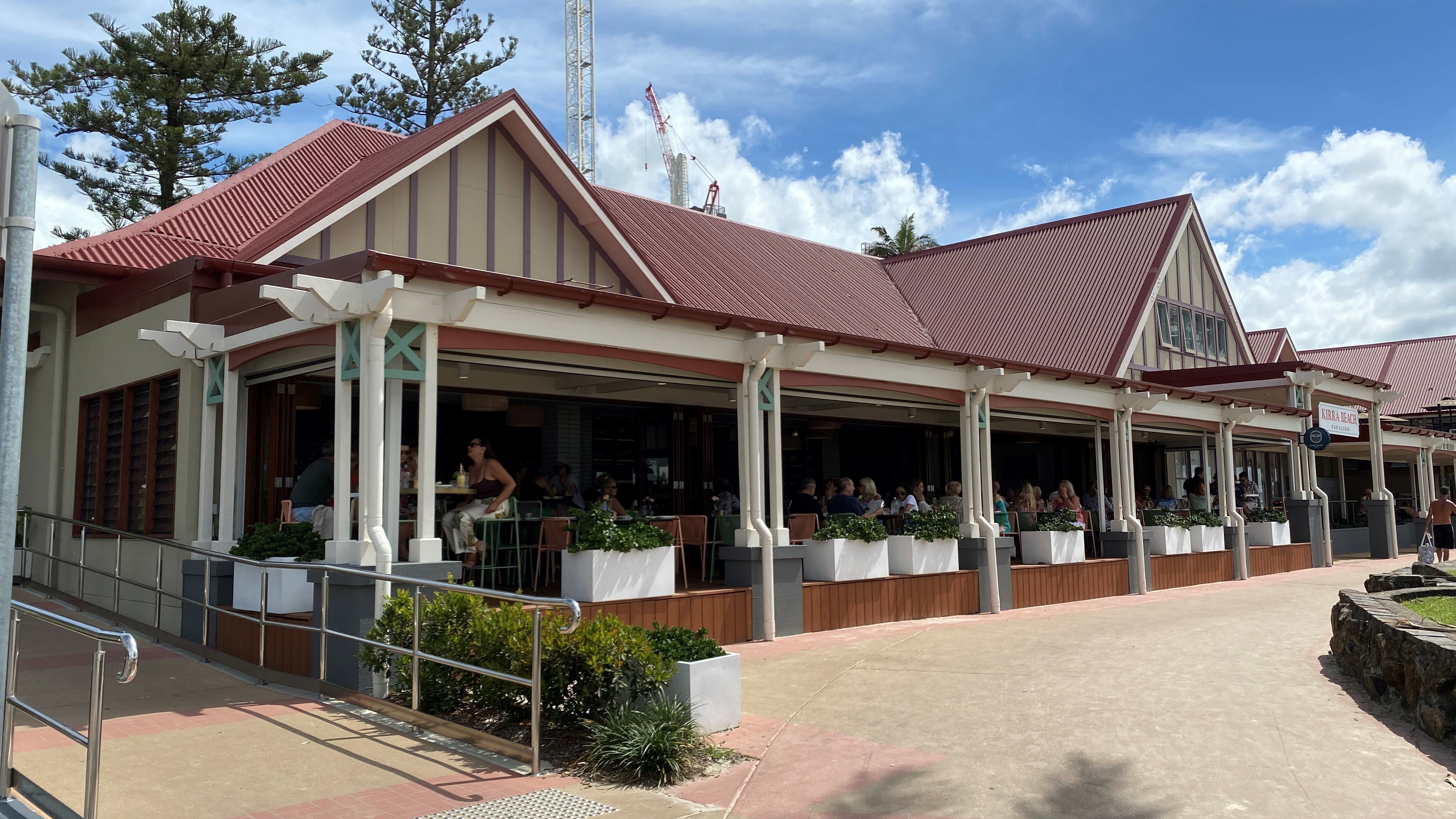
Soon we were in our Uber on the way to Sibllings Restaurant at Kirra Beach. Paul and Michele were already there, having flown down in one of the C172’s along with Carol as passenger. Luc turned up in a short while, having walked and swum all the way from the airport. He’d arrived quite a bit earlier.
Lunch at Siblings Restaurant
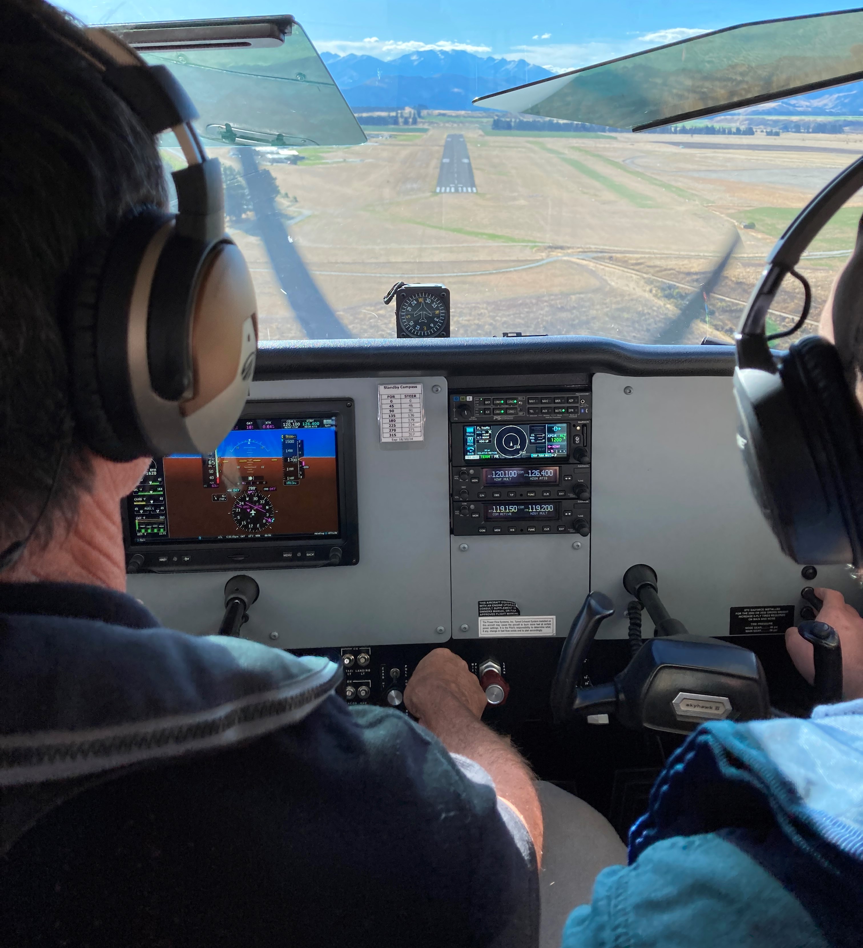
A lovely casual lunch lasted from 12 until 2 when we called another Uber and headed back to the airport. This time I’d planned to fly inland and called up Gold Coast Clearance Delivery to obtain my airways clearance to Redcliffe via Mount Warning. They told me that I’d have to contact Brisbane Approach on 123.6 after takeoff. Next was the taxi clearance from Gold Coast Ground that took us to holding point Hotel for RWY16. The wind had changed you see so we could take off to the south, making our track to Mt Warning straightforward. We did our run ups at holding point Hotel and then taxied to the holding point for RWY16. I told the tower we were “ready” and they cleared us to line up and take off, “Make a right turn” onto our track and climb and maintain 2500ft.
Once airborne I gave a departure report and Tower told me to change to Brisbane Approach. They then monitored us until we left controlled airspace on our way past Murwillimbah.
Back in uncontrolled airspace we were soon passing Mt Warning and the Scenic Rim, and climbed to 4000ft to hop over the edge of the caldera and into the valley beyond.
Then it was a fairly straight track via Beaudesert to Park Ridge Water Tower where we called up Archer Tower and requested a transit over Archerfield at 1500ft. Passing over the field and the Walter Taylor Bridge we had a great view of the Brisbane CBD as we headed north on the eastern edge of Mount Coot-the and via Petrie back to Redcliffe.
All in all a very pleasant outing and a great opportunity for Garry to see how to fly cross country through Class G, Class D and Class C airspace.
Port Macquarie – Newcastle – Warnervale – Sydney – Harbour Scenic – Victor 1 – Shellharbour – Wollongong – HARS museum – Orange – Cirrus CPPP – Glen Innes
The Cirrus Owners and Pilots Association (COPA) organise training weekends in Australia every two years. The 2022 event was at Orange on the weekend of 11-13th November. Brett Silvester and I decided to go and to make it all the more worthwhile we decided to fly down the coast to Wollongong the day before so we could enjoy the views past Newcastle and Sydney and visit the Historic Aircraft Restoration Society (HARS) museum at Shellharbour Airport.
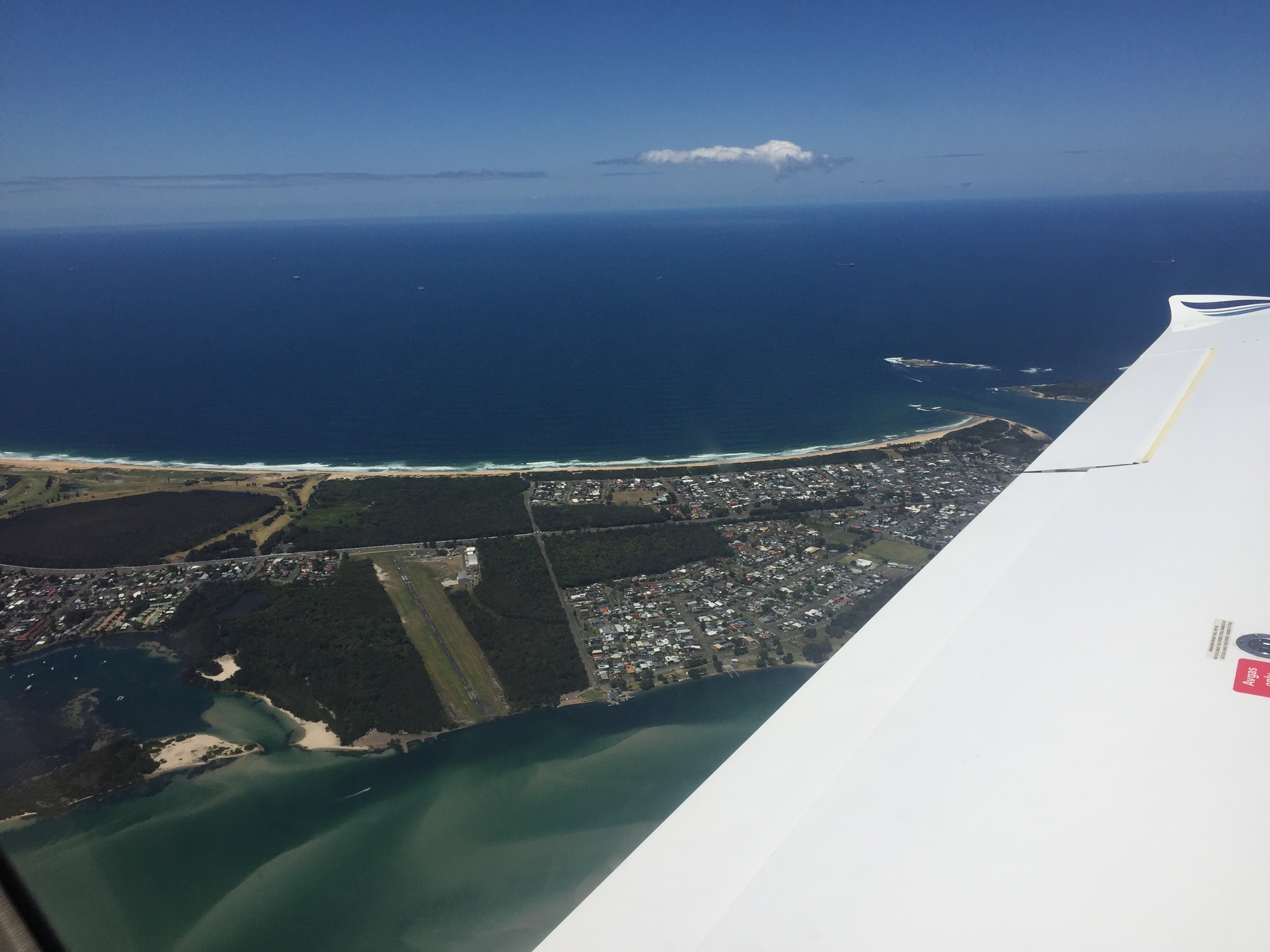
We departed Redcliffe on Thursday 10th November at about 9am. The flight plan I’d prepared originally was to depart IFR at 7000ft over the top of Brisbane airport then track via the Gold Coast and follow the coast to our first fuel stop at Port Macquarie. There were a couple of snags however. First, the RAAF was doing maneuvers and the whole Evans Head restricted area was active so we couldn’t plan or fly through it. So, I submitted a plan via the Gold Coast but around the restricted area. After takeoff however ATC didn’t clear us directly over Brisbane Airport. Instead, we were vectored out over The Gap and between Amberley and Archerfield airspace. This was apparently to avoid Brisbane International traffic. By the time the traffic around Brisbane had been avoided there was no point heading for the Gold Coast anymore, as it would’ve been a roundabout way, so ATC asked whether we wanted to fly direct to Coffs Harbour and we agreed. Even then ATC vectored us well clear of the Evans Head restricted airspace as we passed. Those jets must have been having dog fights. It was fairly cloudy on the way Coffs so views were limited but it started to clear as we progressed, and we had good visual conditions approaching Port Macquarie.
We refuelled at YPMQ then took off again, this time VFR along the coast at 2500ft, passing Taree, Forster and then descended over water at Sugarloaf Point for the VFR coastal route past Williamtown RAAF base. Flying past Broughton Island we were at 500ft and obtained a clearance from ‘Willy Delivery’. He passed us over to ‘Willy Approach’ who we monitored as we flew at 500ft and 150knots over water next to the beach past Hawks Nest, Point Stephens Lighthouse, Anna Bay and the very, very wide Stockton Beach and the Williamtown runway itself.
From there it was on past the mouth of the Hunter River and Newcastle.
Passing out of Williamtown controlled airspace we climbed to 2500ft and tracked for Warnervale, our lunch stop. We passed over the Lake Macquarie airstrip on the way.
The half hour lunch stop gave us time to collect our thoughts and plan our next leg via Sydney to Shellharbour. This time we’d fly at 1500ft along the coast from Terrigal to Barrenjoey Head at the mouth of the Hawkesbury River, then request a clearance for a “Harbour Scenic” from Sydney Terminal. All went smoothly and as we approached Long Reef ATC told us to expect Harbour Scenic 2 in 5 minutes. This meant we wouldn’t be flying directly next to the Harbour Bridge and Opera House but a few miles north at Chadstone. Never mind. We still had excellent views of the CBD as we orbited over Middle Harbour.
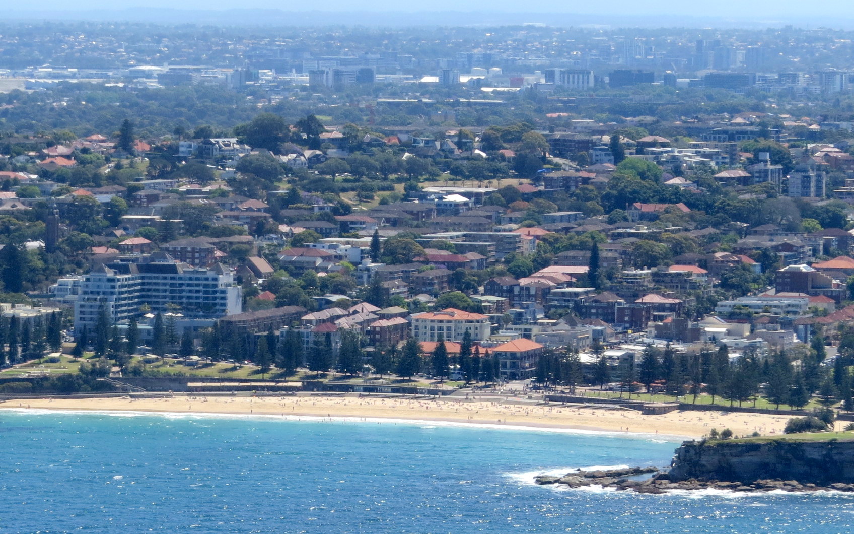
After the regulation two orbits we tracked back to Manly and then towards Long Reef where we descended to 500ft to be below controlled airspace and commenced our flight along Victor 1, the VFR route along Sydney’s beaches.
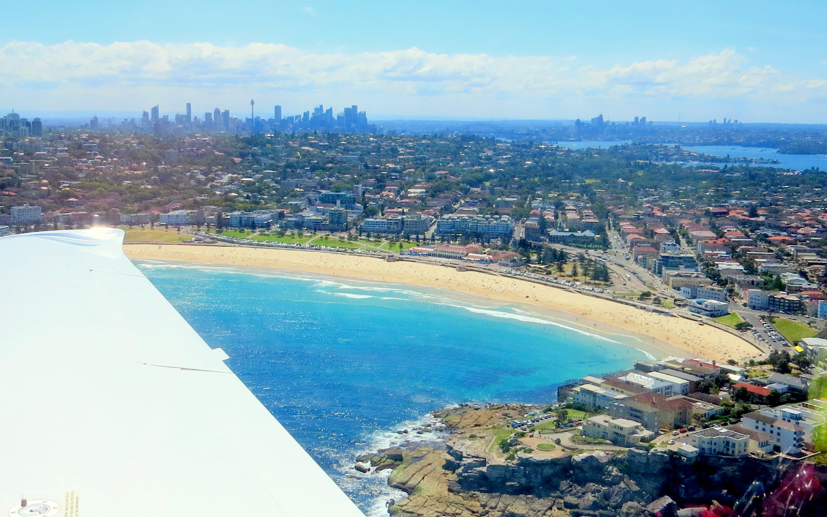
After passing the heads we saw Bondi Beach…
then Coogee Beach…
then Botany Bay and the Sydney International Airport.
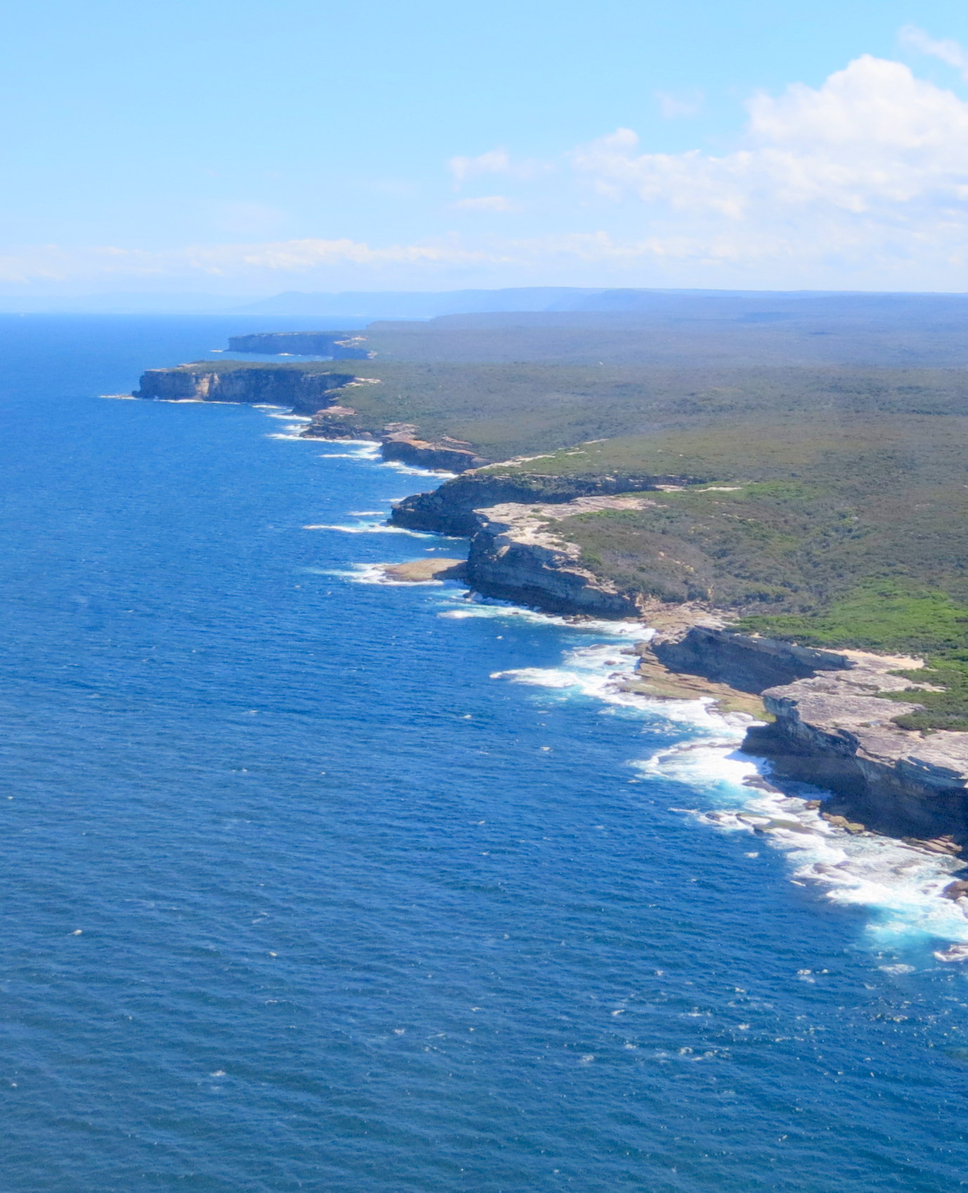
It wasn’t long and we were out from under the controlled airspace and could climb as we were abeam the cliffs of the Royal National Park.
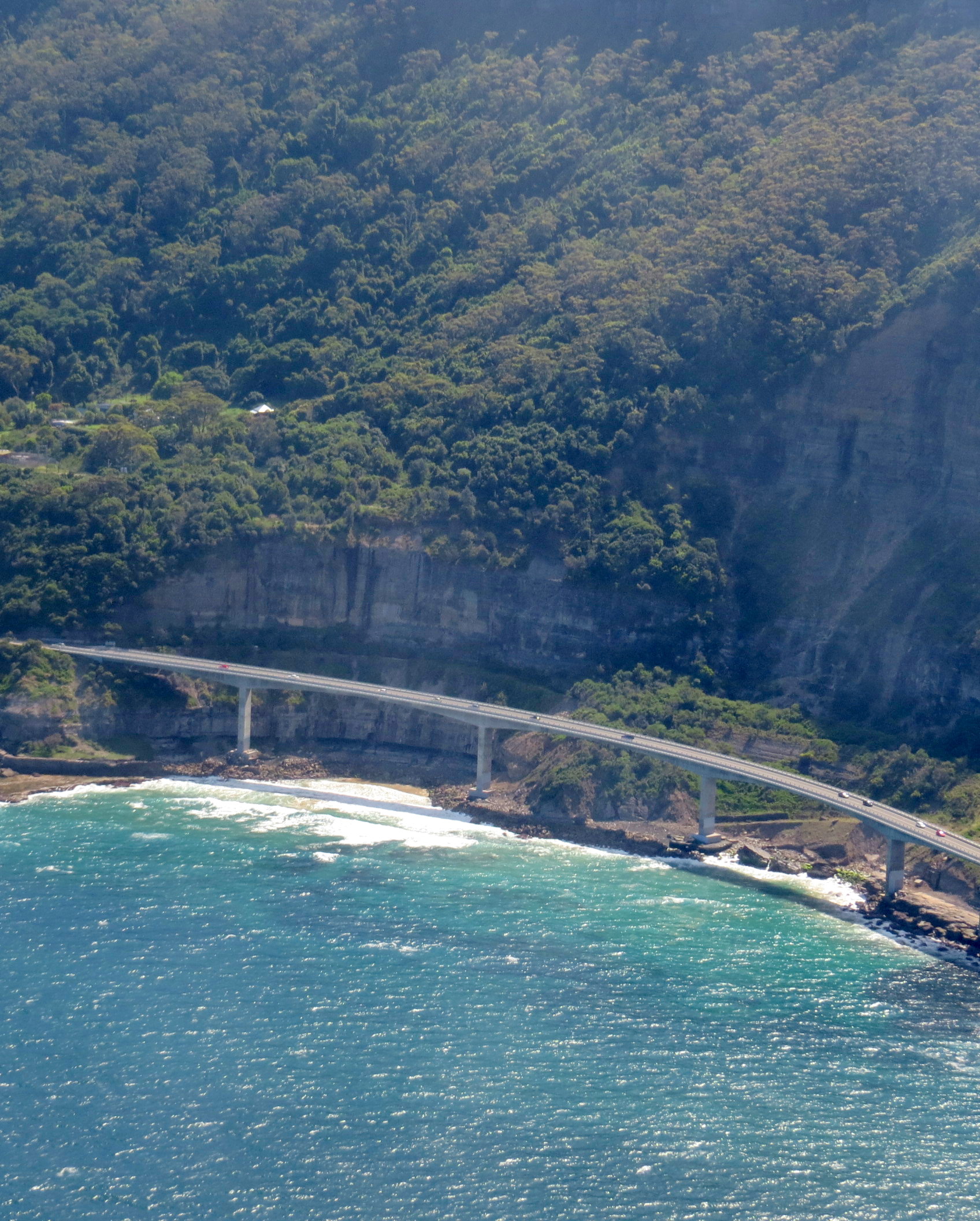
Our flightpath then took us past the 665 metre long Sea Cliff Bridge, a highlight along the Grand Pacific Drive on the coast of the Royal National Park.
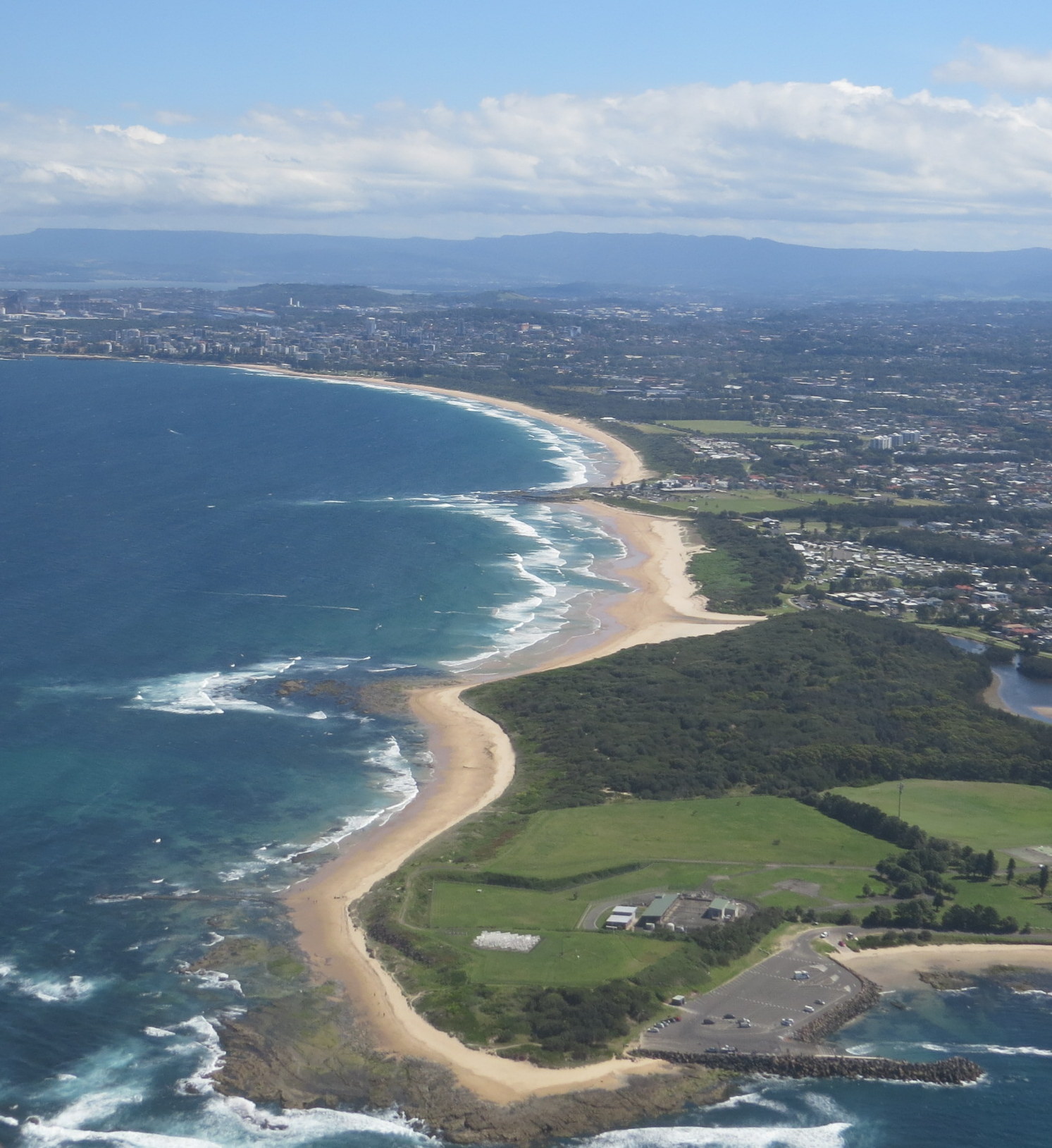
We were soon approaching Wollongong.
We passed the Wollongong Boat Harbour and the motel where we would stay the night…
and then past the Port Kembla Steelworks.
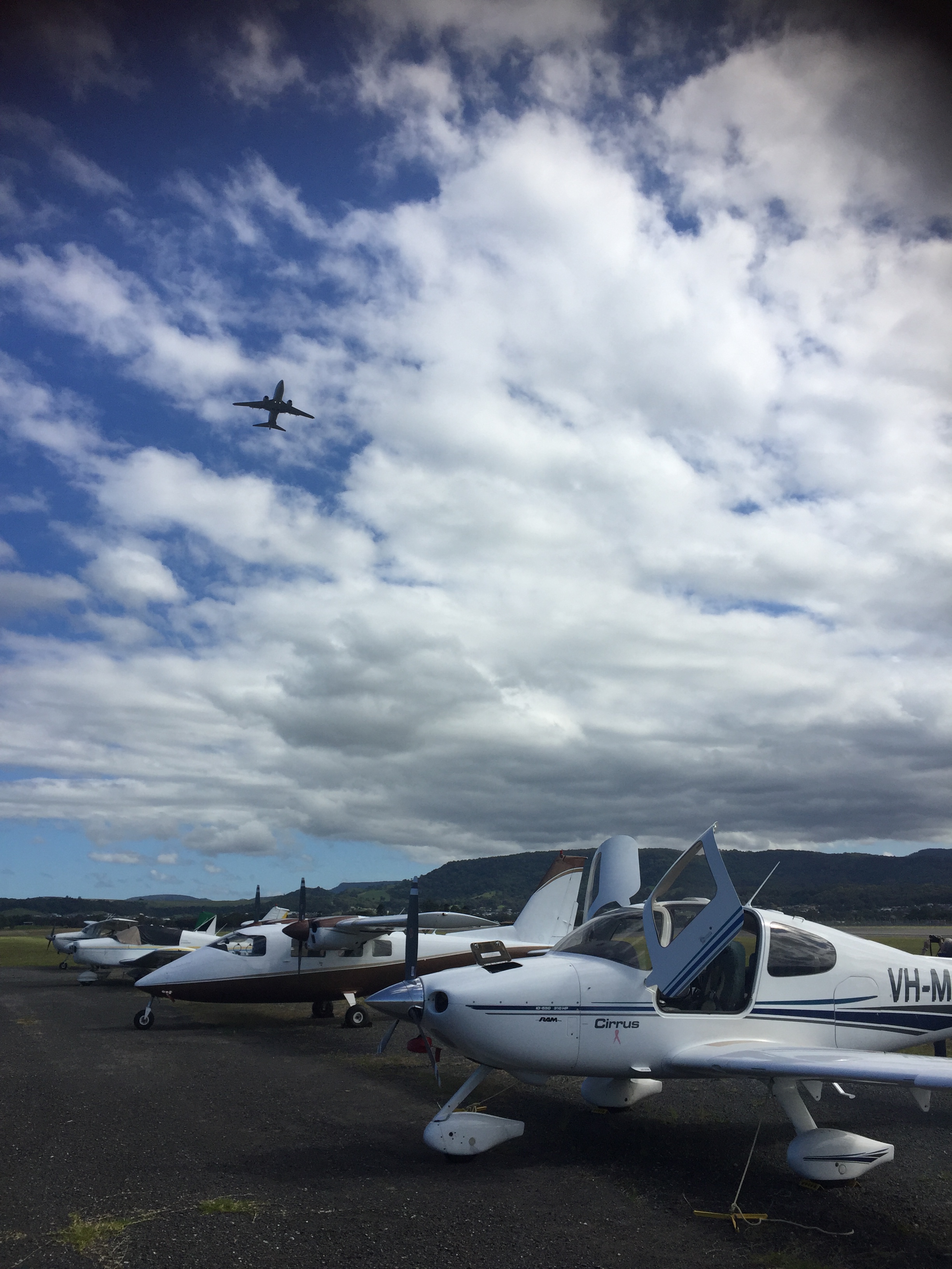
From there it was short hop across to Shellharbour airport where we refuelled, tied down and watched an RAAF Wedgetail do missed approaches.
After a quick inspection of the HARS museum from airside we climbed into an Uber and headed into Wollongong where we checked into the Boat Harbour Motel and then had a walk along the promenade, followed by a cooling ale in the local brewery and dinner at an Italian restaurant.
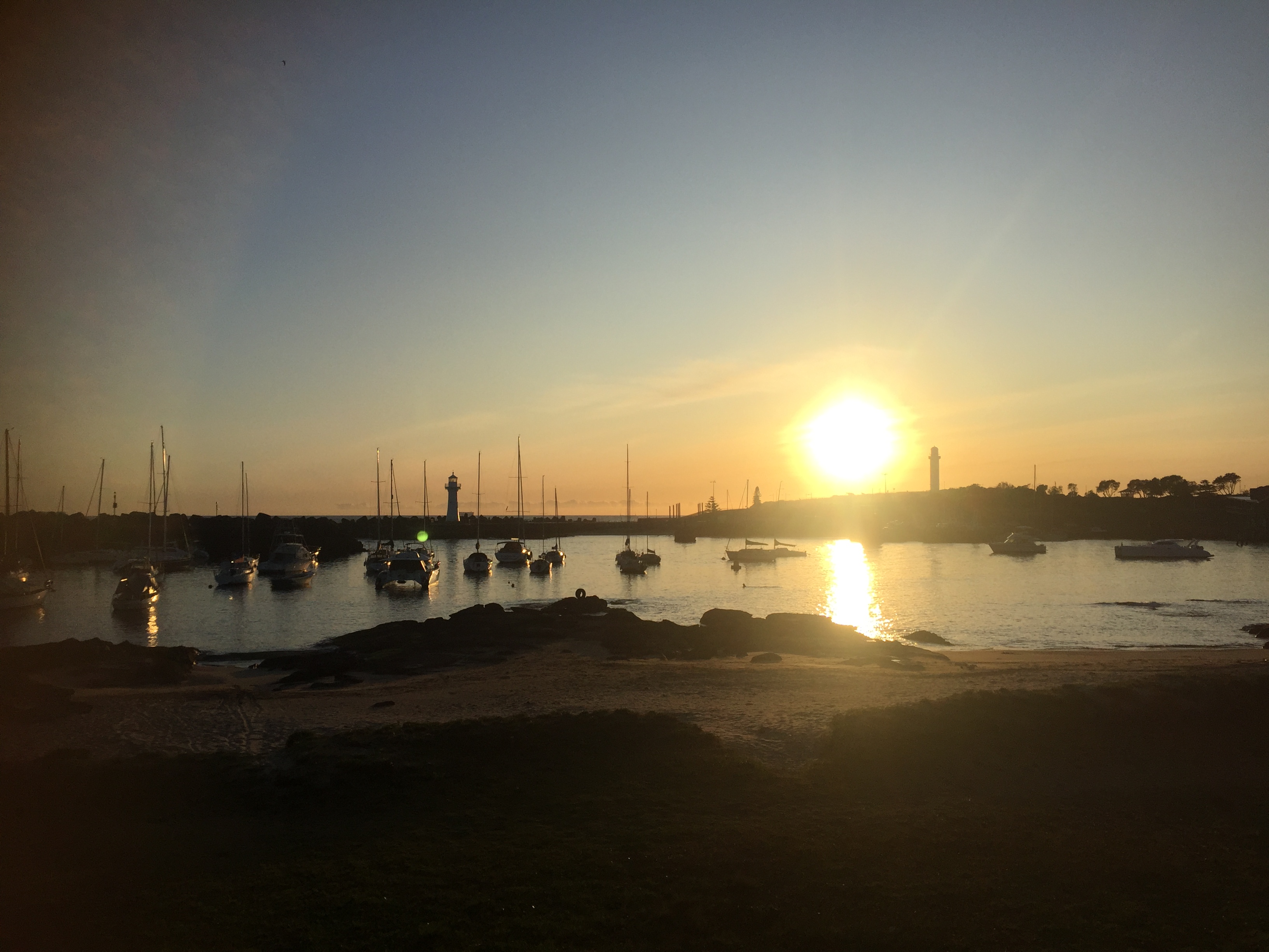
Next morning, I was up early and walked along the promenade in the opposite direction, joining the masses of early morning joggers, swimmers, yoga devotees and caffeine addicts.
Sunrise at Wollongong Boat Harbour
Some extra keen bods were partaking in ice baths. They had plastic drums that were filled with water and bags of ice that they would lower themselves into and sit in until the pain was unbearable. Certainly, one way to wake up.
I read the weather report as I drank my decaf flat white. It indicated that rain and storms would approach from the west in the afternoon so when Brett arrived we agreed to head out to the HARS museum as soon as it opened so we could get away at lunch time for Orange.
The Uber dropped us at the airport around 9:15. We carried our bags to MSF and I completed the preflight. Then it was a short walk over the apron to the museum. It was the day before the annual “Wings over Illawarra Airshow” weekend so there was lots of activity. A very kind volunteer took Brett and me on a private tour of the collection. First stop was the QANTAS 747-800 that was in service until 2015 and is still in top condition. Apparently, it held the record for the longest 747 flight and the shortest. The delivery flight from Heathrow to Sydney was the longest. The final flight from Sydney to Shellharbour was the shortest. We spent two hours on our private tour and then I had to cut it short because we had to depart by 12:30 as they would close the airspace at that time for few hours so they could practise some flight routines for the following day’s events.
I submitted an IFR flight plan direct to Orange and we headed back across the apron to MSF. The TAF at Orange indicated low cloud so we briefed the RNP instrument approach. Starting up, we heard plenty of traffic in the vicinity and the main taxiway was blocked with some aircraft so we worked out we’d have to back track a bit and would need to allow time for other aircraft in the circuit. After the runups we waited for a Jabiru who seemed to take forever on downwind, base and final. Then we could backtrack, turn and take off to the north, turning right and climbing over the field as other aircraft joined downwind below us. We gave our departure call and obtained a code from Melbourne Centre for the 40 minute leg to Orange. Passing over the Southern Highlands we could see Mittagong but then the cloud closed in below us and we flew between cloud layers for a while then eventually entered IMC. Forty miles out of Orange we informed ATC that we’d be tracking for the RNP instrument approach, and they advised of other traffic heading to Orange. Brett and I rebriefed the approach then started our descent, popping out of the cloud about 1000 ft above ground level with the runway straight in front. It was a smooth touchdown and we taxied to the bowser to fill with fuel. As we experienced in March 2022 the AvGas price was the cheapest in the country.
Then we had to find a place to tie down. After a bit of confusion, we found Rodney from COPA who guided us into a parking spot on the grass.
So started our COPA training weekend or CPPP (Cirrus Pilot Proficiency Program). It was held at the Orange Aeroclub, a very well-equipped building that used to be the airport terminal until a new one was built a few years ago. Rodney who was the “local” organiser (he was from the Gold Coast while the main organiser was from Germany and had just flown in) drove us into town in his Tesla Model X so we could check into our motel, then picked us up again later so we could attend the welcome drinks at the aero club. We caught up with old friends and made new ones and inspected the flock of Cirrus that had landed including two Cirrus Vision Jets that everyone was keen to inspect.
After the drinks and canapes, we were taken by specially organised bus into town where we had dinner at the Hotel Canobolos aka the “red pub” with a few of our new friends. Some locals had told us to go there and not across the road to the “white pub” as the food is much better. A couple of steaks and a few glasses of house red later and we toddled back to the motel.
Saturday was a day of lectures and thunderstorms.
One of the lectures was actually about thunderstorms, which was very useful as the forecast for our trip home the next day included a possibility of storms. A few passing rain showers and thunderstorms perked our interest during the afternoon.
A couple of Cirrus simulators had been set up in one of the smaller adjacent rooms and some of the attendees took the opportunity to fly the simulator under the watchful eye of an instructor.
By Saturday evening it was clear again, the sun was out, and Brett and I had a quick beer in the motel beer garden.
Then we headed to the course gala dinner, held at one of the better restaurants in town where a few of the attendees who had undertaken flying lessons during the weekend received some awards.
Knowing that we had a long day and a long, and potentially challenging, flight home the next day (weather permitting) we retired early.
The next morning the weather was foul. Low cloud and rain. We walked in the rain to a nearby cafe for breakfast, where a few other Cirrus people also appeared. Back at the motel we were ferried with our luggage to the aero club again. The weather forecast left us wondering whether we’d be returning that evening for another night’s stay. Keeping one eye on the TAFs for Orange, Mudgee, Tamworth and Glen Innes (our planned route home) we had the other eye on the lectures. These were useful again with quite a few interesting tips. During lunch I preflighted MSF and submitted my IFR flight plan so we were ready to depart as soon as the weather cleared. Looking at the skies and again at the forecast Brett and I decided to grab the moment as the lectures were about to begin again. The weather was clearing, and it looked like it’d worsen again later in the afternoon.
We said some quick goodbyes (many of the other attendees had already left) and loaded up the plane. It was still overcast at about 1500ft but the TAF indicated the cloud layer was thin and above it was clear air all the way up to 8000ft. So, we took off and entered IMC over the aerodrome. Orbiting up in the clouds we climbed up into clear air and were pleased to see no towering cumulus clouds (a sign of thunderstorm activity) in any direction. We tracked for Mudgee and climbed to our cruising level of 7000ft between the cloud layers.
It’s moments like these you think “thank God I’m instrument rated”. If we couldn’t fly IFR we would not have got home that day, that much was clear.
It was still cloudy over Mudgee and we didn’t see anything of the town. By the time we reached Tamworth however we could see parts of it between the clouds.
The forecast had indicated that the cloud was only present a bit north of Tamworth and sure enough it soon cleared and we had a great view of the amazing green countryside as we approached Glen Innes.
Originally, I’d planned to fly non-stop to Redcliffe but on the way to Glen Innes I decided to land there. I had two reasons. First, it’d give me a chance to practise an instrument approach at very little additional cost or time. And second, I was feeling a bit of pressure in my bladder and thought it would be prudent to relieve myself before it became too painful. So, we flew the RNP approach into Glen Innes, following an air ambulance who was parked on the apron when we arrived.
The kind ladies at the Orange aero club had given us some sandwiches for our journey so we ate them while the air ambulance started up and taxied out. Then it was our turn. Taking off we turned over the airfield then tracked for Redcliffe, via the Scenic Rim.
The light from the late afternoon sun was stunning as we passed over the border ranges around Tenterfield and Stanthorpe. Soon we were descending from overhead Amberley and past the winding Brisbane River.
ATC gradually descended us in the controlled airspace as we approached Redcliffe.
The airfield was deserted. Amazing on such a great Sunday afternoon. We did a nice smooth landing and put MSF away in the hangar. A great ending to a great experience.
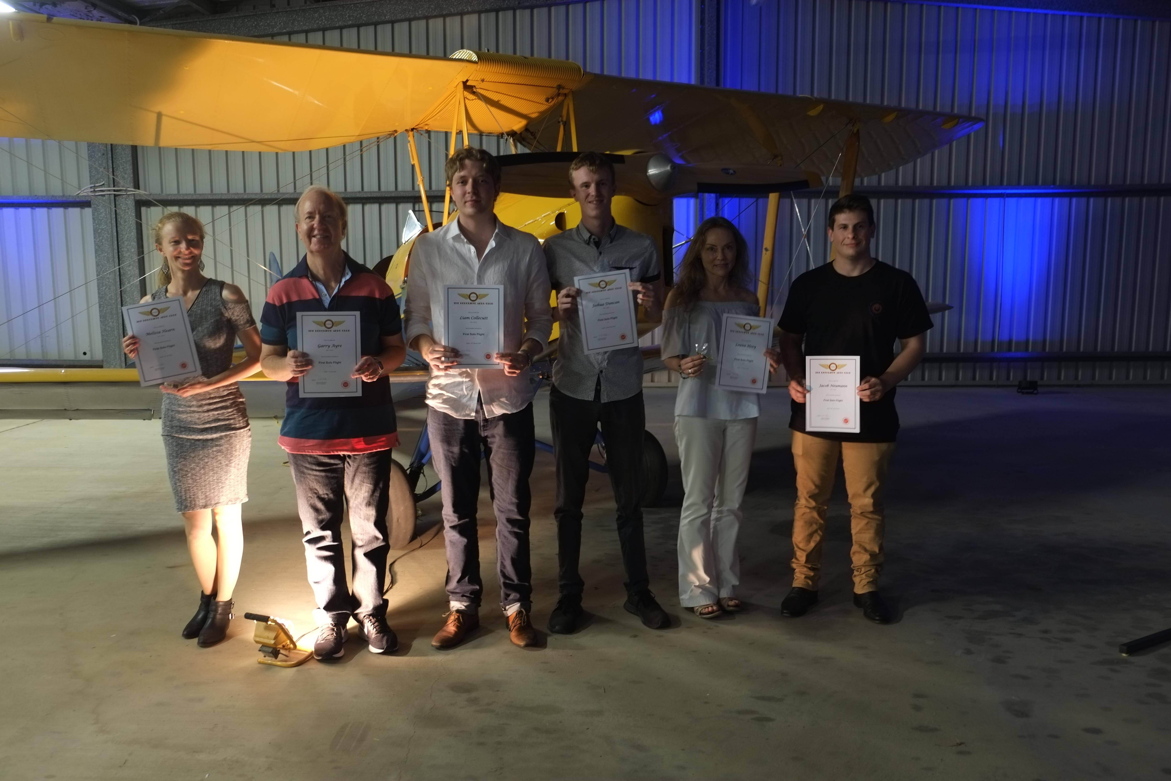
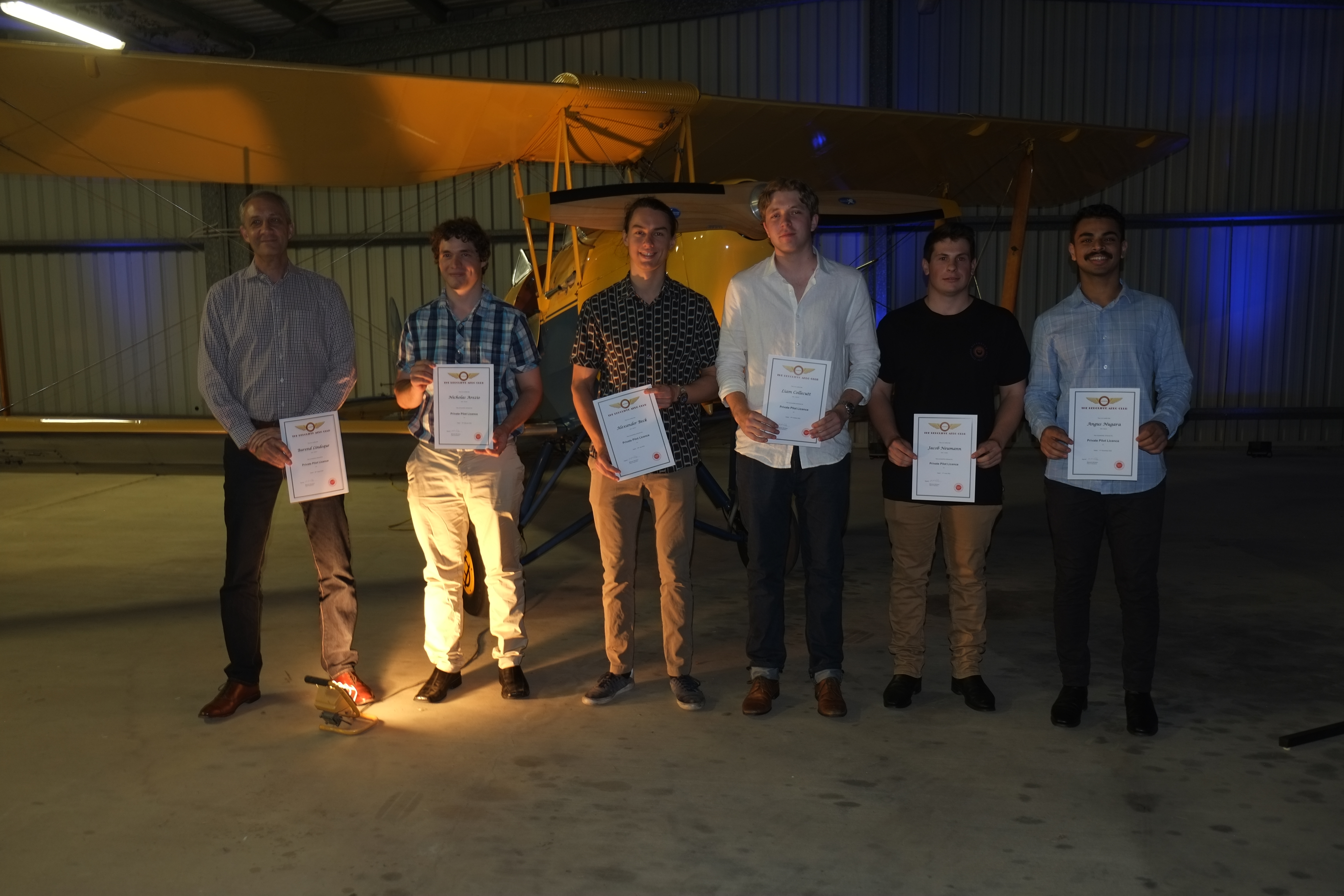
On Saturday 19th November 2022 the Redcliffe Aero Club held its annual awards dinner and presentations in the hangar at the airport. It was a great occasion with a number of students being awarded their certificates for first solo, restricted pilot licence, private pilot licence and commercial pilot licence.
Bundaberg – Macadamias – Bert Hinkler Museum – Fire fighting aircraft – Q400
On the weekend of 15th-16th October 2022 the Redcliffe Aero Club organised a club flyaway to Bundaberg. Aircraft taking part were Cherokee VH-BHN (piloted by Sam Keenan), Archer VH-FRF (Ron Ennis), Cherokee VH-WKE (Luc George), C182 VH-NDP (Mark Roberts-Thomson), C182 VH-ROC (Paul Smeath) and Cirrus VH-MSF (Mike Cahill), Brett Silvester and I flew in MSF with Mike. For the flight to Bundy Mike was PIC with Brett as co-pilot and I was in the back seat (flying business class) and so able to take a few photos. The weather enroute was forecast to be a bit cloudy, so Mike submitted an IFR flight plan over the Sunshine Coast and Maryborough.
We took off and flew past the mouth of the Caboolture River as we climbed over the bay.
Caboolture River Mouth and Beachmere
Further on we climbed through the clouds to cruise at 9000ft. Mike had chosen this level as the cloud tops were forecast at 8000ft. It was amazing how green the country looked after all the rain we’ve had over the winter.
Near Gympie
Bundaberg is famous for its sugar and Rum and on our descent we passed over plenty of cane fields.
Over the radio ATC informed us that there was also a Virgin Dash 8 on descent into Bundy with arrival time about the same time as us. Soon Mike was co-ordinating with the Dash 9 pilot how we’d sequence ourselves. The wind was from the south so the active runway was 14. This allowed us to join left downwind to the east of the airport as the Dash 8 flew the RNAV approach from the northwest and Mike extended a looooong downwind to allow time for the Dash 8 to land, roll out to the end of the runway and backtrack to the apron. He asked me to tell him when the jet turned at the end of the runway as that would be a good time for us to turn onto base. He timed it well so we were on short final just as the jet exited the runway and we could land, roll through to the exit point and taxi to the apron.
Most of the other RAC aircraft had arrived before us so after we’d tied down and unpacked the aircraft we chatted and watched as the last member of our party, much to our surprise, flew a right downwind and landed the wrong way on RWY14. There was much discussion about this indiscretion later.
Walking to the terminal we called the taxi company and waited. And waited. And waited.
Apparently they have limited taxis in Bundaberg. There is another company called https://bundabergshuttleservice.com.au who we should have booked with but didn’t on this occasion. We’ll know for next time.
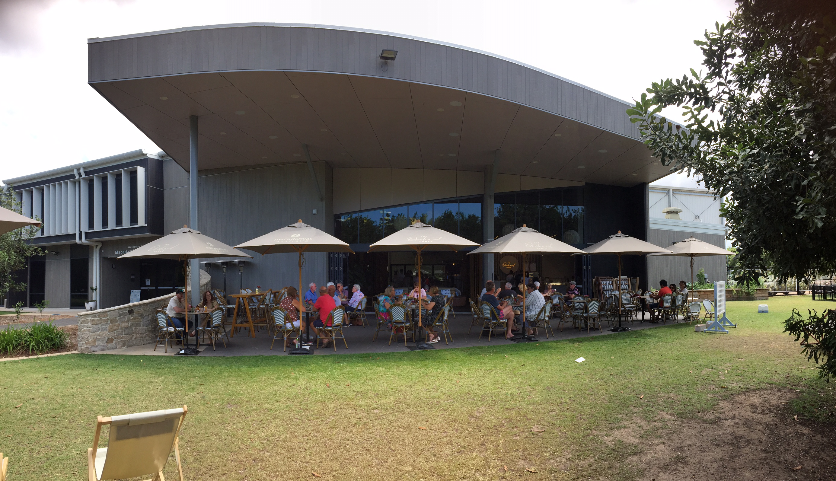
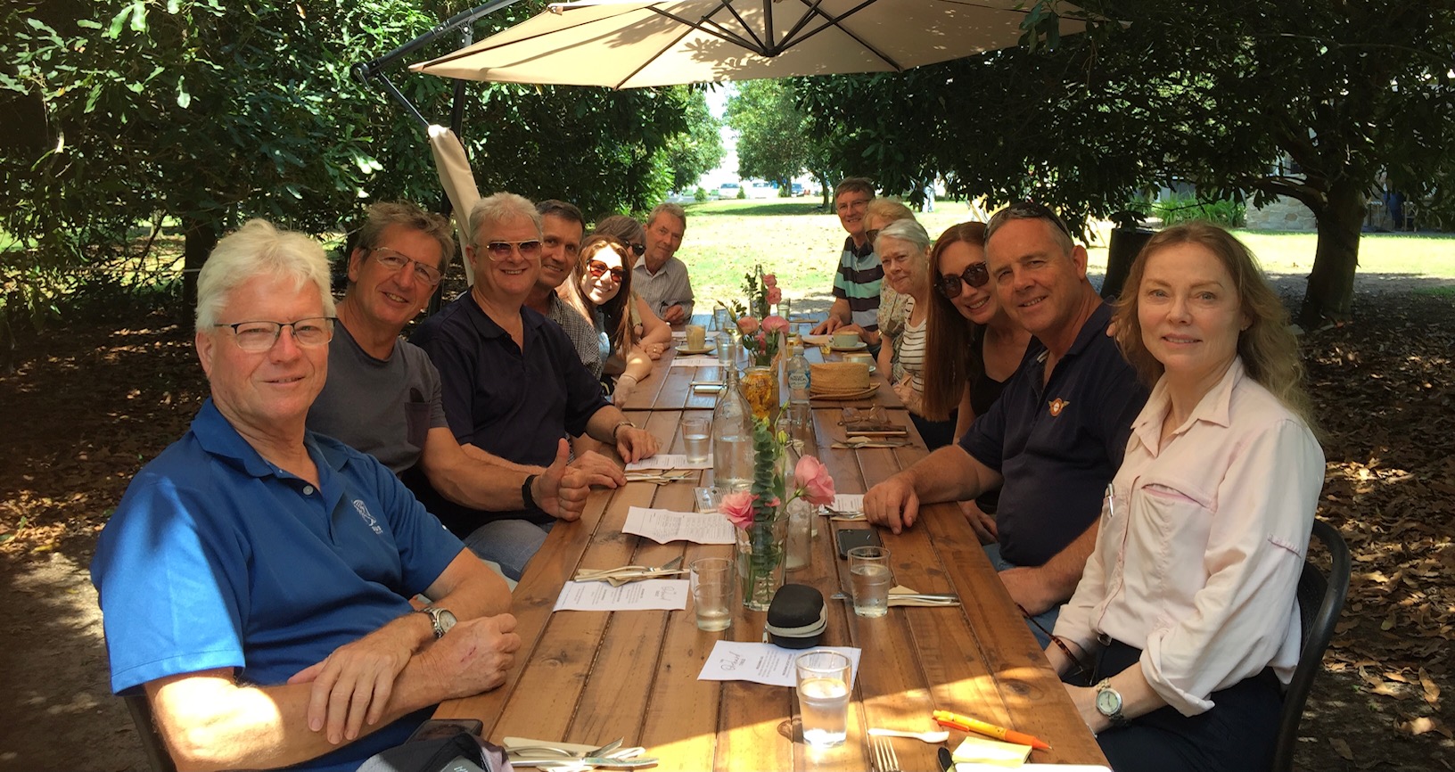
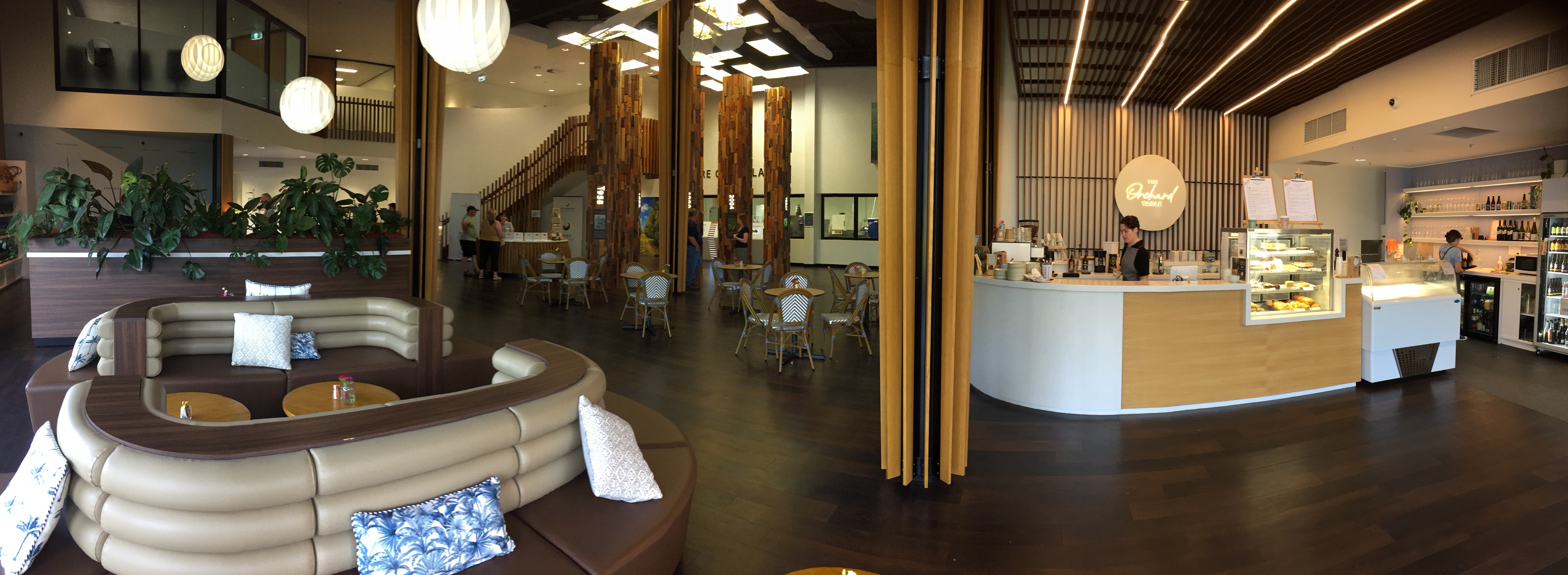
It was about 90 minutes before we were finally transported to our lunch spot – the Macadamias Australia information centre and restaurant. This was a very impressive building located on their farm on the southern outskirts of Bundaberg. The family that owns it was originally into sugar cane farming but diversified to macadamias about 30 years ago and have been very successful.
As we were a large group they’d put us on a long table in a shady setting in the Macadamia orchard that was great for lunch.
They gave us some macadamia tastings as well, including the vanilla infused macadamias that were delicious. After a very relaxed and chatty lunch we explored the shop and bought some nuts to take home with us.
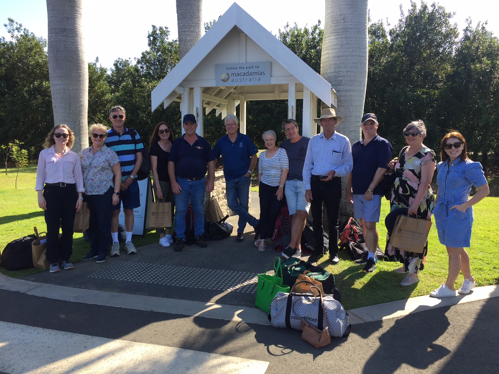
Having booked our taxi for the 3pm trip into town we assembled out the front of the Macadamia farm and were soon on our way to our overnight accommodation.
Having checked in I went for a walk/run along the river and inspected the main street. Not too busy on a Saturday afternoon. I also discovered the Ballistic Brewery just off the main street so after a quick walk back to the motel to meet up with Mike and Brett we headed to the brewery to sample one of their IPAs.
That evening we had a group dinner at one of the restaurants with a view over the Burnett River and chatted about our flight, the next day’s flight and future trips amongst other things.
Sunday dawned and from the motel balcony we could see a bit of sun and cloud and after checking the NAIPS we agreed it was a generally positive weather forecast. We could fly VFR home along the coast.
On Saturday evening some in our party had held fears of rain and too much cloud on the tirp home but these fears were dismissed as we assembled at a cafe overlooking the river for breakfast. More talk about flying and people getting their breakfast orders mixed up but generally good coffee and food.
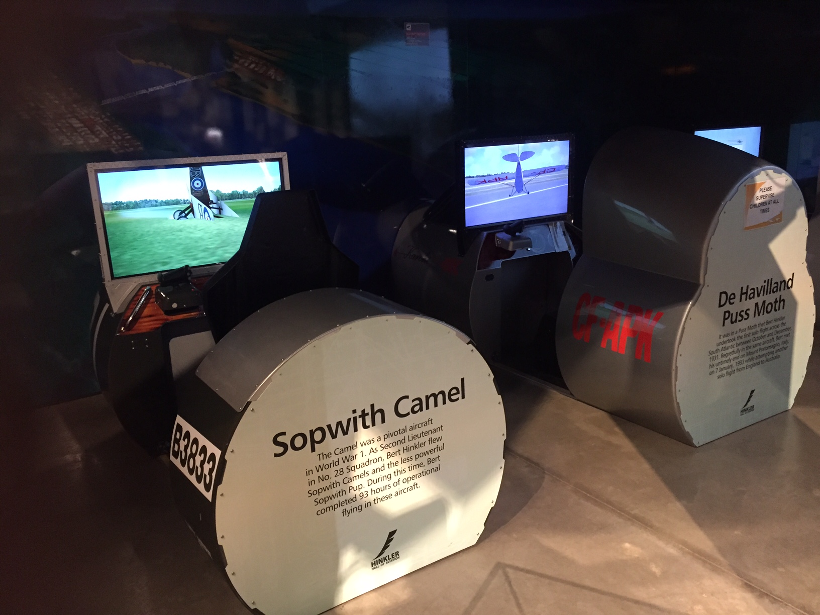
The shuttle guys picked us up at 9am and we headed for the Bert Hinkler Hall of Aviation on the outskirts of town. Now this was the real reason for coming to Bundy. It’s a really good collection of aircraft and tells the story of Bert Hinkler’s youth in the town, learning to fly starting with his own home made glider on a nearby beach, travelling to the UK to learn how to fly powered aircraft and his world record flights in Australia, across the Atlantic and from England to Australia. It was very unfortunate that he was killed at 40 when he crashed in the Tuscan hills outside of Florence. The reason for his crash is unknown but he was always pushing the envelope so maybe it was just a matter of time till his luck ran out.
There were a couple of simulators there that we could play on. We quickly realised that simulators aren’t as easy to fly as you might think. Also that it’s not a big deal if you crash a simulator, as a couple of us did.
Bert Hinkler’s cottage “Mon Repos” is also located nearby. It’s named after the nearby beach where Bert undertook his first trial glider flights when he was 19 years old. The house was dismantled at its original home in England and rebuilt brick by brick by the local community in the 1980s and formed the first part of the Hinkler Aviation Museum.
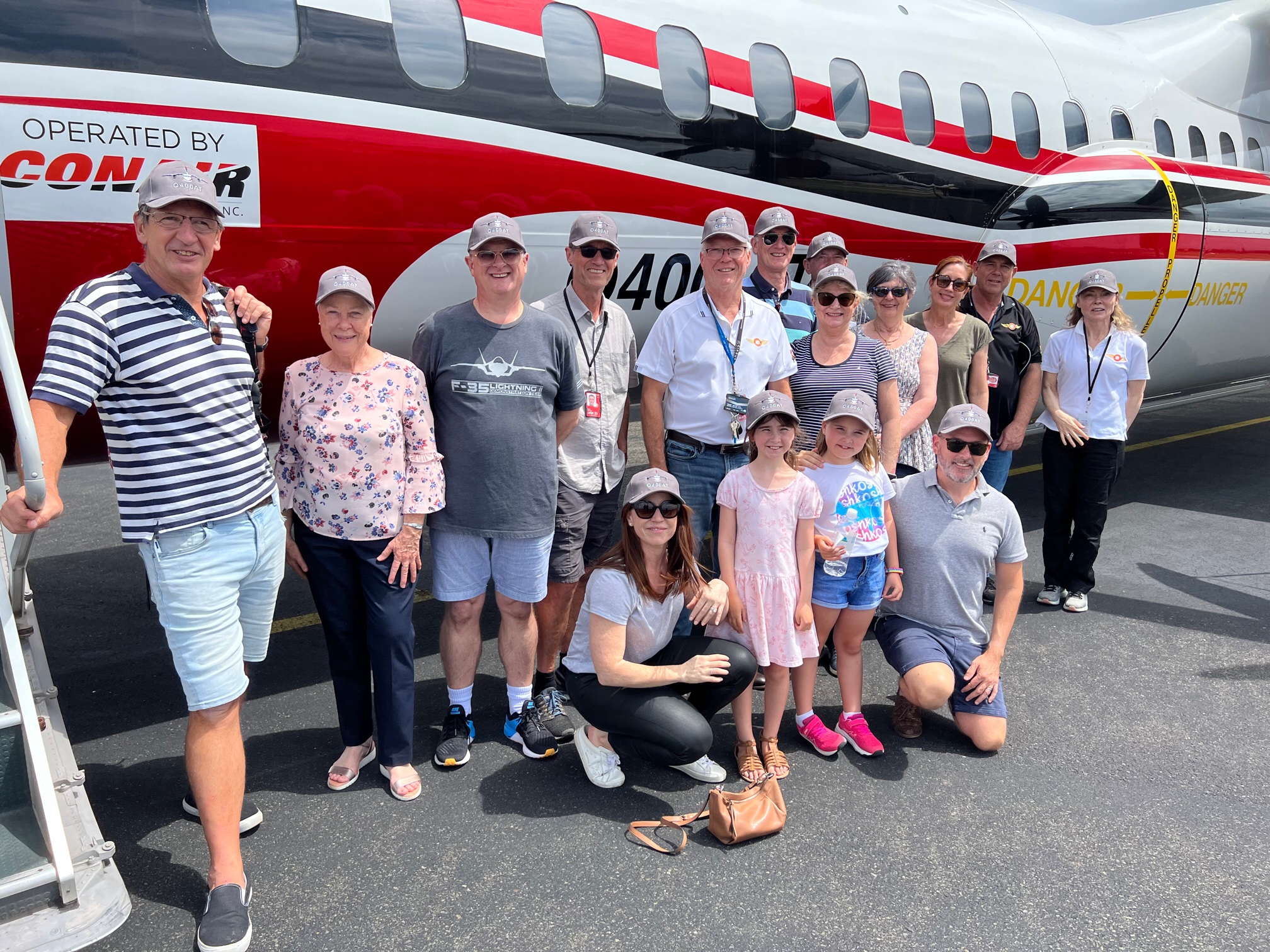
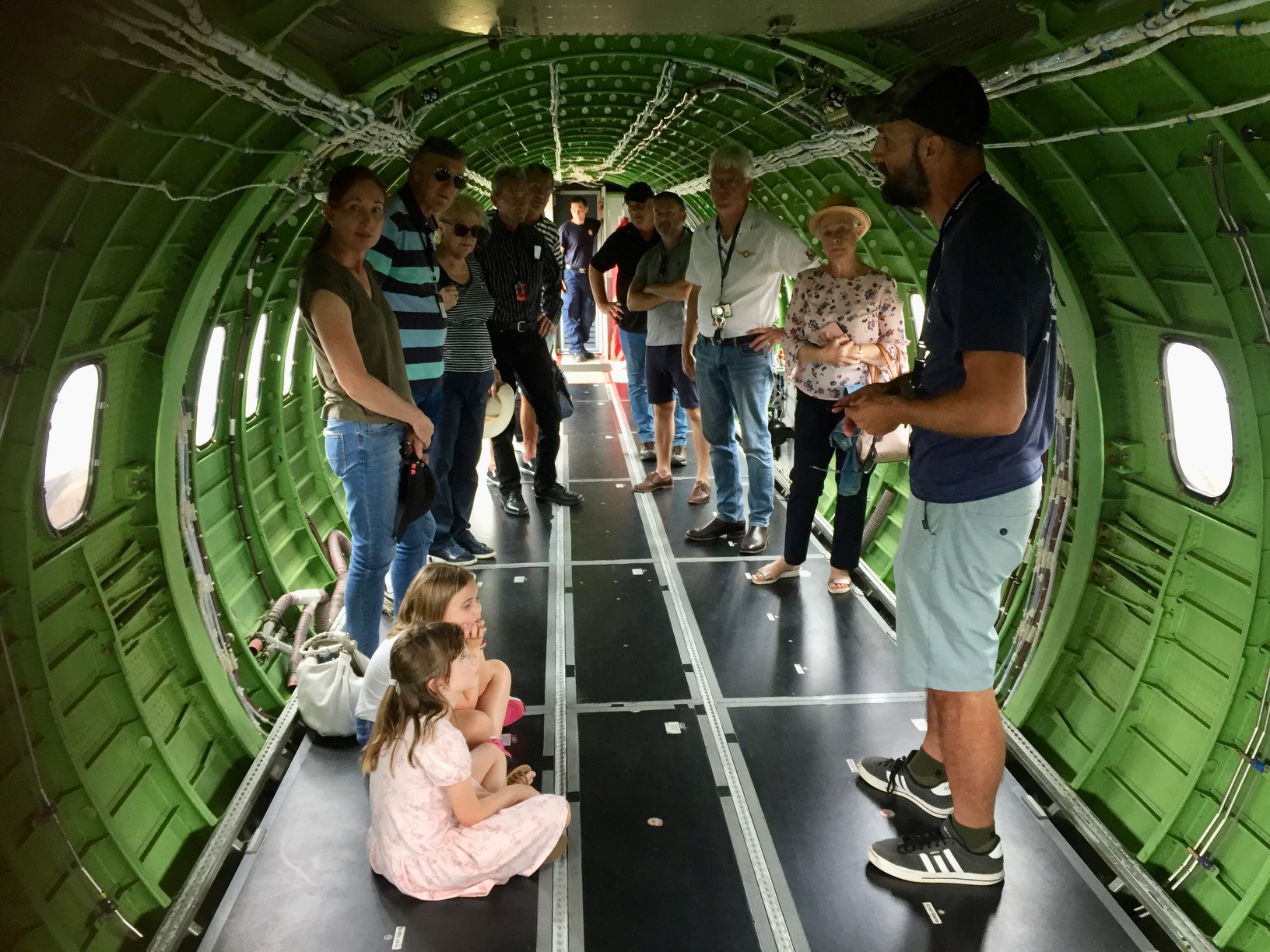
After a quick sandwich at the cafe we climbed aboard the shuttles again for the quick trip to the airport where Paul Smeath had arranged a tour of the fire fighting aviation services for us. Paul works for the Queensland Fire and Rescue and co-ordinates the firefighters when they have a large bushfire to fight, as was the case around Bundaberg in 2019. He knows the guys well so was able to get them to come out on a Sunday to show us around. While he organised things I took the opportunity to preflight MSF ready for the trip home.
There were a couple of helicopters and a fixed wing spotter plane as well as a Q400 that is leased from a Canadian company.
Assembled outside the Q400
It can carry and dump 10,000 litres of fire retardant mix at a time and the pump station is capable of refilling its tanks in 8 minutes while the props are idling. This make a pretty fast turn around time. This winter they have had almost no work as it’s been so wet. They’ll be moving south to Avalon in Victoria in about one month to work there for the southern fire season over summer.
It was very impressive equipment and a great tour of the facility.
Mark and I inspect the Q400 cockpit
Following our tour it was back to the GA apron where I submitted my VFR flight plan. It was VFR as the weather was fine, with a bit of cloud at 6000ft so we could fly at 3500ft down the coast all the way. After letting Brett get acquainted with the avionics so he could input the flight plan, we taxied over to the runway. Mark Roberts-Thomson was right behind us and requested an intersection departure while we back tracked to the start of the runway. He’s a long-term 747 pilot with his own plane so obviously had more faith in his engine than we did. As my dad used to say – “It’s no use having runway behind you” – meaning always use all the runway that’s available to you.
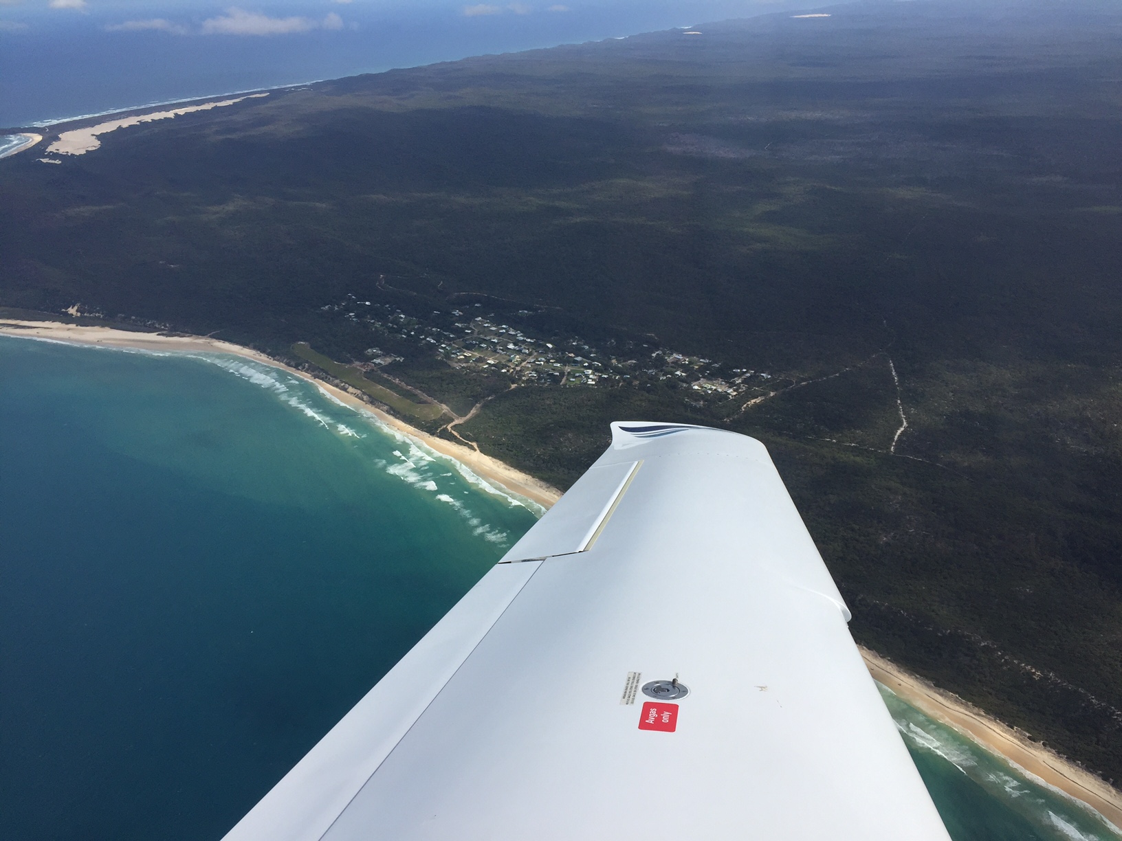
Taking off we climbed quickly to 3500ft and headed directly for Hervey Bay, passing Mark at 1500ft below us. At Urangan we turned left and headed direct to Orchid Beach at the northern end of Fraser Island.
Orchid Beach
After a quick orbit over the village and airstrip to check it out (it was very green) we headed south along the coast past Happy Valley, Rainbow Beach, Double Island Point and Noosa. We were catching Sam in BKN by this stage who had not done the dog leg to Orchid Beach but was significantly slower than us and was held up by ATC at the Sunshine Coast. We were waved straight through at 1500ft and were soon over Bribie heading for Redcliffe.
For our approach into Redcliffe I did the conventional overhead pass at 1500ft and mid field crosswind entry to join mid downwind on RWY07, while some guy in a tail dragger joined base in front of us and landed on the grass stip. I managed to slow our approach enough to give him time to leave the runway before we touched down. Then it was back to Mike’s new hangar that he’d bought a few weeks before. Much more room than the old hangar and doors that actually work smoothly. A big improvement.
On October 5th 2022 Sigi and I flew up to Agnes Water for a couple of nights. As anyone who reads this blog will know, Agnes is one of our favourite beach spots. This time we were able to book the cabins in the Agnes Water camping ground with direct access to the beach. They’re normally booked out months in advance so we’ve been trying to stay there for years and finally managed to book one a few days before departure. Someone must have cancelled.
We left on the Wednesday morning and went IFR because the forecast had broken cloud most of the way. Fortunately the forecast for Agnes Water was a bit friendlier than in Brisbane. It was overcast and grey as we climbed out of Redcliffe across the bay towards Bribie Island but pretty soon we had a clearance from ATC to climb through the clouds to 6000ft.
Emerging above the clouds we had blue sky above us again but it was not to last. Further north there was a lot of stratus and cumulostratus so were in IMC for about 50 minutes of the trip that lasted just over an hour. The photo below was taken somewhere east of Gympie where there were some holes in the clouds.
By the time we passed Bundaberg the clouds were behind us and we descended under blue sky into Agnes.
We did a quick overfly to check for kangaroos (there were none visible) then touched down lightly on RWY14. With MSF tied down and our folding bikes and bags unloaded it was off into town for our first dip in the ocean. Twenty minutes from land to sand!
Lunch at Codies Place just next door to the camp ground was followed by check in to the cabin and the afternoon at the beach.
The next day we did a early morning walk/run along the beach followed by coffee at the Holidays Cafe. This is a top spot within the camp ground and literally 50 metres from the cabin. After a swim we walked along coast to the south through the bush and past a few picturesque bays, enjoying the views of the mostly deserted coastline.
We are very fortunate to have so many amazing beaches in this country.
In the evening we were invited to dinner at Wayne and Debbie’s. They live at 1770 and have built a few houses around the area over the years. As we are thinking of building in Agnes too they gave us some tips about building there. Wayne is a keen fisherman and cook so he made an amazing fish curry for dinner.
On Friday we had another early morning walk along the beach, a swim and a coffee at Holidays then packed our bags and cycled back to the airstrip. After loading the plane there was time for a ride up to Town of 1770 for lunch and to check out the views from the marina. We also inspected a modular home that Wayne had recommended we check out. It’s amazing the sorts of places they can build offsite and bring in by crane these days.
Then it was back to the airstrip and our return flight. Once again there was cloud forecast south of Double Island Point so I submitted an IFR flight plan. There was a light southerly blowing but with a downhill slope on RWY 32 I decided to use the slope and took off with a tailwind. We were off the ground less than half way down the runway and climbed out over the bay. A left turn and orbit over Agnes and 1770 gave us some great views of the towns and the beaches.
Agnes Water and airstrip
It was clear skies at 7000ft over water past Bundaberg, Bargara, Harvey Bay with scattered stratocumulus over the land. The cloud started to build over Fraser Island and Double Island point, and by the time we reached Noosa it was overcast below us. After a quick descent through the clouds we emerged above Roys Orchards and flew the last few miles to Redcliffe where we had a soft landing, put the plane away and then attended the monthly aeroclub barbecue.
On Tuesday 4th October 2022 I took Mary and Janet for a flight up past the Sunny Coast. They both volunteer at the Paten Park Native Nursery where I’ve volunteered since the start of Covid. After potting up together for a couple of years I offered to take them for a flight and they jumped at the opportunity. It was a great day for flying and MSF proved itself as a great sightseeing aircraft. From Redcliffe we headed for Bribie Island where we checked out Mary’s shack with an orbit over Toorbul then followed the coast to Noosa Heads before tracking to Boreen Point and retracing our steps to Redcliffe. Thanks to Mary and Janet for the photos.
Tie down in Tyabb – Ground Rush – Old Station Flying – William Creek – Brisbane Airshow – Ballina Radio Changes – Trouble in Paradise – Your Passengers, Your Unknown Hazards – Staff Intros
On Wednesday 7th September 2022 a group of us flew from Redcliffe to Rockhampton for a couple of days playing golf. Peter is a regular golfer with a handicap while Ted, Mark and I are happy hackers who enjoy the occasional game but don’t usually bother scoring. Having flown to Bargara for a couple of games of golf in 2021 we decided to go a bit further afield this time, with Yeppoon, on the coast east of Rockhampton and on the Tropic of Capricorn, our target. There is a community course in Yeppoon itself and the “Capricorn Resort” course about 10km to the north. The resort was quite a big deal in its heyday of the 1970s and 1980s when it was visited by plenty of Japanese tourists but it’s been closed for decades and the golf course is the only thing that is still operating there.
I’d originally planned to fly to Hedlow, a private airstrip between Rocky and Yeppoon but we needed a car to get around and there were no hire cars in Yeppoon so we decided to fly into Rocky instead as some cars were available at the airport. YBRK is a D Class airport with a tower and a new approach service called “Coral Approach” that acts as a C Class overlay down to 1000ft AMSL. I spoke to the Tower and the local ARO in the days leading up to our trip to get a heads up on what to expect on our approach and once we landed. One point of interest was that the Singapore Airforce was carrying out military manouvres (Exercise Wallaby) at Shoalwater Bay nearby so parts of the apron were cordoned off as parking for their helicopters. But the ARO assured me there’d still be plenty of parking spots with tie downs available.
The weather had been a bit poor in the days leading up to our departure but cleared enough so that we could make the trip, with the weather in Yeppoon looking like it’d be warm and sunny. We wanted to hit off at 1pm so time was of the essence. Ted picked us up at 6:45 and as we drove out to Redcliffe I played Mike’s preflight video on the Ipad for Peter’s benefit. Peter hadn’t flown in the Cirrus before while Ted and Mark had both flown a couple of times so were old hands. As with all newbies, Peter was impressed by the airframe parachute and the overall design of the Cirrus.
We were out at Redcliffe just after 7:30 and after completing my preflight checks and a passenger briefing we took off at 8:30. There was a small amount of cumulus cloud forecast along the route but I’d submitted an IFR flight plan so that wasn’t an issue. I had practised flying the last 20 miles into Rocky on my home simulator to familiarise myself with the topography and also flown the RNP approach just in case we’d have to fly it. Initially the weather seemed clear up north but it could change. We climbed out of Redcliffe and I was fairly busy on the radio for the first 15 minutes. I’d explained the “sterile cockpit” concept to the guys during the briefing so after a bit of excited chatter from them as we flew along the coast I invoked the sterile cockpit so I could concentrate on the ATC directives. Eventually I obtained a clearance from Brisbane Approach to climb to 6000ft over the Sunshine Coast. There were no clouds at that stage so we had a clear view of the coast from Caloundra up to Noosa Heads.
Caloundra and the northern tip of Bribie Island
I was switched over to Brisbane Centre who requested that I extend my first leg beyond my planned waypoint directly over the Sunshine Coast Airport to allow other aircraft to descend into it. Once we’d passed and were overhead Noosa Heads ATC advised we should track direct for Rockhampton.
The cloud gathered as we headed north and we ended up spending about 60 minutes of the 100 minute flight in IMC. Not very interesting for the passengers but good practice for me. On the way I listened to the other traffic flying out of Hervey Bay, Bundaberg and Rocky. ATC asked whether I was qualified to fly a STAR approach (a different instrument approach used by commercial jets amongst others) but I replied in the negative. We’d have to fly the RNP approach. Initially I thought we could fly the RNP for RWY33 and do a circling approach at the airport but when I requested it Centre told me to “standby”. After about a minute they came back to me and said we should expect to join the RNP for RWY15 from the north. As we approached Rocky we were transferred from Brisbane Centre to Coral Approach who advised that with the south easterly wind there’d be aircraft taking off directly towards us so we’d be vectored around the east of the CTR and could join the RNP instrument approach from the north.
This involved flying to the east of Rockhampton over the hills then turning northwest to join the approach via waypoint GOKUN.
Coral Approach vectored us to a point where we could enter the approach without having to do a sector entry (we could turn directly towards BRKNI) and descended us to 3500ft. We were still in and out of cloud as we tracked towards the approach and at NI we started our descent.
While turning at NI, Coral Approach handed us over to Rocky Tower and by the time we were passing NF we were visual with a clear view of RWY 15.
Final approach onto RWY 15 at Rocky
Touching down smoothly at 10:30, we taxied over to the GA apron and I refuelled while Peter and Mark fetched the hire car (involving a 1km walk to the RPT terminal) while Ted kept an eye on our bags. There were a few helicopters parked on the apron but I found a good spot to tie down MSF and soon we were off on the 30 minute drive to Yeppoon. On the way Peter, who’d been sitting in the back seat and had never flown in a Cirrus before, asked how I controlled the plane without a “steering wheel”. He hadn’t noticed the side sticks that act as control yokes in all Cirrus aircraft. He’d obviously thought it was pretty cool to be able to fly a plane “no hands”!
After a spot of lunch at the one of the beachside cafes we headed to the Yeppon Golf Club for our first 18 holes. It was a pleasant enough, open course, littered with kangaroos.
Peter was able to avoid hitting any of them and avoided landing in the water on this hole, something that the rest of us couldn’t quite manage. By the end of the 18 holes we were well and truly ready for the 19th.
Heading back to town we checked into our AirBNB, a luxurious virtually brand new 4 bedroom property about 10 minutes’ drive south of the town centre. It had everything you’d need including a view of the coastline and an 8 ball table on the deck outside.
The next day dawned perfectly and we headed into town for breakfast at one of the many cafes in the main street. The Capricorn Resort course was booked for 10am and they don’t have a food outlet there so we bought some lunch from the bakery before heading out. It was a bit surreal driving out to the resort along a dual carriageway that had obviously been built specifically for the resort a few decades ago during the head days of “Queensland Inc” with Japanese money. The road is showing signs of age, with weedy patches appearing and quite a few potholes. The hotel facility must have dozens of rooms and has been closed for many years so the question was asked why it hadn’t been used as a Covid quarantine facility over the past 2 years. I guess we’ll never know. The clubhouse itself is also looking a bit tired and one of the 18 hole courses has been abandoned but the remaining one was in surprisingly good condition.
Capricorn Resort Golf Course
The photo above, taken on our departure shows the operating course in the centre with the abandoned one behind it.
This course proved to be a bit more challenging than the Yeppoon one, with lots more water hazards, particularly on the second nine, tackled after a lunch break. Once again there were plenty of kangaroos and even a carpet python came to watch us play.
My game seemed to fall apart on the “back nine” and it was clear that two days of 18 holes per day was tiring us out. We lost a few balls into the water and I had some hopeless drives that went all over the place. Even though it had been fun, I was glad to reach the end. We did actually score both days but I can’t for the life of me remember what the numbers were!! I seem to remember that after taking into account the handicaps that Peter had cunningly come up with Ted emerged the overall winner.
We’d originally planned to fly home the next day and I’d been keeping an eye on the weather forecasts. Peter had asked me on Wednesday whether we’d be home in time for a meeting on Friday afternoon and I’d said I couldn’t guarantee it so he’d cancelled the meeting. This was just one part of giving them a heads up and reducing the risk of “get there itis” setting in.
As we drove back to the AirBNB I checked the aviation weather for Friday and broke the news to the others. The weather forecast for Rocky was for showers of rain starting during the night and extending into the middle of the day while the Brisbane forecast was for cloud, rain and thunderstorms most of the day. I did not feel comfortable flying with passengers in that weather and it would not be enjoyable for any of us. So we agreed that we’d formulate a Plan B, which would be an option to fly to Kingaroy to refuel and reassess the situation and a Plan C, which would be to stay in Yeppoon or Rocky and fly home on Saturday when the weather was supposed to be clear. We’d decide in the morning.
That evening we had pizzas back at the AirBNB with a few glasses of wine and a few games of 8 ball.
The morning dawned as predicted. Overcast and showers of rain. And Peter emerged from his room with a serious case of food poisoning. It appears one of the prawns on the pizza was off. So we decided on Plan C. We wouldn’t fly that day. Ted and Mark and I headed to Rosslyn Bay for breakfast at the marina while Peter went back to bed.
We were disappointed to be told we couldn’t stay another night at the AirBNB as it was booked over the weekend (no surprise) and soon discovered that there was no accommodation in Yeppoon that night but found a motel in Rocky with 4 rooms. They’d even let Peter move into his room at 11am, which was something that he really needed. We packed up and left the AirBNB at 10am as the cleaner rolled up to prepare it for the next guests. Dropping by a pharmacy Peter picked up some medicine for his condition and we drove into Rocky, dropped him off to escape to the solitude of his room while Ted, Mark and I drove out to the airport to drop off the hire car. Now hire cars are hard to come by these days since Covid so we’d been lucky to get one and we’d not managed to extend it. We didn’t need it anyway and at almost $300/day it was much smarter to use a taxi from that point on anyway. We climbed into the taxi and were entertained by the driver giving us a rundown on the drug dealing business in Rockhampton. Seems to be quite an industry. He’d apparently even earned $3000 by taking a drug dealer with a large bag to Hervey Bay one day. He called Rocky “the town that never sleeps”. So, with that bit of local knowledge, we decided to walk along the bank of the river to the Criterion, one of Rocky’s famous pubs, for a long and relaxed lunch.
By late afternoon Peter emerged feeling much better and we reconvened at a local boutique brewery to sample their ales.
Dinner was at a chock full Malaysian restaurant by which time the skies were clear, the moon was out and all looked good for our departure the following morning.
Rising at 6:30 on Saturday I noticed that a heavy fog had descended on the city. The forecast indicated that it’d clear by 8am so it didn’t pose a problem. It looked like it’d be CAVOK all the way to Brisbane so I went for a short walk along the banks of the Fitzroy River to enjoy the crisp morning air as the sun started to break through the clouds.
After breakfast we caught a taxi back out to the airport, this time to the GA apron. I made a quick call to the ARO who appeared within minutes, took a photo of my ASIC card and ushered us in through the high security gate. I’d submitted my VFR flightplan already so, after I’d completed my preflight checks and my “ground crew” had cleaned the windscreen and we’d packed our bags into the hold, we climbed aboard for the flight home.
This time we had the luxury of doing a coastal scenic in perfect blue sky weather. It started with a departure at 1000ft out of Rocky, departing on RWY15. Tower asked me to climb to 1000ft before making a left turn, presumably to avoid low flying over the city. I then had to identify a Robinson helicopter over the city and stay clear of him and then was permitted to climb to 1500ft to depart the CTR. We flew directly over Hedlow and then on to Yeppoon.
Heading north we identified the Capricorn Resort golf course from the air.
After passing over Yeppoon I tracked for Great Keppel Island off the coast. It had a resort that also closed some years ago. It also has a runway that is now closed. There were lots of boats heading out to Keppel from Rosslyn Bay and lots more anchored around the island.
We flew on past Gladstone where there were plenty of ships waiting to load with coal.
And we had a great view of the Boyne Island aluminium smelter and the adjacent “red mud” dams from the QAL alumina refinery.
Passing over Agnes Water I pointed out where our block of land is situated and we carried on to Bargara, where we spotted the golf courses we’d played on in 2021. Soon we were passing a very busy Hervey Bay with numerous aircraft coming and going, and crossed over to Fraser Island where we passed directly over Lake McKenzie with its pristine white sand beaches.
With clear air and blue skies, everyone agreed it had been a great idea to delay our return trip by one day.
Further on we passed Noosa Heads.
And passed through the sunny coast controlled airspace to Caloundra.
It was then a small hop back to Redcliffe for another smooth landing. MSF was refuelled and pushed back into the hangar.
All in all another great trip.
And what were some take home messages from this little adventure?
Brief first time passengers thoroughly, including the sterile cockpit concept, especially if you’re planning to fly IFR. Idle chatter can lead to unnecessary distractions.
Make your passengers aware of the need to remain flexible with flight times and dates. Ask them to avoid locking in any plans on the day of your return or the day after.
Allow for bad weather and other unexpected events that lead to a change of plans. Be prepared to formulate a Plan B and Plan C if necessary, together with your passengers.
A couple of days before you fly to towered airports you haven’t been to before call up the Tower personnel and ARO to get a heads up on what to expect when you approach and land there.
Prepare for an instrument approach anytime you fly IFR. Even if it’s clear weather ATC might ask you to fly via the approach.