Snorkelling on the Great Barrier Reef

Town of 1770 – Lady Musgrave Island – Agnes Water

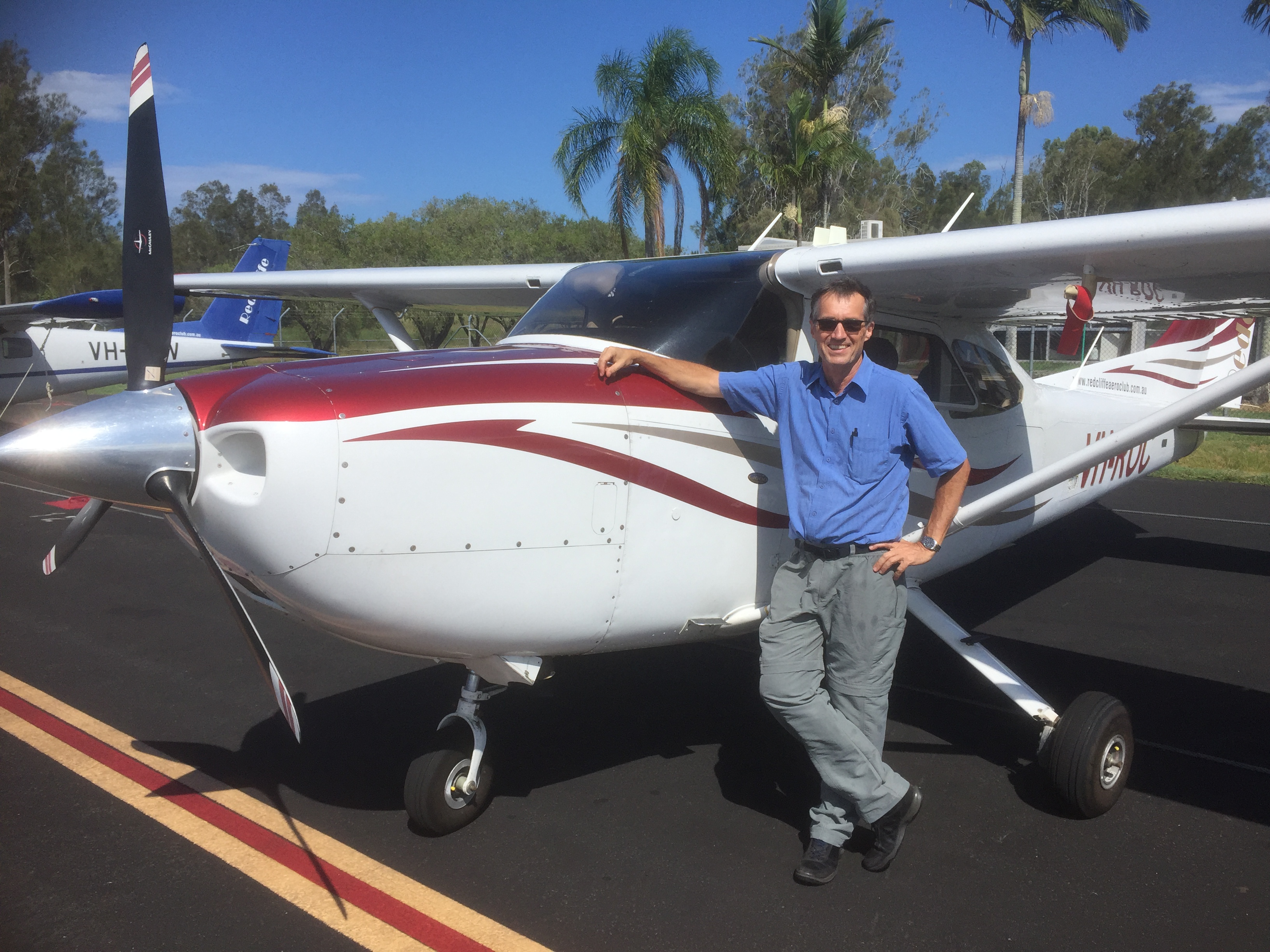
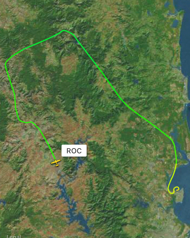
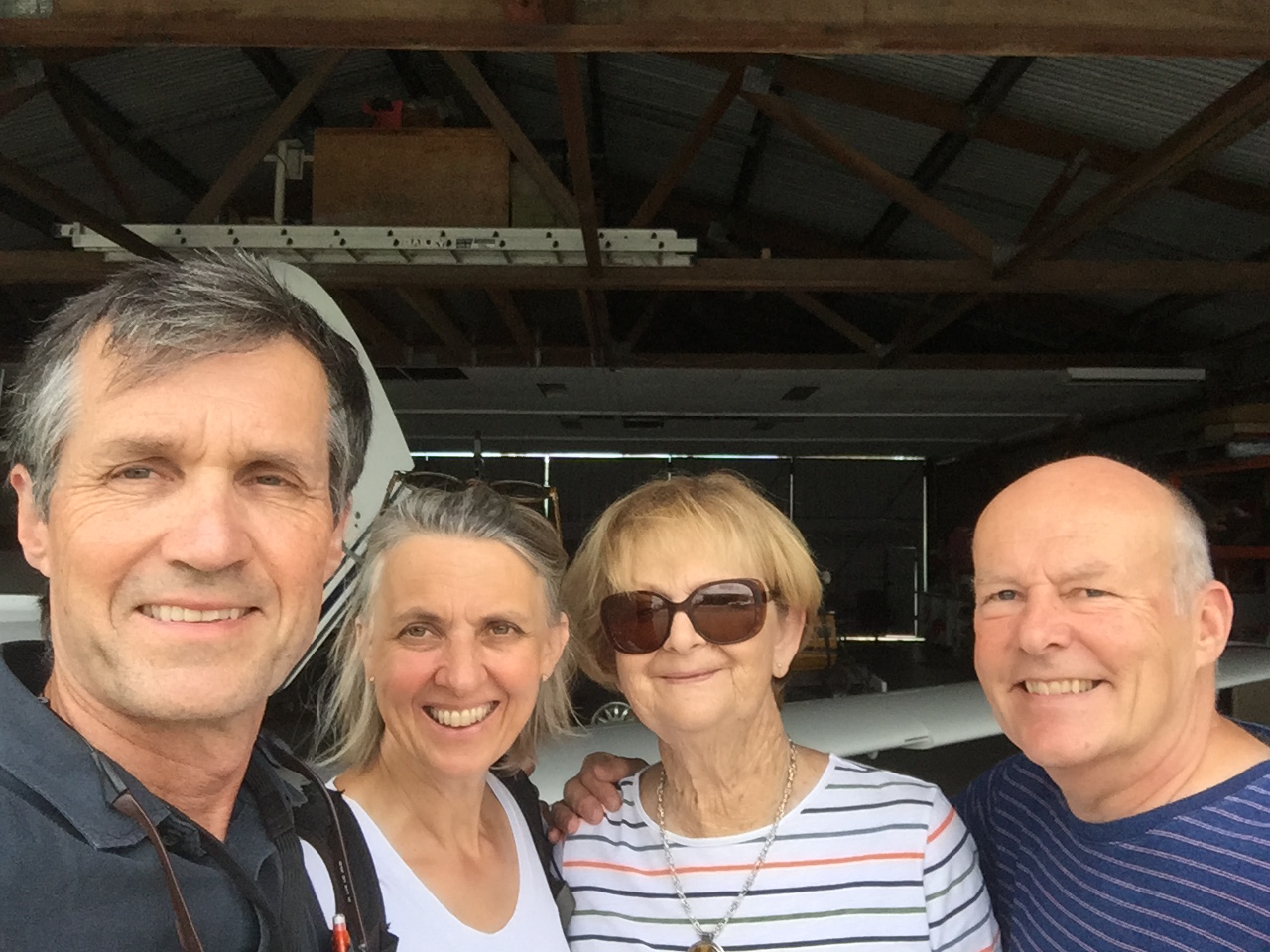
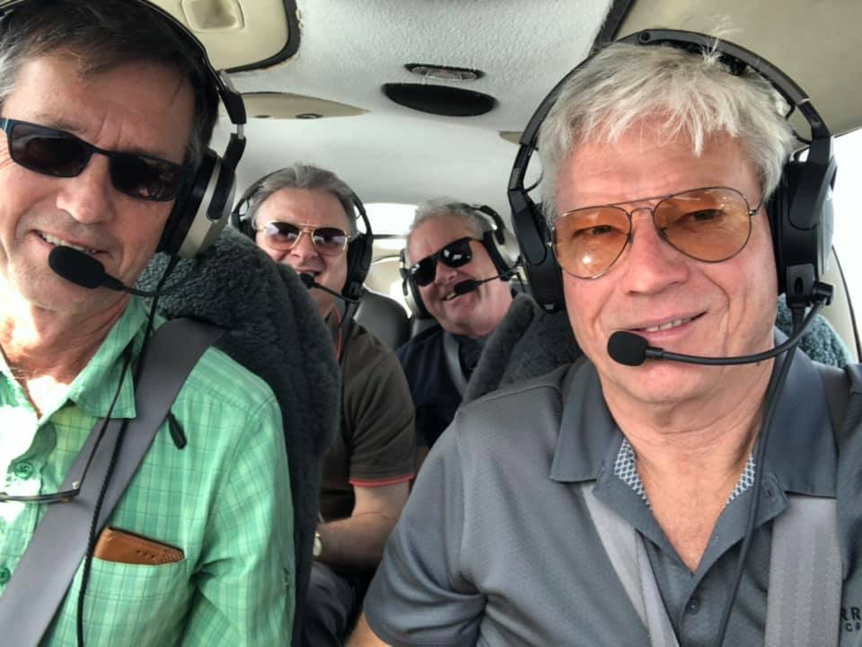
Beth had been wanting to go on another trip with us since the trip to St George in 2020 so we arranged that she and another friend Sandra join us for a few days at Agnes Water/1770, one of our favourite destinations. This time there’d be the special attraction of a day trip out to Lady Musgrave Island in the southern reaches of the Great Barrier Reef. It would give us the opportunity to snorkel amongst the coral and the turtles and other fish. Originally we had planned to depart at a reasonable hour on the morning of Saturday March 27 and had booked a boat trip to lady Musgrave on Sunday but two days before they cancelled the Sunday boat trip to Lady Musgrave so we had to get the boat on Saturday instead. This meant being up at 4 in the morning, taking off from Redcliffe at 6:30 and making it into Agnes at 8am to catch the trip.

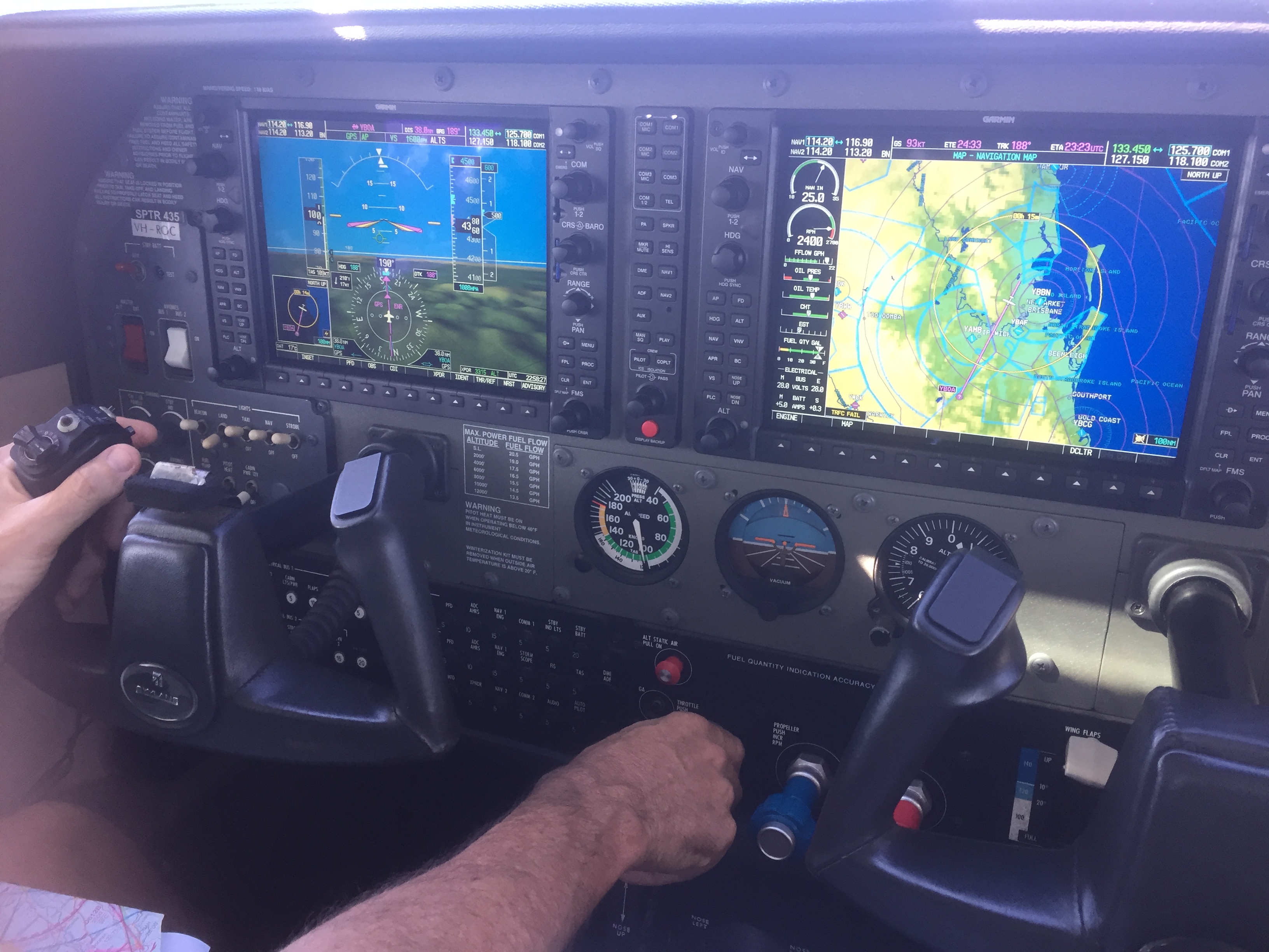
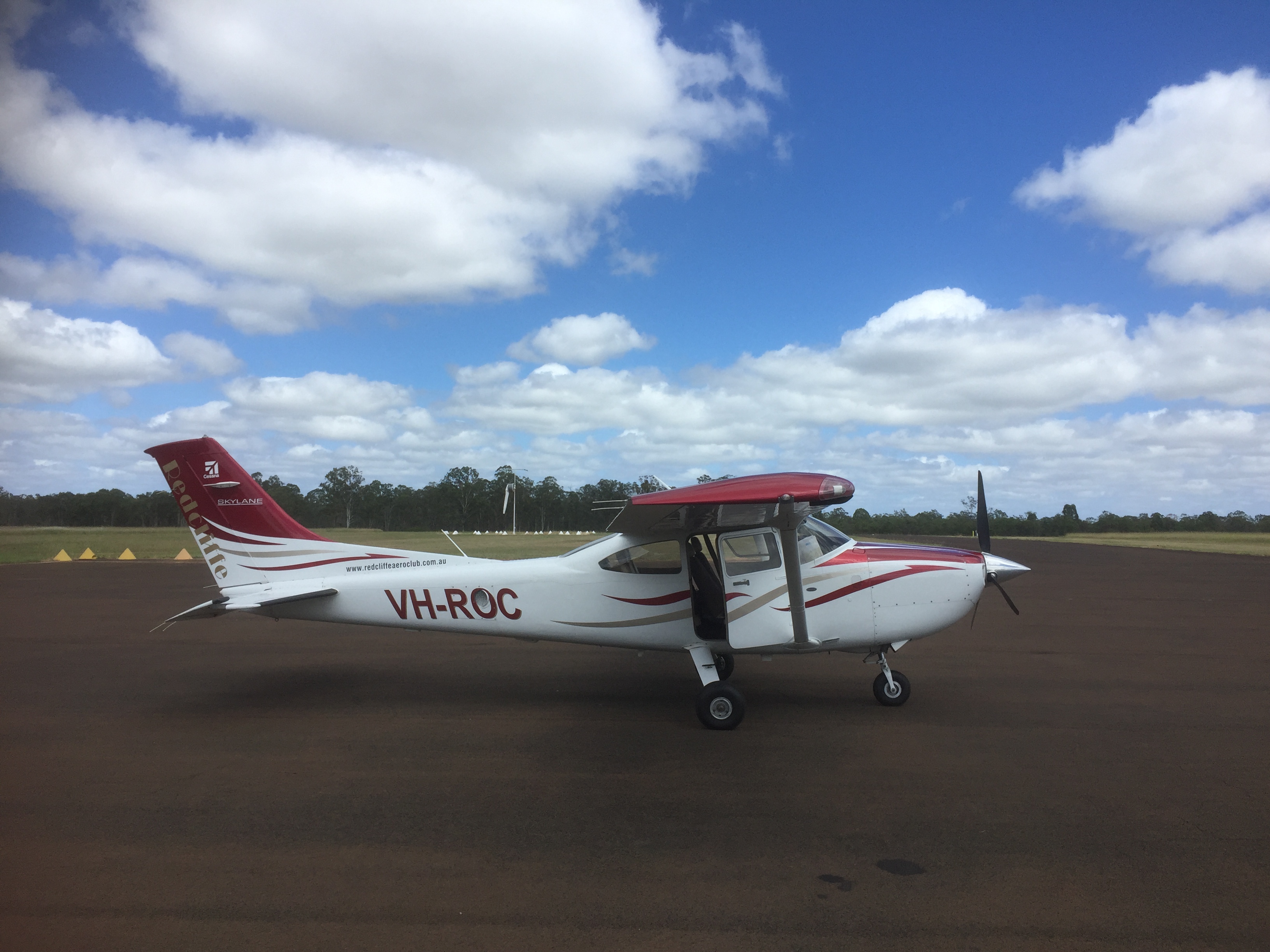
Despite the early start we made the rendezvous and Beth delivered us to Redcliffe nice and early. After a quick preflight and passenger briefing it was all aboard for Agnes Water.

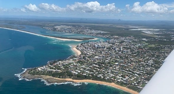
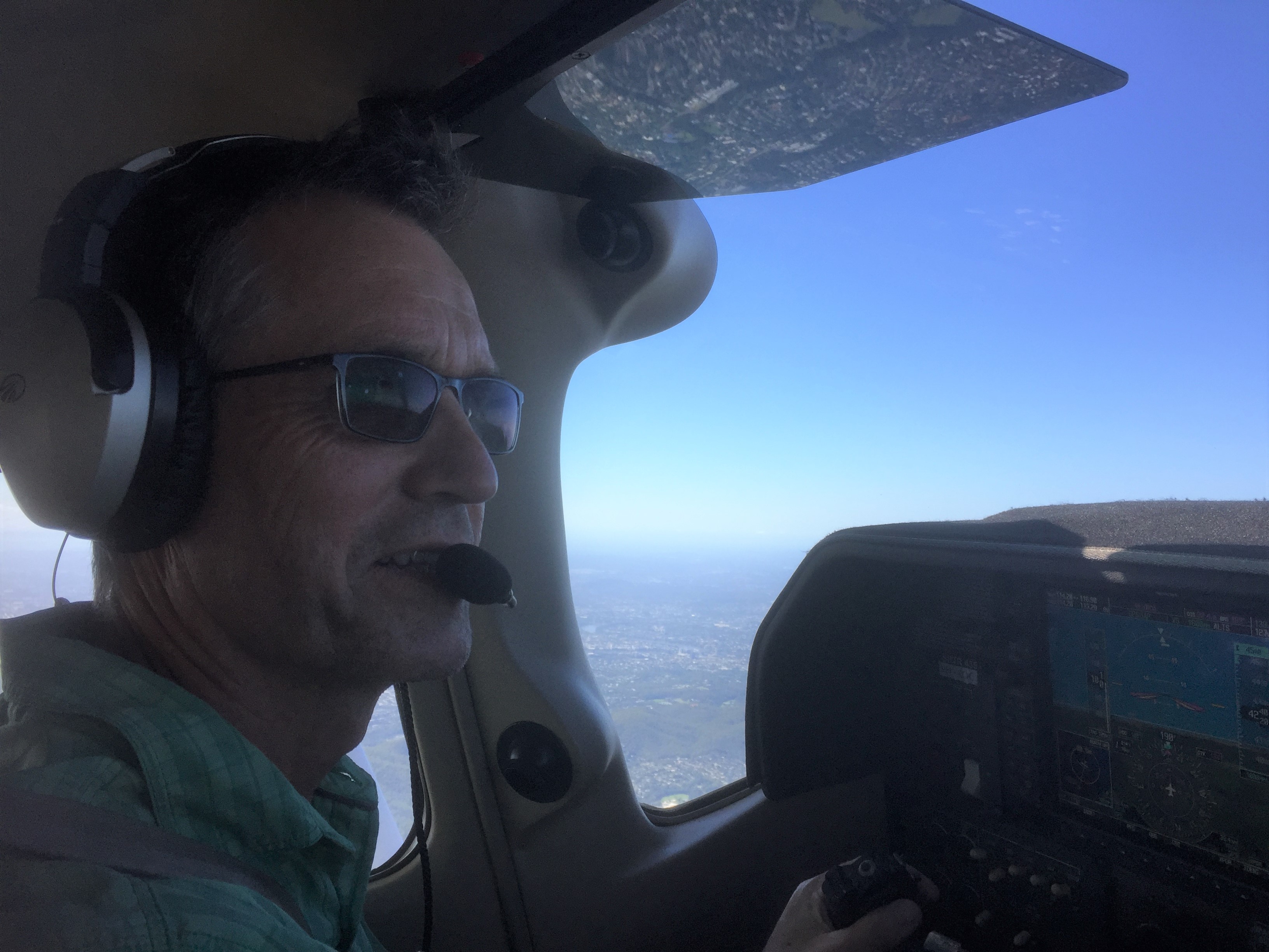
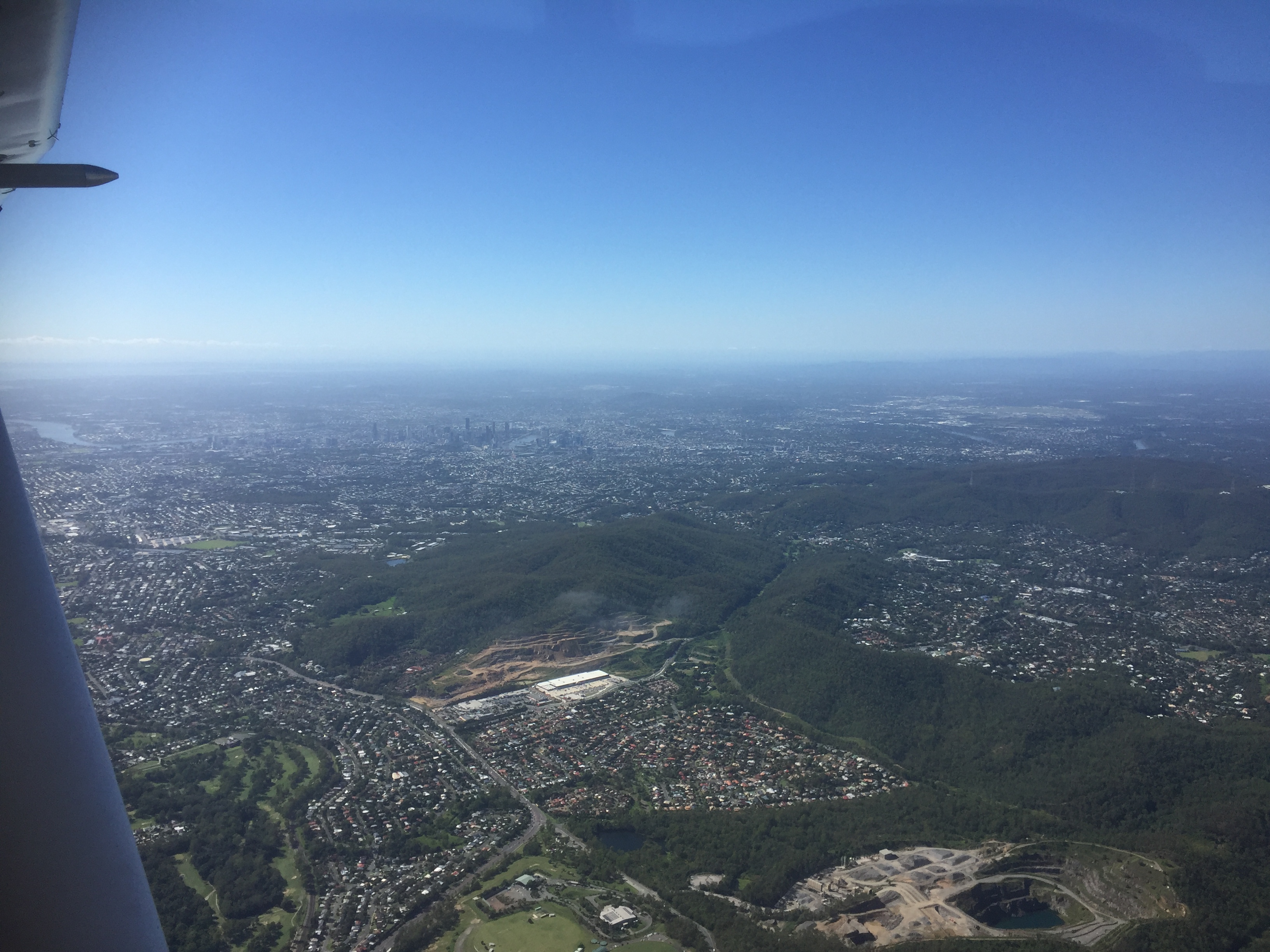
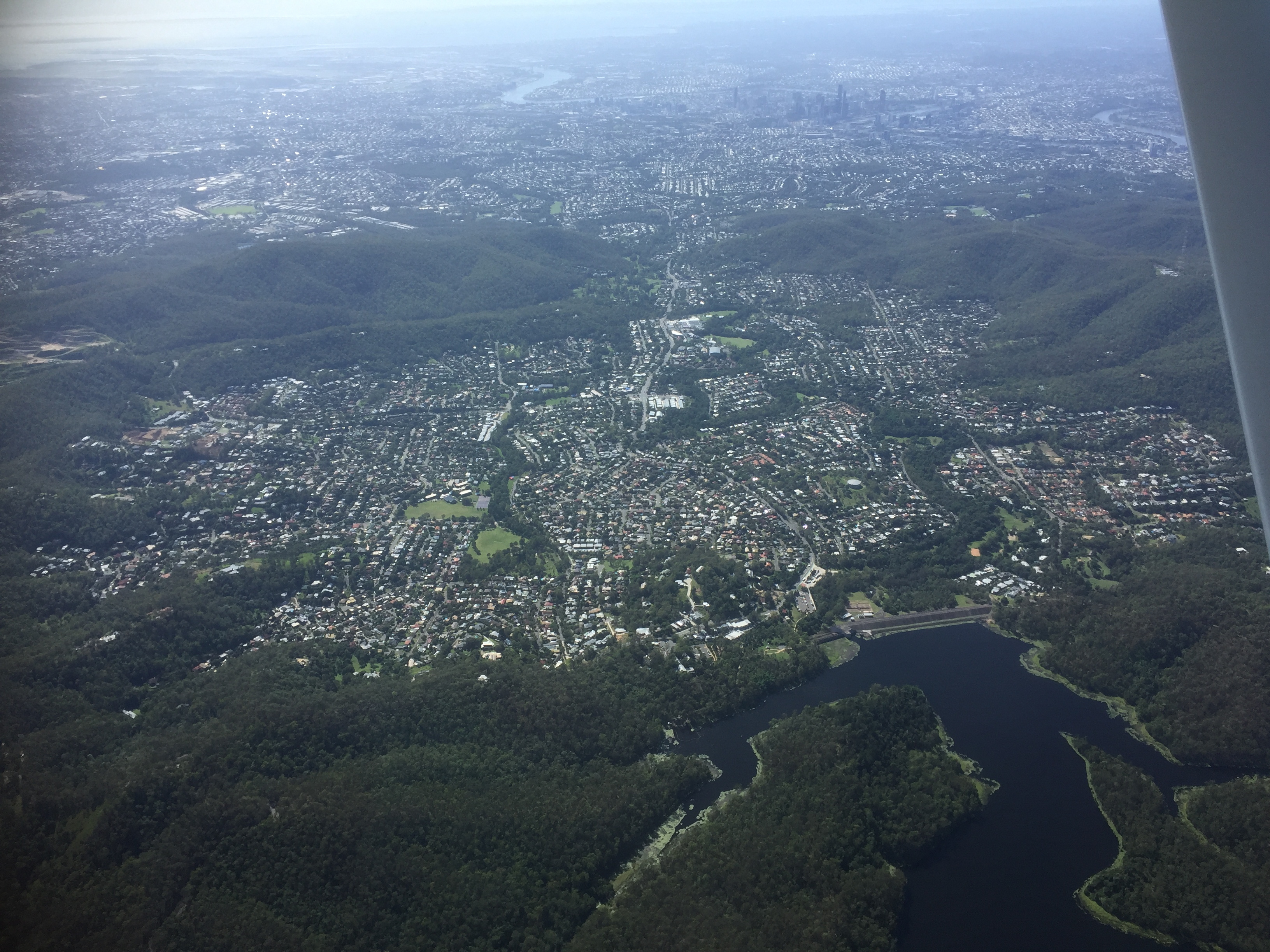
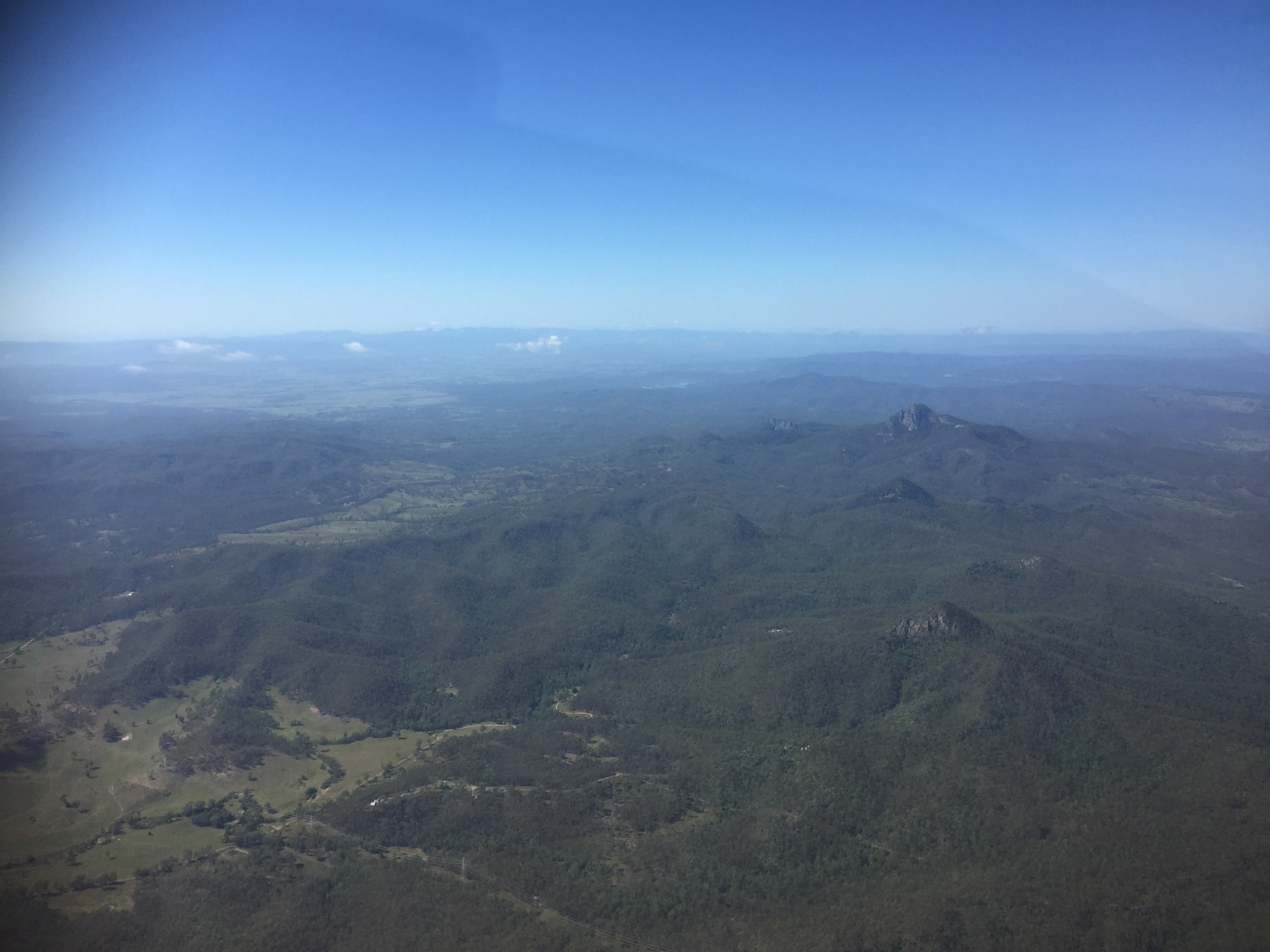
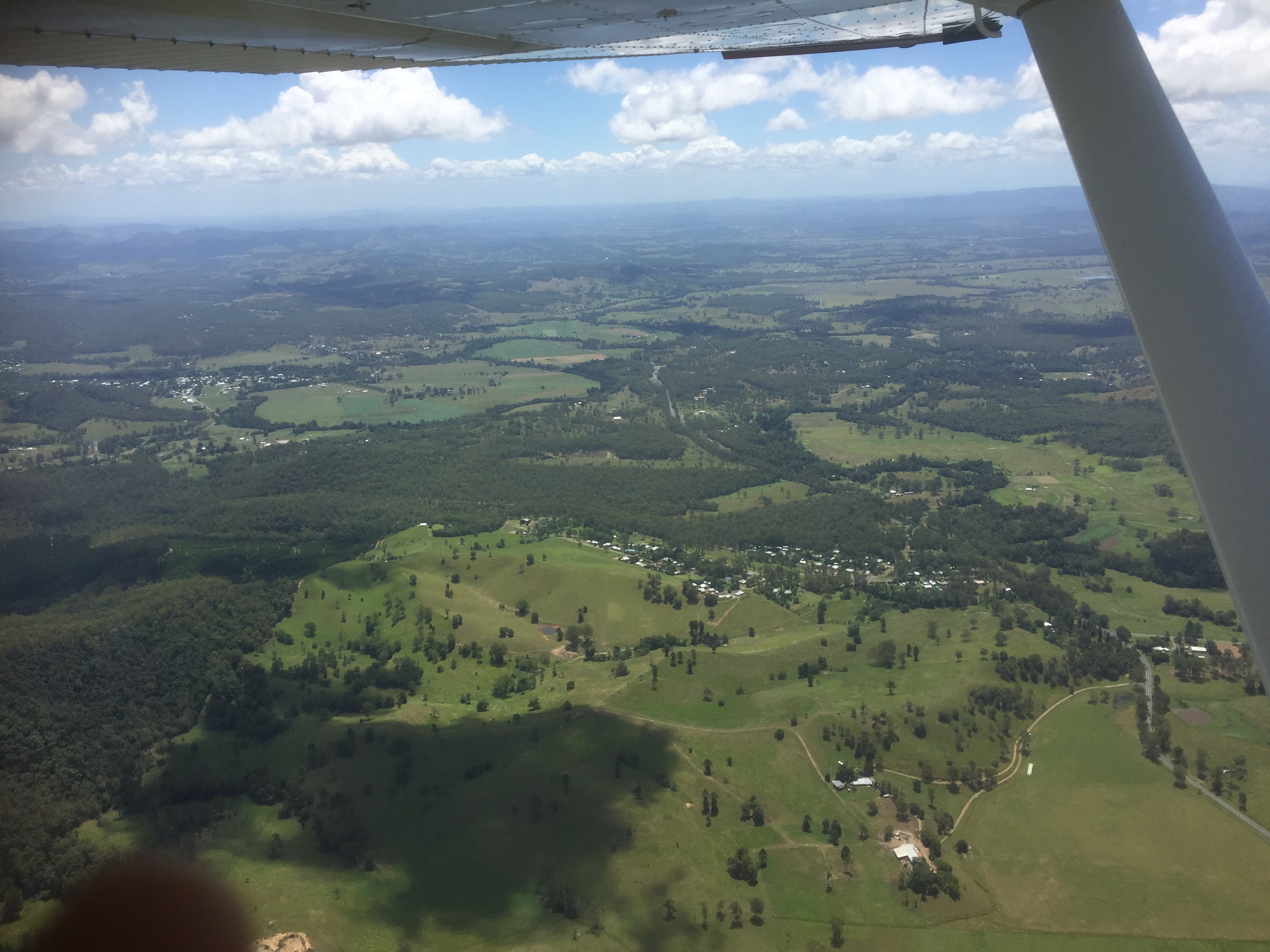
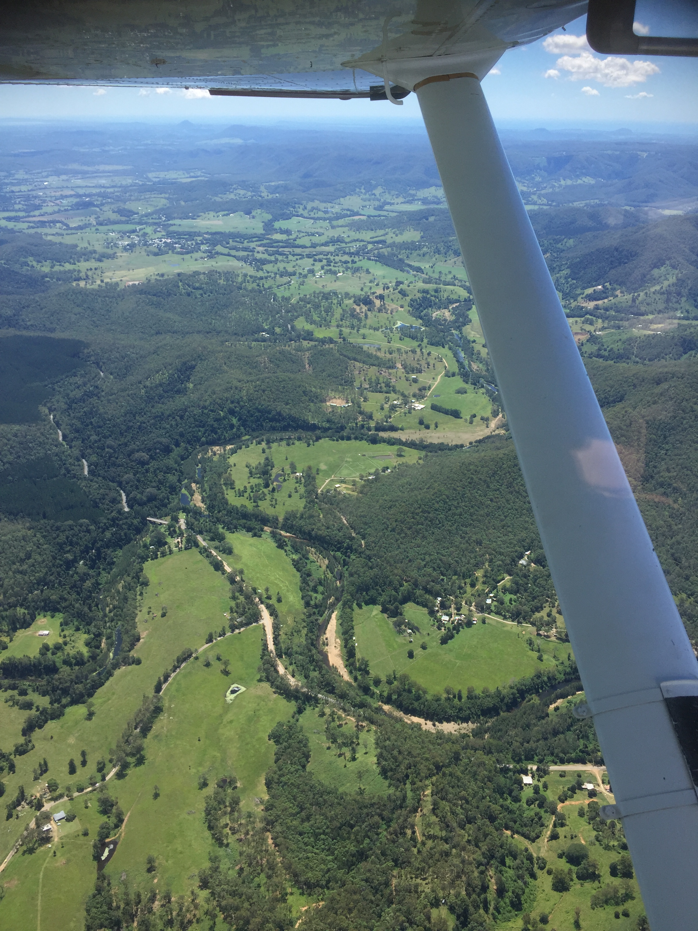
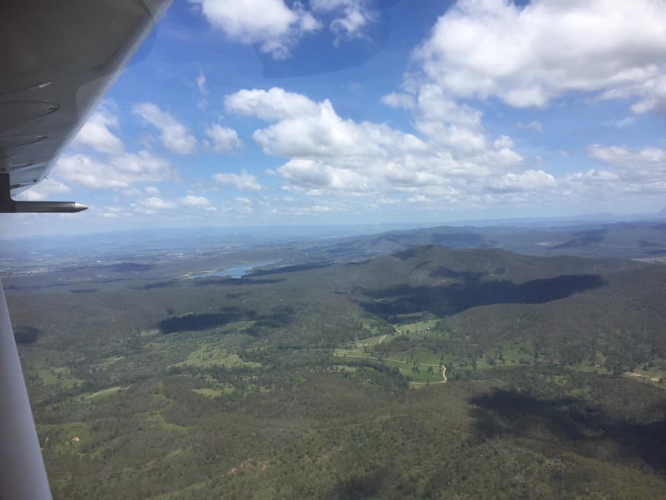
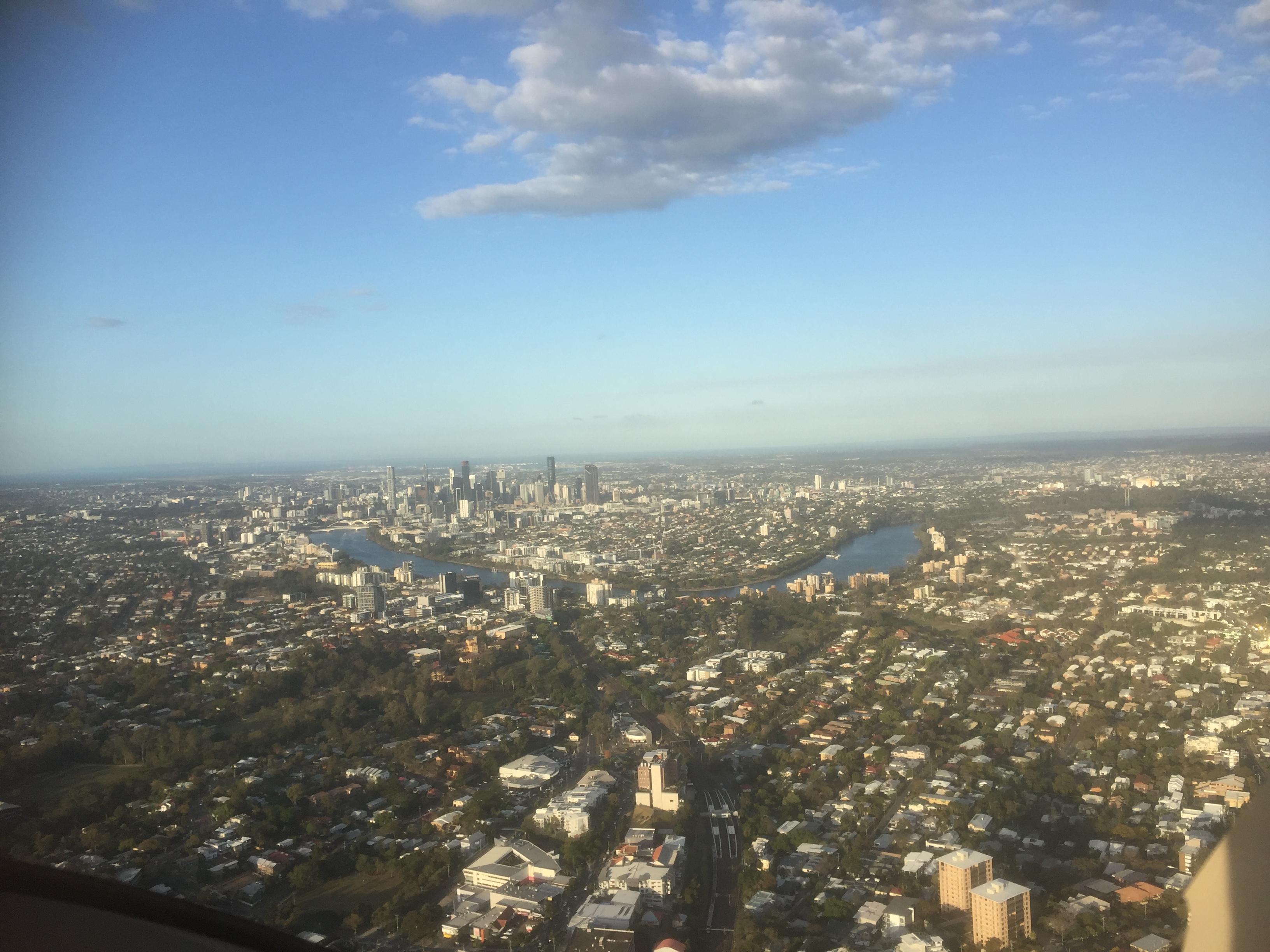
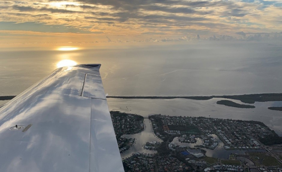
Taking off we were treated to an amazing view of the Sunshine Coast and its hinterland as the sun rose in the east.

Sunshine Coast hinterland

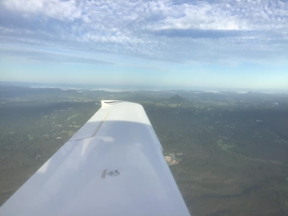
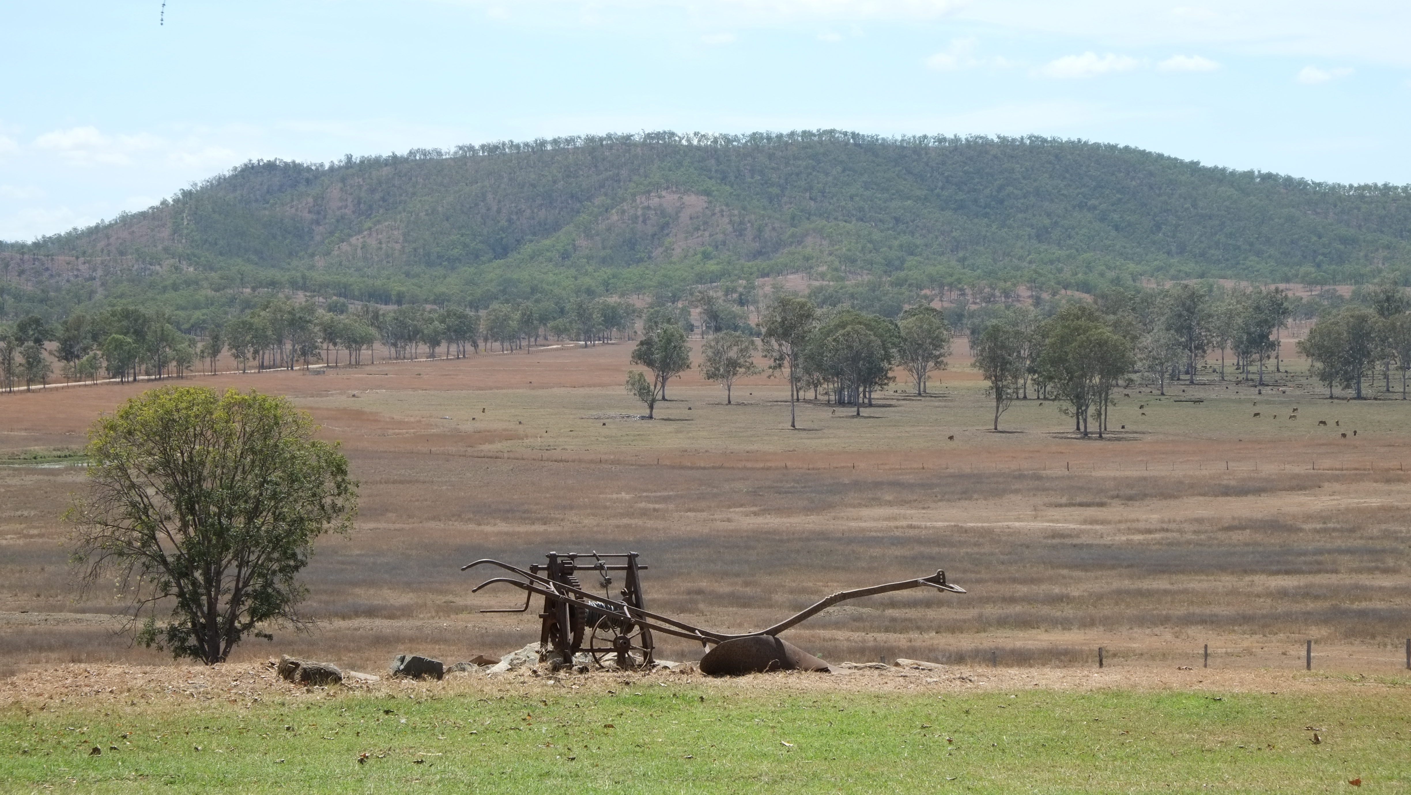
I never get tired of flying over this part of Queensland. It is really quite beautiful, especially first thing in the morning.

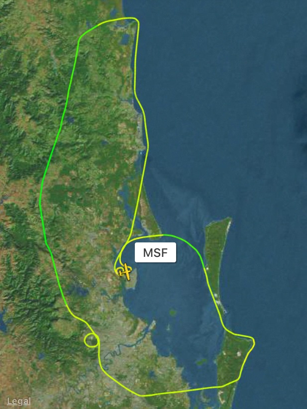
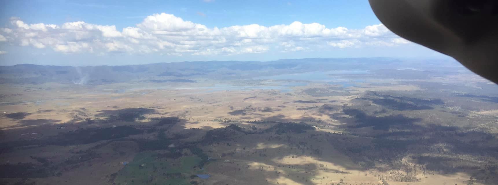
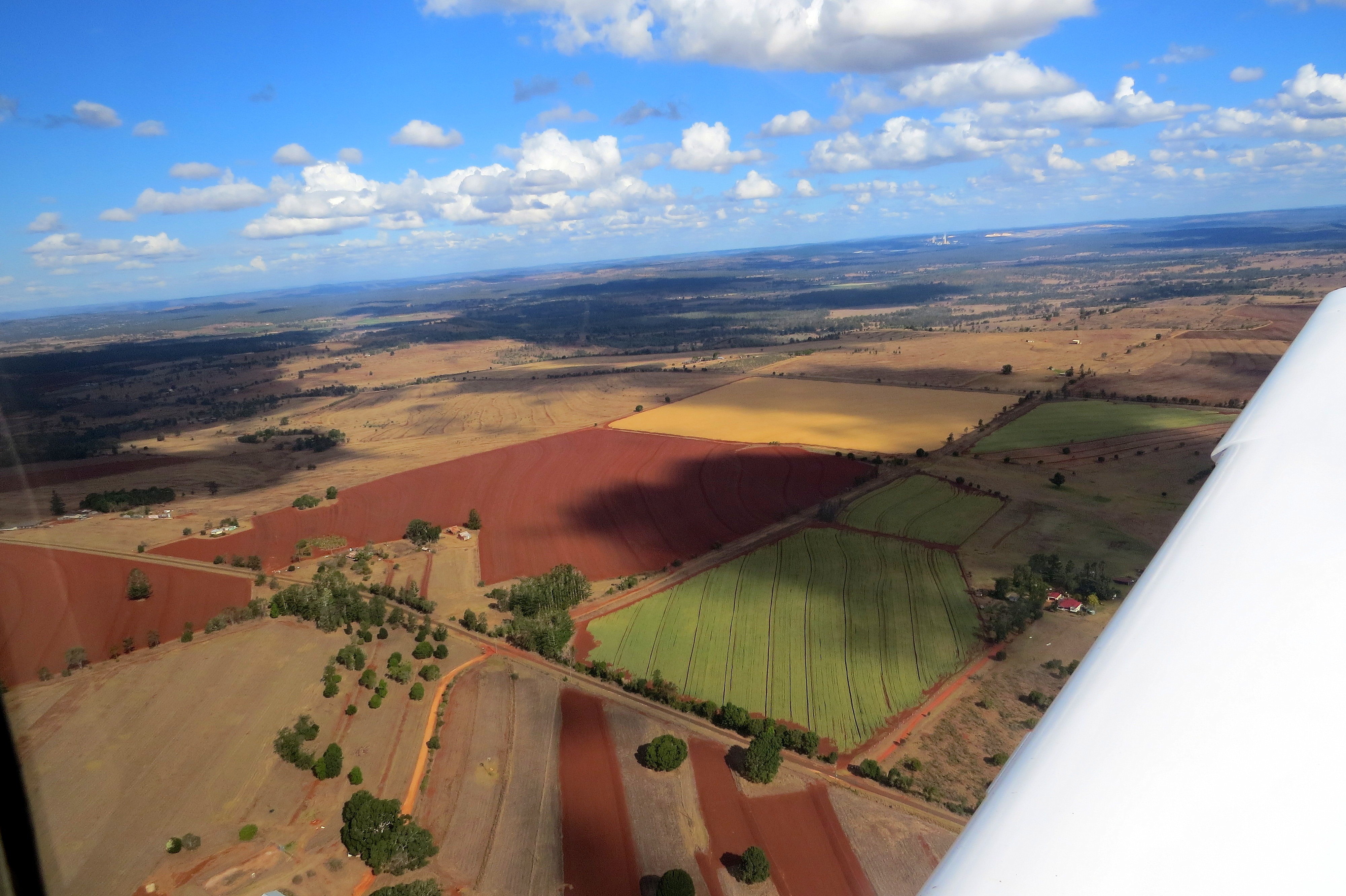
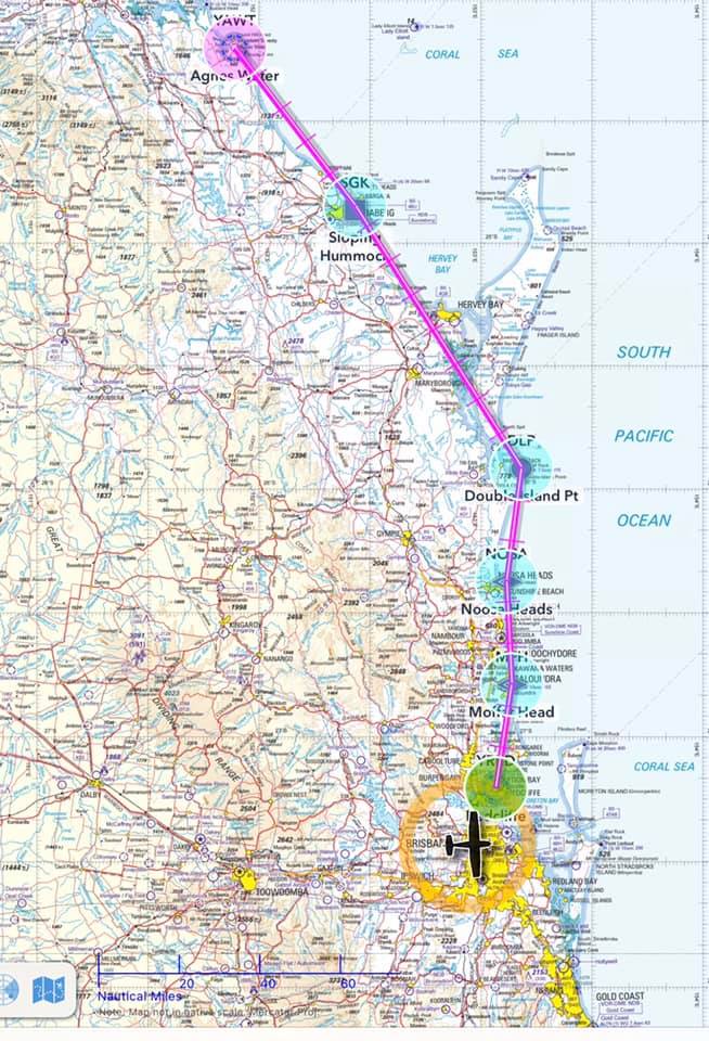
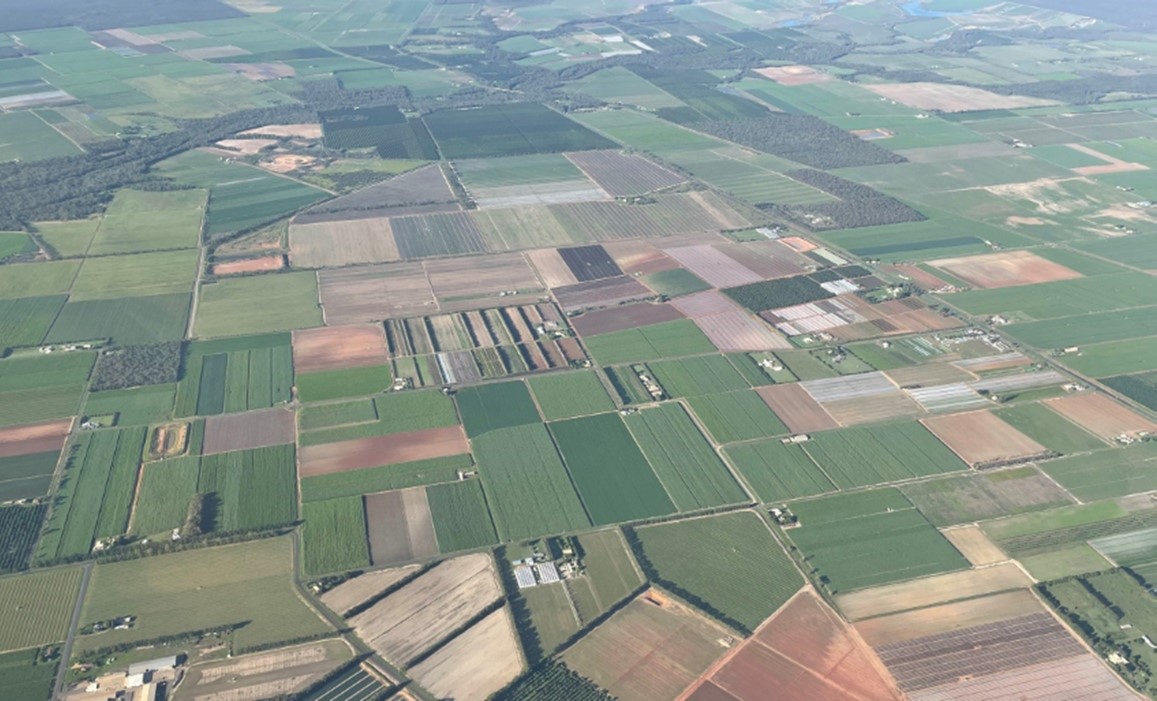
We tracked on up over Maryborough, Hervey Bay and Bundaberg, flying over some sugar cane fields on the way.

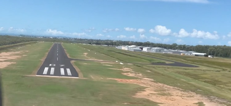
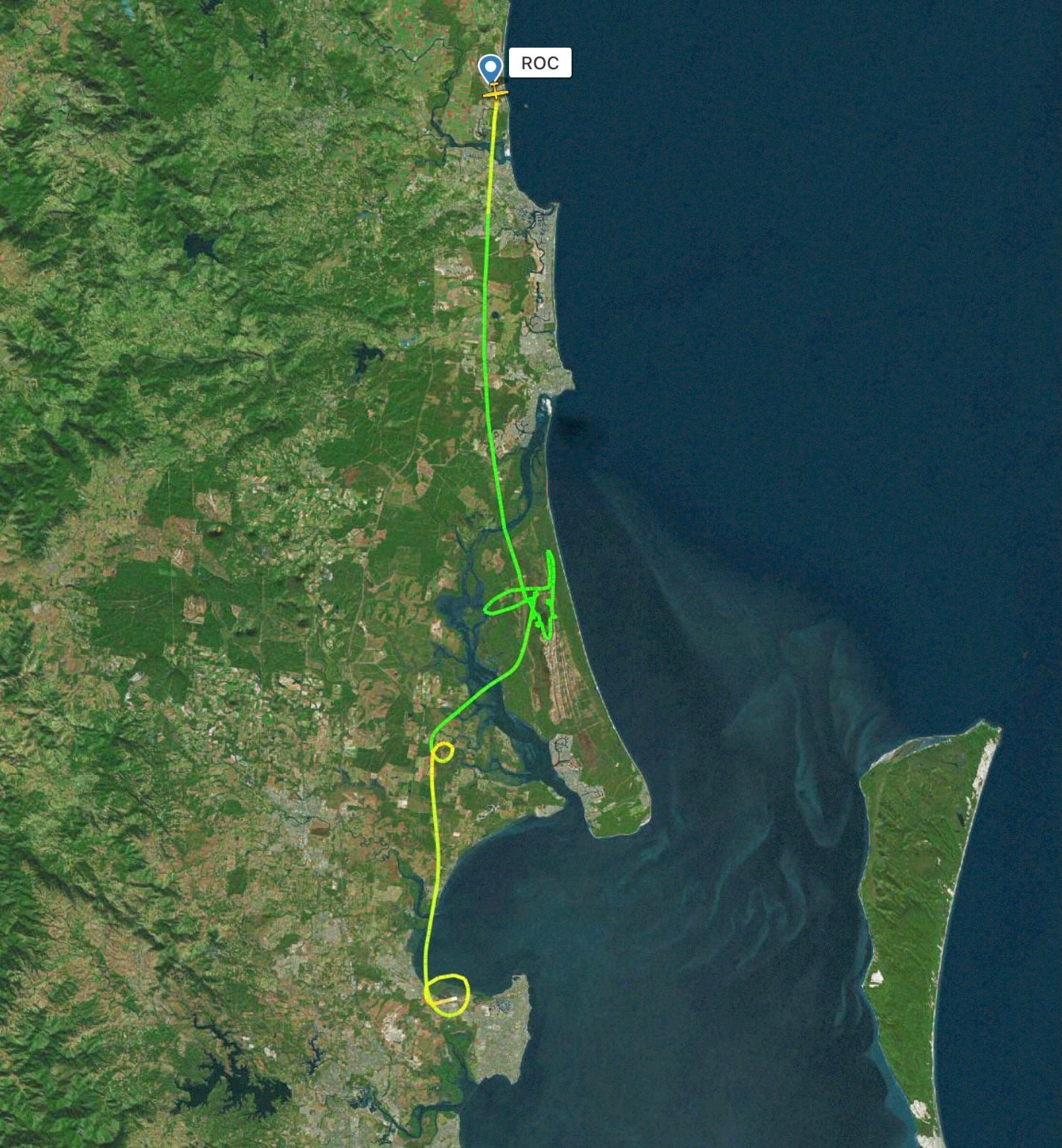
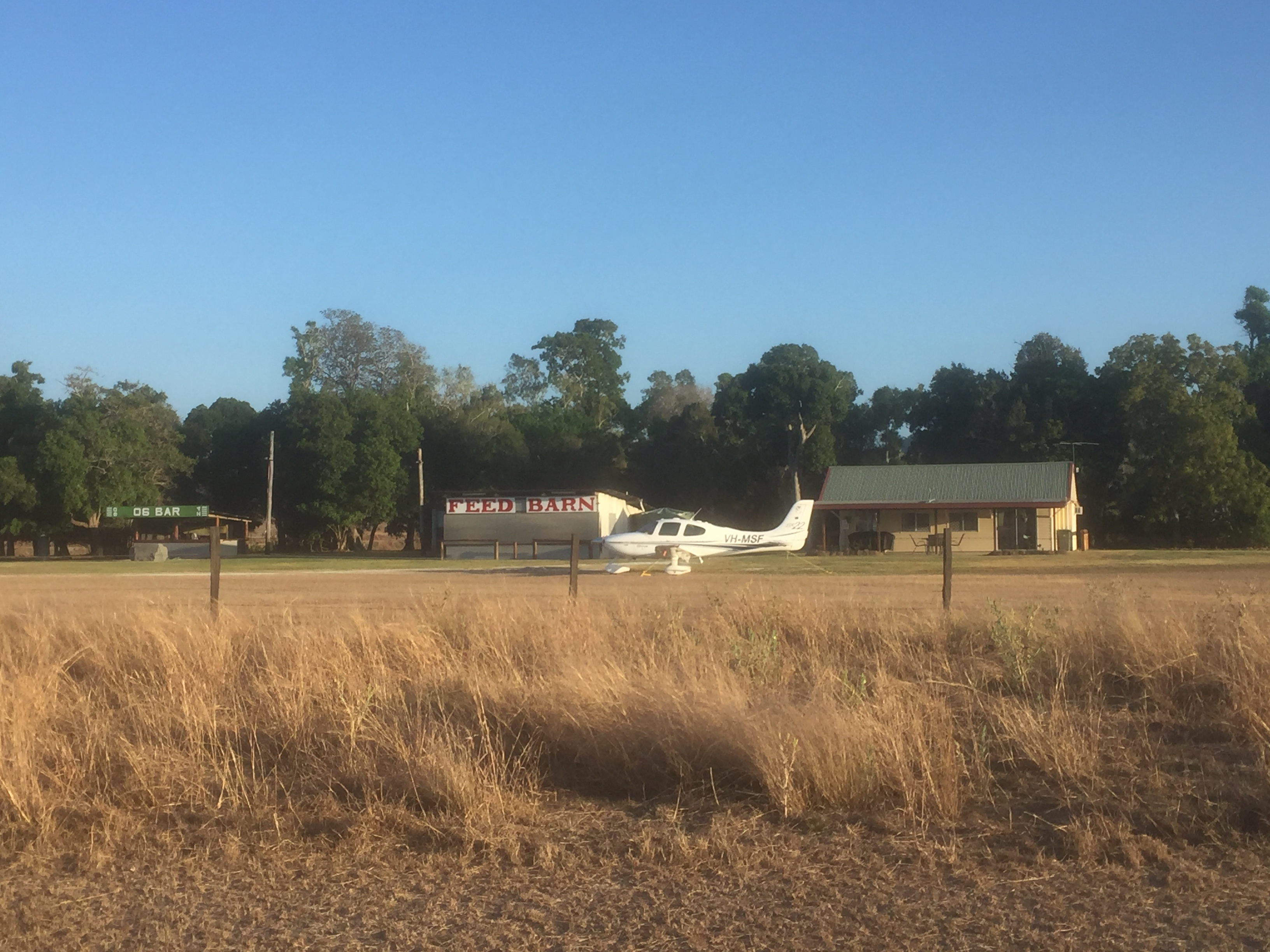
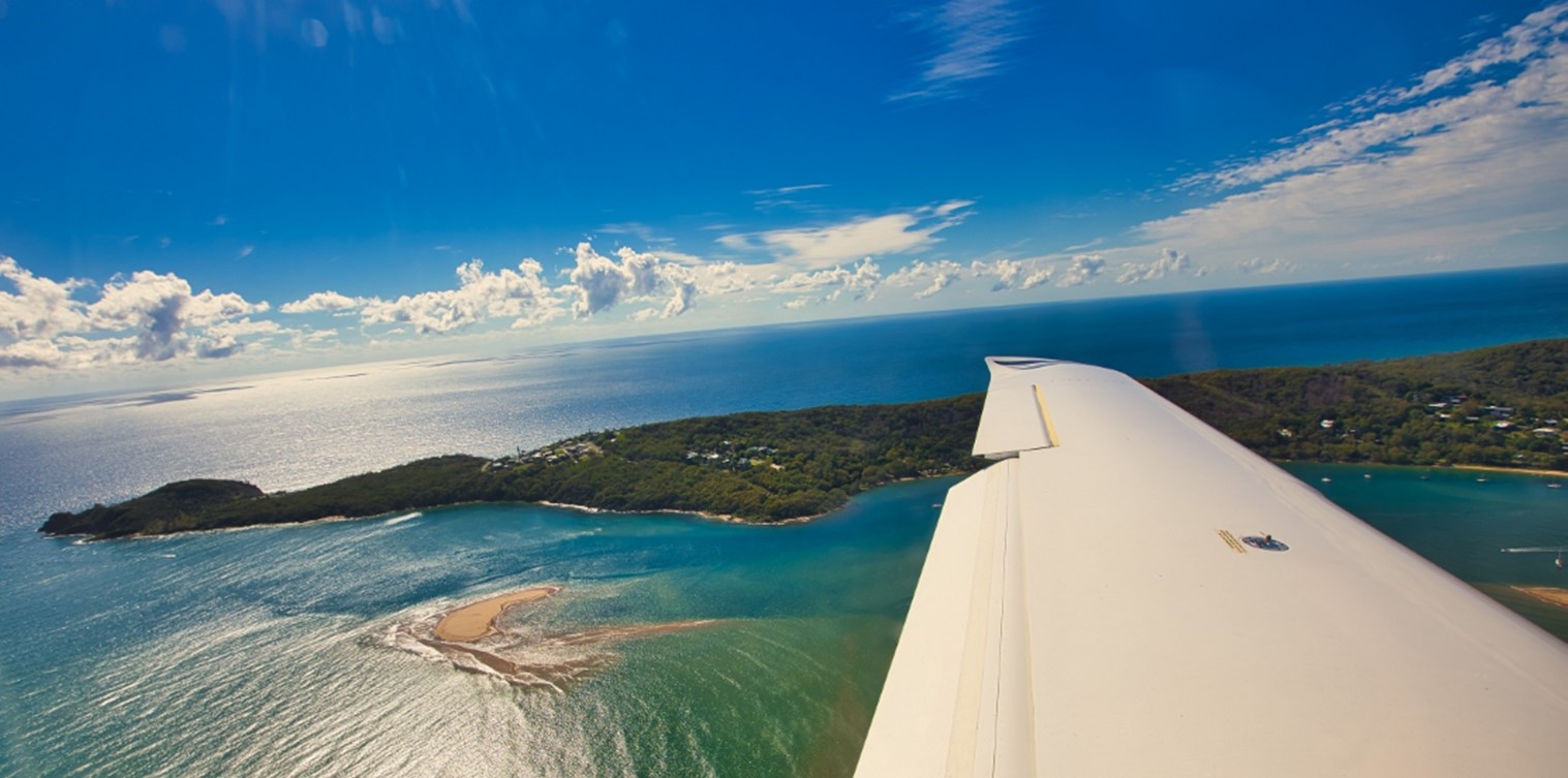
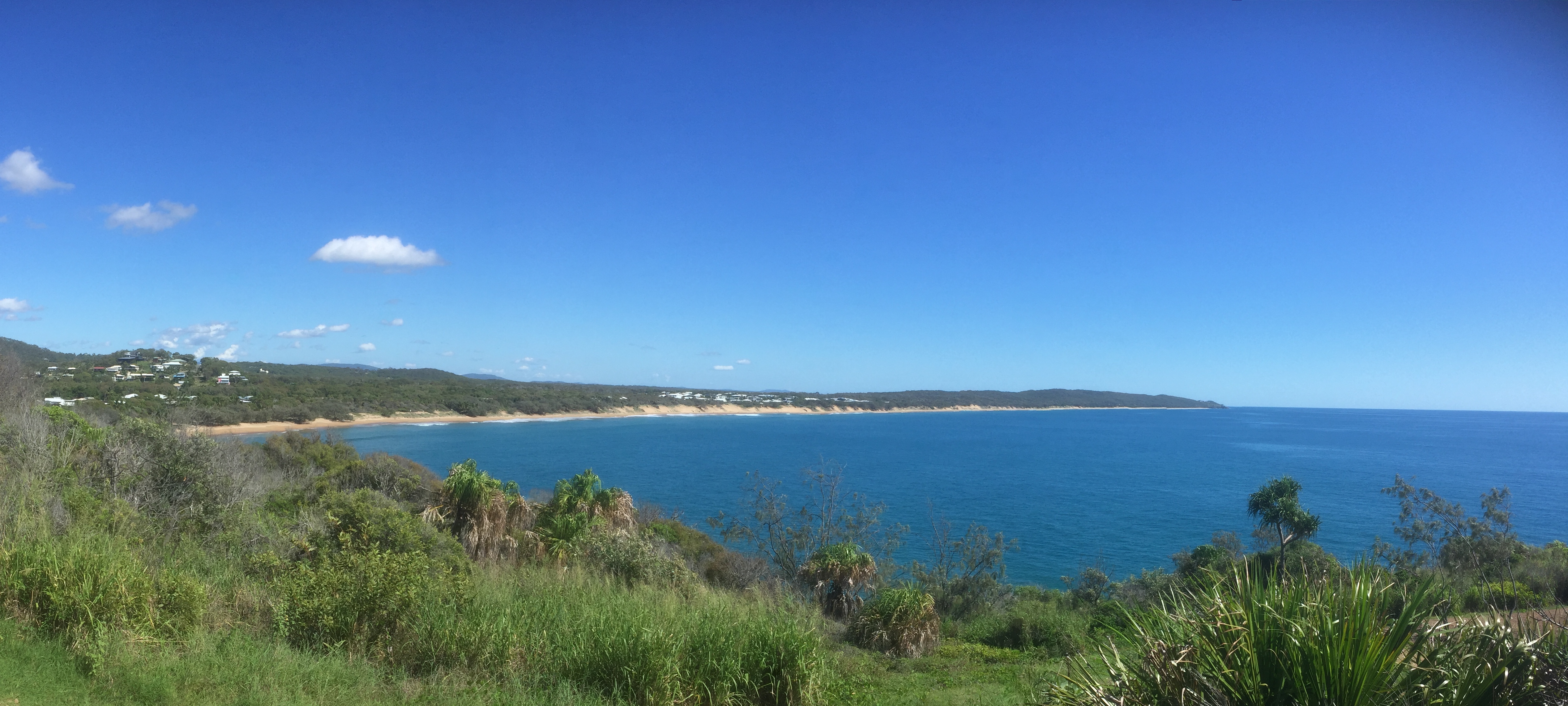
After about 80 minutes’ flying we rounded the head at 1770…

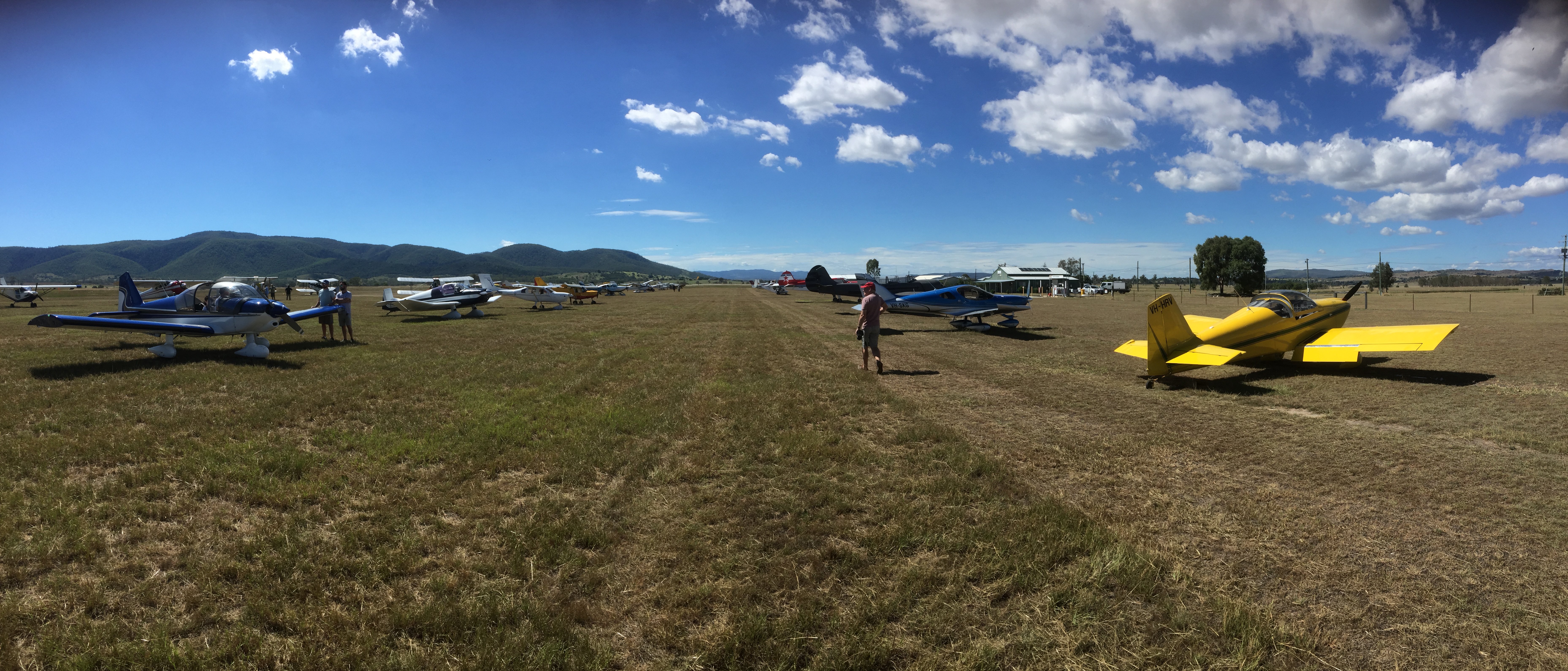
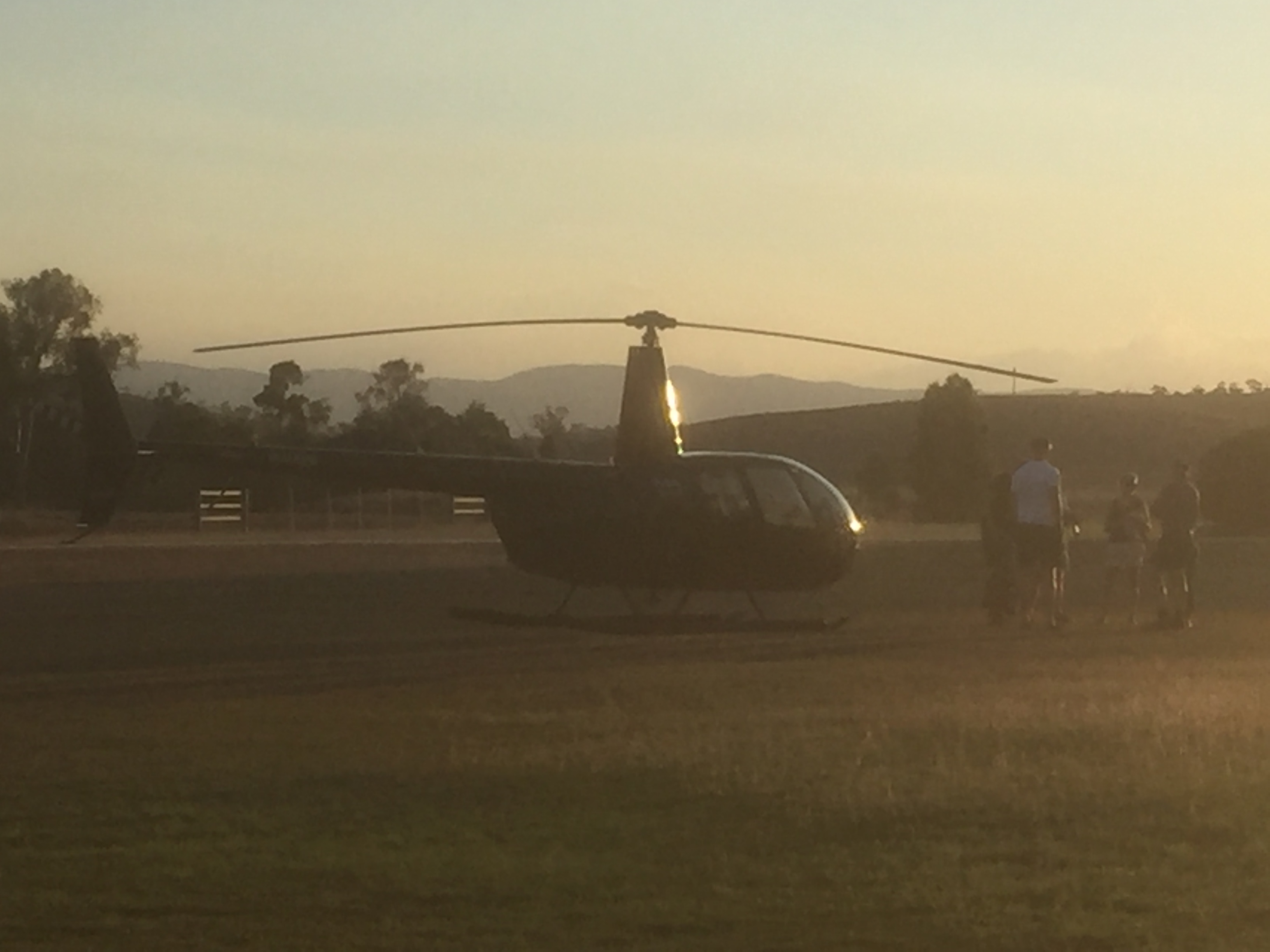
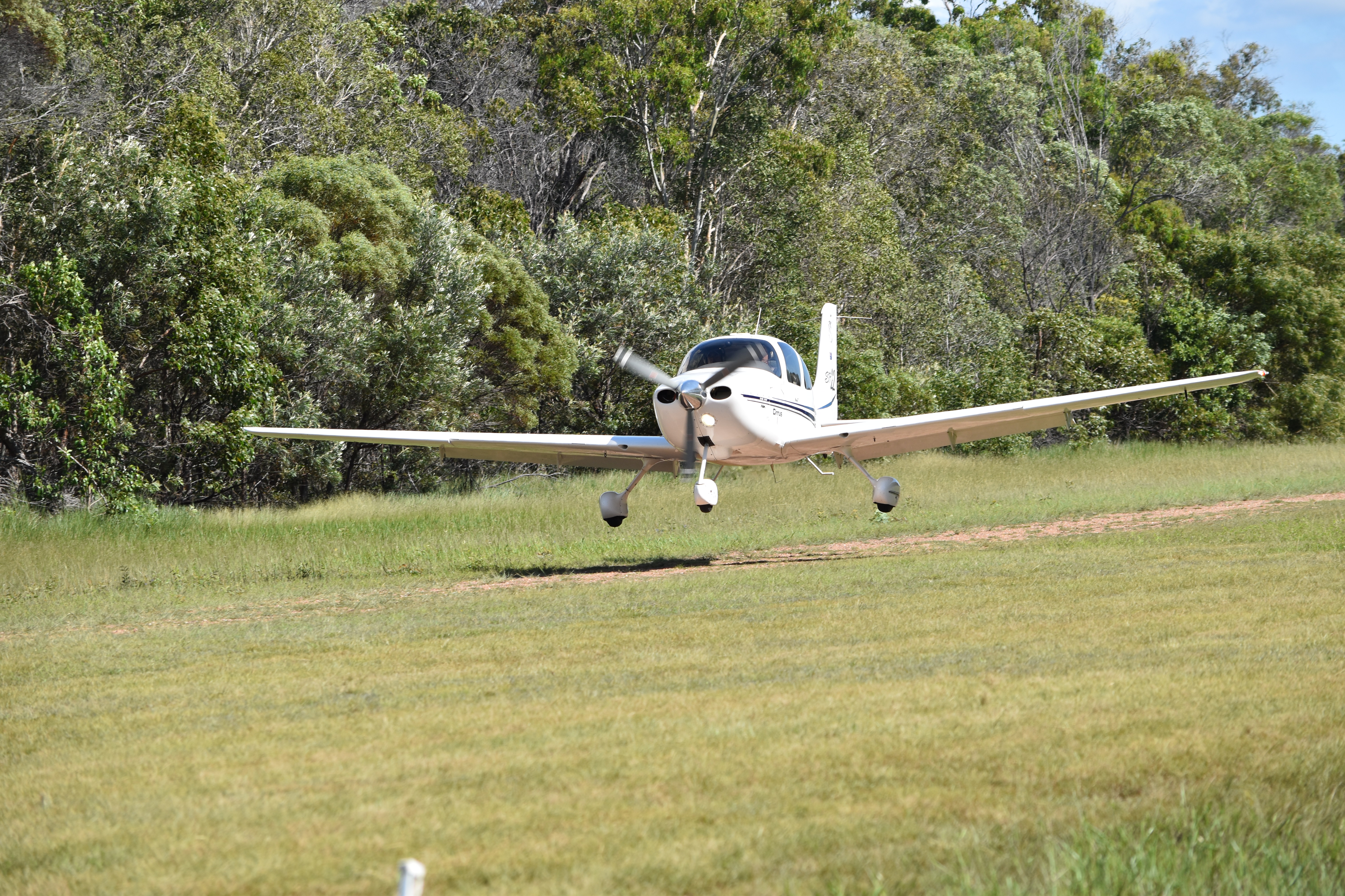
and were soon touching down on the Agnes Water airstrip.

Our taxi arrived shortly afterwards and took us the 5 minute trip to the 1770 marina where we boarded the boat.

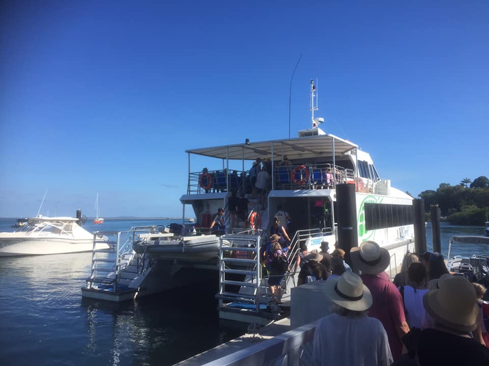
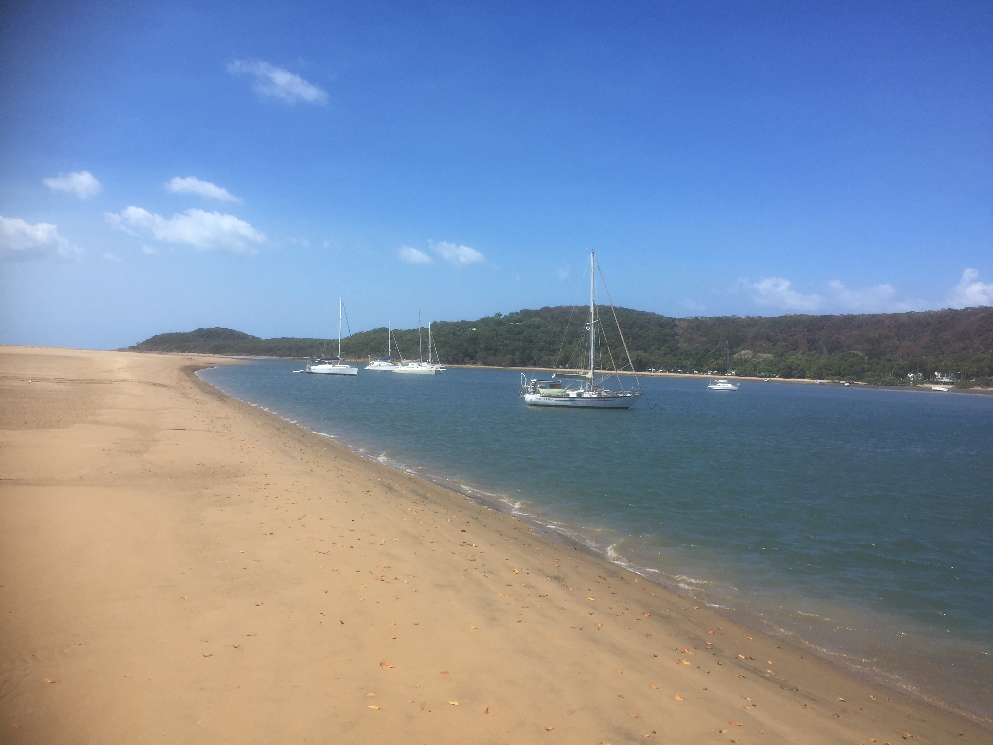
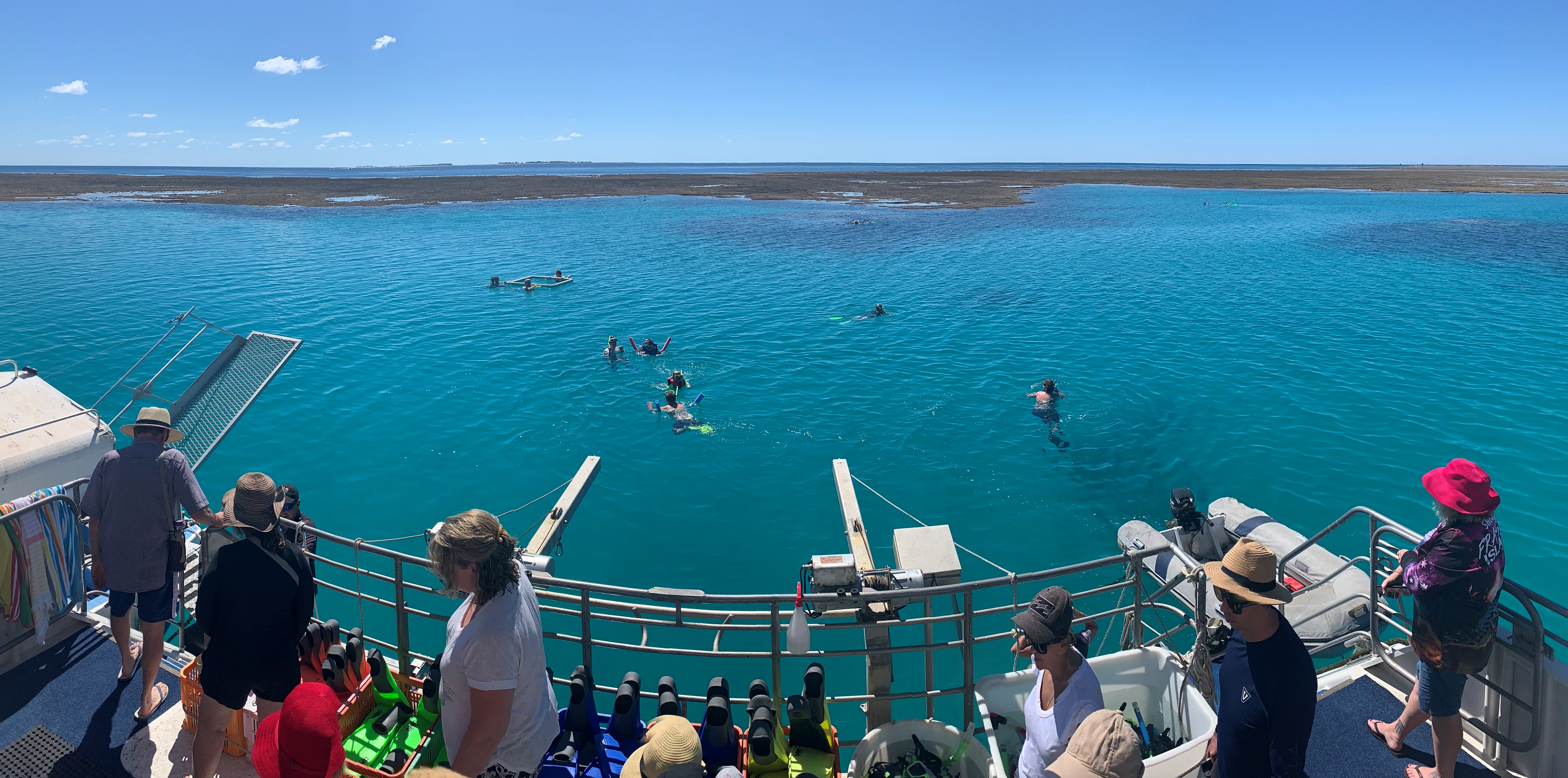
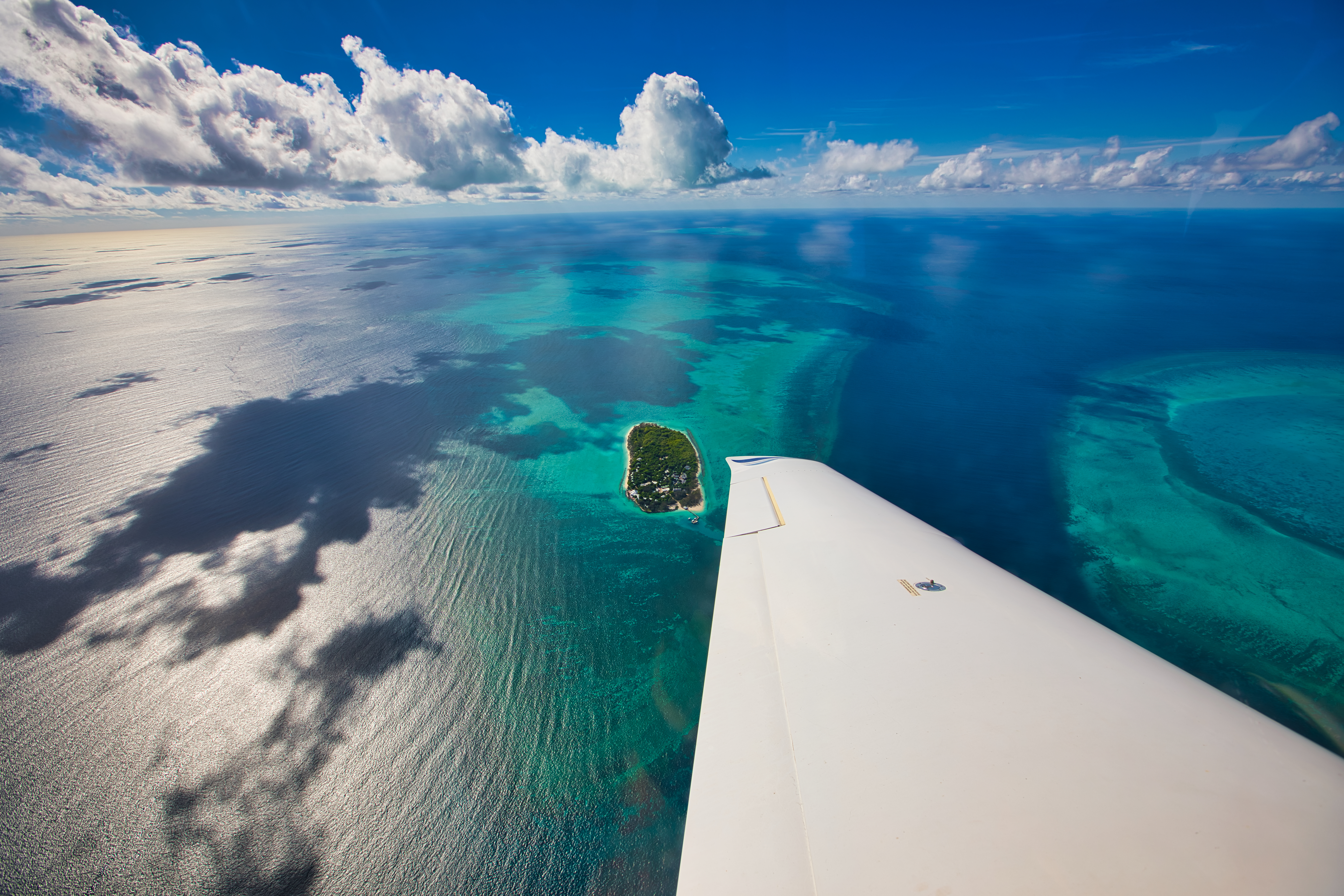
Ninety minutes later we were at the island, ideal for snorkelling.

Lady Musgrave Island is the southern-most island in the Capricorn Cay, formed entirely of coral and covered by pisonia trees.  Its only inhabitants are a variety of breeding bird species, including Black Noddy Terns, known for their voluminous pooping behaviour.  Perilous to the unsuspecting walkers! This island sanctuary is surrounded by an 8 km turquoise lagoon with an abundance of sea life. 

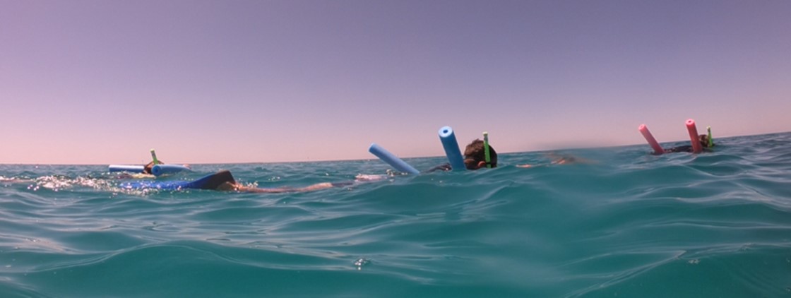
First up, struggling with our flippers (fins for the experts), was snorkelling, delighting in the coral, beautiful fish and turtles!  Magic!  Beth’s go pro came into its own capturing the extensive marine life and certain ungainly fellow snokellers!

Next, the glass bottomed boat ride to the Island afforded us great images, including some very curious turtles.

Our guide’s enthusiasm and knowledge of the marine world below was just amazing.  Upon arrival, we had a guided walk to learn about the Island formation and bird life.  Interestingly, there are no predators for the birds such as snakes or lizards.

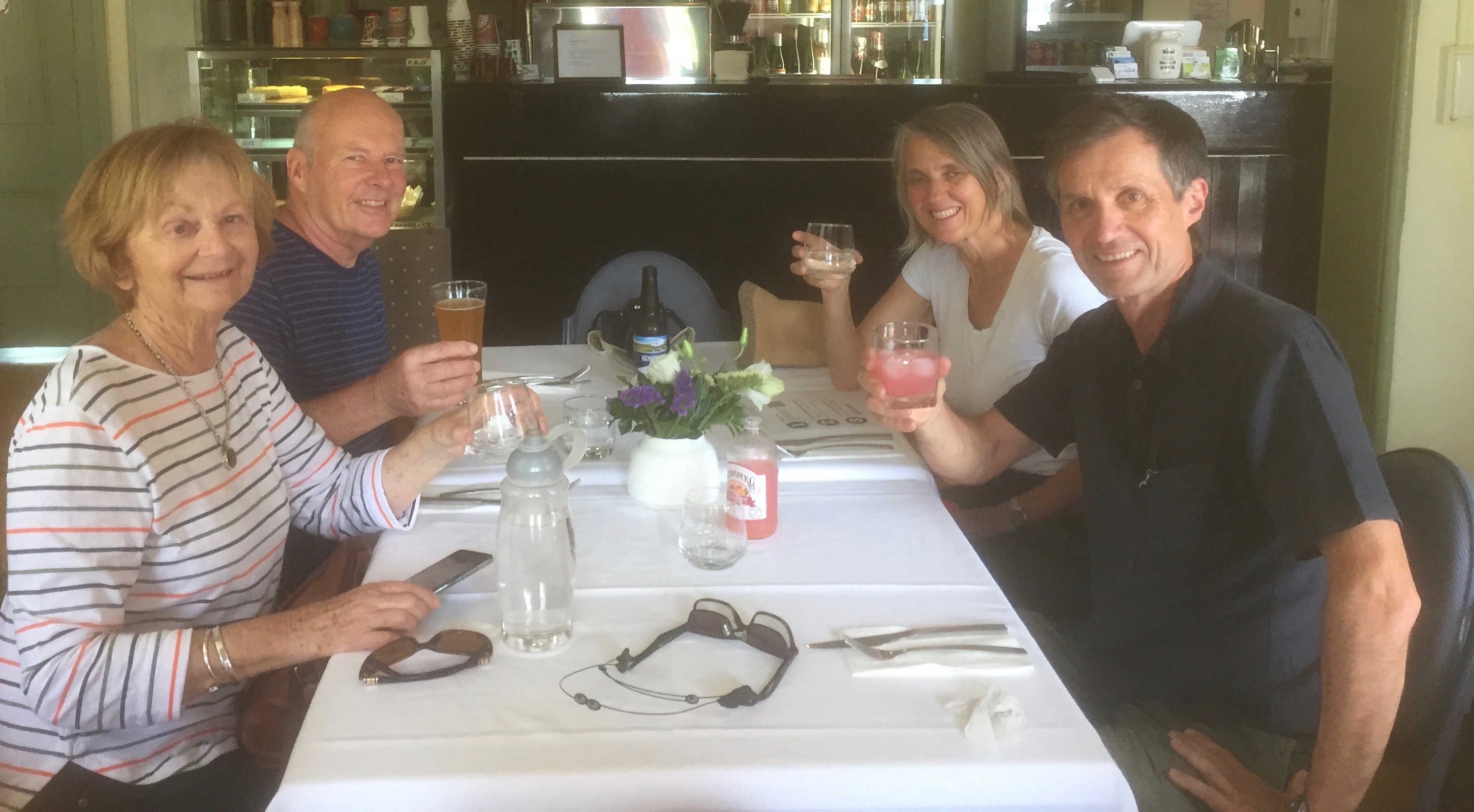
All of us left Lady Musgrave Island with a new appreciation for the pristine beauty of this stunning area.  We finished with a cooling lager at the newly opened wine bar at 1770 marina to watch the brilliant orange hues of the sunset over Bustard Bay. 

A perfect end to a perfect day.

On day 2 of our reef trip Sandra, Sigi and I were eager for a swim (where was Beth?) first up and met Beth for breakfast at Holidays Café with its fabulous beach views. Beth and Sandra left Sigi and me and took a taxi to the Paper Bark Forest. 

That was another highlight for them.  Only 400m long but a beautiful walk along planks and stepping stumps enjoying the paper bark tea trees, dappled sunshine, somewhat elusive butterflies and birds.  Some of the path was underwater due to recent heavy rains but was easily traversed in bare feet! Faced with a long walk back, their feet were saved, by yet another wonderful local who offered them a lift to our morning tea destination at the Getaway Garden Café to meet up with Sigi and me.

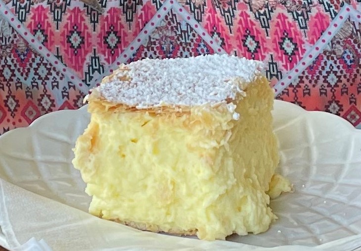
Now for the much awaited vanilla slice, which, we have been told, is one of the best in QLD.  Of course, we had to sample. Having tasted with great gusto it could well be true!

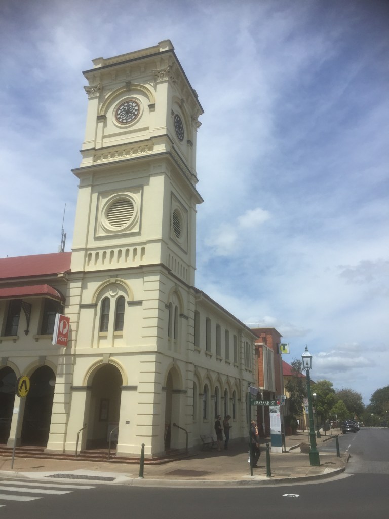
Our walk back to the motel took us via Discovery Trail Lookout with fabulous views. 

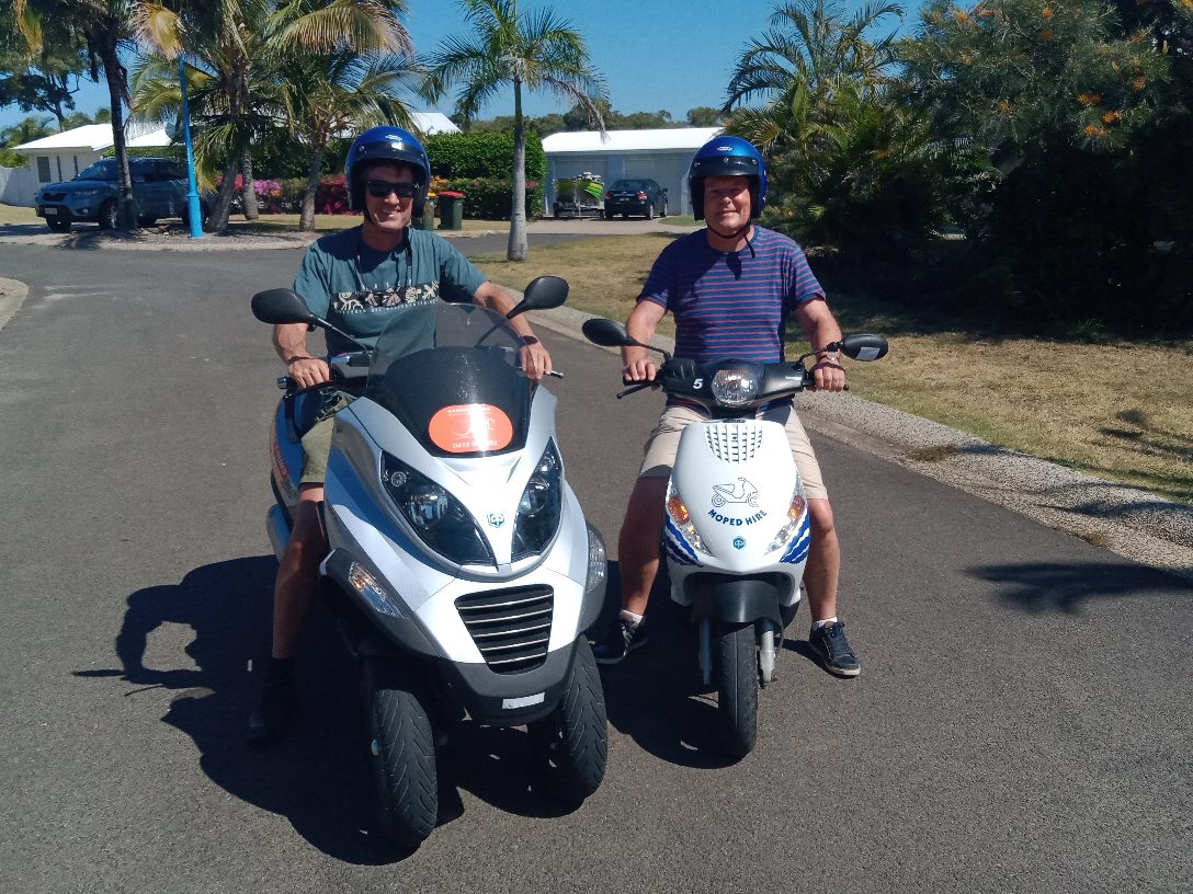
Sandra enjoyed another swim (where was Beth?) then they were off to the LARC (Lighter Amphibian Replenish Cargo) tour. 

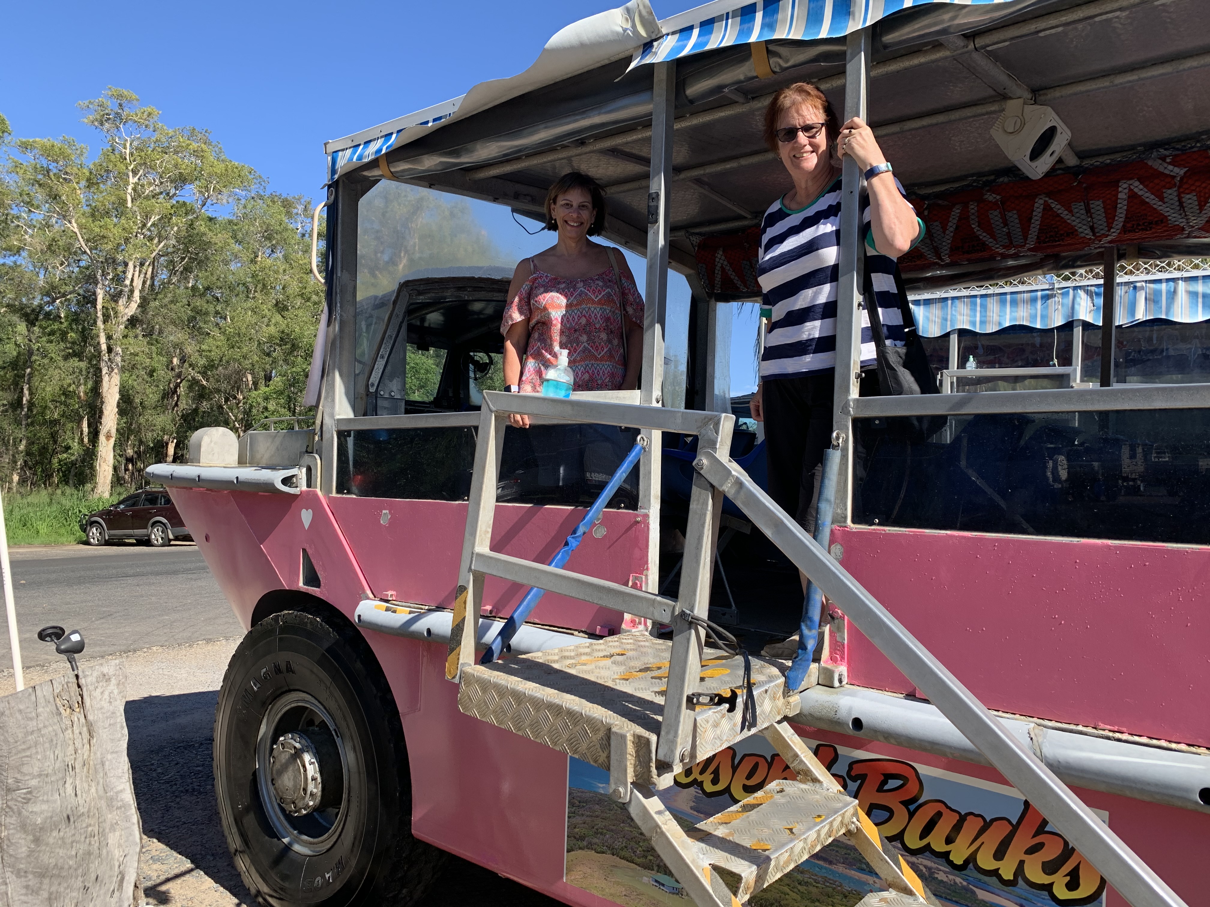
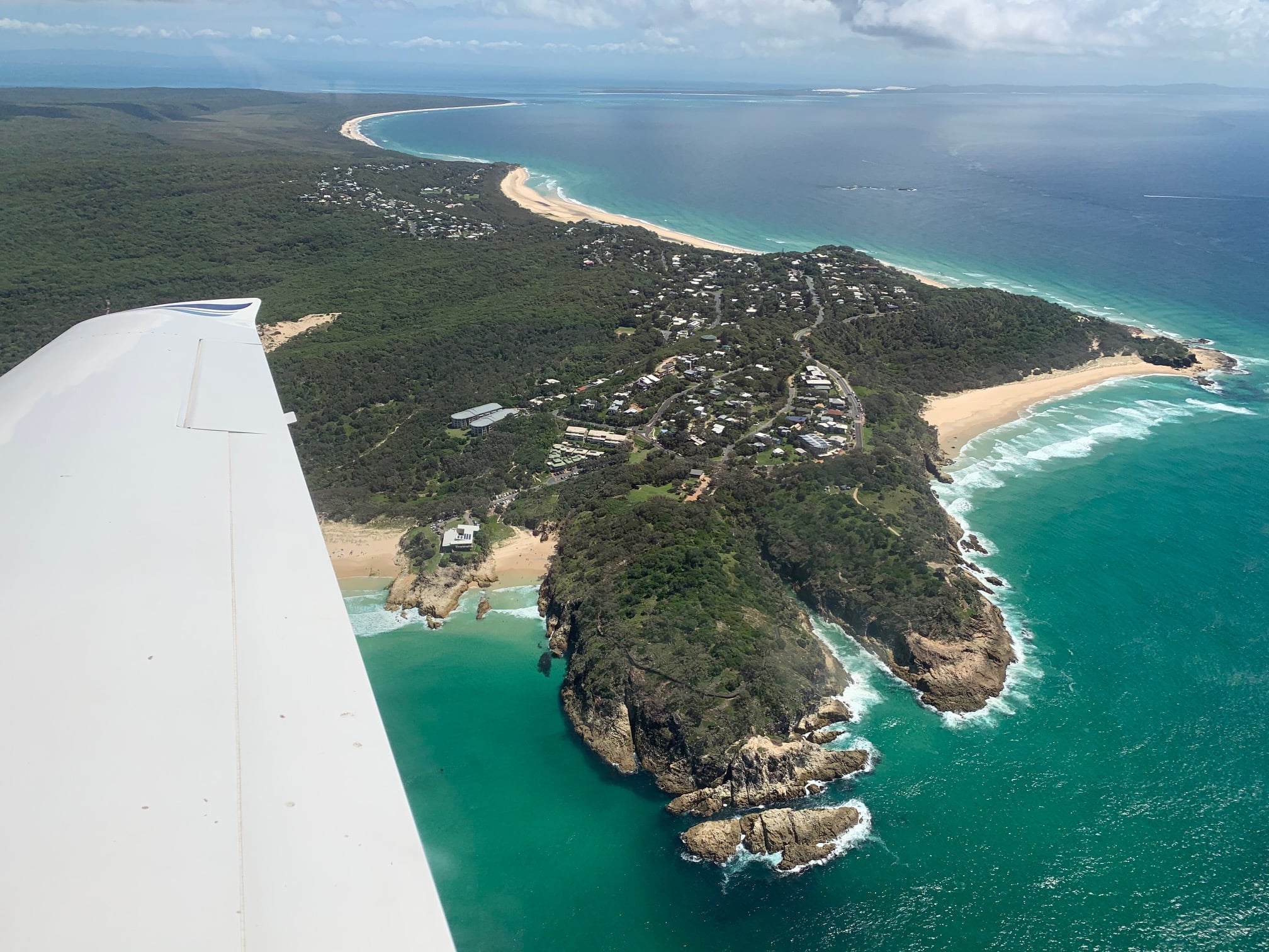
The LARC tour, 1 hour across sand and water with a couple of exciting splashdowns, was great fun with a humorous and knowledgeable guide.  They then walked along the beach to the Captain Cook Monument – a cairn commemorating the first landing of the Endeavour 24/5/1770.  It stands near Bustard Bay, which was named after the crew shot a bird for dinner claiming it was the best meal since leaving England in 1768!

Meanwhile, Sigi and I, having done the LARC tour on our last trip to 1770, relaxed at Agnes Water and enjoyed the beach.

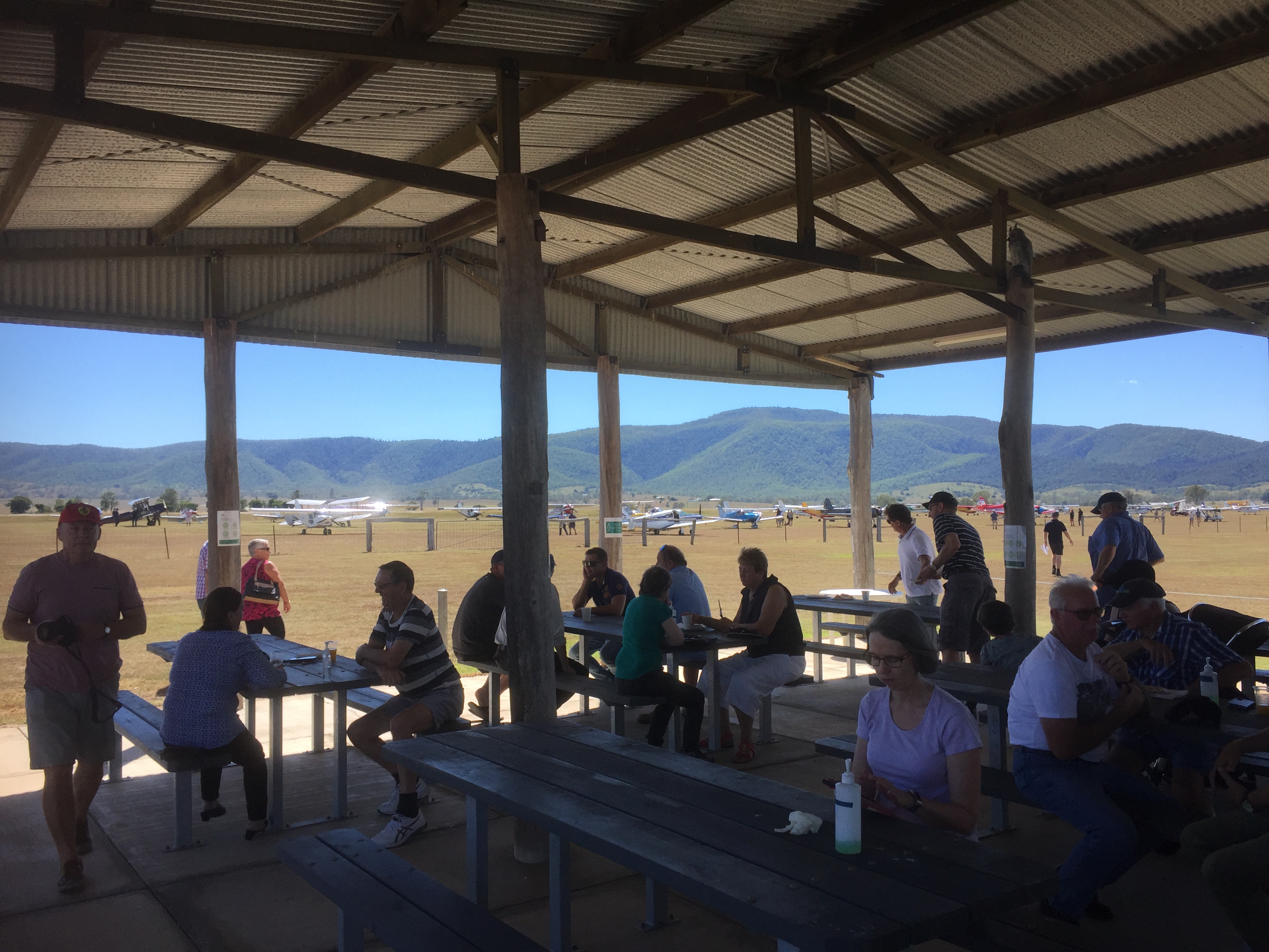
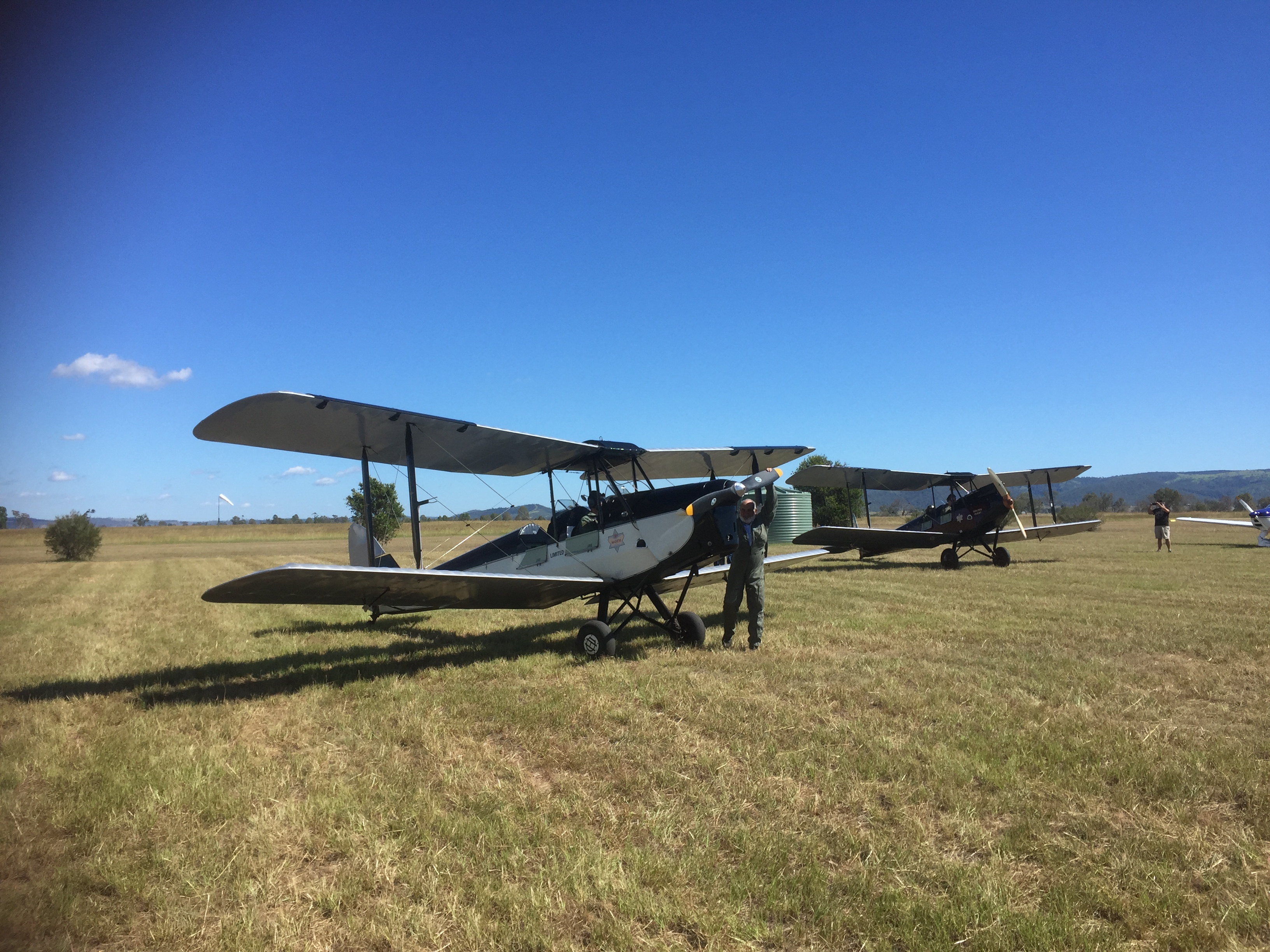
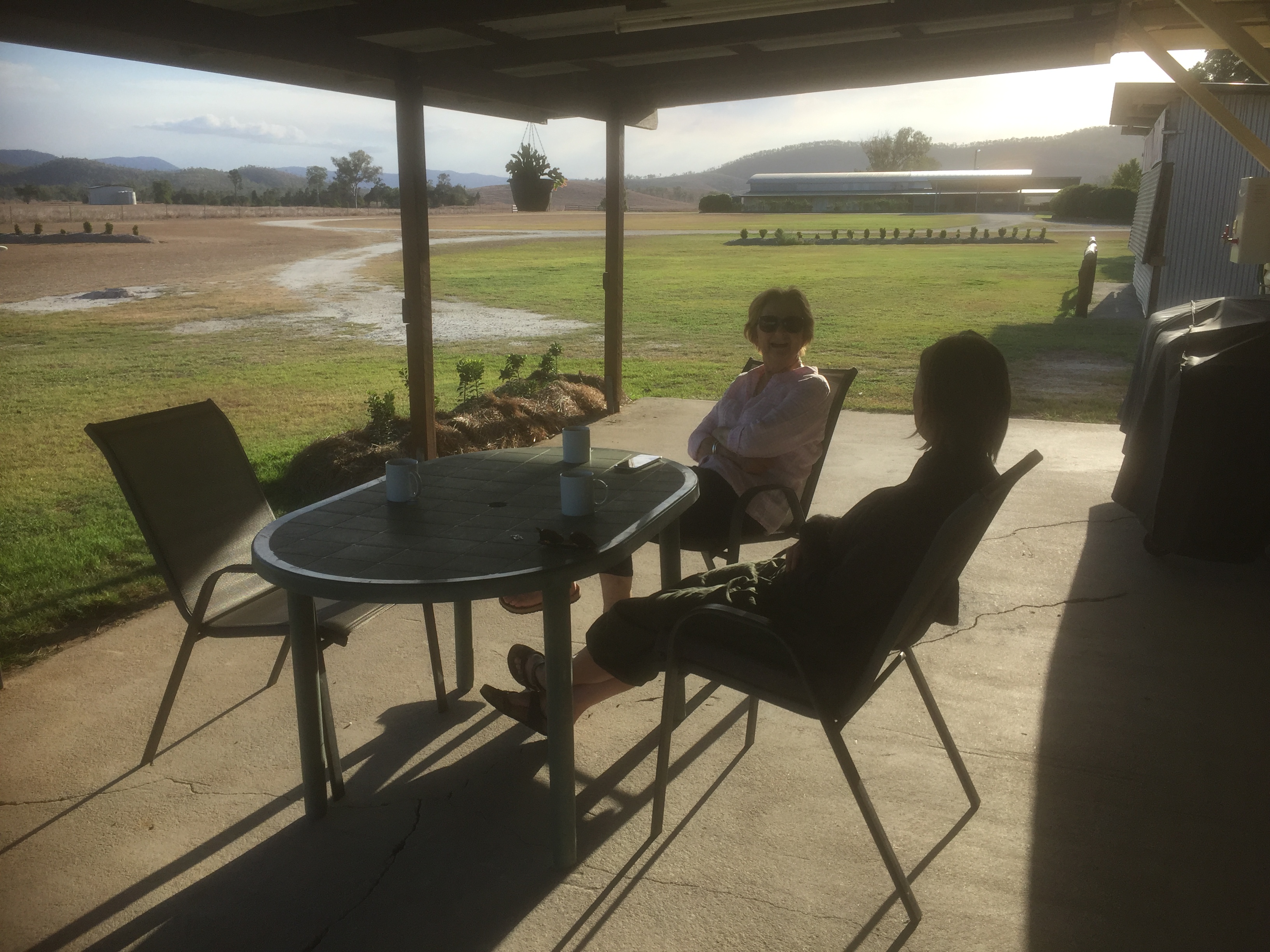
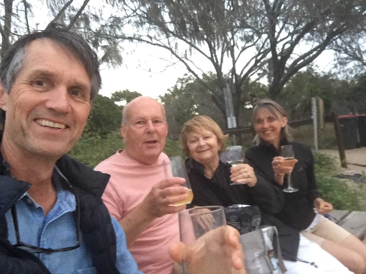
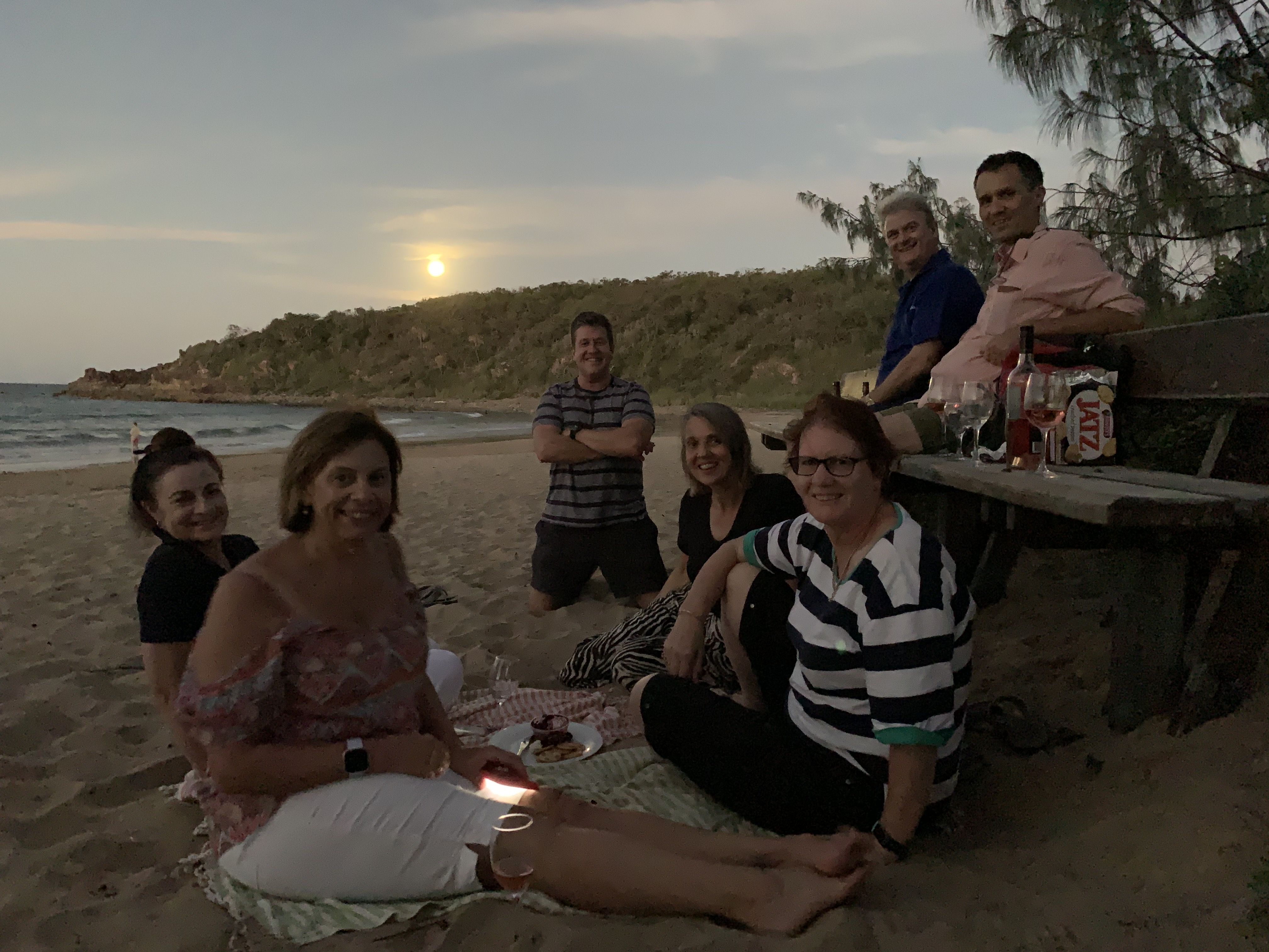
That evening, we enjoyed bubbles and nibbles at the beach, watching the sunset and the moonrise. We were joined by fellow Cirrus pilot Brett and his wife Sharon who happened to be staying at Sharon’s sister’s new beach house just up the road!

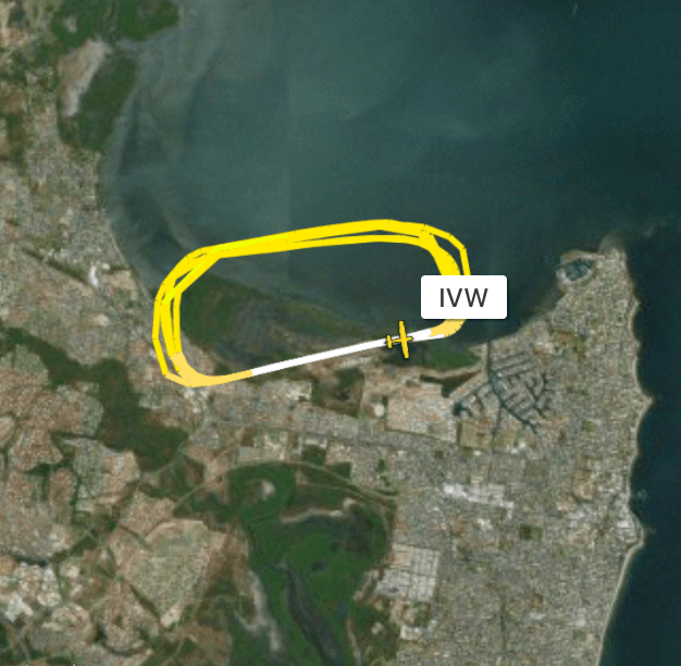
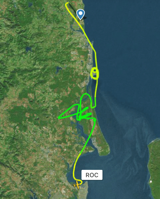
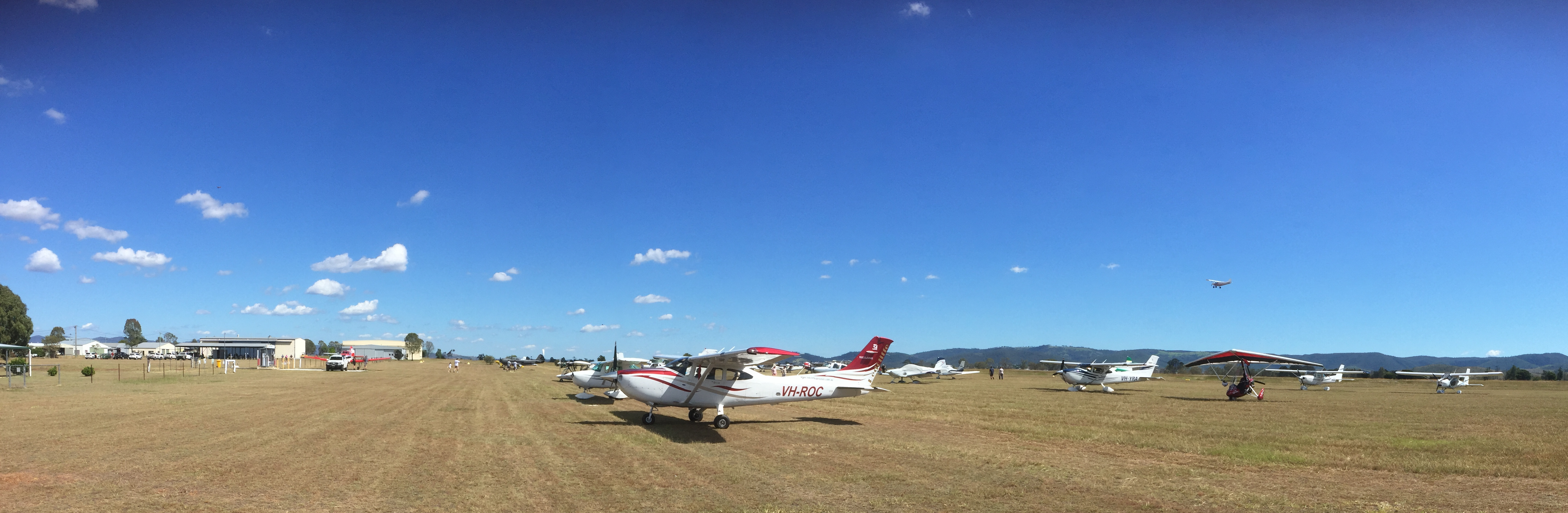
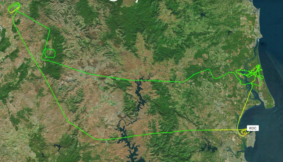
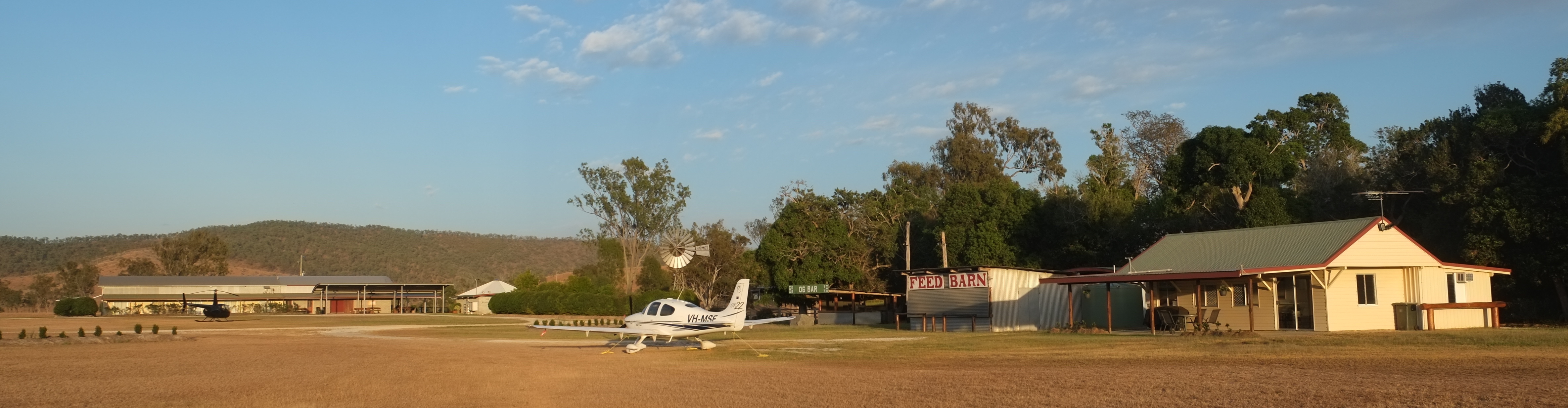
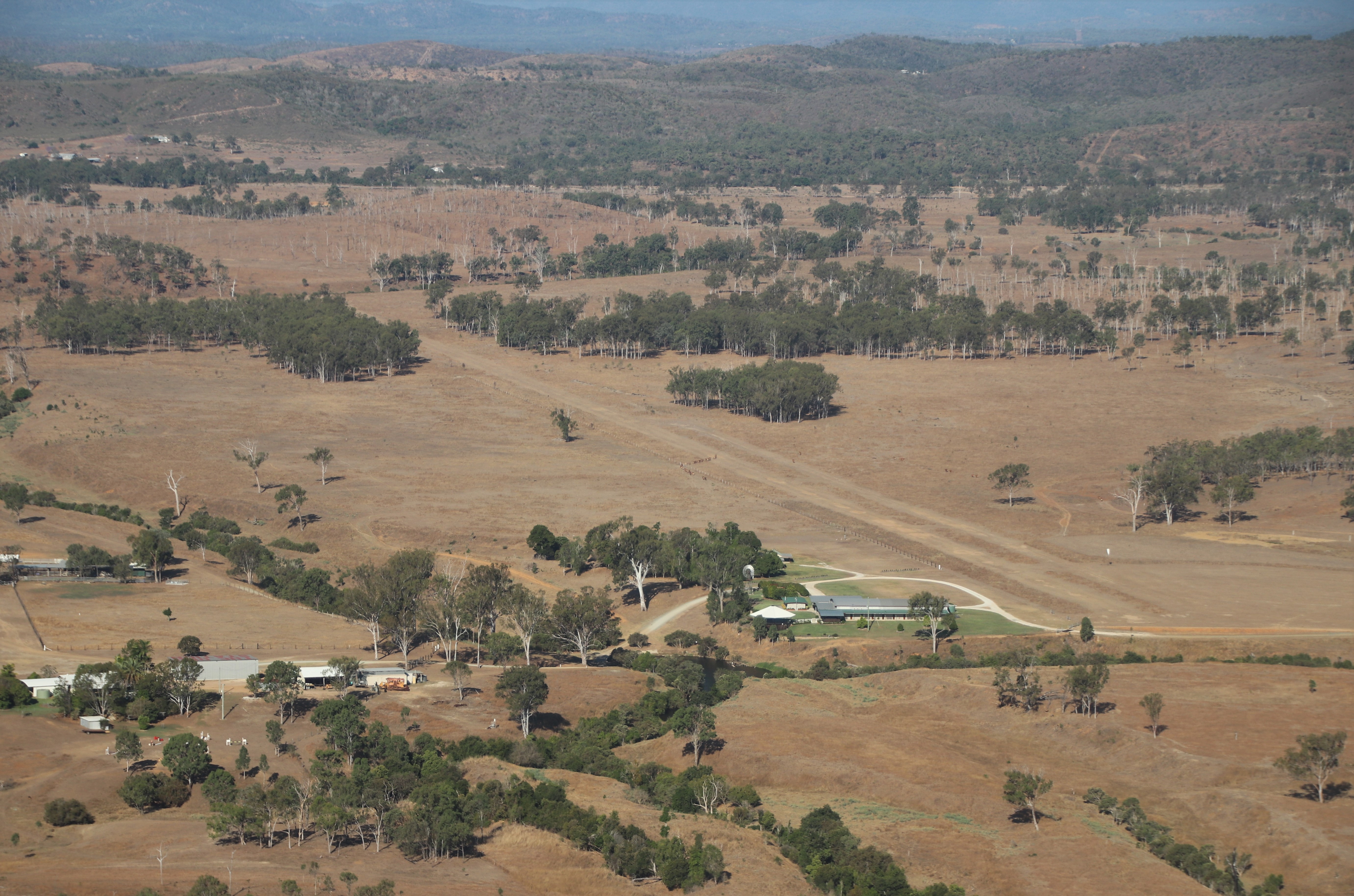
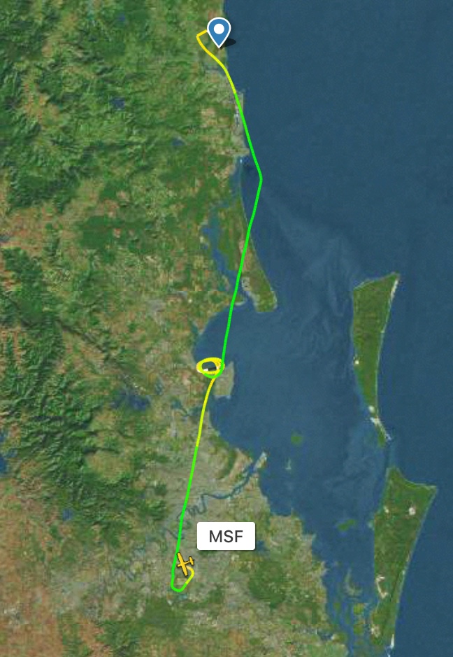
I began day 3 of our reef and beach trip with breakfast at the beach cafe then a short drive out to the airstrip with Stefan, Brett and Jodie. They’d asked whether they could have an early morning flight out to Lady Musgrave so who was I to quibble? I did the aircraft preflighting while Brett and Jodie chased a couple of kangaroos off the airstrip then we were all aboard for departure over the water to Lady Musgrave, about 20 miles out to sea. We had a great view of the 1770 cape as we departed.

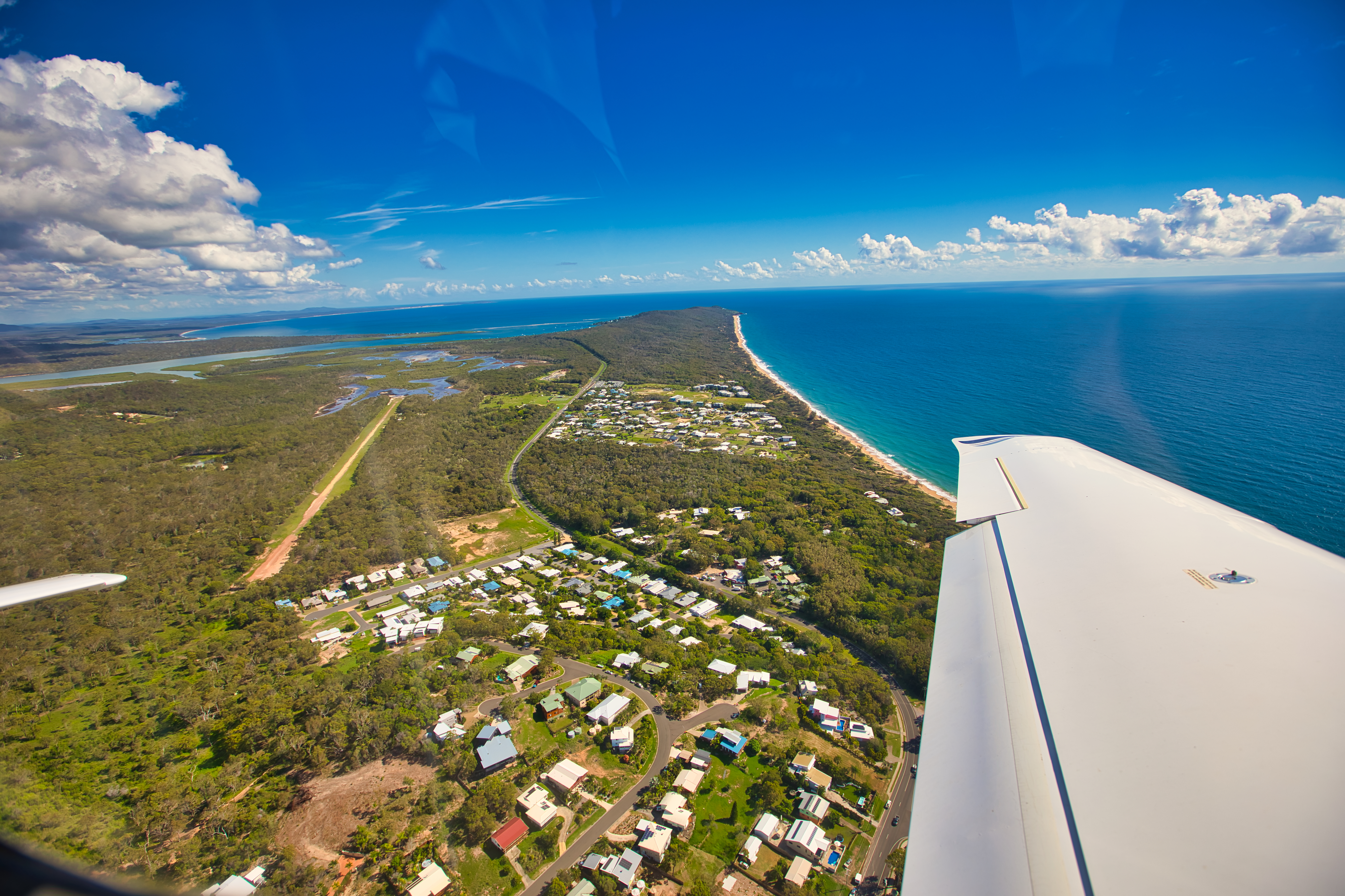
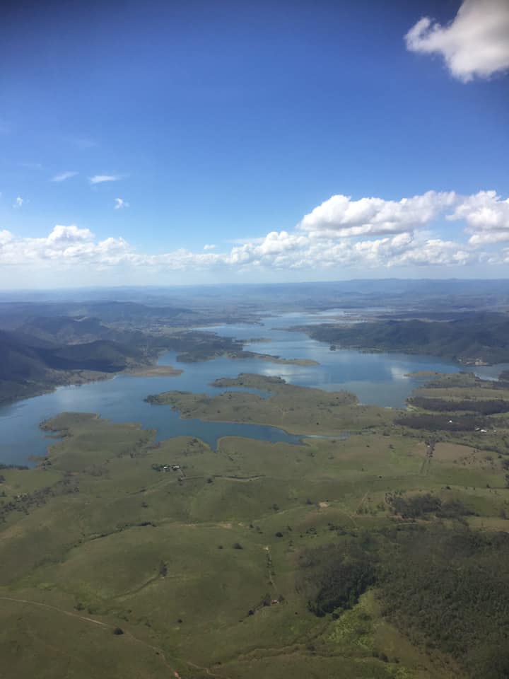
Ten minutes later we were over Lady Musgrave and its turquoise lagoon.

Flying north, we followed a chain of reefs and islets until we reached Heron Island about 20 miles away.

From there it was a quick trip back to Agnes via Round Hill Head at 1770.

Round Hill Head

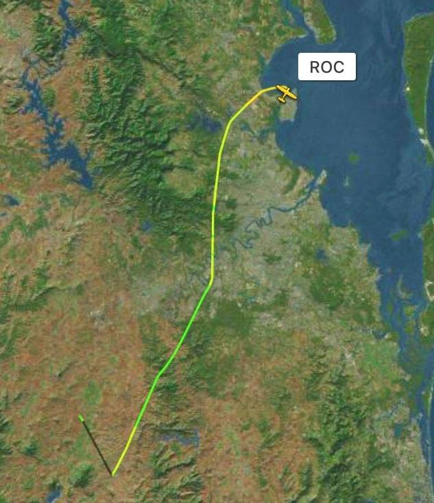
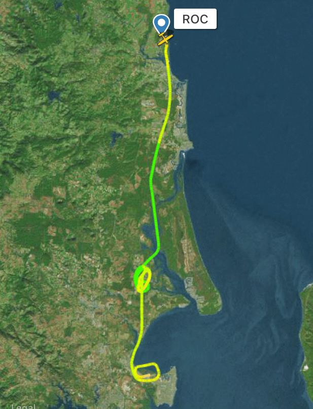
Meanwhile, Sigi, Beth and Sandra had begun their final day in paradise with a beach visit, breakfast at Codie’s Place, then a quick taxi ride to the airstrip to meet us for our return. We swapped crews and took off at 0930.  Following the coast we tracked to Bundaberg to top up the fuel tanks.

Short final at Bundaberg

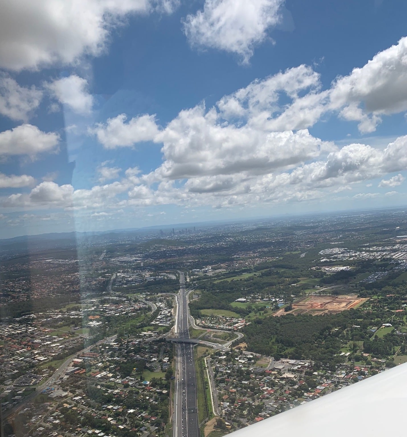
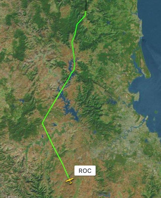
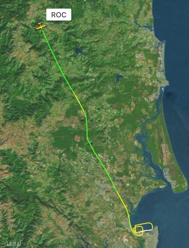
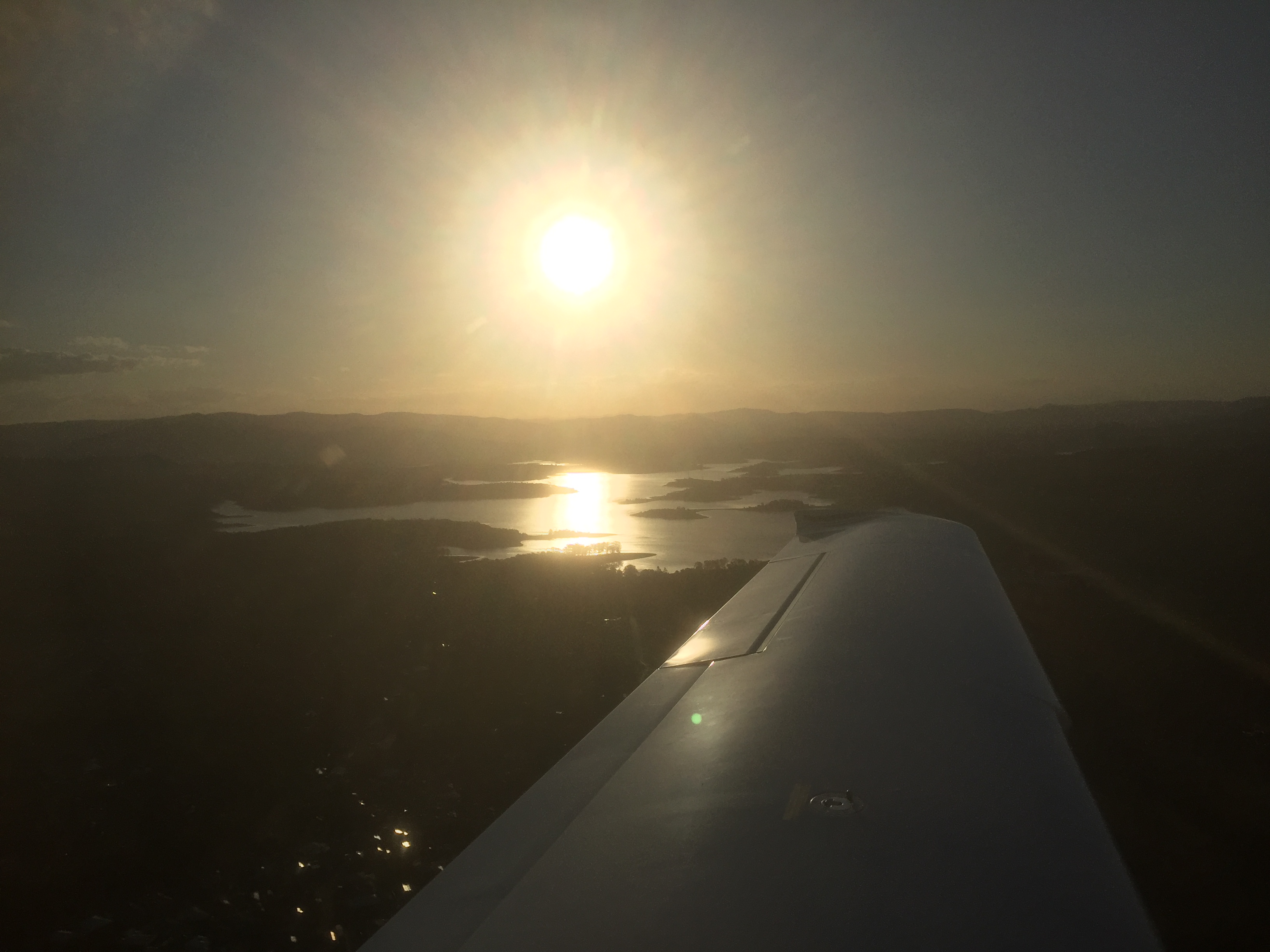
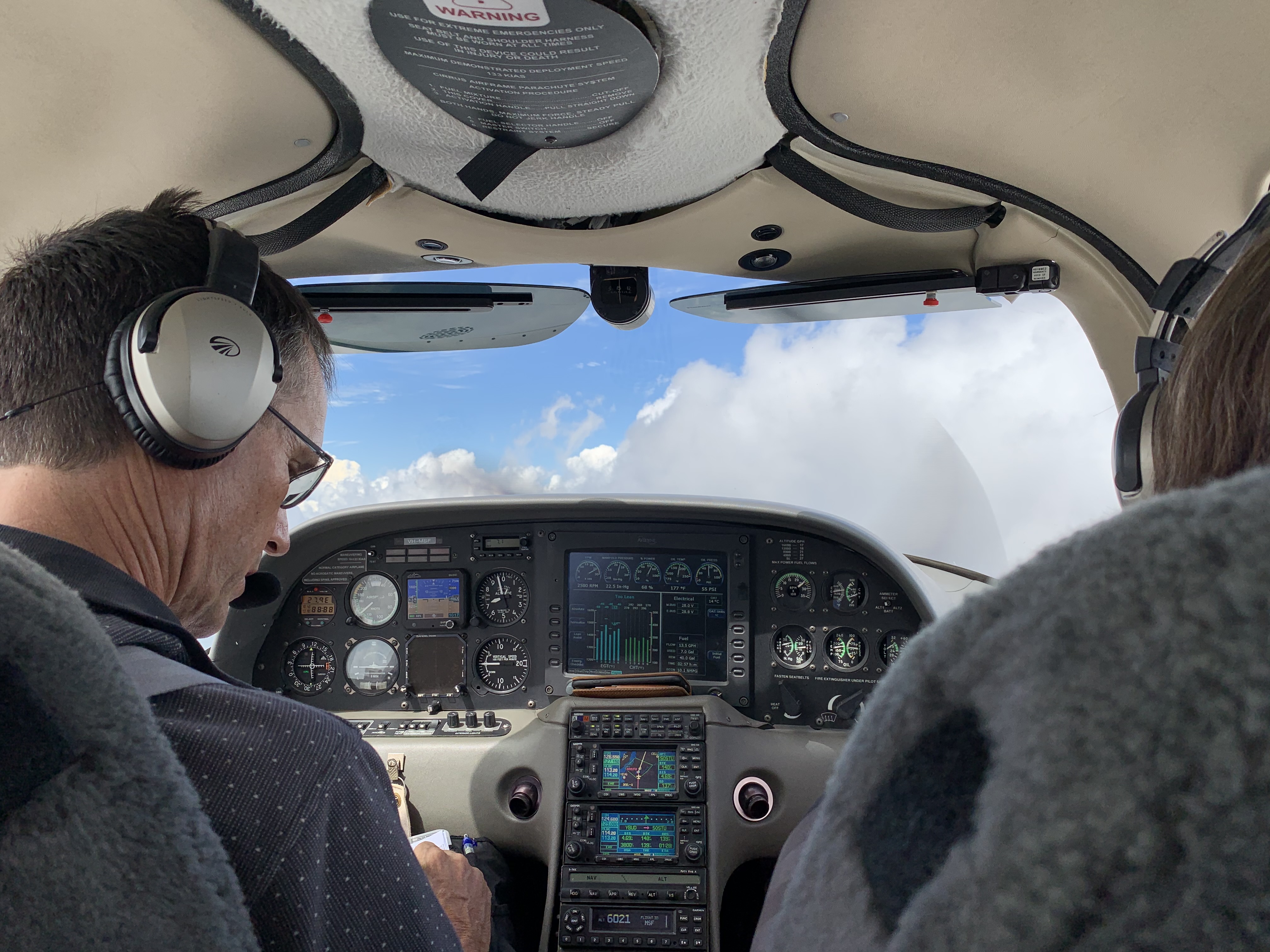
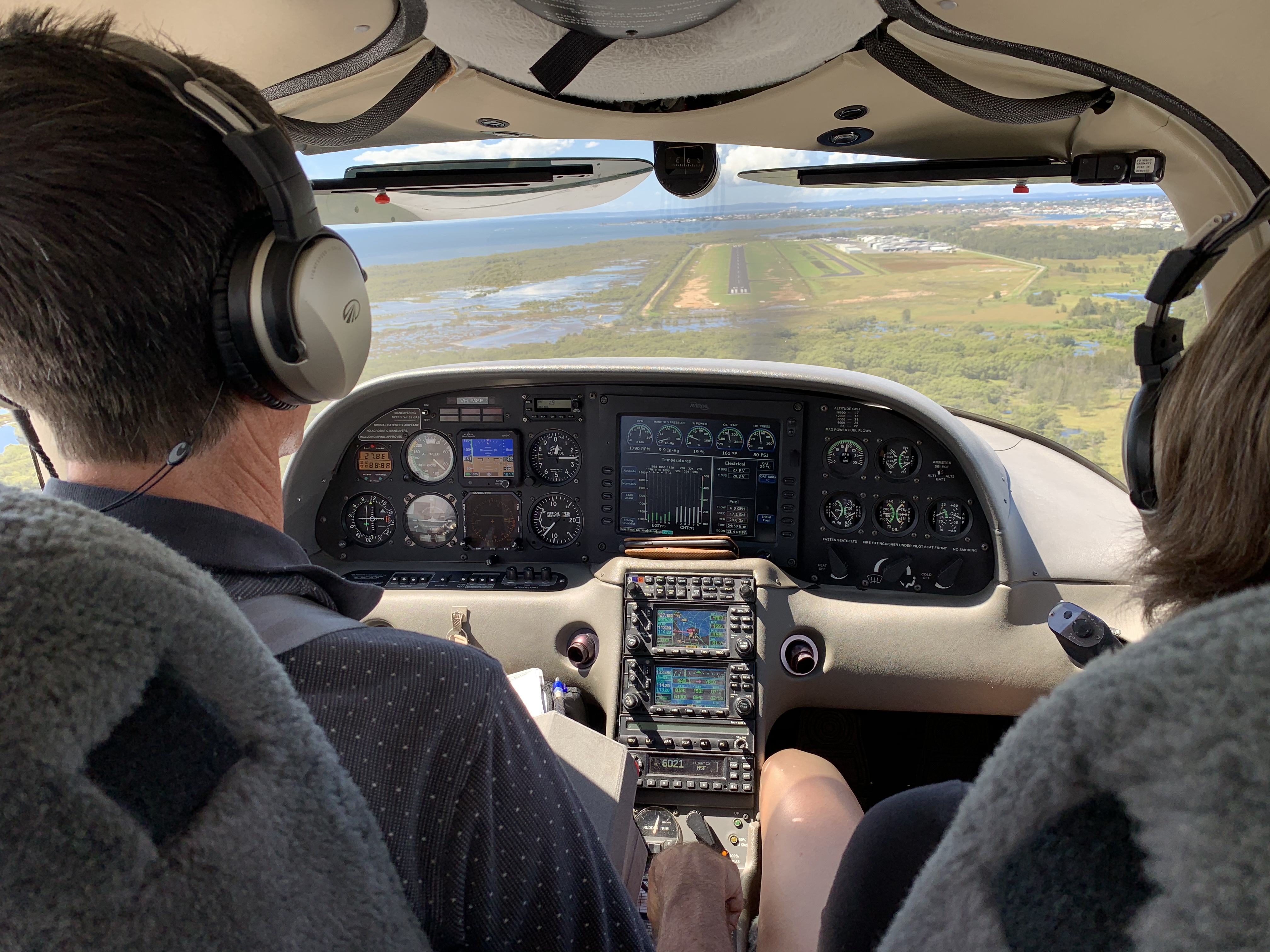
From Bundaberg we headed for home. Knowing that there would be some cloud along the way I planned IFR and sure enough we encountered some friendly cumulus that caused a few minor bumps and some instrument meteorological conditions (IMC) at times. 

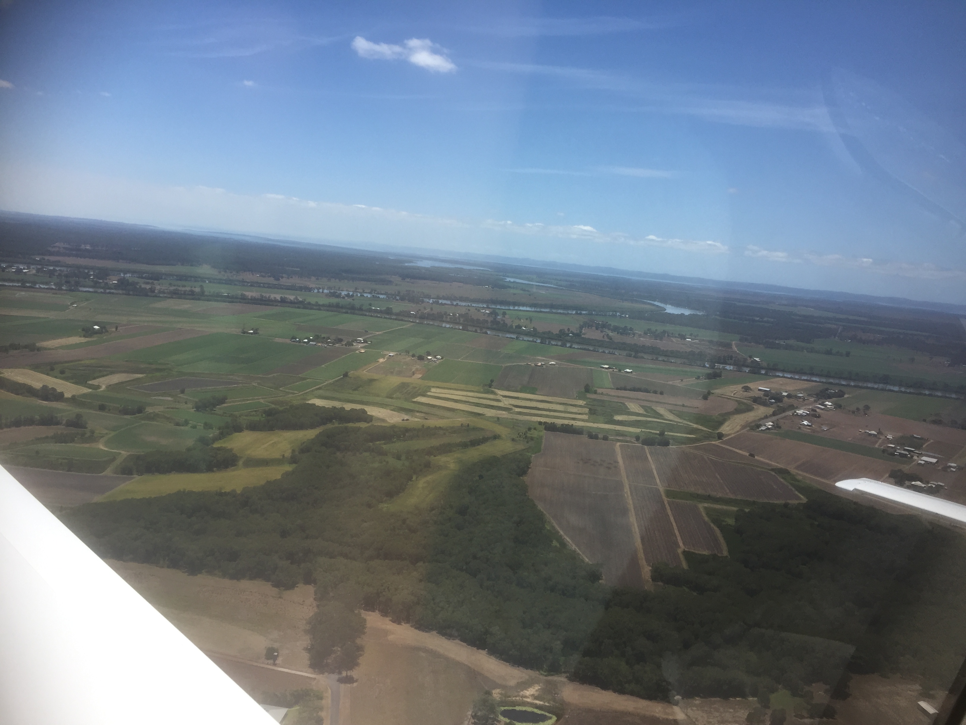
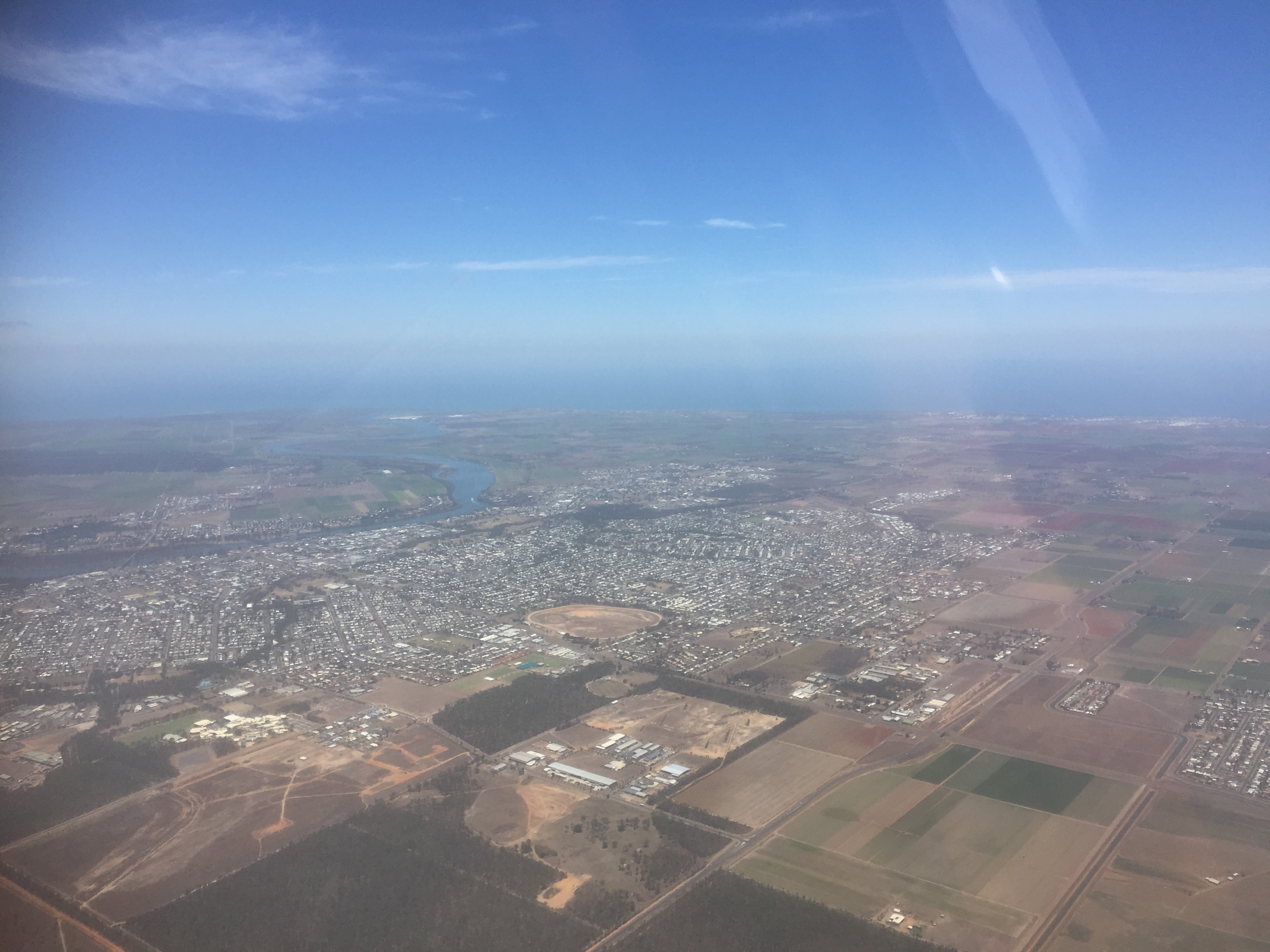
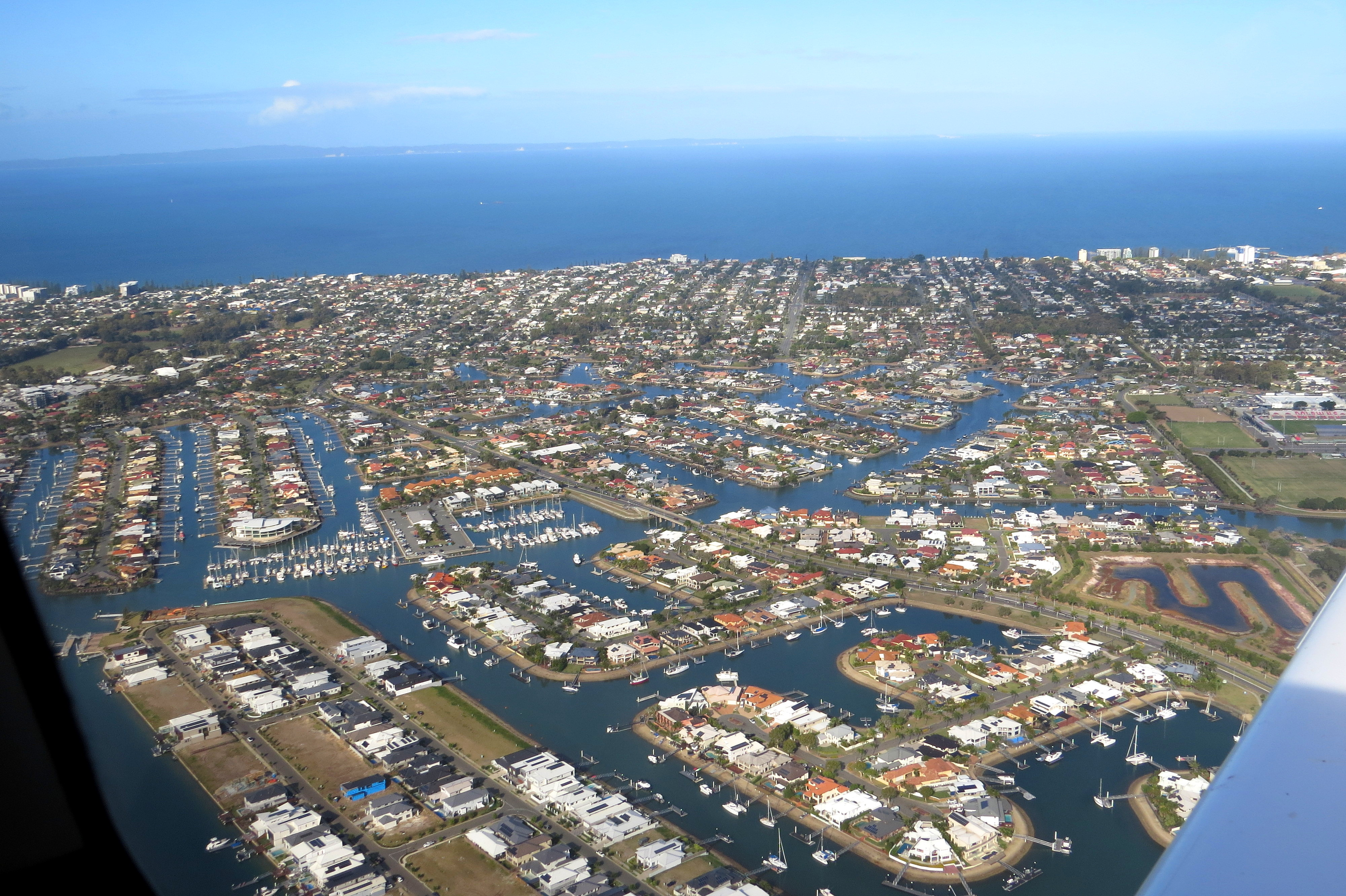
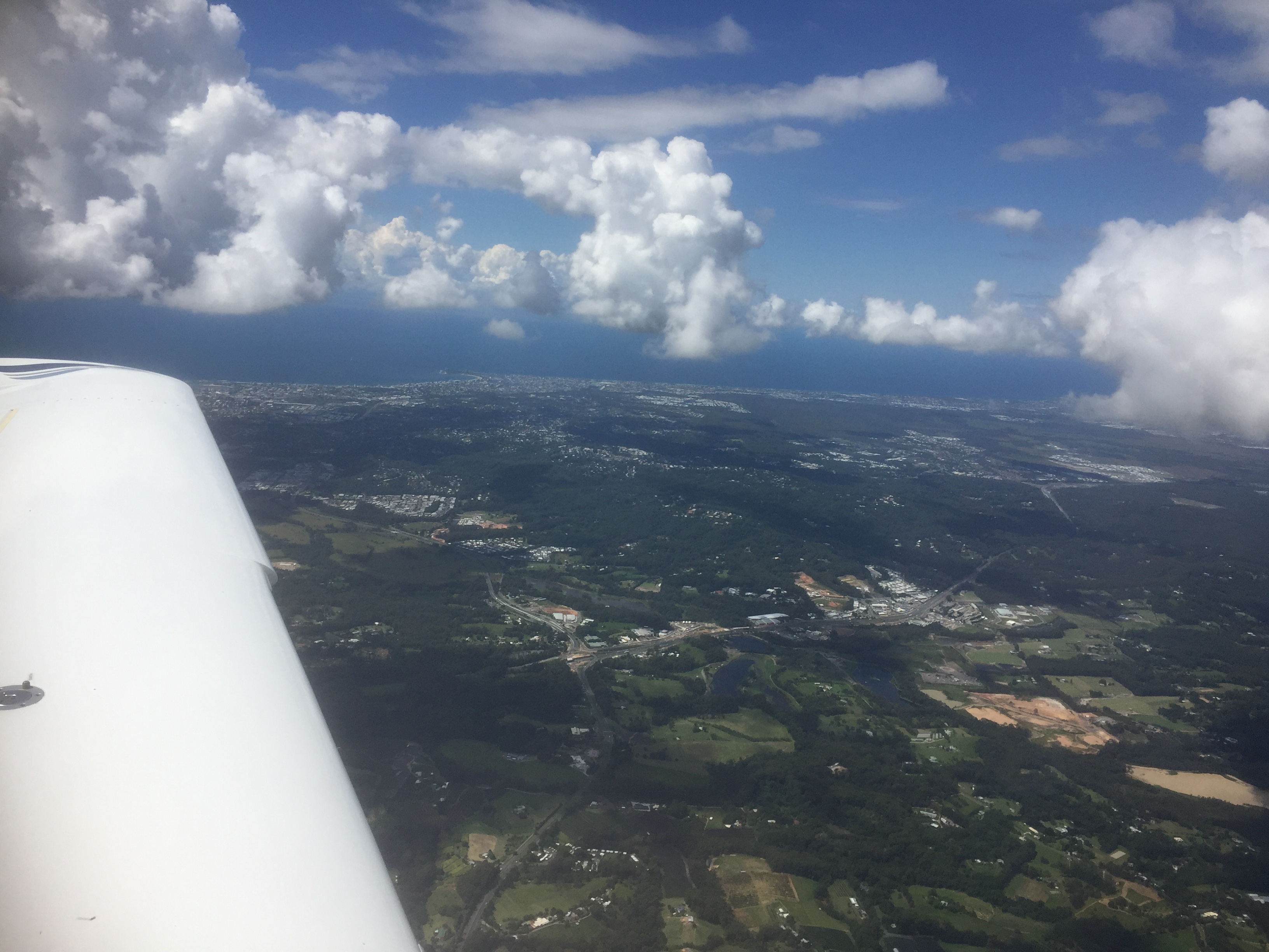
Despite this, we had some great views as we flew past Woodgate, Fraser Island, Maryborough and the Sunshine Coast hinterland.

Hinterland

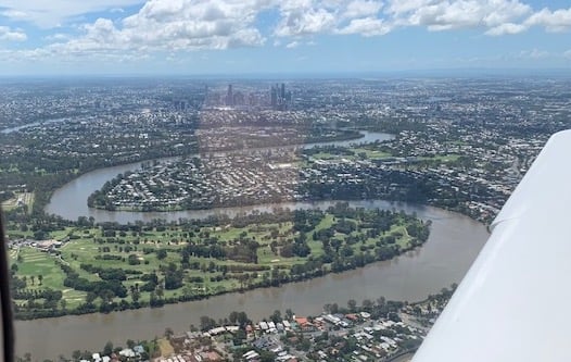
Shortly after we were passing over Redcliffe airport.

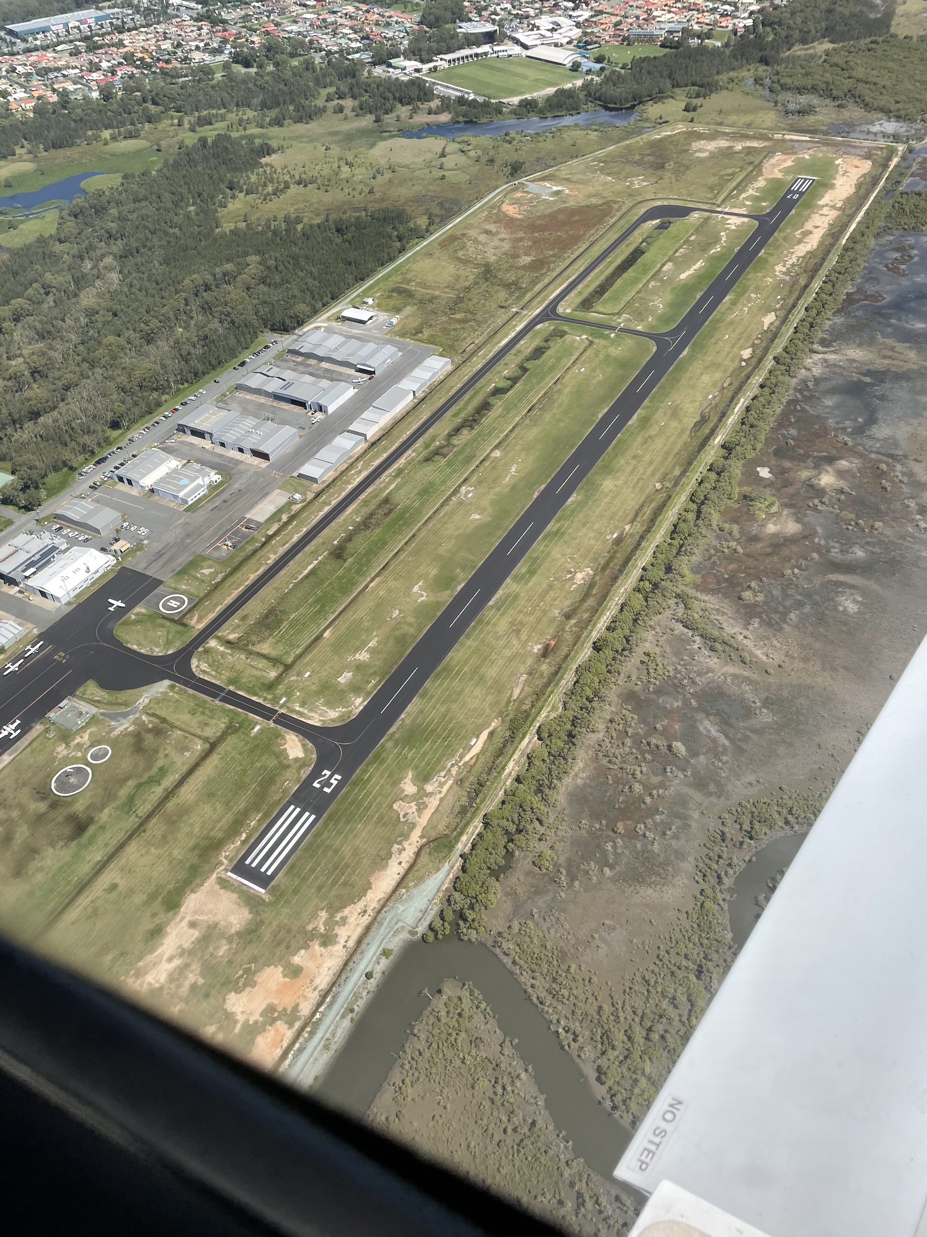
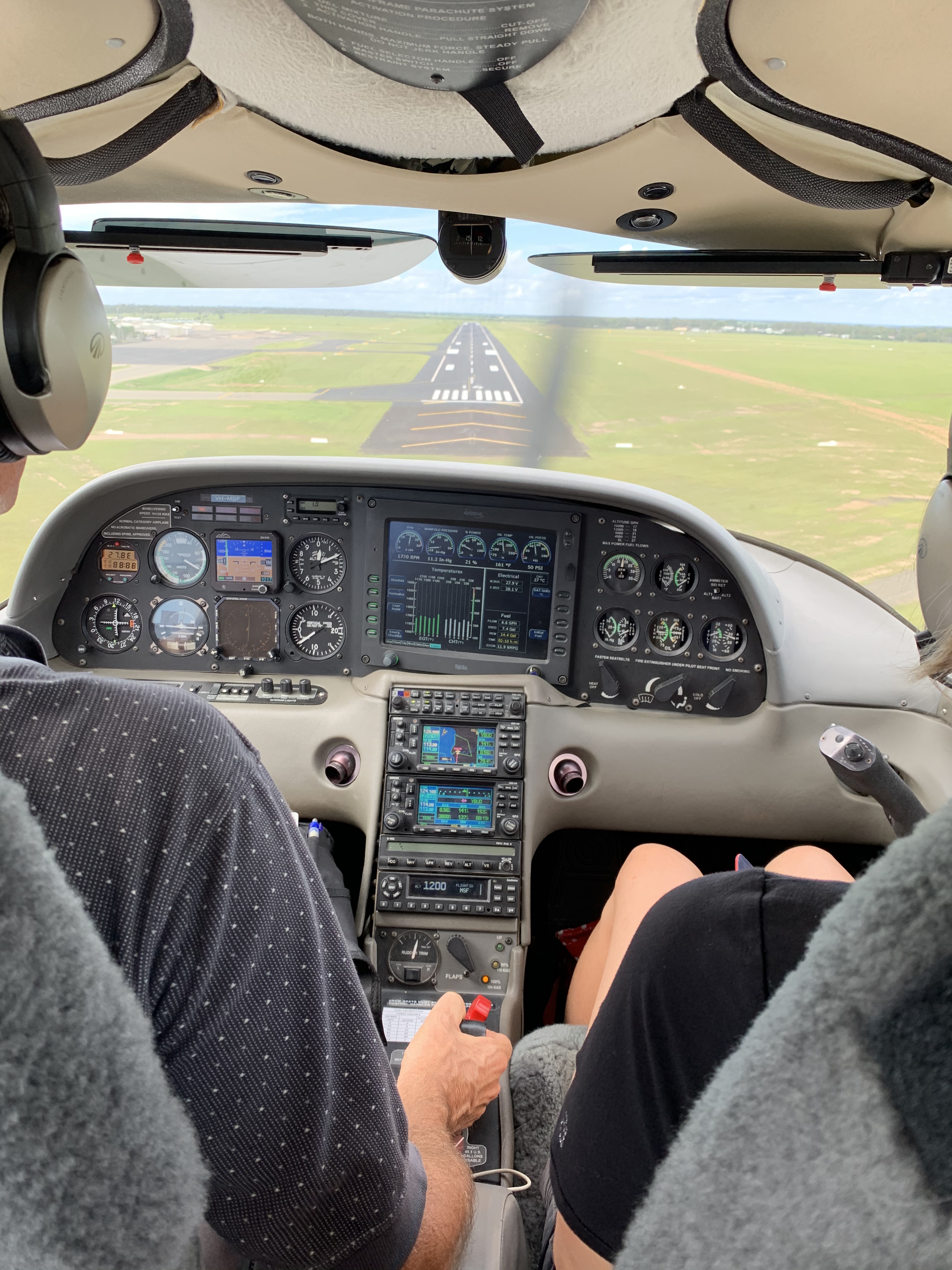
And then final for RWY07.

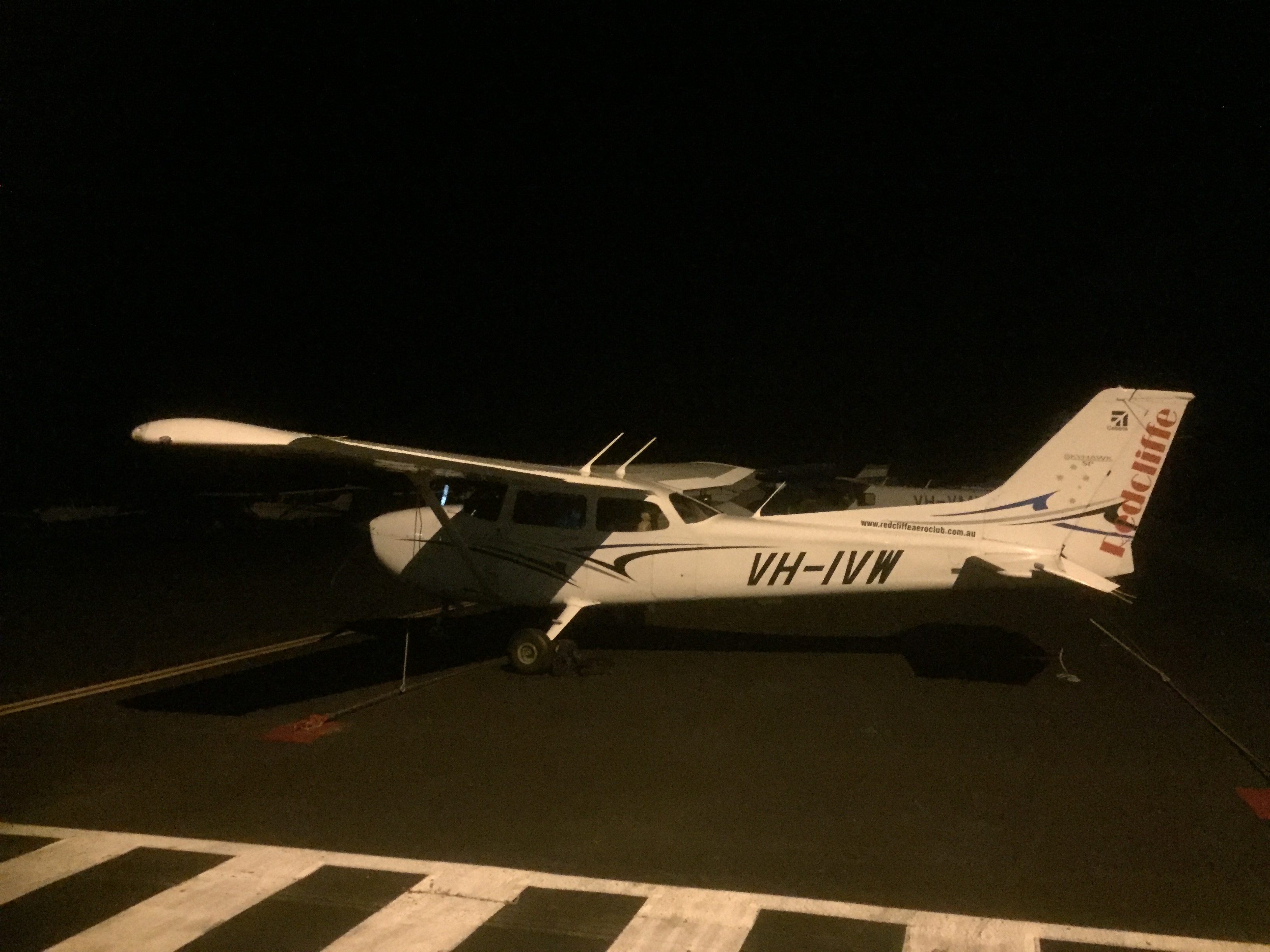
Landing smoothly we taxied to the hangar to put MSF to bed. Beth summed things up well – it was a “truly magical trip”. 

Grand orbit scenic flight

Moreton Bay – Stradbroke Island – Sunshine Coast

March 14, 2021 was a perfect day to fly so Vonnie, Ros and John accompanied me in MSF on a “grand orbit” of Moreton Bay, Brisbane and the Sunshine Coast.

Taking off from Redcliffe we flew up to Bribie where the radio was just full of chatter. Everyone must have agreed it was the day to fly with a week of wet weather forecast from the day after. We headed over to Tangalooma on Moreton Island and on to Point Lookout on Straddie.

Point Lookout

Tracking over North Stradbroke Island we headed for Archerfield and obtained a clearance to traverse their controlled airspace.

M1 at Springwood, approaching Archerfield

We passed to the west of the CBD and over the top of Indooroopilly Golf Course on our way to a scenic orbit over The Gap.

From there it was a gentle climb via Dayboro and the Glasshouse Mountains to Maleny and the Sunshine Coast hinterland.

Sunshine coast hinterland

We then descended towards Cooroy and on to Noosa Heads.

Tewantin and Noosa

We passed Noosa and turned over the heads with a great view of Hells Gates.

Hells Gates and Alexandra Bay

Following the standard scenic coastal route now we headed down the coast past Mooroochydore and Mooloolaba.

Point Cartwright and Mooloolaba

Soon we were over Caloundra and heading for Bribie Island.

Caloundra and the northern tip of Bribie

Soon we were approaching Redcliffe.

After a standard mid field cross wind entry we joined the circuit and finished with a soft touchdown on runway 07.

About 1h 40min all up. Thanks to John and Vonnie for the photos.

Happy crew

Night circuits at Redcliffe

March 13, 2021. It was time to practise night landings. To be able to carry passengers I have to have undertaken at least 3 take offs and landings by day in the previous 90 days. That’s not a problem with the regular flying I do. However if I want to take passengers at night I have to have completed at least 3 night landings in the previous 90 days at night. Now it’s not that I plan to fly at night but the reason I have a night rating is just in case we’re flying somewhere and are a bit late and have to arrive after last light. So I like to maintain my currency. I therefore try to fly the minimum of three circuits at night every 90 days.

I’m a bit of a rarity as I only have a night IFR rating and no night VFR. Most GA pilots have night VFR which is a bit less stringent regarding requirements to remain in contact with air traffic control. With night IFR I need to have radio contact with ATC from when I taxi out until when I’m back on the ground at the end of my flight. Some may see that as an inconvenience but I see it as an advantage. I have to set up my transponder and “squawk” a unique code that’s provided by ATC during taxiing and am then under surveillance from ATC while flying. Given that the circuits from Redcliffe are out over the bay, being under surveillance is a good thing, especially at night. Given that it’s not a usual thing to do (IFR circuits) I like to call up the ATC shift manager before I fly and tell him or her what I plan to do. That just helps avoid any misunderstandings while I’m flying.

Anyway it was a perfect day and the evening also looked fine so I started with a couple of daytime VFR circuits in C172 IVW to get a feel for the aircraft (which I only fly infrequently now) and then waited for last light. Switching to IFR I taxied out again obtained my transponder code from Brisbane Centre and told them I’d be staying in the circuit area at no higher than 1500ft AMSL. I then took off and once on downwind called up Brisbane Centre again and they advised that I’d been “identified” ie they saw me on their radar. I nominated an “ops normal” time of about 30 minutes later. This meant that if I hadn’t contacted them within 30 minutes they’d start trying to raise me and if they couldn’t they’d initiate the search and rescue procedures. Thirty minutes gave me ample time to do three circuits. There was still a bit of light in the sky and as I flew my circuits it gradually became darker. This is a good way of improving skills at night as you gradually have to deal with less and less light as the evening progresses. After three smooth landings I taxied back to the apron and cancelled my “sarwatch” with Brisbane Centre. Currency requirements satisfied for another 90 days.

CPL test day

So this was what all the training was for. March 9, 2021 was the big day. It was finally time for my Commercial Pilot Licence practical test. After 12 months of theory study and 7 exams followed by 12 months of practical training that was interrupted by COVID-19, the day had arrived. My plans of reducing the stress in the morning by having the C182 VH-ROC fuelled up and ready to go the evening before were foiled by another member returning it from Roma after closing time. So I was out there at 7am to preflight and top up the fuel. Luckily the test examiner was running one hour late so it gave me some extra time to prepare.

First leg to Boonah

I submitted my flight notification YBAF-YBOA-YKRY-YBSU-YRED and did some theory revision with the examiner before heading out to the aircraft. I asked for a transponder code and clearance direct to Boonah as we taxied out but once we were in the air it was clear from the amount of chatter on the radio that I wasn’t going to be cleared through Brisbane airspace. It was too busy. The cloud was down at 2500ft so there wasn’t much point anyway. This was VFR after all, so we had to stay clear of the clouds. So I switched on the autopilot and climbed to 1500 on heading 220 then near Petrie turned towards the TV Towers and climbed to 2000 as we approached Keperra and The Gap. As we passed Archerfield Brisbane Centre asked whether I’d like a clearance through Amberley airspace so I responded “yes if possible” and they handed me over to Amberley Clearance Delivery who rapidly gave me my clearance direct to Boonah at 2000ft. Dodging around Flinders Peak we started descending into Boonah and did a circuit and approached for a short field landing but the examiner said “there are kangaroos on the runway – go around” so we did, and set off in the direction of Kingaroy. Of course there weren’t really any kangaroos, he just didn’t want to stop at Boonah and wanted to see how I handled an emergency go around.

On the way to Gatton we did a practice forced landing without power and then after reaching Lake Wivenhoe the examiner instructed me to do a diversion towards Gympie. I climbed to just under the clouds and we did some steep turns and stalls over Lake Somerset, then some limited panel work wearing “the hood” as we made our way north. A lost procedure was conducted over Kenilworth and then we headed back to Redcliffe for a couple of circuits with one normal landing and one short field.

It was 2.6 hours of flying all up in less than ideal conditions. And the result? A pass. Time to celebrate!

Passed!

I’d have to say thanks to the whole RAC team for the training over the past 12 months but especially Mal for constructing a tailor-made syllabus for me, Stephen White for helping me to lose my fear of the wing drop stall and Mark for his professionalism and patience while showing me how to polish up the gamut of aviator skills to CPL level. And also thanks to examiner Tim Holland who put me at ease during the test so I could concentrate on the job at hand.

Some take homes were: 8 hours bottle to throttle doesn’t really mean that. It’s 8 hours before commencing any safety sensitive aviation activities (which includes anything airside and flight planning), use rudder more in general and remember to balance those steep turns, use the VTC whenever possible rather than the VNC (more detail when you’re trying to work out where you are) and always notify ATC after making a diversion from your planned route (no search and rescue pilots should have to risk their lives looking for someone who’s gone missing in the wrong location). I highly recommend CPL training to any PPL holder who would like to rid themselves of any bad habits they may have acquired over the years and lift their skills back up to PPL test level and beyond, to achieve a much higher level of competency.

CPL pretest

Boonah – Kingaroy – Sunshine Coast – precautionary search – lost procedure – FLWOP

On March 5, 2021 I had an opportunity to do a pretest exercise. It was another cross country practice in ROC, once again accompanied by Brett. This time was different however. The testing examiner had given me the route we’d use for the test the following week so I decided to make as much use as possible of this critical piece of intel by flying the route beforehand. I planned direct from Redcliffe to Boonah at 4500 via Brisbane and Amberley controlled airspace and before starting up I called the Air Services shift manager to give him a heads up and ask whether we’d get a clearance. He said it may be possible, so I asked for a transponder code from Brisbane Centre while we taxied and then took off and lo and behold, pretty well immediately obtained our clearance and climbed to 4500. We could track direct for Boonah as we had our clearance, first passing over Keperra with a great view of the CBD.

Keperra and CBD from 4500ft

Next we were over The Gap with a great view of the dam.

The Gap with Ennogerra Dam

This was all going pretty well so we settled into a smooth flight past Archerfield and into Amberley airspace.

Brisbane Centre handed us over to Amberley who guided us past Flinders Peak and on towards Boonah.

Flinders Peak

From top of descent we descended to circuit height and carried out a precautionary search and landing on RWY04 at Boonah. First pass at 500ft AGL, second at 200ft, third at 100ft then a short field landing. After a short break I did a short field takeoff and headed for Kingaroy, obtaining a clearance from Amberley Clearance Delivery to climb to 6500ft through their airspace.

We passed over Laidley and the Ripcord airstrip, and passed the Cressbrook Reservoir where we had to descend to 4500ft to avoid clouds and on past Tarong power station and into Kingaroy for a glide approach on RWY16. I did a full stop and we climbed out and stretched our legs.

Kingaroy apron

Starting up again we did another circuit and another glide approach then took off again and set a heading of 080 towards the Sunshine Coast. After 10 minutes Brett had me turn onto a heading of 028 for 8 minutes then did a lost procedure. Turns out we were over Gallangowan. I then replanned direct to Sunshine Coast passing overhead Manumbar, Brooloo and Kenilworth Bluff. Amazing lush green country around there.

Brooloo

Approaching the Sunshine Coast we had to do two orbits over Bli Bli while we waited for various aircraft to land and take off, then we joined final as a Jetstar took off in front of us and a short field landing with full stop.

ATC instructed us to do a Stop and Go landing to avoid the wake turbulence of the jet. So after touching down, ever so gently, we stopped and sat on the runway for about 4 minutes, waiting for the wake turbulence to settle and were then cleared to take off and head to Redcliffe. Over Bribie we did some steep turns and stalls then a practice forced landing without power at Hazelton, finishing with a flapless landing at Redcliffe. Lovely day for it.

More cross country practice

Wondai – Bribie Island – FLWOP – steep turns – stalls – dead reckoning

The CPL training continued on February 27, 2021. As they say, practice makes perfect, so I was off on another cross country flight in ROC, accompanied by Brett, fellow Cirrus pilot, who for once agreed to fly in an aircraft that doesn’t have its own air frame parachute. The first leg was a dead reckoning one from Redcliffe to Linville, originally planned for 4500ft but limited to 3000ft by scattered friendly cumulus cloud. There was a 6 knot cross wind from the right (don’t you love a G1000?) so I changed our heading by 3 degrees to the right and it brought us right over the top. After an orbit over the town we were off on another dead reckoning leg to a place called “Boomtown” near the Bunya mountains where OzRunways allege there’s an airstrip, so we tried to find it. There had been no strip showing on Google Earth so I was interested to see whether we could find anything in real life. Passing over Blackbutt we were on track and on schedule and we arrived over the airstrip location on time but there was no airstrip to be seen. Deciding it was all a ploy by OzRunways to check whether other app creators were copying their database we headed north on a further dead reckoning leg to Wondai, flying to the west of Kingaroy, listening out for traffic on the approach as someone did circuits there.

At Wondai we did a couple of short field landings and takeoffs then did a full stop landing for a short break to chat with one of the locals and sign the visitors’ book.

Wondai apron

After about 20 minutes we took off again and I did three practice glide approaches with touch and go landings, while contending with an RAAus pilot who was doing circuits and refused to respond to my radio calls. The first two approaches were a bit high and steep but we landed smoothly nevertheless. The third approach was pretty much textbook. Next was a final dead reckoning leg to Jimna, initially at 3000ft to remain under the clouds but as the ground rose to meet us we climbed to 3500ft to remain 1000ft above ground level while remaining clear of cloud. Once again there was a slight heading correction for cross wind and we arrived over Jimna right on time. Originally I’d planned some steep turns overhead but the clouds limited our height above ground so we headed for Bribie Island via the Kilcoy Gap to avoid the tiger country and hills, practising a FLWOP near Woodford. There was quite a bit of traffic around Bribie but I managed a few good steep turns before heading back to Redcliffe and a flapless landing. A good bit of practice on a lovely morning.

Steep turns, stalls and forced landings

On February 22, 2021 I continued my CPL training with more air work as I progressed towards the CPL test. An instructor and I flew up to Bribie Island for a series of steep turns (60deg bank) then stalls (clean, approach configuration and wing drop) at 3500ft. Definitely improving but still not quite up to CPL standard 100% of the time.

Then it was off to the Sunshine Coast that was sooooo busy. We had to orbit over Caloundra for almost 15 minutes waiting for a clearance and then extend downwind on the new RWY 13 nearly all the way to Mt Cooroy while a 737 landed and another took off. Eventually we were cleared to land and could taxi to the western apron.

After a short break we taxied back out to RWY13 for departure at 1500 ft for Redcliffe via Hazelton for a few practice forced landings without power. These involved pulling the throttle to idle at 2500ft then gliding at best glide speed, going through emergency checks and shutdown procedure, and establishing ourselves on short final on the grass strip, then putting power back on at 500ft and climbing away. They went fairly well but I did pick up a few more hints for fine tuning the approach from Mark, my instructor.

There was so much traffic out. Must have been the good weather. Even at Redcliffe we had four in the circuit when we arrived back.

Watts for breakfast, Brisbane and Mary River valleys

Watts Bridge – Brisbane River – Mary River

Sunday February 21, 2021 was another perfect flying day. It was time for the monthly breakfast at Watts Bridge Memorial Airfield and I wanted some more practice for my CPL test so I gathered up a crew and we headed out to Redcliffe and were soon taking off in the ROC, heading west over Dayboro and Lake Samsonvale, then over the hills to Lake Somerset. In 15 minutes we were on the ground and having breakfast with fellow aviators.

After a feed of bacon and eggs, and a cup of tea we wandered up and down the line inspecting the various aircraft.

There was a large variety of planes as usual, including some biplanes. We watched as one was hand cranked by someone who was skilled in the art.

Then it was time to depart again, this time to the north, following the Brisbane River (which meanders its way around Watts Bridge) to its source. The upper reaches are not easy to pick so it was a useful navigation exercise with my crew assisting with spotting duties. Eventually we exhausted the Brisbane River and flew over the hills to the Mary Valley and its lush green pastures.

From there it wasn’t far to Maleny and the rolling hills of the Sunshine Coast Hinterland, with the coast in the distance.

We carried on over the Glasshouse Mountains and were soon back at Redcliffe. This really is a great area to fly around.

Our route from Watts Bridge up the Brisbane River Valley and back to Redcliffe

Practice CPL Nav (cross country) flight

On February 16, 2021 I continued the preparation for my CPL test with a cross country (nav) exercise in VH ROC. We started with a dead reckoning leg (using compass, watch and map) from Redcliffe out to Eskdale homestead where we did some steep turns. Next there was more dead reckoning to Nanango with a precautionary search and 500ft and 200ft overfly. Then I donned the hood and flew on instruments for 12 minutes and carried out a lost procedure over Blackbutt. That was followed by a diversion to Kilcoy and on to the Glasshouse Mountains and Bribie Island for more steep turns and some stalls just below the clouds. Finally I did a couple of glide approaches into Redcliffe. Just under 3 hours in the air. Quite a challenge but it all went well.

Practice (pretest) flight to Boonah

February 12, 2021 was a mild summer day. More like autumn really. A good excuse for a flight to Boonah. I’d never landed there before but knew it was likely to be on the route for my CPL (Commercial Pilot Licence) test in the coming weeks. Nestled in amongst the hills of the Scenic Rim, Boonah is a beautiful spot. It’s home to a few light aircraft and gliders. I took off from Redcliffe and flew to the west of Brisbane, “threading the needle” between the Brisbane airspace, Archerfield airspace and Amberley airspace. I knew that one of the other club students had recently failed her CPL test because she almost inadvertently flew into Amberley airspace without a clearance so I wanted to make sure I knew all the visual cues to help me avoid making the same mistake. Flinders Peak is one such landmark, so I identified that and stayed well clear of it.

Flinders Peak

I could then head straight for Boonah and enjoyed the rolling hills as I approached.

Approaching Boonah

Boonah appeared, I joined downwind, did a 500ft overfly to check the condition of the strip and then did a second circuit and landed. Pulling off to one side I shut down and prepared for the next leg.

Taking off to the north west it was on to the Lockyer Valley and over the top of Gatton. Lake Wivenhoe appeared to be fairly dry for the time of year. February is nearing the end of the wet season in Brisbane so normally the lake, which is Brisbane’s largest water storage facility, should have more water in it.

Lake Wivenhoe

Soon we passed over Esk and I was pleased to see the water level in Lake Somerset was reasonably high. We needed more summer rains but the country was still looking pretty amazing.

Esk
Lake Somerset

From there it was short hop back to Redcliffe. Good practice for the upcoming test.

Practising instrument approaches

IFR – RNAV – Maryborough – Bundaberg – Hervey Bay – QADCAPS

It was December 2020. I’d decided it was time to brush up on my instrument approaches. Private instrument rated pilots have to practise them at least once every 6 months to stay current but it’s best to do them more often. I had a chat to Mike, the owner of MSF, and we decided Friday 4th December looked like a good day to fly. Mostly clear, not too hot, and only the chance of a thunderstorm in the evening, well after we’d be back home. It was a good excuse to go flying and practice makes perfect as they say, so off we went.

I am instrument rated on RNAVs only. These are aRea NAVigation approaches that use the GPS system to direct you through a series of waypoint and then specify at what altitude you should be to stay well above any “obstacles”. They allow you to fly into airports even when there is low cloud. The cloud base can be as low as 500ft above ground level. This gives you much great freedom to land and fly even when the weather is not good. Not that I really want to fly in bad weather as you can’t see much anyway, but sometimes on longer trip you have to deal with bad weather so it’s a very useful skill to have and to retain. There are plenty of other ratings you can obtain such as ILS (for large airports with jets), NDBs (almost all removed) and VORs (slowly being removed) but the GPS (or more correctly GNSS) RNAVs are by far the most common now and most useful. They are relatively easy to set up and maintain, having no ground based hardware. It’s all based on satellite technology. All good as long as the satellites remain functional.

I submitted my IFR flight plan and we flew out of Redcliffe, climbing to the northwest and obtaining a clearance from Brisbane Departures to climb into controlled airspace. As we settled into the flight to Maryborough (chosen as our first destination as I expected the airport to be quiet) I donned the “hood” while Mike acted as safety pilot, so I could simulate flying in IMC (cloud) and record some instrument time in my log book.

There was no traffic around so all was good. We were on our own. At 25 miles from Maryborough I obtained traffic from Brisbane Centre and tracked for waypoint SB, briefing the RNAV on RWY35 using the QADCAPS acronym as we went.

Q: QNH was obtained from the AWIS

A: Aids – The GPS showed that RAIM was available

D: DG and Compass were aligned

C: A review of the RNAV chart showed entry level as 3100ft, top of descent after SI and 4.2 miles from SF, minimum descent altitude 600ft. missed approach straight ahead to SH with climb to 3100ft and turn left onto track 163M

A: Audio – the correct CTAF and area frequencies were selected

P: PAX and PAL – Mike was OK to continue acting as safety pilot and no runway lights were required

S: Speed was slowed to 120KIAS for entry into the approach

I switched to OBS, did a sector 3 entry, turning left onto heading of 163M for 60 seconds then left again onto 343M, flicked off the OBS, passed through SB, on to SI, made a 10 mile call on the CTAF, slowed to 30% power, extended 50% flap and at 4.2 miles to SF started the descent. Mike assured me all was good as we passed SF and at 3 miles from SM I made the 3 mile call on the CTAF. Still no sign of any other traffic in the circuit. We could continue with the straight in approach. If there had been other traffic around we’d have had to break off and join the circuit as normal. Descending to 600ft I held that altitude until we passed over SM and then put on full power, climbed and carried out a missed approach.

We climbed out to SH and turned west. Levelling out at 2000ft AMSL I turned right turn and headed for waypoint ND on the RNAV on RWY17.

By this time it was starting to get a bit busy on the radio. My plan of doing a straight in approach and full stop was foiled partly by a bit of a tailwind blowing from the north and water bombers arriving from Fraser Island to be refilled with water. So, after turning at waypoint NI and descending to NF I removed the hood and joined downwind for RWY35. On the ground water bombers were coming and going and the local fire brigade was coordinating the refilling of them with water. They were obviously very busy dousing the flames of a bushfire on Fraser.

After a short break Mike climbed into the left hand seat and flew us to Bundaberg.

Departing Maryborough

We passed overhead the airport and he tracked for waypoint NC, doing a sector 2 entry (teardrop) for the RNAV on RWY14.

Bundaberg

As we started to descend the radio became active and the traffic situation was busy again, with a large Canadian water bomber arriving from the south. Mike broke off the straight in approach and joined downwind for RWY 32.

Short final at Bundaberg

On landing we topped up with some fuel and tried to buy a coffee but the terminal was deserted. COVID is still a latent threat so there’s not many flights in or out of Bundaberg.

Canadian water bomber

So it was off to Hervey Bay at 3000ft where Mike could practise another RNAV and we could buy a coffee. This time it was via waypoint WE and once again there was traffic arriving from the south. He broke off the straight in approach again and we joined downwind and landed from the south. And of course there were more water bombers. The terminal was deserted there too so we walked 500m up the road to the IGA for some lunch. Back in the plane Mike climbed to 9000ft for the return trip to Redcliffe, arriving in time for the monthly club barbecue.


Back at the club

Cattle station and beaches

The Old Station – Agnes Water – Town of 1770

In October 2020 we flew back to a couple of our favourite spots – The Old Station, west of Gladstone and Agnes Water/Town of 1770, on the coast north of Bundaberg. This time we took Ann and Harpur with us to share the delights of these two wonderful spots with them. Day 1 took us up to central Queensland, starting with a flight along the coast past Noosa and Double Island Point then across to Maryborough for lunch.

The Portside Cafe came recommended and was great. Bit of Mexican influence.

We had a walk along the river after lunch admiring the old buildings and noting how high the Mary River has flooded over the years.

Then it was back to the airport and we took off for the Old Station.

The cattle station has a 2km long grass airstrip but there’s always the possibility of livestock so we had a good look as we overflew it to see if we could spot any. It looked clear so we turned downwind and then base and then final. Suddenly a herd of cattle appeared from nowhere and started sauntering across the runway, about 500m from the threshold. So it was time to practise a go around. I applied full power, and we climbed back out to 1000ft for a second circuit. By the time we were on final for the second attempt the herd had cleared off into the trees so it was all clear and we landed smoothly. Ron and Helen Creed met us and we moved into our accommodation directly next to the aircraft, meeting Ron and Helen for a cuppa and some home made muffins shortly after.

You can park your plane right next to the accommodation

While we were sitting there a helicopter with a second group of four visitors arrived from Archerfield.

Dinner was in the big hangar space they use for weddings, conferences, tour groups and other functions. Lots of aviation stories were shared as we enjoyed Helen’s cooking and a selection of wines.

Suitably nourished we walked back to our lodgings under the starry starry night sky. It really is a great spot.

The next day it was time to explore property. The Creed family have lived there for 5 generations. Ron and Helen, along with Ron’s brother Andrew and his wife Nancy now own about 42,000 acres stretching out west to the Great Dividing Range. They currently have about 3,000 cattle and are aiming to grow the stock numbers to 5,500 over the next few years.

Nancy drove us to their house, at Langmorn Station about 5 km west of Old Station, for a look around their historical homestead and to meet some of the pups, guinea fowl and kangaroos. Langmorn homestead is like an antique shop. The wooden rocking horses were made by one of the family members.

After a cup of tea and some home made cake Nancy took us for a long drive around the property so she could check on the cattle and the water levels in the dams. Most of the cattle are Brahman, favoured as they’re resistant to ticks, but some of the land is agisted to Ron’s Uncle John who has Brahman crossed with Hereford.

Arriving back at the Old Station it was time for a late lunch prepared by Helen who is best described as a human dynamo.

There was time to relax on the porch in the afternoon and then go for a walk to enjoy the views of the Great Dividing Range.

At dinner we were joined by Kiwi, who also lives on the property but works as a aviation mechanic in Gladstone. He owns a Cessna 185 and a Cessna 150 and does aerial photography as a sideline. Helen cooked up another great meal. Two days later she had to cook for 280 guests as a car rally was passing through and the participants would camp there overnight. The day after that she had a wedding for about 70 people starting at 3pm and her son’s school graduation in the morning. It was a busy week. Their hospitality business was closed for weddings and other events during the height of Covid so people were starting to book extra slots, including during the week, to catch up.

One of Helen’s breakfast feasts started the next day and was followed by us boarding our 9am flight to Agnes Water.

First though was a recce over the Creed estates. Taking off on RWY 06 we turned and climbed out to the west over Old Station then flew at 3000 ft over Langmorn, Uncle John’s and Priory Park, their latest addition, then turned east and passed a marble quarry and Old Station at 3500ft.

From there it was south of Gladstone to Boyne Island with its red mud dams and aluminium smelter. The red mud is the tailings from the alumina refinery at Gladstone.

Following the coast we passed Turkey Creek and soon descended into Agnes Water/Town of 1770.

After a 500ft overfly to check for kangaroos we descended past the Town of 1770 to the grass runway and pulled into the parking area. With the plane tied down, a quick ride in the Agnes Water shuttle bus brought us to Agnes Central where the Mango Tree Motel’s apartment was ready and waiting.

Visit Mango Tree Motel

It was high time for a coffee at the Holidays Cafe with a marvellous view over the main beach area. The cafe is part of the caravan park but, unlike many such establishments attached to caravan parks, is really excellent.

Holidays Cafe

A swim followed and then a long walk along the beach.

The day pretty much just disappeared after that…until we had predinner drinks (BYO from the local bottle-o) with a view over the water.

The evening meal was enjoyed at Codies Place, directly downstairs from our apartment. Casual and a great view to the beachside park.

https://www.codiesplace.com

The next day was a chance to explore Agnes Water and 1770 including a visit to the museum and a ride on the LARC (Lighter Amphibian Replenish Cargo). We splashed into the water of the bay and travelled up the coast a bit, then emerged onto a sandbank where the Dutch lady driver explained some of the natural wonders to us. It was then time for a “splashdown” where she drove at full speed off the edge of the sandbank creating a wave that sort of splashed us all and cooled us all down for the return trip to the harbour. The LARC is a bit of a lark and worth a trip out on if you’re in town.

http://www.1770larctours.com.au

1770 harbour from the sandbank

That was followed by a walk along the beach past downtown 1770 and on through the Sir Joseph Banks Conservation Park up to Round Hill Head. By the time we returned is was well and truly beer o’clock and a drink was enjoyed on the deck of the 1770 Hotel as the sun sank in the west over Bustard Bay. There’s not that many west facing beaches in Queensland and 1770 has one of them so you can enjoy the sunset over the water.

Captain Cook and Joseph Banks came ashore at 1770 on May 24 1770, hence the name of the settlement. They shot a bustard and had it for dinner that night. Cook wrote in his journal that “it was the finest bird we had eaten since leaving England”. So the obvious question is why isn’t there a bustard business promoting native poultry here these days?

The following day was a chance to relax at Agnes Water, including morning swims. Harpur and I tried out a couple of Piaggio scooters around town. One was a 50cc with top speed of 60km/h and the other an MP3 250 three wheeler that went faster. I’d wanted to try one of those for a while and it was good. Stef, the owner of Kanga Scooter Hire was very efficient and friendly.

http://kangascooterhire.com.au

We also identified some cabins next to the cafe where we’ll try to stay on our next visit. They are directly on the beach with views to the beach and operated by the caravan park.

https://www.agneswaterbeach.com.au/accommodation/apartments/

The next morning it was time to head home. The shuttle bus dropped us off at the airstrip where we met Les “Woody” Woodall, the airstrip manager. After a bit of a chat about plane crashes and the wonders of bureaucracy we headed off, rolling down RWY32 and practising a soft field takeoff then climbing out past 1770. Turning around the end of Round Hill Head we followed the coast to Bundy for refuelling.

Lack of operating cafe facilities at the terminal meant we were soon up in the air once more heading for the coast.

It was a spectacular panorama under clear blue skies as we passed Woodgate, Burrum Heads, and on to Hervey Bay then crossed to Fraser Island.

Woodgate

Lake McKenzie glistened clear blue and at Eurong we started tracking along the beach, passing Inskip Point, Rainbow Beach and Double Island Point, a giant car park full of four wheel drives. Soon we were being waved through Sunshine Coast controlled airspace where we had to descend from 2500ft to 1500 ft to avoid skydivers at Currimundi (not sure how being 1000ft lower avoided a conflict) and on around Bribie to Redcliffe. Another smooth landing capped off a great trip.

SIDS and Deps

Instrument departures – IFR – Archerfield – Redcliffe – Sunshine Coast

On 14th September 2020 I passed a test for another instrument endorsement on my private pilot licence. This one was for “SIDS” and “Deps”. It allows you to depart from airports with low cloud and/or visibility and climb through it to safe levels where you are well clear of “obstacles” such as mountains. A SID is a Standard Instrument Departure, a specially designed and approved procedure that allows you to use the aircraft’s GPS to fly via a particular set of waypoints and climb safely in “instrument meteorological conditions” (IMC) to a height that is considered safe. It’s what most of the large aircraft fly on departure. It doesn’t have to be IMC though. You can fly a SID in clear blue skies but it gives you the option to take off even if the weather is such that you don’t have Visual Meteorological Conditions (VMC). A Dep on the other hand is useful when you’re departing from a small airport with no SID, like Redcliffe. You orbit overhead the aerodrome while climbing (potentially in IMC or at night) remaining within a couple of miles of an aerodrome (within the “circling area”) until you reach a safe altitude. You can then head off in your desired direction without risking flying into an “obstacle”.

The cloud was simulated for the test as it was a blue sky day. Adam Starr from Starr Aviation was my testing officer and I used MSF for the flight. First I had to fly the plane from Redcliffe to Archerfield to meet up with Adam. This 10 minute flight brought me over The Gap and Upper Kedron.

Upper Kedron (foreground) and The Gap (background)

He’d brought along a dreaded “hood” for me to wear after takeoff so I missed out on seeing most of the scenery during the test. The IFR flight starting with a SID out of Archerfield, donning the hood as we passed through 300ft above ground level, a flight over Brisbane CBD at 5000ft and a full stop landing at Redcliffe. I was allowed to remove the hood as we descended into the circuit. I then did a DEP out of Redcliffe, again donning the hood at 300ft above ground level with orbiting climb to 3000ft before tracking to the Sunshine Coast Airport for another full stop landing.

After a short break we took off again via another SID from the new runway 13. Breaking off from the SID at about 2000ft we turned and headed for Archerfield at 6000ft. I wasn’t permitted to use the autopilot for the test. It was all hand flown. Good experience. Landing at Archerfield Adam climbed out and congratulated me on passing the tests. I taxied back out to the runway, took off and flew back to Redcliffe past the Brisbane CBD and Lake Samsonvale as the sun sank in the west.

Watts for breakfast and Biggenden for lunch

Watts Bridge is a small airstrip in the Brisbane Valley near Esk. It’s home to a number of aerobatics enthusiasts and has hosted airshows from time to time. It’s also well known for its monthly “Watts for Breakfast?” flyins during normal (non-Covid) times. On 13th September 2020 they had the first one for a while. The Redcliffe aero club had organised a flyaway to Biggenden for lunch the same day. It’s only about 40 minutes by air from Redcliffe to Biggenden so it seemed a good idea to head to Watts for breakfast first and then head off to Biggenden for lunch after that so that’s what we did. Mike and I were joined by Brad Green and Brett Silvester in MSF and just after 8am we headed off over the hills from Redcliffe on the 14 minute flight to Watts Bridge. Given it’s such a short distance and we had blue skies over Redcliffe Mike decided to fly VFR and as we departed there was a great view of Redcliffe and Scarborough.

As we passed over Dayboro however some clouds gathered over the ranges and as a result we had to dodge around some of them on the way. Neither Mike nor I had ever flown into Watts Bridge before so I had a quick fly on the home simulator the day before to see what the terrain is like leading into the airfield. It helped us get our bearings. We flew over the northern end of Lake Wivenhoe and were soon overhead the Brisbane River and joining downwind.

Approximately 40 aircraft turned up, including a Spitfire that gave an awesome performance for everyone.

After enjoying the entertainment we took off and overflew the airfield.

Watts Bridge airfield with upper reaches of the Brisbane River in the background

Climbing out the course was set for Biggenden where we caught up with the rest of the group and walked into town for lunch at one of the pubs.

After a nice steak it was a 10 minute walk back to aircraft.

I flew the homeward leg. We climbed aboard and were soon soaring over the hills. A few clouds had gathered and I tried to climb above them, but eventually gave up and descended below them again.

The clouds had largely dissipated by the time we were approaching Kingaroy, where we had to land to top up the fuel. Soon we were soaring towards Redcliffe and celebrating another good day out with a few drinks at the club bar.

Approaching Kingaroy